
—
Total Campsites
Campground
—
Reservable Sites
Check by phone
—
Accessible
ADA-compliant sites
Organization
Overview
About TWIN CREEKS PICNIC
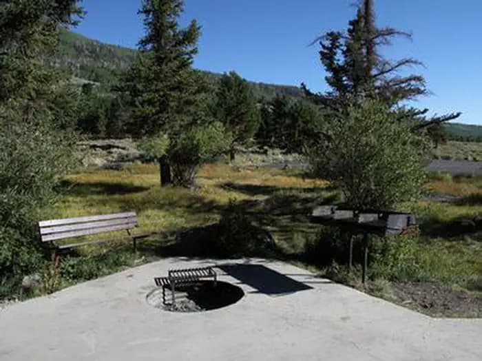
Overview Twin Creeks Picnic Area is is a day-use site located next to Fish Lake, Twin Creeks and the Fishlake Scenic Byway at an elevation of 8,800 feet. Visitors enjoy fishing, boating, exploring local trails and viewing spawning salmon from the board walk that meanders along the creek. This takes place mid to late fall. Some fish can usually be found year round. Recreation Fish Lake is Utah's largest natural mountain lake, covering 2,500 acres. It is famous for its 20-40 pound Mackinaw lake trout. Anglers also enjoy fishing for rainbow trout and splake. Boating, canoeing, swimming and scuba diving are popular activities. The 5-mile Pelican Canyon Trail begins a mile away at Bowery Creek Campground. It leads through meadows and dense forests of spruce, pine and aspen as it climbs to the 11,633-foot Fish Lake Hightop. The popular Lakeshore National Recreation Trail extends around the eastern side of the lake. Hikers are rewarded with stunning lake views after climbing 900 feet in elevation. Facilities Fish Lake is Utah's largest natural mountain lake, covering 2,500 acres. It is famous for its 20-40 pound Mackinaw lake trout. Anglers also enjoy fishing for rainbow trout and splake. Boating, canoeing, swimming and scuba diving are popular activities. The 5-mile Pelican Canyon Trail begins a mile away at Bowery Creek Campground. It leads through meadows and dense forests of spruce, pine and aspen as it climbs to the 11,633-foot Fish Lake Hightop. The popular Lakeshore National Recreation Trail extends around the eastern side of the lake. Hikers are rewarded with stunning lake views after climbing 900 feet in elevation. Natural Features The shelter sits amid scattered pines and aspens on the shore above Fish Lake. Sagebrush and summer wildflowers dot the landscape. Nearby Attractions Johnson Valley Reservoir is just north of Fish Lake, offering additional fishing and boating opportunities. Pando Clone is located on the south end of the basin and identified with signs along highway 25. Lakeshore trail a varying 17 mile loop.
- Map coordinates are available for trip planning.

Reservations & Contact
Plan your stay
Getting There
From Highway 24 northwest of Loa, Utah, take Highway 25 northeast approximately 9 miles to the campground.
FAQ
Common questions
Everything you need to know before your trip to TWIN CREEKS PICNIC.
How do reservations work for TWIN CREEKS PICNIC?
Reservation availability for TWIN CREEKS PICNIC can vary by season and campsite type. Check the contact and access section before booking.
What campsite types are available at TWIN CREEKS PICNIC?
Campsite type details are limited right now. Check back as this listing is enriched.
Where is TWIN CREEKS PICNIC located?
TWIN CREEKS PICNIC is in Utah near Loa. Coordinates: 38.5492, -111.7220.
Keep Exploring