
Campgrounds Near Capitol Reef
A hidden gem of red rock cliffs, canyons, and the Waterpocket Fold geologic feature.
20
Campgrounds within 50 mi
Utah
Primary state
7 mi
Closest campground
Nearby campgrounds
20 campgrounds within 50 miles of Capitol Reef
UT · Campground
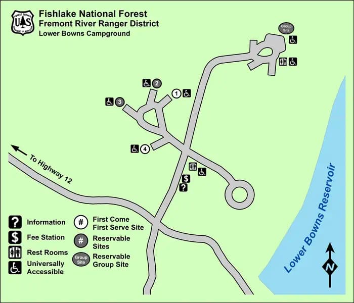
Overview Lower Bowns Campground is located on the east side of Boulder Mountain on the shore of Lower Bowns Reservoir at an elevation of 7,000 feet. Visitors enjoy boating, fishing and exploring local trails. View Lower Bowns Campground Map Recreation Popular activities in the area include hiking, biking, hunting and riding the Rosebud ATV Trail. Lower Bowns Reservoir offers boating, canoeing and fishing for rainbow, brook and cutthroat trout. Facilities Popular activities in the area include hiking, biking, hunting and riding the Rosebud ATV Trail. Lower Bowns Reservoir offers boating, canoeing and fishing for rainbow, brook and cutthroat trout. Natural Features The campground is sparsely forested with pinyon pines and juniper, which offer only limited shade. Boulder Mountain lies to the west of the site, and Capitol Reef National Park's Waterpocket Fold and the Henry Mountains lie to the east. Nearby Attractions Capitol Reef National Park is just 45 minutes from the campground. This unique park offers excellent hiking trails, historic sites and breathtaking scenery. Sightseeing along Utah Highway 12, a National Scenic Byway, is very popular. Travelers visit from every corner of the world to gaze upon stunning red rock canyons and desert landscapes.
View details →
UT · Campground
Overview Rosebud ATV Campground is located high on the Colorado Plateau at an elevation of 8300 feet. Torrey, Utah is just 17 miles northwest. Visitors enjoy exploring miles of local ATV trails. View Rosebud ATV Campground Map Recreation Rosebud is a haven for off-road vehicle enthusiasts. It is adjacent to the Rosebud ATV Trail, which leads to Lower Bowns Reservoir, offering fishing and boating opportunities. Facilities Rosebud is a haven for off-road vehicle enthusiasts. It is adjacent to the Rosebud ATV Trail, which leads to Lower Bowns Reservoir, offering fishing and boating opportunities. Natural Features The campground is situated in a scenic ponderosa pine forest on the east side of Boulder Mountain. Pleasant Creek flows next to the site. Nearby Attractions Capitol Reef National Park is approximately 30 miles from Rosebud. This unique park offers excellent hiking trails, historic sites, scenic driving and breathtaking scenery. Sightseeing along Utah Highway 12, a National Scenic Byway, is very popular. Travelers visit from every corner of the world to gaze upon stunning red rock canyons and desert landscapes.
View details →
UT · Campground
Overview Oak Creek Campground is located high on the Colorado Plateau at an elevation of 8300 feet. Torrey, Utah is just 20 miles northwest. Visitors enjoy exploring miles of local ATV trails. Recreation Lower Bowns Reservoir near by offers fishing and boating opportunities. Facilities The campground has pit toilets and drinking water. Natural Features The campground is situated in a scenic ponderosa pine forest on teh east side of the Boulder Mountain. Nearby Attractions Capital Reef National Park is approximately 30 miles from Oak Creek Campground. This unique park offers excellent hiking trails, historic sites, scenic driving and breathtaking scenery. Sightseeing along Utah Highway 12, a National Scenic Byway, is very popular. Travelers visit from every corner of the world to gaze upon stunning red rock canyons and desert landscapes.
View details →
UT · Campground
Overview Singletree Campground is located on the east side of Boulder Mountain in central Utah. Visitors enjoy hiking and sightseeing in this beautiful area. View Singletree Campground Map Recreation A one-mile hiking trail begins within the campground, leading to Singletree Falls. The trail follows Singletree Creek and offers sweeping views of the red rock desert landscape below. Horseshoe pits and a volleyball court are located near the group sites, offering additional activities. Facilities A one-mile hiking trail begins within the campground, leading to Singletree Falls. The trail follows Singletree Creek and offers sweeping views of the red rock desert landscape below. Horseshoe pits and a volleyball court are located near the group sites, offering additional activities. Natural Features The campground is situated at an elevation of 8,200 feet in a scenic ponderosa pine and aspen forest. Summer wildflowers are abundant and autumn leaves put on a spectacular show. Beautiful open vistas of Capitol Reef National Park and the Henry Mountains can be viewed from within the campground. Nearby Attractions Capitol Reef National Park is approximately 20 miles from Singletree. This unique park offers excellent hiking trails, historic sites, scenic driving and breathtaking scenery. Sightseeing along Utah Highway 12, a National Scenic Byway, is very popular. Visitors enjoy the stunning red rock canyons and desert landscapes.
View details →
UT · Campground
Overview Located in south-central Utah in the heart of red rock country, Capitol Reef National Park is a hidden treasure filled with cliffs, canyons, domes and bridges in the Waterpocket Fold, a geologic monocline (a wrinkle on the earth) extending almost 100 miles (160 km). The Fruita Campground area is located one mile south of the visitor center and is often described as an oasis within the desert. The Group Campsite is near Loop C of the Fruita Campground. It is a semi-shaded, grassy campsite and is located in the Fruita Historic District of the park. Recreation Walk to historic inscriptions on the Capitol Gorge Trail and stroll the Goosenecks Trail. Visitors looking for longer trails can visit our Trail Guide and perhaps explore Cohab Canyon, Chimney Rock, and Cassidy Arch. Enjoy the geology and view the Fremont Culture Petroglyphs along Hwy 24. In addition, the Scenic Drive will introduce you to the fascinating cultural and geological history of Capitol Reef National Park. The drive includes a portion of the original road through the Waterpocket Fold. The road passes through parts of the Fruita Historic District and follows the western faces of the Waterpocket Fold, and spur roads allow exploration into beautiful Grand Wash and Capitol Gorge. Check at the Visitor Center for a current schedule of interpretive programs, which may include geology talks, Fremont culture talks, evening programs, star gazing, moonwalks, and geology hikes. Stop in at Ripple Rock Nature Center to experience interactive exhibits, games, activities, and free educational programs. Wander through the historic Fruita Orchards and pick fresh fruit when in season. The orchards contain approximately 3,100 trees including cherry, apricot, peach, pear, apple, plum, mulberry, almond, and walnut. Discover Mormon pioneer history at the historic Gifford Homestead store and museum. Facilities Walk to historic inscriptions on the Capitol Gorge Trail and stroll the Goosenecks Trail. Visitors looking for longer trails can visit our Trail Guide and perhaps explore Cohab Canyon, Chimney Rock, and Cassidy Arch. Enjoy the geology and view the Fremont Culture Petroglyphs along Hwy 24. In addition, the Scenic Drive will introduce you to the fascinating cultural and geological history of Capitol Reef National Park. The drive includes a portion of the original road through the Waterpocket Fold. The road passes through parts of the Fruita Historic District and follows the western faces of the Waterpocket Fold, and spur roads allow exploration into beautiful Grand Wash and Capitol Gorge. Check at the Visitor Center for a current schedule of interpretive programs, which may include geology talks, Fremont culture talks, evening programs, star gazing, moonwalks, and geology hikes. Stop in at Ripple Rock Nature Center to experience interactive exhibits, games, activities, and free educational programs. Wander through the historic Fruita Orchards and pick fresh fruit when in season. The orchards contain approximately 3,100 trees including cherry, apricot, peach, pear, apple, plum, mulberry, almond, and walnut. Discover Mormon pioneer history at the historic Gifford Homestead store and museum. Natural Features At Fruita Group site, large deciduous trees provide a shaded setting among beautiful and striking red rock cliffs. The group site sits adjacent to the Fremont River at approximately 5,500 feet (1676 m) elevation and is surrounded by unique historic orchards. Nearby, the Waterpocket Fold defines Capitol Reef National Park. The varied topography, geology, elevations, and precipitation patterns along the fold have resulted in a diversity of microhabitats and niches for plant species to inhabit. Seventeen geologic formations are exposed within the Waterpocket Fold, each with unique combinations of minerals, soil types, aspect and slope. contact_info For facility specific information, please call (435) 425-3791. Nearby Attractions The group site is a short walk from the main campground, amphitheater, picnic areas, hiking trails, the historic Gifford house and orchards.
View details →
UT · Campground
Overview Located in south-central Utah in the heart of red rock country, Capitol Reef National Park is a hidden treasure filled with cliffs, canyons, domes and bridges in the Waterpocket Fold, a geologic monocline (a wrinkle on the earth) extending almost 100 miles (160 km). The Fruita Campground has 71 sites. 65 sites are reservable year round- there are no longer first come, first serve sites any time of year . Sites 1, 2, 3, 6, 7 and 8 are used as administrative sites. Sites 14, 24, and 63 are accessible sites with electrical hookups. While Loop C is closed in the winter season, generators are allowed in Loops A & B during generator hours. The rest of the year, generators are only allowed in Loop C. Recreation Walk to historic inscriptions on the Capitol Gorge Trail and stroll the Goosenecks Trail or longer trails such as Cohab Canyon, Chimney Rock, and Cassidy Arch. Check out our Trail Guide to explore your options. Enjoy the geology and view the Fremont Culture Petroglyphs along Hwy 24. In addition, the Scenic Drive will introduce you to the fascinating cultural and geological history of Capitol Reef National Park. The drive includes a portion of the original road through the Waterpocket Fold. The road passes through parts of the Fruita Historic District and follows the western faces of the Waterpocket Fold, and spur roads allow exploration into beautiful Grand Wash and Capitol Gorge. Check at the Visitor Center for a current schedule of interpretive programs, which may include geology talks, Fremont culture talks, evening programs, star gazing, moonwalks, and geology hikes. Stop in at Ripple Rock Nature Center to experience interactive exhibits, games, activities, and free educational programs. Wander through the historic Fruita Orchards and pick fresh fruit when in season. The orchards contain approximately 3,100 trees including cherry, apricot, peach, pear, apple, plum, mulberry, almond, and walnut. Discover Mormon pioneer history at the historic Gifford Homestead store and museum. Facilities Walk to historic inscriptions on the Capitol Gorge Trail and stroll the Goosenecks Trail or longer trails such as Cohab Canyon, Chimney Rock, and Cassidy Arch. Check out our Trail Guide to explore your options. Enjoy the geology and view the Fremont Culture Petroglyphs along Hwy 24. In addition, the Scenic Drive will introduce you to the fascinating cultural and geological history of Capitol Reef National Park. The drive includes a portion of the original road through the Waterpocket Fold. The road passes through parts of the Fruita Historic District and follows the western faces of the Waterpocket Fold, and spur roads allow exploration into beautiful Grand Wash and Capitol Gorge. Check at the Visitor Center for a current schedule of interpretive programs, which may include geology talks, Fremont culture talks, evening programs, star gazing, moonwalks, and geology hikes. Stop in at Ripple Rock Nature Center to experience interactive exhibits, games, activities, and free educational programs. Wander through the historic Fruita Orchards and pick fresh fruit when in season. The orchards contain approximately 3,100 trees including cherry, apricot, peach, pear, apple, plum, mulberry, almond, and walnut. Discover Mormon pioneer history at the historic Gifford Homestead store and museum. Natural Features The Fruita Campground area is located one mile south of the visitor center and is often described as an oasis within the desert. Fruita Campground is a semi-shaded, grassy campground and is located in the Fruita Historic District of the park. contact_info For facility specific information, please call (435) 425-3791. Nearby Attractions The Fruita campground is adjacent to the Fremont River and is a short walk from the group site, amphitheater, picnic areas, hiking trails, the historic Gifford house and orchards.
View details →
UT · Campground
Overview Sunglow Campground is located in a scenic red rock box canyon just 2 miles from Bicknell, Utah. Visitors enjoy exploring local trails and day-tripping to Capitol Reef National Park. View Sunglow Campground Map Recreation Many miles of trails for hiking, biking and off-road vehicles are in the area. The Great Western Trail passes nearby. Facilities Many miles of trails for hiking, biking and off-road vehicles are in the area. The Great Western Trail passes nearby. Natural Features The canyon sits at an elevation of 7,200 feet. Cottonwoods and junipers provide very limited shade. Sagebrush and summer wildflowers dot the landscape. contact_info For facility specific information, please call (877) 444-6777. Nearby Attractions The Ke Bullock Waterfowl Management Area is nearby, just south of Bicknell, with wildlife viewing and fishing opportunities. Capitol Reef National Park is approximately 20 miles away, offering excellent hiking trails, historic sites, scenic driving and breathtaking scenery. Sightseeing along Utah Highway 12, a National Scenic Byway, is very popular. Travelers visit from every corner of the world to gaze upon stunning red rock canyons and desert landscapes.
View details →
UT · Campground
Overview Elkhorn Campground is located 20 miles northeast of Loa, Utah, on the scenic Thousand Lake Mountain at an elevation of approximately 9300 feet. Visitors enjoy exploring local trails on foot, bike or off-road vehicle. View Elkhorn Campground Map Recreation Miles of trails, including the Great Western Trail, crisscross the area, offering excellent hiking, biking and off-roading opportunities. Numerous sparkling alpine lakes provide great fishing and scenery. Facilities Miles of trails, including the Great Western Trail, crisscross the area, offering excellent hiking, biking and off-roading opportunities. Numerous sparkling alpine lakes provide great fishing and scenery. Natural Features A thick stand of aspen, pine, and spruce trees covers the campground, offering pleasant shade. Summer wildflowers are abundant in the surrounding meadow.
View details →
UT · Campground
Overview Posey Lake Campground is located next to its beautiful namesake lake high on the Colorado Plateau at an elevation of 8,800 feet. Visitors enjoy canoeing, fishing and exploring local trails. Recreation Posey Lake offers rainbow and brook trout fishing, canoeing, kayaking and non-motorized boating. Two hiking trails begin at the campground. The Posey Overlook Trail is a mile long and leads to a beautiful overlook. The Posey Spur Trail connects the campground to the Great Western Trail, which provides excellent hiking and mountain biking. Facilities Posey Lake offers rainbow and brook trout fishing, canoeing, kayaking and non-motorized boating. Two hiking trails begin at the campground. The Posey Overlook Trail is a mile long and leads to a beautiful overlook. The Posey Spur Trail connects the campground to the Great Western Trail, which provides excellent hiking and mountain biking. Natural Features The campground is situated on a hillside above Posey Lake. A scenic forest of towering ponderosa pines covers the area. Clusters of aspens dot the landscape and summer wildflowers are abundant. Nearby Attractions Posey Lake offers a cool escape from the surrounding desert landscape and is often used as a base to explore the surrounding region. The Escalante area of southern Utah offers breathtaking scenery nearly everywhere you look. Sightseeing along Forest Road 153 (Hell's Backbone) and Utah Highway 12, a National All American Highway, is very popular. The Grand Staircase-Escalante National Monument, Anasazi State Park, and the Escalante Petrified Forest State Park are all located in the area.
View details →
UT · Campground
Overview Barker Recreation Area is located high on the Colorado Plateau at an elevation of 9,300 feet. Visitors enjoy canoeing, fishing and exploring local trails. Recreation Upper Barker Reservoir provides canoeing, kayaking and fishing for rainbow and brook trout. Numerous hiking, biking and horse trails can be accessed from both the Upper and Lower Barker Reservoir trailheads. Trails, including the non-motorized Great Western Trail, lead to nine backcountry fishing lakes and beautiful mountain views. The area also has excellent stream fishing and spectacular fall colors. Facilities Upper Barker Reservoir provides canoeing, kayaking and fishing for rainbow and brook trout. Numerous hiking, biking and horse trails can be accessed from both the Upper and Lower Barker Reservoir trailheads. Trails, including the non-motorized Great Western Trail, lead to nine backcountry fishing lakes and beautiful mountain views. The area also has excellent stream fishing and spectacular fall colors. Natural Features A dense canopy of aspen and spruce trees forests Barker Recreation Area. Summer wildflowers are plentiful and a variety of wildlife frequents the area, including black bear, blue grouse, golden eagle, ducks and wild turkey. Nearby Attractions Both the Grand Staircase-Escalante National Monument and Escalante Petrified Forest State Park are located approximately 45 minutes away. Sightseeing along Utah Highway 12, a National Scenic Byway, is very popular. Travelers visit from every corner of the world to see the stunning red rock canyons and desert landscapes. Bryce Canyon National Park, Kodachrome Basin State Park and Anasazi State Park are also located in the area.
View details →
UT · Campground
Overview Bowery Creek Campground is located next to Fish Lake in the Fishlake National Forest of central Utah. Visitors enjoy boating, fishing and exploring local trails. View Bowery Creek Campground Map Recreation Fish Lake is Utah's largest natural mountain lake, covering 2,500 acres. It is famous for its 20-40 pound Mackinaw lake trout. Anglers also enjoy fishing for rainbow trout and splake. Boating, canoeing, swimming and scuba diving are popular activities. The 5-mile Pelican Canyon Trail begins in the campground. It leads through meadows and dense forests of spruce, pine and aspen as it climbs to the 11,633-foot Fish Lake Hightop. The popular Lakeshore National Recreation Trail extends around the eastern side of the lake. Hikers are rewarded with stunning lake views after climbing 900 feet in elevation. Facilities Fish Lake is Utah's largest natural mountain lake, covering 2,500 acres. It is famous for its 20-40 pound Mackinaw lake trout. Anglers also enjoy fishing for rainbow trout and splake. Boating, canoeing, swimming and scuba diving are popular activities. The 5-mile Pelican Canyon Trail begins in the campground. It leads through meadows and dense forests of spruce, pine and aspen as it climbs to the 11,633-foot Fish Lake Hightop. The popular Lakeshore National Recreation Trail extends around the eastern side of the lake. Hikers are rewarded with stunning lake views after climbing 900 feet in elevation. Natural Features The campground sits at an elevation of 9,000 feet on a sagebrush-covered hillside above the valley floor, offering sweeping views of Fish Lake. Aspen and cottonwood trees forest the site. Nearby Attractions Johnson Valley Reservoir is just north of Fish Lake, offering additional fishing and boating opportunities.
View details →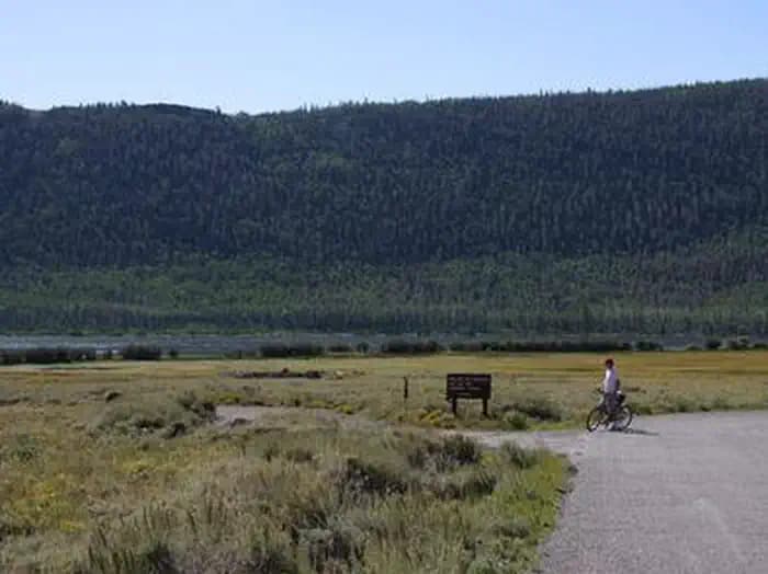
UT · Campground
Overview Doctor Creek Campground is located next to Fish Lake in the Fishlake National Forest of central Utah. Visitors enjoy fishing, boating, wildlife viewing and exploring local trails. Located within the Aspen Pando Clone it is a great explore this world renound natural treasure. View Doctor Creek Campground, Group Site & Dump station Map Recreation Fish Lake is Utah's largest natural mountain lake, covering 2,500 acres. It is famous for its 20-40 pound Mackinaw lake trout. Anglers also enjoy fishing for rainbow trout and splake. Boating, canoeing, swimming and scuba diving are popular activities. The scenic Lakeshore National Recreation Trail extends around the eastern side of the lake. Hikers are rewarded with stunning lake views after climbing 900 feet in elevation. Facilities Fish Lake is Utah's largest natural mountain lake, covering 2,500 acres. It is famous for its 20-40 pound Mackinaw lake trout. Anglers also enjoy fishing for rainbow trout and splake. Boating, canoeing, swimming and scuba diving are popular activities. The scenic Lakeshore National Recreation Trail extends around the eastern side of the lake. Hikers are rewarded with stunning lake views after climbing 900 feet in elevation. Natural Features Doctor Creek sits at at an elevation of 9,000 feet on the southern tip of Fish Lake on Mallard Bay. A series of ponds, known as Coots Slough, dot the area just south of the campground. Aspens and cottonwoods provide limited shade in this sagebrush-covered area. Sites on the outer edge of the campground offer excellent lake views but no shade. Nearby Attractions The 5-mile Pelican Canyon Trail begins nearby at Bowery Creek Campground. It leads through meadows and dense forests of spruce, pine and aspen as it climbs to the 11,633-foot Fish Lake Hightop. Johnson Valley Reservoir is just north of Fish Lake, offering additional fishing and boating opportunities.
View details →
UT · Campground
Overview Twin Creeks Picnic Area is is a day-use site located next to Fish Lake, Twin Creeks and the Fishlake Scenic Byway at an elevation of 8,800 feet. Visitors enjoy fishing, boating, exploring local trails and viewing spawning salmon from the board walk that meanders along the creek. This takes place mid to late fall. Some fish can usually be found year round. Recreation Fish Lake is Utah's largest natural mountain lake, covering 2,500 acres. It is famous for its 20-40 pound Mackinaw lake trout. Anglers also enjoy fishing for rainbow trout and splake. Boating, canoeing, swimming and scuba diving are popular activities. The 5-mile Pelican Canyon Trail begins a mile away at Bowery Creek Campground. It leads through meadows and dense forests of spruce, pine and aspen as it climbs to the 11,633-foot Fish Lake Hightop. The popular Lakeshore National Recreation Trail extends around the eastern side of the lake. Hikers are rewarded with stunning lake views after climbing 900 feet in elevation. Facilities Fish Lake is Utah's largest natural mountain lake, covering 2,500 acres. It is famous for its 20-40 pound Mackinaw lake trout. Anglers also enjoy fishing for rainbow trout and splake. Boating, canoeing, swimming and scuba diving are popular activities. The 5-mile Pelican Canyon Trail begins a mile away at Bowery Creek Campground. It leads through meadows and dense forests of spruce, pine and aspen as it climbs to the 11,633-foot Fish Lake Hightop. The popular Lakeshore National Recreation Trail extends around the eastern side of the lake. Hikers are rewarded with stunning lake views after climbing 900 feet in elevation. Natural Features The shelter sits amid scattered pines and aspens on the shore above Fish Lake. Sagebrush and summer wildflowers dot the landscape. Nearby Attractions Johnson Valley Reservoir is just north of Fish Lake, offering additional fishing and boating opportunities. Pando Clone is located on the south end of the basin and identified with signs along highway 25. Lakeshore trail a varying 17 mile loop.
View details →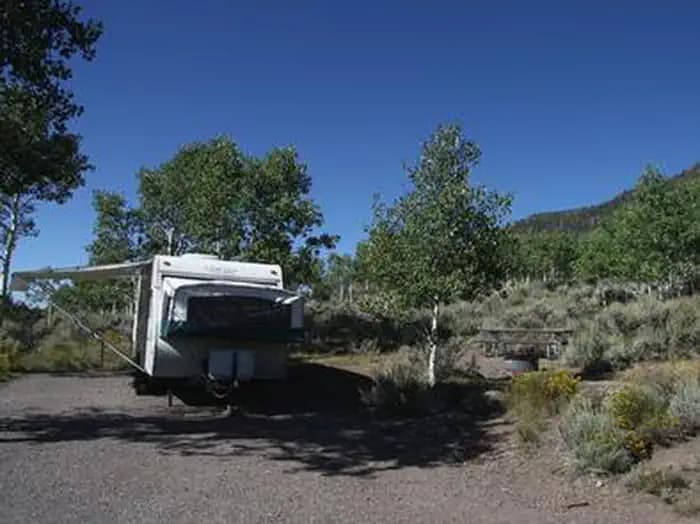
UT · Campground
Overview Mackinaw Campground is located next to Fish Lake and the Fishlake Scenic Byway in central Utah at an elevation of 9,000 feet. Visitors enjoy boating, fishing and exploring local trails. Recreation Fish Lake is Utah's largest natural mountain lake, covering 2,500 acres. It is famous for its 20-40 pound Mackinaw lake trout. Anglers also enjoy fishing for rainbow trout and splake. Boating, canoeing, swimming and scuba diving are popular activities. The 5-mile Pelican Canyon Trail begins next door at Bowery Creek Campground. It leads through meadows and dense forests of spruce, pine and aspen as it climbs to the 11,633-foot Fish Lake Hightop. The popular Lakeshore National Recreation Trail extends around the eastern side of the lake. Hikers are rewarded with stunning lake views after climbing 900 feet in elevation. Facilities Fish Lake is Utah's largest natural mountain lake, covering 2,500 acres. It is famous for its 20-40 pound Mackinaw lake trout. Anglers also enjoy fishing for rainbow trout and splake. Boating, canoeing, swimming and scuba diving are popular activities. The 5-mile Pelican Canyon Trail begins next door at Bowery Creek Campground. It leads through meadows and dense forests of spruce, pine and aspen as it climbs to the 11,633-foot Fish Lake Hightop. The popular Lakeshore National Recreation Trail extends around the eastern side of the lake. Hikers are rewarded with stunning lake views after climbing 900 feet in elevation. Natural Features The campground sits on a sagebrush-covered hillside above the valley floor and offers views of Fish Lake. Aspen trees forest the site, providing partial shade. Nearby Attractions Johnson Valley Reservoir is just north of Fish Lake, offering additional fishing and boating opportunities.
View details →
UT · Campground
Overview Paiute Campground is 29 miles north of Loa, Utah, on Highway 25 adjacent to Johnson Reservoir at 8,800 feet elevation. With 48 pull-through camp sites, Piute campground is ideal for large groups or individual campers looking for a secluded experience. Paiute Campground is located near Johnson Valley Reservoir in the Fishlake National Forest of central Utah. Visitors enjoy boating, fishing and exploring local trails. Recreation Fish Lake is Utah's largest natural mountain lake, covering 2,500 acres. It is famous for its 20-40 pound Mackinaw lake trout. Anglers alos enjoy fishing for rainbow trout and splake. Boating, canoeing, swimming, and scuba diving are popular activities. The 5-mile Pelican Canyon Trail begins near by. It leads through meadows and dense forests of spruce, pine and aspen as it climbs to the 11,633-foot Fish Lake Hightop. The popular Lakeshore National Recreation Trail exteds around the eastern side of the lake. Hikers are rewarded with stunning lake views after climbing 900 feet in elevation. Facilities Fish Lake is Utah's largest natural mountain lake, covering 2,500 acres. It is famous for its 20-40 pound Mackinaw lake trout. Anglers alos enjoy fishing for rainbow trout and splake. Boating, canoeing, swimming, and scuba diving are popular activities. The 5-mile Pelican Canyon Trail begins near by. It leads through meadows and dense forests of spruce, pine and aspen as it climbs to the 11,633-foot Fish Lake Hightop. The popular Lakeshore National Recreation Trail exteds around the eastern side of the lake. Hikers are rewarded with stunning lake views after climbing 900 feet in elevation. Natural Features The campground sits at an elevation of 8,800 feet on a sagebrush-covered hillside on the valley floor, offering sweeping views of the Aspen, Pine and Cottonwood forest. Nearby Attractions Johnson Valley Reservoir is near by, offering fishing and boating opportunities. Visitors enjoy hiking the non-motorized trail from the campground to nearby Tasha Creek and beyond.
View details →
UT · Campground
Overview Frying Pan Campground is located on the Fishlake Scenic Byway in central Utah, just 3 miles north of Fish Lake, at an elevation of 9,000 feet. Visitors enjoy boating, fishing and exploring local trails. View Frying Pan Campground Map Recreation Fish Lake is Utah's largest natural mountain lake and covers 2,500 acres. It is famous for its 20-40 pound Mackinaw lake trout. Anglers also enjoy fishing for rainbow trout and splake. Boating, canoeing, swimming and scuba diving are popular activities. The scenic Lakeshore National Recreation Trail extends around the eastern side of the lake. Hikers are rewarded with stunning lake views after climbing 900 feet in elevation. Facilities Fish Lake is Utah's largest natural mountain lake and covers 2,500 acres. It is famous for its 20-40 pound Mackinaw lake trout. Anglers also enjoy fishing for rainbow trout and splake. Boating, canoeing, swimming and scuba diving are popular activities. The scenic Lakeshore National Recreation Trail extends around the eastern side of the lake. Hikers are rewarded with stunning lake views after climbing 900 feet in elevation. Natural Features The campground sits on a sagebrush-covered hillside above the valley floor and offers views of the north end of Fish Lake Basin. Aspen trees forest the site, providing limited shade. Nearby Attractions Johnson Valley Reservoir is just north of Fish Lake, offering additional fishing and boating opportunities. The 5-mile Pelican Canyon Trail begins nearby at Bowery Creek Campground. It leads through meadows and dense forests of spruce, pine and aspen as it climbs to the 11,633-foot Fish Lake Hightop.
View details →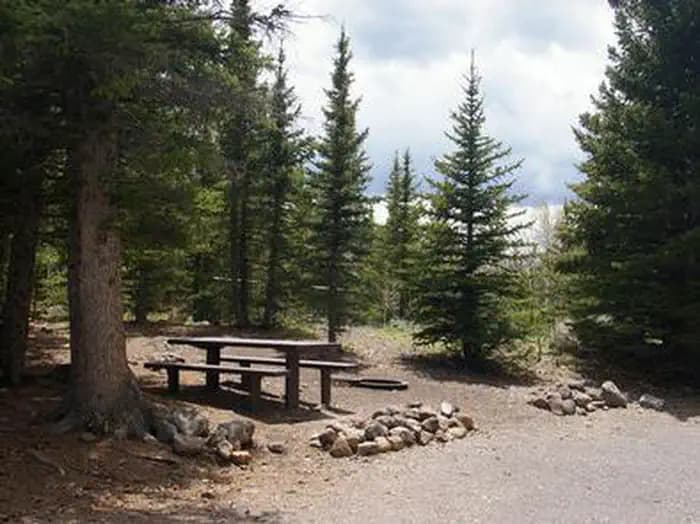
UT · Campground
Overview Tasha Equestrian Campground is located in central Utah, just 4 miles north of beautiful Fish Lake at an elevation of 9,000 feet. Visitors enjoy horseback riding and fishing for famous Mackinaw lake trout. Recreation Many miles of horseback riding, hiking, biking and off-road vehicle trails crisscross the area. Johnson Valley Reservoir is just a half-mile from the campground, offering boating, fishing and a boat ramp. Facilities Many miles of horseback riding, hiking, biking and off-road vehicle trails crisscross the area. Johnson Valley Reservoir is just a half-mile from the campground, offering boating, fishing and a boat ramp. Natural Features Tasha's high mountain setting is beautiful but remote and is prone to rapid weather changes due to its elevation. The site is forested with a mixed stand of aspen, spruce and pines, which provides partial shade. Most sites provide sweeping mountain and valley views. Nearby Attractions Fish Lake, Utah's largest natural mountain lake, is less than 10 minutes from the campground. The lake is famous for its 20-40 pound Mackinaw lake trout. Boating, swimming and scuba diving are popular activities on the lake. Boat ramps, rentals, a marina, fuel, groceries, restaurants and fishing and camping supplies can all be found at Fish Lake. The Mytoge Mountain Trail, a 25-mile hiking/biking loop, offers everything from easy cruising to challenging singletrack in the mountains around Fish Lake.
View details →
Overview Temple Mountain Townsite is a fee campground in the San Rafael Swell Recreation Area. Recreation Temple Mountain Townsite is at the intersection of Temple Mountain Road and the Behind-the-Reef Road. From the campground, visitors can hike to reclaimed uranium mines, drive a short distance down the wash to the Temple Mountain Pictograph Panel, or drive the longer North Temple Wash loop. The Behind-the-Reef Road is accessible to most vehicles for six miles, accessing several trailheads for hikes into the San Rafael Reef Wilderness. Two of these (Chute Canyon and Wild Horse Canyon) are accessible for horseback riders. The road continues for another 14 miles requiring high clearance and four-wheel-drive as it follows the rugged base of the reef against a backdrop of 500-foot cliffs and jagged canyons. After about seven miles, the road narrows to a maximum vehicle width of 50 feet. More wilderness slot canyons hikes can be accessed from this road. Motorized vehicle use is not permitted in wilderness. Facilities Temple Mountain Townsite is at the intersection of Temple Mountain Road and the Behind-the-Reef Road. From the campground, visitors can hike to reclaimed uranium mines, drive a short distance down the wash to the Temple Mountain Pictograph Panel, or drive the longer North Temple Wash loop. The Behind-the-Reef Road is accessible to most vehicles for six miles, accessing several trailheads for hikes into the San Rafael Reef Wilderness. Two of these (Chute Canyon and Wild Horse Canyon) are accessible for horseback riders. The road continues for another 14 miles requiring high clearance and four-wheel-drive as it follows the rugged base of the reef against a backdrop of 500-foot cliffs and jagged canyons. After about seven miles, the road narrows to a maximum vehicle width of 50 feet. More wilderness slot canyons hikes can be accessed from this road. Motorized vehicle use is not permitted in wilderness. Natural Features The campground is at the mouth of a short, steep canyon (Temple Wash) which cuts through the San Rafael Reef. One of the most distinctive geologic features of central Utah, the Reef is a 75-mile-long rocky spine that reaches up to 1,000 feet high and forms the eastern edge of the San Rafael Swell. The Temple Mountain area provides acces to many scenic slot canyons, hills, and spires cut from red and white rock. Nearby Attractions Goblin Valley State Park (fee area), 2 miles east: The state park entrance is two miles up the Temple Wash Road going back towards Highway 24. The state park is famous for its unique landscape of sandstone hoodoos (goblins) and buttes. The park has hiking and mountain biking trails as well as a fee campground and yurt rentals. Little Wild Horse Canyon: The Little Wild Horse slot canyon is the most popular hike in the San Rafael Reef. Visitors can appreciate sculpted sandstone walls and narrows through the three-mile canyon. Paired with Bell Canyon via the Behind-the-Reef Road, this makes for an eight-mile moderate day hike with varied scenery. The canyon bottoms are gravel and there are some obstacles requiring straightforward scrambling. Temple Mountain Mining District: The townsite is in the heart of the historic Temple Mountain Mining District. Visitors can visit sites and learn about the history of Cold War-era uranium mining by foot or vehicle. contact_info For facility specific information, please call (435) 636-3600.
View details →
Overview South Temple Wash is a fee campground in the San Rafael Swell Recreation Area. Recreation South Temple Wash campground is located along the Temple Mountain Road on the east side of the Reef. A short distance back to the east of the campground is the turn to go to Goblin Valley State Park. Turning west before the entrance of the state park will lead to Little Wild Horse Canyon, a popular hike for many in a slot canyon. From the campground and driving west on the Temple Mountain Road will lead to the Temple Mountain Pictograph Panel, a short drive further is Temple Mountain Townsite. Here visitors can hike to reclaimed uranium mines. Opposite Temple Mountain Townsite is The Behind-the-Reef Road and it is accessible to most vehicles for six miles, accessing several trailheads for hikes into the San Rafael Reef Wilderness. Two of these (Chute Canyon and Wild Horse Canyon) are accessible for horseback riders. The road continues for another 14 miles requiring high clearance and four-wheel-drive as it follows the rugged base of the reef against a backdrop of 500-foot cliffs and jagged canyons. After about seven miles, the road narrows to a maximum vehicle width of 50 feet. More wilderness slot canyons hikes can be accessed from this road. Motorized vehicle use is not permitted in wilderness. Facilities South Temple Wash campground is located along the Temple Mountain Road on the east side of the Reef. A short distance back to the east of the campground is the turn to go to Goblin Valley State Park. Turning west before the entrance of the state park will lead to Little Wild Horse Canyon, a popular hike for many in a slot canyon. From the campground and driving west on the Temple Mountain Road will lead to the Temple Mountain Pictograph Panel, a short drive further is Temple Mountain Townsite. Here visitors can hike to reclaimed uranium mines. Opposite Temple Mountain Townsite is The Behind-the-Reef Road and it is accessible to most vehicles for six miles, accessing several trailheads for hikes into the San Rafael Reef Wilderness. Two of these (Chute Canyon and Wild Horse Canyon) are accessible for horseback riders. The road continues for another 14 miles requiring high clearance and four-wheel-drive as it follows the rugged base of the reef against a backdrop of 500-foot cliffs and jagged canyons. After about seven miles, the road narrows to a maximum vehicle width of 50 feet. More wilderness slot canyons hikes can be accessed from this road. Motorized vehicle use is not permitted in wilderness. Natural Features The campground is at the Eastern mouth of a short, steep canyon (Temple Wash) which cuts through the San Rafael Reef. One of the most distinctive geologic features of central Utah, the Reef is a 75-mile-long rocky spine that reaches up to 1,000 feet high and forms the eastern edge of the San Rafael Swell. The Temple Mountain area provides acces to many scenic slot canyons, hills, and spires cut from red and white rock. contact_info For facility specific information, please call (435) 636-3600. Nearby Attractions Goblin Valley State Park (fee area), 2 miles east: The state park entrance is two miles up the Temple Wash Road going back towards Highway 24. The state park is famous for its unique landscape of sandstone hoodoos (goblins) and buttes. The park has hiking and mountain biking trails as well as a fee campground and yurt rentals. Little Wild Horse Canyon: The Little Wild Horse slot canyon is the most popular hike in the San Rafael Reef. Visitors can appreciate sculpted sandstone walls and narrows through the three-mile canyon. Paired with Bell Canyon via the Behind-the-Reef Road, this makes for an eight-mile moderate day hike with varied scenery. The canyon bottoms are gravel and there are some obstacles requiring straightforward scrambling. Temple Mountain Mining District: The townsite is in the heart of the historic Temple Mountain Mining District. Visitors can visit sites and learn about the history of Cold War-era uranium mining by foot or vehicle.
View details →
UT · Campground
Overview Pine Lake Campground is located next to its scenic namesake lake high on the Colorado Plateau at an elevation of 8,100 feet. Visitors enjoy canoeing, fishing and exploring local hiking and off-road vehicle trails. Recreation A short trail leads from the campground to Pine Lake, which offers excellent canoeing and kayaking, as well as fishing for rainbow, cutthroat and brook trout. Hiking and off-road vehicle trails are plentiful within the area, however off-road vehicles are not allowed in the campground. The Pine Lake OHV Trailhead is located adjacent to the campground. A loading ramp is provided. Facilities A short trail leads from the campground to Pine Lake, which offers excellent canoeing and kayaking, as well as fishing for rainbow, cutthroat and brook trout. Hiking and off-road vehicle trails are plentiful within the area, however off-road vehicles are not allowed in the campground. The Pine Lake OHV Trailhead is located adjacent to the campground. A loading ramp is provided. Natural Features Pine Lake is situated at the foot of beautifully forested peaks banded with red and white layers of sandstone. The campground is nestled among a forest of spruce and towering ponderosa pines, and is adjacent to Pine Lake. Nearby Attractions Bryce Canyon National Park is approximately 30 minutes from the campground, offering breathtaking scenery and excellent hiking opportunities. Kodachrome Basin State Park is an hour away, with towering rock spires, a natural arch and great hiking trails.
View details →Planning tips
Camping near Capitol Reef
When is the best time to camp near Capitol Reef?
Peak season varies, but summer (June–August) is the busiest time near Capitol Reef National Park. For fewer crowds and pleasant weather, consider shoulder seasons — late May or September–October. Check seasonal road closures before planning your trip.
Should I make a reservation?
Campgrounds near popular national parks fill up fast, especially on weekends and holidays. Reserve as early as possible — some sites open reservations 6 months in advance. First-come, first-served sites may be available on weekdays.
How far are these campgrounds from Capitol Reef?
The closest campground is about 7 mi away. Most campgrounds on this page are within a 30–50 mile drive of Capitol Reef National Park.
Keep exploring