—
Total Campsites
Campground
—
Reservable Sites
Check by phone
—
Accessible
ADA-compliant sites
Organization
Overview
About WATERCRESS
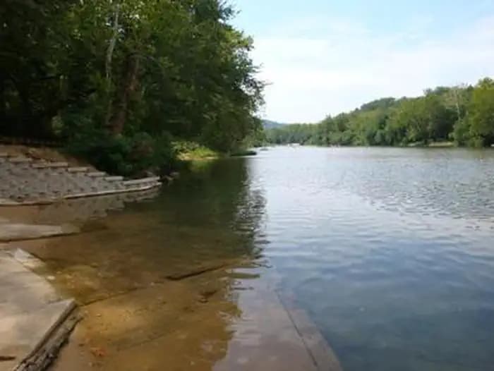
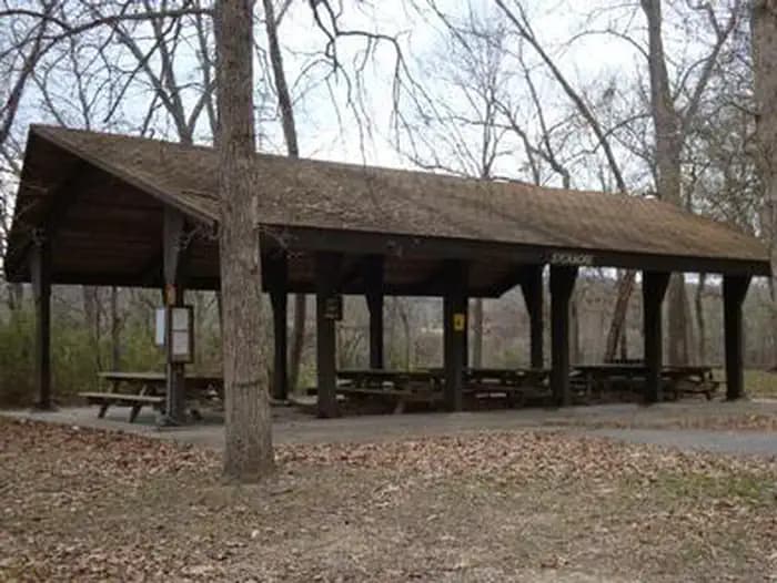
Overview ***Watercress sustained substantial damage to the pavilions during the 2017 flood, they are not reservable at this time, however the boat ramp is still open for public use.*** Watercress Campground lies on the banks one of the forest’s greatest treasures; the Current River. Floats on the river provide views of southeastern Missouri that otherwise can't be seen. The area is home to a variety of birds and wildlife and recreation opportunities are plentiful in the surrounding area. Recreation Boating and canoeing on the Current River, as well as on other nearby rivers, are popular activities. A boat ramp for both motorized and non-motorized boats is available on the east bank of the Current River. Anglers enjoy fishing for bass, walleye, sunfish and the occasional catfish. Big Spring, Missouri's largest spring, is just five miles from the campground. Hikers at Watercress area enjoy the Songbird Trail, a 1.2-mile loop that leads to Watercress Spring, passing remnants of Civil War-era earthwork that overlook the Current River. Facilities Boating and canoeing on the Current River, as well as on other nearby rivers, are popular activities. A boat ramp for both motorized and non-motorized boats is available on the east bank of the Current River. Anglers enjoy fishing for bass, walleye, sunfish and the occasional catfish. Big Spring, Missouri's largest spring, is just five miles from the campground. Hikers at Watercress area enjoy the Songbird Trail, a 1.2-mile loop that leads to Watercress Spring, passing remnants of Civil War-era earthwork that overlook the Current River. Natural Features Located within the town of Van Buren, the campground and day use area are adjacent to the Current River, which flows past scenic bluffs, springs, caves as it meanders through the Mark Twain National Forest toward Doniphan, MO. Nearby Attractions The campground is adjacent to the Ozark National Scenic Riverways, which is a series of protected rivers in the area managed by the National Park Service. More information about the National Park Service sites can be found here .
- Map coordinates are available for trip planning.

Reservations & Contact
Plan your stay
Getting There
From Highway 60, drive north on Main Street to the National Park Service sign on Watercress Road. Turn north and drive just past the Park Service building complex, then make a left to Watercress Recreation Area. The picnic shelters are on the left toward the north end of the day use area.
FAQ
Common questions
Everything you need to know before your trip to WATERCRESS.
How do reservations work for WATERCRESS?
Reservation availability for WATERCRESS can vary by season and campsite type. Check the contact and access section before booking.
What campsite types are available at WATERCRESS?
Campsite type details are limited right now. Check back as this listing is enriched.
Where is WATERCRESS located?
WATERCRESS is in Missouri near Poplar Bluff. Coordinates: 37.0019, -91.0186.
Keep Exploring