
Campgrounds in Missouri
Camp in the beautiful Ozarks and along rivers in the Show Me State
51
Campgrounds listed
100%
With photos
100%
Detailed descriptions
Campground
Top campground type
Highlights
Featured campgrounds in Missouri
Explore by campground name letter
Jump to A-Z landing hubs for stronger discovery paths beyond Missouri.
All campgrounds
Showing 51 campgrounds
Overview River Run Park is conveniently located just below Powersite Dam allowing quick lake access for fishing or recreational watersports. Recreation Hiking, birding, all types of water sports, and in-season hunting are featured attractions. Spring and fall are the best seasons for fishing, but spotted bass, crappie and similar fish can be sought throughout the year. Facilities Hiking, birding, all types of water sports, and in-season hunting are featured attractions. Spring and fall are the best seasons for fishing, but spotted bass, crappie and similar fish can be sought throughout the year. Natural Features The campground in in south-central Missouri just below the Powersite Dam on Bull Shoals Lake. Nearby, sturdy, green hardwoods and cedar glades encompass the rocky bluffs and unique rock formations of the mountains. contact_info For facility specific information, please call (870) 425-2700. Nearby Attractions Visit the Jones Point State Wildlife Management Area for promising wildlife spotting and birding. The lively tourist town of Branson is just minutes away. Here, visitors can shop, dine and find live music. Charges & Cancellations Cancellations up to 2 days before a reservation start date incur a $10.00 cancellation fee.
View details →
Overview In our park, "backcountry campground" refers to sites that have some basic amenities, but not as many as developed campgrounds. All backcountry sites have picnic tables, fire rings, lantern posts, and vault toilet restrooms. These campgrounds may have less amenities, but they are some of the most beautiful locations in the park. Certain sites are located right on the river's edge, allowing quick water access. Some sites are far away from other campers, giving you a chance to enjoy natural peace and quiet. If you crave a camping experience that is off the beaten path, these are the sites for you! Keep in mind that these campgrounds are often harder to reach due to their location. Most backcountry sites require driving down gravel roads. Some roads are unsuitable for vehicles with low clearance. Be sure to dowload the Recreation.gov app before starting your journey to the backcountry sites, as cell serivce can be limited or simply non existent in these remote areas of the park. All backcountry sites are now payable with Scan & Pay and you will need the Recreation.gov app to complete the purchase of your campsite. Recreation The river flows past the campground, offering excellent canoeing, tubing, swimming and fishing. Over 130 miles (209 km) of waterways exist within the park. Canoe and kayak rentals and outfitters can be found nearby. Several miles of hiking and horseback riding trails crisscross the region, include the Alley Overlook Trail, Chubb Hollow Trail, Ozark Trail, Cave Spring Trail and Big Springs Trail. Facilities This campground has vault toilets available. Picnic tables, fire rings, and lantern posts are provided. Natural Features The Ozark National Scenic Riverways is known for its caves, springs, sinkholes and losing streams, and features over 300 identified caves within its boundaries. The caves range in size from a rock overhang to almost seven miles of identified passages. Eight caves, including an open sinkhole, have been designated as outstanding natural features. The Ozark forest is mostly White oak and Shortleaf pine, Missouri's only native pine species. Along the rivers, Sycamore, Cottonwood, River birch and maples are common. Redbud and dogwoods are also abundant, putting on a spectacular show during most spring months. Nearby Attractions Round Spring Cave is nearby, with ranger-guided tours offered daily during summer months. Historic and picturesque Alley Mill and Alley Spring are also nearby. The mill is open daily in the summer and ranger-guided tours are available upon request. Scenic Big Spring is the largest freshwater spring in North America and produces an outflow of 280 million gallons a day. Charges & Cancellations With the backcountry sites now utilizing the Recreation.gov Scan and Pay system, there will not be any capability for changes and refunds. If you are unsure of your plans, please pay one night at a time.
View details →
Overview In our park, "backcountry campground" refers to sites that have some basic amenities, but not as many as developed campgrounds. All backcountry sites have picnic tables, fire rings, lantern posts, and vault toilet restrooms. These campgrounds may have less amenities, but they are some of the most beautiful locations in the park. Certain sites are located right on the river's edge, allowing quick water access. Some sites are far away from other campers, giving you a chance to enjoy natural peace and quiet. If you crave a camping experience that is off the beaten path, these are the sites for you! Keep in mind that these campgrounds are often harder to reach due to their location. Most backcountry sites require driving down gravel roads. Some roads are unsuitable for vehicles with low clearance. Be sure to double-check the location of your site before making a reservation. Be sure to dowload the Recreation.gov app before starting y our journey to the backcountry sites, as cell serivce can be limited or simply non existent in these remote areas of the park. All backcountry sites are now payable with Scan & Pay and you will need the Recreation.gov app to complete the purchase of your campsite. Recreation The Current River flows past the campground, offering excellent canoeing, tubing, swimming and fishing. Over 130 miles (209 km) of waterways exist within the park. Canoe and kayak rentals and outfitters can be found nearby. Several miles of hiking and horseback riding trails crisscross the region, include the Alley Overlook Trail, Chubb Hollow Trail, Ozark Trail, Cave Spring Trail and Big Springs Trail. Facilities These campgrounds have vault toilets available. Picnic tables, fire rings and lantern posts are provided. Natural Features The Ozark National Scenic Riverways protects 134 miles of the Current and Jacks Fork Rivers and some 80,000 acres of river, forest, open field and glade environments. Riparian habitats are a major component of the park. Typified by sycamores, maples, cottonwoods and willows, floodplain forests line the rivers. These provide habitat for Swainson's warblers, wood ducks, great blue herons and a wide variety of other species. As a significant karst resource, the park contains the world's largest collection of first magnitude springs. It also contains over 300 known caves, numerous sinkholes and losing streams. The park also contains several "Missouri Natural Areas", parcels set aside due to their unique scenic beauty or scientific value. Nearby Attractions Scenic Big Spring is the largest freshwater spring in North America and produces an outflow of 280 million gallons per day. Round Spring Cave is nearby with ranger guided tours offered daily during the summer months. Historic and picturesque Alley Mill and Alley Spring are also nearby. The mill is open daily in the summer and ranger guided tours are available upon request.
View details →
Overview In our park, "backcountry campground" refers to sites that have some basic amenities, but not as many as developed campgrounds. All backcountry sites have picnic tables, fire rings, lantern posts, and vault toilet restrooms. These campgrounds may have less amenities, but they are some of the most beautiful locations in the park. Certain sites are located right on the river's edge, allowing quick water access. Some sites are far away from other campers, giving you a chance to enjoy natural peace and quiet. If you crave a camping experience that is off the beaten path, these are the sites for you! Keep in mind that these campgrounds are often harder to reach due to their location. Most backcountry sites require driving down gravel roads. Some roads are unsuitable for vehicles with low clearance. Be sure to dowload the recreation.gov app before starting your journey to the backcountry sites, as cell serivce can be limited or simply non existent in these remote areas of the park. Be sure to dowload the Recreation.gov app before starting y our journey to the backcountry sites, as cell serivce can be limited or simply non existent in these remote areas of the park. All backcountry sites are now payable with Scan & Pay and you will need the Recreation.gov app to complete the purchase of your campsite. Recreation The Current River flows past the campgrounds, offering excellent floating, fishing, and swimming. Over 130 miles (209 km) of waterways exists within the park. Canoe and kayak rentals and outfitters can be found nearby. Several miles of hiking and horseback riding trails crisscross the region. Facilities The backcountry campgrounds have vault toilets available. Picnic tables, fire rings and lantern posts are provided at each campsite. Natural Features The Ozark National Scenic Riverways protects 134 miles of the Current and Jacks Fork Rivers and some 80,000 acres of river, forest, open field and glade environments. Riparian habitats are a major component of the park. Typified by sycamores, maples, cottonwoods and willows, floodplain forests line the rivers. These provide habitat for Swainson's warblers, wood ducks, great blue herons and a wide variety of other species. As a significant karst resource, the park contains the world's largest collection of first magnitude springs. It also contains over 300 known caves, numerous sinkholes and losing streams. The park also contains several "Missouri Natural Areas", parcels set aside due to their unique scenic beauty or scientific value. Nearby Attractions Round Spring Cave is nearby, with ranger-guided tours offered daily during summer months. Historic and picturesque Alley Mill and Alley Spring are also nearby. The mill is open daily in the summer and ranger-guided tours are available upon request. Scenic Big Spring is the largest freshwater spring in North America and produces an outflow of 280 million gallons a day.
View details →
Overview The Council Bluff Recreation Area is perfect for anyone looking to enjoy the outdoors. The Wild Boar Campground and sheltered picnic area, available for individual families or large groups, is next to the largest lake in the Mark Twain National Forest. The area provides ample opportunities for camping, picnicking, hiking, fishing, swimming and more. Recreation Boating is a popular pastime on the lake, but all boats on the lake must operate at a no-wake speed. Visitors can access the water via the two boat ramps located at the lake. Canoeing, swimming and fishing are also available. Anglers can expect a catch of a variety of freshwater fish, including bass bluegills, catfish and crappies. The 12-mile Council Bluff Trail encircles the lake, with spurs to the campground. Hikers can enjoy scenic views of the lake and a look at the Mark Twain wilderness. Waterfowl hunting is permitted on Council Bluff Lake and the nearby Enough Fields provide upland game opportunities. A variety of wildlife makes its home in the heavily wooded area. Facilities Boating is a popular pastime on the lake, but all boats on the lake must operate at a no-wake speed. Visitors can access the water via the two boat ramps located at the lake. Canoeing, swimming and fishing are also available. Anglers can expect a catch of a variety of freshwater fish, including bass bluegills, catfish and crappies. The 12-mile Council Bluff Trail encircles the lake, with spurs to the campground. Hikers can enjoy scenic views of the lake and a look at the Mark Twain wilderness. Waterfowl hunting is permitted on Council Bluff Lake and the nearby Enough Fields provide upland game opportunities. A variety of wildlife makes its home in the heavily wooded area. Natural Features Located in southern Missouri, the Council Bluff Lake was created by a dam across Big River. It is 440 acres in size and 87 feet deep in some places. The Chapel Hill Beach is at the eastern end of the campground and provides 54,000 square-feet of sandy beach. Visitors can either walk or drive to the lake. Nearby Attractions The Trace Creek section of the Ozark Trail is located just west of the recreation area.
View details →
Overview Red Bluff Campground is named for towering red bluffs along Huzzah Creek, carved by the elements over the past 10,000 years. The area used to be home to timber mills, but now provides a serene spot for camping and enjoying nature. Early settlement of the area surrounded the Boyer Mill constructed around 1830. Railroads created a thriving timber industry till the supply was depleted. The land was purchased by the U.S. Forest Service in 1940 and has been used as a recreation area. Red Bluff is located in the Potosi-Fredericktown Ranger District of the Mark Twain National Forest. Large, red bluffs on the opposite side of Huzzah Creek, gravel bars along the creek, a mixture of pools and riffles and natural vegetation provide a backdrop for a very relaxing camping experience. Wading and swimming in Huzzah Creek are enjoyed by visitors. The water can be swift-moving at times and rocks and drop-offs are not marked. Fishing is also popular in the area and anglers can expect to find bass, sunfish, suckers, and catfish. Three new camping loops were constructed above the Huzzah Creek floodplain – Ridge Top Loop, Creek Loop, and Group Loop - each of which have modern restrooms, water, and electricity on 2023. A new shower house, a dump station, and second pavilion were also added for visitor convenience. Camping spurs are variable in size and layout to accommodate recreational vehicles and trailers of all types. A fourth camping loop, Pines Overlook, was renovated but remains a non-electric loop. Recreation Many sites are within 200 yards of Huzzah Creek, where tubing and swimming are enjoyed by visitors. The water can be swift-moving at times and rocks and drop-offs are not marked. Fishing is also popular in the area and anglers can expect to find bass, perch and catfish. The Red Bluff Trail lies within the boundaries of the campground. It is a 1.2-mile loop that winds through a pine plantation and big oak timber, into an adjoining hollow before returning to the campground. The short trail provides an opportunity for visitors to enjoy a variety of ecological communities, while reaping the benefits of a half-hour of hiking. Facilities Many sites are within 200 yards of Huzzah Creek, where tubing and swimming are enjoyed by visitors. The water can be swift-moving at times and rocks and drop-offs are not marked. Fishing is also popular in the area and anglers can expect to find bass, perch and catfish. The Red Bluff Trail lies within the boundaries of the campground. It is a 1.2-mile loop that winds through a pine plantation and big oak timber, into an adjoining hollow before returning to the campground. The short trail provides an opportunity for visitors to enjoy a variety of ecological communities, while reaping the benefits of a half-hour of hiking. Natural Features Large, red bluffs on the opposite side of Huzzah Creek, gravel bars along the creek, a mixture of pools and riffles and natural vegetation provide a backdrop for a very relaxing camping experience at the campground. Red Bluff is located in the Potosi-Fredericktown Ranger District of the Mark Twain National Forest. Nearby Attractions This campground is located in southeastern Missouri, approximately one mile from the town of Davisville.
View details →
Overview Silver Mines Campground is located on the St. Francis River in the Mark Twain National Forest. It offers a variety of recreational opportunities and abundant historic and geological wonders. Recreation Parts of the river are available for swimming, while other portions provide good fishing. Whitewater kayaking is a popular activity during the springtime when water runs high. Depending on water levels, the state holds an annual kayaking competition the third weekend of March. The 2-mile Silver Mines Trail follows both sides of the river, leading to various picnic areas. A 1.2-mile trail spurs to a popular conservation area, where visitors can view spectacular rock formations along the river. Facilities Parts of the river are available for swimming, while other portions provide good fishing. Whitewater kayaking is a popular activity during the springtime when water runs high. Depending on water levels, the state holds an annual kayaking competition the third weekend of March. The 2-mile Silver Mines Trail follows both sides of the river, leading to various picnic areas. A 1.2-mile trail spurs to a popular conservation area, where visitors can view spectacular rock formations along the river. Natural Features This beautiful area is located along the St. Francis River, the only river in Missouri classified as a whitewater river. It is widely used for kayaking during springtime. The campground is located at a historic mining operation and is known for its Precambrian granite and felsite rocks. A variety of wildlife makes its home in the area. Nearby Attractions The Millstream Gardens Conservation Area is located eight miles west of Fredericktown, or four miles west of the campground, on Highway 72. It is home to the scenic Tiemann Shut-ins and other spectacular sights along the riverbed.
View details →
Overview Float Camp Picnic Area is located only 150 feet from the cool waters of the crystal clear Current River. Visitors enjoy floating the river, fishing and hiking. A campground is only a half-mile away for those who want to stay longer than a day. Recreation The swift-moving river allows for enjoyable float trips, as well as canoeing and great fishing. Swimming is also a popular pastime. Visitors enjoy horseshoe pits and volleyball courts, as well as hiking and other recreational opportunities nearby. Facilities The swift-moving river allows for enjoyable float trips, as well as canoeing and great fishing. Swimming is also a popular pastime. Visitors enjoy horseshoe pits and volleyball courts, as well as hiking and other recreational opportunities nearby. Natural Features The picnic area is nestled under a mature forest of hardwoods, which offers plentiful shade. It is adjacent to the Current River. Nearby Attractions Doniphan is four miles away and offers float trip outfitters, restaurants and lodging.
View details →
Overview Roomy campsites surrounded by open lawn and natural shading, cool breezes, abundant songbirds and scenic views all await visitors at the Sutton Bluff Recreation Area. The campground is a popular site for those using the nearby designated Sutton Bluff off-road vehicle trails. Recreation A 20 mile off-road vehicle trail can be accessed from the campground. Permits are required for off-road vehicle use in the area. The Karkaghne section of the Ozark Trail, which is popular among backpackers, hikers and mountain bikers, is accessible from a trailhead less than a mile from the campground. The West Fork of Black River provides access to a serene, slow-moving mountain stream and a natural gravel beach. Visitors enjoy wading in the waters, however the current is not strong enough to enable floating the river. Anglers can enjoy a variety of bass and bluegill. Facilities A 20 mile off-road vehicle trail can be accessed from the campground. Permits are required for off-road vehicle use in the area. The Karkaghne section of the Ozark Trail, which is popular among backpackers, hikers and mountain bikers, is accessible from a trailhead less than a mile from the campground. The West Fork of Black River provides access to a serene, slow-moving mountain stream and a natural gravel beach. Visitors enjoy wading in the waters, however the current is not strong enough to enable floating the river. Anglers can enjoy a variety of bass and bluegill. Natural Features Sutton Bluff is located 13 miles outside Centerville, Missouri, on the Black River. It is nestled among a variety of short-leaf pine trees and shrubs, and a number of campsites sit alongside the West Fork of the Black River. Nearby Attractions The small mining town of Centerville is located roughly six miles from the campground.
View details →
Overview Pinewoods Lake Recreation Area sits next to Pinewoods Lake in southeastern Missouri. It is an ideal location to enjoy lake fishing and scenic trails. Recreation A 1.3-mile walking trail surrounds the lake. Most of the trail has a concrete surface and is accessible. The entire trail is relatively flat, with no difficult sections. Circling the 32-acre lake, the trail provides views of the lake, songbirds and wildlife, and an abundance of wildflowers. The lake offers a floating fishing pier and a concrete boat ramp. Anglers can enjoy fishing for bass, sunfish and catfish. Facilities A 1.3-mile walking trail surrounds the lake. Most of the trail has a concrete surface and is accessible. The entire trail is relatively flat, with no difficult sections. Circling the 32-acre lake, the trail provides views of the lake, songbirds and wildlife, and an abundance of wildflowers. The lake offers a floating fishing pier and a concrete boat ramp. Anglers can enjoy fishing for bass, sunfish and catfish. Natural Features The lake is located on the southeastern quadrant of the Mark Twain National Forest. The area is densely wooded. Nearby Attractions Ellsinore is the closest city to the campground, just 3 miles away, with a few dining options, a grocery store and fuel station.
View details →
Overview Baxter is a spacious and sunny campground that sits along the White River Arm of Table Rock Lake. The highly productive fishing waters of the White River Arm will appeal to anglers, while the Baxter full-service marina offers everything a boater needs from fuel to fishing licenses. Recreation Whether on water or land, Baxter Campground offers visitors countless recreational activities. Picnicking, swimming, scuba diving, boating, fishing, hiking and wildlife viewing are all popular pastimes at the park. Water sports including tubing, wakeboarding and water skiing are extremely popular on the deep, clear, beautiful waters of Table Rock Lake. The Baxter marina provides rentals from ski boats to life vests, meeting any of your recreation needs. While the lake boasts an abundance of crappie, catfish, and bluegill, Table Rock is most famous for bass, and is acclaimed as one of the best bass fishing lakes in this hemisphere. Table Rock Lakeshore Trail, about 2 miles long, runs from the Dewey Short Visitor Center to the Table Rock State Park Marina. During the spring hikers will see dogwood, serviceberry and redbud trees in bloom as well as many wildflower species. During the autumn months, visitors are treated to nature's colorful fall foliage. The trail also offers beautiful views of Table Rock Lake. Other hiking and mountain biking opportunities are available at the Mark Twain National Forest, parts of which are easily accessible from the campground. Click here for more information. Facilities Whether on water or land, Baxter Campground offers visitors countless recreational activities. Picnicking, swimming, scuba diving, boating, fishing, hiking and wildlife viewing are all popular pastimes at the park. Water sports including tubing, wakeboarding and water skiing are extremely popular on the deep, clear, beautiful waters of Table Rock Lake. The Baxter marina provides rentals from ski boats to life vests, meeting any of your recreation needs. While the lake boasts an abundance of crappie, catfish, and bluegill, Table Rock is most famous for bass, and is acclaimed as one of the best bass fishing lakes in this hemisphere. Table Rock Lakeshore Trail, about 2 miles long, runs from the Dewey Short Visitor Center to the Table Rock State Park Marina. During the spring hikers will see dogwood, serviceberry and redbud trees in bloom as well as many wildflower species. During the autumn months, visitors are treated to nature's colorful fall foliage. The trail also offers beautiful views of Table Rock Lake. Other hiking and mountain biking opportunities are available at the Mark Twain National Forest, parts of which are easily accessible from the campground. Click here for more information. Natural Features Table Rock Lake is a beautiful body of water surrounded by a forest of oak and hickory trees. Its waters wind down through the valleys and hollows of the Ozark Mountains, from Branson, Missouri to Eureka Springs, Arkansas. More than five million visitors per year take advantage of this recreational oasis. Originally built for flood control, the Table Rock Dam has created a lake that boasts 779 miles of shoreline for the public to enjoy. Nearby Attractions The Dewey Short Visitors Center is located at the south end of Table Rock Dam. It offers three educational films focused on the history of the dam, the story of Lewis and Clark and the history of eagles and their endangerment in the state of Missouri. The visitor center also contains exhibits on the natural history of the area. Those visitors arriving by boat can take advantage of the courtesy dock. Baxter Campground is only 23 miles from Branson, Missouri, which offers grocery stores, gas and additional tourist attractions.
View details →
Overview Escape from the hustle and bustle of city-life at Beaver Creek, a small, quiet campground tucked between a forested area and the lower shores of Bull Shoals Lake. The lake, in the beautiful Ozark Mountains, attracts visitors year-round as each season unfolds a new panorama. Recreation Hiking, birding, all types of water sports, and in-season hunting are featured attractions. Spring and fall are the best seasons for fishing, but spotted bass, crappie and similar fish can be sought throughout the year. Facilities Hiking, birding, all types of water sports, and in-season hunting are featured attractions. Spring and fall are the best seasons for fishing, but spotted bass, crappie and similar fish can be sought throughout the year. Natural Features The campground is in south-central Missouri along the Beaver Creek arm of Bull Shoals Lake. Sturdy, green hardwoods and cedar glades encompass the rocky bluffs and unique rock formations of the mountains. Nearby Attractions Visit the Jones Point State Wildlife Management Area for promising wildlife spotting and birding. The lively tourist town of Branson is just 30 minutes away. Here, visitors can shop, dine and find live music. Charges & Cancellations Cancellations up to 2 days before a reservation start date incur a $10.00 cancellation fee.
View details →
Overview Big M is a spacious and grassy campground that sits along the White River Arm of Table Rock Lake in the Missouri countryside. Big M provides plenty of sites with a panoramic view of the beautiful Table Rock Lake, surrounded by the scenic foothills of the Ozark Mountains. Recreation Whether on water or land, Big M Campground offers visitors countless recreational activities. Picnicking, swimming, scuba diving, boating, fishing, hiking and wildlife viewing are all popular pastimes at the park. With a large marina located just a short walking distance from the campsites, boating and fishing enthusiasts will find they have everything they need to enjoy the deep, clear waters of Table Rock Lake. While the lake boasts an abundance of crappie, catfish, and bluegill, Table Rock is most famous for bass, and is acclaimed as one of the best bass fishing lakes in this hemisphere. Multiple fishing tournaments are hosted yearly and anglers will there is no shortage of Largemouth, Smallmouth, White or Spotted bass. For visitors interested in staying near shore, a designated swimming beach near the campground's volleyball court, offers a convenient way to cool off during warm summer months. Table Rock Lakeshore Trail, about 2 miles long, runs from the Dewey Short Visitor Center to the Table Rock State Park Marina. During the spring hikers will see dogwood, serviceberry and redbud trees in bloom as well as many wildflower species. During the autumn months, visitors are treated to nature's colorful fall foliage. The trail also offers beautiful views of Table Rock Lake. Other hiking and mountain biking opportunities are available at the Mark Twain National Forest, parts of which are easily accessible from the campground. Click here for more information. Facilities Whether on water or land, Big M Campground offers visitors countless recreational activities. Picnicking, swimming, scuba diving, boating, fishing, hiking and wildlife viewing are all popular pastimes at the park. With a large marina located just a short walking distance from the campsites, boating and fishing enthusiasts will find they have everything they need to enjoy the deep, clear waters of Table Rock Lake. While the lake boasts an abundance of crappie, catfish, and bluegill, Table Rock is most famous for bass, and is acclaimed as one of the best bass fishing lakes in this hemisphere. Multiple fishing tournaments are hosted yearly and anglers will there is no shortage of Largemouth, Smallmouth, White or Spotted bass. For visitors interested in staying near shore, a designated swimming beach near the campground's volleyball court, offers a convenient way to cool off during warm summer months. Table Rock Lakeshore Trail, about 2 miles long, runs from the Dewey Short Visitor Center to the Table Rock State Park Marina. During the spring hikers will see dogwood, serviceberry and redbud trees in bloom as well as many wildflower species. During the autumn months, visitors are treated to nature's colorful fall foliage. The trail also offers beautiful views of Table Rock Lake. Other hiking and mountain biking opportunities are available at the Mark Twain National Forest, parts of which are easily accessible from the campground. Click here for more information. Natural Features Table Rock Lake is a beautiful body of water surrounded by a forest of oak and hickory trees. Its waters wind down through the valleys and hollows of the Ozark Mountains, from Branson, Missouri to Eureka Springs, Arkansas. More than five million visitors per year take advantage of this recreational oasis. Originally built for flood control, the Table Rock Dam has created a lake that boasts 779 miles of shoreline for the public to enjoy. Nearby Attractions The Dewey Short Visitors Center is located at the south end of Table Rock Dam. It offers three educational films focused on the history of the dam, the story of Lewis and Clark and the history of eagles and their endangerment in the state of Missouri. The visitor center also contains exhibits on the natural history of the area. Those visitors arriving by boat can take advantage of the courtesy dock.
View details →
Overview Bluff View Campground on Clearwater Lake greets visitors with excellent camping, fishing, swimming, boating and picnicking opportunities. Local wildlife includes wetland waterfowl, fox, deer, turkey, and geese. Bald eagles nest at Clearwater, and remain in the area year-round. Recreation A trailhead for the Bluff View Nature Trail begins at the campground. This is a wonderful loop trail to look for wildlife among a mix of towering hardwood trees. Facilities A trailhead for the Bluff View Nature Trail begins at the campground. This is a wonderful loop trail to look for wildlife among a mix of towering hardwood trees. Natural Features The lake, surrounded by the picturesque hills of the Ozarks, is fed by the Black River. Average temperatures range from 33 to 59 degrees Fahrenheit in March, and 65 to 92 degrees in summer. Nearby Attractions In the area, campers enjoy visiting traditional drive-in movie theaters, the Sam A. Baker State Park, local golf courses, and the historic Civil War site at Fort Benton.
View details →
Overview Campbell Point is a spacious and shady campground that sits along the White River Arm of Table Rock Lake. Plenty of soft, grassy areas are available for picnicking and running around, while a large sandy beach provides the ideal location for water lovers and visitors looking to soak up some sun. Recreation Whether on water or land, Campbell Point Campground offers visitors countless recreational activities. Picnicking, swimming, scuba diving, boating, fishing, hiking and wildlife viewing are all popular pastimes at the park. Campbell point offers a full-service marina for visitors with any fishing or boating needs. With such convenient access to the lake, Campbell Point is popular among water sports enthusiasts, including visitors interested in water skiing, wakeboarding and tubing. The White River Arm of the lake is particularly productive for anglers and with plenty of spacious shoreline available, visitors don't have to leave the campground to find great fishing. While the lake boasts an abundance of crappie, catfish, and bluegill, Table Rock is most famous for its bass fishing. Tournaments take place year round and there is no shortage of Largemouth, Smallmouth, White and Spotted bass. Table Rock Lakeshore Trail, about 2 miles long, runs from the Dewey Short Visitor Center to the Table Rock State Park Marina. During the spring hikers will see dogwood, serviceberry and redbud trees in bloom as well as many wildflower species. During the autumn months, visitors are treated to nature's colorful fall foliage. The trail also offers beautiful views of Table Rock Lake. Other hiking and mountain biking opportunities are available at the Mark Twain National Forest, parts of which are easily accessible from the campground. Click here for more information. Facilities Whether on water or land, Campbell Point Campground offers visitors countless recreational activities. Picnicking, swimming, scuba diving, boating, fishing, hiking and wildlife viewing are all popular pastimes at the park. Campbell point offers a full-service marina for visitors with any fishing or boating needs. With such convenient access to the lake, Campbell Point is popular among water sports enthusiasts, including visitors interested in water skiing, wakeboarding and tubing. The White River Arm of the lake is particularly productive for anglers and with plenty of spacious shoreline available, visitors don't have to leave the campground to find great fishing. While the lake boasts an abundance of crappie, catfish, and bluegill, Table Rock is most famous for its bass fishing. Tournaments take place year round and there is no shortage of Largemouth, Smallmouth, White and Spotted bass. Table Rock Lakeshore Trail, about 2 miles long, runs from the Dewey Short Visitor Center to the Table Rock State Park Marina. During the spring hikers will see dogwood, serviceberry and redbud trees in bloom as well as many wildflower species. During the autumn months, visitors are treated to nature's colorful fall foliage. The trail also offers beautiful views of Table Rock Lake. Other hiking and mountain biking opportunities are available at the Mark Twain National Forest, parts of which are easily accessible from the campground. Click here for more information. Natural Features Table Rock Lake is a beautiful body of water surrounded by a forest of oak and hickory trees. Its waters wind down through the valleys and hollows of the Ozark Mountains, from Branson, Missouri to Eureka Springs, Arkansas. More than five million visitors per year take advantage of this recreational oasis. Originally built for flood control, the Table Rock Dam has created a lake that boasts 779 miles of shoreline for the public to enjoy. Nearby Attractions The Dewey Short Visitors Center is located at the south end of Table Rock Dam. It offers three educational films focused on the history of the dam, the story of Lewis and Clark and the history of eagles and their endangerment in the state of Missouri. The visitor center also contains exhibits on the natural history of the area. Those visitors arriving by boat can take advantage of the courtesy dock. Campbell Point Campground is about 40 miles from Branson, Missouri, which offers grocery stores, gas and additional tourist attractions.
View details →
Overview Cape Fair is a spacious and shady campground that sits along the James River Arm of Table Rock Lake. Perfect for water and nature lovers alike, Cape Fair campground provides a scenic escape in the beautiful foothills of the Ozark Mountains. Recreation Whether on water or land, Cape Fair Campground offers visitors countless recreational activities. But above all, this is a fisherman's favorite--Its location on the upper James River Arm affords visitors the opportunity to be near some of the best fishing action on Table Rock Lake. With plenty of campsites located right near the water's edge, visitors don't even have to leave the campground to find excellent fishing along the campground's spacious shoreline. For visitors looking to get out on the water, the Cape Fair Boat Dock and Marina can service all of your boating needs, including fuel, storage and equipment rentals. Popular activities include water skiing, wakeboarding and tubing on the bright blue waters of Table Rock Lake. A large swimming beach is located on the left side of the campground, within walking distance of a picnic area. Visitors can make a day of picnicking by the water, soaking up the sun and cooling off in the lake. Table Rock Lakeshore Trail, about 2 miles long, runs from the Dewey Short Visitor Center to the Table Rock State Park Marina. During the spring hikers will see dogwood, serviceberry and redbud trees in bloom as well as many wildflower species. During the autumn months, visitors are treated to nature's colorful fall foliage. The trail also offers beautiful views of Table Rock Lake. Other hiking and mountain biking opportunities are available at the Mark Twain National Forest, parts of which are easily accessible from the campground. Click here for more information. Facilities Whether on water or land, Cape Fair Campground offers visitors countless recreational activities. But above all, this is a fisherman's favorite--Its location on the upper James River Arm affords visitors the opportunity to be near some of the best fishing action on Table Rock Lake. With plenty of campsites located right near the water's edge, visitors don't even have to leave the campground to find excellent fishing along the campground's spacious shoreline. For visitors looking to get out on the water, the Cape Fair Boat Dock and Marina can service all of your boating needs, including fuel, storage and equipment rentals. Popular activities include water skiing, wakeboarding and tubing on the bright blue waters of Table Rock Lake. A large swimming beach is located on the left side of the campground, within walking distance of a picnic area. Visitors can make a day of picnicking by the water, soaking up the sun and cooling off in the lake. Table Rock Lakeshore Trail, about 2 miles long, runs from the Dewey Short Visitor Center to the Table Rock State Park Marina. During the spring hikers will see dogwood, serviceberry and redbud trees in bloom as well as many wildflower species. During the autumn months, visitors are treated to nature's colorful fall foliage. The trail also offers beautiful views of Table Rock Lake. Other hiking and mountain biking opportunities are available at the Mark Twain National Forest, parts of which are easily accessible from the campground. Click here for more information. Natural Features Table Rock Lake is a beautiful body of water surrounded by a forest of oak and hickory trees. Its waters wind down through the valleys and hollows of the Ozark Mountains, from Branson, Missouri to Eureka Springs, Arkansas. More than five million visitors per year take advantage of this recreational oasis. Originally built for flood control, the Table Rock Dam has created a lake that boasts 779 miles of shoreline for the public to enjoy. Nearby Attractions The Dewey Short Visitors Center is located at the south end of Table Rock Dam. It offers three educational films focused on the history of the dam, the story of Lewis and Clark and the history of eagles and their endangerment in the state of Missouri. The visitor center also contains exhibits on the natural history of the area. Those visitors arriving by boat can take advantage of the courtesy dock. Cape Fair Campground is about 25 miles from Branson, Missouri, which offers grocery stores, gas and additional tourist attractions.
View details →
Overview Eagle Rock is a spacious and grassy campground located on the White River Arm of Table Rock Lake in the Missouri countryside. Eagle Rock is conveniently located right off Highway 86, 3 miles south of Eagle Rock, MO. Recreation Whether on water or land, Eagle Rock Campground offers visitors countless recreational activities. Picnicking, swimming, scuba diving, boating, fishing, hiking and wildlife viewing are all popular pastimes at the park. Eagle Rock features a full-service marina servicing all your boating and water recreation needs. While the lake boasts an abundance of crappie, catfish, and bluegill, Table Rock is most famous for bass, and is acclaimed as one of the best bass fishing lakes in this hemisphere. Table Rock Lakeshore Trail, about 2 miles long, runs from the Dewey Short Visitor Center to the Table Rock State Park Marina. During the spring hikers will see dogwood, serviceberry and redbud trees in bloom as well as many wildflower species. During the autumn months, visitors are treated to nature's colorful fall foliage. The trail also offers beautiful views of Table Rock Lake. Other hiking and mountain biking opportunities are available at the Mark Twain National Forest, parts of which are easily accessible from the campground. Click here for more information. Facilities Whether on water or land, Eagle Rock Campground offers visitors countless recreational activities. Picnicking, swimming, scuba diving, boating, fishing, hiking and wildlife viewing are all popular pastimes at the park. Eagle Rock features a full-service marina servicing all your boating and water recreation needs. While the lake boasts an abundance of crappie, catfish, and bluegill, Table Rock is most famous for bass, and is acclaimed as one of the best bass fishing lakes in this hemisphere. Table Rock Lakeshore Trail, about 2 miles long, runs from the Dewey Short Visitor Center to the Table Rock State Park Marina. During the spring hikers will see dogwood, serviceberry and redbud trees in bloom as well as many wildflower species. During the autumn months, visitors are treated to nature's colorful fall foliage. The trail also offers beautiful views of Table Rock Lake. Other hiking and mountain biking opportunities are available at the Mark Twain National Forest, parts of which are easily accessible from the campground. Click here for more information. Natural Features Table Rock Lake is a beautiful body of water surrounded by a forest of oak and hickory trees. Its waters wind down through the valleys and hollows of the Ozark Mountains, from Branson, Missouri to Eureka Springs, Arkansas. More than five million visitors per year take advantage of this recreational oasis. Originally built for flood control, the Table Rock Dam has created a lake that boasts 779 miles of shoreline for the public to enjoy. Nearby Attractions The Dewey Short Visitors Center is located at the south end of Table Rock Dam. It offers three educational films focused on the history of the dam, the story of Lewis and Clark and the history of eagles and their endangerment in the state of Missouri. The visitor center also contains exhibits about the natural history of the area. Those visitors arriving by boat can take advantage of the courtesy dock. Eagle Rock Campground is about 40 miles from Branson, Missouri, which offers grocery stores, gas and additional tourist attractions.
View details →
Overview Indian Point is a green and spacious campground on the White River Arm of Table Rock Lake in the mountainous Missouri countryside. A wooded campground with plenty of shade and access to the lake is ideal for visitors looking for the best of both worlds: a scenic outdoors experience as well as close proximity to theme parks, live music and shopping. Recreation Whether on water or land, Indian Point Campground offers visitors countless recreational activities. Picnicking, swimming, scuba diving, boating, fishing, hiking and wildlife viewing are all popular pastimes at the park. While the lake boasts an abundance of crappie, catfish, and bluegill, Table Rock is most famous for bass, and is acclaimed as one of the best bass fishing lakes in this hemisphere. Table Rock Lakeshore Trail, about 2 miles long, runs from the Dewey Short Visitor Center to the Table Rock State Park Marina. During the spring hikers will see dogwood, serviceberry and redbud trees in bloom as well as many wildflower species. During the autumn months, visitors are treated to nature's colorful fall foliage. The trail also offers beautiful views of Table Rock Lake. Other hiking and mountain biking opportunities are available at the Mark Twain National Forest, parts of which are easily accessible from the campground. Click here for more information. Facilities Whether on water or land, Indian Point Campground offers visitors countless recreational activities. Picnicking, swimming, scuba diving, boating, fishing, hiking and wildlife viewing are all popular pastimes at the park. While the lake boasts an abundance of crappie, catfish, and bluegill, Table Rock is most famous for bass, and is acclaimed as one of the best bass fishing lakes in this hemisphere. Table Rock Lakeshore Trail, about 2 miles long, runs from the Dewey Short Visitor Center to the Table Rock State Park Marina. During the spring hikers will see dogwood, serviceberry and redbud trees in bloom as well as many wildflower species. During the autumn months, visitors are treated to nature's colorful fall foliage. The trail also offers beautiful views of Table Rock Lake. Other hiking and mountain biking opportunities are available at the Mark Twain National Forest, parts of which are easily accessible from the campground. Click here for more information. Natural Features Table Rock Lake is a beautiful body of water surrounded by a forest of oak and hickory trees. Its waters wind down through the valleys and hollows of the Ozark Mountains, from Branson, Missouri to Eureka Springs, Arkansas. More than five million visitors per year take advantage of this recreational oasis. Originally built for flood control, the Table Rock Dam has created a lake that boasts 779 miles of shoreline for the public to enjoy. Nearby Attractions The Dewey Short Visitors Center is located at the south end of Table Rock Dam. It offers three educational films focused on the history of the dam, the story of Lewis and Clark and the history of eagles and their endangerment in the state of Missouri. The visitor center also contains exhibits about the natural history of the area. Those visitors arriving by boat can take advantage of the courtesy dock. Indian Point Campground is about 8 miles from Branson, Missouri, which offers grocery stores, gas and additional tourist attractions.
View details →
Overview Mill Creek is a spacious and sunny campground on the White River Arm of Table Rock Lake in the Missouri countryside. Many campsites within this park are located adjacent to the waters edge, with the remaining campsites only a short walk from the water with some of the best views on the lake. Recreation Whether on water or land, Mill Creek Campground offers visitors countless recreational activities. Picnicking, swimming, scuba diving, boating, fishing, hunting, hiking and wildlife viewing are all popular pastimes at the park. While the lake boasts an abundance of crappie, catfish, and bluegill, Table Rock is most famous for bass, and is acclaimed as one of the best bass fishing lakes in this hemisphere. Table Rock Lakeshore Trail, about 2 miles long, runs from the Dewey Short Visitor Center to the Table Rock State Park Marina. During the spring hikers will see dogwood, serviceberry and redbud trees in bloom as well as many wildflower species. During the autumn months, visitors are treated to nature's colorful fall foliage. The trail also offers beautiful views of Table Rock Lake. Other hiking and mountain biking opportunities are available at the Mark Twain National Forest, parts of which are easily accessible from the campground. Click here for more information. A boat ramp, swimming beach, basketball court and volleyball court are provided. The campground is surrounded by water on three sides, providing visitors with convenient access to the lake. Facilities Whether on water or land, Mill Creek Campground offers visitors countless recreational activities. Picnicking, swimming, scuba diving, boating, fishing, hunting, hiking and wildlife viewing are all popular pastimes at the park. While the lake boasts an abundance of crappie, catfish, and bluegill, Table Rock is most famous for bass, and is acclaimed as one of the best bass fishing lakes in this hemisphere. Table Rock Lakeshore Trail, about 2 miles long, runs from the Dewey Short Visitor Center to the Table Rock State Park Marina. During the spring hikers will see dogwood, serviceberry and redbud trees in bloom as well as many wildflower species. During the autumn months, visitors are treated to nature's colorful fall foliage. The trail also offers beautiful views of Table Rock Lake. Other hiking and mountain biking opportunities are available at the Mark Twain National Forest, parts of which are easily accessible from the campground. Click here for more information. A boat ramp, swimming beach, basketball court and volleyball court are provided. The campground is surrounded by water on three sides, providing visitors with convenient access to the lake. Natural Features Table Rock Lake is a beautiful body of water surrounded by a forest of oak and hickory trees. Its waters wind down through the valleys and hollows of the Ozark Mountains, from Branson, Missouri to Eureka Springs, Arkansas. More than five million visitors per year take advantage of this recreational oasis. Originally built for flood control, the Table Rock Dam has created a lake that boasts 779 miles of shoreline for the public to enjoy. Nearby Attractions The Dewey Short Visitors Center is located at the south end of Table Rock Dam. It offers three educational films focused on the history of the dam, the story of Lewis and Clark and the history of eagles and their endangerment in the state of Missouri. The visitor center also contains exhibits about the natural history of the area. Those visitors arriving by boat can take advantage of the courtesy dock. Mill Creek Campground is about 18 miles from Branson, Missouri, which offers grocery stores, gas and additional tourist attractions.
View details →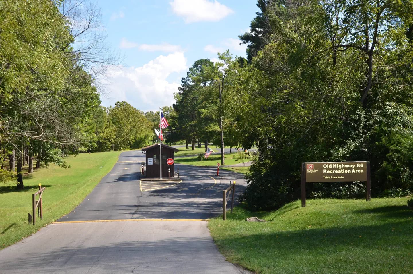
Overview Old Highway 86 is a spacious and sunny campground that sits along the White River Arm of Table Rock Lake in the rolling Missouri countryside. Recreation Whether on water or land, Old Highway 86 Campground offers visitors countless recreational activities. Picnicking, swimming, scuba diving, boating, fishing, hiking and wildlife viewing are all popular pastimes at the park. Many campsites are adjacent to the waters edge, and the remaining campsites are only a short walk away. Built on a peninsula, this park has water on three sides. Visitors can find plenty of room to fish from shore. While the lake boasts an abundance of crappie, catfish, and bluegill, Table Rock is most famous for bass, and is acclaimed as one of the best bass fishing lakes in this hemisphere. Table Rock Lakeshore Trail, about 2 miles long, runs from the Dewey Short Visitor Center to the Table Rock State Park Marina. During the spring hikers will see dogwood, serviceberry and redbud trees in bloom as well as many wildflower species. During the autumn months, visitors are treated to nature's colorful fall foliage. The trail also offers beautiful views of Table Rock Lake. Other hiking and mountain biking opportunities are available at the Mark Twain National Forest, parts of which are easily accessible from the campground. Click here for more information. Facilities Whether on water or land, Old Highway 86 Campground offers visitors countless recreational activities. Picnicking, swimming, scuba diving, boating, fishing, hiking and wildlife viewing are all popular pastimes at the park. Many campsites are adjacent to the waters edge, and the remaining campsites are only a short walk away. Built on a peninsula, this park has water on three sides. Visitors can find plenty of room to fish from shore. While the lake boasts an abundance of crappie, catfish, and bluegill, Table Rock is most famous for bass, and is acclaimed as one of the best bass fishing lakes in this hemisphere. Table Rock Lakeshore Trail, about 2 miles long, runs from the Dewey Short Visitor Center to the Table Rock State Park Marina. During the spring hikers will see dogwood, serviceberry and redbud trees in bloom as well as many wildflower species. During the autumn months, visitors are treated to nature's colorful fall foliage. The trail also offers beautiful views of Table Rock Lake. Other hiking and mountain biking opportunities are available at the Mark Twain National Forest, parts of which are easily accessible from the campground. Click here for more information. Natural Features Table Rock Lake is a beautiful body of water surrounded by a forest of oak and hickory trees. Its waters wind down through the valleys and hollows of the Ozark Mountains, from Branson, Missouri to Eureka Springs, Arkansas. More than five million visitors per year take advantage of this recreational oasis. Originally built for flood control, the Table Rock Dam has created a lake that boasts 779 miles of shoreline for the public to enjoy. Nearby Attractions The Dewey Short Visitors Center is located at the south end of Table Rock Dam. It offers three educational films focused on the history of the dam, the story of Lewis and Clark and the history of eagles and their endangerment in the state of Missouri. The visitor center also contains exhibits about the natural history of the area. Those visitors arriving by boat can take advantage of the courtesy dock. Old Highway 86 Campground is about 17 miles from Branson, Missouri, which offers grocery stores, gas and additional tourist attractions.
View details →
Overview Viola sits along the Kings River Arm of Table Rock Lake in the Missouri countryside. Boaters and water sports enthusiasts are particularly drawn to Viola for its easy access to the clear blue waters of Table Rock Lake. Recreation Whether on water or land, Viola Campground offers visitors countless recreational activities. Picnicking, swimming, scuba diving, boating, fishing, hiking and wildlife viewing are all popular pastimes at the park. Kings River Marina, located in the Viola Recreation Area offers everything from fuel to equipment rentals, to boat storage for visitors. Fishing licenses can also be purchased at the marina and anglers can go from there to try their hand at the excellent bass fishing the lake provides. Adjacent to the Marina, a playground, boat ramp and designated swimming area, each provide endless avenues for outdoors entertainment. Facilities Whether on water or land, Viola Campground offers visitors countless recreational activities. Picnicking, swimming, scuba diving, boating, fishing, hiking and wildlife viewing are all popular pastimes at the park. Kings River Marina, located in the Viola Recreation Area offers everything from fuel to equipment rentals, to boat storage for visitors. Fishing licenses can also be purchased at the marina and anglers can go from there to try their hand at the excellent bass fishing the lake provides. Adjacent to the Marina, a playground, boat ramp and designated swimming area, each provide endless avenues for outdoors entertainment. Natural Features Table Rock Lake is a beautiful body of water surrounded by a forest of oak and hickory trees. Its waters wind down through the valleys and hollows of the Ozark Mountains, from Branson, Missouri to Eureka Springs, Arkansas. More than five million visitors per year take advantage of this recreational oasis. Originally built for flood control, the Table Rock Dam has created a lake that boasts 779 miles of shoreline for the public to enjoy. Nearby Attractions The Dewey Short Visitors Center is located at the south end of Table Rock Dam. It offers three educational films focused on the history of the dam, the story of Lewis and Clark and the history of eagles and their endangerment in the state of Missouri. The visitor center also contains exhibits about the natural history of the area. Those visitors arriving by boat can take advantage of the courtesy dock. Viola Campground is about 36 miles from Branson, Missouri, which offers grocery stores, gas and additional tourist attractions.
View details →
Overview Cobb Ridge Campground is adjacent to the Chadwick Riding area, which is popular among and off-road vehicles (dirt bikes; ATVs and side by sides 50 inches or less) enthusiasts. Numerous trails provide nearly 80 miles of interconnecting loops that vary from easy to difficult terrain, winding in and out of deep, forested hollows and down long ridge tops. Family and group camping is available, providing access to Missouri's beautiful Mark Twain National Forest. Recreation Visitors to the area mostly come for the plentiful off-road vehicle trails (motorcycle; ATVs and side by sides 50 inches or less). Some trail segments are very rocky, steep, rough, rutted and are technically challenging, while others that don't drain well have been built up with concrete. Hiking on the trails is also permissible but requires caution. If using the trails, you will need a Chadwick riding permit - they are available at our District office; Casey's General Store in Sparta, MO. Cost is $45 for an annual; $7/day for motorcycles, ATVs and side by sides. $3 for mountain bike. You will need make/model and VIN# of vehicle along with rider information. The permit is valid for the machine and cannot be transferred. Facilities Visitors to the area mostly come for the plentiful off-road vehicle trails (motorcycle; ATVs and side by sides 50 inches or less). Some trail segments are very rocky, steep, rough, rutted and are technically challenging, while others that don't drain well have been built up with concrete. Hiking on the trails is also permissible but requires caution. If using the trails, you will need a Chadwick riding permit - they are available at our District office; Casey's General Store in Sparta, MO. Cost is $45 for an annual; $7/day for motorcycles, ATVs and side by sides. $3 for mountain bike. You will need make/model and VIN# of vehicle along with rider information. The permit is valid for the machine and cannot be transferred. Natural Features The Chadwick area is mostly forested with oak, hickory and pine woods on rocky ridge tops, with a few small open forest glades. Steep ridges break into narrow hollows with scattered surface rock and occasional rock ledges and patches of eastern red cedar. Nearby Attractions The campground is 30 miles from Springfield, Branson, Silver Dollar City and Shepherd of the Hills attractions. Lake Taneycomo is 20 miles south of Cobb Ridge.
View details →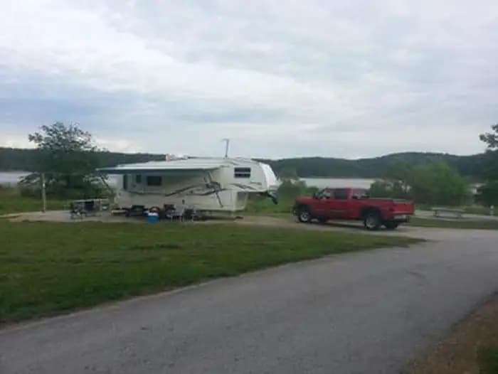
Overview Berry Bend Campground sits on the shores of Harry S. Truman Lake in the hills of western Missouri. Visitors enjoy fishing, hunting, and boating. Click here for the Harry S. Truman Lake virtual tour. Recreation Berry Bend Area is an excellent fishing location. Truman Lake is also a popular destination for tournament fishermen. Several miles of trails are available for hikers and horses within Berry Bend. The Park Trail is a 2.5 mile trail that is a great hike for beginners and those wanting to explore the area. The West Trail is approximately 10 miles and traverses many steep ridges and valleys, while the East Trail is approximately 16 miles and is somewhat more level and overlooks the lake in several areas. Both the West and the East trails have cut through trails for riders that dont wish to go the entire route. Facilities Berry Bend Area is an excellent fishing location. Truman Lake is also a popular destination for tournament fishermen. Several miles of trails are available for hikers and horses within Berry Bend. The Park Trail is a 2.5 mile trail that is a great hike for beginners and those wanting to explore the area. The West Trail is approximately 10 miles and traverses many steep ridges and valleys, while the East Trail is approximately 16 miles and is somewhat more level and overlooks the lake in several areas. Both the West and the East trails have cut through trails for riders that dont wish to go the entire route. Natural Features Harry S Truman Reservoir lies among the rolling hills and rocky bluffs of the Ozark Plateau. Mature hardwoods of Oak and Hickory with cedar trees mixed in cover the area. Wildlife such as whitetail deer, turkey, hawks, ospreys, eagles, and many different water birds can be found in and around the park. An abundance of fish such as crappie, bass, walleye, paddlefish, blue and channel catfish can also be found in Harry S Truman Reservoir. Approximately 8,800 acres of standing timber were left in the lake to provide quality aquatic habitat. Nearby Attractions The 950 miles of shoreline around Truman Lake provide plentiful opportunities for fun in the outdoors. Many parks surround the lake, including Harry S. Truman State Park. The Harry S. Truman Visitor Center sits atop Kaysinger Bluff and provides a spectacular view of the dam and reservoir. Exhibits provide information about the rich history of the Osage River Valley from pre-civilization to modern day. Waterfowl, bald eagles and turkey vultures are commonly seen from the observation deck.
View details →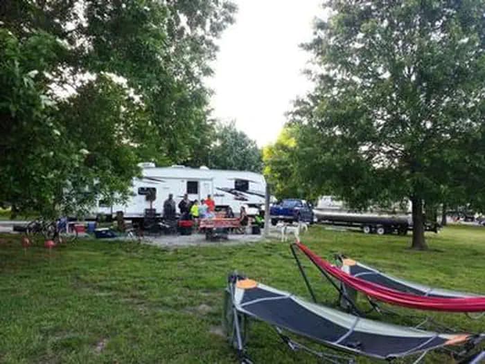
Overview Bucksaw Campground sits on the Grand River Arm of the Harry S. Truman Lake in the hills of western Missouri. The campground is an excellent destination for all types of water recreation. Click here for the Harry S. Truman Lake virtual tour. Recreation Popular activities in the area include wildlife viewing, fishing, hunting, swimming, hiking and boating. For an enjoyable short hike, be sure to check out the mile long hiking trail located across the road from the A & B loop's showerhouse. For more information about this trail upon your arrival, please see the booth attendant. Bucksaw is an excellent fishing location. Anglers find crappie, largemouth bass and blue and flathead catfish. Truman Lake is also a popular destination for tournament fishermen. Bucksaw Point Marina is also located next to the park. Facilities Popular activities in the area include wildlife viewing, fishing, hunting, swimming, hiking and boating. For an enjoyable short hike, be sure to check out the mile long hiking trail located across the road from the A & B loop's showerhouse. For more information about this trail upon your arrival, please see the booth attendant. Bucksaw is an excellent fishing location. Anglers find crappie, largemouth bass and blue and flathead catfish. Truman Lake is also a popular destination for tournament fishermen. Bucksaw Point Marina is also located next to the park. Natural Features Bucksaw is located on a peninsula with primarily flat terrain and excellent lake views. Campsites are well-shaded, while expansive grassy areas are spread throughout the campground. Wildlife such as whitetail deer, turkey, hawks, ospreys, eagles, and many different water birds can be found in and around the park. An abundance of fish such as crappie, bass, walleye, paddlefish, blue and channel catfish can also be found in Harry S Truman Reservoir. Approximately 8,800 acres of standing timber were left in the lake to provide quality aquatic habitat. Nearby Attractions Bucksaw Marina
View details →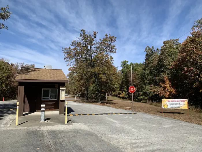
Overview Cedar Ridge is located on Stockton Lake in the scenic Ozark Mountains of southwestern Missouri. The lake and surrounding landscape offer countless recreational opportunities along nearly 300 miles of shoreline, providing visitors with many ways to explore one of the most sought-after natural areas in the state. Fishing, hunting, camping, sailing, boating and scuba diving are popular activities. Recreation Boating is a popular pastime at the lake. Sailing is especially popular and the lake hosts several races each year. The campground provides two boat ramps for easy access to the water. A swimming beach and an accessible fishing dock are also on-site. The waters of Stockton Lake are home to several species of fish including small and largemouth bass, crappie, white bass, walleye, catfish and sunfish, making it an ideal destination for anglers. Facilities Boating is a popular pastime at the lake. Sailing is especially popular and the lake hosts several races each year. The campground provides two boat ramps for easy access to the water. A swimming beach and an accessible fishing dock are also on-site. The waters of Stockton Lake are home to several species of fish including small and largemouth bass, crappie, white bass, walleye, catfish and sunfish, making it an ideal destination for anglers. Natural Features The land surrounding the lake contains hundreds of acres of native prairie grasses, rolling hills and thick forests that turn crimson in autumn. An abundance of wildlife lives around the water, including wild turkey, Great Blue heron, deer and Bald eagles. Visitors can learn about the lake's Bald eagles at the area's annual eagle-watching event hosted each winter. Nearby Attractions Three full-service marinas are located around the lake, offering a wide range of services and supplies, including boat rentals, fuel, fishing tackle and restaurants.
View details →
Overview Crabtree Cove is a shady campground located on Stockton Lake in the scenic Ozark Mountains of southwestern Missouri. The lake and surrounding landscape offer countless recreational opportunities along its nearly 300 miles of shoreline, providing visitors with many ways to explore one of the most sought-after natural areas in the state. Recreation Boating is always a popular pastime at the lake. Sail boating is especially popular and the lake hosts several races each year. The facility provides a boat ramp for easy access to the water. The waters of Stockton Lake are home to several species of fish including small and largemouth bass, crappie, white bass, walleye, catfish and sunfish, making it an ideal area for anglers. Several trails wind around the lake shore and through the landscape. The Stockton Lake Equestrian Trail continues approximately 15 miles between Hawker Point and Orleans Trail Campgrounds. Facilities Boating is always a popular pastime at the lake. Sail boating is especially popular and the lake hosts several races each year. The facility provides a boat ramp for easy access to the water. The waters of Stockton Lake are home to several species of fish including small and largemouth bass, crappie, white bass, walleye, catfish and sunfish, making it an ideal area for anglers. Several trails wind around the lake shore and through the landscape. The Stockton Lake Equestrian Trail continues approximately 15 miles between Hawker Point and Orleans Trail Campgrounds. Natural Features The land surrounding the lake contains hundreds of acres of native prairie grasses, rolling hills and thick forests that turn crimson in autumn. An abundance of wildlife lives both in and around the water, including wild turkey, great blue heron, deer and bald eagles. Visitors can learn about the lake's bald eagles by attending an annual eagle-watching event during the winter. Nearby Attractions There are three full-service marinas located around the lake, which offer a wide range of services and supplies, including boat rentals, fuel, fishing tackle and restaurants.
View details →
Overview Frank Russell Campground, set near the picturesque Mark Twain Lake, has a location near the dam, providing campers with easy access to the lake, river and surrounding attractions. The campground also features an amphitheater with weekly events in the summer. The lake's namesake and legendary author and humorist, Mark Twain, was born in a town beside the lake. Recreation The 32-mile long Joanna Trail is accessible from the campground. Here, horseback riders, mountain bikers and hikers can enjoy the rough and varied terrain that meanders along the northern banks of the lake, across bluffs and over hills. Campfire programs are provided every Saturday from Memorial Day to Labor Day. Facilities The 32-mile long Joanna Trail is accessible from the campground. Here, horseback riders, mountain bikers and hikers can enjoy the rough and varied terrain that meanders along the northern banks of the lake, across bluffs and over hills. Campfire programs are provided every Saturday from Memorial Day to Labor Day. Natural Features Mark Twain Lake is sourced by the Salt River in northeast Missouri. The Clarence Cannon Dam sits on the eastern edge of the lake, providing flood control and hydroelectricity to the region. Nearby Attractions While here, many visitors tour the birthplace of world-famous humorist and author, Mark Twain, in Florida, Missouri. The David C. Berti Shooting Range is below the dam and the M.W. Boudreaux Visitor Center is located on the south end of the Dam.
View details →
Overview Hawker Point Campground is a shady campground located on Stockton Lake in the scenic Ozark Mountains of southwestern Missouri. The lake and surrounding landscape offer countless recreational opportunities along its nearly 300 miles of shoreline, providing visitors with many ways to explore one of the most sought-after natural areas in the state. Recreation Boating is always a popular pastime at the lake. Sail boating is especially popular and the lake hosts several races each year. The facility provides a boat ramp for easy access to the water. The waters of Stockton Lake are home to several species of fish including small and largemouth bass, crappie, white bass, walleye, catfish and sunfish, making it an ideal area for anglers. Several trails wind around the lake shore and through the landscape. The Stockton Lake Equestrian Trail continues approximately 15 miles between Hawker Point and Orleans Trail Campgrounds. Facilities Boating is always a popular pastime at the lake. Sail boating is especially popular and the lake hosts several races each year. The facility provides a boat ramp for easy access to the water. The waters of Stockton Lake are home to several species of fish including small and largemouth bass, crappie, white bass, walleye, catfish and sunfish, making it an ideal area for anglers. Several trails wind around the lake shore and through the landscape. The Stockton Lake Equestrian Trail continues approximately 15 miles between Hawker Point and Orleans Trail Campgrounds. Natural Features The land surrounding the lake contains hundreds of acres of native prairie grasses, rolling hills and thick forests that turn crimson in autumn. An abundance of wildlife lives both in and around the water, including wild turkey, great blue heron, deer and bald eagles. Visitors can learn about the lake's bald eagles by attending an annual eagle-watching event during the winter. Nearby Attractions There are three full-service marinas located around the lake, which offer a wide range of services and supplies, including boat rentals, fuel, fishing tackle and restaurants.
View details →
Overview Indian Creek lies on the northern banks of Mark Twain Lake. It is the largest campground on the lake with 215 standard campsites, plus additional non-electric and tent-only sites. The lake is named for the beloved writer and humorist, Mark Twain, who was born just south of the lake in Florida, Missouri. Recreation Boating is convenient with Indian Creek's public boat ramp. Bass fishing and hunting are also popular. Facilities Boating is convenient with Indian Creek's public boat ramp. Bass fishing and hunting are also popular. Natural Features Mark Twain Lake is sourced by the Salt River in northeast Missouri. The Clarence Cannon Dam sits on the eastern edge of the lake, providing flood control and hydroelectricity to the region, in addition to an extensive habitat for wildlife. Nearby Attractions While visiting the area, tour the birthplace of the world-famous humorist and writer Mark Twain in the nearby Mark Twain State Park. The David C. Berti Shooting Range is located below the dam.
View details →
Overview Lightfoot Landing is a smaller campground compared to neighboring park areas, making it a more quiet and peaceful location for boating and fishing on Pomme de Terre Lake, known as the ''Gem of the Ozarks.'' Recreation The lake is well known for fishing, with one of the highest catch ratios in the country. Species include bass, catfish, walleye and crappie, but the lake is probably best known for its muskie, which is stocked each fall. Both canoeing and power boating are popular on the lake, with a good amount of water skiing and other water activities taking place. Facilities The lake is well known for fishing, with one of the highest catch ratios in the country. Species include bass, catfish, walleye and crappie, but the lake is probably best known for its muskie, which is stocked each fall. Both canoeing and power boating are popular on the lake, with a good amount of water skiing and other water activities taking place. Natural Features The Pomme de Terre River and Lindley Creek are the major sources for Pomme de Terre Lake, which spans 7,790 sparkling surface acres, with 113 miles of shoreline. Nearby Attractions One of the best dirt tracks in the country and is located down 83 highway in Wheatland. Also nearby is the Pomme de Terre Multipurpose Trail, located in Bolivar Landing.
View details →
Overview Pomme de Terre lake is divided into two arms which extend from the damsite. Nemo landing is located on the shorter arm, which follows the long and winding Lindley Creek and features numerous coves. Although Pomme de Terre is small in comparison to other lakes in Missouri, its clear, deep waters have plenty to offer visitors. Recreation Visitors can find ideal fishing locations in one of the many tucked away coves, abundant with bass, walleye, crappie, catfish and muskie. Muskie is particularly popular as Pomme de Terre is the only lake in Missouri with a notable amount of the species. Jet skiing, water skiing and canoeing are also popular water sports. Across the Road from the campground is Nemo Marina, one of four full-service marinas on the lake, offering fuel, storage, tackle and rentals. Facilities Visitors can find ideal fishing locations in one of the many tucked away coves, abundant with bass, walleye, crappie, catfish and muskie. Muskie is particularly popular as Pomme de Terre is the only lake in Missouri with a notable amount of the species. Jet skiing, water skiing and canoeing are also popular water sports. Across the Road from the campground is Nemo Marina, one of four full-service marinas on the lake, offering fuel, storage, tackle and rentals. Natural Features Pomme de Terre Lake is located in the rugged, tree-topped hills of the west-central Missouri Ozarks. The lake stems mostly from the Pomme de Terre River and boasts 113 miles of shoreline. Nearby Attractions The Pomme de Terre Multipurpose Trail, located in Bolivar Landing, is great for hikers, bikers and is the only trail that allows horses. Another option is the Indian Point Trail, located in the Pittsburg State Park, this trail ends on a rock platform overlooking the lake for a very scenic view.
View details →
Overview Orleans Trail Campground is a shady campground located on Stockton Lake in the scenic Ozark Mountains of southwestern Missouri. The lake and surrounding landscape offer countless recreational opportunities along its nearly 300 miles of shoreline, providing visitors with many ways to explore one of the most sought-after natural areas in the state. Recreation Boating is always a popular pastime at the lake. Sail boating is especially popular and the lake hosts several races each year. The facility provides a boat ramp for easy access to the water. The waters of Stockton Lake are home to several species of fish including small and largemouth bass, crappie, white bass, walleye, catfish and sunfish, making it an ideal area for anglers. Several trails wind around the lake shore and through the landscape. The Stockton Lake Equestrian Trail continues approximately 15 miles between Hawker Point and Orleans Trail Campgrounds. Facilities Boating is always a popular pastime at the lake. Sail boating is especially popular and the lake hosts several races each year. The facility provides a boat ramp for easy access to the water. The waters of Stockton Lake are home to several species of fish including small and largemouth bass, crappie, white bass, walleye, catfish and sunfish, making it an ideal area for anglers. Several trails wind around the lake shore and through the landscape. The Stockton Lake Equestrian Trail continues approximately 15 miles between Hawker Point and Orleans Trail Campgrounds. Natural Features The land surrounding the lake contains hundreds of acres of native prairie grasses, rolling hills and thick forests that turn crimson in autumn. An abundance of wildlife lives both in and around the water, including wild turkey, great blue heron, deer and bald eagles. Visitors can learn about the lake's bald eagles by attending an annual eagle-watching event during the winter. Nearby Attractions The Orleans Trail Marina is located nearby with camping and full marina services available.
View details →
Overview Ray Behrens is a scenic campground and recreation area, conveniently located on the southeastern shores of Mark Twain Lake. Here, visitors can enjoy the perks of the campground, go boating on the lake or explore the area's historic attractions. Twain, the legendary author, was born in a village beside the lake and grew up in a town about 20 miles down the road. Recreation Mark Twain Lake provides countless opportunities for outdoor recreation – boating, swimming, fishing, picnicking, camping, hiking and hunting to name a few. Facilities Mark Twain Lake provides countless opportunities for outdoor recreation – boating, swimming, fishing, picnicking, camping, hiking and hunting to name a few. Natural Features The Salt River flows through rolling hills of north-central Missouri, where it is dammed to form the 18,000-acre Mark Twain Lake. A variety of recreation areas surround the lake, including the Mark Twain State Park. Nearby Attractions Beside the lake is the village of Florida, where Mark Twain was born. Twenty-five miles east is the town of Hannibal, where visitors can tour the author's boyhood home.
View details →
Overview Ruark Bluff East Campground is a shady campground located on Stockton Lake in the scenic Ozark Mountains of southwestern Missouri. The lake and surrounding landscape offer countless recreational opportunities along its nearly 300 miles of shoreline, providing visitors with many ways to explore one of the most sought-after natural areas in the state. Recreation Boating is always a popular pastime at the lake. Sail boating is especially popular and the lake hosts several races each year. The facility provides a boat ramp for easy access to the water. The waters of Stockton Lake are home to several species of fish including small and largemouth bass, crappie, white bass, walleye, catfish and sunfish, making it an ideal area for anglers. Several trails wind around the lake shore and through the landscape. The Stockton Lake Equestrian Trail continues approximately 15 miles between Hawker Point and Orleans Trail Campgrounds. Facilities Boating is always a popular pastime at the lake. Sail boating is especially popular and the lake hosts several races each year. The facility provides a boat ramp for easy access to the water. The waters of Stockton Lake are home to several species of fish including small and largemouth bass, crappie, white bass, walleye, catfish and sunfish, making it an ideal area for anglers. Several trails wind around the lake shore and through the landscape. The Stockton Lake Equestrian Trail continues approximately 15 miles between Hawker Point and Orleans Trail Campgrounds. Natural Features The land surrounding the lake contains hundreds of acres of native prairie grasses, rolling hills and thick forests that turn crimson in autumn. An abundance of wildlife lives both in and around the water, including wild turkey, great blue heron, deer and bald eagles. Visitors can learn about the lake's bald eagles by attending an annual eagle-watching event during the winter. Nearby Attractions Several full service marinas are located around the lake, offering groceries, gas, tackle and more. Charges & Cancellations There is a $10 cancellation fee for all reservations. A $10 fee is also applied when changing reservation dates. If you would like to modify your reservation during the original dates, you can do so for no additional fee.
View details →
Overview Sparrowfoot Campground is situated on the Grand River Arm of the Harry S. Truman Lake in the hills of western Missouri. Visitors enjoy fishing, hunting and boating. Recreation Sparrowfoot is an excellent fishing location. Truman Lake is also a popular destination for tournament fishermen. Facilities Sparrowfoot is an excellent fishing location. Truman Lake is also a popular destination for tournament fishermen. Natural Features A mosaic of hardwood forests and grasslands covers the area's rolling hills. Rocky bluffs extend into the lake. Wildlife such as whitetail deer, turkey, hawks, ospreys, eagles, and many different water birds can be found in and around the park. An abundance of fish such as crappie, bass, walleye, paddlefish, blue and channel catfish can also be found in Harry S Truman Reservoir. Approximately 8,800 acres of standing timber were left in the lake to provide quality aquatic habitat. Nearby Attractions Katy Trail State Park, the nation's longest rails-to-trails project, is nearby. This unique park stretches from Clinton to Machens, with dozens of trailheads in between. Biking and hiking are allowed on the entire length of the trail, and horses are allowed from Clinton to Sedalia.
View details →
Overview Greenville Recreation Area is located on the northen end of Wappapello Lake Project, nestled on the banks of the St. Francis River. The spacious campground is built on the original site of the historical Old Greenville City, visitors have seemingly endless opportunities for fun. The Memory Lane trail winds along the historical foundations and streets offering a glimpse back in time. The Greenville Trail, a three mile hike or bike trail, connects the modern city of Greenville to the campground. The expansive grounds, multiple playgrounds, play courts and large event area provide opportunities for all ages and abilities. Click here to take a virtual tour of the facilities at Wappapello Lake! Recreation Greenville boasts a one-mile historical trail to explore. A three-mile hike/bike trail is open year-round and a great choice for families. The lake is home to some of Missouri's most sought after game fish, including largemouth bass, crappie, bluegill, white bass and channel catfish. Hunting and trapping are popular activities around the lake, boasting 44,000 acres for public use. Special events are put on throughout the year but the annual Black Powder Rendezvous, Old Greenville Days and Halloween Boo Bash events are notable experiences in Greenville. Facilities Greenville boasts a one-mile historical trail to explore. A three-mile hike/bike trail is open year-round and a great choice for families. The lake is home to some of Missouri's most sought after game fish, including largemouth bass, crappie, bluegill, white bass and channel catfish. Hunting and trapping are popular activities around the lake, boasting 44,000 acres for public use. Special events are put on throughout the year but the annual Black Powder Rendezvous, Old Greenville Days and Halloween Boo Bash events are notable experiences in Greenville. Natural Features Wappapello Lake, fed by the St. Francis River, has a seemingly endless string of secluded coves hugged by a winding, wooded shoreline. The public recreation area spans 45,000 acres in the southeastern Ozark foothills. The St. Francis River provides multiple caves, gravel bars, and open stretchs of water surrounded by open woodlands and rocky bluffs. Nearby Attractions Explore one of the 9 trail systems along the Wappapello Lake. The nearby Ozark Trail is the only Horse friendly trail at the Lake. The Pine Ridge Nature trail, Shell Lake Archery Trail and Wappapllo Wildflower Trail and Greenhouse areas or lower St. Francis River are approximately 22 miles away. The Mingo Wildlife Refuge is approximately 31 miles from Old Greenville Recreation Area. The Lake Wappapello State Park is approximately 21 miles away, and the Sam A. Baker State park is 14 miles away from Old Greenville Recreation Area. The nearby 34 Bridge Recreation Area is an ideal place to swim or picnic along its large gravel bars. contact_info Between 03/16/2022 and 11/22/2022 this location is staffed. Please call (573) 224-3884 to speak with local staff. From 01/19/2022 to 03/15/2022 this location is unstaffed. Please call (573) 222-8562 for general information.
View details →
Overview People's Creek Recreation Area, located in the southeastern Ozark foothills of Missouri, is a great launchpad for boating, fishing, swimming, hiking or simply exploring the Wappapello Lake area. Completed in 1941, Wappapello Lake provides an estimated $3.9 million in annual flood protection to agricultural lands and developed areas along the St. Francis River. A peaceful cove offers endless recreation opportunities with 57 campsites, a picnic shelter, beach, accessible fishing pier, and Lake View Trail. Click here to take a virtual tour of the facilities at Wappapello Lake. Recreation People's Creek is ideally suited for swimming and boating activities. The lake is home to some of Missouri's most sought after game fish, including largemouth bass, crappie, bluegill, white bass and channel catfish. Hunting, fishing and kayaking are popular activities year-round. Hiking and biking on one of the Lake's 9 trail systems provides opportunities for all ages and abilities. The new accessible Shell Lake Archery Trail is a unique destination for achery enthusiasts. Facilities People's Creek is ideally suited for swimming and boating activities. The lake is home to some of Missouri's most sought after game fish, including largemouth bass, crappie, bluegill, white bass and channel catfish. Hunting, fishing and kayaking are popular activities year-round. Hiking and biking on one of the Lake's 9 trail systems provides opportunities for all ages and abilities. The new accessible Shell Lake Archery Trail is a unique destination for achery enthusiasts. Natural Features Wappapello Lake stretches 8,400 acres on 45,000 acres of public land. Lightly wooded shorelines add shade to the scenic landscape. contact_info Between 09/23/2022 and 09/27/2022 this location is staffed. Please call (573) 222-8234 to speak with local staff. From 09/28/2022 to 04/06/2023 this location is unstaffed. Please call (573) 778-5404 for general information. Nearby Attractions Explore the nearby Pine Ridge Nature trail, Shell Lake Archery Trail and Wappapllo Wildflower Trail and Greenhouse areas or St. Francis River. The Mingo Wildlife Refuge is approximately 11.5 miles from Peoples Creek Recreation Area. The Lake Wappapello State Park is approximately 18.2 miles away, and the Sam A. Baker State park is 33.4 miles away from Peoples Creek Recreation Area.
View details →
Overview Redman Creek offers a varirty of recreational opportunities for every visitor! This large park is an ideal place for just a day visit or an extended stay. Redman Creek Campground features 109 full service campsites in the Redman East and West Campground. Each campground loop has a playground and shower house, with some restroom facilites replaced in 2021. Enjoy the scenic view along the new paved Lake View Trail, this multi-use trail is a hiker, biker or walkers dream. Beginning at Redman East Campground, the trail connects the entire Wappapello Dam area featuring multiple trailheads with unique landscapes. A tennis court, basketball court, sand volleyball court and playground are available for use year-round. A family picnic or a day of grilling are easy at one of 17 picnic sites or 4 reservable group shelters. An accessible fishing pier, 4-lane boat ramp with courtesy dock and a seasonal swimming beach provide a multitude of water recreation opportunities. Click here to take a virtual tour of the facilities at Wappapello Lake! Recreation Wappapello Lake can be a boater's paradise with a string of secluded coves, islands and wooded shorelines. Hunting, fishing and kayaking are popular activities year-round. Hiking and biking on one of the Lake's 9 trail systems provides opportunities for all ages and abilities. The new accessible Shell Lake Archery Trail is a unique destination for achery enthusiasts. Facilities Wappapello Lake can be a boater's paradise with a string of secluded coves, islands and wooded shorelines. Hunting, fishing and kayaking are popular activities year-round. Hiking and biking on one of the Lake's 9 trail systems provides opportunities for all ages and abilities. The new accessible Shell Lake Archery Trail is a unique destination for achery enthusiasts. Natural Features Wappapello Lake is fed by the St. Francis River and boasts 8,400 acres on a whopping 45,000-acre expanse of public land in the foothills of the Ozark Mountains. contact_info Between 03/16/2022 and 11/01/2022 this location is staffed. Please call (573) 222-8233 to speak with local staff. From 01/07/2022 to 03/15/2022 this location is unstaffed. Please call (573) 222-8562 for general information. Nearby Attractions Explore the nearby Pine Ridge Nature trail, Shell Lake Archery Trail and Wappapllo Wildflower Trail and Greenhouse areas or St. Francis River. The Mingo Wildlife Refuge is approximately 11.6 miles from Redman Creek Recreation Area. The Lake Wappapello State Park is approximately 17 miles away, and the Sam A. Baker State park is 34 miles away from Redman Creek Recreation Area.
View details →
Overview Ruark Bluff West is a shady campground located on Stockton Lake in the scenic Ozark Mountains of southwestern Missouri. The lake and surrounding landscape offer countless recreational opportunities along its nearly 300 miles of shoreline, providing visitors with many ways to explore one of the most sought-after natural areas in the state. Recreation Boating is always a popular pastime at the lake. Sail boating is especially popular and the lake hosts several races each year. The facility provides a boat ramp for easy access to the water. The waters of Stockton Lake are home to several species of fish including small and largemouth bass, crappie, white bass, walleye, catfish and sunfish, making it an ideal area for anglers. Several trails wind around the lake shore and through the landscape. The Stockton Lake Equestrian Trail continues approximately 15 miles between Hawker Point and Orleans Trail Campgrounds. Facilities Boating is always a popular pastime at the lake. Sail boating is especially popular and the lake hosts several races each year. The facility provides a boat ramp for easy access to the water. The waters of Stockton Lake are home to several species of fish including small and largemouth bass, crappie, white bass, walleye, catfish and sunfish, making it an ideal area for anglers. Several trails wind around the lake shore and through the landscape. The Stockton Lake Equestrian Trail continues approximately 15 miles between Hawker Point and Orleans Trail Campgrounds. Natural Features The land surrounding the lake contains hundreds of acres of native prairie grasses, rolling hills and thick forests that turn crimson in autumn. An abundance of wildlife lives both in and around the water, including wild turkey, great blue heron, deer and bald eagles. Visitors can learn about the lake's bald eagles by attending an annual eagle-watching event during the winter. Nearby Attractions Several full service marinas are located around the lake, offering groceries, gas, tackle and more.
View details →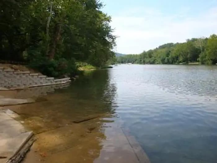
Overview ***Watercress sustained substantial damage to the pavilions during the 2017 flood, they are not reservable at this time, however the boat ramp is still open for public use.*** Watercress Campground lies on the banks one of the forest’s greatest treasures; the Current River. Floats on the river provide views of southeastern Missouri that otherwise can't be seen. The area is home to a variety of birds and wildlife and recreation opportunities are plentiful in the surrounding area. Recreation Boating and canoeing on the Current River, as well as on other nearby rivers, are popular activities. A boat ramp for both motorized and non-motorized boats is available on the east bank of the Current River. Anglers enjoy fishing for bass, walleye, sunfish and the occasional catfish. Big Spring, Missouri's largest spring, is just five miles from the campground. Hikers at Watercress area enjoy the Songbird Trail, a 1.2-mile loop that leads to Watercress Spring, passing remnants of Civil War-era earthwork that overlook the Current River. Facilities Boating and canoeing on the Current River, as well as on other nearby rivers, are popular activities. A boat ramp for both motorized and non-motorized boats is available on the east bank of the Current River. Anglers enjoy fishing for bass, walleye, sunfish and the occasional catfish. Big Spring, Missouri's largest spring, is just five miles from the campground. Hikers at Watercress area enjoy the Songbird Trail, a 1.2-mile loop that leads to Watercress Spring, passing remnants of Civil War-era earthwork that overlook the Current River. Natural Features Located within the town of Van Buren, the campground and day use area are adjacent to the Current River, which flows past scenic bluffs, springs, caves as it meanders through the Mark Twain National Forest toward Doniphan, MO. Nearby Attractions The campground is adjacent to the Ozark National Scenic Riverways, which is a series of protected rivers in the area managed by the National Park Service. More information about the National Park Service sites can be found here .
View details →
Overview In the rolling, forested landscape of Big Spring, two of America's most beautiful spring-fed rivers combine to make up the Ozark National Scenic Riverways. As the first national park area to protect a wild river system, visitors have plenty of scenic water activities to enjoy as well as hiking, horseback riding and wildlife viewing. Recreation The Current River flows past the campground, offering excellent canoeing, tubing, swimming and fishing. Over 130 miles (209 km) of waterways exist within the park. Canoe and kayak rentals and outfitters can be found nearby. Several miles of hiking and horseback riding trails crisscross the region, include the Alley Overlook Trail, Chubb Hollow Trail, Ozark Trail, Cave Spring Trail and Big Springs Trail. Facilities The Current River flows past the campground, offering excellent canoeing, tubing, swimming and fishing. Over 130 miles (209 km) of waterways exist within the park. Canoe and kayak rentals and outfitters can be found nearby. Several miles of hiking and horseback riding trails crisscross the region, include the Alley Overlook Trail, Chubb Hollow Trail, Ozark Trail, Cave Spring Trail and Big Springs Trail. Natural Features The Ozark National Scenic Riverways is known for its caves, springs, sinkholes and losing streams, and features over 300 identified caves within its boundaries. The caves range in size from a rock overhang to almost seven miles of identified passages. Eight caves, including an open sinkhole, have been designated as outstanding natural features. The Ozark forest is mostly White oak and Shortleaf pine, Missouri's only native pine species. Along the rivers, Sycamore, Cottonwood, River birch and maples are common. Redbud and dogwoods are also abundant, putting on a spectacular show during most spring months. contact_info This location is unstaffed. To speak with our main office for general information, please call: (573) 323-4236. Nearby Attractions Scenic Big Spring is the largest freshwater spring in North America and produces an outflow of 280 million gallons a day. Round Spring Cave is nearby, with ranger-guided tours offered daily during summer months. Historic and picturesque Alley Mill and Alley Spring are also nearby. The mill is open daily in the summer and ranger-guided tours are available upon request.
View details →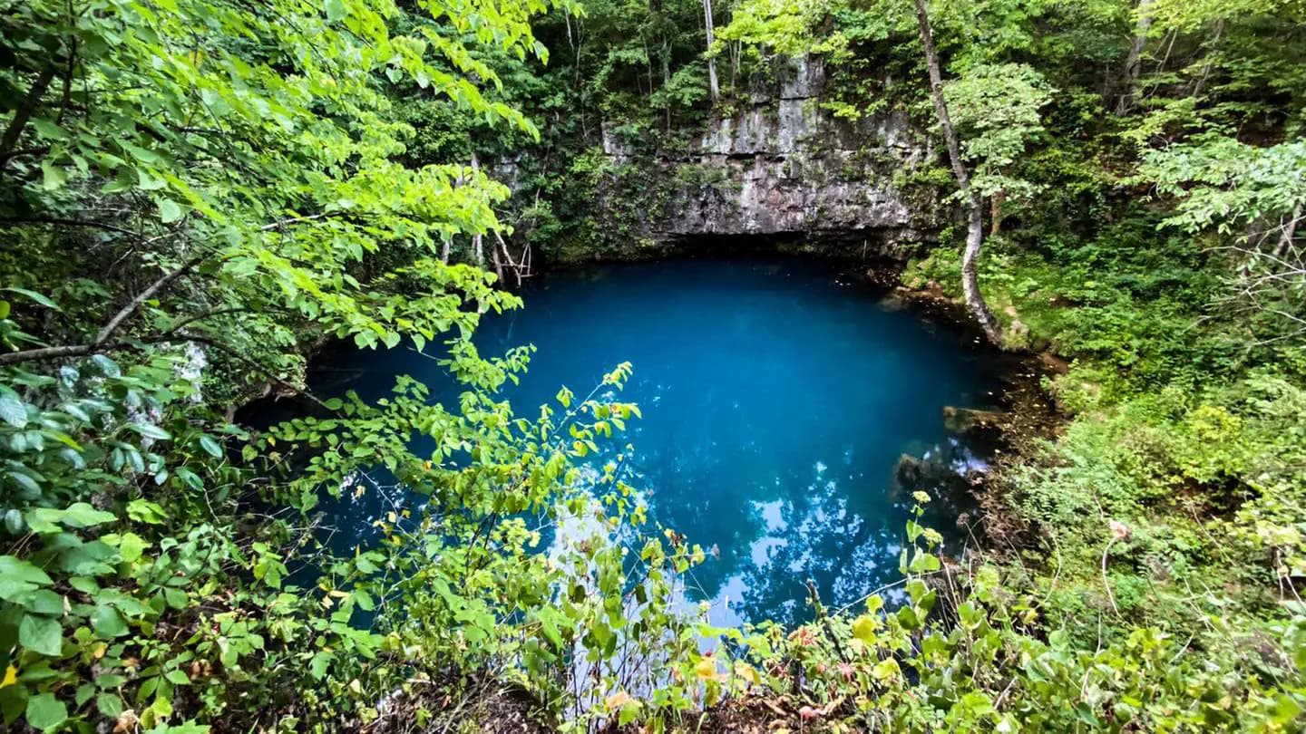
Overview In the rolling, forested landscape of Round Spring, two of America's most beautiful spring-fed rivers combine to make up the Ozark National Scenic Riverways. As the first national park area to protect a wild river system, visitors have plenty of scenic water activities to enjoy as well as hiking, horseback riding and wildlife viewing. Recreation The crystal clear Current River flows past the campground, offering excellent canoeing, tubing, swimming and fishing. Over 130 miles (209 km) of waterways exist within the park. Canoe and kayak rentals and outfitters can be found nearby. Several miles of hiking and horseback riding trails crisscross the region, including the Alley Overlook Trail, Chubb Hollow Trail, Ozark Trail, Cave Spring Trail and Big Springs Trail. Facilities The crystal clear Current River flows past the campground, offering excellent canoeing, tubing, swimming and fishing. Over 130 miles (209 km) of waterways exist within the park. Canoe and kayak rentals and outfitters can be found nearby. Several miles of hiking and horseback riding trails crisscross the region, including the Alley Overlook Trail, Chubb Hollow Trail, Ozark Trail, Cave Spring Trail and Big Springs Trail. Natural Features The Ozark National Scenic Riverways is known for its caves, springs, sinkholes and losing streams, and features over 300 identified Caves/Kart Systems within its boundaries. The caves range in size from a rock overhang to almost seven miles of identified passages. Eight caves, including an open sinkhole, have been designated as outstanding natural features. The Ozark forest is mostly White oak and Shortleaf pine, Missouri's only native pine species. Along the rivers, Sycamore, Cottonwood, River birch and maples are common. Redbud and Dogwood are also abundant, putting on a spectacular show during most spring months. contact_info This location is unstaffed. To speak with our main office for general information, please call: (573) 323-4236. Nearby Attractions Scenic Round Spring Cave is nearby, with ranger-guided tours offered daily during summer months. Historic and picturesque Alley Mill and Alley Spring are also nearby. The mill is open daily in the summer and rangers offer tours upon request.
View details →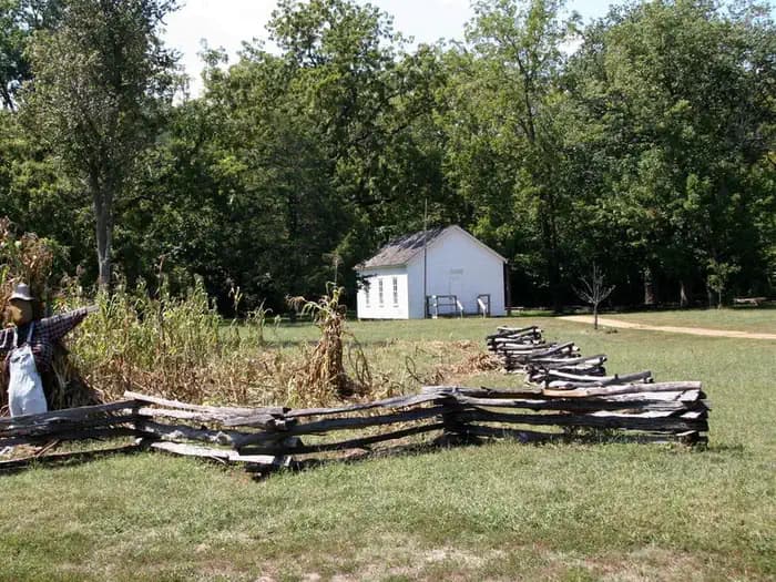
Overview The rolling, forested landscape around Alley Spring is where two of America's most beautiful spring-fed rivers combine to make up the Ozark National Scenic Riverways. As the first national park area to protect a wild river system, visitors are able to enjoy various water activities as well as hiking, horseback riding and wildlife viewing. Recreation Canoeing, tubing, swimming and fishing are popular activities on the vast waterways in the region, with over 130 miles (209 km) of water trails. Canoe and kayak rentals and outfitters can be found nearby. A short walk from the campground leads to a popular swimming area on the Jacks Fork River, a crystal clear and spring fed waterway that's cool and refreshing on a hot summer day. Several interpretive trails with educational exhibits meander nearby. Other hiking trails include the Alley Overlook Trail, Chubb Hollow Trail, Ozark Trail, Cave Spring Trail and Big Springs Trail. Facilities Canoeing, tubing, swimming and fishing are popular activities on the vast waterways in the region, with over 130 miles (209 km) of water trails. Canoe and kayak rentals and outfitters can be found nearby. A short walk from the campground leads to a popular swimming area on the Jacks Fork River, a crystal clear and spring fed waterway that's cool and refreshing on a hot summer day. Several interpretive trails with educational exhibits meander nearby. Other hiking trails include the Alley Overlook Trail, Chubb Hollow Trail, Ozark Trail, Cave Spring Trail and Big Springs Trail. Natural Features Known for its caves, springs, sinkholes and losing streams, the Ozark National Scenic Riverways has over 300 identified caves within its boundaries. They range in size from a rock overhang to almost seven miles of identified passages. Eight caves, including an open sinkhole, have been designated as outstanding natural features. The Ozark forest is mostly White oak and Shortleaf pine, Missouri's only native pine species. Along the rivers, Sycamore, Cottonwood, River birch and maples are common. Redbud and Dogwood are abundant, putting on a spectacular show during most spring months. contact_info This location is unstaffed. To speak with our main office for general information, please call: (573) 323-4236. Nearby Attractions Historic and picturesque Alley Mill and the scenic Alley Spring are nearby. The mill is open daily in the summer and rangers offer tours upon request. Pretty Round Spring is close to the campground as well.
View details →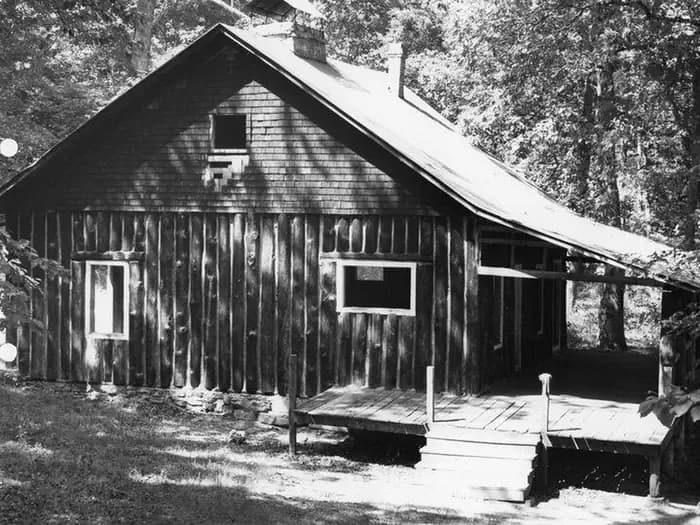
Overview In the rolling, forested landscapes around Pulltite, two of America's most beautiful spring-fed rivers combine to make up the Ozark National Scenic Riverways. As the first national park area to protect a wild river system, visitors have plenty of scenic water activities to enjoy as well as hiking, horseback riding and wildlife viewing. Recreation The Current River flows past the campground, offering excellent canoeing, tubing, swimming and fishing. Over 130 miles of waterways exist within the park. Canoe and kayak rentals and outfitters can be found nearby. The historic Pulltite Cabin is across the river from the campground. The only way to see the cabin is by boat or by wading across the river. The cabin is next to scenic Pulltite Spring, for which the campground is named. Several miles of hiking and horseback riding trails crisscross the region, include the Alley Overlook Trail, Chubb Hollow Trail, Ozark Trail, Cave Spring Trail and Big Springs Trail. Facilities The Current River flows past the campground, offering excellent canoeing, tubing, swimming and fishing. Over 130 miles of waterways exist within the park. Canoe and kayak rentals and outfitters can be found nearby. The historic Pulltite Cabin is across the river from the campground. The only way to see the cabin is by boat or by wading across the river. The cabin is next to scenic Pulltite Spring, for which the campground is named. Several miles of hiking and horseback riding trails crisscross the region, include the Alley Overlook Trail, Chubb Hollow Trail, Ozark Trail, Cave Spring Trail and Big Springs Trail. Natural Features The Ozark National Scenic Riverways is known for its caves, springs, sinkholes and losing streams, and features over 300 identified caves within its boundaries. They range in size from a rock overhang to almost seven miles of identified passages. Eight caves, including an open sinkhole, have been designated as outstanding natural features. The Ozark forest is mostly White oak and Shortleaf pine, Missouri's only native pine species. Along the rivers, Sycamore, Cottonwood, River birch and maples are common. Redbud and Dogwoods are also abundant, putting on a spectacular show during most spring months. contact_info This location is unstaffed. To speak with our main office for general information, please call: (573) 323-4236. Nearby Attractions Scenic Round Spring Cave is nearby, with ranger-guided tours offered daily during summer months. Historic and picturesque Alley Mill and Alley Spring are also nearby. The mill is open daily in the summer and rangers offer tours upon request.
View details →
Overview Moonshine Beach Recreation Area is a very popular sandy swimming beach along the shores of Table Rock Lake. Unlike the smaller swimming areas at the campgrounds surrounding Table Rock Lake, Moonshine beach is spacious enough to make visitors forget they are actually on a lake and not at the ocean. Recreation Whether on water or land, Moonshine Beach Recreation Area offers visitors countless recreational activities. Picnicking, swimming, scuba diving, boating, fishing, hiking and wildlife viewing are all popular pastimes at the park. Soaking up the sun and cooling off in the bright blue waters of Table Rock Lake are the most popular activities at Moonshine Beach. For visitors looking to spend some time exploring the shore, the adjacent Dewey Short Visitor Center offers a hiking trail leaving from the grounds. Table Rock Lakeshore Trail, about 2 miles long, runs from the Dewey Short Visitor Center to the Table Rock State Park Marina. During the spring hikers will see dogwood, serviceberry and redbud trees in bloom as well as many wildflower species. During the autumn months, visitors are treated to nature's colorful fall foliage. The trail also offers beautiful views of Table Rock Lake. Facilities Whether on water or land, Moonshine Beach Recreation Area offers visitors countless recreational activities. Picnicking, swimming, scuba diving, boating, fishing, hiking and wildlife viewing are all popular pastimes at the park. Soaking up the sun and cooling off in the bright blue waters of Table Rock Lake are the most popular activities at Moonshine Beach. For visitors looking to spend some time exploring the shore, the adjacent Dewey Short Visitor Center offers a hiking trail leaving from the grounds. Table Rock Lakeshore Trail, about 2 miles long, runs from the Dewey Short Visitor Center to the Table Rock State Park Marina. During the spring hikers will see dogwood, serviceberry and redbud trees in bloom as well as many wildflower species. During the autumn months, visitors are treated to nature's colorful fall foliage. The trail also offers beautiful views of Table Rock Lake. Natural Features Table Rock Lake is a beautiful body of water surrounded by a forest of oak and hickory trees. Its waters wind down through the valleys and hollows of the Ozark Mountains, from Branson, Missouri to Eureka Springs, Arkansas. More than five million visitors per year take advantage of this recreational oasis. Originally built for flood control, the Table Rock Dam has created a lake that boasts 779 miles of shoreline for the public to enjoy. Nearby Attractions The Dewey Short Visitor Center features interactive exhibits, great lake views, a film about the area and construction of Table Rock Dam. For more information please call 1-877-444-6777. The visitor center also contains exhibits about the natural history of the area. Those visitors arriving by boat can take advantage of the courtesy dock. Moonshine Beach Recreation Area is just outside of Branson, Missouri, which offers grocery stores, gas and additional tourist attractions.
View details →
Overview In the rolling, forested landscape of Two Rivers, two of America's most beautiful spring-fed rivers combine to make up the Ozark National Scenic Riverways. As the first national park area to protect a wild river system, visitors have plenty of scenic water activities to enjoy as well as hiking, horseback riding and wildlife viewing. Recreation The crystal clear Current River flows past the campground, offering excellent canoeing, tubing, swimming, and fishing. Jacks Fork meets the Current River nearby. Over 130 miles (209 km) of waterways exist within the park. Find canoe and kayak rentals through our list of Riverways Outfitters on the park website. Several miles of hiking and horseback riding trails crisscross the region, including the Alley Overlook Trail, Chubb Hollow Trail, Ozark Trail, Cave Spring Trail, and Big Springs Trail. Facilities The crystal clear Current River flows past the campground, offering excellent canoeing, tubing, swimming, and fishing. Jacks Fork meets the Current River nearby. Over 130 miles (209 km) of waterways exist within the park. Find canoe and kayak rentals through our list of Riverways Outfitters on the park website. Several miles of hiking and horseback riding trails crisscross the region, including the Alley Overlook Trail, Chubb Hollow Trail, Ozark Trail, Cave Spring Trail, and Big Springs Trail. Natural Features Known for its caves, springs, sinkholes and losing streams, the Ozark National Scenic Riverways has over 300 identified Caves/Karst systems within its boundaries. The caves range in size from a rock overhang to almost seven miles of identified passages. Eight caves, including an open sinkhole, have been designated as outstanding natural features. The Ozark forest is mostly white oak and Shortleaf pine, Missouri's only native pine species. Along the rivers, Sycamore, Cottonwood, River birch and maples are common. Redbud and Dogwood are also abundant, putting on a spectacular show during most spring months. Nearby Attractions Historic and picturesque Alley Mill and scenic Alley Spring are nearby. The mill is open daily in the summer and rangers offer tours upon request. Round Spring and Round Spring Cave are nearby as well, with ranger-guided tours offered daily during summer months.
View details →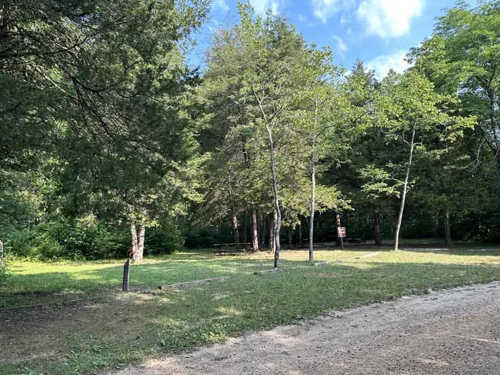
Overview Two of America's clearest spring-fed rivers combine to create the Ozark National Scenic Riverways in the rolling, forested landscape of Akers. Visitors to the campground enjoy various water activities, as well as hiking, horseback riding and wildlife viewing. Recreation The crystal-clear Current River flows past the campground, offering excellent canoeing, tubing, swimming and fishing. Over 130 miles of waterways exist within the park. Canoe and kayak rentals and outfitters can be found nearby. Several miles of hiking and horseback riding trails crisscross the region, include the Alley Overlook Trail, Chubb Hollow Trail, Ozark Trail, Cave Spring Trail and Big Springs Trail. Facilities The crystal-clear Current River flows past the campground, offering excellent canoeing, tubing, swimming and fishing. Over 130 miles of waterways exist within the park. Canoe and kayak rentals and outfitters can be found nearby. Several miles of hiking and horseback riding trails crisscross the region, include the Alley Overlook Trail, Chubb Hollow Trail, Ozark Trail, Cave Spring Trail and Big Springs Trail. Natural Features Known for its caves, springs, sinkholes and losing streams, the Ozark National Scenic Riverways have over 300 identified caves within its boundaries. The caves range in size from a rock overhang to almost seven miles of identified passages. Eight caves, including an open sinkhole, have been designated as outstanding natural features. The Ozark forest is mostly White oak and Shortleaf pine, Missouri's only native pine species. Along the rivers, Sycamores, Cottonwoods, River birch and maples are common. Redbud and dogwood are also abundant, putting on a spectacular show during most spring months. contact_info This location is unstaffed. To speak with our main office for general information, please call: (573) 323-4236. Nearby Attractions Scenic Round Spring Cave is nearby, with ranger-guided tours offered daily during summer months. Historic and picturesque Alley Mill and Alley Spring are nearby. The mill is open daily in the summer and ranger-offered tours are available upon request.
View details →
Overview Markham Springs Campground is set on the Black River in a scenic and historic recreation area in the southwestern corner of Missouri's Mark Twain National Forest. The area provides access to multiple trails and recreational opportunities. Markham Springs Recreation Area gets its name from former owner, M. J. Markham, who acquired the property in 1901 and operated a lumber mill at the site until the 1930s. The Fuchs House, a five-bedroom concrete and native stone home, also sits on the property, along with a neighboring mill. At times, it is also available for rent. Recreation River and stream fishing are popular activities near the campground. The Black River boasts bass, sunfish, walleye and catfish. Many anglers fish from boats, but others fish from the riverbanks. Canoeing and kayaking is also possible on the river. Various day hikes within the Markham Springs Trail System are accessible from the campground. Eagle Bluff Trail is a 1.5-mile loop along the river, where birding and wildlife viewing are favorite pastimes. Facilities River and stream fishing are popular activities near the campground. The Black River boasts bass, sunfish, walleye and catfish. Many anglers fish from boats, but others fish from the riverbanks. Canoeing and kayaking is also possible on the river. Various day hikes within the Markham Springs Trail System are accessible from the campground. Eagle Bluff Trail is a 1.5-mile loop along the river, where birding and wildlife viewing are favorite pastimes. Natural Features Located adjacent to the Black River, the recreation area contains a small pond that dates back to the 1800s. The area is covered by a dense forest of colorful trees, including ash, elm, maple and poplar. Nearby Attractions The small town of Williamsville is just 3 miles from the campground, offering a general store and fuel station.
View details →
Overview Located deep in the interior forests of Shannon County, Logger's Lake Campground is situated along the southeast shore of Logger's Lake. Constructed in 1942, this spring-fed lake is maintained as a fishery and is a destination for anglers looking for non-motorized boating and quiet bank fishing. Recreation Logger's Lake offers good fishing for large-mouth bass, sunfish and channel catfish. The Day Use area has a small swim beach, boat ramp, picnic tables, and grills. Facilities Logger's Lake offers good fishing for large-mouth bass, sunfish and channel catfish. The Day Use area has a small swim beach, boat ramp, picnic tables, and grills. Natural Features The campground is located on 22-acre, spring-fed Logger's Lake. A variety of colorful vegetation, clear creeks and springs provide a picturesque setting.
View details →
Overview Webb Creek Campground on Clearwater Lake greets visitors with excellent camping, fishing, swimming, boating and picnicking opportunities. Water sport enthusiasts love the lakes diverse offerings, from boating to jet skiing and canoeing to swimming. Clearwater is considered a "wilderness lake" because it lacks private boat docks and offers plenty of unspoiled shorelines to explore. Recreation Wildlife viewing is popular with wetland waterfowl, fox, deer and geese. Picnicking is also a favorite pastime, as is lounging on the beach, boating and fishing. Facilities Wildlife viewing is popular with wetland waterfowl, fox, deer and geese. Picnicking is also a favorite pastime, as is lounging on the beach, boating and fishing. Natural Features The lake, surrounded by the picturesque hills of the Ozarks, is fed by the Black River. Average temperatures range from 33 to 59 degrees Fahrenheit in March, and 65 to 92 degrees in summer. Nearby Attractions Part of the Ozark National Scenic Riverways, stop by a historic sawmill known as the Klepzig Mill, or visit Blue Spring, Reed Spring and Rocky Falls while in the area. Elk viewing is available at Peck Ranch Wildlife Reserve. For those looking for a fun outing, a drive-in movie theater is also nearby.
View details →
Overview In the late 1930s, Rudolph Fuchs built a five bedroom concrete and native stone house for his family, and also built the present wheel house to produce electricity for his needs. Power was obtained by building a dam in a semi-circle below a large spring forming a small pond. The water was to pour through a chute on the wheel to produce electricity; however, electricity arrived to the site before the wheel ever needed to do its job. The area had an undershot wheel providing power to a grist mill in the late 19th century. Recreation The Black River boasts bass, sunfish, walleye and catfish. Many anglers fish from boats, but others fish from the riverbanks. Canoeing and kayaking is also possible on the river. Various day hikes within the Markham Springs Trail System are accessible from the campground. Eagle Bluff Trail is a one and a half mile loop along the river, where birding and wildlife viewing are favorite pastimes. The day use area has a two-acre, 20 foot deep mill pond that dates back to the 1800s, several picnic sites, open fields; river access for boating, fishing and float tubes and canoes; and short hiking trails that provide views of the river, the pond, the springs and the uplands. Facilities The Black River boasts bass, sunfish, walleye and catfish. Many anglers fish from boats, but others fish from the riverbanks. Canoeing and kayaking is also possible on the river. Various day hikes within the Markham Springs Trail System are accessible from the campground. Eagle Bluff Trail is a one and a half mile loop along the river, where birding and wildlife viewing are favorite pastimes. The day use area has a two-acre, 20 foot deep mill pond that dates back to the 1800s, several picnic sites, open fields; river access for boating, fishing and float tubes and canoes; and short hiking trails that provide views of the river, the pond, the springs and the uplands. Natural Features Located adjacent to the Black River, the recreation area contains a small pond that dates back to the 1800s. The area is covered by a dense forest of colorful trees, including ash, elm, maple and poplar. Six springs pour almost five million gallons of water per day into the pond, and the bubble spring, a smaller outlet of Markham Spring outside of the pond that has air with it which rises in the soft sand forming unique air bubbles. Nearby Attractions The Fuchs House is located in the Markham Springs Recreation Area. Camping with both electric sites and primitive sites, day use, and pavilion rental is available. The town of Williamsville is three miles from the Fuchs House and offers a general store ad fuel station.
View details →FAQ
Camping in Missouri
How many campgrounds are listed in Missouri?
TheCampVerse currently lists 51 campgrounds in Missouri.
What campground types are most common in Missouri?
The most common campground types are Campground.
How can I compare campgrounds in Missouri?
Use the campground cards and featured links on this page to compare descriptions, amenities, and details before opening each campground profile.
Keep exploring