—
Total Campsites
Campground
—
Reservable Sites
Check by phone
—
Accessible
ADA-compliant sites
Organization
Overview
About COLES POINT
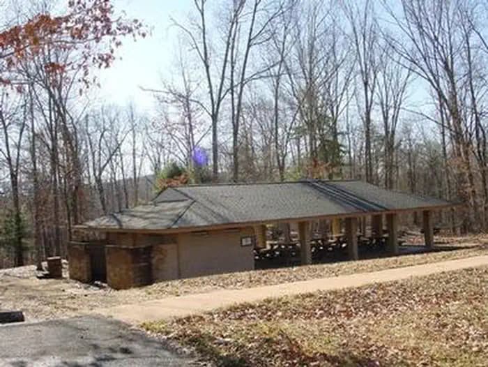
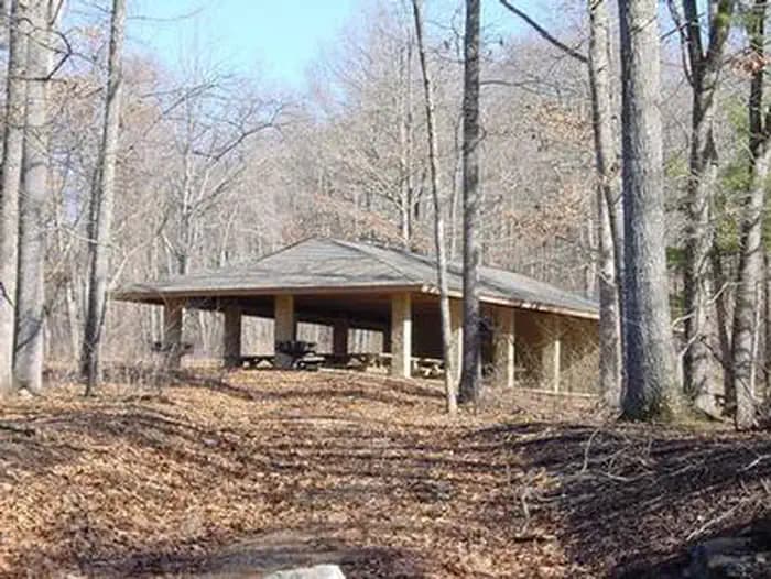
Overview Coles Point Picnic Shelters are tucked in a small opening surrounded by a hardwood forest. Opportunities abound for hiking, photography, nature study, birding and viewing wildlife. Best of all, Coles Point is perched along Moomaw Lake, providing convenient access to boating, fishing, swimming and relaxing on the beach. Recreation An inviting swimming beach within the recreation area lures crowds, and the picnic area has an open field for games like Frisbee and soccer. The park offers boating and fishing for large and smallmouth bass, brown trout, bluegill, crappie, shad, catfish, sunfish and chain pickerel. Two fishing docks, two boat ramps and a swimming beach with a bathhouse are located on-site. Back Creek is nearby, also a nice stream for trout fishing. The 1-mile Morris Hill Bike Trail is popular among hikers and bikers. The 3-mile Fortney Loop Trail is open to hiking along a path with several switchbacks. Facilities An inviting swimming beach within the recreation area lures crowds, and the picnic area has an open field for games like Frisbee and soccer. The park offers boating and fishing for large and smallmouth bass, brown trout, bluegill, crappie, shad, catfish, sunfish and chain pickerel. Two fishing docks, two boat ramps and a swimming beach with a bathhouse are located on-site. Back Creek is nearby, also a nice stream for trout fishing. The 1-mile Morris Hill Bike Trail is popular among hikers and bikers. The 3-mile Fortney Loop Trail is open to hiking along a path with several switchbacks. Natural Features The shelters are situated on a wooded peninsula on the south end of Lake Moomaw in Alleghany County. The manmade lake, at 2,530 acres, sits on the Jackson River and has 43 miles of wooded shoreline. Coles Point is part of the George Washington and Jefferson National Forests which span across Virginia and parts of West Virginia and Kentucky. These forests protect 40 species within mostly Appalachian hardwood and mixed pine-hardwood forests, 60 species of mammals and 200 species of birds. Nearby Attractions Head downstream on the Jackson River for fly-fishing, canoeing, rafting and kayaking. A half-hour east of the lake is Hot Springs, Virginia, a quaint and small rural resort town. The nearest groceries and gas are located in Covington, Virginia about 30 minutes from the lake. A pay phone is located at the nearby Morris Hill Campground.
- Map coordinates are available for trip planning.
Reservations & Contact
Plan your stay
Phone
540-279-4144
smohney@fs.fed.us
Getting There
From I-64 at Exit 16A or 16B in Covington, follow signs to U.S. Highway 220 and travel north about 5.5 miles. Turn left on State Road 687/Jackson River Road and travel about 3.2 miles. Turn left on State Road 641/Indian Draft Road, which soon becomes State Road 666. Travel about 4.2 miles on 641/666 to a 3-way intersection. Turn right on State Road 605 and travel 4.5 miles past the Morris Hill Campground entrance, and across the Gathright Dam. Picnic shelter #1 will be on the left.
FAQ
Common questions
Everything you need to know before your trip to COLES POINT .
How do reservations work for COLES POINT ?
Reservation availability for COLES POINT can vary by season and campsite type. Check the contact and access section before booking.
What campsite types are available at COLES POINT ?
Campsite type details are limited right now. Check back as this listing is enriched.
Where is COLES POINT located?
COLES POINT is in Virginia near Covington. Coordinates: 37.9503, -79.9622.
Keep Exploring