
—
Total Campsites
Campground
—
Reservable Sites
Check by phone
—
Accessible
ADA-compliant sites
Organization
Overview
About SHIRTTAIL CREEK
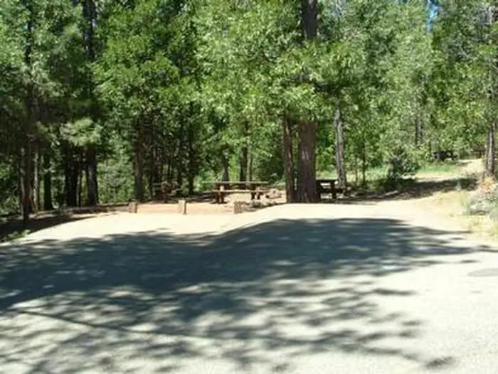
Overview Shirttail Campground is located on the north shore of Sugar Pine Reservoir, in the Tahoe National Forest, 15 miles from Foresthill. Visitors enjoy the area for its fishing, boating, OHV, and hiking opportunities. This facility is operated and maintained by the Tahoe National Forest. Recreation Fishing, swimming and both motorized and non-motorized boating are popular activities on the reservoir. A paved, non-motorized accessible trail connects recreation sites on the north shore with recreation sites on the south shore and has interpretive signs and shaded benches for rest breaks. The North Fork of the American River is nearby, with additional fishing, white water boating, and swimming. Many miles of hiking, biking and off-road vehicle trails are in the surrounding area. Facilities Fishing, swimming and both motorized and non-motorized boating are popular activities on the reservoir. A paved, non-motorized accessible trail connects recreation sites on the north shore with recreation sites on the south shore and has interpretive signs and shaded benches for rest breaks. The North Fork of the American River is nearby, with additional fishing, white water boating, and swimming. Many miles of hiking, biking and off-road vehicle trails are in the surrounding area. Natural Features Sugar Pine Reservoir covers 160 acres at an elevation of 3600 feet. The campground lies above the north shoreline, in a forest of manzanita and ponderosa pine. Summertime temperatures are warm during the day and cool at night. Nearby Attractions Shirttail Creek Campground is a recreation site within the Sugar Pine Recreation Area which includes an additional family campground, a group campground, a boat ramp, and a day use picnic site, as well as a trail that circles the entire lake. The North Fork American Wild And Scenic River can be accessed near by. Other recreation opportunities include many hiking, equestrian, mountain biking, and OHV trails.
- Map coordinates are available for trip planning.

Reservations & Contact
Plan your stay
Phone
530-367-2224
Getting There
From either east bound or west bound Interstate 80 take exit 121, Auburn Ravine Road to Foresthill. Continue east for 17 miles, to Foresthill. Travel through town, about 9 miles, to Forest Road 10/Sugar Pine Road. Turn left and continue 9 miles to the Sugar Pine Campgrounds road (approximately 1 mile after crossing the Sugar Pine Reservoir dam). Turn right and continue about 1.5 miles, turn left into the campground.
FAQ
Common questions
Everything you need to know before your trip to SHIRTTAIL CREEK.
How do reservations work for SHIRTTAIL CREEK?
Reservation availability for SHIRTTAIL CREEK can vary by season and campsite type. Check the contact and access section before booking.
What campsite types are available at SHIRTTAIL CREEK?
Campsite type details are limited right now. Check back as this listing is enriched.
Where is SHIRTTAIL CREEK located?
SHIRTTAIL CREEK is in California near Foresthill. Coordinates: 39.1419, -120.7865.
Keep Exploring