
Campgrounds Near Lassen Volcanic
All four types of volcanoes, boiling mud pots, and alpine lakes in northern California.
34
Campgrounds within 50 mi
California
Primary state
< 1 mi
Closest campground
Nearby campgrounds
34 campgrounds within 50 miles of Lassen Volcanic

CA · Campground
Overview Summit Lake Stock Corral (elevation 6,700 ft.) is conveniently located on the main road of Lassen Volcanic National Park. The stock corral is within walking distance of the small but scenic Summit Lake and seven miles from the trailhead to Lassen Peak, the largest volcano in the park (elevation 10,457 ft.). Riders will find one of the park's major trails only 1/4 mile away from the stock corral. A convenient horse trail leads to the Summit Lake Ranger Station where the trailhead is located. Many more trails are in close proximity with access to Juniper Lake, Snag Lake, and Butte Lake. The Pacific Crest Trail, which runs through the park, is also accessible from the Summit Lake Stock Corral. Recreation The Summit Lake area is a hub for hiking and horse riding enthusiasts. Many of the park's 150 miles of trails can be accessed from this area. Located a short distance from the stock corral is the Cluster Lakes loop trail, a major trailhead into the park's interior, bypassing several alpine lakes and popular among birders. Evening programs are presented at an amphitheater within the Summit Lake Campground area. Facilities The Summit Lake area is a hub for hiking and horse riding enthusiasts. Many of the park's 150 miles of trails can be accessed from this area. Located a short distance from the stock corral is the Cluster Lakes loop trail, a major trailhead into the park's interior, bypassing several alpine lakes and popular among birders. Evening programs are presented at an amphitheater within the Summit Lake Campground area. Natural Features The national park is known for its volcanic history, as well as its diversity of plants and animals. It contains 300 active volcanic domes and many hydrothermal features, such as mud pots and steam vents. Lassen Peak is the southernmost active volcano in the Cascades, and the second most recent volcano to erupt in the lower 48 of the United States before Mount Saint Helens. Lassen Volcanic National Park boasts over 700 species of flowering plants and 250 native species including birds, mammals, reptiles and fish. The park is at the junction of the Cascade Mountains, the Sierra Nevada Mountains and the Great Basin, providing many unique habitats.
View details →
CA · Campground
Overview Summit Lake North Campground (elevation 6,700 ft.) is conveniently located on the main road of Lassen Volcanic National Park. The campground is within walking distance of the small but scenic Summit Lake and eight miles from the 10,457-ft. Lassen Peak, the largest volcano in the park.. Hikers will find one of the park's major trails only 1/4-mile away from the campground and many more within a close proximity. Summit Lake North is on the opposite side of the lake from Summit Lake South Campground. Recreation The campground is a hub for hiking and backpacking enthusiasts. Campers can access many of the park's 150 miles of hiking trails from the Summit Lake area. The Cluster Lakes loop trail--a major trailhead into the park's interior that bypasses several alpine lakes and is popular among birders--is located a short walk from the Summit Lake Ranger Station. This is the closest campground to the Lassen Peak Trail and within 10 miles of the hydrothermal area Bumpass Hell. Educational programs are presented at an amphitheater within the facility. Facilities The campground is a hub for hiking and backpacking enthusiasts. Campers can access many of the park's 150 miles of hiking trails from the Summit Lake area. The Cluster Lakes loop trail--a major trailhead into the park's interior that bypasses several alpine lakes and is popular among birders--is located a short walk from the Summit Lake Ranger Station. This is the closest campground to the Lassen Peak Trail and within 10 miles of the hydrothermal area Bumpass Hell. Educational programs are presented at an amphitheater within the facility. Natural Features The national park is known for its volcanic history, as well as its diversity of plants and animals. It contains 300 active volcanic domes and many hydrothermal features, such as mud pots and steam vents. Lassen Peak is the southernmost active volcano in the Cascades, and the second most recent volcano to erupt in the lower 48 of the United States before Mount Saint Helens. Lassen National Park boasts over 700 species of flowering plants and 250 native species including birds, mammals, reptiles and fish. The park is at the junction of the Cascade Mountains, the Sierra Nevada Mountains and the Great Basin, providing many unique habitats.
View details →
CA · Campground
Overview Summit Lake South Campground (elevation 6,700 ft.) is conveniently located on the main road of Lassen Volcanic National Park. The campground is within walking distance of the small but scenic Summit Lake and eight miles from the 10,457-ft. Lassen Peak, the largest volcano in the park. Hikers will find one of the park's major trails only 1/4-mile away from the campground and many more within a close proximity. Summit Lake South is on the opposite side of the lake from Summit Lake North Campground. Recreation The campground is a hub for hiking and backpacking trails within the park. Campers can access many of the park's 150 miles of hiking trails from the Summit Lake area. The Cluster Lakes loop trail--a major trailhead into the park's interior that bypasses several alpine lakes and is popular among birders--is located a short walk away at the Summit Lake Ranger Station. This is the closest campground to the Lassen Peak Trail and within 10 miles of the hydrothermal area, Bumpass Hell. Educational programs are presented at an amphitheater within the facility. Facilities The campground is a hub for hiking and backpacking trails within the park. Campers can access many of the park's 150 miles of hiking trails from the Summit Lake area. The Cluster Lakes loop trail--a major trailhead into the park's interior that bypasses several alpine lakes and is popular among birders--is located a short walk away at the Summit Lake Ranger Station. This is the closest campground to the Lassen Peak Trail and within 10 miles of the hydrothermal area, Bumpass Hell. Educational programs are presented at an amphitheater within the facility. Natural Features The national park is known for its volcanic history, as well as its diversity of plants and animals. It contains 300 active volcanic domes and many hydrothermal features, such as mud pots and steam vents. Lassen Peak is the southernmost active volcano in the Cascades, and the second-most recent volcano to erupt in the lower 48 of the United States before Mount Saint Helens. Lassen National Park boasts over 700 species of flowering plants and 250 native species including birds, mammals, reptiles and fish. The park is at the junction of the Cascade Mountains, the Sierra Nevada Mountains and the Great Basin, thus providing many unique habitats.
View details →
CA · Campground
Overview Warner Valley campground is a limited development facility in the south eastern area of the park. It has vault toilets and potable water spigots. Numerous trails can be accessed from the campground. Recreation Hiking trails accessible from the campground Facilities Hiking trails accessible from the campground Natural Features Lassen Volcanic national park is known for its volcanic history, as well as its diversity of plants and animals. It contains 300 active volcanic domes, as well as many hydrothermal features, such as mud pots and steam vents. Lassen Peak is the southernmost active volcano in the Cascades, and the second most recent to erupt in the lower 48 of the United States before Mount Saint Helens. Lassen National Park boasts over 700 species of flowering plants and 250 species of birds, mammals, reptiles and fish. The park is at the junction of the Cascade Mountains, the Sierra Nevada Mountains and the Great Basin, thus providing many unique habitats. Nearby Attractions Drakesbad Guest Ranch - half a mile away, at the end of Warner Valley road. Dining room serves meals - please contact the ranch for reservations Charges & Cancellations A customer who cancels a reservation the day before or on the day of arrival will pay a $10.00 service fee AND forfeit the first night's use fee (not to exceed the total paid for the original reservation). Cancellations for a one-night reservation will forfeit the entire amount paid and will not be subject to an additional service fee
View details →
Overview Lost Creek Group Campground (elevation 5,700 ft.) is approximately five miles south of Manzanita Lake, and close to the Lost Creek and Devastated areas. Located on the main park road, it is also in close proximity to the main attractions and hiking trails of Lassen Volcanic National Park, the general store, showers and other amenities. The Loomis Museum and educational programs are a within a short drive. Recreation Within a short drive, campers can access several hiking trails and Manzanita Lake. The lake is popular with fly fishermen for catching trout; however, the area does maintain a catch-and-release policy and requires the use of artificial lures and single barb-less hooks only. Non-motorized boating is also permitted with kayak rentals nearby. Facilities Within a short drive, campers can access several hiking trails and Manzanita Lake. The lake is popular with fly fishermen for catching trout; however, the area does maintain a catch-and-release policy and requires the use of artificial lures and single barb-less hooks only. Non-motorized boating is also permitted with kayak rentals nearby. Natural Features The Lost Creek area has a pleasant atmosphere dominated by large ponderosa pines. The national park is known for its volcanic history, as well as its diversity of plants and animals. It contains 300 active volcanic domes and many hydrothermal features, such as mud pots and steam vents. Lassen Peak is the southernmost active volcano in the Cascades, and the second most recent volcano to erupt in the lower 48 of the United States before Mount Saint Helens. Lassen National Park boasts over 700 species of flowering plants and 250 species of vertebrates, including birds, mammals, reptiles and fish. The park is at the junction of the Cascade Mountains, the Sierra Nevada Mountains and the Great Basin, thus providing many unique habitats. Nearby Attractions The Loomis Museum is located about a fifteen minute drive away and the Kohm Yah-mah-nee Visitor Center is located about forty-five minute drive away.
View details →
CA · Campground
Overview Juniper Lake Group Campground (elevation 6,800 feet) is a remote, rustic facility in the southeastern part of Lassen Volcanic National Park. It is on the eastern shore of Juniper Lake, a popular swimming spot, and offers a fantastic view of Lassen Peak, the largest volcano in the park, towering at 10,457 feet. Recreation The main trailheads for Horseshoe Lake, Snag Lake and the interior of the park are within the facility. The Mount Harkness Trail ascends to a historic fire tower that is still in use. Juniper Lake is popular for canoeing, kayaking and swimming; Motorized boating is not permitted. Facilities The main trailheads for Horseshoe Lake, Snag Lake and the interior of the park are within the facility. The Mount Harkness Trail ascends to a historic fire tower that is still in use. Juniper Lake is popular for canoeing, kayaking and swimming; Motorized boating is not permitted. Natural Features The national park is known for its volcanic history, as well as its diversity of plants and animals. It contains 300 active volcanic domes and many hydrothermal features, such as mud pots and steam vents, some of which are close to the campground. Lassen Peak is the southernmost active volcano in the Cascades, and the second-most recent volcano to erupt in the lower 48 of the United States before Mount Saint Helens in 1980. Lassen National Park boasts over 700 species of flowering plants and 250 species of vertebrates, including birds, mammals, reptiles and fish. The park is at the junction of the Cascade Mountains, the Sierra Nevada Mountains and the Great Basin, thus providing many unique habitats.
View details →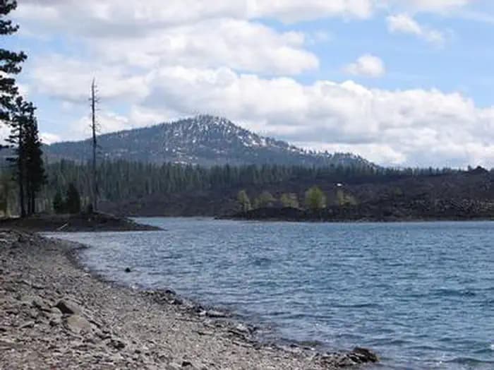
Overview Butte Lake Campground (elevation 6,100 feet) is located in the northeastern section of Lassen Volcanic National Park in northern California. It is fairly remote and within walking distance of Butte Lake, which is popular for fishing, canoeing, kayaking and swimming. Several hiking and backpacking trails are located nearby. The facility is 45 minutes from the main park road. Recreation Outdoor enthusiasts stay at Butte Lake Campground for its many recreation opportunities. The lake is popular for trout fishing, as well as non-motorized boating. Within the facility, hikers and backpackers will find the trailhead for the Cinder Cone Trail, one of the most popular trails in the park that ascends a nearby volcanic dome. The Painted Dunes, Snag Lake and Bathtub Lake areas are also nearby. Facilities Outdoor enthusiasts stay at Butte Lake Campground for its many recreation opportunities. The lake is popular for trout fishing, as well as non-motorized boating. Within the facility, hikers and backpackers will find the trailhead for the Cinder Cone Trail, one of the most popular trails in the park that ascends a nearby volcanic dome. The Painted Dunes, Snag Lake and Bathtub Lake areas are also nearby. Natural Features The campground has a pleasant atmosphere dominated by Ponderosa pines. It sits on soft volcanic soils, and several ponds dot the landscape. Butte Lake has a large black lava flow running into it, creating rocky shores and interesting views for visitors in kayaks and canoes to explore. The national park is known for its volcanic history, as well as its diversity of plants and animals. It contains 300 active volcanic domes and many hydrothermal features, such as mud pots and steam vents. Lassen Peak is the southernmost active volcano in the Cascades, and the second most recent volcano to erupt in the lower 48 of the United States before Mount Saint Helens. Lassen National Park boasts over 700 species of flowering plants and 250 species of vertebrates, including birds, mammals, reptiles and fish. The park is at the junction of the Cascade Mountains, the Sierra Nevada Mountains and the Great Basin, thus providing many unique habitats. Nearby Attractions Visitors can explore Subway Cave, an underground lava tube, in the adjacent Lassen National Forest from late April through November. Free tours are offered every weekend during summer. Subway Cave, Lassen National Forest
View details →
CA · Campground
Overview Butte Lake Group Campground (elevation 6,100 feet) is located in the northeastern section of Lassen Volcanic National Park in northern California. It is fairly remote and within walking distance of Butte Lake, which is popular for fishing, canoeing, kayaking and swimming. Several hiking and backpacking trails are located nearby. The facility is 45 minutes from the main park road. Recreation Outdoor enthusiasts stay at Butte Lake Campground for its many recreation opportunities. The lake is popular for trout fishing, as well as non-motorized boating. Within the facility, hikers and backpackers will find the trailhead for the Cinder Cone Trail, one of the most popular trails in the park that ascends a nearby volcanic dome. The Painted Dunes, Snag Lake and Bathtub Lake areas are also nearby. Facilities Outdoor enthusiasts stay at Butte Lake Campground for its many recreation opportunities. The lake is popular for trout fishing, as well as non-motorized boating. Within the facility, hikers and backpackers will find the trailhead for the Cinder Cone Trail, one of the most popular trails in the park that ascends a nearby volcanic dome. The Painted Dunes, Snag Lake and Bathtub Lake areas are also nearby. Natural Features The campground has a pleasant atmosphere dominated by Ponderosa pines. It sits on soft volcanic soils, and several ponds dot the landscape. Butte Lake has a large black lava flow running into it that creates rocky shores and interesting areas for visitors in kayaks and canoes to explore. The national park is known for its volcanic history, as well as its diversity of plants and animals. It contains 300 active volcanic domes and many hydrothermal features, such as mud pots and steam vents. Lassen Peak is the southernmost active volcano in the Cascades, and the second-most recent volcano to erupt in the lower 48 of the United States before Mount Saint Helens in 1980. Lassen National Park boasts over 700 species of flowering plants and 250 species of vertebrates, including birds, mammals, reptiles and fish. The park is at the junction of the Cascade Mountains, the Sierra Nevada Mountains and the Great Basin, thus providing many unique habitats. Nearby Attractions Visitors can explore Subway Cave, an underground tube created by lava flow, in the adjacent Lassen National Forest from late April through November. Free tours are offered every weekend during summer. Subway Cave, Lassen National Forest
View details →
CA · Campground
Overview Situated near the northwest entrance to the park, the rustic Manzanita Lake Camping Cabins offer convenience and comfort in the scenic setting of Lassen Volcanic National Park. These 20 cabins are the first new accommodations in Lassen Volcanic National Park since 1972, and are available in three models: 2 Room, 1 Room, and Bunkhouse. They are within walking distance of Manzanita Lake, a popular catch & release fishing and family destination, and offer a view of 10,457-foot Lassen Peak, the largest volcano in the park. The cabins are located one mile south of the park entrance, perched at an elevation of 5,890 feet and adjacent to a 179-site campground. The Loomis Museum, Loomis Ranger Station and popular hiking trails are nearby. Educational programs are presented at the museum and amphitheater within the campground. Groceries, supplies, gifts, gasoline, laundromat and hot showers are located at the nearby Manzanita Lake Camper Store. Our cafe features a variety of delicious and healthy items including salads, fresh fruits, hot or cold sandwiches, espresso drinks and soft-serve ice cream. Kayak and paddle board rentals are also available on a first come, first serve basis at the Camper Store. A map of our cabins can be viewed under additional information or on our website, www.lassenlodging.com. Follow us on Facebook at www.facebook.com/ManzanitaLake. Recreation Manzanita Lake is popular with fly fishermen for its trout; however, the area does maintain a catch-and-release policy and requires the use of artificial lures and single barb-less hooks only. Non-motorized boating is permitted and kayak rentals are nearby. The park boasts more than 150 miles of hiking trails, a variety of which can be accessed from the campground, including family-friendly hikes as well as those for more experienced hikers. Manzanita Lake is also a favorite spot for birders. Facilities Manzanita Lake is popular with fly fishermen for its trout; however, the area does maintain a catch-and-release policy and requires the use of artificial lures and single barb-less hooks only. Non-motorized boating is permitted and kayak rentals are nearby. The park boasts more than 150 miles of hiking trails, a variety of which can be accessed from the campground, including family-friendly hikes as well as those for more experienced hikers. Manzanita Lake is also a favorite spot for birders. Natural Features Lassen Volcanic National Park is known for its volcanic history, as well as its diversity of plants and animals. It contains 300 active volcanic domes and many hydrothermal features, such as mud pots and steam vents. Lassen Peak is the southernmost active volcano in the Cascades and the second most recent volcano to erupt in the lower-48 of the United States before Mount St. Helens. Lassen Volcanic National Park boasts over 700 species of flowering plants and 250 native species including birds, mammals, reptiles and fish. The park is at the junction of the Cascade Range, the Sierra Nevada mountains and the Great Basin, thus providing many unique habitats. The Manzanita Lake Camping Cabins lie within a ponderosa pine forest. Nearby Attractions The Loomis Museum is at the north end of the park and the Kohm Yah-mah-nee Visitor Center is at the south end of the park. Both offer information, photos and videos of some of the most popular hikes in the park, along with a movie about the history of Lassen Peak eruptions. When visiting the Kohm Yah-mah-nee Visitor Center at the south entrance of the park, please visit us at Lassen Cafe & Gift. If interested in booking a stay with us at Drakesbad Guest Ranch, please visit www.lassenlodging.com.
View details →
CA · Campground
Overview Manzanita Lake Group Campground is located at the west end of Loop B in Manzanita Lake Campground, the largest campground in Lassen Volcanic National Park. It is within walking distance of scenic Manzanita Lake, a popular fishing and family destination, and offers impressive views of Lassen Peak, the largest volcano in the park at 10,457 feet. Recreation Manzanita Lake is popular with fly fishermen who enjoy the catch-and-release policy. Non-motorized boating is also permitted and kayak rentals are available nearby. The park boasts more than 150 miles of hiking trails, a variety of which can be accessed from the campground. Many family-friendly hikes are available, as well as those for more experienced hikers. Facilities Manzanita Lake is popular with fly fishermen who enjoy the catch-and-release policy. Non-motorized boating is also permitted and kayak rentals are available nearby. The park boasts more than 150 miles of hiking trails, a variety of which can be accessed from the campground. Many family-friendly hikes are available, as well as those for more experienced hikers. Natural Features The campground is situated at an elevation of 5,900 feet, adjacent to Manzanita Lake, surrounded by towering Jeffrey and ponderosa pines. The national park is known for its volcanic history, as well as its diversity of more than 950 species of animals and flowering plants. The park is at the junction of the Cascade Mountains, the Sierra Nevada Mountains and the Great Basin, thus providing many unique habitats. Lassen contains 300 active volcanic domes, as well as many hydrothermal features, such as mud pots and steam vents. Lassen Peak is the southernmost active volcano in the Cascades, and the second most recent to erupt in the lower 48 states, after Mount St. Helens.
View details →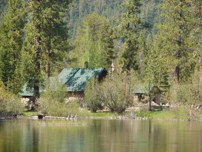
CA · Campground
Overview Manzanita Lake Campground (elevation 5,900 ft.) is the largest campground in Lassen Volcanic National Park. It is within walking distance of the scenic Manzanita Lake, a popular fishing and family destination, and offers impressive views of Lassen Peak, the largest volcano in the park at 10,457 feet. The facility is conveniently located one mile south of the park entrance, close to The Loomis Museum, Loomis Ranger Station and popular hiking trails. Educational programs are presented at the museum and amphitheater. Recreation Manzanita Lake is popular with fly fishermen, but the campground does maintain a catch-and-release policy. Non-motorized boating is also permitted and Kayak rentals are available nearby. The park boasts more than 150 miles of hiking trails, a variety of which can be accessed from the campground, including family-friendly hikes as well as those for more experienced hikers. Facilities Manzanita Lake is popular with fly fishermen, but the campground does maintain a catch-and-release policy. Non-motorized boating is also permitted and Kayak rentals are available nearby. The park boasts more than 150 miles of hiking trails, a variety of which can be accessed from the campground, including family-friendly hikes as well as those for more experienced hikers. Natural Features The national park is known for its volcanic history, as well as its diversity of plants and animals. It contains 300 active volcanic domes, as well as many hydrothermal features, such as mud pots and steam vents. Lassen Peak is the southernmost active volcano in the Cascades, and the second most recent to erupt in the lower 48 of the United States before Mount Saint Helens. Lassen National Park boasts over 700 species of flowering plants and 250 species of birds, mammals, reptiles and fish. The park is at the junction of the Cascade Mountains, the Sierra Nevada Mountains and the Great Basin, thus providing many unique habitats.
View details →
CA · Campground
Overview Hat Creek is one of six campgrounds available in the Hat Creek Recreation Area, home to some of the area's best trout fishing. Scenic hiking trails and an active volcanic area can easily be accessed from the facility. Recreation Hat Creek is popular for its trophy trout fishing. The cold waters of the creek allow for a refreshing play on hot summer days. Other popular activities in the area include wildlife viewing, hunting, backpacking, hiking and caving. A variety of day hikes are available in the area, including the Spatter Cones Nature Trail, which is located just across the highway from the campground. The 1.5-mile loop trail provides hikers with a unique opportunity to explore craters, cones and crevices, as well as other geologic features left by the Hat Creek Lava Flow. Nearby, visitors can take a self-guided tour of Subway Cave. The trail is less than a half-mile long and explores the underground world of a lava tube. Visitors are encouraged to bring flashlights for hiking through the cave. Facilities Hat Creek is popular for its trophy trout fishing. The cold waters of the creek allow for a refreshing play on hot summer days. Other popular activities in the area include wildlife viewing, hunting, backpacking, hiking and caving. A variety of day hikes are available in the area, including the Spatter Cones Nature Trail, which is located just across the highway from the campground. The 1.5-mile loop trail provides hikers with a unique opportunity to explore craters, cones and crevices, as well as other geologic features left by the Hat Creek Lava Flow. Nearby, visitors can take a self-guided tour of Subway Cave. The trail is less than a half-mile long and explores the underground world of a lava tube. Visitors are encouraged to bring flashlights for hiking through the cave. Natural Features The campground is situated next to Hat Creek in a mixed conifer forest at an elevation of about 4,390 feet. Pine needles, grasses and volcanic rocks cover the forest floor. Sites are widely spaced for privacy. Nearby Attractions The campground is located about a mile west of the town of Old Station, and 12 miles east of the northwest entrance to Lassen Volcanic National Park, where active, hissing fumaroles and boiling mud pots are continually shaping the landscape. The Pacific Crest National Scenic Trail can be accessed near the Spatter Cones Nature Trailhead.
View details →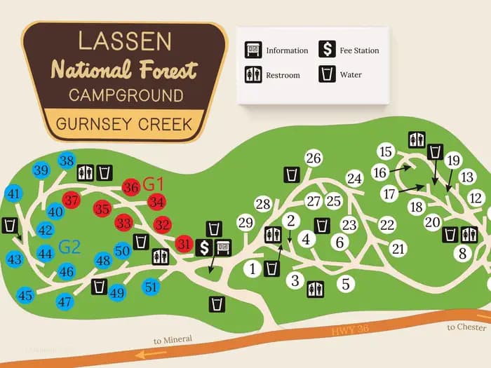
CA · Campground
Overview Gurnsey Creek Campground is located in the mountains of northern California. It offers access to a variety of nearby recreational opportunities, including hiking, fishing and picnicking. Recreation The area provides access to plentiful hiking trails, picnic spots and rainbow trout fishing. Facilities The area provides access to plentiful hiking trails, picnic spots and rainbow trout fishing. Natural Features The campground is nestled in a mixed conifer forest in the Lassen National Forest at an elevation of 4,700 feet. It is located next to Gurnsey Creek. Nearby Attractions The campground is located 14 miles west of the town of Chester and Lake Almanor, where boating, fishing, sailing and water skiing are popular activities. The southwest entrance to Lassen Volcanic National Park is about 14 miles north. The park is known for its active hissing fumaroles and boiling mud pots that continually shape and alter the landscape.
View details →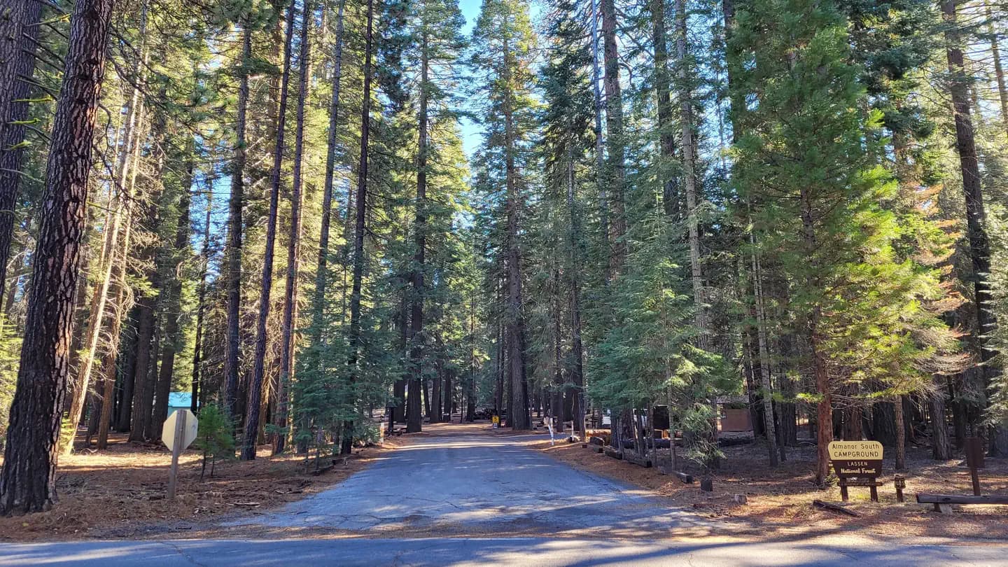
CA · Campground
Overview Almanor Campground is a large family-friendly facility for individuals and large groups alike. It provides direct access to beautiful Lake Almanor and a variety of recreational opportunities in the area. Recreation The 28,000-acre lake provides ample boating, swimming, water skiing and sailing opportunities. A boat ramp can be found next to the north campground. The adjacent beach is mostly rocky, but contains some sand. Fishing in the lake or nearby streams, is a popular activity. Anglers will find a variety of trout, bass, salmon and catfish, among other species. The Lake Almanor Recreation Trail can be accessed from within the campground. The trail winds through the forest, providing spectacular views of the lake, nearby Dyer Mountain and Lassen Peak. The trail stretches approximately 11 miles along the west shore of the lake. It is a non-motorized trail, open to all non-motorized activity. Facilities The 28,000-acre lake provides ample boating, swimming, water skiing and sailing opportunities. A boat ramp can be found next to the north campground. The adjacent beach is mostly rocky, but contains some sand. Fishing in the lake or nearby streams, is a popular activity. Anglers will find a variety of trout, bass, salmon and catfish, among other species. The Lake Almanor Recreation Trail can be accessed from within the campground. The trail winds through the forest, providing spectacular views of the lake, nearby Dyer Mountain and Lassen Peak. The trail stretches approximately 11 miles along the west shore of the lake. It is a non-motorized trail, open to all non-motorized activity. Natural Features The campground sits on the west shore of Lake Almanor at an elevation of 4,540 feet. A scenic mixed conifer forest covers the area. Parts of the campground are shaded, while other sections have grassy meadows that often contain wildflowers. Nearby Attractions The campground is located 12 miles outside of the town of Chester, California.
View details →
CA · Campground
Overview Christie Campground is located in the Eagle Lake Recreation Area of the Lassen National Forest. This recreation area has five campgrounds, three designated day use areas and a marina on the south shore of Eagle Lake. All these recreation facilities are connected by a 5.2 mile paved hiking/bike trail. The Osprey Overlook, another day use area in the recreation area, can be hiked or driven to for a scenic view of the southern end of Eagle Lake and the surrounding forest basin. The Lassen National Forest offers a variety of lakes, streams and wilderness areas for recreational opportunities. The forest offers miles of trails that are used for hiking, mountain biking, off-highway vehicle riding and in the winter months, snowmobiling. Recreation Fishing for the Eagle Lake Rainbow Trout, a California Heritage Trout, is the primary recreational activity on Eagle Lake, but the 3rd largest natural lake in California (22,000 acres), provides for plenty of room for swimming, kayaking, skiing and all other boating activities by motor or sail. There are no 2-cycle restrictions for outboard boat motors or PWCs. Facilities Fishing for the Eagle Lake Rainbow Trout, a California Heritage Trout, is the primary recreational activity on Eagle Lake, but the 3rd largest natural lake in California (22,000 acres), provides for plenty of room for swimming, kayaking, skiing and all other boating activities by motor or sail. There are no 2-cycle restrictions for outboard boat motors or PWCs. Natural Features Eagle Lake is located where the Sierras meet the Cascades at the southwestern end of the lake, and the Modoc Plateau of the Great Basin at the northeastern end. This unique location offers diverse landscapes, geology, wildlife and vegetation. Christie Campground is located in a mature conifer forest of pines and firs, on the southwestern shoreline of Eagle Lake, at an elevation of 5,100 feet. contact_info For facility specific information, please call (530) 825-3454. Nearby Attractions The Lassen National Forest has many other recreational opportunities and the Lassen Volcanic National Park is an easy day’s drive to and from Eagle Lake Recreational Area.
View details →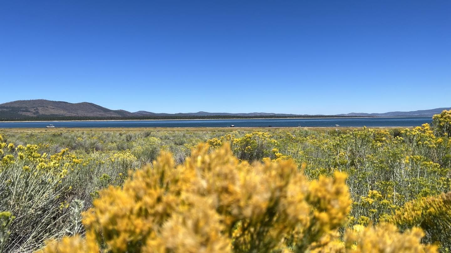
Overview Merrill Campground is located in the Eagle Lake Recreation Area of the Lassen National Forest. This recreation area has five campgrounds, three designated day use areas and a marina on the south shore of Eagle Lake. All of these recreation facilities are connected by a 5.2 mile paved hiking/bike trail. The Osprey Overlook, another day use area in the recreation area, can be hiked or driven to for a scenic view of the southern end of Eagle Lake and the surrounding forest basin. The Lassen National Forest offers a variety of lakes, streams and wilderness areas for recreational opportunities. The forest offers miles of trails that are used for hiking, mountain biking, off-highway vehicle riding and in the winter months, snowmobiling. Recreation Fishing for the Eagle Lake Rainbow Trout, a California Heritage Trout, is the primary recreational activity on Eagle Lake, but the 3rd largest natural lake in California (22,000 acres), provides for plenty of room for swimming, kayaking, skiing and all other boating activities by motor or sail. There are no 2-cycle restrictions for outboard boat motors or PWCs. Facilities Fishing for the Eagle Lake Rainbow Trout, a California Heritage Trout, is the primary recreational activity on Eagle Lake, but the 3rd largest natural lake in California (22,000 acres), provides for plenty of room for swimming, kayaking, skiing and all other boating activities by motor or sail. There are no 2-cycle restrictions for outboard boat motors or PWCs. Natural Features Eagle Lake is located where the Sierras meet the Cascades at the southwestern end of the lake, and the Modoc Plateau of the Great Basin at the northeastern end. This unique location offers diverse landscapes, geology, wildlife and vegetation. Merrill Campground is located in a mature conifer forest of pines and firs on the southern shoreline of Eagle Lake, at an elevation of 5,100 feet. Nearby Attractions The Lassen National Forest has many other recreational opportunities and the Lassen Volcanic National Park is an easy day’s drive to and from Eagle Lake Recreational Area.
View details →
Overview Eagle Campground is located in the Eagle Lake Recreation Area of the Lassen National Forest. This recreation area has five campgrounds, three designated day use areas and a marina on the south shore of Eagle Lake. All of these recreation facilities are connected by a 5.2 mile paved hiking/bike trail. The Osprey Overlook, another day use area in the recreation area, can be hiked or driven to for a scenic view of the southern end of Eagle Lake and the surrounding forest basin. The Lassen National Forest offers a variety of lakes, streams and wilderness areas for recreational opportunities. The forest offers miles of trails that are used for hiking, mountain biking, off-highway vehicle riding and in the winter months, snowmobiling. Recreation Fishing for the Eagle Lake Rainbow Trout, a California Heritage Trout, is the primary recreational activity on Eagle Lake, but the 3rd largest natural lake in California (22,000 acres), provides for plenty of room for swimming, kayaking, skiing and all other boating activities by motor or sail. There are no 2-cycle restrictions for outboard boat motors or PWCs. Facilities Fishing for the Eagle Lake Rainbow Trout, a California Heritage Trout, is the primary recreational activity on Eagle Lake, but the 3rd largest natural lake in California (22,000 acres), provides for plenty of room for swimming, kayaking, skiing and all other boating activities by motor or sail. There are no 2-cycle restrictions for outboard boat motors or PWCs. Natural Features Eagle Lake is located where the Sierras meet the Cascades at the southwestern end of the lake, and the Modoc Plateau of the Great Basin at the northeastern end. This unique location offers diverse landscapes, geology, wildlife and vegetation. Eagle Campground is located in a mature conifer forest of pines and firs, on the southern shoreline of Eagle Lake, at an elevation of 5,100 feet. contact_info For facility specific information, please call (530) 825-3454. Nearby Attractions The Lassen National Forest has many other recreational opportunities and the Lassen Volcanic National Park is an easy day’s drive to and from Eagle Lake Recreational Area.
View details →
Overview West Eagle Campground is part of the Eagle Lake Recreation Area in the Lassen National Forest, which offers a variety of lakes, streams and wilderness areas and an abundance of recreation opportunities. In addition to water sports on the lake, the area also offers miles of trails that are used year-round for hiking and mountain biking and by snowmobiling enthusiasts during the winter months. Recreation The 27,000-acre lake provides ample boating, swimming, water skiing and sailing opportunities. Visitors also enjoy the plentiful trout fishing. A boat ramp can be found not far from the campground, and a beach is located at the nearby Aspen Campground. The campground offers access points for miles of trails within the Eagle Lake Recreation Area. A 6-mile hiking, biking and horseback riding trail parallels the lake and winds through the surrounding forest. Facilities The 27,000-acre lake provides ample boating, swimming, water skiing and sailing opportunities. Visitors also enjoy the plentiful trout fishing. A boat ramp can be found not far from the campground, and a beach is located at the nearby Aspen Campground. The campground offers access points for miles of trails within the Eagle Lake Recreation Area. A 6-mile hiking, biking and horseback riding trail parallels the lake and winds through the surrounding forest. Natural Features The campground is located on the southeastern shores of Eagle Lake, in northeastern California, at an elevation of approximately 5,100 feet. It is nestled in a forest of mature pine trees with a grassy understory. A few sites offer sweeping views of the adjacent lake and some have space to moor a boat. contact_info For facility specific information, please call (530) 825-3454.
View details →
CA · Campground
Overview Hallsted campground is conveniently situated in the Feather River Canyon, just off the main road in the northern Sierra Nevada Mountains. At an elevation of 2,300 feet, it offers a cool getaway from the summer heat, as well as a variety of outdoor activities The route on the nearby Feather River National Scenic Byway traverses a steeply carved river gorge that encapsulates the historic railroad system from Oroville to Quincy and impressive powerhouses built to provide hydroelectricity. Recreation Fly fishing for trout and swimming are popular activities in the nearby north fork of the Feather River. Facilities Fly fishing for trout and swimming are popular activities in the nearby north fork of the Feather River. Natural Features Mature pine and fir trees provide ample shade for the campground, as well as a perfect atmosphere for mountain camping. Several sites parallel the north fork of the Feather River. A variety of wildlife make its home in the area. Nearby Attractions A general store is available in Twain, less than a half-mile from the campground. Quincy is approximately 17 miles east, providing the nearest source of fuel.
View details →
CA · Campground
Overview Spanish Creek Campground is located on Highway 70 just east of the Highway 89 intersection; just east of where Banish Creek and Indian Creek merge together to create the east branch of the North Fork Feather River. The campground is right on Spanish Creek with a very popular swimming hole. Although the campground has been recently upgraded, it still holds the charm that it did in years past. Recreation Anglers enjoy a healthy supply of rainbow trout in the nearby Feather River, which is within walking distance from the campground. The river and nearby Spanish Creek are also popular for swimming and wading activities. Facilities Anglers enjoy a healthy supply of rainbow trout in the nearby Feather River, which is within walking distance from the campground. The river and nearby Spanish Creek are also popular for swimming and wading activities. Natural Features This campground is located in the Plumas National Forest, which is attractive to outdoor enthusiasts because of its many streams and lakes, beautiful deep canyons, rich mountain valleys, meadows, and lofty peaks. Spanish Creek is in the Feather River Canyon, at an elevation of 2,000 feet. contact_info For facility specific information, please call (530) 927-7878. Nearby Attractions Within the Plumas National Forest, Spanish Creek campground is just a few short miles from Indian Falls. This is one attraction not to miss. Some have said that the mist created by the falls resembles a feather -- thus naming the Feather River. Just southeast on Highway 70 from Spanish Creek Campground is the quaint high Sierra town of Quincy. We recommend walking around the town if you get a chance. Very close to the campground is the Butterfly Valley Botanical Area. This is also a neat spot to explore. Before you get to the town of Quincy you will pass the Mount Hough Ranger District - a wonderful stop to discover more information about local area attractions.
View details →
Overview Hutchins Group Campground is the perfect location for groups who want to explore the greater Bucks Lake area of the Plumas National Forest. This campground was severely impacted by the Dixie Fire in 2021. Timber salvage management has left the campground barren and hot so prepare by providing adequate shade for your stay. American Land & Leisure are the concession operators working for PG&E to service the campgrounds, boat ramps and day use areas that are owned by the USDA Forest Service. Recreation The greater Bucks Lake area provides ample opportunities for fishing, boating, and canoeing. The boat ramp at Shady Point provides a boat dock to launch boats, showers, and day use picnicking. Hiking trails are only a short drive away with trailheads located in the Mill Creek Campground, Mill Creek Trailhead on the way to Bucks Summit, and at Bucks Summit where the PCT or Bucks Creek Loop trail are located. Facilities The greater Bucks Lake area provides ample opportunities for fishing, boating, and canoeing. The boat ramp at Shady Point provides a boat dock to launch boats, showers, and day use picnicking. Hiking trails are only a short drive away with trailheads located in the Mill Creek Campground, Mill Creek Trailhead on the way to Bucks Summit, and at Bucks Summit where the PCT or Bucks Creek Loop trail are located. Natural Features At a 5,000-foot elevation, Hutchins campground provides a great jumping off point to explore the greater Bucks Lake area. Hot days, followed by cooler nights, provide the perfect atmosphere for camping. This campground would be a great place for star gazers night owls who really appreciate a wide open sky for night viewing. Nearby Attractions The campground is located within walking distance of Bucks Lake. Bucks Lake Wilderness borders the lake and the Pacific Crest National Scenic Trail System traverses the surrounding area. A wilderness permit is not required; however, it is advised that hikers and backpackers leave an itinerary at the trailhead or with campground host.
View details →
CA · Campground
Overview Whitehorse campground is located within three miles of Bucks Lake in the northern Sierra Mountains on the Plumas National Forest. The Bucks Lake area offers year-round recreation activities including fishing, hiking, snowmobiling, skiing,snowshoeing and horseback riding. Recreation Staying at the Whitehorse campground provides access to several activites located in the greater Bucks Lake area. Fishing, boating, and canoeing, as well as hiking are all activities that can be achieved by staying in this campground. There are walking trails to the lake. A hiking trail runs from the campground and provides access to the Bucks Lake Wilderness and the Pacific Crest Trail. Marinas and boat docks are also within a short drive as well as restaurants at the Lakeside Resort and Bucks Lake Lodge which will re-open under new management in the summer for 2025, weather permitting. Limited supplies and a deli are located at the Haskins Valley Store just a short drive away. Facilities Staying at the Whitehorse campground provides access to several activites located in the greater Bucks Lake area. Fishing, boating, and canoeing, as well as hiking are all activities that can be achieved by staying in this campground. There are walking trails to the lake. A hiking trail runs from the campground and provides access to the Bucks Lake Wilderness and the Pacific Crest Trail. Marinas and boat docks are also within a short drive as well as restaurants at the Lakeside Resort and Bucks Lake Lodge which will re-open under new management in the summer for 2025, weather permitting. Limited supplies and a deli are located at the Haskins Valley Store just a short drive away. Natural Features This campground is set in a fir and pine forest offering shade during the warm summer months. Situated at 5,500 feet in elevation, the campground is settled along a small creek that feeds into Bucks Lake. Nearby Attractions The nearby Bucks Lake Lodge has a bar, restaurant and store offering fishing supplies and groceries.
View details →
Overview Lower Jones Valley Campground is located on the Pit River Arm of Shasta Lake, it has trash service, vault toilets and potable water. This is campground has 9 single sites and 2 double sites with an average back in around 30'. This Campground is on a First Come - First Serve Basis, vistors are required to physically be at the campground to purchase and claim a site. You must also occupy the area the day you pay for it, no advance payments. We encourage our visitors to download the recreation.gov app to take advantage of the Scan & Pay Option. There is also a Iron Ranger on site that you can pay with cash or check. Recreation A public boat ramp is located approximately 1 mile away at Jones Valley (dependent on water level). This area is popular for water skiing and jet skiing. Lake Shasta offers excellent fishing for trout, catfish, Chinook salmon, crappie, bluegill, white sturgeon, brown bullhead and bass. Facilities A public boat ramp is located approximately 1 mile away at Jones Valley (dependent on water level). This area is popular for water skiing and jet skiing. Lake Shasta offers excellent fishing for trout, catfish, Chinook salmon, crappie, bluegill, white sturgeon, brown bullhead and bass. Natural Features Shasta-Trinity is the largest national forest in California with a diverse landscape encompassing five wilderness areas, hundreds of mountain lakes and 6,278 miles of streams and rivers. Lake Shasta sits at an elevation of 1,067 feet, with 365 miles of shoreline punctuated by steep mountains blanketed in manzanita and evergreens. A snow-capped Mount Shasta, the second-tallest mountain in the Cascade Range, looms in the distance. Wildlife is abundant in the area. Nearby Attractions There are several attractions in the area for a list of a few view our website: Local Attractions Charges & Cancellations Refunds for Check or Cash Purchases: Refunds for cash payments will be issued a check or cash refund. A refund will be processed within 30 days of receipt and approval. For cash or check refunds please call us at 530-275-8113. Please Note! Refund requests made during or after departure can only be processed when approved by the facility management staff based upon local policy. Refunds for Emergency Closures: In the event of an emergency closure the Recreation.gov will attempt to notify users and offer alternate dates and sites (as appropriate). If this is not possible, reservations will be canceled and all fees paid will be refunded. Refunds for Naturally Occurring Events: Refunds will not be issued for naturally occurring events like rain, snow, wind, smoke, extreme temperature, low lake level, etc. If you are requesting a refund for a walk-up site, please contact the host on-site or call us 530-275-8113. All refunds must be approved and issued through our office or processed though Recreation.gov.
View details →
Overview Jones Valley Inlet Dispersed/Day Use Area is located on the Pit River Arm of Shasta Lake, it has trash and portable restrooms provided in season. This is a shoreline area and doesn't have designated sites. This Campground is on a First Come - First Serve Basis, vistors are required to physically be at the campground to purchase and claim a site. You must also occupy the area the day you pay for it, no advance payments. We encourage our visitors to download the recreation.gov app to take advantage of the Scan & Pay Option. There is also a Iron Ranger on site that you can pay with cash or check. Dispersed Area has no facilities and is pack in/pack out in winter months typically Mid September to Mid May - no fees are due during that time. Recreation A public boat ramp is located approximately 2 miles away at Jones Valley (dependent on water level), but informal mooring is allowed if the water levels are sufficient. This area is popular for water skiing and jet skiing. Lake Shasta offers excellent fishing for trout, catfish, Chinook salmon, crappie, bluegill, white sturgeon, brown bullhead and bass. Facilities A public boat ramp is located approximately 2 miles away at Jones Valley (dependent on water level), but informal mooring is allowed if the water levels are sufficient. This area is popular for water skiing and jet skiing. Lake Shasta offers excellent fishing for trout, catfish, Chinook salmon, crappie, bluegill, white sturgeon, brown bullhead and bass. Natural Features Shasta-Trinity is the largest national forest in California with a diverse landscape encompassing five wilderness areas, hundreds of mountain lakes and 6,278 miles of streams and rivers. Lake Shasta sits at an elevation of 1,067 feet, with 365 miles of shoreline punctuated by steep mountains blanketed in manzanita and evergreens. A snow-capped Mount Shasta, the second-tallest mountain in the Cascade Range, looms in the distance. Wildlife is abundant in the area. Nearby Attractions There are several attractions in the area for a list of a few view our website: Local Attractions Charges & Cancellations Refunds for Check or Cash Purchases: Refunds for cash payments will be issued a check or cash refund. A refund will be processed within 30 days of receipt and approval. For cash or check refunds please call us at 530-275-8113. Please Note! Refund requests made during or after departure can only be processed when approved by the facility management staff based upon local policy. Refunds for Emergency Closures: In the event of an emergency closure the Recreation.gov will attempt to notify users and offer alternate dates and sites (as appropriate). If this is not possible, reservations will be canceled and all fees paid will be refunded. Refunds for Naturally Occurring Events: Refunds will not be issued for naturally occurring events like rain, snow, wind, smoke, extreme temperature, low lake level, etc. If you are requesting a refund for a walk-up site, please contact the host on-site or call us 530-275-8113. All refunds must be approved and issued through our office or processed though Recreation.gov.
View details →
Overview Jones Valley Inlet West Dispersed/Day Use Area is located on the Pit River Arm of Shasta Lake, it has trash and portable restrooms provided in season. This is a shoreline area and doesn't have designated sites. This Campground is on a First Come - First Serve Basis, vistors are required to physically be at the campground to purchase and claim a site. You must also occupy the area the day you pay for it, no advance payments. We encourage our visitors to download the recreation.gov app to take advantage of the Scan & Pay Option. There is also a Iron Ranger on site that you can pay with cash or check. Dispersed Area has no facilities and is pack in/pack out in winter months typically Mid September to Mid May - no fees are due during that time. Recreation A public boat ramp is located approximately 1 mile away at Jones Valley (dependent on water level), but informal mooring is allowed if the water levels are sufficient. This area is popular for water skiing and jet skiing. Lake Shasta offers excellent fishing for trout, catfish, Chinook salmon, crappie, bluegill, white sturgeon, brown bullhead and bass. Facilities A public boat ramp is located approximately 1 mile away at Jones Valley (dependent on water level), but informal mooring is allowed if the water levels are sufficient. This area is popular for water skiing and jet skiing. Lake Shasta offers excellent fishing for trout, catfish, Chinook salmon, crappie, bluegill, white sturgeon, brown bullhead and bass. Natural Features Shasta-Trinity is the largest national forest in California with a diverse landscape encompassing five wilderness areas, hundreds of mountain lakes and 6,278 miles of streams and rivers. Lake Shasta sits at an elevation of 1,067 feet, with 365 miles of shoreline punctuated by steep mountains blanketed in manzanita and evergreens. A snow-capped Mount Shasta, the second-tallest mountain in the Cascade Range, looms in the distance. Wildlife is abundant in the area. Nearby Attractions There are several attractions in the area for a list of a few view our website: Local Attractions Charges & Cancellations Refunds for Check or Cash Purchases: Refunds for cash payments will be issued a check or cash refund. A refund will be processed within 30 days of receipt and approval. For cash or check refunds please call us at 530-275-8113. Please Note! Refund requests made during or after departure can only be processed when approved by the facility management staff based upon local policy. Refunds for Emergency Closures: In the event of an emergency closure the Recreation.gov will attempt to notify users and offer alternate dates and sites (as appropriate). If this is not possible, reservations will be canceled and all fees paid will be refunded. Refunds for Naturally Occurring Events: Refunds will not be issued for naturally occurring events like rain, snow, wind, smoke, extreme temperature, low lake level, etc. If you are requesting a refund for a walk-up site, please contact the host on-site or call us 530-275-8113. All refunds must be approved and issued through our office or processed though Recreation.gov.
View details →
CA · Campground
Overview Mariners Point Campground is located where the Pit and Squaw arm of Shasta Lake come together and offers sites to both tent and RV campers. Visitors to this area can enjoy boating and fishing at the nearby Shasta Lake or hiking around the Shasta-Trinity National Forest. Recreation The nearest public boat ramp is six miles away in Jones Valley. Nearby lakeside resorts offer boat rentals and fuel. Shasta Lake is popular for power and non-motorized boating, fishing and water skiing. Anglers can fish for trout, catfish, Chinook salmon, crappie, bluegill, white sturgeon, brown bullhead and bass. Facilities The nearest public boat ramp is six miles away in Jones Valley. Nearby lakeside resorts offer boat rentals and fuel. Shasta Lake is popular for power and non-motorized boating, fishing and water skiing. Anglers can fish for trout, catfish, Chinook salmon, crappie, bluegill, white sturgeon, brown bullhead and bass. Natural Features Shasta-Trinity is the largest national forest in California with a diverse landscape encompassing five wilderness areas, hundreds of mountain lakes and 6,278 miles of streams and rivers. Lake Shasta sits at an elevation of 1,067 feet, with 365 miles of shoreline punctuated by steep mountains blanketed in manzanita and evergreens. A snow-capped Mount Shasta, the second-tallest mountain in the Cascade Range, looms in the distance.
View details →
CA · Campground
Overview Lone Rock Campground is one of three in the Antelope Lake Recreation Area. Nestled in the beautiful northern Sierra Nevada mountain range, it offers forested woods and scenic vistas as far as the eye can see. Antelope Lake is one of the more remote, quiet lakes in the Plumas National Forest, making it a popular destination for anglers and explorers of all abilities. Recreation The campground's close proximity to the lake provides visitors with access to fishing, swimming, boating, water skiing and other water-related recreation activities. Anglers can look forward to a well-stocked trout, bass and catfish population. Educational programs are offered at the campground's amphitheater. Hiking and mountain biking opportunities abound. The Sunset Point trail begins near the campground. Facilities The campground's close proximity to the lake provides visitors with access to fishing, swimming, boating, water skiing and other water-related recreation activities. Anglers can look forward to a well-stocked trout, bass and catfish population. Educational programs are offered at the campground's amphitheater. Hiking and mountain biking opportunities abound. The Sunset Point trail begins near the campground. Natural Features Tall pine and fir trees provide plentiful shade to the area, which is situated at an elevation of 5,000 feet. Nearby Attractions The campground is 30 miles from the small town of Taylorsville. The drive along Janesville Grade has some terrific views.
View details →
CA · Campground
Overview Camp Discovery Group Campground is a reservation only campground located just outside the full service town of Red Bluff, California. The campground has 11 screened sleeping cabins, showers, dish washing facilities, vault toilets, amphitheater, two cabanas with picnic tables, preperation tables, secure storage areas, lighting, and four large grills. Additional tent camping is available under the small conifer forest at the same location. There are Sycamore, Oak, and Cottonwood shade trees. Other visitor facilities include day use areas, campground, 4.2 miles of hiking/walking trails, boat ramp, and the Sacramento River Discovery Center. Recreation Visitors can enjoy the 4-mile paved nature trail, which winds through flowering grasslands, wetlands and oak woodlands, providing access to an abundance of plants and wildlife, as well as incredible views of Mount Shasta, Mount Lassen and the Yolla Bolly Mountains. The nearby river provides visitors with access to a variety of water-related recreation opportunities, including fishing, boating, water skiing, jet skiing, swimming and canoeing. A variety of fish can be seen in the river, including Chinook, Steelhead, and Striped Bass. Facilities Visitors can enjoy the 4-mile paved nature trail, which winds through flowering grasslands, wetlands and oak woodlands, providing access to an abundance of plants and wildlife, as well as incredible views of Mount Shasta, Mount Lassen and the Yolla Bolly Mountains. The nearby river provides visitors with access to a variety of water-related recreation opportunities, including fishing, boating, water skiing, jet skiing, swimming and canoeing. A variety of fish can be seen in the river, including Chinook, Steelhead, and Striped Bass. Natural Features The campground is surrounded by mature Sycamore, Oak, and Cottonwood trees. The Sacramento River is less than a five minute walk away. Nearby Attractions Camp Discovery Group Campground is located in the middle of the Northern Sacramento Valley. It is two miles from the city of Red Bluff, 25 miles from Rolling Hills Casino, 34 Miles from Redding California, 40 miles from Lake Shasta, and 60 miles from Lassen Volcanic National Park. Charges & Cancellations Please review the rules and reservations policies for questions about refunds an d changing your reservation.
View details →
CA · Campground
Overview Sycamore Grove Campground sits along the banks of the sparkling Sacramento River at a 300-foot elevation, within the 488-acre Red Bluff Recreation Area. The area is an isolated parcel of the Mendocino National Forest in Northern California, in Red Bluff, CA. Visitors to the campground enjoy shady oak and sycamore trees and grassy fields within a beautiful riparian environment. Recreation Visitors can enjoy the 4-mile paved nature trail, which winds through flowering grasslands, wetlands and oak woodlands, providing access to an abundance of plants and wildlife, as well as incredible views of Mount Shasta, Mount Lassen and the Yolla Bolly Mountains. The nearby river provides visitors with access to a variety of water-related recreation opportunities, including fishing, boating, water skiing, jet skiing, swimming and canoeing. A variety of fish can be seen in the river, including Chinook, Steelhead, and Striped Bass. Facilities Visitors can enjoy the 4-mile paved nature trail, which winds through flowering grasslands, wetlands and oak woodlands, providing access to an abundance of plants and wildlife, as well as incredible views of Mount Shasta, Mount Lassen and the Yolla Bolly Mountains. The nearby river provides visitors with access to a variety of water-related recreation opportunities, including fishing, boating, water skiing, jet skiing, swimming and canoeing. A variety of fish can be seen in the river, including Chinook, Steelhead, and Striped Bass. Natural Features Sycamore Grove is a beautiful campground that is open year-round. Campsites and open areas throughout the campground are covered in lush, green grass, with shade trees towering overhead. The campground provides access to a variety of hiking and biking trails, as well as the scenic Sacramento River, which is open to all types of water sports. Nearby Attractions Sycamore Grove Campground is located in the middle of the Northern Sacramento Valley. It is two miles from the city of Red Bluff, 25 miles from Rolling Hills Casino, 34 Miles from Redding California, 40 miles from Lake Shasta, and 60 miles from Lassen Volcanic National Park. contact_info For facility specific information, please call (530) 934-3316.
View details →
CA · Campground
Overview Boulder Creek Campground is located in the northern Sierra Nevada Mountains, where ancient glaciers gave way to numerous mountain lakes and vast granite peaks. Year round, outdoor enthusiasts are attracted to the area's many streams and lakes, beautiful deep canyons, rich mountain valleys, meadows and lofty peaks. Recreation The campground provides educational campfire programs at the amphitheater. It offers several single-family campsites and while none are directly on the lake, a few sites have a limited view of the water. Antelope Lake provides ample opportunities for swimming, canoeing, kayaking, boating and water skiing. A multi-lane boat ramp is available less than two miles from the campground. Anglers enjoy fishing for large and smallmouth bass, bluegill and a variety of trout. The rugged terrain and dusty mountain trails are perfect for mountain biking, but offer limited opportunities for hiking near the campground. Facilities The campground provides educational campfire programs at the amphitheater. It offers several single-family campsites and while none are directly on the lake, a few sites have a limited view of the water. Antelope Lake provides ample opportunities for swimming, canoeing, kayaking, boating and water skiing. A multi-lane boat ramp is available less than two miles from the campground. Anglers enjoy fishing for large and smallmouth bass, bluegill and a variety of trout. The rugged terrain and dusty mountain trails are perfect for mountain biking, but offer limited opportunities for hiking near the campground. Natural Features The campground is located near Antelope Lake, which is a small, remote lake with about 15 miles of forested shoreline. Surrounding the lake are mountains blanketed with Jeffrey and lodgepole pines and fir trees. Protected coves around the lake attract several species of migratory birds. The site sits at an elevation of 5,000 feet. Nearby Attractions Fishing is also plentiful in Indian Creek, below the spillway at nearby Antelope Dam. The nearest gas and phone is 25 miles from the campground in Taylorsville, CA.
View details →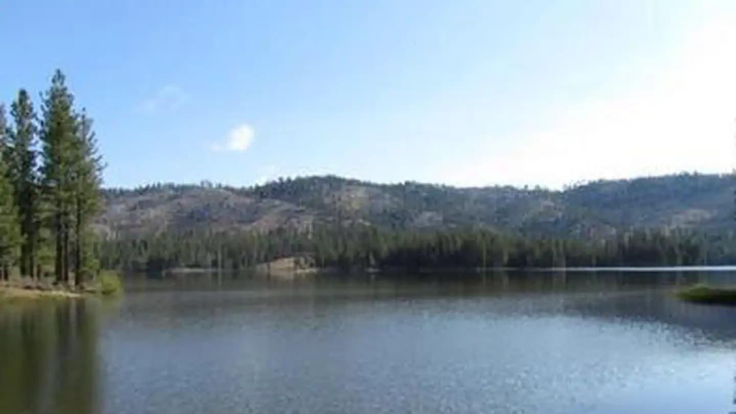
CA · Campground
Overview Long Point Campground is one of three in the Antelope Lake Recreation Area. It is situated on the lake's southwestern side, providing clear water views at nearly every location within the campground. Antelope Lake is one of the more remote, quiet lakes in the Sierra Nevada's Plumas National Forest, making it a popular destination for anglers and explorers of all abilities. Recreation Due to its prime location on the lake, Long Point is known for great bass fishing. Sailing and other boating activities are also popular at Antelope Lake. Some sites are very near to shallow water and are ideal for wading near the campground; other sites are near deeper water, allowing visitors the opportunity to anchor their boats nearby. Facilities Due to its prime location on the lake, Long Point is known for great bass fishing. Sailing and other boating activities are also popular at Antelope Lake. Some sites are very near to shallow water and are ideal for wading near the campground; other sites are near deeper water, allowing visitors the opportunity to anchor their boats nearby. Natural Features The campground is situated at an elevation of 5,000 ft. and is shaded with plentiful pine and fir trees. It is nestled in the beautiful northern Sierra Nevada mountain range, offering forested woods and scenic vistas as far as the eye can see. Nearby Attractions Campground is located about 30 miles from the small town of Taylorsville. contact_info For facility specific information, please call (530) 927-7878.
View details →
CA · Campground
Overview Moore Creek Campground is situated on the McCloud Arm of Shasta Lake. This cozy campground is partially shaded and can accommodate both tents and RVs. Camping at Moore Creek provides easy access to a variety of water sports, as well as the opportunity to enjoy scenic views and abundant wildlife. Recreation The nearest public boat ramp is 4 miles away at Hirz Bay. Boat rentals and fuel are available at nearby lakefront resorts. Shasta Lake is popular for power and non-motorized boating, fishing and water skiing. Anglers can fish for trout, catfish, Chinook salmon, crappie, bluegill, white sturgeon, brown bullhead and bass. Facilities The nearest public boat ramp is 4 miles away at Hirz Bay. Boat rentals and fuel are available at nearby lakefront resorts. Shasta Lake is popular for power and non-motorized boating, fishing and water skiing. Anglers can fish for trout, catfish, Chinook salmon, crappie, bluegill, white sturgeon, brown bullhead and bass. Natural Features Shasta-Trinity is the largest national forest in California with a diverse landscape encompassing five wilderness areas, hundreds of mountain lakes and 6,278 miles of streams and rivers. Lake Shasta sits at an elevation of 1,067 feet, with 365 miles of shoreline punctuated by steep mountains blanketed in manzanita and evergreens. A snow-capped Mount Shasta, the second-tallest mountain in the Cascade Range, looms in the distance. Nearby Attractions The nearby Hirz Mountain Lookout offers panoramic views of Mt. Shasta, Mt. Lassen and the surrounding area at an elevation of 3,500 feet.
View details →
CA · Campground
Overview Bailey Cove Campground is nestled in a forested area on the McCloud Arm of Shasta Lake. The site is a popular destination due to its convenient access from I-5 and the adjacent public boat ramp. The area surrounding the campground offers an abundance of recreational and sightseeing opportunities. Recreation The campground provides access to the 3-mile Bailey Cove Trail. This trail hugs the shoreline and is open to both hikers and mountain bikers. Lake Shasta attracts anglers due to its wide variety of fish. Boaters can access the lake via the adjacent boat ramp, and boat rentals are available nearby. Facilities The campground provides access to the 3-mile Bailey Cove Trail. This trail hugs the shoreline and is open to both hikers and mountain bikers. Lake Shasta attracts anglers due to its wide variety of fish. Boaters can access the lake via the adjacent boat ramp, and boat rentals are available nearby. Natural Features Shasta-Trinity is the largest national forest in California with a diverse landscape encompassing five wilderness areas, hundreds of mountain lakes and 6,278 miles of streams and rivers. Lake Shasta sits at an elevation of 1,067 feet, with 365 miles of shoreline punctuated by steep mountains blanketed in manzanita and evergreens. A snow-capped Mount Shasta, the second-tallest mountain in the Cascade Range, looms in the distance. This area boasts abundant wildlife. Osprey nests are often seen in the area around Bailey Cove Campground. Nearby Attractions Lake Shasta Caverns are also located on the McCloud Arm of Shasta Lake in an area know as the Grey Rocks. Tours are given daily at this privately owned facility. At an elevation of 3,500 feet, the nearby Hirz Mountain Lookout offers panoramic views of Mt. Shasta, Mt. Lassen and the surrounding area.
View details →
CA · Campground
Overview Hirz Cabin is nestled among manzanita and oak trees on a hilltop overlooking the McCloud Arm of Shasta Lake. The scenic location offers a variety of recreational activities, including a nearby boat ramp for water sports and a hiking trail. Recreation The nearest boat launch is about one mile away at Hirz Bay. Resorts on the lake have watercraft rentals and marinas with fuel. Popular water activities include power and non-motorized boating, fishing and water skiing. Lake Shasta offers excellent fishing for trout, catfish, Chinook salmon, crappie, bluegill, white sturgeon, brown bullhead and bass. Hikers can access the two-mile Hirz Bay Trail from the campground. Facilities The nearest boat launch is about one mile away at Hirz Bay. Resorts on the lake have watercraft rentals and marinas with fuel. Popular water activities include power and non-motorized boating, fishing and water skiing. Lake Shasta offers excellent fishing for trout, catfish, Chinook salmon, crappie, bluegill, white sturgeon, brown bullhead and bass. Hikers can access the two-mile Hirz Bay Trail from the campground. Natural Features Shasta-Trinity is the largest national forest in California with a diverse landscape encompassing five wilderness areas, hundreds of mountain lakes and 6,278 miles of streams and rivers. Lake Shasta sits at an elevation of 1,067 feet, with 365 miles of shoreline punctuated by steep mountains blanketed in manzanita and evergreens. A snow-capped Mount Shasta, the second-tallest mountain in the Cascade Range, looms in the distance. Nearby Attractions Lake Shasta Caverns are also located on the McCloud Arm of Shasta Lake in an area known as the Grey Rocks. Tours are given daily at this privately-owned facility. The nearby Hirz Mountain Lookout offers panoramic views of Mt. Shasta, Mt. Lassen and the surrounding area at an elevation of 3,500 feet.
View details →Planning tips
Camping near Lassen Volcanic
When is the best time to camp near Lassen Volcanic?
Peak season varies, but summer (June–August) is the busiest time near Lassen Volcanic National Park. For fewer crowds and pleasant weather, consider shoulder seasons — late May or September–October. Check seasonal road closures before planning your trip.
Should I make a reservation?
Campgrounds near popular national parks fill up fast, especially on weekends and holidays. Reserve as early as possible — some sites open reservations 6 months in advance. First-come, first-served sites may be available on weekdays.
How far are these campgrounds from Lassen Volcanic?
The closest campground is about < 1 mi away. Most campgrounds on this page are within a 30–50 mile drive of Lassen Volcanic National Park.
Keep exploring