
Campgrounds in North Carolina
Explore camping from mountains to beaches in the diverse Tar Heel State
54
Campgrounds listed
100%
With photos
100%
Detailed descriptions
Campground
Top campground type
Highlights
Featured campgrounds in North Carolina
Explore by campground name letter
Jump to A-Z landing hubs for stronger discovery paths beyond North Carolina.
All campgrounds
Showing 54 campgrounds

Overview Located just minutes from the popular city of Asheville, North Carolina, Lake Powhatan Glamping is the perfect, all inclusive getaway. The campground is convenient to a variety of cultural and natural attractions, including art and music venues, shopping, breweries, restaurants, and scenic drives on the Blue Ridge Parkway. Onsite you'll enjoy numerous hiking and biking trails as well as lakeside recreational opportunities. Learn more to prepare for your trip HERE . The custom designed glamping sites are brand new at Lake Powhatan! Choose one of 12 fully furnished canvas platform tents in the heart of the national forest for your next mountain adventure. Experience nature and outdoor recreation without sacrificing the comforts and luxuries of home. Learn more about glamping near Asheville . Recreation Visitors have a number of different activities to choose from. Kids love the lake's sandy swimming beach and anglers enjoy the calm waters for trout fishing. The French Broad River, popular for fishing, wading and tubing is also nearby. The use of personal watercraft in the lake is STRICTLY PROHIBITED due to potential introduction of foreign material to the Lake Powhatan riprarian ecosystem. The forest is known for its hiking and mountain biking trails (44 miles of them!), several of which are located near the campground. Facilities Visitors have a number of different activities to choose from. Kids love the lake's sandy swimming beach and anglers enjoy the calm waters for trout fishing. The French Broad River, popular for fishing, wading and tubing is also nearby. The use of personal watercraft in the lake is STRICTLY PROHIBITED due to potential introduction of foreign material to the Lake Powhatan riprarian ecosystem. The forest is known for its hiking and mountain biking trails (44 miles of them!), several of which are located near the campground. Natural Features The campground is situated in a heavily wooded area on the banks of Lake Powhatan in the Appalachian Mountains of western North Carolina. The elevation is 2,200 feet. The surrounding land boasts mile-high peaks, cascading waterfalls and slopes thickly forested with hardwoods and conifers. Nearby Attractions Among the more popular nearby destinations are Sliding Rock, Looking Glass Falls, the scenic Blue Ridge Parkway, The NC Arboretum and the Biltmore Estate. contact_info For facility specific information, please call (828) 577-7278.
View details →
Overview Wolf Ford Horse Camp is a reservation only campground located in the Pisgah Ranger District of Pisgah National Forest, near the town of Brevard. The campground is designed and intended for equestrian use. This campground provides access to a comprehensive network of multiple use trails, as well as creeks, streams, and waterfalls, which the Pisgah is known for. In addition to its many waterfalls, Pisgah Ranger District is famous for its scenic vistas and the Cradle of Forestry, which is located only a short 4 mile drive from the campground itself. Wolf Ford Horse Camp is located 3.2 miles down Yellow Gap Road, gravel Forest Service Road 1206, therein providing a serene escape from the main visiting traffic on Highway 276. Consequently, this campground provides the perfect launching point to explore many different destinations in the Forest, including the Blue Ridge Parkway, 276 Corridor, and countless other waterfalls accessed off of the district's many gravel Forest Service roads. After you make your reservations online, we highly reccomend a stop to our visitor center located right off Route 276 near the forest entrance for help in creating your itinerary. The visitor center provides a wide variety of resources and local experts happy to answer any of your questions. Recreation Pisgah Ranger District contains over 100 miles of equestrian use trails. Beyond trails, there are also plenty of Forest Service roads that enable miles more of recreational use. Wolf Ford provides the perfect access point for many of these trails and roads, enabling a variety of lengths and difficulty levels. The forest provides a perfect blend of natural and cultural history, best seen through the Forest Heritage National Scenic Byway and a trip to the Cradle of Forestry, the first school of forestry in America. In addition, the nearby Blue Ridge Parkway affords hundreds of miles worth of scenic views, including long mountain vistas, roadside waterfalls, and pastoral farmland. Finally, all National Forests in North Carolina property is considered North Carolina gamelands. See the North Carolina Wildlife Resources Commission for rules and restrictions. Facilities Pisgah Ranger District contains over 100 miles of equestrian use trails. Beyond trails, there are also plenty of Forest Service roads that enable miles more of recreational use. Wolf Ford provides the perfect access point for many of these trails and roads, enabling a variety of lengths and difficulty levels. The forest provides a perfect blend of natural and cultural history, best seen through the Forest Heritage National Scenic Byway and a trip to the Cradle of Forestry, the first school of forestry in America. In addition, the nearby Blue Ridge Parkway affords hundreds of miles worth of scenic views, including long mountain vistas, roadside waterfalls, and pastoral farmland. Finally, all National Forests in North Carolina property is considered North Carolina gamelands. See the North Carolina Wildlife Resources Commission for rules and restrictions. Natural Features This campground is located near the confluence of many creeks, as well as the South Fork of the Mills River. Additionally, the area is home to a wide variety of bird species and animal species ranging from chipmunks to black bears. Finally, the campground affords plenty of shade with large trees including maples, oaks, poplars, birches, and pines, that create a patchwork quilt of beauty in the fall season. Nearby Attractions Wolf Ford Horse Campround is within a short distance of the Cradle of Forestry, Pisgah Inn & Restaurant on the Blue Ridge Parkway, North Carolina Wildlife Education Center and Fish Hatchery, Dupont State Forest, and the town of Brevard just down the mountain from this strategic location. Within Brevard one can enjoy blocks of shops and restaurants on Main Street, or seek out guides for fishing, riding, hiking, or floating expeditions in and around Pisgah National Forest. contact_info This location is unstaffed. To speak with our main office for general information, please call: (828) 577-4910. Charges & Cancellations If Yellow Gap Road (FSR 1206) is administratively closed, all reservations will be refunded.
View details →
Overview Located next to one of the most popular creeks in the Great Smoky Mountains National Park, Deep Creek Group Camp provides traditional primitive camping with the stunning backdrop of the mountains. Whether blanketed in bright wildflowers in the spring or vivid colors in the fall, the scenery at Deep Creek never disappoints. The camp offers 92 individual sites, all with grills, tables and campfire rings, perfect for a meal or a late-night s'mores session. Hookups and showers are not provided, but flush toilets and drinking water are available. Recreation Great Smoky Mountains National Park is a hiker's paradise, offering over 800 miles of maintained trails ranging from short, leg-stretchers to strenuous treks, with a number of those trails easily accessible from the picnic area. But hiking is not the only reason for visiting the Smokies: Fishing, picnicking, wildlife viewing and auto touring are also popular activities. Campers can enjoy high-quality backcountry fishing in the cool waters of the countless streams and rivers that snake through the mountains, with trout available in abundance. The nearby Bradley Fork River provides a great place to go for a dip or fish for trout. Wildlife viewing is a popular pastime, and with around 1,500 bears living in the park, it's not uncommon for visitors to spot one. The park is a sanctuary for a magnificent array of animal and plant life, all of which is protected for future generations to enjoy. The park also holds one of the best collections of log buildings in the eastern United States. Over 90 historic structures, including houses, barns, outbuildings, churches, schools and grist mills, have been preserved or rehabilitated in the park. Facilities Great Smoky Mountains National Park is a hiker's paradise, offering over 800 miles of maintained trails ranging from short, leg-stretchers to strenuous treks, with a number of those trails easily accessible from the picnic area. But hiking is not the only reason for visiting the Smokies: Fishing, picnicking, wildlife viewing and auto touring are also popular activities. Campers can enjoy high-quality backcountry fishing in the cool waters of the countless streams and rivers that snake through the mountains, with trout available in abundance. The nearby Bradley Fork River provides a great place to go for a dip or fish for trout. Wildlife viewing is a popular pastime, and with around 1,500 bears living in the park, it's not uncommon for visitors to spot one. The park is a sanctuary for a magnificent array of animal and plant life, all of which is protected for future generations to enjoy. The park also holds one of the best collections of log buildings in the eastern United States. Over 90 historic structures, including houses, barns, outbuildings, churches, schools and grist mills, have been preserved or rehabilitated in the park. Natural Features Deep Creek is in the southeastern portion of the park and provides a moderate climate, typified by mild winters and hot, humid summers. Because of its proximity to water, Deep Creek is an ideal campground for water recreation and books up quickly during summer months. Nearby Attractions Great Smoky Mountains National Park is a hiker's paradise, with plenty of trails easily accessible from the Deep Creek Group Site. An easy 1.6 mile roundtrip hike will allow you to enjoy two beautiful waterfalls in the Deep Creek area. Walk Deep Creek Trail 0.7 mile to the junction with Indian Creek Trail. On your way you can view elegant Tom Branch Falls located on the far side of Deep Creek. Turn right at the junction with Indian Creek Trail and proceed approximately 200' to Indian Creek Falls. The falls are 25 feet in height. Deep Creek runs on the edge of the campground and provides easily accessible fishing, wading and tubing. Visitors can also enjoy high-quality backcountry fishing in the cool waters of the countless streams and rivers that snake through the mountains, with trout available in abundance. contact_info This location is staffed. Please call (828) 488-3184 to speak with local staff.
View details →
Overview Old John’s River Road Backcountry Camping is a primitive camping location along the Mountains to Sea Trail near Blowing Rock, North Carolina. There are 2 sites available, each with a fire ring. Maximum capacity is 6 people per site and the maximum stay length is 3 nights. Access this location either by hiking the Boone Fork Trail from the Julian Price Park Picnic Area, or Old John’s River Road between mile 296 and 297 on the Blue Ridge Parkway. Black bears and other wildlife frequent this area, so bring an approved bear cannister or hang food or any scented items from a tree at least 10 feet high and 4 feet from the trunk. No toilets are available. All human waste must be buried a minimum of 6 inches deep and a minimum of 100 feet from any stream. All trash must be packed out. Water should be purified before consumption. Bathing and washing dishes with soap in the nearby stream is prohibited. There is likely no cellphone service at this site. Recreation Julian Price Memorial Park has 3 main loop trails. Price Lake Loop Trail is an easy to moderate 2.3-mile trail around the Price Lake through mixed hardwood forest and rhododendron thickets. The Green Knob Trail is a moderate 2-mile loop that runs along Sim’s Creek through a mixed hardwood forest, with a small section through an open cow pasture. The Boone Fork Trail is a strenuous 4.9-mile loop that traverses a variety of landscapes along Boone Fork Creek. It features stream crossings and trail ladders and lots of uneven footing. The most popular feature of this trail is the Hebron Colony Falls, which is a section of the Boone Fork Creek that cascades through a boulder field. Hikers are advised to allow for 3-4 hours for this trail, bring plenty of water and snacks, and wear sturdy shoes. Price Lake offers fishing and paddling opportunities. A North Carolina or Virginia fishing license is required. Price Lake Boat Rentals offers canoes, kayaks, and standup paddleboards. There is also a public boat ramp. No motors or sails are allowed. Facilities Julian Price Memorial Park has 3 main loop trails. Price Lake Loop Trail is an easy to moderate 2.3-mile trail around the Price Lake through mixed hardwood forest and rhododendron thickets. The Green Knob Trail is a moderate 2-mile loop that runs along Sim’s Creek through a mixed hardwood forest, with a small section through an open cow pasture. The Boone Fork Trail is a strenuous 4.9-mile loop that traverses a variety of landscapes along Boone Fork Creek. It features stream crossings and trail ladders and lots of uneven footing. The most popular feature of this trail is the Hebron Colony Falls, which is a section of the Boone Fork Creek that cascades through a boulder field. Hikers are advised to allow for 3-4 hours for this trail, bring plenty of water and snacks, and wear sturdy shoes. Price Lake offers fishing and paddling opportunities. A North Carolina or Virginia fishing license is required. Price Lake Boat Rentals offers canoes, kayaks, and standup paddleboards. There is also a public boat ramp. No motors or sails are allowed. Natural Features Julian Price Memorial Park offers hiking through hardwood and coniferous forests as well as open pasture and Creekside riparian zones. The Boone Fork Creek and Price Lake provide fishing opportunities and boat rentals are available at Price Lake near the Julian Price Campground. Nearby Attractions Things to Do in Boone, NC Things to do in Boone, NC Grandfather Mountain State Park Grandfather Mountain State Park Julian Price Park Julian Price Park - Milepost 297 Moses H. Cone Memorial Park Moses H. Cone Memorial Park - Milepost 294 contact_info For facility specific information, please call (828) 276-2300.
View details →
Overview Rock Castle Gorge Backcountry Campground is a primitive camp located along the Rock Castle Gorge Trail in the Rocky Knob Recreational Area which is part of the Blue Ridge Parkway. The Rock Castle Gorge Backcountry Campsites can be reached from various points ranging in distance from 1/2 mile to 8 miles. The complete Rock Castle Gorge Trail is a 10.8 mile loop, there are several other loop trails that connect to it. Rock Castle Creek, Little Rock Castle Creek and many other streams and creeks meander along the trail and run right by the campground. Fishing requires a Virginia Fishing License, and the State of Virginia laws and regulations apply. The year-round campground has eight campsites. Each has a fire ring/pad and food storage lockers. A Portable Toilet is available. Plan to pack in your water for safety. Summers are hot (70 to 88 Degrees) and humid as Rock Castle Creek is adjacent to the campground. Winter temperatures (Daytime 30 to 50 Degrees) can easily drop below freezing at night. Recreation Hiking, sightseeing, majestic Blue Ridge Parkway views and simple relaxation are all in store in the Rocky Knob Recreational Area. Facilities Hiking, sightseeing, majestic Blue Ridge Parkway views and simple relaxation are all in store in the Rocky Knob Recreational Area. Natural Features Venture into one of the Parkway’s more rugged areas at Rocky Knob. Hike through forests, explore mountain ridges, or enjoy spring wildflowers and rhododendrons. Rock Castle Creek, Little Rock Castle Creek and many other streams and creeks abound. Bare Rocks and other geological outcrops and long distance views from the upper elevations of the Rock Castle Gorge Trail are sure to please. Plenty of wildlife including black bears. contact_info For facility specific information, please call (828) 276-2300. Nearby Attractions Floyd, VA is less than 8 miles away, known for eclectic shops, mountain music venues and great places to eat along with grocery stores, variety stores and pharmacies. Visit Floyd Virginia
View details →
Overview Basin Cove backcountry is a primitive camp located in historic Basin Cove at Doughton Park on the Blue Ridge Parkway in North Carolina.. Multiple trails allow access to the primitive campground. Click to see a map Doughton Park Hiking Trails Overnight parking for backcountry is permitted at designated areas. From the parkway, the trails descend over 1500 feet into the Basin Cove Area. Easiest trail is the Grassy Gap Fire Road entrance from Longbottom Road. This year-round campground has eight campsites each with individual fire rings, lantern post, and food storage boxes. No pit toilet or privy exists. Note particularly that surface water is unsafe. Water from natural sources must be purified by boiling or filtering and disinfecting. Thunderstorms are common along the escarpment. Cell phones most likely do not work in the area. Multiple creeks provide fishing opportunities. Recreation Doughton Park trails system offers more than 28 miles of hiking trails. From the campsites, trails ascend 1,500 feet to the Blue Ridge Parkway. The most difficult trail up to the parkway is the Bluff’s primitive trail. The easiest route in and out of the campsite is at Longbottom Road via the Grassy Gap Fire Road. Facilities Doughton Park trails system offers more than 28 miles of hiking trails. From the campsites, trails ascend 1,500 feet to the Blue Ridge Parkway. The most difficult trail up to the parkway is the Bluff’s primitive trail. The easiest route in and out of the campsite is at Longbottom Road via the Grassy Gap Fire Road. Natural Features Basin Cove was a thriving community of over 50 families from 1863 to 1916. Two stalled tropic storms dumped 22.2 inches of rain during a 3-day period in 1916, causing massive mudslides that wiped out all but 1 and half homes. Remnants of homesites and graves are scattered throughout the area. The 3.5-mile Caudill Cabin trail leads the only existing cabin. The campground is situated among a mixed hardwood and conifer forest with multiple creeks. Special Parkway water regulations apply in Basin Cove. Fishing Black Bears inhabit the 6,000 plus acres of public land. contact_info For facility specific information, please call (828) 276-2300. Nearby Attractions Stone Mountain State Park Stone Mountain State Park Alleghany County Alleghany County Wilkes County Wilkes County New River New River
View details →
Overview Cove Creek Upper Group Camp is one of two group campsites nestled along Cove Creek in the lush forests of the Appalachian Mountains. The facility can accommodate large groups of up to 60 people and offers year-round opportunities for hiking, mountain biking, fishing and picnicking in one of the most scenic areas in the state. Recreation Campers can easily relax with a book or deck of cards in the shaded camping area, or seek out activities close by. The area is a hub for numerous hiking, backpacking and mountain biking trails, some of which can be accessed from the campground. Hikers can follow a trail along the creek that leads to a scenic waterfall. Great trout fishing is also available in the creek and river. For visitors wishing to learn more about the area, interpretive programs may be available upon request. Facilities Campers can easily relax with a book or deck of cards in the shaded camping area, or seek out activities close by. The area is a hub for numerous hiking, backpacking and mountain biking trails, some of which can be accessed from the campground. Hikers can follow a trail along the creek that leads to a scenic waterfall. Great trout fishing is also available in the creek and river. For visitors wishing to learn more about the area, interpretive programs may be available upon request. Natural Features The campground lies in Pisgah National Forest. The surrounding land boasts mile-high peaks, cascading waterfalls and slopes thickly forested with hardwoods. The group camping area is adjacent to both Cove Creek and the beautiful Davidson River. Visitors should note that two creek crossings are required on the road leading to the upper group camp. Heavy rains may temporarily make crossing impossible; a four-wheel drive or high clearance vehicle is highly recommended and all crossings are attempted at users own risk. contact_info For facility specific information, please call (828) 577-4910. Nearby Attractions The city of Asheville, North Carolina, is about an hour away and offers numerous cultural attractions, art galleries, shops and restaurants.
View details →
Overview Davidson River Recreation Area offers camping and outdoor activities for the whole family. The campground boasts several loops of shaded campsites, as well as access to hiking trails, fishing spots, waterfalls and several nearby attractions within Pisgah National Forest. It lies just four miles west of the town of Brevard and less than an hour from the city of Asheville. The facility is open year-round. Learn more here to prepare for your trip. Recreation The forest is known for its hiking trails, several of which are near the campground. Hikers can challenge themselves with the 12.3-mile Art Loeb Trail, the 3.7-mile North Slope Trail or a 1.5-mile walking trail. The Davidson River offers excellent trout fishing, plus tubing and swimming, which are kid-friendly favorite activities. Visitors wishing to learn more about the area can attend educational programs in summer and fall. Facilities The forest is known for its hiking trails, several of which are near the campground. Hikers can challenge themselves with the 12.3-mile Art Loeb Trail, the 3.7-mile North Slope Trail or a 1.5-mile walking trail. The Davidson River offers excellent trout fishing, plus tubing and swimming, which are kid-friendly favorite activities. Visitors wishing to learn more about the area can attend educational programs in summer and fall. Natural Features The campground is located in Pisgah National Forest at an elevation of 2,150 feet. The surrounding land boasts mile-high peaks, cascading waterfalls and slopes thickly forested with hardwoods and conifers. The group camping area is adjacent to the beautiful Davidson River. Nearby Attractions Several natural and cultural attractions are within close proximity to the campground. Sliding Rock, Looking Glass Falls and the scenic Blue Ridge Parkway are among the more popular sites. The small town of Brevard offers various amenities and services, and visitors can take a trip to Asheville to visit art galleries, shops and restaurants. contact_info For facility specific information, please call (828) 885-7557. Charges & Cancellations Any cancellations must be taken care of directly with recreation.gov. Note that this facility does not provide refunds for No Shows or incliment weather.
View details →
Overview Large groups enjoy this cozy mountain campground in the Pisgah National Forest of western North Carolina. Ample opportunities for recreation exist in the area, including hiking, picnicking, scenic driving, swimming, fishing, mountain biking and more. Recreation This is a great place for campers to simply relax in the woods and listen to the sound of the creek. Visitors can also explore the area's numerous hiking trails, check out crystal clear waterfalls or fish for trout in the creek and a nearby lake. Facilities This is a great place for campers to simply relax in the woods and listen to the sound of the creek. Visitors can also explore the area's numerous hiking trails, check out crystal clear waterfalls or fish for trout in the creek and a nearby lake. Natural Features Kuykendall Group Camp is just 4 miles from the town of Brevard and about an hour from the city of Asheville. The site is located in the Appalachian Mountains at an elevation of 2,600 feet. The surrounding national forest boasts mile-high peaks, cascading waterfalls and slopes thickly forested with hardwoods. The group camping area is adjacent to Kuykendall Creek. Visitors should note that creek crossing is required on the road leading to the campground. Heavy rains may temporarily make crossing difficult; a four-wheel drive or high clearance vehicle is recommended. contact_info For facility specific information, please call (828) 577-4910. Nearby Attractions The city of Asheville is about an hour away and offers numerous cultural attractions, art galleries, shops and restaurants. The quaint mountain community of Brevard is also nearby and has various amenities and services.
View details →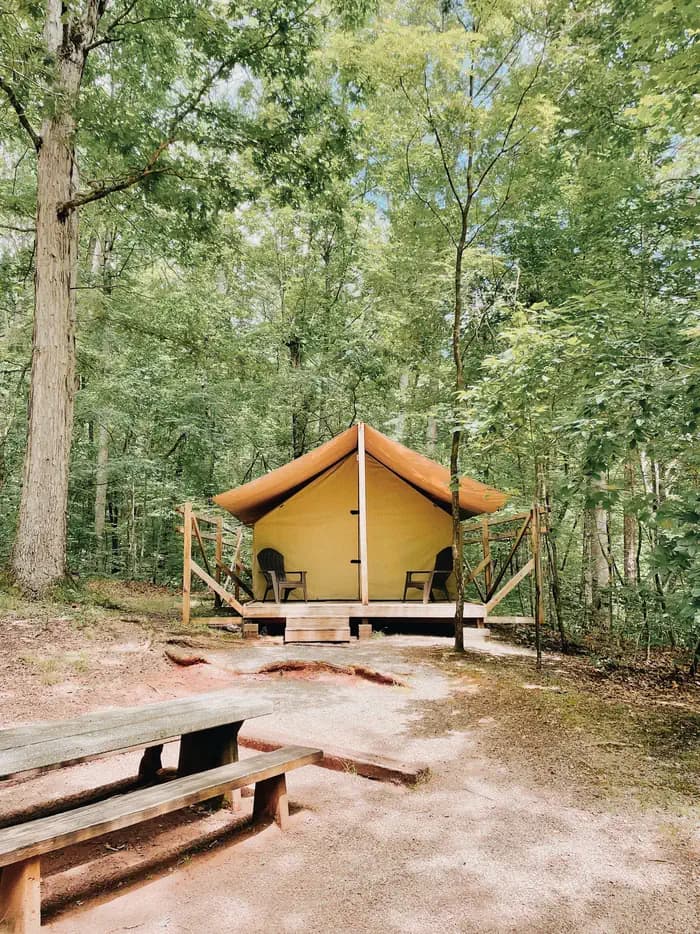
Overview Glamping sites are now available at Lake Powhatan! Experience nature and outdoor recreation without sacrificing the comforts and luxuries of home. Choose one of 12 custom designed, fully furnished canvas platform tents in the heart of the national forest for your next mountain adventure, only 10 minutes from downtown Asheville, NC. Learn more about glamping near Asheville . To book your glamping site, click here . Located just minutes from the popular city of Asheville, North Carolina, Lake Powhatan has something for everyone. The campground is convenient to a variety of cultural and natural attractions, including art and music venues, shopping and dining in Asheville, scenic driving on the Blue Ridge Parkway, numerous hiking trails and lakeside recreation. Recreation Visitors have a number of different activities to choose from. Kids love the lake's sandy swimming beach and anglers enjoy the calm waters for trout fishing. The French Broad River, popular for fishing, is also nearby. Note that use of personal watercraft is STRICTLY PROHIBITED in the lake due to potential introduction of foreign material to the Lake Powhatan riprarian ecosystem. The forest is known for its hiking and mountain biking trails, several of which are located near the campground. Facilities Visitors have a number of different activities to choose from. Kids love the lake's sandy swimming beach and anglers enjoy the calm waters for trout fishing. The French Broad River, popular for fishing, is also nearby. Note that use of personal watercraft is STRICTLY PROHIBITED in the lake due to potential introduction of foreign material to the Lake Powhatan riprarian ecosystem. The forest is known for its hiking and mountain biking trails, several of which are located near the campground. Natural Features The campground is situated in a heavily wooded area on the banks of Lake Powhatan in the Appalachian Mountains of western North Carolina. The elevation is 2,200 feet. The surrounding land boasts mile-high peaks, cascading waterfalls and slopes thickly forested with hardwoods and conifers. Nearby Attractions Among the more popular nearby destinations are Sliding Rock, Looking Glass Falls, the scenic Blue Ridge Parkway, The NC Arboretum and the Biltmore Estate. contact_info For facility specific information, please call (828) 577-7278. Charges & Cancellations Any cancellations must be taken care of directly with recreation.gov. Note that this facility does not provide refunds for No Shows or incliment weather.
View details →
Overview North Mills River Campground is a rustic mountain getaway in Pisgah National Forest in western North Carolina. Located just outside the popular city of Asheville, the campground provides access to a variety of cultural and natural attractions, including an arboretum, the scenic Blue Ridge Parkway and numerous hiking, fishing and mountain biking opportunities. Recreation The forest is known for its hiking and mountain biking trails, several of which are near the campground. Mills River offers excellent trout fishing, as well as tubing and swimming, which are kid-friendly favorite activities. Visitors wishing to learn more about the area can attend educational programs during the summer. Facilities The forest is known for its hiking and mountain biking trails, several of which are near the campground. Mills River offers excellent trout fishing, as well as tubing and swimming, which are kid-friendly favorite activities. Visitors wishing to learn more about the area can attend educational programs during the summer. Natural Features The campground is situated in the Appalachian Mountains at an elevation of 2,200 feet. The surrounding land boasts mile-high peaks, cascading waterfalls and slopes densely forested with hardwoods. The group camping area is adjacent to the beautiful, shallow waters of the Mills River. Nearby Attractions Several natural and cultural attractions are within close proximity to the campground. Sliding Rock, Looking Glass Falls and the scenic Blue Ridge Parkway are among the most popular sites. The small town of Brevard offers various amenities and services, and visitors can take a trip to Asheville to visit art galleries, music venues, shops and restaurants. contact_info For facility specific information, please call (828) 577-4167.
View details →
Overview Van Hook Glade is a scenic, secluded campground in the heart of the Nantahala National Forest. Convenient for families and anglers, the campground is in close proximity to hiking trails, scenic views, waterfalls and a nearby lake. Recreation Campers can easily relax with a book or deck of cards in the shaded campsites, or seek out many activities close by. A short trail in the campground leads to the Cliffside Lake Recreation Area, which offers six hiking trails ranging from easy to moderate, as well as trout fishing, picnicking and swimming. Boating is not permitted. Van Hook glade is a short drive from Dry Falls and Whitewater Falls. Facilities Campers can easily relax with a book or deck of cards in the shaded campsites, or seek out many activities close by. A short trail in the campground leads to the Cliffside Lake Recreation Area, which offers six hiking trails ranging from easy to moderate, as well as trout fishing, picnicking and swimming. Boating is not permitted. Van Hook glade is a short drive from Dry Falls and Whitewater Falls. Natural Features The campground is located just 4 miles from the scenic and cultural attractions of Highlands, North Carolina, offering shady campsites in a heavily wooded and secluded area situated on rolling hills. The elevation is 4,118 feet, and the calm waters of Cliffside Lake sit adjacent. contact_info For facility specific information, please call (828) 787-1980. Nearby Attractions A morning or late afternoon drive down scenic Highway 64 is sure to present visitors with amazing views. The quaint town of Highlands has a general store and various attractions, while the larger town of Franklin has shopping, a casino, grocery stores and performing arts.
View details →
Overview Cataloochee Group Camp in the remote and historic Cataloochee Valley, is surrounded by some of the most rugged mountains in the park, providing excellent hiking opportunities as well as ideal fishing conditions in the area's many creeks. Because of its relatively secluded location, visitors can enjoy the best that the Smoky Mountains National Park has to offer, without encountering crowds, which are sometimes common in other areas of the park. Recreation Great Smoky Mountains National Park is a hiker's paradise, with a number of trails easily accessible from the Cataloochee Valley. Most notably, the Boogerman Trail, an almost 6-mile loop overlapping with the Caldwell Fork Trail, allows hikers to take in groves of old-growth forest. High-quality backcountry fishing in the cool, remote waters of the countless streams that snake through the valley, provide anglers with choice opportunities to catch wild trout. The park also holds one of the best collections of log buildings in the eastern United States. Over 90 historic structures, including houses, barns, outbuildings, churches, schools and grist mills, have been preserved or rehabilitated in the park. A handful of which can be found nearby the campground, including the Palmer House, which offers a self-guided museum. Facilities Great Smoky Mountains National Park is a hiker's paradise, with a number of trails easily accessible from the Cataloochee Valley. Most notably, the Boogerman Trail, an almost 6-mile loop overlapping with the Caldwell Fork Trail, allows hikers to take in groves of old-growth forest. High-quality backcountry fishing in the cool, remote waters of the countless streams that snake through the valley, provide anglers with choice opportunities to catch wild trout. The park also holds one of the best collections of log buildings in the eastern United States. Over 90 historic structures, including houses, barns, outbuildings, churches, schools and grist mills, have been preserved or rehabilitated in the park. A handful of which can be found nearby the campground, including the Palmer House, which offers a self-guided museum. Natural Features Cataloochee Group Camp is in an area characterized by picturesque mountain ranges and pristine streams, like the nearby Cataloochee Creek and its many tributaries. Whether blanketed in bright spring wildflowers or vivid fall colors, the scenery at Cataloochee never disappoints. The Smokies have the most biological diversity of any area in the world's temperate zone. The park is a sanctuary for a magnificent array of animal and plant life, all of which is protected for future generations to enjoy. In particular, the Cataloochee area is known for the elk herd, which populates the valley in the spring and fall. Nearby Attractions A number of the park's famous historical buildings, including cabins and churches, are located close to the campground. The town of Asheville, NC is approximately 35 miles from the campground and offers plenty of cultural and historic activities as well as restaurants and groceries. Charges & Cancellations Customers who cancel a group overnight facility reservation less than 14 days before the arrival date will pay a $10.00 service fee AND forfeit the first night's use fee.
View details →
Overview Deep Creek Picnic Pavilion, surrounded by pristine mountain streams and clear blue skies, is the perfect mountain backdrop for your party or family get-together. Whether blanketed in bright wildflowers in the spring or vivid colors in the fall, the scenery at Deep Creek never disappoints. Recreation Picnicking is the most popular activity at Deep Creek Pavilion, but visitors also enjoy an excursion to one of three scenic waterfalls in the nearby area. From Deep Creek Campground, walk Deep Creek Trail 0.7 miles to the junction with Indian Creek Trail. On your way you can view elegant Tom Branch Falls located on the far side of Deep Creek. Turn right at the junction with Indian Creek Trail and proceed approximately 200' to Indian Creek Falls. The falls are 25 feet in height. Juney Whank Falls is divided into an upper and lower section. Both can be viewed from the footbridge which crosses Juney Whank Branch at the falls. Together they drop 90 feet from top to bottom. The trail to the waterfall is 0.8 miles roundtrip and can be accessed from the trailhead at the end of Deep Creek Road. Deep Creek runs on the edge of the nearby group campground and provides easily accessible fishing, wading and tubing. Visitors can also enjoy high-quality backcountry fishing in the cool waters of the countless streams and rivers that snake through the mountains, with trout available in abundance. Facilities Picnicking is the most popular activity at Deep Creek Pavilion, but visitors also enjoy an excursion to one of three scenic waterfalls in the nearby area. From Deep Creek Campground, walk Deep Creek Trail 0.7 miles to the junction with Indian Creek Trail. On your way you can view elegant Tom Branch Falls located on the far side of Deep Creek. Turn right at the junction with Indian Creek Trail and proceed approximately 200' to Indian Creek Falls. The falls are 25 feet in height. Juney Whank Falls is divided into an upper and lower section. Both can be viewed from the footbridge which crosses Juney Whank Branch at the falls. Together they drop 90 feet from top to bottom. The trail to the waterfall is 0.8 miles roundtrip and can be accessed from the trailhead at the end of Deep Creek Road. Deep Creek runs on the edge of the nearby group campground and provides easily accessible fishing, wading and tubing. Visitors can also enjoy high-quality backcountry fishing in the cool waters of the countless streams and rivers that snake through the mountains, with trout available in abundance. Natural Features Deep Creek provides a moderate climate, characterized by mild winters and hot, humid summers. With such close proximity to one of the park's most popular creeks, this facility is ideal for guests looking for scenic water recreation and hiking opportunities. Nearby Attractions Bryson City, located about three miles away, offers grocery stores and medical facilities. Charges & Cancellations Customers who cancel a day-use facility reservation less than 14 days before the arrival date will forfeit the total day-use fee.
View details →
Overview Big Creek Group Camp is located in the far northeastern corner of the Great Smoky Mountains National Park, near the Tennessee-North Carolina border. With the gentle waters of Big Creek running alongside the site, and a handful of trailheads within walking distance, this campsite offers an ideal setting for group camping excursions. Recreation Numerous hiking and horseback riding trails are accessible from the campground and in the surrounding areas. Most notably, the Appalachian Trail is easily reached via the Chestnut Branch Trail, a 2.1 mile trail for hikers only, beginning down the road from the campground. Nearby Baxter Creek Trail meanders along the water, while equestrian campers might enjoy taking the Big Creek Trail to Mouse Creek Falls or Midnight Hole, an area where Big Creek squeezes between large boulders, forming a deep, beautifully-colored pool. Compared to some other areas of the park, Big Creek is not crowded with anglers. Spring provides ideal conditions for fly fishing on Big Creek, with Rainbow and Brook trout looking for the aquatic insects which hatch during this time. Facilities Numerous hiking and horseback riding trails are accessible from the campground and in the surrounding areas. Most notably, the Appalachian Trail is easily reached via the Chestnut Branch Trail, a 2.1 mile trail for hikers only, beginning down the road from the campground. Nearby Baxter Creek Trail meanders along the water, while equestrian campers might enjoy taking the Big Creek Trail to Mouse Creek Falls or Midnight Hole, an area where Big Creek squeezes between large boulders, forming a deep, beautifully-colored pool. Compared to some other areas of the park, Big Creek is not crowded with anglers. Spring provides ideal conditions for fly fishing on Big Creek, with Rainbow and Brook trout looking for the aquatic insects which hatch during this time. Natural Features Big Creek Group Camp is nestled among the scenic mountains and pristine streams surrounding the big creek section of the North Carolina Smokies. Nearby Mouse Creek Falls, a 35 foot waterfall forming at the confluence of Mouse Creek and Big Creek, is a stunning geological feature of the area. The falls splits over moss covered rocks and falls about 20 ft. before pooling and falling another 15 ft. into Big Creek. The falls can be reached via the Big Creek Trail, which is covered in wildflowers during spring months. Nearby Attractions The Big Creek Horse Camp is located nearby, with horse stables and riding trails available. Full service grocery stores and medical facilities are located 16 miles away in Newport, Tennessee. Charges & Cancellations Customers who cancel a group overnight facility reservation less than 14 days before the arrival date will pay a $10.00 service fee AND forfeit the first night's use fee.
View details →
Overview Situated in the stunning Great Smoky Mountains National Park, this sunny group camp offers an ideal setting for camping excursions. Ridge upon ridge of forest straddles the border between North Carolina and Tennessee in Great Smoky Mountains National Park. World-renowned for its diversity of plant and animal life, the beauty of its ancient mountains and the quality of its remnants of Southern Appalachian culture, this is America's most visited national park. Recreation Great Smoky Mountains National Park is a hiker's paradise, with over 800 miles of maintained trails ranging from short, leg-stretchers to strenuous treks, with a number of those trails, including The Smokemont Loop Trail and the Bradley Fork Trail, accessible from the camp. But hiking is not the only reason for visiting the Smokies: Fishing, picnicking, wildlife viewing and auto touring are also popular activities. Campers can enjoy high-quality backcountry fishing in the cool waters of the countless streams and rivers that snake through the mountains, with trout available in abundance. The nearby Bradley Fork River provides a great place to splash in the stream or fish for trout. Wildlife viewing is a popular pastime, and with around 1,500 bears living in the park, it's not uncommon for visitors to spot one. From the big animals like bears, deer, and elk, down to microscopic organisms, the Smokies have the most biological diversity of any area in the world's temperate zone. The park is a sanctuary for a magnificent array of animal and plant life, all of which is protected for future generations to enjoy. The park also holds one of the best collections of log buildings in the eastern United States. Over 90 historic structures, including houses, barns, outbuildings, churches, schools and grist mills, have been preserved or rehabilitated in the park. Facilities Great Smoky Mountains National Park is a hiker's paradise, with over 800 miles of maintained trails ranging from short, leg-stretchers to strenuous treks, with a number of those trails, including The Smokemont Loop Trail and the Bradley Fork Trail, accessible from the camp. But hiking is not the only reason for visiting the Smokies: Fishing, picnicking, wildlife viewing and auto touring are also popular activities. Campers can enjoy high-quality backcountry fishing in the cool waters of the countless streams and rivers that snake through the mountains, with trout available in abundance. The nearby Bradley Fork River provides a great place to splash in the stream or fish for trout. Wildlife viewing is a popular pastime, and with around 1,500 bears living in the park, it's not uncommon for visitors to spot one. From the big animals like bears, deer, and elk, down to microscopic organisms, the Smokies have the most biological diversity of any area in the world's temperate zone. The park is a sanctuary for a magnificent array of animal and plant life, all of which is protected for future generations to enjoy. The park also holds one of the best collections of log buildings in the eastern United States. Over 90 historic structures, including houses, barns, outbuildings, churches, schools and grist mills, have been preserved or rehabilitated in the park. Natural Features Smokemont Group Camp is surrounded by picturesque mountain ranges, blanketed in wildflowers during the spring and bursting with vivid foliage in the fall. At 2,200 feet, Smokemont provides a moderate climate, characterized by mild winters and hot, humid summers. Great Smoky Mountains National Park preserves a rich cultural history of Southern Appalachia. From the pre-historic Paleo Indians to early 19th century European settlers, the park strives to protect the historic structures, landscapes and artifacts that tell the stories of the people who once called these mountains home. Nearby Attractions The adjacent Smokemont Campground provides additional camping facilities for smaller groups. The Museum of the Cherokee Indian, Oconaluftee Indian Village and Qualla Arts and Crafts Mutual, located six miles away in Cherokee, North Carolina, provides cultural and historical information about the Eastern Band of Cherokee Indians. Cherokee also provides grocery stores and fuel. Charges & Cancellations Customers who cancel a group overnight facility reservation less than 14 days before the arrival date will pay a $10.00 service fee AND forfeit the first night's use fee.
View details →
Overview Located next to one of the most popular creeks in the Great Smoky Mountains National Park, Deep Creek Group Camp provides traditional primitive camping with the stunning backdrop of the mountains. Whether blanketed in bright wildflowers in the spring or vivid colors in the fall, the scenery at Deep Creek never disappoints. The camp offers 92 individual sites, all with grills, tables and campfire rings, perfect for a meal or a late-night s'mores session. Hookups and showers are not provided, but flush toilets and drinking water are available. Deep Creek is in the southeastern portion of the park and provides a moderate climate, typified by mild winters and hot, humid summers. Because of its proximity to water, Deep Creek is an ideal campground for water recreation and books up quickly during summer months. Recreation Great Smoky Mountains National Park is a hiker's paradise, with plenty of trails easily accessible from the Deep Creek Group Site. An easy 1.6 mile roundtrip hike will allow you to enjoy two beautiful waterfalls in the Deep Creek area. Walk Deep Creek Trail 0.7 mile to the junction with Indian Creek Trail. On your way you can view elegant Tom Branch Falls located on the far side of Deep Creek. Turn right at the junction with Indian Creek Trail and proceed approximately 200' to Indian Creek Falls. The falls are 25 feet in height. Deep Creek runs on the edge of the campground and provides easily accessible fishing, wading and tubing. Visitors can also enjoy high-quality backcountry fishing in the cool waters of the countless streams and rivers that snake through the mountains, with trout available in abundance. Facilities Great Smoky Mountains National Park is a hiker's paradise, with plenty of trails easily accessible from the Deep Creek Group Site. An easy 1.6 mile roundtrip hike will allow you to enjoy two beautiful waterfalls in the Deep Creek area. Walk Deep Creek Trail 0.7 mile to the junction with Indian Creek Trail. On your way you can view elegant Tom Branch Falls located on the far side of Deep Creek. Turn right at the junction with Indian Creek Trail and proceed approximately 200' to Indian Creek Falls. The falls are 25 feet in height. Deep Creek runs on the edge of the campground and provides easily accessible fishing, wading and tubing. Visitors can also enjoy high-quality backcountry fishing in the cool waters of the countless streams and rivers that snake through the mountains, with trout available in abundance. Natural Features Deep Creek is in the southeastern portion of the park and provides a moderate climate, typified by mild winters and hot, humid summers. Because of it's proximity to water, Deep Creek is an ideal campground for water recreation and books up quickly during summer months. Nearby Attractions Although the Deep Creek Group Camp is available by reservation only, the nearby Deep Creek Campground offers first-come, first-served camping, and can also accommodate RV campers. Bryson City, located about three miles away, offers grocery stores and medical facilities. Charges & Cancellations Customers who cancel a group overnight facility reservation less than 14 days before the arrival date will pay a $10.00 service fee AND forfeit the first night's use fee.
View details →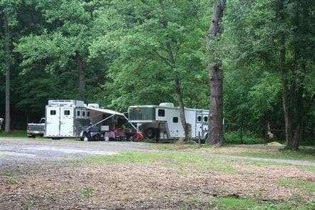
Overview Located in the scenic Cataloochee Valley, tucked in a cool and shady canopy, this campground offers the best that the Great Smoky Mountains National park has to offer, including some of the most coveted horseback riding trails in the park. World-renowned for its diversity of plant and animal life, the beauty of its ancient mountains and the preservation of Southern Appalachian culture, the Great Smoky Mountains is America's most visited national park. You MUST have a HORSE to camp at Cataloochee Horse Camp! Recreation With access to some of the most popular trails in the area, including the Rough Fork and Caldwell Fork Trails, this site is a favorite for horseback riding enthusiasts. Great Smoky Mountains National Park is also a hiker's paradise. Boogerman Trail, accessed via the Caldwell Fork Trail, provides a 3.9 mile detour through a beautiful, densely forested terrain, allowing visitors to stretch their legs and explore the area. Campers can enjoy high-quality backcountry fishing in the cool waters of the countless streams and rivers that snake through the mountains, with wild trout available in abundance. Wildlife viewing is a popular pastime, and with around 1,500 bears living in the park, it's not uncommon for a visitor to spot one. The Cataloochee area is also known for an elk herd that populates the valley, making for an impressive display of wildlife. The park also holds one of the best collections of log buildings in the eastern United States. Over 90 historic structures, including houses, barns, outbuildings, churches, schools and grist mills, have been preserved or rehabilitated in the park. A handful of these buildings are nearby the campground, including the Palmer House, which offers a self-guided museum. Facilities With access to some of the most popular trails in the area, including the Rough Fork and Caldwell Fork Trails, this site is a favorite for horseback riding enthusiasts. Great Smoky Mountains National Park is also a hiker's paradise. Boogerman Trail, accessed via the Caldwell Fork Trail, provides a 3.9 mile detour through a beautiful, densely forested terrain, allowing visitors to stretch their legs and explore the area. Campers can enjoy high-quality backcountry fishing in the cool waters of the countless streams and rivers that snake through the mountains, with wild trout available in abundance. Wildlife viewing is a popular pastime, and with around 1,500 bears living in the park, it's not uncommon for a visitor to spot one. The Cataloochee area is also known for an elk herd that populates the valley, making for an impressive display of wildlife. The park also holds one of the best collections of log buildings in the eastern United States. Over 90 historic structures, including houses, barns, outbuildings, churches, schools and grist mills, have been preserved or rehabilitated in the park. A handful of these buildings are nearby the campground, including the Palmer House, which offers a self-guided museum. Natural Features Cataloochee Horse Camp sits in along the gentle waters of Cataloochee Creek in the remote Catalooche Valley, surrounded by some of the park's most picturesque and rugged mountain ranges. Whether blanketed in wildflowers in the spring or vivid colors in the fall, the scenery at Cataloochee never disappoints. Nearby Attractions A number of Great Smoky's famous historical buildings, including cabins and churches, are located close to the campground. The nearby towns of Maggie Valley or Waynesville offer groceries and other supplies.
View details →
Overview Saddle up your horses for a camping trip in the stunning Great Smoky Mountains National Park. Located in the North Carolina portion of the park, this campsite offers miles of horse trails with a breathtaking backdrop. Whether blanketed in bright spring wildflowers or vivid fall colors, the scenery at Round Bottom never disappoints. World-renowned for its diversity of plant and animal life, the beauty of its ancient mountains and the quality of its remnants of Southern Appalachian culture, Great Smoky Mountains is America's most visited national park. You MUST have a HORSE to camp at Round Bottom Horse Camp! Recreation With access to several of the Smokies' popular horseback riding trails, equestrians will never be bored. Great Smoky Mountains National Park is a hiker's paradise, offering over 800 miles of maintained trails ranging from short, leg-stretchers to strenuous treks, with a number of those trails easily accessible from the picnic area. But hiking is not the only reason for visiting the Smokies: Fishing, picnicking, wildlife viewing and auto touring are also popular activities. Campers can enjoy high-quality backcountry fishing in the cool waters of the countless streams and rivers that snake through the mountains, with trout available in abundance. Wildlife viewing is a popular pastime, and with around 1,500 bears living in the park, it's not uncommon for visitors to spot one. The park is a sanctuary for a magnificent array of animal and plant life, all of which is protected for future generations to enjoy. The park also holds one of the best collections of log buildings in the eastern United States. Over 90 historic structures, including houses, barns, outbuildings, churches, schools and grist mills, have been preserved or rehabilitated in the park. Facilities With access to several of the Smokies' popular horseback riding trails, equestrians will never be bored. Great Smoky Mountains National Park is a hiker's paradise, offering over 800 miles of maintained trails ranging from short, leg-stretchers to strenuous treks, with a number of those trails easily accessible from the picnic area. But hiking is not the only reason for visiting the Smokies: Fishing, picnicking, wildlife viewing and auto touring are also popular activities. Campers can enjoy high-quality backcountry fishing in the cool waters of the countless streams and rivers that snake through the mountains, with trout available in abundance. Wildlife viewing is a popular pastime, and with around 1,500 bears living in the park, it's not uncommon for visitors to spot one. The park is a sanctuary for a magnificent array of animal and plant life, all of which is protected for future generations to enjoy. The park also holds one of the best collections of log buildings in the eastern United States. Over 90 historic structures, including houses, barns, outbuildings, churches, schools and grist mills, have been preserved or rehabilitated in the park. Natural Features Round Bottom Horse Camp is surrounded by picturesque mountain ranges, pristine mountain streams and rivers and clear blue skies that set the backdrop for your camping and horseback riding adventure. At 3,060 feet elevation, the campground provides a moderate climate, typified by mild winters and hot, humid summers. Great Smoky Mountains National Park preserves a rich cultural tapestry of Southern Appalachian history. The mountains have had a long human history spanning thousands of years, from the prehistoric Paleo Indians to early European settlement in the 1800s to loggers and Civilian Conservation Corps enrollees in the 20th century. The park strives to protect the historic structures, landscapes, and artifacts that tell the stories of people who once called these mountains home. Nearby Attractions Cherokee, North Carolina, located about 13 miles away, offers fuel and grocery stores.
View details →
Overview Situated in the stunning Great Smoky Mountains National Park, this campsite offers an ideal setting to enjoy the outdoors. Ridge upon ridge of forest straddles the border between North Carolina and Tennessee in Great Smoky Mountains National Park. World-renowned for its diversity of plant and animal life, the beauty of its ancient mountains and the quality of its remnants of Southern Appalachian culture, this is America's most visited national park. Recreation Great Smoky Mountains National Park is a hiker's paradise, offering over 800 miles of maintained trails ranging from short, leg-stretchers to strenuous treks, with a number of those trails easily accessible from the picnic area. But hiking is not the only reason for visiting the Smokies: Fishing, picnicking, wildlife viewing and auto touring are also popular activities. Campers can enjoy high-quality backcountry fishing in the cool waters of the countless streams and rivers that snake through the mountains, with trout available in abundance. The nearby Bradley Fork River provides a great place to go for a dip or fish for trout. Wildlife viewing is a popular pastime, and with around 1,500 bears living in the park, it's not uncommon for visitors to spot one. The park is a sanctuary for a magnificent array of animal and plant life, all of which is protected for future generations to enjoy. The park also holds one of the best collections of log buildings in the eastern United States. Over 90 historic structures, including houses, barns, outbuildings, churches, schools and grist mills, have been preserved or rehabilitated in the park. Facilities Great Smoky Mountains National Park is a hiker's paradise, offering over 800 miles of maintained trails ranging from short, leg-stretchers to strenuous treks, with a number of those trails easily accessible from the picnic area. But hiking is not the only reason for visiting the Smokies: Fishing, picnicking, wildlife viewing and auto touring are also popular activities. Campers can enjoy high-quality backcountry fishing in the cool waters of the countless streams and rivers that snake through the mountains, with trout available in abundance. The nearby Bradley Fork River provides a great place to go for a dip or fish for trout. Wildlife viewing is a popular pastime, and with around 1,500 bears living in the park, it's not uncommon for visitors to spot one. The park is a sanctuary for a magnificent array of animal and plant life, all of which is protected for future generations to enjoy. The park also holds one of the best collections of log buildings in the eastern United States. Over 90 historic structures, including houses, barns, outbuildings, churches, schools and grist mills, have been preserved or rehabilitated in the park. Natural Features Smokemont Campground is surrounded by picturesque mountain ranges, with pristine mountain streams and rivers setting the backdrop for your camping adventure. Whether blanketed in spring wildflowers or vivid fall colors, the scenery at Smokemont never disappoints. At 2,200 feet, Smokemont provides a moderate climate, characterized by mild winters and hot, humid summers. Great Smoky Mountains National Park preserves a rich cultural history of Southern Appalachia. From the prehistoric Paleo Indians to the early European settlements in the 1800s, the park strives to protect its historic structures, landscapes and artifacts that tell the stories of the people who once called these mountains home. Nearby Attractions The Museum of the Cherokee Indian, Oconaluftee Indian Village and Qualla Arts and Crafts Mutual, located 6 miles away in Cherokee, North Carolina, provides cultural and historical information about the Eastern Band of Cherokee Indians. Cherokee also has fuel.
View details →
Overview Located in the famous Outer Banks area of the stunning North Carolina coast, this campground is perfect for a beach getaway trip. Recreation The seashore provides a place for active recreation or for quiet reflection. Campers can visit a lighthouse, look for seashells, go fishing and clamming or just sit back and enjoy the peace and beauty of the white sandy beaches. More active recreational activities include swimming, kayaking and windsurfing. Bird and wildlife viewing is also a popular pastime for campers. The seashore provides a home and habitat for creatures large and small, on land and in the water. Facilities The seashore provides a place for active recreation or for quiet reflection. Campers can visit a lighthouse, look for seashells, go fishing and clamming or just sit back and enjoy the peace and beauty of the white sandy beaches. More active recreational activities include swimming, kayaking and windsurfing. Bird and wildlife viewing is also a popular pastime for campers. The seashore provides a home and habitat for creatures large and small, on land and in the water. Natural Features Ocracoke Campground sits on a barrier island along the Cape Hatteras National Seashore. The shore a recreational oasis for beach lovers. This ribbon of sand provides some of the most dazzling scenery that the Atlantic coast has to offer. contact_info For facility specific information, please call (252) 475-9054. Nearby Attractions Nearby Ocracoke Village offers restaurants, gift shops, grocery stores, a gas station and tackle shop.
View details →
Overview White Pine South Group Camp is one of two group campsites nestled along Avery Creek in the lush forests of the Appalachian Mountains. The facility provides tent camping year-round and can accommodate families, scout troops and other groups of up to 25 people. Visitors have access to a number of recreation opportunities, including hiking, swimming, mountain biking, fishing and picnicking, in one of the most scenic areas in the state. Recreation The forest is known for its hiking and mountain biking trails, several of which are close to the campground. Avery Creek and the Davidson River offer great trout fishing. Facilities The forest is known for its hiking and mountain biking trails, several of which are close to the campground. Avery Creek and the Davidson River offer great trout fishing. Natural Features The campground lies in Pisgah National Forest at an elevation of 2,600 feet. The surrounding land boasts mile-high peaks, cascading waterfalls and slopes thickly forested with hardwoods. The group camping area is adjacent to Avery Creek and near the beautiful Davidson River. Nearby Attractions The city of Asheville is about an hour away and offers numerous cultural attractions, art galleries, shops and restaurants. The small town of Brevard is also nearby and has various amenities and services. contact_info For facility specific information, please call (828) 577-4910.
View details →
Overview Cataloochee campground is located in the historic Cataloochee Valley--a relatively remote part of Smoky Mountain National Park. The secluded setting offers visitors the ability to enjoy a multitude of recreational activities like hiking and fishing, without the crowds, which are sometimes common in other parts of the park. Recreation The Cataloochee Valley features an extensive trail system that is less heavily used compared to other areas of the park. The two main trails, Caldwell Fork and nearby Rough Fork Trail, run mostly parallel to one another in the central portion of the valley. Either of these trails extend alongside scenic creeks and streams and support both hikers and horeseback riders. For hikers only, the 3.9-mile Boogerman Trail forms a nice loop off the Caldwell Fork Trail and is less than a mile walk from the campground. Anglers will agree that some of the best Rainbow and Brook trout fishing in the area can be found in the Cataloochee Basin, one of the most remote sections of the park. Fly fishing is particularly good during spring months when aquatic insects hatch in large numbers. The park also holds one of the best collections of log buildings in the eastern United States. Over 90 historic structures, including houses, barns, outbuildings, churches, schools and grist mills, have been preserved or rehabilitated in the park. A handful of which can be found in the Cataloochee Valley, including the nearby Palmer House, built in 1869, which contains a self-guided museum. Facilities The Cataloochee Valley features an extensive trail system that is less heavily used compared to other areas of the park. The two main trails, Caldwell Fork and nearby Rough Fork Trail, run mostly parallel to one another in the central portion of the valley. Either of these trails extend alongside scenic creeks and streams and support both hikers and horeseback riders. For hikers only, the 3.9-mile Boogerman Trail forms a nice loop off the Caldwell Fork Trail and is less than a mile walk from the campground. Anglers will agree that some of the best Rainbow and Brook trout fishing in the area can be found in the Cataloochee Basin, one of the most remote sections of the park. Fly fishing is particularly good during spring months when aquatic insects hatch in large numbers. The park also holds one of the best collections of log buildings in the eastern United States. Over 90 historic structures, including houses, barns, outbuildings, churches, schools and grist mills, have been preserved or rehabilitated in the park. A handful of which can be found in the Cataloochee Valley, including the nearby Palmer House, built in 1869, which contains a self-guided museum. Natural Features Cataloochee Campground is surrounded by picturesque mountain ranges and pristine mountain streams, like nearby Cataloochee Creek. Elk are common in this part of the park, during the spring and fall. At a 2,600 foot elevation, Cataloochee provides a moderate climate, characterized by mild winters and hot, humid summers. Whether blanketed in bright spring wildflowers or exploding with vivid fall colors, the scenery at Cataloochee never disappoints. Nearby Attractions A number of the park's famous historical buildings, including the Steve Woody and Caldwell Houses, both built in the late 19th-century, are nearby the campground. The Steve Woody House, built in 1880, is located along the Rough Fork trail, an easy 2-mile roundtrip hike from the parking lot at the end of Ranger Station Road.
View details →
Overview Cedar Point Campground and Recreation Area is located in eastern North Carolina at the junction of the White Oak River and the Bogue Sound, immediately adjacent to the Swansboro Inlet. It is within 1 mile of full service shopping, and within 2 miles of NC's Crystal Coast and the barrier island beach community of Bogue Banks. The campground is extremely busy and reservations are recommended but must be made 3 days in advance. Of the 36 campsites, 4 are considered first-come, first served campsites that cannot be reserved or held, so a person must physically be there with their camping equipment to purchase the campsite. Cedar Point campground has the option to use Scan & Pay system, but by the rules of recreation.gov it may only be used for first-come, first served sites. Please make sure to contact a campground host to ensure availability before paying for any campsite. Failure to check with the campground host for availability may result in the loss of your camping fee. Recreation Canoeing and fishing are popular options. Power boating is allowed on the White Oak River. Visitors can hike the Tidelands National Trail, a 1.9-mile path divided in two loops that lend themselves to wildlife viewing. Ospreys and the occasional dolphin can be viewed along the loops. The recreation area is also home to a picnic area and shallow draft boat launch. Facilities Canoeing and fishing are popular options. Power boating is allowed on the White Oak River. Visitors can hike the Tidelands National Trail, a 1.9-mile path divided in two loops that lend themselves to wildlife viewing. Ospreys and the occasional dolphin can be viewed along the loops. The recreation area is also home to a picnic area and shallow draft boat launch. Natural Features Cedar Point, at the mouth of the White Oak River, is bordered by a salt marsh and a coastal forest. The salt marsh, where fresh water meets salt water, stretches out like a sea of grass. This nutrient-rich wetland is a valuable habitat for commercial seafood, including fish, shrimp, crabs and oysters. The recreation area is part of the Croatan National Forest, a 160,000-acre tract on North Carolina's coast, bordered on three sides by tidal rivers and Bogue Sound. contact_info For facility specific information, please call (252) 638-5628. Nearby Attractions The campground is a short drive from the developed barrier island town of Bogue Banks. Charges & Cancellations There is a $10.00 fee to cancel Reservations. Reservations canceled within the 3 days of arrival may result in the loss of the fee for one or more nights stay. Refunds for weather or checking out early will not be considered
View details →
Overview Located on the famous Blue Ridge Parkway in the hills of rural Virginia, Rocky Knob Campground is nestled amid rolling meadowlands with impressive displays of seasonal flowers, endless night skies and green pastures. Numerous nearby overlooks and the winding parkway provide an ideal backdrop for a traditional camping experience. Recreation The campground is located in the Rocky Knob Recreation area, surrounded by more than 4,000 acres of forest. The site offers easy access to the Rock Castle Gorge Trail , a 10.8-mile (17.4 km) loop trail ranging in elevation from 1,700 to 3,572 feet (518 to 1,089 m). Rock Castle Gorge, a 1,500-foot (457 m) ravine carved by the waters of Rock Castle Creek, is the focal point of this trail, offering hikers breathtaking scenery. Black Ridge Trail : a moderate 3-mile loop passing through the forest on a seldom-used gravel road and through a meadow. Accessed from the Rocky Knob Visitor Center. Numerous tours and interpretive talks are given near the Gorge and surrounding trails during the summer, offering campers the chance to learn more about the area's historical significance and abundant plants and wildlife. Facilities The campground is located in the Rocky Knob Recreation area, surrounded by more than 4,000 acres of forest. The site offers easy access to the Rock Castle Gorge Trail , a 10.8-mile (17.4 km) loop trail ranging in elevation from 1,700 to 3,572 feet (518 to 1,089 m). Rock Castle Gorge, a 1,500-foot (457 m) ravine carved by the waters of Rock Castle Creek, is the focal point of this trail, offering hikers breathtaking scenery. Black Ridge Trail : a moderate 3-mile loop passing through the forest on a seldom-used gravel road and through a meadow. Accessed from the Rocky Knob Visitor Center. Numerous tours and interpretive talks are given near the Gorge and surrounding trails during the summer, offering campers the chance to learn more about the area's historical significance and abundant plants and wildlife. Natural Features The Blue Ridge Parkway is a scenic byway that stretches almost 500 miles along the crest of the Blue Ridge Mountains through North Carolina and Virginia. It offers plenty of natural attractions and recreational opportunities for visitors, as well as a cross-section of Appalachian mountain history from pre-historic times to early European settlements, and on to today. Rocky Knob Campground, one of the first established sites along the Blue Ridge Parkway, is home to several famous geological attractions. Rock Castle Gorge, known for its beautiful rock crystalline quartz formations, was once home to several mountain families. Visitors can still find remnants of their old apple orchards and abandoned stone chimneys along parkway trails. Nearby Attractions The nearby town of Floyd offers entertainment, shopping, food, gas and lodging. There are also multiple wineries nearby that offer tours and tastings. Visit Mabry Mill at milepost 176 near Meadows of Dan, Virginia. The campground is about 30 miles from Mount Airy, North Carolina , the birthplace of actor Andy Griffith and the inspiration for the fictional TV-series town of Mayberry. Mount Airy also offers grocery stores, gas stations and medical facilities.
View details →
Overview Nestled in a landscape of mountains, open meadows and pioneer cabins, Doughton Park Campground is surrounded by 30 miles (48 km) of hiking trails offering opportunities to view wildlife as well as get a feel for the lives of those who lived here long ago. Originally known as The Bluffs, the area came by its present name in honor of Congressman Robert L. Doughton, a long-time advocate and supporter of the Parkway. Recreation Over 30 miles of trails are available varying from strenuous to easy. Bicycles and motorized vehicles are prohibited on trails. Mileage listed is only traveling one way. Double the trail mileage to include out and back trip. Trail elevations can change more than 2,000 feet as trails descend into the Basin Cove Creek area from the parkway. Maps available on the Blue Ridge Parkway.gov website. Bluff Mountain Trail (7.5 miles) offers many scenic vistas and traverses relatively flat terrain. The trail runs near the parkway and is accessible from many locations along its route from Brinegar Cabin to Basin Cove Overlook. Cedar Ridge Trail (4.4 miles) descends a forested ridgeline to Grassy Gap Fire Road. Trailhead is located at the Brinegar Cabin. Grassy Gap Fire Road (6.1 miles) is wide enough for hikers and horseback riders to travel side by side. The trail starts at Milepost 243.9 and ambles down the mountainside past the primitive campground to State Route 1730 (Longbottom Road). Horseback riders must enter and exit at Longbottom Road. Flat Rock Ridge Trail (5.0) miles begins on the mountain-top meadow of Basin Cove Overlook. And ends on the damp, cool banks of Basin Cove Creek. NC Thurmond Game Lands and bear sanctuary border the south side of the trail. Basin Cove Creek Trail (3.2 miles) is accessible only from the grassy Gap Fire Road at the Long Bottom Road (State Hwy 1730). A 1.7-mile hike is required to reach the beginning of the Basin Cove Creek. It winds past cascading waterfalls to the century-old Caudill Cabin, former home of the Martin Caudill family. Part of the once-thriving Basin cove Community, this cabin was one of the few structures that withstood the devasting 1916 flood. Prepare for over 26 creek crossings on this trail. The total trip one way is 4.9 miles and 9.8 miles for the total trip. Bluff Ridge Primitive Trail (2.7 miles) is the shortest but steepest route into Basin Cove. The strenuous climb up the trail makes the hike seem much longer. Trailhead location is in the Bluffs Picnic Area. Fodder Stack Trail (1.4 miles roundtrip) shows off its delicate display of wildflowers in the spring. It is the easiest hike through a mixture of pine and hardwood forest with a short, steep brief beginning. Recommended for families. Trailhead is at Wildcat Rocks Overlook. The Brinegar Cabin dates from about 1885 and was the home of Martin Brinegar and his family. Brinegar was a cobbler as well as a farmer. His home is open Memorial Day weekend days through October. Hand-loom weaving and other craft demonstrations are often given during the summer months. The one-room Caudill Cabin exhibit can be viewed from the scenic Wildcat Rocks (milepost 240.6). Historic Cemetery: near milepost marker 245.5. The cemetery contains some three dozen graves dating from the 1880's to more recent times. The Basin Cove Creek complex (mileposts 238 - 244) (located off the Parkway on Longbottom Road) has Rainbow and Brook Trout where the streams are stocked. Anyone with a valid Virginia or North Carolina fishing license is welcome, but please check with the visitor center for any special regulations. Facilities Over 30 miles of trails are available varying from strenuous to easy. Bicycles and motorized vehicles are prohibited on trails. Mileage listed is only traveling one way. Double the trail mileage to include out and back trip. Trail elevations can change more than 2,000 feet as trails descend into the Basin Cove Creek area from the parkway. Maps available on the Blue Ridge Parkway.gov website. Bluff Mountain Trail (7.5 miles) offers many scenic vistas and traverses relatively flat terrain. The trail runs near the parkway and is accessible from many locations along its route from Brinegar Cabin to Basin Cove Overlook. Cedar Ridge Trail (4.4 miles) descends a forested ridgeline to Grassy Gap Fire Road. Trailhead is located at the Brinegar Cabin. Grassy Gap Fire Road (6.1 miles) is wide enough for hikers and horseback riders to travel side by side. The trail starts at Milepost 243.9 and ambles down the mountainside past the primitive campground to State Route 1730 (Longbottom Road). Horseback riders must enter and exit at Longbottom Road. Flat Rock Ridge Trail (5.0) miles begins on the mountain-top meadow of Basin Cove Overlook. And ends on the damp, cool banks of Basin Cove Creek. NC Thurmond Game Lands and bear sanctuary border the south side of the trail. Basin Cove Creek Trail (3.2 miles) is accessible only from the grassy Gap Fire Road at the Long Bottom Road (State Hwy 1730). A 1.7-mile hike is required to reach the beginning of the Basin Cove Creek. It winds past cascading waterfalls to the century-old Caudill Cabin, former home of the Martin Caudill family. Part of the once-thriving Basin cove Community, this cabin was one of the few structures that withstood the devasting 1916 flood. Prepare for over 26 creek crossings on this trail. The total trip one way is 4.9 miles and 9.8 miles for the total trip. Bluff Ridge Primitive Trail (2.7 miles) is the shortest but steepest route into Basin Cove. The strenuous climb up the trail makes the hike seem much longer. Trailhead location is in the Bluffs Picnic Area. Fodder Stack Trail (1.4 miles roundtrip) shows off its delicate display of wildflowers in the spring. It is the easiest hike through a mixture of pine and hardwood forest with a short, steep brief beginning. Recommended for families. Trailhead is at Wildcat Rocks Overlook. The Brinegar Cabin dates from about 1885 and was the home of Martin Brinegar and his family. Brinegar was a cobbler as well as a farmer. His home is open Memorial Day weekend days through October. Hand-loom weaving and other craft demonstrations are often given during the summer months. The one-room Caudill Cabin exhibit can be viewed from the scenic Wildcat Rocks (milepost 240.6). Historic Cemetery: near milepost marker 245.5. The cemetery contains some three dozen graves dating from the 1880's to more recent times. The Basin Cove Creek complex (mileposts 238 - 244) (located off the Parkway on Longbottom Road) has Rainbow and Brook Trout where the streams are stocked. Anyone with a valid Virginia or North Carolina fishing license is welcome, but please check with the visitor center for any special regulations. Natural Features Rolling ridgetop meadows and steep mountainsides characterize the 7,000-acre Doughton Park. The elevation is a cool 3688 feet. It is one of the best places along the motor road to view white-tailed deer, raccoons, red and gray foxes, and bobcats. Visitors can enjoy spectacular shows of flame azalea and rhododendron in the late spring and fields of Dense Blazing Stars in mid to late July. Nearby Bluffs picnic area features open areas for night sky viewing with limited light pollution. The Blue Ridge Parkway is a scenic byway that follows the high crests of the central and southern Appalachians for 469 miles from Shenandoah National Park in Virginia, to the Great Smoky Mountains National Park in North Carolina. Nearby Attractions Mount Airy, NC : Andy Griffith's hometown, the ideal American town that was the inspiration for Mayberry--Hwy 52 South; 12 miles south of Fancy Gap, VA. (www.visitmayberry.com) Churches of the Frescoes : MP 259 - The Last Supper, Mary Great with Child, Mystery of Faith, and 7 others. Episcopal Church is always open. (www.churchofthefrescoes.com) Northwest Trading Post : Located south of Doughton Park at milepost 258 near Glendale Springs, this craft store sells handicrafts representative of the Appalachian Mountain culture. (www.CoolSparta.com)
View details →
Overview The Peaks of Otter Campground is nestled between the bases of two dominating mountains in the rolling hills of Virginia. Campers enjoy a rare serenity in this rustic setting. Relax, and leave your cares behind! Recreation The 24-acre Abbott Lake is one of the biggest attractions the Peaks of Otter Park has to offer. The lake is well-stocked with small mouth bass and bluegill. A crystal-clear mountain stream winds through the nearby picnic area. Numerous hiking opportunities range from demanding, scaling the area's high mountain peaks, to the moderate short, flat trail around Abbott Lake. Hikers are likely to stumble upon one of the mountain meadows, filled with wildflowers and migrating butterflies in the spring and a fantastic assortment of colors in the fall. Abundant wildlife like deer and wild turkey are spotted daily at the Peaks of Otter Campground, and many rare species of birds reside or migrate along the mountain ranges. Summer interpretive programs are provided for visitors to learn about the wildlife as well as the history of the area. Facilities The 24-acre Abbott Lake is one of the biggest attractions the Peaks of Otter Park has to offer. The lake is well-stocked with small mouth bass and bluegill. A crystal-clear mountain stream winds through the nearby picnic area. Numerous hiking opportunities range from demanding, scaling the area's high mountain peaks, to the moderate short, flat trail around Abbott Lake. Hikers are likely to stumble upon one of the mountain meadows, filled with wildflowers and migrating butterflies in the spring and a fantastic assortment of colors in the fall. Abundant wildlife like deer and wild turkey are spotted daily at the Peaks of Otter Campground, and many rare species of birds reside or migrate along the mountain ranges. Summer interpretive programs are provided for visitors to learn about the wildlife as well as the history of the area. Natural Features Three mountain peaks sitting atop a thick blanket of forest make up the Peaks of Otter-- a recreational oasis spanning acre upon acre of rolling landscape along the famous Blue Ridge Parkway. The Blue Ridge Parkway is a scenic byway that follows the high crests of the central and southern Appalachians for 469 miles from Shenandoah National Park in Virginia, to the Great Smoky Mountains National Park in North Carolina. Nearby Attractions The Peaks of Otter Lodge and Restaurant are located within walking distance of the campground, as is the Sharp Top Country Store . Restaurant dining, grab-and-go meals, snacks, souvenir items, camping supplies, firewood, and ice are all readily available to campground patrons. The Johnson Farm , an old mountain farmstead restored and preserved to look as it did in the mid-1800s, is just a short walk away. Another restored historic structure, Aunt Polly's Ordinary , sits on the northeastern shore of Abbott Lake.
View details →
Overview Bandits Roost Campground is located on the south side of W. Kerr Scott Reservoir in western North Carolina. Constructed in the beautiful Yadkin River Valley, the lake offers extensive opportunities for outdoor recreational activities. Recreation The 1,475-acre reservoir offers excellent boating, canoeing, kayaking and swimming opportunities. Anglers will find channel catfish, large and smallmouth bass, bluegill, threadfin shad, spotted bass, striped bass, and hybrid striped bass. Miles of multi-use trails, that allow hiking and mountain biking, surround the lake, including the Overmountain Victory National Historic Trail, which has a trailhead at the campground. An additional 25 miles of trails can be found at the Warrior Creek and Dark Mountain areas. Facilities The 1,475-acre reservoir offers excellent boating, canoeing, kayaking and swimming opportunities. Anglers will find channel catfish, large and smallmouth bass, bluegill, threadfin shad, spotted bass, striped bass, and hybrid striped bass. Miles of multi-use trails, that allow hiking and mountain biking, surround the lake, including the Overmountain Victory National Historic Trail, which has a trailhead at the campground. An additional 25 miles of trails can be found at the Warrior Creek and Dark Mountain areas. Natural Features The gentle Yadkin River flows through its scenic namesake valley in the foothills of the eastern Blue Ridge Mountains. Forests of mixed hardwoods, including sycamore, poplar, oak and hickory, cover the region. Wildlife is abundant in the valley. White-tailed deer, black bear, eastern cottontails and more can be found among the hills. Birds in the area include wild turkey, woodpeckers, Carolina chickadees, red-eyed vireo, ovenbirds, mallards and wood ducks. contact_info This location has limited staffing. Please call (336) 921-3390 for general information.
View details →
Overview Warrior Creek is located on the south side of W. Kerr Scott Reservoir in western North Carolina. Constructed in the beautiful Yadkin River Valley, the lake offers extensive opportunities for outdoor recreational activities. Recreation The 1,475-acre reservoir offers excellent boating, canoeing, kayaking and swimming opportunities. Anglers will find channel catfish, large and smallmouth bass, bluegill, threadfin shad, spotted bass, striped bass, and hybrid striped bass. The Warrior Creek trail system completely encircles the campground as it scenically follows the fold of the surrounding landscape. It is recognized by the International Mountain Biking Association as one of the top bike trails in the world. There are 17 miles of single track trail in Warrior Creek with multiple points-of-entry throughout the campground. These trails are also used extensively by hikers and trail runners. Facilities The 1,475-acre reservoir offers excellent boating, canoeing, kayaking and swimming opportunities. Anglers will find channel catfish, large and smallmouth bass, bluegill, threadfin shad, spotted bass, striped bass, and hybrid striped bass. The Warrior Creek trail system completely encircles the campground as it scenically follows the fold of the surrounding landscape. It is recognized by the International Mountain Biking Association as one of the top bike trails in the world. There are 17 miles of single track trail in Warrior Creek with multiple points-of-entry throughout the campground. These trails are also used extensively by hikers and trail runners. Natural Features The gentle Yadkin River flows through its scenic namesake valley in the foothills of the eastern Blue Ridge Mountains. Forests of mixed hardwoods, including sycamore, poplar, oak and hickory, cover the region. Wildlife is abundant in the valley. White-tailed deer, black bear, eastern cottontails and more can be found among the hills. Birds in the area include wild turkey, woodpeckers, Carolina chickadees, red-eyed vireo, ovenbirds, mallards and wood ducks. contact_info This location has limited staffing. Please call (336) 921-3390 for general information. Charges & Cancellations All camping reservations are made in advance. No transactions will be completed at the campground. All refund request will need to be submitted via recreation.gov. No refunds are given at campground. Refer to recreation.gov for a complete list of fees and cancelation policy
View details →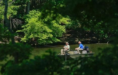
Overview Arrowhead Campground lies in the Badin Lake Recreation Area, a hub for outdoor activities in central North Carolina's Uwharrie National Forest. The variety of sites in the campground offer a comfortable stay for both RV and tent campers. The facility is open year-round and provides easy access to hiking, off-road vehicle riding, horseback riding, mountain biking, fishing and boating. Recreation Badin Lake Recreation Area offers many ways for campers to enjoy the lake. Popular activities include picnicking on the shore or swimming, boating or fishing on the water. About 40 miles of non-motorized trails are available for horseback riding, mountain biking and hiking, as well as 17 miles of motorized trails for off-road vehicle riding. The surrounding land offers both big and small game hunting. Facilities Badin Lake Recreation Area offers many ways for campers to enjoy the lake. Popular activities include picnicking on the shore or swimming, boating or fishing on the water. About 40 miles of non-motorized trails are available for horseback riding, mountain biking and hiking, as well as 17 miles of motorized trails for off-road vehicle riding. The surrounding land offers both big and small game hunting. Natural Features The campground lies in a dense forest of pine, oak and hickory near the shore of 5,000-acre Badin Lake. Winter temperatures range from the low 30s to upper 50s, while summer brings temperatures in the upper 80s and 90s and high humidity. The weather is pleasant in spring and fall, with high temperatures in the 60s and 70s. Nearby Attractions A theme park with a petting zoo, nature center and mini golf course lies just under an hour away and makes a fun day trip for families.
View details →
Overview Badin Lake Campground borders the lakeshore and sits within a shaded forest, offering a year-round retreat for swimmers, boaters and anglers in central North Carolina's Uwharrie National Forest. Badin Lake Recreation Area is a hub for the area's outdoor activities, and the campground offers spacious, waterfront sites for both RV and tent campers. Recreation Badin Lake Recreation Area offers many ways for campers to enjoy the lake. Popular activities include picnicking on the shore or swimming, boating or fishing for bass, bream, crappie and catfish on the water. Anglers and boaters have the convenience of a boat ramp 2 miles from the campground. About 40 miles of non-motorized trails are available for horseback riding, mountain biking and hiking, as well as 17 miles of motorized trails for off-road vehicle riding. The surrounding land offers both big and small game hunting. Facilities Badin Lake Recreation Area offers many ways for campers to enjoy the lake. Popular activities include picnicking on the shore or swimming, boating or fishing for bass, bream, crappie and catfish on the water. Anglers and boaters have the convenience of a boat ramp 2 miles from the campground. About 40 miles of non-motorized trails are available for horseback riding, mountain biking and hiking, as well as 17 miles of motorized trails for off-road vehicle riding. The surrounding land offers both big and small game hunting. Natural Features The campground lies in a dense forest of pines and hardwoods near the shore of 5,000-acre Badin Lake. Winter temperatures range from the low 30s to upper 50s, while summer brings temperatures in the upper 80s and 90s and high humidity. The weather is pleasant in spring and fall, with high temperatures in the 60s and 70s. Nearby Attractions A theme park with a petting zoo, nature center and mini golf course lies just under an hour away and makes a fun day trip for families.
View details →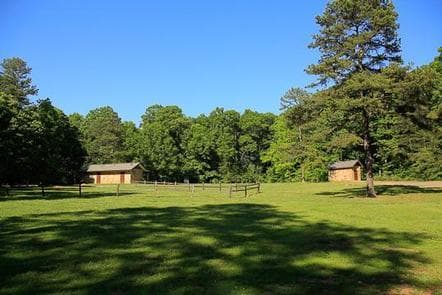
Overview Badin Lake Group Camp offers a fun, relaxing place for clubs, families and other groups to rest and play in the Uwharrie National Forest of central North Carolina. The recreation area is a hub for outdoor activities such as hiking, off-road vehicle riding, hunting, horseback riding, mountain biking, fishing and boating. The group campground is open year-round and can accommodate groups of up to 50 people per site. Recreation Groups have easy access to many recreational opportunities at Badin Lake Recreation Area. The lake shore is the perfect place to watch the sunset or enjoy an afternoon picnic. The lake has plenty of calm water for swimming, boating or fishing for bass, bream, crappie and catfish. King's Mountain Point, just 1 mile from the group camp, has four accessible fishing piers, miles of shoreline and a nice swimming area. A boat ramp is located 2 miles from the campground. Back on land, about 40 miles of non-motorized trails are available for horseback riding, mountain biking and hiking, as well as 17 miles of motorized trails for off-road vehicle riding. The surrounding land offers both big and small game hunting. Facilities Groups have easy access to many recreational opportunities at Badin Lake Recreation Area. The lake shore is the perfect place to watch the sunset or enjoy an afternoon picnic. The lake has plenty of calm water for swimming, boating or fishing for bass, bream, crappie and catfish. King's Mountain Point, just 1 mile from the group camp, has four accessible fishing piers, miles of shoreline and a nice swimming area. A boat ramp is located 2 miles from the campground. Back on land, about 40 miles of non-motorized trails are available for horseback riding, mountain biking and hiking, as well as 17 miles of motorized trails for off-road vehicle riding. The surrounding land offers both big and small game hunting. Natural Features The campground lies in a dense forest of pines and hardwoods near the shore of 5,000-acre Badin Lake. Winter temperatures range from the low 30s to upper 50s, while summer brings temperatures in the upper 80s and 90s and high humidity. The weather is pleasant in spring and fall, with high temperatures in the 60s and 70s. Nearby Attractions A theme park with a petting zoo, nature center and mini golf course lies just under an hour away and makes a fun day trip for families.
View details →
Overview Canebrake Horse Camp lies in the Badin Lake Recreation Area, a hub for outdoor activities in central North Carolina's Uwharrie National Forest. The facility is a scenic and restful overnight spot with both single and double campsites. Canebrake Horse Camp is specifically designed for campers traveling with horses and offers numerous amenities for equestrian camping. If your visit to the Uwharrie National Forest includes camping without horses, please consider one of our other campgrounds: Arrowhead Campground , Badin Lake Campground or Badin Lake Group Camp . Campers will delight in nearly 40 miles of forested horseback riding trails, as well as hiking, mountain biking, off-road vehicle riding, swimming, fishing and boating opportunities in the area. The campground is open year-round. Recreation The equestrian trail system is extensive, with miles of forested paths wandering through forests, over hills and across streams. The trails can be accessed from Canebrake using the Home Trail, which skirts the campground. Trails range from easy to difficult, accommodating riders of every level. The recreation area also offers many ways to enjoy the lake. Campers can spend the afternoon swimming, boating or fishing for bass, bream, crappie and catfish on the water. Back on land, off-road vehicle enthusiasts have access to 17 miles of trails, and hunters and hikers can explore the surrounding national forest. Facilities The equestrian trail system is extensive, with miles of forested paths wandering through forests, over hills and across streams. The trails can be accessed from Canebrake using the Home Trail, which skirts the campground. Trails range from easy to difficult, accommodating riders of every level. The recreation area also offers many ways to enjoy the lake. Campers can spend the afternoon swimming, boating or fishing for bass, bream, crappie and catfish on the water. Back on land, off-road vehicle enthusiasts have access to 17 miles of trails, and hunters and hikers can explore the surrounding national forest. Natural Features Canebrake lies in a quiet forest of pine, oak and hickory near the shore of 5,000-acre Badin Lake. Winter temperatures range from the low 30s to upper 50s, while summer brings temperatures in the upper 80s and 90s and high humidity. Weather is pleasant in spring and fall, with high temperatures in the 60s and 70s. Nearby Attractions A theme park with a petting zoo, nature center and mini golf course lies just under an hour away and makes a fun day trip for families.
View details →
Overview Briar Bottom Group Campground is the perfect getaway for visitors to enjoy mountain scenery and easy access to hiking trails. The campground sits at the base of Mt. Mitchell, the highest peak east of the Mississippi River, in Pisgah National Forest. Recreation With the South Toe River located near the campground, visitors will have no shortage of things to do, including picnicking, day hiking, scenic driving and trout fishing. Hikers will be pleased with a variety of trails from which to choose, including a leisurely half-mile walk through the forest or a challenging 5.6-mile hike up Mt. Mitchell. The adjacent Black Mountain Campground has a playing field, volleyball courts and horseshoe pit available. Facilities With the South Toe River located near the campground, visitors will have no shortage of things to do, including picnicking, day hiking, scenic driving and trout fishing. Hikers will be pleased with a variety of trails from which to choose, including a leisurely half-mile walk through the forest or a challenging 5.6-mile hike up Mt. Mitchell. The adjacent Black Mountain Campground has a playing field, volleyball courts and horseshoe pit available. Natural Features The campground sits at an elevation of 3,040 feet. The 6,684-foot Mt. Mitchell towers over the area, with several other high peaks of the Black Mountains nearby. The lush forest in this part of the Appalachian Mountains is rich with wildlife, plants and scenery. Nearby Attractions Groups can easily head out for a day of scenic driving along Blue Ridge Parkway or hiking in Mount Mitchell State Park.
View details →
Overview Located in a dense pine canopy, within hiking distance of Linville Gorge, and along the famous Blue Ridge Parkway, Linville Falls Campground is an ideal location for your next family camping excursion. Linville River, which winds beside the campground, is stocked for fishing, and the location is central to many area attractions including the Linville Falls waterfall, which has three waterfall overlooks in a one-mile hike. Recreation The Linville Falls area is a hiker's paradise, and the campground provides easy access to several trails that allow visitors to experience the stunning scenery and abundant wildlife. Once at the Linville Gorge , visitors can hike more challenging trails down to the river, where fishing for trout is a popular pastime. Linville Falls is another must-see, carrying water from the river over several layers of falls, ending in a spectacular 45-foot waterfall pouring into the sparkling riverbed below. Duggers Creek Falls : accessible from the Linville Falls Visitor Center on a small loop trail. See views of the falls from the foot bridge. These are native brook trout waters (fishing regulations apply). Lost Cove Cliff Overlook : view Brown Mountain and see the Brown Mountain Lights--a natural occurrence which is believed to be caused by natural gases. A good spot to view hawks and peregrine falcons in the spring and fall. Facilities The Linville Falls area is a hiker's paradise, and the campground provides easy access to several trails that allow visitors to experience the stunning scenery and abundant wildlife. Once at the Linville Gorge , visitors can hike more challenging trails down to the river, where fishing for trout is a popular pastime. Linville Falls is another must-see, carrying water from the river over several layers of falls, ending in a spectacular 45-foot waterfall pouring into the sparkling riverbed below. Duggers Creek Falls : accessible from the Linville Falls Visitor Center on a small loop trail. See views of the falls from the foot bridge. These are native brook trout waters (fishing regulations apply). Lost Cove Cliff Overlook : view Brown Mountain and see the Brown Mountain Lights--a natural occurrence which is believed to be caused by natural gases. A good spot to view hawks and peregrine falcons in the spring and fall. Natural Features Linville Gorge is a vast designated Wilderness area that sits on 11,786 acres of rolling hills and thick forest. The gorge surrounds the Linville River, which is located some 1,400 feet below the ridge, creating a stunning canyon that has earned the nickname "The Grand Canyon of North Carolina." The Blue Ridge Parkway is a scenic byway with plenty of natural attractions and recreational opportunities for visitors. Aside from natural features, the parkway is also a cross-section of Appalachian mountain history. Stretching almost 500 miles along the crest of the Blue Ridge Mountains through North Carolina and Virginia, it encompasses some of the oldest historical sites of both pre-historic and early European settlements. The surrounding forest offers hemlock, white pine, oaks, hickory and birch trees, along with a colorful assortment of wildflowers in the spring and an epic array of orange and red shades of leaves in the autumn. Nearby Attractions Linville Caverns , a privately maintained cave just south of Linville Falls, offers guided tours year-round.
View details →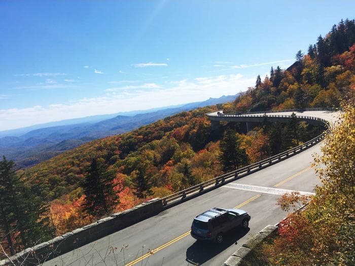
Overview Located along the scenic Blue Ridge Parkway in the lush green expanses of North Carolina, Julian Price Campground is a top destination for boating, hiking, fishing and more. Whether it's for a family camping excursion or a peaceful getaway, this campground has something for everyone. Some campsites at this facility are available on a first-come, first-served basis. Status of these sites is not available online. Recreation Canoe rentals are available at Price Lake, and other types of non-motorized boats are permitted. Fishing is also available at the lake, with a dock provided. Price Lake Trail offers a refreshing hike around the edge of the water, and the Boone Fork , Green Knob and Tanawha Trails are just a few of the trails that are conveniently accessed through the campground. Hebron Falls : A small waterfall accessed from the Boone Fork Trail . The Cascades : A beautiful waterfall accessed by the easy 1-mile loop Cascades Trail. A great hike for children. Moses Cone Flat Top Manor : A historic estate house (currently undergoing restoration) once owned by the Cone family. The grounds offer 25 miles of carriage roads to hike. Tours of the home are available. Currently houses the Southern Highland Craft Guild. Wildlife viewing is also popular as campers have a good chance of spotting bears, grouse, turkeys, owls, hawks and more. Facilities Canoe rentals are available at Price Lake, and other types of non-motorized boats are permitted. Fishing is also available at the lake, with a dock provided. Price Lake Trail offers a refreshing hike around the edge of the water, and the Boone Fork , Green Knob and Tanawha Trails are just a few of the trails that are conveniently accessed through the campground. Hebron Falls : A small waterfall accessed from the Boone Fork Trail . The Cascades : A beautiful waterfall accessed by the easy 1-mile loop Cascades Trail. A great hike for children. Moses Cone Flat Top Manor : A historic estate house (currently undergoing restoration) once owned by the Cone family. The grounds offer 25 miles of carriage roads to hike. Tours of the home are available. Currently houses the Southern Highland Craft Guild. Wildlife viewing is also popular as campers have a good chance of spotting bears, grouse, turkeys, owls, hawks and more. Natural Features Julian Price Campground is adjacent to Price Lake, a pristine body of water that sparkles against the backdrop of rolling Carolina hills. The surrounding forest offers hemlock, white pine, oak, hickory and birch trees, along with a colorful assortment of wildflowers in the spring and an array of vivid orange and red foliage displays in autumn. The Blue Ridge Parkway is a scenic byway that follows the high crests of the central and southern Appalachians for 469 miles from Shenandoah National Park in Virginia to the Great Smoky Mountains National Park in North Carolina. Nearby Attractions The beautiful town of Blowing Rock , located just 20 minutes away on the Blue Ridge Parkway, offers fine dining, shopping and more.
View details →
Overview Jackrabbit Mountain Campground offers scenic lakeside camping in the beautiful Nantahala National Forest of southwestern North Carolina. Campers can breathe the fresh air of the forest while enjoying numerous recreation activities, including hiking, picnicking, mountain biking, fishing and water sports at Jackrabbit Recreation Area. The campground contains three seperate camping loops; Loops A is open May - September, and Loop B and C is open May - October. Recreation Lake Chatuge has more than 130 miles of shoreline and plenty of water for recreation. Popular water activities include boating, jet skiing, swimming and fishing. Beach access fee is not included in camping reservation fee and will require on-site payment at fee collection station. Visitors who wish to stay on dry land can explore hiking, biking and shoreline fishing. Jackrabbit Mountain Recreation Area boasts several hiking trails, and the campground has paved roads for an easy afternoon of bicycling. Mountain bikers can get their wheels dusty on approximately 14 miles of bike-friendly trails. Facilities Lake Chatuge has more than 130 miles of shoreline and plenty of water for recreation. Popular water activities include boating, jet skiing, swimming and fishing. Beach access fee is not included in camping reservation fee and will require on-site payment at fee collection station. Visitors who wish to stay on dry land can explore hiking, biking and shoreline fishing. Jackrabbit Mountain Recreation Area boasts several hiking trails, and the campground has paved roads for an easy afternoon of bicycling. Mountain bikers can get their wheels dusty on approximately 14 miles of bike-friendly trails. Natural Features The campground is located on a peninsula on Lake Chatuge, a dammed lake on the Hiawassee River. The site sits in a mixed deciduous and pine forest at an elevation of 1,860 feet. Nearby Attractions Local attractions include the Fires Creek recreation area and the Georgia Mountain State Fair, which occurs in late July each year. Charges & Cancellations Changes and cancellations must be made through Recreation.gov not the HOST!!
View details →
Overview One of the most popular of the Parkway's campgrounds, Mount Pisgah Campground is perched in the rolling mountains of western North Carolina on the southernmost end of the famous Blue Ridge Parkway. Surrounded by dense hardwood forests at an elevation of 4980 feet, it offers shady, cool respite from the summer heat. Whichever end of the day appeals, spectacular sunrise and sunset panoramic views can be enjoyed from nearby overlooks. Several popular hiking trails, ranging from moderate to strenuous, are accessible from the campground. Drenched in history, this area was once part of the holdings of George Vanderbilt and the site of his hunting camp house, Buck Springs (no longer standing), is close by. Recreation Several popular hiking trails, ranging from moderate to difficult, are easily accessible from the campground. The Frying Pan Trail leads adventurers 1.6 miles (2.6 km) south to the Fire Tower at Frying Pan Mountain. Hiking north on the trail you'll arrive at the Pisgah Inn and from there, the Buck Spring Trail leads visitors through the thick hardwood forest and along rocky terrain to the Mt. Pisgah Parking Area. From the parking area it is a 1.6 mile (2.6 km) uphill trek to the top of Mt. Pisgah. The Shut-In Trail is the original route from the Biltmore Estate to the Buck Spring Lodge, and heads north along the Blue Ridge Parkway toward Asheville. The Buck Spring Lodge was a mountain getaway for George Vanderbilt, owner of the famous Biltmore Estate. The North Carolina Mountains to Sea Trail follows both the Buck Spring and Shut-In Trails , and connects to trails in Pisgah National Forest. Facilities Several popular hiking trails, ranging from moderate to difficult, are easily accessible from the campground. The Frying Pan Trail leads adventurers 1.6 miles (2.6 km) south to the Fire Tower at Frying Pan Mountain. Hiking north on the trail you'll arrive at the Pisgah Inn and from there, the Buck Spring Trail leads visitors through the thick hardwood forest and along rocky terrain to the Mt. Pisgah Parking Area. From the parking area it is a 1.6 mile (2.6 km) uphill trek to the top of Mt. Pisgah. The Shut-In Trail is the original route from the Biltmore Estate to the Buck Spring Lodge, and heads north along the Blue Ridge Parkway toward Asheville. The Buck Spring Lodge was a mountain getaway for George Vanderbilt, owner of the famous Biltmore Estate. The North Carolina Mountains to Sea Trail follows both the Buck Spring and Shut-In Trails , and connects to trails in Pisgah National Forest. Natural Features Mount Pisgah is part of the Appalachian Mountain Range, an area of the country with scenery that never disappoints, whether blanketed in wildflowers in the spring or bursting with red, orange, and yellow hues in the fall. The Blue Ridge Parkway is a scenic byway that follows the high crests of the central and southern Appalachians for 469 miles from Shenandoah National Park in Virginia to the Great Smoky Mountains National Park in North Carolina. At an elevation of 4,980 feet (1,518 m), Mount Pisgah offers moderate to cool temperatures during camping seasons. Nearby Attractions The beautiful Pisgah Inn is located adjacent to the campground and offers a restaurant and country store. Additionally, historic Asheville, North Carolina is about 20 miles away, offering grocery stores, fuel and medical facilities.
View details →
Overview Whether traveling with an RV or tent, Standing Indian Campground is a prime place to stop for a night or spend several days in the picturesque Nantahala National Forest. The campground's many amenities provide a comfortable home base for exploring this fun and historic section of the forest. Standing Indian is located within a 20-minute drive of Franklin, North Carolina. Recreation The Standing Indian Basin is a premier hiking destination. The campground provides access to numerous trails, including the world-famous Appalachian Trail, which journeys from Georgia to Maine. Visitors who wish to get their feet wet can experience the Nantahala River, well-known for whitewater rafting, kayaking and trout fishing (fishing license required). Big and small game hunting is available in the surrounding area. Facilities The Standing Indian Basin is a premier hiking destination. The campground provides access to numerous trails, including the world-famous Appalachian Trail, which journeys from Georgia to Maine. Visitors who wish to get their feet wet can experience the Nantahala River, well-known for whitewater rafting, kayaking and trout fishing (fishing license required). Big and small game hunting is available in the surrounding area. Natural Features The campground is surrounded by 5,000' peaks and crossed by several natural streams. It sits at an elevation of 3,880 feet at the headwaters of the scenic Nantahala River, amidst lush forests of evergreen trees and rhododendrons. Charges & Cancellations There is not a premium type site available but there is some nonelectric double site that is $40.00 per night.
View details →
Overview Rattler Ford Group Campground sits near the swift-moving Santeetlah Creek in the Nantahala National Forest. Groups of up to 25 guests can enjoy the creek, which is popular for fly fishing, as well as nearby Lake Santeetlah, which provides countless water sports and activities. Recreation The campground is located about 2.5 miles from the Avey Branch boat ramp at Lake Santeetlah, which provides visitors access to all types of water-related activities, including fishing, boating, and canoeing. Horseshoe pits and volleyball courts are available within the campground. Visitors can also enjoy a variety of hiking trails and scenic drives in the area. Facilities The campground is located about 2.5 miles from the Avey Branch boat ramp at Lake Santeetlah, which provides visitors access to all types of water-related activities, including fishing, boating, and canoeing. Horseshoe pits and volleyball courts are available within the campground. Visitors can also enjoy a variety of hiking trails and scenic drives in the area. Natural Features Large trees and thick forests provide moderate shade for the campground, while vast meadows also allow for sunshine and open play. Nantahala is a Cherokee word meaning "land of the noonday sun," which is appropriate, as the sun only reaches the deep gorges of the western North Carolina mountains and valleys at midday. Nearby Attractions The entrance to Joyce Kilmer-Slickrock Wilderness, which contains nearly 17,000 acres, and Joyce Kilmer Memorial Forest, containing nearly 6,000 acres of old-growth forest, is located approximately 1/4 mile from the campground.
View details →
Overview Harmon Den Campground is nestled on a mountainside beneath a forest of mixed hardwoods in the Pisgah National Forest. The camp is in a secluded area off of Cold Springs rd. in Haywood County, and the individual sites provide ample privacy. The upper loop is reserved for horse campers while the lower loop is reserved for tent camping and small trailers. There are no hookups, no dump station, and no drinking water at this time. There is a vault toilet facility for each camping loop as well as bear-proof garbage cans. The area trails are horse and hiking use only, NO bikes. The campground is an ideal base for exploring the miles of nearby trails and enjoying the beautiful mountain scenery, with nearby access to I-40, Max Patch, and Hot Springs, NC Recreation Local attractions include more than 14 miles of trails designated for hiking and horseback riding and about 40 miles for hiking. Equestrians may ride other open roads unless signed closed to horses with caution due to traffic during busy recreational seasons. Trails include the 5.4-mile Buckeye Ridge, 2.6-mile Cherry Ridge, 2.5 mile Robert Gap and 3.6-mile Cold Springs Trails. Hunting and fishing are other popular activities in the area. Facilities Local attractions include more than 14 miles of trails designated for hiking and horseback riding and about 40 miles for hiking. Equestrians may ride other open roads unless signed closed to horses with caution due to traffic during busy recreational seasons. Trails include the 5.4-mile Buckeye Ridge, 2.6-mile Cherry Ridge, 2.5 mile Robert Gap and 3.6-mile Cold Springs Trails. Hunting and fishing are other popular activities in the area. Natural Features The Harmon Den Area is located on the Appalachian Ranger District, an area that stretches westward from the Great Smoky Mountain National Park's eastern boundary to Craggy Gardens on the Blue Ridge Parkway to Roan Mountain near Tennessee. Elevations range from 1,900 feet at Max Patch to 6,684 feet at Mount Mitchell. Visitors to the area will find waterfalls, lush forest undergrowth, forested peaks and miles of cold mountain streams. Wildlife in the area include bear, deer, grouse and wild turkey. Nearby Attractions Great Smoky Mountains National Park makes an ideal day trip from Harmon Den. Max Patch is an open bald area with panaramic views and other trials for hiking include the Appalachian Trail, Cherry Creek and Groundhog Creek.
View details →
Overview Cheoah Point Campground lies on a peninsula of the vast Lake Santeetlah in the hills of western North Carolina. The lake and surrounding landscape provide countless recreational opportunities for outdoor enthusiasts. Recreation Anglers enjoy fishing for trout, walleye, a variety of bass, bream and crappie and more in the 2,800-acre Lake Santeetlah. Boating, canoeing, jet skiing and swimming are also popular activities on the lake. Nearby, the Wauchecha Bald Trail, which begins as a an easy hike and gets progressively more difficult, provides access to the famed Appalachian Trail. Facilities Anglers enjoy fishing for trout, walleye, a variety of bass, bream and crappie and more in the 2,800-acre Lake Santeetlah. Boating, canoeing, jet skiing and swimming are also popular activities on the lake. Nearby, the Wauchecha Bald Trail, which begins as a an easy hike and gets progressively more difficult, provides access to the famed Appalachian Trail. Natural Features Lake Santeetlah sits in the Nantahala National Forest, which covers 1.3 million acres of mountain lands. Old forests grace the hills and valleys, with some of the canyons reaching deep into the earth, providing ample hiking opportunities in the beautiful terrain. Cheoah Point is situated in a forest of mature hardwoods at an elevation of 1,760 feet. The campground covers steep terrain and many of the campsites overlook the lake. Nearby Attractions Great Smoky Mountains National Park is just a short distance away, offering an ideal day trip from Cheoah point Recreation Area.
View details →
Overview Located in the Cheoah Point Recreation Area in the Nantahala National Forest, this cabin is part of a campground that includes tent and RV sites. The campground is situated on a peninsula in Santeetlah Lake, surrounded by mixed hardwood forest. Cheoah Point Cabin 1 is reservable from April 15- October 31. Recreation Cheoah Point Recreation Area includes a campground, swim beach and boat ramp. Santeetlah Lake is ideal for fishing, power boating, non-motorized boating, sailing, jet skiing and water skiing. Anglers can find bass, walleye, trout, crappie and bream. The Wauchecha Bald Trail is located directly across from the recreation area, and starts as an easy hike , becoming more difficult throughout its eight mile length. This trail eventually leads to the well-known Appalachian Trail. Facilities Cheoah Point Recreation Area includes a campground, swim beach and boat ramp. Santeetlah Lake is ideal for fishing, power boating, non-motorized boating, sailing, jet skiing and water skiing. Anglers can find bass, walleye, trout, crappie and bream. The Wauchecha Bald Trail is located directly across from the recreation area, and starts as an easy hike , becoming more difficult throughout its eight mile length. This trail eventually leads to the well-known Appalachian Trail. Natural Features Santeetlah Lake is a man-made reservoir and offers 76 miles of shoreline surrounded by natural forest. There are many coves and inlets to discover and mountain views to enjoy. Birders will find several bird species here. Spotted sandpiper and osprey are sometimes seen in the spring and summer. Red crossbills, green herons and warblers have been known to visit during migration. Nearby Attractions Great Smoky Mountains National Park is just a short distance away, offering an ideal day trip from Cheoah Point Recreation Area.
View details →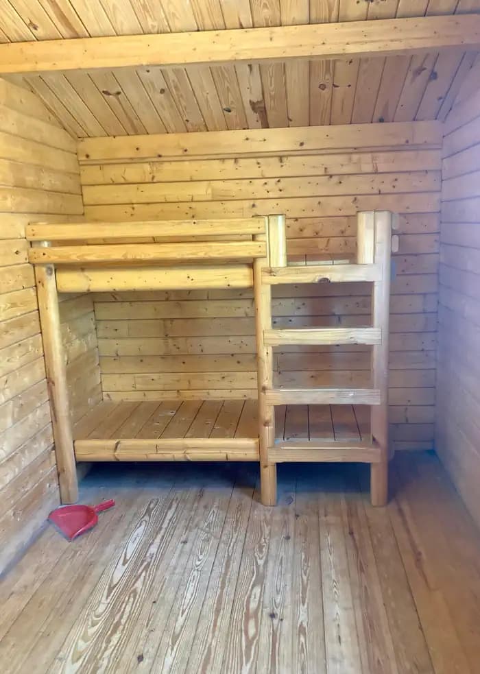
Overview Located in the Cheoah Point Recreation Area in the Nantahala National Forest, this cabin is part of a campground that includes tent and RV sites. The campground is situated on a peninsula in Santeetlah Lake, surrounded by mixed hardwood forest, and this cabin offers a view of the lake. Cheoah Point Cabin 2 is reservable from April 15-October 31. Recreation Cheoah Point Recreation Area includes a campground, swim beach and boat ramp. Santeetlah Lake is ideal for fishing, power boating, non-motorized boating, sailing, jet skiing and water skiing. Anglers can find bass, walleye, trout, crappie and bream. The Wauchecha Bald Trail is located directly across from the recreation area, and starts as an easy hike, becoming more difficult throughout its eight mile length. This trail eventually leads to the well-known Appalachian Trail. Facilities Cheoah Point Recreation Area includes a campground, swim beach and boat ramp. Santeetlah Lake is ideal for fishing, power boating, non-motorized boating, sailing, jet skiing and water skiing. Anglers can find bass, walleye, trout, crappie and bream. The Wauchecha Bald Trail is located directly across from the recreation area, and starts as an easy hike, becoming more difficult throughout its eight mile length. This trail eventually leads to the well-known Appalachian Trail. Natural Features Santeetlah Lake is a man-made reservoir and offers 76 miles of shoreline surrounded by natural forest. There are many coves and inlets to discover and mountain views to enjoy. Birders will find several bird species here. Spotted sandpiper and osprey are sometimes seen in the spring and summer. Red crossbills, green herons and warblers have been known to visit during migration. Nearby Attractions Great Smoky Mountains National Park is just a short distance away, offering an ideal day trip from Cheoah Point Recreation Area.
View details →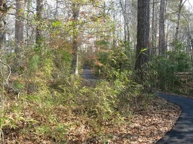
Overview Located in the Neuse River Recreation Area in eastern North Carolina, Flanners Beach Campground is situated on a bluff overlooking the scenic Neuse River and within a half-hour drive from the Atlantic Ocean and Intracoastal Waterway. The campground is extreemly busy and reservations are reccamended but must be made 3 days in advance. Of the 39 campsites, 7 are considered first come-first served campsites that cannot be reserved or held, so a person must physically be there with their camping equipment to purchase the campsite. Flanners Beach campground has the option to use Scan & Pay system, but by the rules of recreaiton.gov it may only be used for first come-first served sites. Please make sure to contact a campground host to ensure availability before paying for any campsite. Failure to check with the campground host for availability may result in the loss of your camping fee. Recreation The area includes a three mile non-motorized trail. Water activities abound and include canoeing, kayaking, and fishing. Hunting is also popular in the area but you must use an alternate location to access the water for these activities. Facilities The area includes a three mile non-motorized trail. Water activities abound and include canoeing, kayaking, and fishing. Hunting is also popular in the area but you must use an alternate location to access the water for these activities. Natural Features The Neuse River is a coastal waterway where saltwater meets fresh, and is approximately two miles wide where the waters meet. The river empties into the Bogue Sound just a few miles down-stream. Nearby Attractions Special places in the area include the Beaches of the Crystal Coast of North Carolina, Tryon Place (the original governor's mansion of the thirteen colonies), the third oldest town in the state and seat of Carteret County, Beaufort, NC, and Fort Macon (an original pre-Civil War Fort). Charges & Cancellations There is a $10.00 fee to cancel Reservations. Reservations canceled within the 3 days of arrival may result in the loss of the fee for one or more nights stay. Refunds for weather or checking out early will not be considered
View details →
Overview Frisco Campground is part of Cape Hatteras National Seashore on the Outer Banks of North Carolina. Camping here will put you in a prime location to experience the history, culture, and breathtaking beauty of North Carolina's barrier islands. Recreation On a walk around the Frisco Campground visitors can enjoy the rolling topography, views of the Atlantic Ocean, and at night, the sweeping beacon of the nearby Cape Hatteras Lighthouse. Boardwalks from the campground to the beach give pedestrians easy access to enjoy activities such as surfing, swimming, and fishing. There is also an off-road vehicle (ORV) ramp at the entrance of the campground for beach driving with a Cape Hatteras ORV permit. Facilities On a walk around the Frisco Campground visitors can enjoy the rolling topography, views of the Atlantic Ocean, and at night, the sweeping beacon of the nearby Cape Hatteras Lighthouse. Boardwalks from the campground to the beach give pedestrians easy access to enjoy activities such as surfing, swimming, and fishing. There is also an off-road vehicle (ORV) ramp at the entrance of the campground for beach driving with a Cape Hatteras ORV permit. Natural Features The elevated dunes in Frisco Campground afford campers the opportunity to have an ocean view from some of the campsites. Dense vegetation creates a sense of privacy not present in the other campgrounds on Cape Hatteras National Seashore. contact_info For facility specific information, please call (252) 475-9054. Nearby Attractions Frisco campground is within a short drive of the historic Cape Hatteras Lighthouse. The beacon gained fame in 1999 when it was picked up and moved 2900 ft. to its current location. It is also the tallest brick lighthouse in the country. Charges & Cancellations Changes and cancellations to reservations follow Recreation.gov polices.
View details →
Overview Oregon Inlet Campground is the northernmost campground on Cape Hatteras National Seashore. When camping here, you are within a short distance of the full service town of Nags Head to the north, and the world class fishing at Oregon Inlet to the south. Recreation The beach adjacent to the campground can be reached by foot from your campsite as well as by vehicle with a Cape Hatteras Off-Road Vehicle Permit. Popular activities include fishing, swimming, surfing, birding, and shell hunting. The calmer waters of the sound to the west of the campground can be accessed at the public boat launch at Oregon Inlet Fishing Center. Popular sound side opportunities include crabbing, clamming, paddle-boarding, boating, and fishing. Facilities The beach adjacent to the campground can be reached by foot from your campsite as well as by vehicle with a Cape Hatteras Off-Road Vehicle Permit. Popular activities include fishing, swimming, surfing, birding, and shell hunting. The calmer waters of the sound to the west of the campground can be accessed at the public boat launch at Oregon Inlet Fishing Center. Popular sound side opportunities include crabbing, clamming, paddle-boarding, boating, and fishing. Natural Features The campground is located on the east side of the barrier island, just a short walk through the dunes to the expansive waters of the Atlantic Ocean. Sea Oats and other native flowering plants blanket the dunes providing a picturesque backdrop for your camping experience. contact_info For facility specific information, please call (252) 475-9054. Nearby Attractions The historic Bodie Island Lighthouse is approximately four miles north of Oregon Inlet Campground on NC Highway 12. The Bodie Island Lighthouse is open seasonally for self-guided climbs. Climb tickets are available on a first come, first served basis and can only be purchased from www.recreation.gov. Tickets go on sale at 7am for that day's climbs only. Tickets may only be purchased on the same day of your intended climb. Coquina Beach Day Use Area is located directly across HWY 12 from the Bodie Island Lighthouse access road. The day use area provides a vehicle free beach perfect for families. From Memorial Day to Labor Day, Coquina Beach is staffed with lifeguards to ensure the safety of visitors. Other amenities at Coquina Beach include a bathhouse with outdoor cold showers, flush toilet restrooms, water fountains, and a boardwalk to the beach. Charges & Cancellations Change Fee: A service fee may be charged at the time a modification is made depending on the changes. Cancellation Fee: A service fee will be withheld from any refunds for a cancelled reservation.
View details →
Overview Curtis Creek Campground is nestled in the mountains at the base of the Blue Ridge just minutes from the quaint town of Old Fort and less than an hour from the popular city of Asheville. Located in the first tract of National Forest land in the eastern US at the site of an old Civilian Conservation Corp (CCC) camp, the campground is surrounded by old growth forests and roaring trout streams. The gravel road through the campground ascends to the Blue Ridge Parkway, providing easy access to the Mount Mitchell area. Recreation Visitors to the campground can enjoy a variety of activities including fishing, swimming, day hiking, picnicking, and scenic driving. Curtis Creek is well known for its excellent trout fishing. Swimming holes along the creek provide wading opportunities on hot summer days. History buffs will enjoy exploring the remains of the old CCC buildings surrounding the campground. Two Forest Service trails depart from the campground. The Hickory Branch trail provides a short (approximately 1/2 mile) hike to a series of waterfalls, and longer hikes to access the backcountry area around Mackey Mountain. Mackey Mountain and the valley of Mackey Creek contain the largest unbroken tract of old-growth forest in the Pisgah National Forest. The Snooks Nose trail provides a strenuous hike to a ridge with beautiful views, eventually ending at the Blue Ridge Parkway. Many other Forest Service trails are within a short drive of the campground, including Catawba Falls and Point Lookout trail. Facilities Visitors to the campground can enjoy a variety of activities including fishing, swimming, day hiking, picnicking, and scenic driving. Curtis Creek is well known for its excellent trout fishing. Swimming holes along the creek provide wading opportunities on hot summer days. History buffs will enjoy exploring the remains of the old CCC buildings surrounding the campground. Two Forest Service trails depart from the campground. The Hickory Branch trail provides a short (approximately 1/2 mile) hike to a series of waterfalls, and longer hikes to access the backcountry area around Mackey Mountain. Mackey Mountain and the valley of Mackey Creek contain the largest unbroken tract of old-growth forest in the Pisgah National Forest. The Snooks Nose trail provides a strenuous hike to a ridge with beautiful views, eventually ending at the Blue Ridge Parkway. Many other Forest Service trails are within a short drive of the campground, including Catawba Falls and Point Lookout trail. Natural Features Located in rich mountain hardwood forests at an elevation of 2,000 feet, Curtis Creek Campground provides a secluded streamside setting. Curtis Creek, a popular trout stream surrounded by lush rhododendron and hemlock, runs along the east side of the campground. Old-growth forests cover the mountain peaks on either side of the valley. The Curtis Creek area provides beautiful scenery year-round, from stunning fall foliage displays to abundant spring and summer wildflowers. Nearby Attractions Curtis Creek Campground is six miles from the town of Old Fort, which has a variety of restaurants, gas stations, grocery stores, and medical facilities. Popular attractions in Old Fort include the Mountain Gateway Museum, the Old Train Depot, Davidson Fort, Catawba Falls, and Andrews Geyser. The campground is seven miles from the scenic Blue Ridge Parkway, close to Mount Mitchell State Park. Visitors can make trips to nearby Black Mountain (15 miles) and Asheville (30 miles) to visit art galleries, shops, and restaurants.
View details →
Overview Otter Creek Campground is located at the Blue Ridge Parkway's lowest elevation, only 649 feet above sea level. Picturesque Otter Creek winds through this quiet, rustic campground. Night skies are spectacular here, and there are several nearby trails to hike including the Otter Creek Trail, which is accessible from the campground. Just imagine enjoying the crackle of an evening campfire with the murmur of the creek in the background! Relax.... Recreation The James River/Otter Creek recreation area has fishing in Otter Lake and a number of hiking trails including Trail of Trees, Otter Creek, Otter Lake Loop, and James River Canal. Hike the Otter Creek Trail to James River Visitor Center . There visitors can view a restored canal lock from the Kanawha Canal, part of the historic James River transporation artery which was once the primary commercial route in the state of Virginia. Facilities The James River/Otter Creek recreation area has fishing in Otter Lake and a number of hiking trails including Trail of Trees, Otter Creek, Otter Lake Loop, and James River Canal. Hike the Otter Creek Trail to James River Visitor Center . There visitors can view a restored canal lock from the Kanawha Canal, part of the historic James River transporation artery which was once the primary commercial route in the state of Virginia. Natural Features This area's abundant water and warmer temperatures support plant and animal communities that are unlike those found at other areas on the Parkway. A short walk along the Trail of Trees or a hike along the clear, cool waters of Otter Creek will give ample proof that there is more to the Blue Ridge Parkway than mountain-top vistas. Nearby Attractions Otter Creek Trail (3.5 miles/5.6 km) parallels the Parkway road as it meanders from Otter Creek campground to the James River Visitor Center. Most sections of this trail are easy to hike and can be reached from many points along the motor road. Otter Lake Loop Trail (0.9 miles/1.4 km) provides scenic views of Otter Lake. This is also a good trail for watching wildlife. Look for beaver lodges and dams along tributary streams. Early morning and late evening are prime times for wildlife observations. Trail of Trees (0.4 miles/.6 km) begins near the James River Visitor Center and wanders through a shaded stream drainage. Trail signs identify many of the trees and shrubs of the river valley. This trail also affords a handsome view of the James River water gap, a rare geological feature. Canal Lock Trail (0.4 miles/.6 km) begins at the visitor center and crosses the James River on a walkway beneath the bridge. The restored Battery Creek Lock, located a short distance from the bridge, is typical of those constructed in the 1800s as part of the James River and Kanawha Canal. This canal, with nearly 100 locks, helped make the river a major transportation corridor before the Civil War. Exhibits at the Battery Creek site explain how locks were used to raise and lower boats to adjust for the changing elevation of the river.
View details →
Overview Cape Point Campground sites have a shortened reservation window. Due to the ground saturation and potential for flooding we encourage you to check the sites prior to paying. Cape Point Campground is centrally located to all of the attractions on Cape Hatteras National Seashore. The campground puts you within walking distance of arguably the best fishing and surfing on the east coast. Recreation A short walk through the dunes leads you to the beach at the infamous Cape Hatteras. Many trophy fish have been landed from the point, and it has been a surfing destination for decades. If you prefer to drive to the beach you can access one of the many off-road vehicle ramps within a short distance of the campground. Exploration of the barrier islands beyond their beaches is possible on a hike through the nearby maritime forest. The Buxton Woods Trail is a 3/4 mile loop that can be accessed just north of the campground at the Buxton Woods Picnic Area on Lighthouse Road. Facilities A short walk through the dunes leads you to the beach at the infamous Cape Hatteras. Many trophy fish have been landed from the point, and it has been a surfing destination for decades. If you prefer to drive to the beach you can access one of the many off-road vehicle ramps within a short distance of the campground. Exploration of the barrier islands beyond their beaches is possible on a hike through the nearby maritime forest. The Buxton Woods Trail is a 3/4 mile loop that can be accessed just north of the campground at the Buxton Woods Picnic Area on Lighthouse Road. Natural Features The campground is nestled between rolling dunes to the south and the largest remaining tract of maritime forest on the North Carolina coast to the north. The environment is naturally suited to accommodate many bird and mammal species. A large heard of white tail deer frequent the area. Nearby Attractions The iconic Cape Hatteras Lighthouse is located just north of Cape Point Campground on Lighthouse Road next to the Visitor Center. Standing at 198 feet, Cape Hatteras Lighthouse is the tallest brick lighthouse in the United States. It has undoubtedly saved the lives of many mariners navigating around the treacherous Diamond Shoals. The Museum of the Sea is also located near the Visitor Center within the shadow of the lighthouse. The museum's operating hours vary with the season. Buxton Beach is a family friendly swimming destination staffed with lifeguards from Memorial Day to Labor Day. It is a short walk or bike ride from the campground. Parking is available at the old lighthouse site adjacent to the current location of the Cape Hatteras Lighthouse. contact_info For facility specific information, please call (252) 475-9054.
View details →
Overview Oyster Point Campground is located on the banks of the Newport River, near the town of Newport, NC. The campground is just a short drive to the beaches of Atlantic Beach, NC and other coastal fishing destinations. The campground can get very busy and reservations are reccamended but must be made 3 days in advance. Of the 15 campsites, 1 are considered a first come-first served campsite that cannot be reserved or held, so a person must physically be there with their camping equipment to purchase the campsite. Oyster Point campground has the option to use Scan & Pay system, but by the rules of recreaiton.gov it may only be used for first come-first served sites. Please make sure to contact a campground host to ensure availability before paying for any campsite. Failure to check with the campground host for availability may result in the loss of your camping fee. Recreation Canoeing and fishing are popular options. Power boating is allowed on the Newport River, however, the boat lanch at this location is a small hand launch with no vehicle access that you may use a canoe or kayak cart/dolly for assistance to get your boat to the water if desired. The Croatan Saltwater Trail weaves south between the barrier islands of the Bogue Sound and north on Adams Creek connecting to the Neuse River. This campground is also the trailhead for the Neusiok trail which is a 21-mile hiking trail that meanders through cypress swamps, loblolly pines and vast bogs of thick vegetation. Facilities Canoeing and fishing are popular options. Power boating is allowed on the Newport River, however, the boat lanch at this location is a small hand launch with no vehicle access that you may use a canoe or kayak cart/dolly for assistance to get your boat to the water if desired. The Croatan Saltwater Trail weaves south between the barrier islands of the Bogue Sound and north on Adams Creek connecting to the Neuse River. This campground is also the trailhead for the Neusiok trail which is a 21-mile hiking trail that meanders through cypress swamps, loblolly pines and vast bogs of thick vegetation. Natural Features Situated in the coastal pine forest and intercostal waterway of the Croatan National Forest, which encompasses 160,000 acres in eastern North Carolina, the Newport River is 12 miles long and opens into the Bogue sound. It is popular with anglers and flatwater paddlers. Nearby Attractions The campground is just a short drive to the towns of Newport, NC and Morehead City, NC. These towns offer full service grocery, retail, and an abundant selection of restaurants. Charges & Cancellations There is a $10.00 fee to cancel Reservations. Reservations canceled within the 3 days of arrival may result in the loss of the fee for one or more nights stay. Refunds for weather or checking out early will not be considered
View details →
Overview Rocky Bluff Campground offers solitude in a wooded setting located just 3 miles south of the quaint town of Hot Springs and the majestic French Broad River. The campground is conviently located off of NC Scenic Byway 209 in the Spring Creek Gorge Area. Recreation Recreation opportunities abound in and around the Hot Springs area. Located on the Appalachian District of the Pisgah National Forest, Rocky Bluff Campground itself is host to three different trail heads. If you are looking for longer-distance hiking opportunities, the famous Appalachian Trail runs right through the town of Hot Springs. Other popular recreation in the area include white water rafting, kayaking, tubing and fishing on the French Broad River. Facilities Recreation opportunities abound in and around the Hot Springs area. Located on the Appalachian District of the Pisgah National Forest, Rocky Bluff Campground itself is host to three different trail heads. If you are looking for longer-distance hiking opportunities, the famous Appalachian Trail runs right through the town of Hot Springs. Other popular recreation in the area include white water rafting, kayaking, tubing and fishing on the French Broad River. Natural Features Rocky Bluff Campground located near Spring Creek, a North Carolina Mountain Heritage Trout Water . Winding it's way through deciduous oak forests, stocked with Brook, Brown and Rainbow trout, this creek is touted as a trout angler's paradise, making Rocky Bluff a perfect destination for your fishing camp. Nearby Attractions Hot Springs has been a well-known relaxation destination for centuries. The natural hot springs are a main draw for the town, along with the abundance of recreation. Visitors can also find several restaurants, art galleries, shopping, live music and festivals here.
View details →
Overview Black Mountain Campground sits in the shadow of Mt. Mitchell, the highest peak in the eastern U.S. and borders the South Toe River. Black Mountain is a mecca for the outdoor enthusiast. Recreation With the South Toe River located adjacent to the campground, visitors will have no shortage of things to do, including picnicking, day hiking, scenic driving and trout fishing. Hikers will be pleased with a variety of trails from which to choose, including a leisurely half-mile walk through the forest or a challenging 5.6-mile hike to Mt. Mitchell. Facilities With the South Toe River located adjacent to the campground, visitors will have no shortage of things to do, including picnicking, day hiking, scenic driving and trout fishing. Hikers will be pleased with a variety of trails from which to choose, including a leisurely half-mile walk through the forest or a challenging 5.6-mile hike to Mt. Mitchell. Natural Features The campground sits at an elevation of 3,040 feet. The 6,684-foot Mt. Mitchell towers over the area, with several other high peaks of the Black Mountains nearby. This lush Appalachian forest is rich with wildlife, plants and scenery. Nearby Attractions Groups can easily head out for a day of scenic driving along Blue Ridge Parkway or hiking in Mount Mitchell State Park.
View details →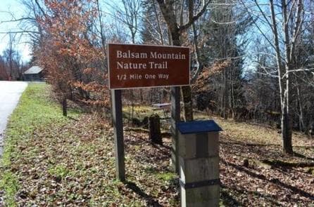
Overview Balsam Mountain Campground is located in a relatively remote part of Great Smoky Mountains National Park. The secluded setting offers visitors the ability to enjoy a multitude of recreational activities without the crowds which are sometimes common in other parts of the park. Recreation Great Smoky Mountains National Park is a hiker's paradise, with over 800 miles of maintained trails ranging from short, leg-stretchers to strenuous treks. The Balsam Mountain area features several trails that are less heavily used compared to other areas of the park. The campground offers a short nature trail located beside site 43. The hiker only Flat Creek Trail is a pleasant walk through a hardwood forest. For the adventurous hiker the Hemphill Bald and Rough Fork trails provide a 14-mile loop hike, with outstanding views and old growth trees. Campers can enjoy high-quality backcountry fishing in the cool waters of the countless streams and rivers that snake through the mountains. Anglers will agree that some of the best trout fishing in the area can be found along the Balsam Mountain and Straight Fork Roads, some of the most remote sections of the park. Fly fishing is particularly good during spring months when aquatic insects hatch in large numbers. Wildlife viewing is a popular pastime, and with around 1,500 bears living in the park, it is not uncommon for visitors to spot one. The park is a sanctuary for a magnificent array of animal and plant life, all of which is protected for future generations to enjoy. The park also holds one of the best collections of log buildings in the eastern United States. Over 90 historic structures have been preserved in the park. For the auto touring enthusiast, the 14-mile Heintooga Round Bottom Road, a one-way unimproved gravel drive, offers spectacular scenery with mountain vistas and the occasional bear or elk sighting. Buses, motorhome, vans longer than 25' and any vehicle towing a trailer are prohibited on this road. Facilities Great Smoky Mountains National Park is a hiker's paradise, with over 800 miles of maintained trails ranging from short, leg-stretchers to strenuous treks. The Balsam Mountain area features several trails that are less heavily used compared to other areas of the park. The campground offers a short nature trail located beside site 43. The hiker only Flat Creek Trail is a pleasant walk through a hardwood forest. For the adventurous hiker the Hemphill Bald and Rough Fork trails provide a 14-mile loop hike, with outstanding views and old growth trees. Campers can enjoy high-quality backcountry fishing in the cool waters of the countless streams and rivers that snake through the mountains. Anglers will agree that some of the best trout fishing in the area can be found along the Balsam Mountain and Straight Fork Roads, some of the most remote sections of the park. Fly fishing is particularly good during spring months when aquatic insects hatch in large numbers. Wildlife viewing is a popular pastime, and with around 1,500 bears living in the park, it is not uncommon for visitors to spot one. The park is a sanctuary for a magnificent array of animal and plant life, all of which is protected for future generations to enjoy. The park also holds one of the best collections of log buildings in the eastern United States. Over 90 historic structures have been preserved in the park. For the auto touring enthusiast, the 14-mile Heintooga Round Bottom Road, a one-way unimproved gravel drive, offers spectacular scenery with mountain vistas and the occasional bear or elk sighting. Buses, motorhome, vans longer than 25' and any vehicle towing a trailer are prohibited on this road. Natural Features Balsam Mountain Campground is surrounded by picturesque mountain ranges and pristine mountain streams. Elk are common in this part of the park during the spring and fall. Located at 5,310 feet elevation, Balsam Mountain's daytime temperatures rarely exceed 70 degrees F and night time temperatures may dip into the low 50's. Nearby Attractions Nearby attractions include: Maggie Valley, NC, Cherokee, NC, the Oconaluftee Visitor Center, the Mountain Farm Museum, the Blue Ridge Parkway, the Nantahala Outdoor Center, the Bryson City Railway and Asheville, NC
View details →FAQ
Camping in North Carolina
How many campgrounds are listed in North Carolina?
TheCampVerse currently lists 54 campgrounds in North Carolina.
What campground types are most common in North Carolina?
The most common campground types are Campground.
How can I compare campgrounds in North Carolina?
Use the campground cards and featured links on this page to compare descriptions, amenities, and details before opening each campground profile.
Keep exploring