
Campgrounds in Oregon
Camp among diverse landscapes from coastal beaches to mountains in the Beaver State
200
Campgrounds listed
100%
With photos
99%
Detailed descriptions
Campground
Top campground type
Common types in Oregon: Campground · Facility
Highlights
Featured campgrounds in Oregon
Explore by campground name letter
Jump to A-Z landing hubs for stronger discovery paths beyond Oregon.
All campgrounds
Showing 200 campgrounds

Located south of Prineville, Oregon, this six-site campground offers year-round camping and Crooked River access along the Lower Crooked Back Country Byway. Castle Rock looms above its namesake campground on the Chimney Rock section of the Crooked WIld and Scenic River. An ADA-accessible vault toilet is onsite. Know Before You Go: Open year-round on a first-come, first-served basis; no potable water available. Cell phone service is not available in the campground. Watch for bicyclists: the section of State Highway 27 between Prineville and Bowman dam is a state scenic bikeway Point of Interest: Castle Rock Campground is the first in a series of twelve Bureau of Land Management recreation sites along the Crooked Wild and Scenic River, south of Prineville, Oregon. Eight additional campgrounds, two day-use areas and a trailhead offer ample access to camping, fishing, hiking and photography.
View details →
Stillwater Campground offers ten large, partially-shaded campsites along a placid stretch of the Lower Crooked Wild and Scenic River. Some pull-through campsites as well as day-use parking are available in the recreation site. Know Before You Go: Open year-round on a first-come, first-served basis; no potable water is available. Cell phone service is not available in the campground. When recreating on public lands, practice Leave-No-Trace Principles. Watch for bicyclists: the section of road between Prineville and Bowman Dam is a state scenic bikeway Point of Interest: The Chimney Rock segment of the Crooked River is characterized by a mostly steady gradient in the wild and scenic segment. Stillwater Campground is situated along one of the quiet locations of flatwater alluding to its name.
View details →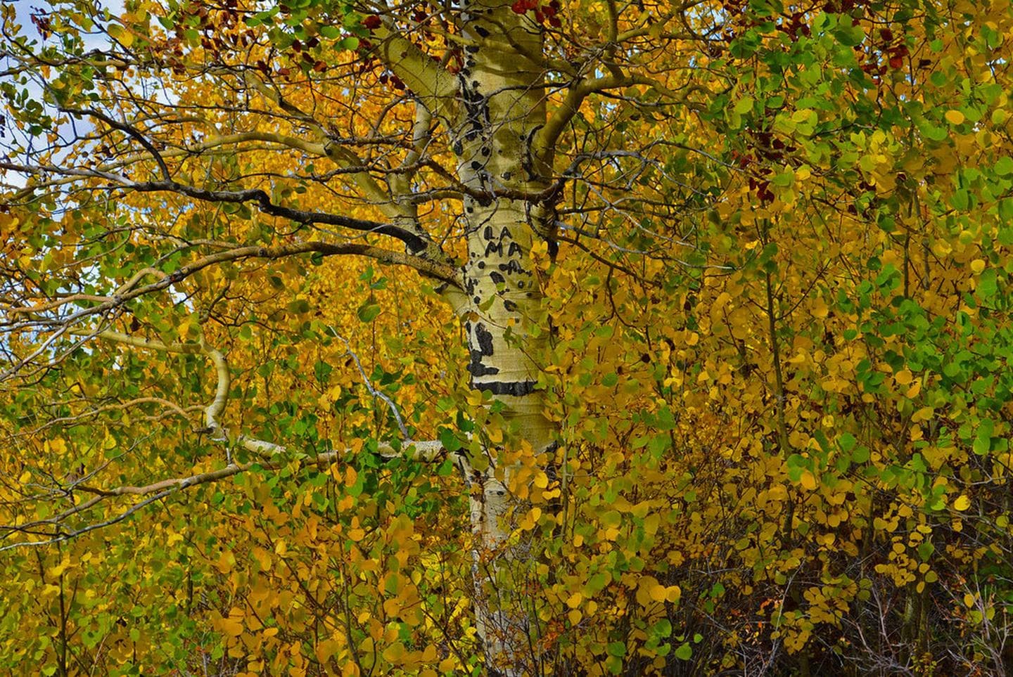
Jackman Park Campground is located on the flanks of Steens Mountain, within the Steens Mountain Cooperative Management and Protective Area (CMPA). This area encompasses an extraordinary landscape with deep glacier carved-gorges, stunning scenery, wilderness, wild rivers, a rich diversity of plant and animal species, and a way of life for all who live there. At 7,800-foot elevation and set among aspen stands, Jackson Park Campground offers some of the best fall color viewing on Steens Mountain. Know Before You Go: Open Season Jackman Park Campground is open mid-June through October. High clearance vehicles recommended on some portions of the Steens Mountain Loop. 6 Campsites with picnic tables and fire grates; first come, first serve. Universal Access Restroom available. Please pack out your trash. Mountain weather can be unpredictable and change suddenly. Ticks, mosquitos, and rattlesnakes may be present during summer months. The nearest services are in the communities of Fields, Frenchglen, Crane, or Narrows, Oregon. Point of Interest: The Jackman Park Campground is located near the Kiger Gorge Overlook with views of the Gorge’s glacially-carved, U-shaped valley and, if you are lucky, it’s famous herd of wild horses.
View details →
Situated on the banks of the Deschutes Wild and Scenic River, Mecca Flat Campground is located just a mile and a half from Oregon State HIghway 26 near Warm Springs. The site features 13 individual campsites and one group use area. The southern terminus of the 7-mile long Trout Creek Trail can be accessed directly from the campground. Know Before You Go: All campsites, including the group use area are open year-round on a first-come, first-served basis; no potable water is available. The 1.6 mile Mecca Flat Road is narrow with few pullouts; use caution particularly when pulling a trailer. Access the nearby non-motorized Trout Creek Trail which fronts the Deschutes Wild and Scenic River for 7 miles where it terminates at Trout Creek Campground . Cell phone service is not available in the campground. Goathead, also known as puncturevine, is present in the area; protect your pets and bicycle tires Point of Interest: The Deschutes Railroad ran on portions of the nearby Trout Creek trail and Mecca Flat Road for several decades, competing with the Oregon Trunk Railroad before abandonment in the early 20th century. Look for the historic, now-abandoned tunnel near Highway 26 - but stay clear of this degrading and unstable structure.
View details →
Unlike most of the other campgrounds along the Crooked River, this 14.5-acre campground is set back some from the Lower Crooked Back Country Byway, providing some isolation. Campground facilities include fourteen mostly broad, spacious campsites, vault toilets and an accessible fishing pier. All but one of the campsites are at river level and accessed by a single-lane road. Know Before You Go: Open year-round on a first-come, first-served basis. No reservations are accepted. Potable water is available year-round at the upriver Chimney Rock Campground, 0.8 miles north on State HIghway 27. Cell phone service is not available in the campground. Watch for bicyclists: the section of State Highway 27 between Prineville and Bowman Dam is designated as the Crooked River Canyon Scenic Bikeway. Point of Interest: The site takes its name from nearby rock outcrops composed of basaltic lava which form the steep, formidable cliff faces across the river from the campground.
View details →
Centered around a single, sentinel Ponderosa Pine tree, this small campground features six campsites and a group use area. Across the Crooked River, the photogenic Rocky Canyon and it’s vertical rimrock cliffs offer photographers a variety of ever-changing light and depth perspectives. Know Before You Go: Open year-round on a first-come, first-served basis. No reservations are accepted. Potable water is available year-round at Chimney Rock Campground, 1.7 miles miles west (upriver) on State HIghway 27. Cell phone service is not available in the campground. Watch for bicyclists: the section of State Highway 27 between Prineville and Bowman Dam is designated as the Crooked River Canyon Scenic Bikeway. Point of Interest: Since 2008, reintroduction of Steelhead trout has been underway in the Deschutes River Basin, which includes the wild and scenic Chimney Rock segment of the Crooked River. The success of this reintroduction is in part dependent on stresses placed on this fish. Anglers should keep them in the water and release them immediately; the harvesting of Steelhead in the Crooked River is unlawful.
View details →
This sprawling 4.4-acre campground offers year-round camping and Crooked Wild and Scenic River access along the Lower Crooked Back Country Byway. Campground facilities include fourteen campsites, some with riverside shading beneath large Ponderosa pine trees. Know Before You Go: Open year-round on a first-come, first-served basis. No reservations are accepted. Potable water is available year-round at the nearby Chimney Rock Campground, one mile north on State HIghway 27. Cell phone service is not available in the campground. Watch for bicyclists: the section of State Highway 27 between Prineville and Bowman Dam is designated as the Crooked River Canyon Scenic Bikeway. Point of Interest: Situated on a bench above the Chimney Rock section of the Crooked River, Cobble Rock Campground is a popular basecamp for fly fishing enthusiasts.
View details →
Located south of Prineville, Oregon, this campground offers year-round camping and Crooked Wild and Scenic River access along the Lower Crooked Back Country Byway. Cooperatively managed in partnership with the Bureau of Reclamation and Oregon Parks and Recreation Department, this campground's facilities include 13 campsites, one group use area and a day-use area with access to the Crooked Wild and Scenic River. Know Before You Go: Open year-round on a first-come, first-served basis. No reservations are accepted. Potable water is available during the warmer spring and summer months. Cell phone service is not available in the campground. Watch for bicyclists: the section of State Highway 27 between Prineville and Bowman Dam is designated as the Crooked River Canyon Scenic Bikeway. Point of Interest: Looming 240 feet above the campground, the mighty Arthur R. Bowman Dam retains the waters of the 3,030-acre Prineville Reservoir, a popular spot for fishing and other water-based activities. At 1.6 miles away from Big Bend Campground, the boat ramp at Powderhouse Cove provides the nearest reservoir access.
View details →
Overview The Crescent Lake Yurts are located within Crescent Lake Campground on the northwestern shore of Crescent Lake at the eastern base of the Cascade mountain range. Yurts are managed by the Crescent Ranger District of the Deschutes National Forest. Recreation The Crescent Lake area offers a wide-variety of recreation opportunities. The Crescent Lake Day Use Area provides boat launch access to the lake. Crescent Lake is a popular destination for boating, swimming, fishing and paddling. Fawn Lake Trailhead departs from the Crescent Lake Campground and Day Use Area providing hiking access into the Diamond Peak Wilderness. Facilities The Crescent Lake Yurts feature three individual yurt sites located within the Crescent Lake Campground. Furnished yurts include one bunkbed with one double and one single mattress, one double futon, table and chairs and a wood stove. Each yurt site also features a fire ring and picnic table. During summer months, visitors have access to drinking water within the Crescent Lake Campground. Yurts do not have electricity. Visitors should be prepared to bring their own linens, cooking utensils and lighting source. Natural Features Crescent Lake sits within a glaciated basin behind a moraine dam east of the Cascade mountain range in northern Klamath County. From within the Crescent Lake basin, visitors will catch views of Diamond Peak and the unique Cowhorn Mountain. Crescent Lake is a popular recreation destination with brilliant blue-green water and sandy beaches. The Crescent Lake Yurts are situated within a predominately ponderosa pine stand on the western edge of the Crescent Lake Campground. contact_info This location is unstaffed. To speak with our main office for general information, please call: (541) 433-3200. Nearby Attractions Cascade Lakes Scenic Byway Crescent Lake Diamond Peak Wilderness Odell Lake Charges & Cancellations A customer who cancels a reservation the day before or on the day of arrival will pay a $10.00 service fee AND forfeit the first night's use fee (not to exceed the total paid for the original reservation). Cancellations for a one-night reservation will forfeit the entire amount paid and will not be subject to an additional service fee. Changes or Cancellations within the Cut-off Window: Once a reservation date has begun, customers cannot change a reservation using the online system or through the Call Center.
View details →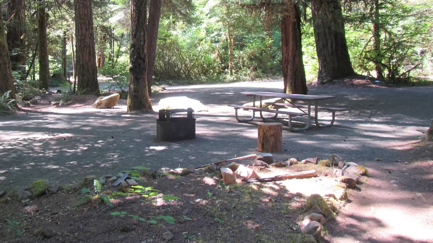
Overview Reservations must be made 5 days prior to arrival. Disregard the "FF" (First-Come-First-Serve) availability. We do not allow on-site transactions. Off the beaten path, this minimally developed campground along Canton Creek features riverside picnic sites, drinking water spigots, and a vault restroom facility. Nearby, there are several outstanding undeveloped swimming holes along both Canton and Steamboat Creeks. Canton Creek and Steamboat Creek are closed to all angling. Just 3 miles downstream from Scaredman, the North Umpqua River offers world-class fly-fishing. Recreation Picnicing, relaxing, and swimming are the primary recreation activites taking place at Cavitt Creek Recreation Site. Fishing and whitewater rafting activites can take place just 3 miles downstream on the North Umpqua River. Facilities Picnicing, relaxing, and swimming are the primary recreation activites taking place at Cavitt Creek Recreation Site. Fishing and whitewater rafting activites can take place just 3 miles downstream on the North Umpqua River. Natural Features The recreation site is remote in heavily wooded area of different species. The campground and day-use area are at 1390' along a creek and many waterfalls, rivers, and forests are in the surrounding region. Nearby Attractions Within a short drive from the campground you can have opportunities for day of rafting on the North Umpqua, fishing, hiking, viewing waterfalls, or driving along the Rogue - Umpqua National Scenic Byway. Just 3 miles downstream from Canton Creek is Steamboat Creek, a short tributary of the North Umpqua River, that can provide many opportunites for swimming.
View details →
Overview Ivan Oakes Campground is located on Lookout Point Lake in Oregon's Willamette Valley. Recreation Ivan Oakes Campground is located on the northern shore of Lookout Point Lake in the Calapooya Mountains. The Eugene-to-Pacific Crest Trail (EPCT), a 108 mile long recreation trail that connects the city of Eugene to the Cascade mountain range, runs along the campground providing easy access for hikers. The reservoir is a popular fishing spot with chinook salmon, walleye, rainbow trout, largemouth bass, and crappie. Facilities Ivan Oakes Campground is located on the northern shore of Lookout Point Lake in the Calapooya Mountains. The Eugene-to-Pacific Crest Trail (EPCT), a 108 mile long recreation trail that connects the city of Eugene to the Cascade mountain range, runs along the campground providing easy access for hikers. The reservoir is a popular fishing spot with chinook salmon, walleye, rainbow trout, largemouth bass, and crappie. Natural Features Located in the Calapooya Mountains, Ivan Oakes is surrounded by woodland. With close proximity to the Willamette National Forest, the area is home to lots of wildlife. The weather is generally mild during the recreation season with temperatures ranging from the low 50s to the upper 90s. Chances of precipitation are high from May through mid-June. Charges & Cancellations Reservation changes or cancellations can be made through Recreation.gov or by calling 1-877-444-6777. Cancelling/Changing a Reservation A $10.00 service fee will apply if you change or cancel your reservation. The $10.00 service fee will be deducted from the refund amount. Depending on when you cancel in relation to your arrival day, it may be considered a late cancellation (see below). Late Cancellations Individual Campsites: A customer who cancels a reservation the day before or on the day of arrival will pay a $10.00 service fee AND forfeit the first night's use fee (not to exceed the total paid for the original reservation). Cancellations for a one-night reservation will forfeit the entire amount paid and will not be subject to an additional service fee. Group Facility: Customers who cancel a group overnight facility reservation less than 14 days before the arrival date will pay a $10.00 service fee AND forfeit the first night's use fee. No-Shows A no-show customer is one who does not arrive at a campground and does not cancel the reservation by check-out time on the day after the scheduled arrival date. Staff will hold a campsite until 2pm on the day following the scheduled arrival date. No-shows are assessed $20.00 service fee and forfeit the first night’s recreation fee for a campsite. Early Departures If a customer departs prior to the scheduled check-out date, they may be eligible for a partial refund. Please notify staff at the facility if you depart early to allow others to use the site. Customers may notify the call center to request a refund of remaining unused nights. If a customer requests a refund for an early departure after the facility check-out time has passed, the customer will not be refunded for that night and is eligible for a refund on any additional nights that will not be used. Refunds Customers may submit a refund request through their Recreation.gov profile within 7 days of the end date of their reservation. Customers may also initiate a refund request through the call center at any time after their reservation has ended. Debit or Credit Card Purchases: Refunds for debit or credit card payments will be issued as a credit to the original card used to pay. Check or Cash Purchases: Recreation.gov will mail a Treasury check for refunds of cash, check, or money order payments to the address associated with the reservation. You may update the address at the time you request the refund. It may take up to 6-8 weeks for the Treasury check to arrive. Please make sure your address is up to date in your customer profile.
View details →
Located at the mouth of its namesake canyon and along the scenic Lower Deschutes River Back Country Byway, Rattlesnake Canyon Campground is located 20.4 miles north of the city of Maupin, Oregon. Several campsites in the campground offer direct river access along a verdant strip of riparian vegetation. Know Before You Go: Rattlesnake Canyon Campground is open year-round with 8 individual campsites, one group-use campsite, a vault toilet and garbage service. No drinking water or utility hookups are available. No reservations are accepted; all campsites are on a first-come, first-served basis only. Campfires and smoking are allowed only from October 16 through May 31, annually, unless posted otherwise. When recreating on public lands, practice the Leave-No-Trace Principles . Point of Interest: Rattlesnakes? Yes, but they are out and about in all low elevation desert river canyons in the region. As predators, rattlesnakes play an important ecological role in keeping small mammal populations in check. Please observe rattlesnakes from a safe distance and do not attempt to engage with them; they want to avoid you as much as you may want to avoid them.
View details →
Featuring riverside campsites and a steep, primitive boat launch this cozy campground is a little bit away from the summertime busyness of nearby Maupin. One campsite offers limited shade so you’ll have to bring your own for the other sites. Know Before You Go: Long Bend Campground is open year-round and is with 4 campsites, one vault toilet and garbage service. No drinking water or utility hookups are available. No reservations are accepted; all campsites, are available on a first-come, first-served basis only. Campfires and smoking are allowed only from October 16 through May 31, annually, unless posted otherwise. When recreating on Public Lands, please practice the seven Leave-No-Trace Principles . Point of Interest: Long Bend offers a quieter alternative to the hubbub of nearby Harpham Flat Campground.
View details →
Overview Nestled in a cove between Hoodview and Gone Creek, Stone Creek includes a day-use area with a non-motorized boat access, trail access, picnicking and a view of Mt. Hood. Separate tent and RV loops limit the sound of generators. Two equestrian-friendly group camps are located across the road. Recreation Proximity to Timothy Lake allows campers to enjoy a variety of water-related recreation activities, including boating and sailing, as well as swimming, windsurfing and fishing. Anglers can expect a catch of kokanee salmon and a variety of trout. A range of trails are located in the area. The Timothy Lake Trail is popular for hiking, mountain biking and horseback riding. The 12 miles of relatively level terrain loops trekkers around the lake, providing scenic views of the area. It connects to the Pacific Crest National Scenic Trail, a lengthy hike that extends across three states, from the borders of Canada and Mexico. Portions of that trail also lead southwest to Clackamas Lake Campground. The Clackamas Lake Ranger Station Historic District is less than 3 miles from the campground. It was built to house forest service workers in the early 1900s. The rustic architecture and historic nature of the buildings and the surrounding area draws thousands of tourists each year. Facilities Proximity to Timothy Lake allows campers to enjoy a variety of water-related recreation activities, including boating and sailing, as well as swimming, windsurfing and fishing. Anglers can expect a catch of kokanee salmon and a variety of trout. A range of trails are located in the area. The Timothy Lake Trail is popular for hiking, mountain biking and horseback riding. The 12 miles of relatively level terrain loops trekkers around the lake, providing scenic views of the area. It connects to the Pacific Crest National Scenic Trail, a lengthy hike that extends across three states, from the borders of Canada and Mexico. Portions of that trail also lead southwest to Clackamas Lake Campground. The Clackamas Lake Ranger Station Historic District is less than 3 miles from the campground. It was built to house forest service workers in the early 1900s. The rustic architecture and historic nature of the buildings and the surrounding area draws thousands of tourists each year. Natural Features The campground is situated on the southeastern shore of the roughly 1,400-acre lake, at an elevation of 3,400 feet. Timothy Lake was created in 1956 as a storage reservoir for the Oak Grove Hydroelectric Project. It is one of the larger lakes in the Mt. Hood National Forest. The campground is nestled in a mixed conifer forest. The day use area offers views of Mt. Hood. A thick understory of rhododendron bushes provide privacy between sites. Nearby Attractions Stone Creek is about 28 miles from the base of majestic Mt. Hood, the highest point in Oregon. The historic Timberline Lodge in Government Camp offers scenic views of the snow-capped mountain. Charges & Cancellations A service fee will apply if you change or cancel your reservation. Late cancellations are subject to additional fees. For full details see the Recreation.gov Rules & Reservation Policies.
View details →
Located just off of the sleepy John Day Highway, this campground offers 8 primitive campsites and an unimproved boat launch accessing the John Day River. The ancient river canyon weaves through the area providing spectacular views with ever-changing light and shadows in the early morning and late evening hours. A picturesque grove of ponderosa pine trees lines a section of the riverbank opposite the campground and the site itself has a large, solitary pine prominently situated. The surrounding layer cake geology is exposed in various peekaboo angles from the campground. Know Before You Go: Open year-round Six drive-in campsites; two walk-to campsites. All campsites are available on a first come, first served basis; no reservations are available. Two wheelchair accessible vault toilets. No utility hookups or potable water are available No garbage service - please pack out your trash An annual fire closure is in effect from June 1 through October 15. Prohibited acts include building, igniting, maintaining, attending, using, tending, or being within 20 feet of a campfire, charcoal fire, or any other type of open flame; smoking, except while in non-public buildings, closed vehicles, in boats on the water, or while standing in the water. Point of Interest Although located along State highway 19 the sights and sounds of the John Day River dominate over any road noise making it easy to forget the highway is even there. Bring a book as there's no cell phone coverage here.
View details →
Set away from the Lower Deschutes Back Country Byway,
View details →
-
View details →
Overview East Dunes Campground is ideal for off-road vehicle lovers, with year-round access to nearly 1,100 acres of coastal sand dunes. The 61-site campground is part of the Sand Lake Recreation Area and home to a sand dune playground. Parking aprons are paved. Campground amenities include drinking water, flush toilets, campfire rings. Sites 1-35 are reservable up to 14 days prior to arrival for stays up to 14 days (Lower East Dunes Parking Lot) Sites 36-39 are first-come, first serve Day-Use sites ONLY, please pay at credit card machine in West Winds Campground (Lower East Dunes Parking Lot) Sites 40-61 are reservable up to six months in advance all year for stays up to 14 days (Upper East Dunes Parking Lot) PLEASE RESERVE YOUR SITE BEFORE ARRIVAL!!! LIMITED CELL PHONE SERVICE!!! Recreation Off-road vehicle riding is the primary attraction for campers. The nearby Sand Lake Estuary offers fishing, swimming, crabbing, kayaking, hiking, and wildlife viewing. The near-natural state of the 900-acre estuary provides a home to many species of waterfowl. Facilities Parking aprons are paved. Campground amenities include drinking water, flush toilets, and campfire rings. There are 61 total sites. There is limited cell phone service, but plans are to have cell phone boosters soon. Natural Features The climate has strong marine influences with cool summers and moderate winters. The Sand Lake Area includes 1,076 acres of open sand dunes, surrounded by forests, adjacent to the Pacific Ocean. contact_info For facility specific information, please call (503) 392-5100.
View details →
Overview Flag Point Lookout is situated on the eastern side of Mt. Hood and is surrounded by the Badger Creek Wilderness, the lookout boasts a spectacular panorama view of snow-covered treetops and rugged Cascade peaks. It provides access to a variety of recreational opportunities, including fishing, hiking and wildlife viewing, as well as winter sports. During summer driving conditions the lookout can be accessed by driving, 4WD or AWD is highly recommended. During winter driving conditions, the lookout can only be accessed by skiing, snowmobiling or snowshoeing either 10 or 17 miles from a parking area at Billybob Sno-park or Little John Sno-park. Winter driving conditions can occur in early fall and persist late into the spring. A Northwest Forest Pass is required for the parking area at Billy Bob Sno-park, annual or day passes can be purchased in person at the Hood River Ranger Station or online at https://www.discovernw.org/annual-northwest-forest-pass. An ODOT Sno-park pass is required for parking at Little John Sno-park and can be purchased at local vendors or online at https://www.oregon.gov/ODOT/DMV/pages/vehicle/sno_park_permits.aspx. Guests are responsible for their own travel arrangements and safety, and must bring several of their own amenities. Basic overnight amenities such as a wood heating stove, gas cook stove, full size bed, cooking utensils, firewood, and a pit toilet are provided. Recreation In the summer months, visitors enjoy hiking, horseback riding and mountain biking in the area, as well as the gorgeous views from the lookout. The lookout is near Fifteenmile Campground, and an established network of trails within the Badger Creek wilderness. The area is popular among winter sports enthusiasts as well, as the location provides access to numerous cross country skiing, snowshoeing and snowmobiling trails. It is a shared winter recreation area and lookout guests should expect other winter sports enthusiasts in the area. Facilities In the summer months, visitors enjoy hiking, horseback riding and mountain biking in the area, as well as the gorgeous views from the lookout. The lookout is near Fifteenmile Campground, and an established network of trails within the Badger Creek wilderness. The area is popular among winter sports enthusiasts as well, as the location provides access to numerous cross country skiing, snowshoeing and snowmobiling trails. It is a shared winter recreation area and lookout guests should expect other winter sports enthusiasts in the area. Natural Features The tower sits on in the center of the Badger Creek Wilderness, at 5,500ft of elevation, on the south east side of Mt. Hood. Of the nine peaks in Oregon's Cascade Mountain Range, Mt. Hood stands the tallest, at 11,239 feet. It is thickly forested and capped with glaciers and snow. The lookout tower is one of three Forest Service watchtowers on Mt. Hood and it is still used to spot fires during summertime each year. A variety of wildlife make its home in the area. contact_info For facility specific information, please call (541) 467-2291.
View details →
Let the sounds of the babbling North Fork of the Malheur River lull yourself to sleep at one of the riverside campsites of Chukar Park Campground. This primitive facility offers 19 campsites, seven of which are situated along the shady, lush riparian vegetation. Popular as a base camp with birders, hunters and fishers as well as those venturing through along nearby highway 20, Chukar Park has campsites with partial shade and in full sun. Note that the high-standard, graded county road leading to the campground may form washboard ridges between gradings. Know Before You Go Open year-round with camp host present, generally late April through November. All campsites are available on a first come, first served basis; no reservations are available. Potable water is available but no showers are offered. No cell phone is coverage available in the campground but some carrier coverage is available in nearby Juntura. This is a primitive campground; no hookups or RV dump station is present. Mosquitoes can be voracious, particularly in the spring. Puncture vine, also known as goathead, is present in some areas of the campground, so be aware for your pet's sake.
View details →
Nestled in a side canyon near the mouth of Leslie Gulch, Slocum Creek Campground makes a good base for gulch explorations. Cool off in the waters of nearby Lake Owyhee or hike the Leslie Gulch Area of Critical Environmental Concern. The campground includes nine campsites, eight of which contain some accessible amenities. The low light of early morning and late evening transforms the abutting rock outcrops of Slocum Creek Wilderness Study Area into magnificent fiery wonder. Know Before You Go Camping and fires are limited to the Slocum Creek campground. Maximum stay is 14 days. Overnight backpacking and horses are not allowed in the Area of Critical Environmental Concern. Vehicles are limited to existing roads and parking areas. Collection of vegetation, rocks and firewood is prohibited. Drinking water is not available. Flash floods, wet roads, or winter conditions can make the road impassable high-clearance vehicles are recommended. Large recreational vehicles are not recommended.
View details →
Overview The Central Oregon Field Office of the Bureau of Land Management oversees four separate fee campgrounds within the John Day River Basin in Central Oregon. Service Creek and Muleshoe Campgrounds are located near Service Creek, Oregon along the John Day River and State Route 207. Big Bend and Lone Pine Campgrounds are located between Kimberly and Monument along the North Fork of the John Day River and State Route 402. The region is rural and tends to be quiet except during spring boating and fall hunting seasons. At around 2,000 feet in elevation, you'll see mostly sage and juniper with the occasional ponderosa pine. This area is a high-desert, so expect highly variable weather conditions especially in the spring and fall. Mid-summer tends to be very hot, but the river is nearby if you need to cool off. The winter is often cold and still. Campgrounds are open year-round, and sites are first-come, first-served only. Reservations are not available. You must physically arrive at the campground to purchase and claim your campsite. Once on-site, you can pay for your campsite(s) by scanning the QR code using the Recreation.gov mobile app. The QR code is posted at the campground kiosk. There is no reliable cell service at any of the campgrounds. Download the free Recreation.gov mobile app on Android or iOS prior to your arrival. You will be able to reserve your campsite using the app even without cell service. Your payment will process once you return to cell service. The most reliable cell service in the region is in Spray. Fees can also be paid with check or cash using the fee envelope and drop box at each campground. Refer to the onsite campground kiosk for further instructions. Recreation Many travelers visit this region along the Journey Through Time Scenic Byway . Beginning in Biggs and ending in Baker City, Oregon, the Scenic Byway travels 286 miles through northcentral and eastern Oregon. John Day River Basin Developed Campgrounds make for a great resting point along this scenic and historic journey. They are also well situated if you are interested in visiting the John Day Fossil Beds National Monument . The John Day River Basin is well known for its river related activities. These include fishing, boating, photography, wildlife viewing, camping, and simply relaxing by the river. The spring snowmelt attracts boaters from around the country. Both Service Creek and Muleshoe serve as common entry points to boat the Wild and Scenic section of the John Day River. A permit is required year-round to boat between Service Creek and Tumwater Falls. For further information visit the John Day River Day Use Permits and our John Day River Overnight Permits webpages. Facilities Many travelers visit this region along the Journey Through Time Scenic Byway . Beginning in Biggs and ending in Baker City, Oregon, the Scenic Byway travels 286 miles through northcentral and eastern Oregon. John Day River Basin Developed Campgrounds make for a great resting point along this scenic and historic journey. They are also well situated if you are interested in visiting the John Day Fossil Beds National Monument . The John Day River Basin is well known for its river related activities. These include fishing, boating, photography, wildlife viewing, camping, and simply relaxing by the river. The spring snowmelt attracts boaters from around the country. Both Service Creek and Muleshoe serve as common entry points to boat the Wild and Scenic section of the John Day River. A permit is required year-round to boat between Service Creek and Tumwater Falls. For further information visit the John Day River Day Use Permits and our John Day River Overnight Permits webpages. Natural Features All four campgrounds are on the river with the road nearby. Be ready for goregous views of desert landscapes with steep hillsides and dark night skies. Without a dam to tame its waters, the river changes drastically from still pools in the summer to a cold and brown torrent in the spring. Juniper trees and the occasional ponderosa pine will provide shade and shelter from hot summer sun and canyon winds. Nearby Attractions John Day Fossil Beds National Monument Fossil Museum Charges & Cancellations Campsites are first-come, first-served . No changes and no refunds are available.
View details →
Located on a sleepy bend of the North Fork John Day River, Lone Pine Campground offers one shady campsite along the river with the remainder of the campsites in full sun. All campsites are flat and can accommodate larger vehicle-trailer combinations. Lone Pine Campground's convenient location makes it a great base for explorations further up the North Fork John Day River or any of the three units of the John Day Fossil Beds National Monument. The fruit orchards of Kimberly are just a couple of miles south of the campground along State Highway 402. Know Before You Go: Open year-round. Campground has five primitive campsites with picnic tables, firerings and limited shade. All campsites are available on a first come, first served basis; no reservations are available. No drinking water or utility hookups are available. No cell phone service here. There is no garbage service here; please pack out your trash. Annual fire closure: June 1 though October 15. During this period of time, building, igniting, maintaining, using, and/or actively attending within 20’, a campfire, charcoal fire, or any other type of open flame is prohibited. This includes portable propane campfires and wood pellet burning devices. Commercially manufactured metal camp stoves used for cooking and shielded lanterns fueled by propane or liquid fuel are exempt from this restriction. Smoking is prohibited, except while in non-public buildings, closed vehicles, in boats on the water, or while standing in the water.
View details →
Enjoy the scenery and passage of time along the banks of the North Fork of the John Day River. Here, one can contemplate the river away from sights and sounds of civilization except for the occasional passing of vehicles along sleepy State Highway 402. Chukars may be seen and heard along the cliff opposite the campground. Know Before You Go: Open year-round. Campground has four primitive campsites with picnic tables, firerings and limited shade. All campsites are available on a first come, first served basis; no reservations are available. No drinking water or utility hookups are available. A primitive small craft launch is located on the west side of the campground. No cell phone service here. There is no garbage service here; please pack out your trash. Annual fire closure: June 1 though October 15. During this period of time, building, igniting, maintaining, using, and/or actively attending within 20’, a campfire, charcoal fire, or any other type of open flame is prohibited. This includes portable propane campfires and wood pellet burning devices. Commercially manufactured metal camp stoves used for cooking and shielded lanterns fueled by propane or liquid fuel are exempt from this restriction. Smoking is prohibited, except while in non-public buildings, closed vehicles, in boats on the water, or while standing in the water.
View details →
Wedged between the Lower Deschutes River Back Country Byway and the Deschutes River, Twin Springs Campground offers six individual campsites, each with a picnic table and firering. Bring you own shade: only one campsite has any and what sun protection it does offer is minimal. Know Before You Go Twin Springs Campground is open year-round with limited river access, one vault toilet and garbage service. There are no group-use campsites. No drinking water or utility hookups are available. No reservations are accepted; all campsites, are available on a first-come, first-served basis only. Lower Deschutes Boater Passes are required year-round, for both day and overnight use, for anyone using a watercraft or any other floating device as a means of transport on the Lower Deschutes River. Limited cell phone service may be available. Campfires and smoking are allowed only from October 16 through May 31, annually, unless posted otherwise. Point of Interest Look around and across the Deschutes River above the train tracks to get a view of the numerous springs on the cliffside. Which are the twin springs?
View details →
This small and off-the-beaten-track campground features three walk-in campsites and a small day use site. Campsite number three is set apart from the others, providing a elusive experience of solitude in a developed campground. The campsites are situated above a thin green strip of lush vegetation and have limited access to the Deschutes Wild and Scenic River. Know Before You Go Devil's Canyon Campground is open year-round and has one vault toilet and garbage service. No drinking water or utility hookups are available. No reservations are accepted; all campsites, are available on a first-come, first-served basis only. Parking is very limited here: larger vehicles and trailers are not advised. The Campground road is narrow and is designated for one-way travel from north to south. Campfires and smoking are allowed only from October 16 through May 31, annually, unless posted otherwise.
View details →
Overview Set back in lodgepole pine forest at the south end of Diamond Lake, Broken Arrow Campground is a quiet retreat for family and large group camping excursions in Umpqua National Forest. This picturesque spot boasts spectacular views of both Mount Bailey and Mount Thielsen and offers visitors fantastic recreational opportunities. Recreation The area around Broken Arrow Campground offers outdoor enthusiasts the opportunity to hike, fish, swim, bike and enjoy a long list of outdoor recreational activities throughout the year. With a backdrop of forested shoreline and mountain peaks, anglers may cast a line from a boat or along the shore into nearby Diamond Lake to reel in rainbow trout. Swimming, kayaking, and picnicking along the shore are wonderful ways to spend a warm afternoon along the waterfront as well. Bicyclists will enjoy riding on the 11-mile paved trail around the lake, while hikers can head out for the day on one of many trails leaving from the area. Interpretive programs are offered on Saturday evenings at nearby Diamond Lake Campground. Trails for horseback riding are within 5 miles of the campground. Facilities The area around Broken Arrow Campground offers outdoor enthusiasts the opportunity to hike, fish, swim, bike and enjoy a long list of outdoor recreational activities throughout the year. With a backdrop of forested shoreline and mountain peaks, anglers may cast a line from a boat or along the shore into nearby Diamond Lake to reel in rainbow trout. Swimming, kayaking, and picnicking along the shore are wonderful ways to spend a warm afternoon along the waterfront as well. Bicyclists will enjoy riding on the 11-mile paved trail around the lake, while hikers can head out for the day on one of many trails leaving from the area. Interpretive programs are offered on Saturday evenings at nearby Diamond Lake Campground. Trails for horseback riding are within 5 miles of the campground. Natural Features Explosive geologic events have shaped the distinctive landscape on the 984,602-acre Umpqua National Forest, and the area provides spectacular scenery as well as an abundance of natural and cultural resources. The translation of the word, "Umpqua," meaning "thundering waters," defines the area. High mountain lakes, heart-stopping rapids, peaceful ponds and thundering waterfalls, including the 272-foot Watson Falls on the North Umpqua Highway, are available to visitors. Several designated wilderness areas provide undisturbed solitude. Encompassing 19,100 acres, Boulder Creek Wilderness is an incredible landscape, with dense old growth forests and steep terrain that tower above Boulder Creek. The most popular area in Boulder Creek is Pine Bench. This flat area overlooking Boulder Creek is home to a grove of old growth Ponderosa pines. Diverse ecosystems support a wide range of habitat for wildlife common to the area. From eagles and owls, to salamanders and salmon, these species, along with many others, depend on surrounding undeveloped wilderness, clean streams, and diverse forests to live. Nearby Attractions The nearby resort offers bicycle, boat, and horse rentals as well as lodging, a restaurant, grocery store, laundry facilities and fuel. Visitors also enjoy a trip to Crater Lake National Park, the only national park in Oregon. Interpretive programs and exhibits offer education about the natural and human history of the area. The Pacific Crest Trail (PCT), one of the world's premier National Scenic Trails, showcases some of North America's most fantastic scenery, winding its way its way from Mexico to Canada through California, Oregon and Washington, and is accessible near the campground.
View details →
Overview Meandering along most of the east shore of the mile-high Diamond Lake, this large campground boasts spectacular views of both Mount Bailey and Mount Thielsen, and offers visitors abundant recreational opportunities. Recreation At an elevation of 5,183 feet, Diamond Lake provides outdoor enthusiasts with a multitude of recreational opportunities year-round. The area offers a scenic backdrop for swimmers braving its cold, refreshing waters, and anglers casting a lines from boat or shoreline. Rainbow trout thrive in the lake, as it is stocked annually with 300,000 fingerlings. Bicyclists will enjoy riding on the 11-miles of paved trail around the lake, while hikers can head out for the day on one of many trails leaving from the area. Interpretive programs are offered on Saturday evenings at the campground amphitheater. Facilities At an elevation of 5,183 feet, Diamond Lake provides outdoor enthusiasts with a multitude of recreational opportunities year-round. The area offers a scenic backdrop for swimmers braving its cold, refreshing waters, and anglers casting a lines from boat or shoreline. Rainbow trout thrive in the lake, as it is stocked annually with 300,000 fingerlings. Bicyclists will enjoy riding on the 11-miles of paved trail around the lake, while hikers can head out for the day on one of many trails leaving from the area. Interpretive programs are offered on Saturday evenings at the campground amphitheater. Natural Features Explosive geologic events have shaped the distinctive landscape on the 984,602-acre Umpqua National Forest, and the area provides spectacular scenery as well as an abundance of natural and cultural resources. The translation of the word, "Umpqua," meaning "thundering waters," defines the area. High mountain lakes, heart-stopping rapids, peaceful ponds and thundering waterfalls, including the 272-foot Watson Falls on the North Umpqua Highway, are available to visitors. Several designated wilderness areas provide opportunities undisturbed solitude. Encompassing 19,100 acres, Boulder Creek Wilderness is an incredible landscape, with dense old growth forests and steep terrain that tower above Boulder Creek. The most popular area in Boulder Creek is Pine Bench. This flat area overlooking Boulder Creek is home to a grove of old growth Ponderosa pines. Diverse ecosystems support a wide range of habitat for wildlife common to the area. From eagles and owls, to salamanders and salmon, these species, along with many others, depend on surrounding undeveloped wilderness, clean streams, and diverse forests to live. Nearby Attractions Access to Diamond Lake is within walking distance, and boat ramps and fish cleaning stations are accessible to visitors. A nearby resort offers bicycle, boat and horse rentals as well as lodging, restaurants, a grocery store, laundry facilities and fuel. Trails for hiking and mountain biking are within 10 miles of the campground. Visitors may want to take some time to visit nearby Crater Lake National Park, the only national park in Oregon! The amazing Crater Lake area offers a glimpse into the volcanic history of the area. The Pacific Crest Trail (PCT), one of the world's premier National Scenic Trails, showcases some of North America's most fantastic scenery, winding its way its way from Mexico to Canada through California, Oregon and Washington, and is accessible near the campground.
View details →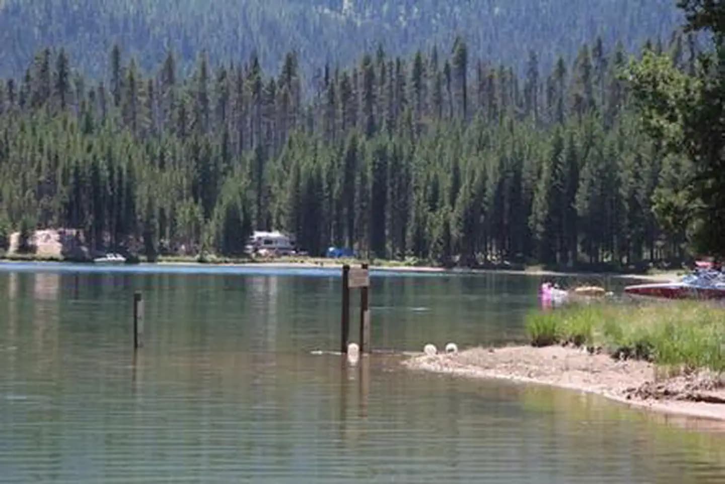
Overview Poole Creek Campground is nestled in a forest of lodgepole pine, mountain hemlock and Shasta red fir, just south of the mouth of Poole Creek on the west shore of Lemolo Lake. The lake is the highest reservoir on the North Umpqua River at an elevation of 4,150 feet. Recreation Boating, fishing, swimming, kayaking, canoeing and water skiing top the list of recreational activities at the campground. Lemolo Lake provides outdoor enthusiasts with a multitude of recreational opportunities year round. The forested shoreline and mountainous backdrop provide a perfect setting for both swimmers braving the lake's cold, refreshing waters, and for anglers casting lines from boat or beach. Populations of German brown trout, Eastern brook trout, rainbow trout and kokanee salmon thrive in the lake which reaches depths of up to 100 feet in places. For waterfall seekers, nearby Lemolo Falls Trail is a steep traverse that drops down into North Umpqua Canyon for a view of Lemolo Falls as it cascades 150 feet to the canyon bottom. A spur trail accesses the bottom of the canyon below the falls. Facilities Boating, fishing, swimming, kayaking, canoeing and water skiing top the list of recreational activities at the campground. Lemolo Lake provides outdoor enthusiasts with a multitude of recreational opportunities year round. The forested shoreline and mountainous backdrop provide a perfect setting for both swimmers braving the lake's cold, refreshing waters, and for anglers casting lines from boat or beach. Populations of German brown trout, Eastern brook trout, rainbow trout and kokanee salmon thrive in the lake which reaches depths of up to 100 feet in places. For waterfall seekers, nearby Lemolo Falls Trail is a steep traverse that drops down into North Umpqua Canyon for a view of Lemolo Falls as it cascades 150 feet to the canyon bottom. A spur trail accesses the bottom of the canyon below the falls. Natural Features Umpqua National Forest visitors are often taken aback by unique and surprising landscapes shaped by explosive geologic events. The 984,602-acre forest provides spectacular scenery and an abundance of natural and cultural resources. The translation of the word, "Umpqua," meaning "thundering waters," defines the area. High mountain lakes, heart-stopping rapids, peaceful ponds and thundering waterfalls, including the 272-foot Watson Falls on the North Umpqua Highway, offer visitors a renewed sense of spirit. Diverse ecosystems support a wide range of habitat for wildlife. From eagles and owls to salamanders and salmon, these species, along with many others, depend on surrounding undeveloped wilderness, clean streams and diverse forests to live. Nearby Attractions Experience 172 miles of diverse river and mountain landscapes along the Rogue-Umpqua National Scenic Byway. Travel from rolling oak-covered hills and towering coniferous forests, to roaring whitewater rapids and ancient lava flows. The highway travels alongside the Upper Rogue and North Umpqua Wild and Scenic Rivers that contain world-class fisheries.
View details →
Overview Campers at Roaring River Group Campground enjoy the soothing sounds of the aptly named Roaring River flowing past their campsites. The campground is tucked in a wooded setting in Willamette National Forest and can accommodate up to 50 overnight visitors. Fishing and hiking are a few of the best ways to spend the day here. The nearby Three Sisters Wilderness offers plenty of trails to explore. Recreation The Box Canyon Trail area is nearby, providing excellent hiking routes like the McBee Trail and the Roaring Ridge Trail. The Roaring Ridge Trail passes through Douglas fir forests with views of the South Fork of the McKenzie River. Mountain biking, fishing and wildlife viewing are popular activities here. Bird sightings may include osprey, great blue herons and bald eagles. Facilities The Box Canyon Trail area is nearby, providing excellent hiking routes like the McBee Trail and the Roaring Ridge Trail. The Roaring Ridge Trail passes through Douglas fir forests with views of the South Fork of the McKenzie River. Mountain biking, fishing and wildlife viewing are popular activities here. Bird sightings may include osprey, great blue herons and bald eagles. Natural Features The group site is just a few feet from the river on the east bank, among Douglas fir, maple and alder. The Willamette National Forest stretches for 110 miles with varied landscapes of high mountains, narrow canyons, cascading streams and wooded slopes. Nearby Attractions The Three Sisters Wilderness Area offers 260 miles of hiking trail through 286,708 acres of wild, incredible mountains and meadows. There is also access to non-wilderness hiking and mountain bike trails within 10 miles.
View details →
Overview Horse Creek Group Campground is located on the banks of Horse Creek. The rushing water and tall Douglas fir trees offer a cool, shady spot to enjoy the outdoors. A picnic area offers a great spot for grilling and group gatherings. Recreation Fishing in Horse Creek is an enjoyable pastime. The McKenzie River National Recreation Trailhead is nearby, offering fun-filled hiking and biking opportunities. The 26-mile trail boasts wonderful scenery along the river, and is an easy hike for all ages. There are also numerous developed boat launches that provide access to the McKenzie River. Facilities Fishing in Horse Creek is an enjoyable pastime. The McKenzie River National Recreation Trailhead is nearby, offering fun-filled hiking and biking opportunities. The 26-mile trail boasts wonderful scenery along the river, and is an easy hike for all ages. There are also numerous developed boat launches that provide access to the McKenzie River. Natural Features The campground sits along Horse Creek among Douglas fir and Western Red Cedar. The creek flows into the McKenzie River, a 90-mile tributary that transports snowmelt from the Cascade Range to the Willamette Valley. Set along the western slopes of the Cascade Mountains, gorgeous, lush mountain landscapes are found in every direction. Nearby Attractions Cougar Reservoir is about 10 miles southwest and boasts excellent boating opportunities.
View details →
Overview McKenzie Bridge Campground is located an hour east of Eugene, Oregon. It rests in the shade of a towering grove of Douglas fir and Western red cedar trees along the banks of the McKenzie River. The campground is small and pleasant, providing an ideal atmosphere for relaxation, fishing and bird watching. Feathered residents of the river include osprey, great blue herons and bald eagles. Recreation At the campground, the river provides catch-and-release fishing for trout and steelhead. Whitewater kayaking and rafting are also popular activities. A boat ramp is located on-site. The McKenzie River National Recreation Trail begins nearby, offering fun-filled hiking and biking opportunities. The 26-mile trail boasts wonderful scenery along the river and is an easy hike for all ages. Facilities At the campground, the river provides catch-and-release fishing for trout and steelhead. Whitewater kayaking and rafting are also popular activities. A boat ramp is located on-site. The McKenzie River National Recreation Trail begins nearby, offering fun-filled hiking and biking opportunities. The 26-mile trail boasts wonderful scenery along the river and is an easy hike for all ages. Natural Features McKenzie Bridge sits on the banks of the McKenzie River at an elevation of 1,200 feet. Rapids in various sections of the river are what make McKenzie one of Oregon's most popular rivers for whitewater rafting. McKenzie Bridge is part of the Willamette National Forest, which stretches for 110 miles along the western slopes of the Cascade Range. Nearby Attractions Restaurants and the Tokatee Golf Course are within a few miles of the campground.
View details →
Overview Paradise Campground is indeed a paradise for campers. Tucked within a lush, old-growth forest of Douglas fir and western red cedar, the area portrays a sub-tropical vibe along the banks of the McKenzie River, where catch-and-release trout and steelhead fishing is a popular activity, along with whitewater rafting and kayaking. Recreation Rafters and kayakers live it up in the whitewater of the McKenzie River. A boat ramp is located on-site. The McKenzie River National Recreation Trail begins nearby, and is a favorite among hikers and mountain bikers. Facilities Rafters and kayakers live it up in the whitewater of the McKenzie River. A boat ramp is located on-site. The McKenzie River National Recreation Trail begins nearby, and is a favorite among hikers and mountain bikers. Natural Features Paradise sits on a bend of the river at an elevation of 1,600 feet. Ferns and other moisture loving plants cover the ground, and mosses drape the trees. The campground is in the heart of Willamette National Forest, which spans 1.6 million acres on the western slopes of the Cascade Range. Nearby Attractions A golf course is located about 7 miles west of the campground.
View details →
Overview Carter Lake Campground is a family favorite in the Oregon Dunes National Recreation Area. This campground is located on Carter Lake, perfect for fishing, swimming, and boating. The Carter Dunes Trailhead is located within the campground, and the Pacific coast is just a short drive away. Recreation Hike the Carter Dune Trail, which attracts campers and locals alike. Fishing for rainbow trout is a good way to pass the time, and canoeing and kayaking are excellent on Carter Lake. The dunes region is also famous for off-road vehicle riding trails. Facilities Hike the Carter Dune Trail, which attracts campers and locals alike. Fishing for rainbow trout is a good way to pass the time, and canoeing and kayaking are excellent on Carter Lake. The dunes region is also famous for off-road vehicle riding trails. Natural Features Campsites are nestled among shore pine, sitka spruce, and Douglas fir, with hedges of rhododendron. Carter Lake spans 28 acres at an elevation of 100 feet. The campground is part of the Oregon Dunes National Recreation Area, known for its wind-sculpted sand dunes towering up to 500 feet above sea level. contact_info For facility specific information, please call (541) 271-6000. Nearby Attractions Carter Lake Campground is located near several non-motorized hiking trails, including Siltcoos Lake Trail and Threemile Creek Trail. Visitors can also use the campground as a base to explore the area's waterways, including the Pacific Ocean, Tahkenitch Lake, and Siltcoos Lake. Charges & Cancellations Campsites that are not occupied after 24 hours of arrival time will be considered as a "no show" and sites will be released for others to reserve. If campers will be arriving after 24 hours of their arrival time, they are encouraged to call the ranger station at 541-271-6000 to let staff know.
View details →
Overview Driftwood is an off-road vehicle-oriented campground that offers direct sand access to the thrilling Oregon Dunes National Recreation Area. Designated off-road vehicle routes and open riding zones are both nearby, making this campground a premier destination for off-roading enthusiasts. Driftwood attracts riders looking for the action of dune riding combined with the comfort of camping in a developed campsite. Recreation This is an outstanding destination for off-road vehicle enthusiasts. The Driftwood II off-road vehicle route begins at the campground and leads riders north into a large section of open sand dunes. This riding area extends all the way to South Jetty Road. For added variety, visitors can enjoy beachcombing, swimming, sunbathing, and watching sea birds at the nearby beach. If in season, whales may be spotted in the ocean as well. For other non-motorized hiking opportunities, visitors can explore the Waxmyrtle Trail, which follows the Siltcoos River from Waxmyrtle Campground to the beach. Elsewhere, visitors can hike the Lagoon Trail, which circles the Lagoon Campground. Facilities This is an outstanding destination for off-road vehicle enthusiasts. The Driftwood II off-road vehicle route begins at the campground and leads riders north into a large section of open sand dunes. This riding area extends all the way to South Jetty Road. For added variety, visitors can enjoy beachcombing, swimming, sunbathing, and watching sea birds at the nearby beach. If in season, whales may be spotted in the ocean as well. For other non-motorized hiking opportunities, visitors can explore the Waxmyrtle Trail, which follows the Siltcoos River from Waxmyrtle Campground to the beach. Elsewhere, visitors can hike the Lagoon Trail, which circles the Lagoon Campground. Natural Features Driftwood sits in the heart of Oregon's coastal dunes, a short distance from the beaches of the Pacific Coast. The Siltcoos River, which flows from Siltcoos Lake into the Pacific Ocean, is also nearby. The campground is surrounded by coastal vegetation, including shore pine, waxmyrtle, huckleberry, and salal. A large section of open dunes is located north of the campground, with a designated off-road vehicle route leading riders through the forest to the open sand. A wide variety of wildlife species are present in this area. Nearby Attractions The nearby Siltcoos Lake offers bass, cutthroat trout, and rainbow trout fishing. Canoes and kayaks can also float the Siltcoos River. For additional hiking opportunities, check out the Siltcoos Lake Trail and Taylor Dunes Trail, which are both located along Highway 101. South Jetty offers additional staging areas and riding areas for off-road vehicles. contact_info For facility specific information, please call (541) 271-6000. Charges & Cancellations Campsites that are not occupied after 24 hours of arrival time will be considered as a "no show" and sites will be released for others to reserve. If campers will be arriving after 24 hours of their arrival time, they are encouraged to call the ranger station at 541-271-6000 to let staff know.
View details →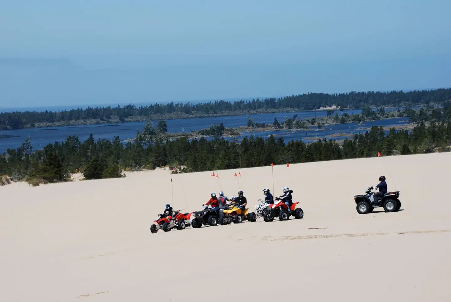
Overview Horsfall Campground, located in the Oregon Dunes National Recreation Area, provides access to miles and miles of dunes. These dunes are open to off-road vehicle use, making this area a prime destination for adventure seekers looking to ride on the sand. The campground also sits within a mile of Horsfall Lake, Bluebill Lake, and a handful of small, tranquil ponds. Recreation The campground is an outstanding home base for off-road vehicle riding on the dunes. Off-road vehicle trails and open riding zones are located northwest of the campground. Horsfall Beach is located to the west at the end of Horsfall Beach road. Nearby non-motorized opportunities include Bluebill Lake Trail and the Wild Mare Horse Trail (which is open to horseback riders and hikers). Facilities The campground is an outstanding home base for off-road vehicle riding on the dunes. Off-road vehicle trails and open riding zones are located northwest of the campground. Horsfall Beach is located to the west at the end of Horsfall Beach road. Nearby non-motorized opportunities include Bluebill Lake Trail and the Wild Mare Horse Trail (which is open to horseback riders and hikers). Natural Features At an elevation of 100 feet, Horsfall sits in a valley of dunes near the Pacific Coast. Horsfall Lake, Spirit Lake, Bluebill Lake, and a number of smaller ponds are located nearby. The Haynes Inlet is a short distance east, and Coos Bay is to the south. The climate at Horsfall Campground is typically mild year round. contact_info For facility specific information, please call (541) 271-6000. Nearby Attractions Explore Coos Bay, a picturesque inlet where the Coos River flows into the Pacific Ocean. The Bay provides an outstanding habitat for sea birds. Charges & Cancellations Campsites that are not occupied after 24 hours of arrival time will be considered as a "no show" and sites will be released for others to reserve. If campers will be arriving after 24 hours of their arrival time, they are encouraged to call the ranger station at 541-271-6000 to let staff know.
View details →
Overview Wild Mare Horse Campground is located along the central Oregon coast, 22 miles south of Reedsport and 2 miles north of North Bend. Horse campers come here to explore the Wild Mare Horse Trail and take in captivating views of Oregon's Pacific Coast, which is just a half mile from the campground. Horse campgrounds have been designed to accommodate people who need to corral their horses. We have a limited number of these kinds of campgrounds and ask, out of courtesy and safety for you and the horses, to consider camping in a different campground if you do not have a horse. Recreation Equestrian campers are fond of the Wild Mare Horse Trail #4500. This trail begins under a canopy of alder and spruce, and then emerges into an open dune area that crosses down to the beach. The dunes south of Horsfall Beach Road are designated for hiking and horseback riding only, while off-road vehicle enthusiasts can roam free on the dunes north of the campground. Facilities Equestrian campers are fond of the Wild Mare Horse Trail #4500. This trail begins under a canopy of alder and spruce, and then emerges into an open dune area that crosses down to the beach. The dunes south of Horsfall Beach Road are designated for hiking and horseback riding only, while off-road vehicle enthusiasts can roam free on the dunes north of the campground. Natural Features Tucked away among shore pine, Douglas fir, and huckleberry, Wild Mare is part of the Oregon Dunes National Recreation Area, which is known for its wind-sculpted sand dunes towering up to 500 feet above sea level. The campground is less than 1 mile from the Pacific Ocean. contact_info For facility specific information, please call (541) 271-6000. Nearby Attractions Scenic water attractions are available in every direction from the campground. Head south to Coos Bay, west to the Pacific, and east to Horsfall Lake and Bluebill Lake. Charges & Cancellations Campsites that are not occupied after 24 hours of arrival time will be considered as a "no show" and sites will be released for others to reserve. If campers will be arriving after 24 hours of their arrival time, they are encouraged to call the ranger station at 541-271-6000 to let staff know.
View details →
Overview This campground provides 49 single campsites. There are both reservable and FCFS sites. The original campsites within Big Lake are in two loops, (sites #1-14 and #15-20) which have eight or so sites with frontage on the lake shore. In 1992 additional campsites were opened (sites #21-49) on a long straight stretch from the boat launch towards Big Lake West. These sites have larger and wider parking spurs, and most sites use stairs to access the table, fire rings and tent pad below the parking spur. Sites can accommodate trailers up to 35 feet in length, depending on site. Drinking water is provided by a water system, built in 1993, which serves the entire Big Lake complex by filtering water drawn from the lake and distributing it to the campgrounds. There are three single vault toilets, and two double vault toilets in the campground. The extra vehicle parking area consists of a boat launch, picnic area, and parking for approximately 15 vehicles and boat trailers. All of these day use facilities are located in the middle of the campground, between the original loops and the "expansion" campsites. *Day Use Fee for day users/boat launch. Extra Vehicle Fee for campers with more than 1 vehicle. Campfires allowed until and unless otherwise posted. Fire bans are common during summer months. Please plan accordingly. Scan and Pay is offered at this campground; you may also pay by cash or check for FCFS campsites. There are no refunds, modifications, cancellations, or other fee changes allowed with Scan and Pay payments. This system is the same as putting cash into a fee tube and cannot be refunded. Please download the Rec.Gov app prior to arriving at the campground as there may be no cellular service or very limited service at the campground. Reservations may be made up to 6 months in advance of arrival date by reserving online at RECREATION.GOV or by calling 877-444-6777. Recreation Water skiing, sailing and swimming are among the favorite activities at the lake. The Patjens Lakes Trail offers excellent hiking opportunities. The trail follows the western side of Big Lake, heads south into the Mt. Washington Wilderness, passes alongside the scenic Patjens Lakes, and then loops back to the campground. Facilities Water skiing, sailing and swimming are among the favorite activities at the lake. The Patjens Lakes Trail offers excellent hiking opportunities. The trail follows the western side of Big Lake, heads south into the Mt. Washington Wilderness, passes alongside the scenic Patjens Lakes, and then loops back to the campground. Natural Features Nearby Attractions The major activities in the Big Lake area revolve around motorized use. Boats frequent the lake and off highway vehicles (OHVs) us the adjacent Santiam Pass Motorized Recreation Area. Other attractions include Mt. Washington Wilderness and associated access trails, historic Santiam Wagon Road, McKenzie Pass-Santiam Pass National Scenic Byway, Pacific Crest Trail, and Sand Mountain Lookout. Water skiing, sailing and swimming are among the favorite activities at the lake. The Patjens Lakes Trail offers excellent hiking opportunities. The trail follows the western side of Big Lake, heads south into the Mt. Washington Wilderness, passes alongside the scenic Patjens Lakes, and then loops back to the campground. contact_info For facility specific information, please call (541) 967-3917.
View details →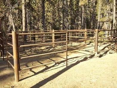
Overview In Deschutes National Forest, Whitefish Horse Campground offers visitors some of the most stunning scenery in central Oregon and easy access to an abundance of recreational activities in the Cascade region. A favorite among horse enthusiasts, the campground looks out onto the waters of Crescent Lake. With snow-capped peaks, high elevation lakes, scenic rivers, and several wilderness areas located nearby, this campground offers visitors the opportunity to experience both the serene and wild aspects of central Oregon. Recreation A favorite among horse enthusiasts, the campground provides visitors with access to a variety of trails. Lakes, lava flows, and forested areas provide the backdrop for many of these rides. Whitefish Creel Trail is popular with both hikers and horseback riders. This trail can be accessed from the west end of Crescent Lake and follows Whitefish Creek up through lodgepole pines to a beautiful view of Diamond Peak at Diamond View Lake. From there, the trail descends along Trapper Creek through Engelmann spruce and white fir to the west end of Odell Lake. Equestrians may want to traverse at least a portion of the spectacular Pacific Crest Trail (PCT), one of America's premier National Scenic Trails. This trail showcases some of North America's most fantastic scenery, winding its way its way from Mexico to Canada through California, Oregon and Washington. Portions of the trail traverse Diamond Peak at timberline. Wilderness passes are required for this trail. Facilities A favorite among horse enthusiasts, the campground provides visitors with access to a variety of trails. Lakes, lava flows, and forested areas provide the backdrop for many of these rides. Whitefish Creel Trail is popular with both hikers and horseback riders. This trail can be accessed from the west end of Crescent Lake and follows Whitefish Creek up through lodgepole pines to a beautiful view of Diamond Peak at Diamond View Lake. From there, the trail descends along Trapper Creek through Engelmann spruce and white fir to the west end of Odell Lake. Equestrians may want to traverse at least a portion of the spectacular Pacific Crest Trail (PCT), one of America's premier National Scenic Trails. This trail showcases some of North America's most fantastic scenery, winding its way its way from Mexico to Canada through California, Oregon and Washington. Portions of the trail traverse Diamond Peak at timberline. Wilderness passes are required for this trail. Natural Features Cresent Lake is nestled in a naturally glaciated basin behind a moraine dam, east of the towering Cascade Mountain Range. Its brilliant blue-green water, sandy beaches, and water temperature are exceptional for a high-elevation lake. The area provides habitat for mammals such as mule deer, coyote, and cougar. Migratory birds and native fish also call the area home. These species, along with many others, depend on surrounding undeveloped wilderness, clean streams, and diverse forests to live. Nearby Attractions Visitors can explore wilderness areas, wild and scenic rivers, lakes and reservoirs, and approximately 1,600 miles of trails in the 2.5 million-acre Deschutes National Forest and adjacent Ochoco National Forest. Lava Lands Visitor Center in Bend, Oregon, is a great starting point for visitors to learn about the diverse landscape and history of the area through interpretive programs and exhibits. Visitors may also enjoy traveling the Cascade Lakes Scenic Byway. The 66-mile drive through the Cascade Mountain range, weaves through snow-capped peaks and alpine lakes, highlighting the beauty of central Oregon. Charges & Cancellations Once your reservation start date has begun, neither the Recreation.gov Contact Center nor the campground manager will be able to modify your reservation.
View details →
Overview Simax Group Campground is located on the northeast end of Crescent Lake in Deschutes National Forest, offering visitors some of the most beautiful scenery in central Oregon and easy access to an abundance of recreational activities. Designed as a fully accessible campground, the four group sites and large picnic pavilion provide all visitors with ample opportunities to explore the area's diverse lush forest and spectacular surroundings. Recreation At Simax Group Campground, water skiing, sailing, windsurfing, sunning, hiking, mountain biking, horseback riding, off-roading and fishing are popular with visitors. Hiking on one or more of the trails in the area offers a wide variety of scenic terrain, ranging from lakeside trails to routes weaving through towering pine, fir, and spruce trees, typical for the area. For anglers, Crescent Lake provides the perfect setting to fish from boat or the shoreline. Fish species found in the lake include kokanee salmon, mackinaw, rainbow trout, brown trout and mountain whitefish. Summer months offer the best fishing. Facilities At Simax Group Campground, water skiing, sailing, windsurfing, sunning, hiking, mountain biking, horseback riding, off-roading and fishing are popular with visitors. Hiking on one or more of the trails in the area offers a wide variety of scenic terrain, ranging from lakeside trails to routes weaving through towering pine, fir, and spruce trees, typical for the area. For anglers, Crescent Lake provides the perfect setting to fish from boat or the shoreline. Fish species found in the lake include kokanee salmon, mackinaw, rainbow trout, brown trout and mountain whitefish. Summer months offer the best fishing. Natural Features Crescent Lake, nestled in a naturally glaciated basin behind a moraine dam, lies east of the towering Cascade Mountain Range. Its brilliant blue-green water, sandy beaches and water temperature are exceptional for a high-elevation lake. Towering lodgepole pine trees provide the backdrop for this area, with mountain hemlock, fir, and spruce also in the mix. Volcanic activity throughout the surrounding area of Deschutes National Forest is evident in its landscape, showcasing cinder cones, calderas and lava flows. Nearby Attractions The trailhead to Fawn Lake starts at the northeast end Crescent Lake and is open to hikers and horseback riding. The trail, 4.7 miles one-way, begins in a forest of white fir, Douglas fir and mountain hemlock before making a transition into lodgepole pine, ending at the Crater Butte Trail near Fawn Lake. There are views of Redtop and Lakeview Mountains at Fawn Lake. Lava Lands Visitor Center in Bend, Oregon, offers visitors the opportunity to learn about the diverse landscape and history of the area through interpretive programs and exhibits. Visitors will also enjoy traveling the Cascade Lakes Scenic Byway, known as Oregon's Highway in the Sky, which climbs into the clouds on a 66-mile drive through the Cascade Mountain range, weaving through snow-capped peaks and alpine lakes. A nearby resort on Crescent Lake offers lodging and a general store. Supplies and equipment rentals are available to visitors. Charges & Cancellations Once your reservation start date has begun, neither the Recreation.gov Contact Center nor the campground manager will be able to modify your reservation.
View details →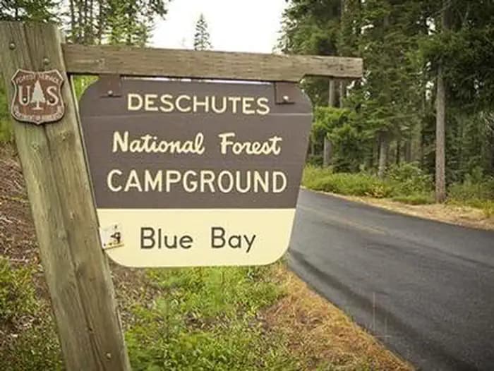
Overview Blue Bay Campground is situated in a diverse forest of pine and fir on the south shore of Suttle Lake in Deschutes National Forest. Its proximity to high alpine lakes, lush forests and towering peaks in nearby wilderness areas make it a popular destination for individual and group camping excursions. Recreation Popular activities in the area include hiking, fishing and motorized boating in the summer months, as well as cross-country skiing and snowshoeing in the winter. Numerous non-motorized trails can be accessed from the campground and in the surrounding area. The 3.2-mile Suttle Lake Loop Trail meanders through the developed recreation areas on Suttle Lake. The trail follows the wooded shoreline of the lake, providing opportunities for fishing or picnicking along the way. For fishing, boats are most commonly used on Suttle Lake. Float tubes are adequate, and wading is possible in some areas. A few areas are fishable from shore. The lake sustains an excellent population of naturally reproducing kokanee, brown trout, whitefish and crayfish. The campground has a shallow boat ramp area, and most campsites have easy access to the waterfront. Motorized and non-motorized boats are allowed on Suttle Lake. Facilities Popular activities in the area include hiking, fishing and motorized boating in the summer months, as well as cross-country skiing and snowshoeing in the winter. Numerous non-motorized trails can be accessed from the campground and in the surrounding area. The 3.2-mile Suttle Lake Loop Trail meanders through the developed recreation areas on Suttle Lake. The trail follows the wooded shoreline of the lake, providing opportunities for fishing or picnicking along the way. For fishing, boats are most commonly used on Suttle Lake. Float tubes are adequate, and wading is possible in some areas. A few areas are fishable from shore. The lake sustains an excellent population of naturally reproducing kokanee, brown trout, whitefish and crayfish. The campground has a shallow boat ramp area, and most campsites have easy access to the waterfront. Motorized and non-motorized boats are allowed on Suttle Lake. Natural Features Suttle Lake is surrounded by mixed conifer forest. Its waters are deep and clear, formed in a terminal moraine, deposited by glacial ice about 25,000 years ago. Lake Creek flows eastward from Suttle Lake to the Metolius River. The clear, cold Metolius flows north from headwater springs through diverse coniferous forests and a volcanic landscape with extinct volcanoes, cinder cones, calderas and ancient lava flows. Nearby Attractions Visitors can explore wilderness areas, lakes, reservoirs, wild and scenic rivers and approximately 1,600 miles of trails that comprise nearly 2.5 million acres within the Deschutes National Forest and the adjacent Ochoco National Forest.
View details →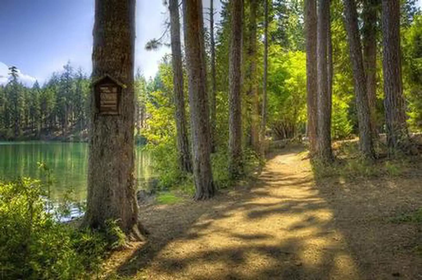
Overview Link Creek Campground is situated on the shores of Suttle Lake in the Deschutes National Forest. Visitors enjoy boating, fishing, hiking and biking in summer, and cross-country skiing and snowshoeing in winter. Recreation Popular activities in the area include hiking, fishing and motorized boating in the summer months, and cross-country skiing and snowshoeing in winter months. Numerous hiking mountain biking trails are accessible from the campground and in the surrounding area. The 3.2 mile Suttle Lake Loop Trail meanders through the developed recreation areas on Suttle Lake. The trail is relatively flat and follows the wooded shoreline of the lake, providing opportunities for fishing or picnicking along the way. A boat ramp is located within the campground. Motorized and non-motorized boats are allowed on Suttle Lake. Facilities Popular activities in the area include hiking, fishing and motorized boating in the summer months, and cross-country skiing and snowshoeing in winter months. Numerous hiking mountain biking trails are accessible from the campground and in the surrounding area. The 3.2 mile Suttle Lake Loop Trail meanders through the developed recreation areas on Suttle Lake. The trail is relatively flat and follows the wooded shoreline of the lake, providing opportunities for fishing or picnicking along the way. A boat ramp is located within the campground. Motorized and non-motorized boats are allowed on Suttle Lake. Natural Features Suttle Lake is surrounded by a mixed conifer forest. The lake is deep and clear. The lake covers an area of 253 acres and has an average depth of 44 feet. It sustains an excellent population of naturally reproducing kokanee, brown trout, whitefish, and crayfish. Link Creek, which empties into Suttle Lake, is shallow and clear enough to view spawning fish. Lake Creek flows eastward from Suttle Lake and eventually joins the Metolius River. In autumn, the local vine maple trees display brilliant orange, red and yellow foliage. Nearby Attractions Visitors can explore wilderness areas, rivers, lakes and reservoirs, and approximately 1,600 miles of trails that comprise nearly 2.5 million acres within the Deschutes National Forest and the adjacent Ochoco National Forest. Visitors enjoy traveling the Cascade Lakes Scenic Byway, known as Oregon's Highway in the Sky, which climbs into the clouds on a 66-mile drive through the Cascade Range, weaving past snow-capped peaks and alpine lakes. Charges & Cancellations Once your reservation start date has begun, neither the Recreation.gov Contact Center nor the campground manager will be able to modify your reservation.
View details →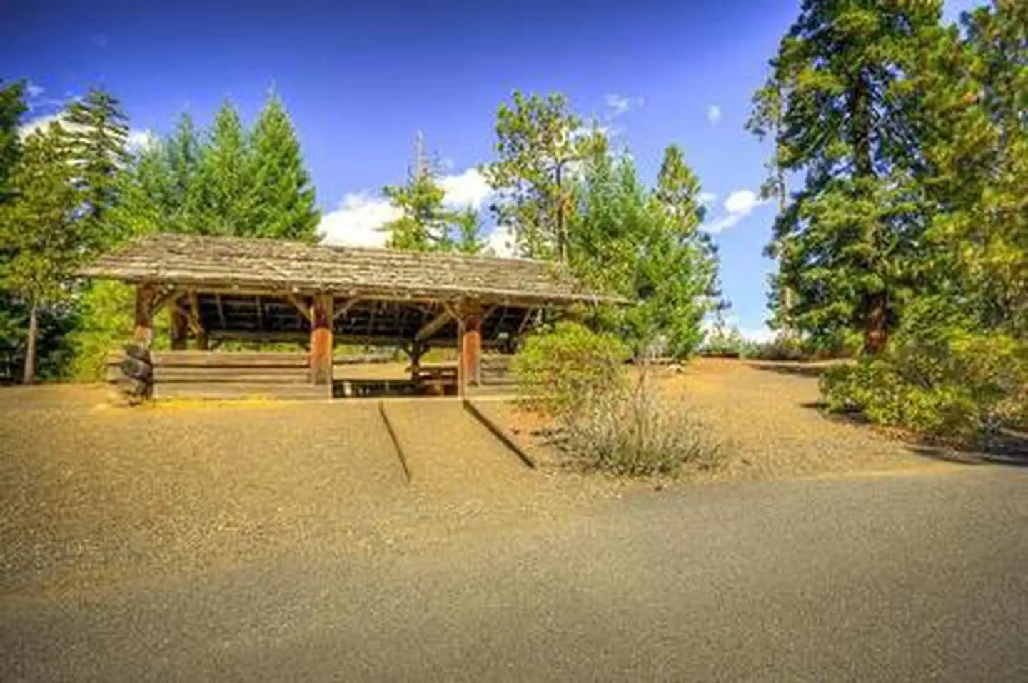
Overview Scout Lake Group Campground sits near the shores of its namesake in Deschutes National Forest. Its proximity to high alpine lakes, lush forests and towering peaks in nearby wilderness areas make it a popular destination for outdoor enthusiasts. Recreation Water sport enthusiasts of all types will enjoy the opportunities available at Scout Creek Lake and nearby Suttle Lake. Only non-motorized watercraft are allowed on Scout Creek, but water skiing, fishing and boating are popular at Suttle Lake, less than one mile away. Nearby trails and a picturesque shoreline offer visitors opportunities for hiking, birding, wading and swimming at Scout Lake, and a large beach is located just steps away. Facilities Water sport enthusiasts of all types will enjoy the opportunities available at Scout Creek Lake and nearby Suttle Lake. Only non-motorized watercraft are allowed on Scout Creek, but water skiing, fishing and boating are popular at Suttle Lake, less than one mile away. Nearby trails and a picturesque shoreline offer visitors opportunities for hiking, birding, wading and swimming at Scout Lake, and a large beach is located just steps away. Natural Features The campground sits at 3,600 feet in the high desert region of central Oregon in a towering mixed conifer forest. Nearby landscapes showcase the unique volcanic activity throughout the region, and visitors can explore extinct volcanoes, calderas and lava flows typical in the area. The surrounding undeveloped wilderness, clean streams and diverse forests support an abundance of wildlife, including deer, squirrel, trout, salmon and a variety of migratory birds. Nearby Attractions Visitors can explore wilderness areas, rivers, lakes, reservoirs and approximately 1,600 miles of trails that comprise nearly 2.5 million acres the Deschutes National Forest and the adjacent Ochoco National Forest. Lava Lands Visitor Center in nearby Bend, Oregon, and the Newberry National Volcanic Monument are popular attractions as well. Visitors will also enjoy traveling the Cascade Lakes Scenic Byway, known as Oregon's Highway in the Sky, which climbs into the clouds on a 66-mile drive through the Cascade Mountain range, weaving through snow-capped peaks and alpine lakes. Charges & Cancellations Once your reservation start date has begun, neither the Recreation.gov Contact Center nor the campground manager will be able to modify your reservation.
View details →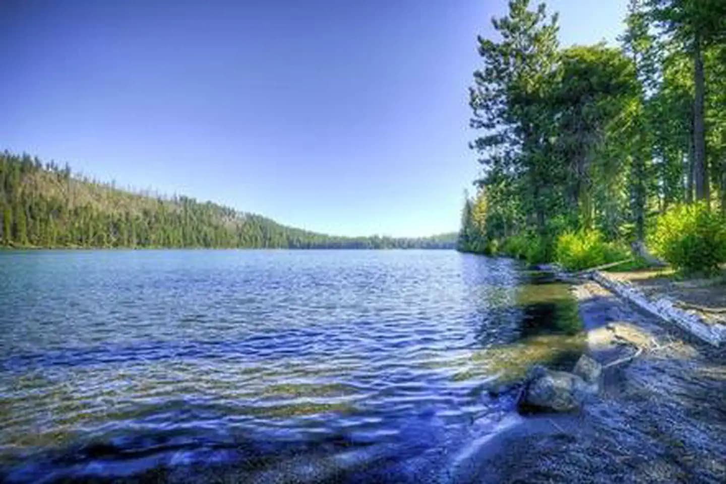
Overview South Shore Campground is located along Suttle Lake, shaded by Douglas fir and Ponderosa pine. One section of the camp sits on the shoreline, while the other is nestled on a hillside. Most sites have lake views. The 3,400-foot elevation and the lake breezes make South Shore Campground a comfortable summertime destination. Recreation There is a boat launch available at this camp. Popular activities include power and non-motorized boating, sailing, water skiing and wind surfing. Anglers can fish for rainbow trout, kokanee salmon and brown trout, and there is a fish cleaning station on-site. Hikers and mountain bikers have access to the 3.2-mile Suttle Lake Shoreline Trail. Facilities There is a boat launch available at this camp. Popular activities include power and non-motorized boating, sailing, water skiing and wind surfing. Anglers can fish for rainbow trout, kokanee salmon and brown trout, and there is a fish cleaning station on-site. Hikers and mountain bikers have access to the 3.2-mile Suttle Lake Shoreline Trail. Natural Features Nestled along the Cascade Mountains, the Deschutes National Forest is one of the most popular recreation forests in the Pacific Northwest. It offers a variety of landscapes, from fields of sagebrush and hay to old-growth forests and glacier-carved volcanic peaks. Suttle Lake is a natural lake formed by glaciers. It has a forested shoreline and offers views of nearby Mt. Washington. Nearby Attractions The town of Sisters is about 15 miles away, offering shopping and restaurants. Charges & Cancellations Once your reservation start date has begun, neither the Recreation.gov Contact Center nor the campground manager will be able to modify your reservation.
View details →
Overview Trillium Lake Campground is a beautiful and popular campground not far from the quaint town of Government Camp. It provides spectacular views of majestic Mt. Hood, Oregon's highest point. The campground is well-known for its scenery and abundant recreational opportunities, as well as being a great, family-friendly place to camp. Recreation Boating, swimming and fishing are popular on 63-acre Trillium Lake. A small boat ramp is available within the campground and a larger ramp is available in the nearby day-use area. An accessible fishing pier is also available. Anglers cast for a variety of trout. The 2-mile Trillium Shoreline Trail circles the lake, and parts of it are accessible. Visitors also enjoy hiking and biking on other trails in the vicinity. Tours of the area's historical sites are also popular. Facilities Boating, swimming and fishing are popular on 63-acre Trillium Lake. A small boat ramp is available within the campground and a larger ramp is available in the nearby day-use area. An accessible fishing pier is also available. Anglers cast for a variety of trout. The 2-mile Trillium Shoreline Trail circles the lake, and parts of it are accessible. Visitors also enjoy hiking and biking on other trails in the vicinity. Tours of the area's historical sites are also popular. Natural Features The campground is located about 40 miles southeast of Portland, in the Mt. Hood National Forest. It sits alongside Trillium Lake at an elevation of 3,600 feet, and is nestled in a shady, mixed conifer forest that provides privacy between campsites. contact_info For facility specific information, please call (503) 622-3191. Nearby Attractions Timberline Lodge, a National Historic Landmark on Mt. Hood, is located within 10 miles of the campground.
View details →
Overview Riley Campground is an equestrian facility located northwest of Oregon's majestic Mt. Hood. Horse corrals are tucked into the forest near the campsites, and several horseback riding trails can be accessed from the campground. A variety of recreational and sightseeing opportunities are available for visitors to enjoy. Recreation Several hiking, biking and horseback riding trails can be accessed from the campground, including the 5.3-mile Cast Creek Trail, which was reconstructed in 1998 and leads from the campground to the Zigzag Mountain Trail. Combined with the nearby 4.9-mile Horseshoe Ridge Trail and part of the Zigzag Mountain Trail, visitors can make a nearly 14-mile excursion. The Sandy River Trail follows the river and stretches about 3 miles. Fishing is available in nearby Lost Creek, as well as the Sandy River, which is not far from the campground. Anglers can expect a variety of trout, salmon and whitefish. The rivers are popular for fly fishing. Scenic drives and picnicking are also popular activities. Facilities Several hiking, biking and horseback riding trails can be accessed from the campground, including the 5.3-mile Cast Creek Trail, which was reconstructed in 1998 and leads from the campground to the Zigzag Mountain Trail. Combined with the nearby 4.9-mile Horseshoe Ridge Trail and part of the Zigzag Mountain Trail, visitors can make a nearly 14-mile excursion. The Sandy River Trail follows the river and stretches about 3 miles. Fishing is available in nearby Lost Creek, as well as the Sandy River, which is not far from the campground. Anglers can expect a variety of trout, salmon and whitefish. The rivers are popular for fly fishing. Scenic drives and picnicking are also popular activities. Natural Features The campground is situated in the Old Maid Flat geologic area of Mt. Hood National Forest at an elevation of about 2,100 feet. It sits alongside Lost Creek and is near the Sandy Wild and Scenic River. A variety of wildlife makes its home in the area. contact_info For facility specific information, please call (503) 622-3191. Nearby Attractions A deviation from the road coming into the campground (Forest Road 1825), will lead to a trailhead for spectacular Ramona Falls, on the Sandy River. The 7.1-mile, moderately difficult trail leads to cascading waterfalls and is one of the most popular hikes in Mt. Hood National Forest.
View details →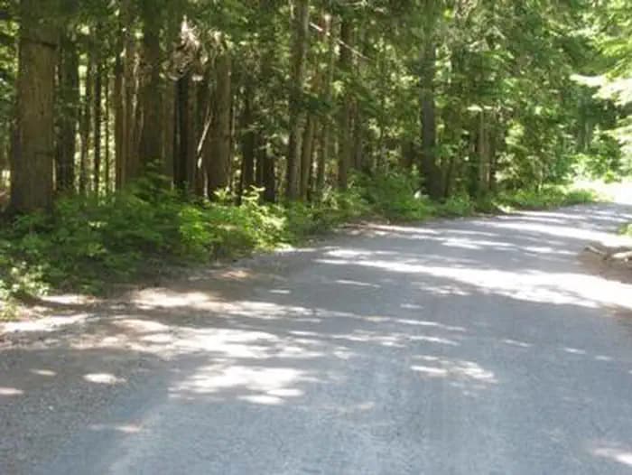
Overview Still Creek Campground lies in the shadows of majestic Mt. Hood, in Oregon's Mt. Hood National Forest. It is one of the closest campgrounds to the mountain, and offers access to a variety of recreational opportunities. The surrounding area contains hiking, mountain biking and horseback riding trails, as well as numerous mountain lakes, rivers and creeks. Recreation A variety of hiking, mountain biking and horseback riding trails can be accessed from the campground, including the historic Barlow Trail. The somewhat primitive, 1-mile trail connects the campground with the town of Government Camp. Fly-fishing is a popular activity on Still Creek. Anglers can expect a variety of trout and occasional whitefish and salmon. Facilities A variety of hiking, mountain biking and horseback riding trails can be accessed from the campground, including the historic Barlow Trail. The somewhat primitive, 1-mile trail connects the campground with the town of Government Camp. Fly-fishing is a popular activity on Still Creek. Anglers can expect a variety of trout and occasional whitefish and salmon. Natural Features The campground sits on the banks of Still Creek just south Mt. Hood at an elevation of about 3,700 feet. It is surrounded by a lush forest of mixed conifers, including cedar, pine and fir trees. A dense understory of shrubs makes for ample privacy between sites. The creek can be heard throughout the campground. Nearby Attractions A fork on Forest Road 1825 that accesses the campground will lead to the trailhead for spectacular Ramona Falls on the Sandy River. The 7.1-mile, moderately difficult trail leads to cascading waterfalls and is one of the most popular hikes in the Mt. Hood National Forest. Timberline Lodge, a National Historic Landmark on Mt. Hood, is located within seven miles of Still Creek Campground. Sightseeing and a variety of recreational opportunities are available. The area is a popular snow sports playground for most of the year.
View details →
Overview Tollgate Campground is one of the most convenient to Portland, making it a great headquarters for exploring the Mt. Hood area. It stands in the southwestern shadow of Oregon's highest point, Mt. Hood. The campground provides access to a variety of trails, as well as historic sites, including spots along the famed Oregon Trail. Recreation A variety of hiking, mountain biking and horseback riding trails are available in the area. The nearly 10-mile Pioneer Bridle Trail passes through the campground. A replica of the original Barlow Road tollgate is just east of the campground. The gate was used by travelers along the Oregon Trail from 1879 to 1919. A day-use picnic area at the campground, providing access to the scenic surroundings, as well as the nearby river and Camp Creek. Anglers enjoy the sport of catch-and-release fishing for small trout and whitefish. Facilities A variety of hiking, mountain biking and horseback riding trails are available in the area. The nearly 10-mile Pioneer Bridle Trail passes through the campground. A replica of the original Barlow Road tollgate is just east of the campground. The gate was used by travelers along the Oregon Trail from 1879 to 1919. A day-use picnic area at the campground, providing access to the scenic surroundings, as well as the nearby river and Camp Creek. Anglers enjoy the sport of catch-and-release fishing for small trout and whitefish. Natural Features The campground is located in the Mt. Hood National Forest, approximately 32 miles southeast of Portland, at an elevation of about 2,100 feet. The campground sits on the north bank of the Zigzag River, just east of the community of Rhododendron, in a humid, semi-subtropic environment of Douglas fir and cedar trees. Tollgate Campground was originally constructed by the Civilian Conservation Corps, and some historic features, such as rock fireplaces and a reconstructed picnic shelter still remain. contact_info For facility specific information, please call (503) 622-3191. Nearby Attractions The campground is 2.5 miles from the town of Zigzag, which offers a variety of services, including lodging, eateries and a variety of shops.
View details →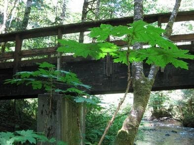
Overview The Camp Creek Campground sits next to a babbling forest creek in the country's scenic Pacific Northwest region. The campground is not far from the base of the majestic, snow-covered Mt. Hood, Oregon's highest point and a prominent landmark of the area. A variety of recreational activities surround the campground, including hiking, biking and horseback riding trails, scenic views and points of exploration. Recreation Surrounding the campground are a variety of hiking and mountain biking trails, including the 1.6-mile Still Creek Trail, which is family-friendly and full of beautiful vegetation, and the Pioneer Bridle Trail, which takes hikers, bikers and horseback riders through about 10 miles of scenic wilderness. Visitors to the area also enjoy mountain biking along the nearby Zigzag River, however bikes are not allowed within designated wilderness areas along the trail. A variety of trout and whitefish populate the nearby creek and river, where anglers typically enjoy catch-and-release fishing. Wading is also popular in the cool mountain waters. The plentiful creeks and streams in the area stem from glaciers atop Mt. Hood. Facilities Surrounding the campground are a variety of hiking and mountain biking trails, including the 1.6-mile Still Creek Trail, which is family-friendly and full of beautiful vegetation, and the Pioneer Bridle Trail, which takes hikers, bikers and horseback riders through about 10 miles of scenic wilderness. Visitors to the area also enjoy mountain biking along the nearby Zigzag River, however bikes are not allowed within designated wilderness areas along the trail. A variety of trout and whitefish populate the nearby creek and river, where anglers typically enjoy catch-and-release fishing. Wading is also popular in the cool mountain waters. The plentiful creeks and streams in the area stem from glaciers atop Mt. Hood. Natural Features The shady and quiet campground is situated on a bench above Camp Creek, in the Mt. Hood National Forest, at an elevation of about 2,200 feet. It is tucked in among a mature forest of Douglas fir and cedar trees that are covered in moss. The campground was originally constructed by the Civilian Conservation Corps in 1936. While updates and renovations have been made, some features from the era remain, such as several stone fireplaces. contact_info For facility specific information, please call (503) 622-3191. Nearby Attractions The town of Rhododendron is about 3 miles from the campground, offering a variety of services and supplies.
View details →
Overview Lost Creek Campground is a fully accessible campground allowing anyone access to campsites, fishing and a paved nature trail that meanders through the area. The campground is also near the Wild and Scenic Sandy River and not far from the popular Ramona Falls Trailhead. Mt. Hood is just southeast of the campground and is close enough for visitors to enjoy a day trip and sightseeing. Recreation A variety of trails exist within and near the campground, including the accessible Lost Creek Nature Trail, which explains events in history that helped form the area's geology. A deviation from the road coming into the campground (Forest Road 1825), will lead to a trailhead for spectacular Ramona Falls on the Sandy River. The 7.1-mile trail leads to cascading waterfalls and is one of the most popular hikes on the forest. Fishing is available in the Sandy River and anglers can expect steelhead year-round, Coho salmon in the fall and Chinook salmon from February through October. Trout also inhabit the river. Scenic driving and picnicking are popular activities as well. Facilities A variety of trails exist within and near the campground, including the accessible Lost Creek Nature Trail, which explains events in history that helped form the area's geology. A deviation from the road coming into the campground (Forest Road 1825), will lead to a trailhead for spectacular Ramona Falls on the Sandy River. The 7.1-mile trail leads to cascading waterfalls and is one of the most popular hikes on the forest. Fishing is available in the Sandy River and anglers can expect steelhead year-round, Coho salmon in the fall and Chinook salmon from February through October. Trout also inhabit the river. Scenic driving and picnicking are popular activities as well. Natural Features Moss and shrubbery covers the ground and evergreens tower overhead, providing ample shade for the campground and privacy between the individual and group campsites. The campground is situated in the Old Maid Flat area of Mt. Hood National Forest, northwest of majestic Mt. Hood at an elevation of about 2,600 feet. It sits on one of the largest pyroclastic volcanic mudflows from Mt. Hood's "Old Maid" eruption in the 1700s. Nearby Attractions The town of Government Camp is located at the base of Mt. Hood, about 18 miles from the campground. Year-round skiing is available there, as well as a variety of activities and amenities.
View details →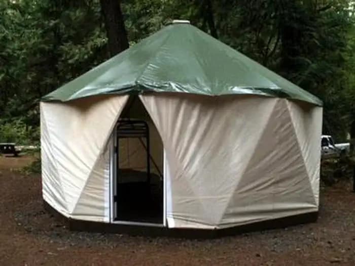
Overview Campground closed due to the 2020 Riverside Wildfire Fish Creek Campground is ideally located next to the Clackamas Wild and Scenic River in Mt. Hood National Forest. It provides access to some of the area's greatest whitewater, as well as a famous place to fish. Whether it is relaxation or expansive exploration, there's something for everyone at Fish Creek. Recreation Fishing is very popular on the Clackamas and anglers can expect to find winter steelhead, spring chinook and late summer coho salmon, as well as other species of freshwater fish. A convenient boat ramp is available within the campground. The Clackamas River also provides miles of wild water as it bends through the scenic Cascade Range, creating prime whitewater rafting opportunities. A hiking trail follows the river north and south and begins within the campground. Scenic driving is available on the West Cascades Scenic Byway, which follows the river. Facilities Fishing is very popular on the Clackamas and anglers can expect to find winter steelhead, spring chinook and late summer coho salmon, as well as other species of freshwater fish. A convenient boat ramp is available within the campground. The Clackamas River also provides miles of wild water as it bends through the scenic Cascade Range, creating prime whitewater rafting opportunities. A hiking trail follows the river north and south and begins within the campground. Scenic driving is available on the West Cascades Scenic Byway, which follows the river. Natural Features The campground is situated along a scenic bend just above the river at an elevation of about 900 feet. It is in a heavily forested area, with a variety of bushes, ferns and grasses covering the forest floor. Vegetation provides minimal privacy within the campground, but with the river so close, noises within the campground are fairly muffled. The river provides habitat for the federally protected bald eagle and northern spotted owl, as well as the occasional peregrine falcon. A variety of wildlife also makes its home in the area. Nearby Attractions The campground is located about an hour's drive from majestic Mt. Hood, Oregon's tallest point.
View details →
Overview Campground closed due to the 2020 Riverside Wildfire Riverside Campground is a charming and rustic campground, situated alongside the Wild and Scenic Clackamas River in Mt. Hood National Forest. It provides access to a variety of hiking, mountain biking and horseback riding trails and is a great place to experience nature. Recreation Fishing is very popular in the Oak Fork and anglers can expect a catch of winter steelhead, spring Chinook and late summer Kokanee salmon, as well as other species of freshwater fish. The Clackamas River also provides miles of wild water as it bends through the scenic Cascade range, making whitewater rafting a popular activity. The 5-mile Riverside National Recreation Trail, popular for hiking and mountain biking, is located not far from the campground. The surrounding area provides numerous additional opportunities for hiking. Facilities Fishing is very popular in the Oak Fork and anglers can expect a catch of winter steelhead, spring Chinook and late summer Kokanee salmon, as well as other species of freshwater fish. The Clackamas River also provides miles of wild water as it bends through the scenic Cascade range, making whitewater rafting a popular activity. The 5-mile Riverside National Recreation Trail, popular for hiking and mountain biking, is located not far from the campground. The surrounding area provides numerous additional opportunities for hiking. Natural Features The campground is located in Mt. Hood National Forest along the Oak Grove Fork of the Clackamas River at an elevation of about 1,400 feet. Huge maple and Douglas fir trees cover the area, and dense shrubbery provides some privacy between campsites. The campground is not far from the Ripplebrook Ranger Station and Ripplebrook Pond. The river provides habitat for the federally protected bald eagle and northern spotted owl, as well as an occasional peregrine falcon. A variety of wildlife makes its home in the area. Nearby Attractions Bagby Hot Springs is located about 14 miles southwest of the campground. A popular site for soaking and relaxing, the springs are in a heavily wooded area in the scenic Cascade Range. The available bathhouses are fed by three major hot water springs and several minor outlets in the area. A historic guard station was built there in 1913.
View details →
Overview Campground closed due to the 2020 Riverside Wildfire Lazy Bend Campground sits next to the Wild and Scenic Clackamas River, close to the city of Estacada. The adjacent river provides countless opportunities for rafting, kayaking, fishing and swimming. The lush, green campground is comfortable for individuals and families who want to escape into nature in Oregon's Mt. Hood National Forest. Recreation Fishing is very popular on the Clackamas River. Anglers can expect a catch of winter steelhead, spring Chinook and late summer Coho salmon, as well as other species of freshwater fish. The Clackamas bends and drops through the scenic Cascade Range and offers famous whitewater rafting opportunities. The Upper Clackamas Whitewater Festival is held annually in May and attracts rafters from all over the country. A hiking trail follows the river north and south and begins at nearby Fish Creek Campground. A boat ramp is also available there. Scenic driving is available on the West Cascades Scenic Byway, which follows the river. Facilities Fishing is very popular on the Clackamas River. Anglers can expect a catch of winter steelhead, spring Chinook and late summer Coho salmon, as well as other species of freshwater fish. The Clackamas bends and drops through the scenic Cascade Range and offers famous whitewater rafting opportunities. The Upper Clackamas Whitewater Festival is held annually in May and attracts rafters from all over the country. A hiking trail follows the river north and south and begins at nearby Fish Creek Campground. A boat ramp is also available there. Scenic driving is available on the West Cascades Scenic Byway, which follows the river. Natural Features The campground is the forest's westernmost campground, situated at an elevation of 800 feet. It lies between the river and the adjacent highway, nestled among a dense stand of trees. Huckleberry bushes can be found throughout the region. The forest provides habitat for the federally protected bald eagle and northern spotted owl, as well as an occasional peregrine falcon. A variety of wildlife makes its home in the area. Nearby Attractions North Fork Reservoir is just over 5 miles northeast of the campground. Boating and other water-related recreation opportunities are available there. The campground is 10 miles from Estacada, which offers a variety of dining and shopping options, groceries and fuel.
View details →
Overview Campground closed due to the 2020 Riverside Wildfire Lockaby Campground is ideally located next to the Wild and Scenic Clackamas River in the lush, green mountains of northern Oregon. It provides access to some of the area's greatest whitewater rafting, as well as a famous place to fish. Whether it is relaxation or recreation, there's something for everyone at the campground. Recreation Fishing is very popular in the Clackamas River and anglers can expect a catch of winter steelhead, spring Chinook and late summer Coho salmon, as well as other species of freshwater fish. The Clackamas contains miles of wild water as it bends and drops through the scenic Cascade Range, creating prime whitewater rafting opportunities. A hiking trail follows the river north and south and begins about a mile away at Fish Creek Campground. Scenic driving is also available on the West Cascades Scenic Byway, which travels alongside the river. Facilities Fishing is very popular in the Clackamas River and anglers can expect a catch of winter steelhead, spring Chinook and late summer Coho salmon, as well as other species of freshwater fish. The Clackamas contains miles of wild water as it bends and drops through the scenic Cascade Range, creating prime whitewater rafting opportunities. A hiking trail follows the river north and south and begins about a mile away at Fish Creek Campground. Scenic driving is also available on the West Cascades Scenic Byway, which travels alongside the river. Natural Features The campground is situated along the river at an elevation of about 900 feet in Mt. Hood National Forest. Most campsites are within a dense stand of cedar trees overlooking the river. Sites are fairly close together and there is very little vegetation on the forest floor. The forest provides habitat for the federally protected bald eagle and northern spotted owl, as well as an occasional peregrine falcon. A variety of wildlife makes its home in the area. Nearby Attractions A boat ramp is available at Fish Creek Campground, which is less than a mile south of the campground. It provides a convenient river launch for kayaks, canoes and rafts. Just below nearby Indian Henry Campground, the Clackamas River offers 12.5 miles of class III-IV whitewater. The Upper Clackamas Whitewater Festival is hosted annually in May, attracting rafters from all over the country.
View details →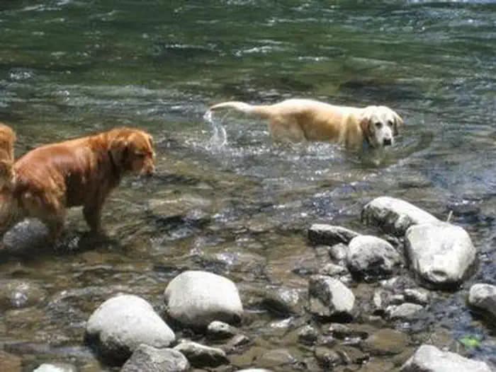
Overview This campground will remain closed due to the 2020 Riverside Wildfire Armstrong Campground is a small but beautiful place to camp, right on the edge of the Clackamas Wild and Scenic River. The river flows right by spacious, lush, family-friendly campsites, giving visitors plenty of access to the river, as well as to the surrounding forest. Recreation Fishing is very popular in the Clackamas River and anglers can expect a catch of winter steelhead, spring chinook and late summer coho salmon, as well as other species of freshwater fish. The Clackamas contains miles of wild water as it bends and drops through the scenic Cascade Range, creating prime whitewater rafting opportunities. A hiking trail follows the river north and south and begins about a mile away at Fish Creek Campground. Facilities Fishing is very popular in the Clackamas River and anglers can expect a catch of winter steelhead, spring chinook and late summer coho salmon, as well as other species of freshwater fish. The Clackamas contains miles of wild water as it bends and drops through the scenic Cascade Range, creating prime whitewater rafting opportunities. A hiking trail follows the river north and south and begins about a mile away at Fish Creek Campground. Natural Features The campground is located in Mt. Hood National Forest at an elevation of about 870 feet. A variety of ferns, shrubs and grasses cover the forest floor and provide some privacy between sites. While the campground is close to the road, the sound of the river blocks most of the noise. The forest provides habitat for the federally protected bald eagle and northern spotted owl, as well as an occasional peregrine falcon. A variety of wildlife makes its home in the area. Nearby Attractions A boat ramp is available at Fish Creek Campground, which is less than half a mile south of the campground. It is a convenient place to launch kayaks, canoes or other boats on the river. Just below Indian Henry Campground, the Clackamas River offers 12.5 miles of class III-IV whitewater. The Upper Clackamas Whitewater Festival is hosted annually on the river, attracting rafters from all over the country.
View details →
Overview Campground closed due to the 2020 Riverside Wildfire Ripplebrook Campground is a charming facility for nature enthusiasts and lies in a beautiful forest setting. Fly fishing and whitewater rafting are popular near the campground, as it neighbors the Clackamas Wild and Scenic River. The small facility is geared more toward tent camping, however, tent trailers and RVs under 19 feet are welcome. Recreation Fishing is very popular in the Clackamas River and anglers can expect a catch of winter steelhead, spring chinook and late summer kokanee salmon, as well as other species of freshwater fish. Whitewater rafting is also a favorite pastime. The Clackamas provides miles of wild water as it bends through the scenic Cascade Range. The 5-mile Riverside National Recreation Trail, popular for hiking and mountain biking, is located not far from the campground. The surrounding area provides numerous additional trail opportunities. Facilities Fishing is very popular in the Clackamas River and anglers can expect a catch of winter steelhead, spring chinook and late summer kokanee salmon, as well as other species of freshwater fish. Whitewater rafting is also a favorite pastime. The Clackamas provides miles of wild water as it bends through the scenic Cascade Range. The 5-mile Riverside National Recreation Trail, popular for hiking and mountain biking, is located not far from the campground. The surrounding area provides numerous additional trail opportunities. Natural Features The campground borders the Oak Fork of the Clackamas River in a dense forest of mature maple, cedar and fir trees. Large shrubs and ferns blanket the forest floor, providing privacy between campsites. The campground is situated at an elevation of about 1,400 feet. The Ripplebrook Ranger Station and Ripplebrook Pond are close by. The river provides habitat for the federally protected bald eagle and northern spotted owl, as well as an occasional peregrine falcon. A variety of wildlife makes its home in the area. Nearby Attractions Bagby Hot Springs is located about 14 miles southwest of the campground. A popular site for soaking and relaxing, the springs are in a heavily wooded area in the scenic Cascade Range. The available bathhouses are fed by three major hot water springs and several minor outlets in the area. A historic guard station was built there in 1913.
View details →
Overview Campground closed due to the 2020 Riverside Wildfire Sunstrip Campground is a primitive campground on the banks of the Clackamas Wild and Scenic River. It provides access to a variety of outdoor activities, but retains the look and feel of true nature, with only a few amenities. Recreation Fishing is very popular in the Clackamas and anglers can expect winter Steelhead, spring Chinook and late summer Kokanee salmon, as well as other species of freshwater fish. Whitewater rafting is also a favorite activity among visitors. The Clackamas River provides miles of wild water as it snakes through the scenic Cascade range. A hiking trail meanders along the riverbank, north and south of the campground. Scenic driving is available on the nearby West Cascades National Scenic Byway, which follows the river. Facilities Fishing is very popular in the Clackamas and anglers can expect winter Steelhead, spring Chinook and late summer Kokanee salmon, as well as other species of freshwater fish. Whitewater rafting is also a favorite activity among visitors. The Clackamas River provides miles of wild water as it snakes through the scenic Cascade range. A hiking trail meanders along the riverbank, north and south of the campground. Scenic driving is available on the nearby West Cascades National Scenic Byway, which follows the river. Natural Features The campground is nestled in a wooded area of the Mt. Hood National Forest, thick with moss and greenery, at an elevation of about 1,000 feet. The river provides habitat for the federally protected bald eagle and northern spotted owl, as well as the occasional peregrine falcon. A variety of wildlife make its home in the area. Nearby Attractions The Clackamas River, just below nearby Indian Henry Campground to the North Fork Reservoir, provides 12.5 miles of class III-IV whitewater. Outfitters are located in the town of Estacada.
View details →
Overview Campground closed due to the 2020 Riverside Wildfire Roaring River Campground is located across from the Wild and Scenic Clackamas River in the beautiful Cascade Range of northern Oregon. The small, rustic campground has some charm and provides visitors with access to a variety of outdoor recreation opportunities, including world-famous whitewater rafting. Recreation Fishing is very popular in the Clackamas River and anglers can expect a catch of winter steelhead, spring Chinook and late summer Coho salmon, as well as other species of freshwater fish. The Clackamas River provides miles of wild water as it bends through the scenic Cascade Range, making whitewater rafting a very popular activity. A hiking trail follows the river north and south. Scenic driving is also available on the nearby West Cascades Scenic Byway, which follows the river. Facilities Fishing is very popular in the Clackamas River and anglers can expect a catch of winter steelhead, spring Chinook and late summer Coho salmon, as well as other species of freshwater fish. The Clackamas River provides miles of wild water as it bends through the scenic Cascade Range, making whitewater rafting a very popular activity. A hiking trail follows the river north and south. Scenic driving is also available on the nearby West Cascades Scenic Byway, which follows the river. Natural Features The campground is nestled in a wooded area thick with moss and greenery, at an elevation of about 1,000 feet. The river is across the highway and is not visible from the campground, but can sometimes be heard. The river provides habitat for the federally protected bald eagle and northern spotted owl, as well as an occasional peregrine falcon. A variety of wildlife makes its home in the area. Nearby Attractions Just below nearby Indian Henry Campground, the Clackamas River provides 12.5 miles of class III-IV whitewater as it works its way toward North Fork Reservoir.
View details →
Overview Frog Lake Campground is a beautiful and somewhat rustic campground on Frog Lake. It provides access to enjoyable outdoor activities, including fishing and leisurely canoeing on the calm, mountain lake. Recreation Frog Lake covers 10 acres and is open to fishing, swimming, canoeing and non-motorized boating. Anglers can expect a catch of rainbow trout. Picnicking is available at the campground's day use area, which provides access to the boat ramp. A hiking trail leads east, up Frog Lake Buttes, as does an unimproved forest road, which is open to mountain biking and high-clearance off-road vehicles. The Pacific Crest National Scenic Trail passes just north of the campground, off Forest Road 2610. Facilities Frog Lake covers 10 acres and is open to fishing, swimming, canoeing and non-motorized boating. Anglers can expect a catch of rainbow trout. Picnicking is available at the campground's day use area, which provides access to the boat ramp. A hiking trail leads east, up Frog Lake Buttes, as does an unimproved forest road, which is open to mountain biking and high-clearance off-road vehicles. The Pacific Crest National Scenic Trail passes just north of the campground, off Forest Road 2610. Natural Features The campground is located between the highway and Frog Lake at an elevation of 3,800 feet, just past the town of Government Camp in Mt. Hood National Forest. The small campground is situated in a heavily forested area, where the sounds of frogs are heard at night. contact_info For facility specific information, please call (541) 352-6002. Nearby Attractions The Sno-Park at Frog Lake is about 12 miles east of Government Camp. It provides trail access to Twin Lakes and Frog Lake Butte. The latter trail is closed to snowmobiles during February.
View details →
Overview Clear Lake Campground is a shady outdoor paradise ON Clear Lake in the mountains of northern Oregon. Visitors enjoy boating, fishing, swimming and sailing on the lake, and hiking and exploring the nearby hills and terraces. Winter recreation opportunities are available in the area when it snows. Recreation Boating is popular on the lake, however speeds are limited to 10 mph. A steady breeze keeps bugs away at the campground, and also propels sailboats on the lake. Swimming and fishing are available. Anglers can expect to find a variety of trout. Visitors enjoy picnicking in the day use area near the boat ramp. A hiking trail begins near the north end of the lake, connecting to the Pacific Crest Trail. In the winter, miles of snow-covered roads and trails crisscross the forest. Shellrock Creek and High Rock, off Forest Road 57, are open to cross-country skiers and snowmobile enthusiasts. Facilities Boating is popular on the lake, however speeds are limited to 10 mph. A steady breeze keeps bugs away at the campground, and also propels sailboats on the lake. Swimming and fishing are available. Anglers can expect to find a variety of trout. Visitors enjoy picnicking in the day use area near the boat ramp. A hiking trail begins near the north end of the lake, connecting to the Pacific Crest Trail. In the winter, miles of snow-covered roads and trails crisscross the forest. Shellrock Creek and High Rock, off Forest Road 57, are open to cross-country skiers and snowmobile enthusiasts. Natural Features The campground is located in a mixed conifer forest, just north of Warm Springs Indian Reservation, in Mt. Hood National Forest. It is situated on the eastern shore of the 560-acre lake, at an elevation of 3,600. Clear Lake is used primarily for irrigation purposes. Wild mushrooms are abundant in the area during late summer and early fall. A variety of wildlife makes its home in the area. contact_info For facility specific information, please call (541) 352-6002. Nearby Attractions The small Mt. Hood village of Government Camp is 12 miles northwest of the campground. The area offers a visitor center, restaurants and year-round skiing, as well as scenic views.
View details →
Overview Campground closed due to the 2020 Riverside Wildfire Raab Group Campground is a new group campground for those that are looking for multiple campsites or have large families. It is located on the banks of the Collawash River, which flows into the mighty Clackamas River in the mountains of northern Oregon. Recreational opportunities are not far from the campground, making it the perfect getaway spot. It can comfortably accommodate any outdoorsman, including the hiking enthusiast, the fly fisherman, bicyclist and whitewater rafter, among others who wish to enjoy nature. Recreation Catch and release fishing for trout is allowed on the main fork of the Collawash, but the streams are closed to fishing for salmon and steelhead. Whitewater rafting and kayaking are popular activities. At least one 5-mile stretch of the more than 17-mile river boasts class III-IV whitewater. The Collawash flows into the nearby Clackamas River, which also provides miles of wild water as it snakes through the scenic Cascade Range. Anglers enjoy fishing the Clackamas for steelhead, Kokanee and Chinook salmon. The river provides a perfect habitat for the federally protected bald eagle and northern spotted owl, as well as an occasional peregrine falcon. A variety of other wildlife makes its home in the area. Visitors enjoy hiking in the Bull of the Woods Wilderness, which is south of the campground. Several primitive forest roads nearby are open to mountain biking. West Cascades Scenic Byway runs just outside the campground, meandering along the Wild and Scenic Clackamas River. Facilities Catch and release fishing for trout is allowed on the main fork of the Collawash, but the streams are closed to fishing for salmon and steelhead. Whitewater rafting and kayaking are popular activities. At least one 5-mile stretch of the more than 17-mile river boasts class III-IV whitewater. The Collawash flows into the nearby Clackamas River, which also provides miles of wild water as it snakes through the scenic Cascade Range. Anglers enjoy fishing the Clackamas for steelhead, Kokanee and Chinook salmon. The river provides a perfect habitat for the federally protected bald eagle and northern spotted owl, as well as an occasional peregrine falcon. A variety of other wildlife makes its home in the area. Visitors enjoy hiking in the Bull of the Woods Wilderness, which is south of the campground. Several primitive forest roads nearby are open to mountain biking. West Cascades Scenic Byway runs just outside the campground, meandering along the Wild and Scenic Clackamas River. Natural Features The campground is located southeast of the city of Estacada, on the Collawash River at an elevation of about 1,500 feet. It lies in a dense forest of old-growth Douglas fir trees and plentiful rhododendron bushes that provide privacy between campsites. Nearby Attractions Bagby Hot Springs is located about 10 miles southwest of the campground. A popular site for soaking and relaxing, the springs are in a heavily wooded area in the scenic Cascade Range. A historic guard station was built there in 1913 and the available bathhouses are fed by three major hot springs and several minor outlets in the area.
View details →
Overview Campground closed due to the 2020 Riverside Wildfire Indian Henry Campground is located in the Mount Hood National Forest, along the scenic Clackamas River. The campground is a great location for relaxation and a spectacular outdoor experience, providing ample access to the river and the surrounding wilderness, as well as other scenic spots in the area. Recreation The family-friendly Clackamas River Trail is popular for hiking and mountain biking and begins at the upper end of the campground. It extends about 8 miles and climbs about 450 feet in elevation along the way. It is available year-round, but may be covered in snow during winter months. The Indian Henry Trail, which trolls through the forest, is also located near the campground. Fishing is very popular in the nearby river and anglers can expect a catch of winter steelhead, spring chinook and late summer kokanee salmon, as well as other species of freshwater fish. Whitewater rafting is also enjoyed by visitors to the area. The Clackamas River provides miles of wild water as it bends through the scenic Cascade range. Facilities The family-friendly Clackamas River Trail is popular for hiking and mountain biking and begins at the upper end of the campground. It extends about 8 miles and climbs about 450 feet in elevation along the way. It is available year-round, but may be covered in snow during winter months. The Indian Henry Trail, which trolls through the forest, is also located near the campground. Fishing is very popular in the nearby river and anglers can expect a catch of winter steelhead, spring chinook and late summer kokanee salmon, as well as other species of freshwater fish. Whitewater rafting is also enjoyed by visitors to the area. The Clackamas River provides miles of wild water as it bends through the scenic Cascade range. Natural Features The campground is situated at an elevation of 1,249 feet, in Oregon's Cascade Mountains, nestled in a mixed forest of conifers and hardwoods, including grand old Douglas firs and a variety of evergreens. A thick gathering of ferns and ivy increase privacy between campsites. Some sites overlook the river and others neighbor a mountain creek. Nearby Attractions The picturesque, blue-green Surprise Lake is located not far from the campground, up a steep climb. It is most popular for fishing, as the lake isn't large enough for motorized boats. The Bagby Hot Springs are located about 20 miles southwest of the campground. A popular site for soaking and relaxation, the springs are in a heavily wooded forest in the scenic Cascade Mountains of Oregon. A historic guard station was built there in 1913 and the available bathhouses are fed by three major hot water springs and several minor outlets in the area.
View details →
Overview Campground closed due to the 2020 Riverside Wildfire Kingfisher Campground is a diamond in the rough. Its unkempt appearance gives it a true nature feel, yet it offers numerous modern conveniences and is close to a variety of recreational opportunities. It lies next to the scenic Hot Springs Fork of Collawash River, a tributary to the Wild and Scenic Clackamas River nearby. Recreation Catch and release fishing for trout is allowed on the main fork of the Collawash, but the streams are closed to fishing. Whitewater rafting and kayaking are popular activities in the area. At least one 5-mile stretch of the more than 17-mile river boasts class III-IV whitewater. Visitors enjoy hiking in the Bull of the Woods Wilderness, which is south of the campground and offers numerous trailheads. Several primitive forest roads nearby are open to mountain biking. The Cascades Scenic Byway, which follows the Clackamas River, is not far from the campground. Facilities Catch and release fishing for trout is allowed on the main fork of the Collawash, but the streams are closed to fishing. Whitewater rafting and kayaking are popular activities in the area. At least one 5-mile stretch of the more than 17-mile river boasts class III-IV whitewater. Visitors enjoy hiking in the Bull of the Woods Wilderness, which is south of the campground and offers numerous trailheads. Several primitive forest roads nearby are open to mountain biking. The Cascades Scenic Byway, which follows the Clackamas River, is not far from the campground. Natural Features The campground is located in the Mt. Hood National Forest along the banks of the Hot Springs Fork of Collawash River, just north of the Bull of the Woods Wilderness. It is situated in a mixed evergreen forest at an elevation of about 1,250 feet. A variety of birds and wildlife make their homes in the area. Nearby Attractions Kingfisher Campground is at the center of the Mt. Hood National Forest, where a variety of tourist attractions and historic sites draw thousands of visitors every year. A map of the area can be found at the Ripplebrook Camp Store about 9 miles north of the campground. Bagby Hot Springs is located about 5 miles southwest of the campground. A popular site for soaking and relaxing, the springs are in a heavily wooded area. The available bathhouses are fed by three major hot water springs and several minor outlets in the area. A historic guard station was built there in 1913. The city of Estacada is 35 miles northwest of the campground, with a variety of dining and shopping options, groceries and fuel.
View details →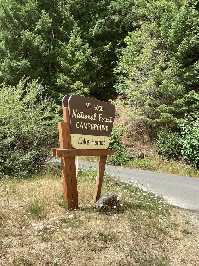
Overview Lake Harriet Campground sits on the eastern shores of crystal clear Lake Harriet. It is located between the Oak Grove Fork of the Clackamas River, which flows into the lake, and the nearby forest highway. It is a great location for camping, fishing and boating. Recreation Boating, canoeing and fishing on Lake Harriet are popular activities. There is a speed limit of 10 mph. The lake is stocked with rainbow trout each year, resulting in easy fly fishing. Anglers can also expect to catch cutthroat and brown trout, which spawn in the nearby river. The campground offers a boat ramp and fishing dock for easy lake access. The nearby Oak Grove Fork of Clackamas River is also popular for fishing. Steelhead, chinook and kokanee salmon can often be caught there. Further down the river, the Clackamas provides class III-IV whitewater rafting. The river provides a perfect habitat for the bald eagle and northern spotted owl, as well as an occasional peregrine falcon. Visitors can also enjoy hiking in the Bull of the Woods Wilderness area, just south of the campground. Several primitive forest roads nearby are useful for mountain biking and the Cascades Scenic Byway, which follows the Clackamas River, runs near the campground. Facilities Boating, canoeing and fishing on Lake Harriet are popular activities. There is a speed limit of 10 mph. The lake is stocked with rainbow trout each year, resulting in easy fly fishing. Anglers can also expect to catch cutthroat and brown trout, which spawn in the nearby river. The campground offers a boat ramp and fishing dock for easy lake access. The nearby Oak Grove Fork of Clackamas River is also popular for fishing. Steelhead, chinook and kokanee salmon can often be caught there. Further down the river, the Clackamas provides class III-IV whitewater rafting. The river provides a perfect habitat for the bald eagle and northern spotted owl, as well as an occasional peregrine falcon. Visitors can also enjoy hiking in the Bull of the Woods Wilderness area, just south of the campground. Several primitive forest roads nearby are useful for mountain biking and the Cascades Scenic Byway, which follows the Clackamas River, runs near the campground. Natural Features The campground is surrounded by a sparse forest of alder trees that provide limited shade to the area. It is situated at an elevation of about 2,000 feet in the Mt. Hood National Forest. The 22-acre lake and surrounding wilderness rest in a narrow, heavily forested canyon of Oregon's Cascade Mountain Range. contact_info Between 05/26/2023 and 09/09/2023 this location is staffed. Please call (503) 834-2215 to speak with local staff. From 11/22/2022 to 05/25/2023 this location is unstaffed. Please call (503) 464-8515 for general information. Nearby Attractions The Ripplebrook Ranger Station is located just over 6 miles west of the campground. A variety of services can be found there, including a general store and visitor center. Charges & Cancellations A service fee will apply if you change or cancel your reservation. Late cancellations are subject to additional fees. For full details see Recreation.Gov, Rules & Reservation Policies.
View details →
Overview Joe Graham Horse Campground is a beautiful equestrian camp with views of majestic Mt. Hood and its surrounding forest. It provides access to a variety of hiking, mountain biking and horseback riding trails, as well as scenic historic sites. Recreation Clackamas Lake is a great place for fishing, swimming and non-motorized boating. Anglers can expect a catch of cutthroat, brook, rainbow and German brown trout. Nearby Timothy Lake provides opportunities for picnicking as well as water-related recreation, including the use of power boats. The Clackamas Lake Ranger Station Historic District is less than a mile from the campground. The structures and cabins were built to house forest service workers in the early 1900s. Rustic architecture and the historic nature of the buildings and the surrounding area draws thousands of visitors each year. It is a must-see while staying at the campground. Hiking, mountain biking and horseback riding are popular activities. The 1-mile Joe Graham Trail begins in the campground and connects to the Pacific Crest Trail, which extends more than 2,650 miles through California, Oregon and Washington as it stretches from Mexico to Canada. Trails to scenic Little Crater Lake and the Mt. Jefferson Wilderness are also nearby. Facilities Clackamas Lake is a great place for fishing, swimming and non-motorized boating. Anglers can expect a catch of cutthroat, brook, rainbow and German brown trout. Nearby Timothy Lake provides opportunities for picnicking as well as water-related recreation, including the use of power boats. The Clackamas Lake Ranger Station Historic District is less than a mile from the campground. The structures and cabins were built to house forest service workers in the early 1900s. Rustic architecture and the historic nature of the buildings and the surrounding area draws thousands of visitors each year. It is a must-see while staying at the campground. Hiking, mountain biking and horseback riding are popular activities. The 1-mile Joe Graham Trail begins in the campground and connects to the Pacific Crest Trail, which extends more than 2,650 miles through California, Oregon and Washington as it stretches from Mexico to Canada. Trails to scenic Little Crater Lake and the Mt. Jefferson Wilderness are also nearby. Natural Features The campground is located in Mt. Hood National Forest at an elevation of about 3,350 feet. It is near Clackamas Lake and larger Timothy Lake. The campground sits among a forest of tall fir trees near a marshy meadow. A variety of wildlife makes its home in the area. Nearby Attractions The campground is less than 40 miles from Mt. Hood, where a historic lookout provides scenic views of the snow-capped mountain. Hiking and year-round skiing is available there. contact_info For facility specific information, please call (503) 622-3191.
View details →
Overview Pine Point Campground is located on the shores of Timothy Lake in the shadow of Oregon's Mt. Hood. It is a beautiful place for individuals, families and larger groups to camp and enjoy nature with a standard sites and a large group camp as well as miles of scenic trails around the lake providing endless recreation possibilities. Recreation Proximity to Timothy Lake allows campers to enjoy a variety of water-related recreation activities, including boating and sailing, as well as swimming, windsurfing and fishing. Anglers can expect a catch of kokanee salmon and a variety of trout. A range of trails are located in the area. The Timothy Lake Trail is popular for hiking, mountain biking and horseback riding. The 12 miles of relatively level terrain loops trekkers around the lake, providing scenic views of the area. It connects to the Pacific Crest National Scenic Trail, a lengthy hike that extends across three states, from the borders of Canada and Mexico. Portions of that trail also lead southwest to Clackamas Lake Campground. The Clackamas Lake Ranger Station Historic District is less than 3 miles from the campground. It was built to house forest service workers in the early 1900s. The rustic architecture and historic nature of the buildings and the surrounding area, draws thousands of tourists each year. Facilities Proximity to Timothy Lake allows campers to enjoy a variety of water-related recreation activities, including boating and sailing, as well as swimming, windsurfing and fishing. Anglers can expect a catch of kokanee salmon and a variety of trout. A range of trails are located in the area. The Timothy Lake Trail is popular for hiking, mountain biking and horseback riding. The 12 miles of relatively level terrain loops trekkers around the lake, providing scenic views of the area. It connects to the Pacific Crest National Scenic Trail, a lengthy hike that extends across three states, from the borders of Canada and Mexico. Portions of that trail also lead southwest to Clackamas Lake Campground. The Clackamas Lake Ranger Station Historic District is less than 3 miles from the campground. It was built to house forest service workers in the early 1900s. The rustic architecture and historic nature of the buildings and the surrounding area, draws thousands of tourists each year. Natural Features The campground is situated on the south shore of the roughly 1,400-acre lake, at an elevation of 3,400 feet. Timothy Lake was created in 1956 as a storage reservoir for the Oak Grove Hydroelectric Project. It is one of the larger lakes in the Mt. Hood National Forest. The campground is nestled in a mixed conifer forest, with many sites with views of the water's edge. Nearby Attractions Pine Point is about 28 miles from the base of majestic Mt. Hood, the highest point in Oregon. The historic Timberline Lodge in Government Camp offers scenic views of the snow-capped mountain. contact_info Between 05/26/2023 and 09/30/2023 this location is staffed. Please call (503) 834-2215 to speak with local staff. From 11/22/2022 to 05/25/2023 this location is unstaffed. Please call (503) 464-8515 for general information. Charges & Cancellations A service fee will apply if you change or cancel your reservation. Late cancellations are subject to additional fees. For details, see the Recreation.Gov, Rules & Reservation Policies.
View details →
Overview Gone Creek Campground sits on the edge of the beautiful Timothy Lake, in the shadows of Mt. Hood, Oregon's highest peak. The lush, green forest surrounding the campground provides campers with ample recreational opportunities. Recreation Proximity to Timothy Lake allows campers to enjoy a variety of water-related recreation activities, including boating and sailing, as well as swimming, windsurfing and fishing. Anglers can expect a catch of kokanee salmon and a variety of trout. A range of trails are located in the area. The Timothy Lake Trail is popular for hiking, mountain biking and horseback riding. The 12 miles of relatively level terrain loops trekkers around the lake, providing scenic views of the area. It connects to the Pacific Crest National Scenic Trail, a lengthy hike that extends across three states, from the borders of Canada and Mexico. Portions of that trail also lead southwest to Clackamas Lake Campground. The Clackamas Lake Ranger Station Historic District is less than 2 miles from the campground. It was built to house forest service workers in the early 1900s. The rustic architecture and historic nature of the buildings and the surrounding area draws thousands of tourists each year. Facilities Proximity to Timothy Lake allows campers to enjoy a variety of water-related recreation activities, including boating and sailing, as well as swimming, windsurfing and fishing. Anglers can expect a catch of kokanee salmon and a variety of trout. A range of trails are located in the area. The Timothy Lake Trail is popular for hiking, mountain biking and horseback riding. The 12 miles of relatively level terrain loops trekkers around the lake, providing scenic views of the area. It connects to the Pacific Crest National Scenic Trail, a lengthy hike that extends across three states, from the borders of Canada and Mexico. Portions of that trail also lead southwest to Clackamas Lake Campground. The Clackamas Lake Ranger Station Historic District is less than 2 miles from the campground. It was built to house forest service workers in the early 1900s. The rustic architecture and historic nature of the buildings and the surrounding area draws thousands of tourists each year. Natural Features The campground is situated on the south shore of the roughly 1,400-acre lake, at an elevation of 3,400 feet. Timothy Lake was created in 1956 as a storage reservoir for the Oak Grove Hydroelectric Project. It is one of the larger lakes in the Mt. Hood National Forest. The campground is nestled in a mixed conifer forest, with many sites with views of the water's edge. Nearby Attractions Gone Creek is about 28 miles from the base of majestic Mt. Hood, the highest point in Oregon. The historic Timberline Lodge in Government Camp offers scenic views of the snow-capped mountain. contact_info Between 05/26/2023 and 09/09/2023 this location is staffed. Please call (503) 834-2215 to speak with local staff. From 11/22/2022 to 05/25/2023 this location is unstaffed. Please call (503) 464-8515 for general information. Charges & Cancellations A service fee will apply if you change or cancel your reservation. Late cancellations are subject to additional fees. For full details see the Recreation.gov Rules & Reservation Policies.
View details →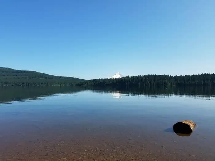
Overview The Hoodview Campground sits on the shores of Timothy Lake, in the shadow of Oregon's Mt. Hood. The surrounding forest setting offers spectacular views, miles of trails for exploration and abundant fishing. Recreation Proximity to Timothy Lake allows campers to enjoy a variety of water-related recreation activities, including boating and sailing, as well as swimming, windsurfing and fishing. Anglers can expect a catch of kokanee salmon and a variety of trout. A range of trails are located in the area. The Timothy Lake Trail is popular for hiking, mountain biking and horseback riding. The 12 miles of relatively level terrain loops trekkers around the lake, providing scenic views of the area. It connects to the Pacific Crest National Scenic Trail, a lengthy hike that extends across three states, from the borders of Canada and Mexico. Portions of that trail also lead southwest to Clackamas Lake Campground. The Clackamas Lake Ranger Station Historic District is less than 3 miles from the campground. It was built to house forest service workers in the early 1900s. The rustic architecture and historic nature of the buildings and the surrounding area draws thousands of tourists each year. Facilities Proximity to Timothy Lake allows campers to enjoy a variety of water-related recreation activities, including boating and sailing, as well as swimming, windsurfing and fishing. Anglers can expect a catch of kokanee salmon and a variety of trout. A range of trails are located in the area. The Timothy Lake Trail is popular for hiking, mountain biking and horseback riding. The 12 miles of relatively level terrain loops trekkers around the lake, providing scenic views of the area. It connects to the Pacific Crest National Scenic Trail, a lengthy hike that extends across three states, from the borders of Canada and Mexico. Portions of that trail also lead southwest to Clackamas Lake Campground. The Clackamas Lake Ranger Station Historic District is less than 3 miles from the campground. It was built to house forest service workers in the early 1900s. The rustic architecture and historic nature of the buildings and the surrounding area draws thousands of tourists each year. Natural Features The campground is situated on the southeastern shore of the roughly 1,400-acre lake, at an elevation of 3,400 feet. Timothy Lake was created in 1956 as a storage reservoir for the Oak Grove Hydroelectric Project. It is one of the larger lakes in the Mt. Hood National Forest. The campground is nestled in a mixed conifer forest, with many sites with views of the water's edge, offering views of Mt. Hood. A thick understory of rhododendron bushes provide privacy between sites. contact_info Between 05/26/2023 and 09/30/2023 this location is staffed. Please call (503) 834-2215 to speak with local staff. From 11/22/2022 to 05/25/2023 this location is unstaffed. Please call (503) 464-8515 for general information. Nearby Attractions Hoodview is about 28 miles from the base of majestic Mt. Hood, the highest point in Oregon. The historic Timberline Lodge in Government Camp offers scenic views of the snow-capped mountain. Charges & Cancellations A service fee will apply if you change or cancel your reservation. Late cancellations are subject to additional fees. For full details see Recreation.Gov, Rules & Reservation Policies.
View details →
Overview Oak Fork Campground is located on the shores of Timothy Lake in the shadow of Oregon's Mt. Hood. The surrounding forest setting offers spectacular views, miles of trails for exploration and abundant fishing. Recreation Proximity to Timothy Lake allows campers to enjoy a variety of water-related recreation activities, including boating and sailing, as well as swimming, windsurfing and fishing. Anglers can expect a catch of kokanee salmon and a variety of trout . A range of trails are located in the area. The Timothy Lake Trail is popular for hiking, mountain biking and horseback riding. The 12 miles of relatively level terrain loops trekkers around the lake, providing scenic views of the area. It connects to the Pacific Crest National Scenic Trail, a lengthy hike that extends across three states, from the borders of Canada and Mexico. Portions of that trail also lead southwest to Clackamas Lake Campground. The Clackamas Lake Ranger Station Historic District is less than 2 miles from the campground. It was built to house forest service workers in the early 1900s. The rustic architecture and historic nature of the buildings and the surrounding area draws thousands of tourists each year. Facilities Proximity to Timothy Lake allows campers to enjoy a variety of water-related recreation activities, including boating and sailing, as well as swimming, windsurfing and fishing. Anglers can expect a catch of kokanee salmon and a variety of trout . A range of trails are located in the area. The Timothy Lake Trail is popular for hiking, mountain biking and horseback riding. The 12 miles of relatively level terrain loops trekkers around the lake, providing scenic views of the area. It connects to the Pacific Crest National Scenic Trail, a lengthy hike that extends across three states, from the borders of Canada and Mexico. Portions of that trail also lead southwest to Clackamas Lake Campground. The Clackamas Lake Ranger Station Historic District is less than 2 miles from the campground. It was built to house forest service workers in the early 1900s. The rustic architecture and historic nature of the buildings and the surrounding area draws thousands of tourists each year. Natural Features The campground is situated on the southeastern shore of the roughly 1,400-acre lake, at an elevation of 3,400 feet. Timothy Lake was created in 1956 as a storage reservoir for the Oak Grove Hydroelectric Project. It is one of the larger lakes in the Mt. Hood National Forest. contact_info Between 05/26/2023 and 09/09/2023 this location is staffed. Please call (503) 834-2215 to speak with local staff. From 11/22/2022 to 05/25/2023 this location is unstaffed. Please call (503) 464-8515 for general information. Nearby Attractions Oak Fork is about 27 miles from the base of majestic Mt. Hood, the highest point in Oregon. The historic Timberline Lodge in Government Camp offers scenic views of the snow-capped mountain. Charges & Cancellations A service fee will apply if you change or cancel your reservation. Late cancellations are subject to additional fees. For full details see the Recreation.Gov, Rules & Reservation Policies.
View details →
Overview Clackamas Lake Campground is a great camping destination, especially when nearby Timothy Lake sites are full. The lake is small and shallow. The facility is located in the Clackamas Lake Historic District in Mt. Hood National Forest. It provides access to fishing, swimming and leisurely boating, as well as a number of trails and historic points along the way. Recreation Clackamas Lake is a great place for fishing, swimming and non-motorized boating. Anglers can expect a catch of cutthroat, brook, rainbow or German brown trout. A variety of wildlife make its home in the area as well. Nearby Timothy Lake provides opportunities for picnicking and water-related recreation, including use of power boats. The Clackamas Lake Ranger Station Historic District is less than a mile from the campground. It is a series of structures and cabins built to house Forest Service workers in the early 1900s. Rustic architecture and the historic nature of the buildings and the surrounding area, draws thousands of tourists each year. It is a must-see while staying at the campground. Hiking, mountain biking and horseback riding are also popular activities. The 2.2-mile Miller Trail begins in the campground and connects to the Pacific Crest Trail, which extends more than 2,650 miles, from Canada to Mexico. Additional trails, to scenic Little Crater Lake and to the Mt. Jefferson Wilderness, are also available in the area. Facilities Clackamas Lake is a great place for fishing, swimming and non-motorized boating. Anglers can expect a catch of cutthroat, brook, rainbow or German brown trout. A variety of wildlife make its home in the area as well. Nearby Timothy Lake provides opportunities for picnicking and water-related recreation, including use of power boats. The Clackamas Lake Ranger Station Historic District is less than a mile from the campground. It is a series of structures and cabins built to house Forest Service workers in the early 1900s. Rustic architecture and the historic nature of the buildings and the surrounding area, draws thousands of tourists each year. It is a must-see while staying at the campground. Hiking, mountain biking and horseback riding are also popular activities. The 2.2-mile Miller Trail begins in the campground and connects to the Pacific Crest Trail, which extends more than 2,650 miles, from Canada to Mexico. Additional trails, to scenic Little Crater Lake and to the Mt. Jefferson Wilderness, are also available in the area. Natural Features The campground is nestled in a heavily wooded forest of pine trees, with partial views of Oregon's highest peak. A lush, green understory provides some privacy between campsites. The campground is near the shores of 3-acre Clackamas Lake, and just three miles from larger Timothy Lake. It is situated at an elevation of about 3,400 feet. contact_info For facility specific information, please call (503) 622-3191. Nearby Attractions The campground is less than 40 miles from Mt. Hood, where a historic lookout provides scenic views of the snow-capped mountain. Hiking and year-round skiing is available.
View details →
Overview Little Crater Lake Campground is one of the most scenic spots in Mt. Hood National Forest and a very comfortable place to camp. It is not far from Little Crater Lake, a cold, crystal clear, spring-fed pond. Also nearby is Timothy Lake, where boaters and anglers enjoy recreating, all in the shadows of Mt. Hood, Oregon's highest point. Recreation A short path to view Little Crater Lake begins in the campground. It connects to the Pacific Crest National Scenic Trail, which winds its way through the area, past Timothy Lake and up the slopes of Mt. Hood. The long-distance trail is popular among hikers and backpackers, stretches 2,650 miles through California, Oregon and Washington, from Canada to Mexico. Visitors enjoy fishing at Timothy Lake, which covers roughly 1,400 acres. Anglers will find Kokanee salmon and a variety of stocked trout. Facilities A short path to view Little Crater Lake begins in the campground. It connects to the Pacific Crest National Scenic Trail, which winds its way through the area, past Timothy Lake and up the slopes of Mt. Hood. The long-distance trail is popular among hikers and backpackers, stretches 2,650 miles through California, Oregon and Washington, from Canada to Mexico. Visitors enjoy fishing at Timothy Lake, which covers roughly 1,400 acres. Anglers will find Kokanee salmon and a variety of stocked trout. Natural Features The quiet campground is nestled in an evergreen forest at an elevation of 3,300 feet. Little Crater Lake is a geologic oddity, possibly formed by artesian water forcing its way through soft, volcanic rock. The beautiful, turquoise water is a wonder to see. The surrounding meadow is a great place for observing birds and other wildlife. The region is ripe for huckleberry picking as well. Nearby Attractions The Clackamas Lake Ranger Station Historic District is less than 10 miles from the campground. It was built to house forest service workers in the early 1900s. The rustic architecture and historic nature of the buildings and the surrounding area draws thousands of visitors each year. contact_info For facility specific information, please call (503) 622-3191.
View details →
Overview Packard Creek is a popular campground on the western side of Hills Creek Reservoir. The family-friendly destination offers a picturesque setting among tall trees, with views of the lake beyond. Most of the campground is accessible. Recreation Larison Creek Trail is excellent for mountain biking, horseback riding and hiking. It meanders along Larison Cove and Larison Creek, through lush vegetation of hemlock, Douglas fir and red cedar. Visitors also enjoy boating, swimming and fishing. Anglers often catch catfish, blue gill, crappie and coho salmon. A fishing dock, swimming area and boat ramp can be found in the day use area. Facilities Larison Creek Trail is excellent for mountain biking, horseback riding and hiking. It meanders along Larison Cove and Larison Creek, through lush vegetation of hemlock, Douglas fir and red cedar. Visitors also enjoy boating, swimming and fishing. Anglers often catch catfish, blue gill, crappie and coho salmon. A fishing dock, swimming area and boat ramp can be found in the day use area. Natural Features The campground is situated on a large flat beside Hills Creek Reservoir. The lake, hugged by a diverse mix of vegetation, covers 2,735 acres with 44 miles of shoreline in Willamette National Forest. Nearby Attractions The campground is near Oakridge, Oregon, once a railroad boomtown at the turn of the 20th century. Other noteworthy places include many hot springs found within the forest.
View details →
Overview Tahkenitch Campground is a beautiful camping destination located in the Oregon Dunes National Recreation Area, 8 miles north of Reedsport. The campground offers some very secluded sites surrounded by local coastal shrubbery, with some other sites that are more open. Three hiking trails can be accessed next to the campground, leading to Threemile Lake and the Tahkenitch Dunes. Across the road is Tahkenitch Lake. The name Tahkenitch means "lake of many fingers." Fishing here can be relaxing and rewarding. Recreation The adjacent day use area serves as the trailhead for Tahkenitch Dunes Trail, Threemile Lake Trail, and Threemile Lake South Trail. All three trails are good for sand play and scenery. Tahkenitch Dunes Trail goes through a mile of conifer forest, opening onto the dunes with views of the ocean. The trail then enters a smaller stand of shore pine and completes its journey at the Pacific Coast. Boating and fishing are popular at nearby Tahkenitch Lake. Fishing may yield cutthroat and steelhead trout, largemouth bass, and yellow perch. Facilities The adjacent day use area serves as the trailhead for Tahkenitch Dunes Trail, Threemile Lake Trail, and Threemile Lake South Trail. All three trails are good for sand play and scenery. Tahkenitch Dunes Trail goes through a mile of conifer forest, opening onto the dunes with views of the ocean. The trail then enters a smaller stand of shore pine and completes its journey at the Pacific Coast. Boating and fishing are popular at nearby Tahkenitch Lake. Fishing may yield cutthroat and steelhead trout, largemouth bass, and yellow perch. Natural Features The campground is within reach of coastal forests, expansive dunes, Tahkenitch Lake, and the Pacific Ocean. Many sites are heavily wooded and secluded, separated by a thick understory. Douglas fir and wild berries can be seen throughout the campground. The lake spans 1,674 acres. Roosevelt elk, pelicans, sea lions, and bald eagles are just some of the wildlife that live in this area. Nearby Attractions The campground is a few miles from off-road vehicle trails on the dunes. contact_info For facility specific information, please call (541) 271-6000. Charges & Cancellations Campsites that are not occupied after 24 hours of arrival time will be considered as a "no show" and sites will be released for others to reserve. If campers will be arriving after 24 hours of their arrival time, they are encouraged to call the ranger station at 541-271-6000 to let staff know.
View details →
Overview Tyee Campground, located 6 miles south of Florence, is part of the Oregon Dunes National Recreation Area. The small campground sits on the northern banks of the Siltcoos River near the Siltcoos Lake outlet. Many campers bring kayaks for paddling up and down the river. This is a great campground for kids to play and anglers to try their luck from the riverbank. Recreation Hikers can enjoy expansive nearby beaches and explore dune formations above the Siltcoos River. Meanwhile, anglers have a chance to catch coho salmon and bird watchers can view a variety of shorebirds and waterfowl. Facilities Hikers can enjoy expansive nearby beaches and explore dune formations above the Siltcoos River. Meanwhile, anglers have a chance to catch coho salmon and bird watchers can view a variety of shorebirds and waterfowl. Natural Features A few sites are secluded by coastal shrubbery and other sites are located in an open meadow alongside the water. The Siltcoos River flows west past the campground, starting its journey at the 3,164-acre Siltcoos Lake and emptying into the Pacific Ocean. The Oregon Dunes National Recreation Area boasts the largest coastal dunes system in North America. Roosevelt elk, panfish, and bald eagles are just some of the wildlife that live in this area. contact_info For facility specific information, please call (541) 271-6000. Nearby Attractions Boating is available at Tahkenitch Lake, Siltcoos Lake, and Siltcoos River. Off-road vehicle riding trails weave along the nearby dunes at South Jetty. Charges & Cancellations Campsites that are not occupied after 24 hours of arrival time will be considered as a "no show" and sites will be released for others to reserve. If campers will be arriving after 24 hours of their arrival time, they are encouraged to call the ranger station at 541-271-6000 to let staff know.
View details →
Overview Eel Creek Campground sits among coastal shrubbery on the edge of the sandy dunes within the Oregon Dunes National Recreation Area. The campground provides a peaceful and attractive atmosphere for hikers and birders. The most popular non-motorized trail here is the John Dellenback Dunes Trail, which guides hikers through the scenic dunes to the Pacific beach. This section of dunes features spectacular heights and stunning, expansive vistas. Recreation The John Dellenback Dunes Trail takes hikers on a 2.7-mile (one way) trek from a conifer forest across the open dunes to the beach at the Pacific Ocean. Along the way, hikers will be treated to expansive views of the surrounding landscape. This hike makes for an incredible workout, due to tall dunes and soft sand. Quality wildlife watching is also available at the campground. Facilities The John Dellenback Dunes Trail takes hikers on a 2.7-mile (one way) trek from a conifer forest across the open dunes to the beach at the Pacific Ocean. Along the way, hikers will be treated to expansive views of the surrounding landscape. This hike makes for an incredible workout, due to tall dunes and soft sand. Quality wildlife watching is also available at the campground. Natural Features Most sites are secluded and private due to dense shrubbery like rhododendrons and salal. Sites 7, 8, 42, and 43 are perched on the sand of the dunes. The Oregon Dunes National Recreation Area is known for its wind-sculpted sand dunes towering up to 500 feet above sea level. contact_info For facility specific information, please call (541) 271-6000. Nearby Attractions Visit Umpqua Lighthouse State Park, which features a historic lighthouse, camping, and hiking trails around Lake Marie. The Umpqua River Lighthouse stands on the site where the first lighthouse on the Oregon Coast was built in 1857. The current lighthouse dates back to 1890. Boating and fishing are available at Tenmile Lake and Eel Lake. Charges & Cancellations Campsites that are not occupied after 24 hours of arrival time will be considered as a "no show" and sites will be released for others to reserve. If campers will be arriving after 24 hours of their arrival time, they are encouraged to call the ranger station at 541-271-6000 to let staff know.
View details →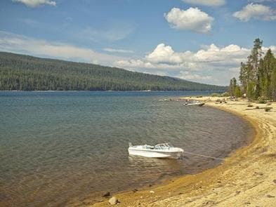
Overview Located on the southwest end of spectacular Crescent Lake in Deschutes National Forest, Windy Group Campground offers visitors the opportunity to experience the beauty and recreational opportunities of the Cascade region in a rustic and secluded setting. A large group site sits at the lake's edge. Visitors enjoy hiking nearby trails and water activities on the lake. Recreation Boating, swimming and fishing are popular activities enjoyed by visitors during spring, summer and fall months. Anglers have the opportunity to fish from boat or shoreline for abundant salmon and trout. Summer months offer the best fishing. Crescent Lake Snowpark offers skiers and snowmobilers a base camp for winter excursions. Open to snowmobiling, Summit Lake Trail, about 9 miles one-way, follows the road leading from Crescent Lake to Summit Lake, offering excellent views across Crescent Lake and showcasing Diamond Peak. Facilities Boating, swimming and fishing are popular activities enjoyed by visitors during spring, summer and fall months. Anglers have the opportunity to fish from boat or shoreline for abundant salmon and trout. Summer months offer the best fishing. Crescent Lake Snowpark offers skiers and snowmobilers a base camp for winter excursions. Open to snowmobiling, Summit Lake Trail, about 9 miles one-way, follows the road leading from Crescent Lake to Summit Lake, offering excellent views across Crescent Lake and showcasing Diamond Peak. Natural Features Crescent Lake, nestled in a naturally glaciated basin behind a moraine dam, lies east of the towering Cascade Mountain Range. Its brilliant blue-green water, sandy beaches and water temperature are exceptional for a high-elevation lake. Towering lodgepole pine trees provide the backdrop for this area, with mountain hemlock, fir, and spruce also in the mix. Volcanic activity throughout the surrounding area of Deschutes National Forest is evident in its landscape, showcasing cinder cones, calderas and lava flows. Nearby Attractions Visitors can explore wilderness areas, wild and scenic rivers, lakes and reservoirs and approximately 1,600 miles of trails that comprise nearly 2.5 million acres the Deschutes National Forest and the adjacent Ochoco National Forest. Lava Lands Visitor Center in nearby Bend, Oregon, and the Newberry National Volcanic Monument draw visitors to the region as well. Visitors will also enjoy traveling the Cascade Lakes Scenic Byway, known as Oregon's Highway in the Sky, which climbs into the clouds on a 66-mile drive through the Cascade Mountain range, weaving through snow-capped peaks and alpine lakes. A nearby resort on Crescent Lake offers lodging and a general store where supplies and equipment rentals are available. Charges & Cancellations Once your reservation start date has begun, neither the Recreation.gov Contact Center nor the campground manager will be able to modify your reservation.
View details →
Overview One of Eastern Oregon’s largest Forest Service campgrounds, Union Creek Campground is located 18 miles South of Baker City. Sitting along Phillips Reservoir’s North shore, Union Creek Campground boasts many amenities including over 60 tent/trailer sites, some with full hookups. There is access to boating, mountain biking, hiking and more. This campground is part of the Union Creek Recreation Area, which includes a picnic and day-use area. Union Creek Campground is set on three loops with separate walk-in tent camping, and it has four group sites that can accommodate large groups up to 60 people. PLEASE NOTE: This Union Creek Campground is located in northeastern Oregon in the Wallowa Whitman National Forest. This is not the Union Creek Campground located in southwestern Oregon near Medford. Recreation The campground is near a boat launch and a small, rocky swim beach. Activities include swimming, fishing, boating, and water skiing. Anglers can fish for bass, trout and perch. There's an access point for the Phillips Lake Shoreline Trail, a scenic trail for hiking and mountain biking. This trail can be connected to make a 16 mile loop around the lake. Facilities The campground is near a boat launch and a small, rocky swim beach. Activities include swimming, fishing, boating, and water skiing. Anglers can fish for bass, trout and perch. There's an access point for the Phillips Lake Shoreline Trail, a scenic trail for hiking and mountain biking. This trail can be connected to make a 16 mile loop around the lake. Natural Features Phillips Reservoir is a popular destination within the Wallowa-Whitman National Forest because it offers scenic views of the surrounding Elkhorn Mountains. The shoreline is forested with a mix of Ponderosa pine and various firs interspersed with small grasslands. Visitors enjoy several varieties of colorful wildflowers in the spring. Nearby Attractions The historic gold mining town of Sumpter is about 10 miles away, West of Hwy 7. Visitors can explore the Sumpter Dredge State Heritage Park, browse the holiday weekend flea markets or take a ride on a historic steam locomotive. Charges & Cancellations A $10.00 service fee will apply if you change or cancel your reservation. Late cancellations are subject to additional fees. For full details see NRRS Reservation Policy
View details →
Overview At an elevation of 7,100 feet, this campground keeps cool in the summertime heat. The sites sit among boulders and mixed conifers on a bluff over Anthony Lake. For questions for Anthony Lake, Grande Ronde Lake, Mud Lake, Peavey Cabin, and Anthony Lake Guard Station call (541) 894-2332 None of the sites offer lake views, but campers can enjoy gazing on Gunsight Mountain and the surrounding peaks of the Elkhorn range. Anthony Lakes Campgrounds Website Recreation There is a boat ramp available at the camp. Activities on Anthony Lake include boating, canoeing, kayaking and trout fishing. Trails in the area include the 22.6-mile Elkhorn Crest (foot and equestrian), 1-mile Black Lake (foot and equestrian) and the 1-mile Shoreline (foot). Facilities There is a boat ramp available at the camp. Activities on Anthony Lake include boating, canoeing, kayaking and trout fishing. Trails in the area include the 22.6-mile Elkhorn Crest (foot and equestrian), 1-mile Black Lake (foot and equestrian) and the 1-mile Shoreline (foot). Natural Features The Wallowa-Whitman National Forest, 2.3 million acres of varied landscape, extends from the Blue Mountains and rugged Wallowa Mountains down to the spectacular canyon country of the Snake River on the Idaho border. Anthony Lake Campground is located in the Southern Elkhorn Mountain/Powder River Basin Area, with the highest peak in the Elkhorn Mountains at 9,108 feet. The area around the lake is known for conifer forests, wildflower meadows and the resident mountain goats. Nearby Attractions The Elkhorn Scenic Byway is a 106-mile drive through the Elkhorn Mountains. Along this drive are ghost towns and an abundance of lakes and rivers. Charges & Cancellations A $10.00 service fee will apply if you change or cancel your reservation. Late cancellations are subject to additional fees. For full details see NRRS Reservation Policy
View details →
Overview Eagleview Group Campground is situated between the Pacific Coast and the city of Roseburg, Oregon. Its location on the Umpqua River caters to avid anglers and water sport enthusiasts while the grassy field and horseshoe pits offered onsite, provide more casual recreation options closer to the campground. Recreation Fishing enthusiasts will enjoy the chance to catch chinook salmon, coho, steelhead or smallmouth bass depending on the season. Float the river on a kayak or canoe or just swim in the cool Umpqua waters on a hot summer's day. These are just a few of the many things to do at Eagleview. Facilities Fishing enthusiasts will enjoy the chance to catch chinook salmon, coho, steelhead or smallmouth bass depending on the season. Float the river on a kayak or canoe or just swim in the cool Umpqua waters on a hot summer's day. These are just a few of the many things to do at Eagleview. Natural Features Eagleview is situated along the Umpqua River in southwestern Oregon. It is only one of two rivers in Oregon with headwaters that begin high up in the Cascade Mountains and meander on down to the Pacific Ocean. The campground lies in a broad river canyon surrounded by deeply forested mountainsides. The name, Umpqua, is a surviving term of the Native American Umpqua language, and translates to "thundering waters," "satisfied," or "across the waters." Nearby Attractions The Umpqua River Scenic Byway offers travelers the opportunity to drive along the Umpqua River from Interstate 5 to the coastal communities of Reedsport and Winchester Bay. Along the byway lies the town of Elkton, well-known for its wineries. West of Elkton is the Dean Creek Elk Viewing Area, where spotting majestic Roosevelt Elk near the roadway is almost guaranteed. The Pacific Ocean is roughly 45 miles from Eagleview via Highway 138.
View details →
Overview THIS LOCATION IS CLOSED UNTIL FURTHER NOTICE DUE TO WILDFIRE DAMAGE. Lone Pine Group Campground is adjacent to Rock Creek, a tributary of the North Umpqua River. Lone Pine is situated at the site of the old Rock Creek sawmill that once operated in the 1930s thru the 1950s. The campground is a short drive from the Umpqua National Forest, which boasts incredible glacier-cut mountain slopes across 984,602 acres of forest. The name, Umpqua, is a surviving term of the Native American Umpqua language, and is believed to mean "thundering waters," "across the waters" or "satisfied." Recreation Hiking picnicking and relaxing are the primary activities at the campground. In summer, swimming in the cool creek is a refreshing treat. In spring and fall, salmon and steelheads come upriver to spawn. To protect valuable native runs of salmon and steelhead, Rock Creek is closed to anglers. Instead, head to the North Umpqua River for abundant fishing opportunities. A drive along the Rogue-Umpqua Scenic Byway yields gorgeous views of mountain peaksforested canyons and alpine lakes. Facilities Hiking picnicking and relaxing are the primary activities at the campground. In summer, swimming in the cool creek is a refreshing treat. In spring and fall, salmon and steelheads come upriver to spawn. To protect valuable native runs of salmon and steelhead, Rock Creek is closed to anglers. Instead, head to the North Umpqua River for abundant fishing opportunities. A drive along the Rogue-Umpqua Scenic Byway yields gorgeous views of mountain peaksforested canyons and alpine lakes. Natural Features Lone Pine is on the western edge of the Cascade Mountains, set along Rock Creek, which eventually flows into the North Umpqua River. Majestic fir, cedar and hemlock trees dominate the mountainous region. Nearby Attractions Visitors can get their adventure-fix with kayaking and whitewater rafting in the North Umpqua River or mountain biking and hiking adventures along the 79-mile long North Umpqua Trail--both are just five miles away. The nearby Rock Creek Fish Hatchery is an educational destination, where families can feed rainbow trout and observe Steelhead and salmon. A trip to nearby Crater Lake National Park is another "can't miss" destination.
View details →
Overview Tyee is a delightful riverfront pavilion perfect for company functions, family reunions and even weddings. It faces the main stem of the Umpqua River and is ideal for a day of fun, food and water activities. The pavilion is located inside the Tyee campground. The Umpqua River Recreation Area has no shortage of recreational activities, ranging from horseback riding to birding and whitewater rafting. Wildlife viewing in the area includes deer, bald eagles, osprey and a herd of elk that populates the region in the fall. Recreation Head upstream, then kayak or canoe down to the pavilion for some food and relaxation. Fishing, especially for steelhead and salmon, is very popular in the Umpqua River. For a more casual afternoon, a round of horseshoe on the grounds of the pavilion is also very fun. Facilities Head upstream, then kayak or canoe down to the pavilion for some food and relaxation. Fishing, especially for steelhead and salmon, is very popular in the Umpqua River. For a more casual afternoon, a round of horseshoe on the grounds of the pavilion is also very fun. Natural Features The Tyee Pavilion is perched on the banks of the Umpqua River in southwestern Oregon. It is only one of two rivers in Oregon with headwaters that begin high up in the Cascade Mountains, and it meanders down to the Pacific Ocean. The campground lies in a broad river canyon surrounded by deeply forested mountainsides. Nearby Attractions The Umpqua River Scenic Byway offers breathtaking views and outstanding scenery. Along the byway lies the town of Elkton, well-known for it's wineries. West of Elkton is the Dean Creek Elk Viewing Area, where spotting majestic Roosevelt Elk near the roadway is almost guaranteed. The Pacific Coast is roughly 50 miles from Tyee.
View details →
Overview Located in southwest Oregon in the Rogue River-Siskiyou National Forest, Hart-Tish Park is surrounded by a variety of landscapes, boasting nearby volcanic peaks, rivers and old-growth forests. Hart-Tish Park offers several acres of beautifully groomed lawn sloping down to the shores of Applegate Lake. Visitors can spot the peaks of the majestic Red Buttes Wilderness while looking south over the lake. General Store with lengthy non alcoholic drink selection w/no sugar drinks as well, large snack selection as well as camping, fishing, outdoor ammenities sold. Boat Ramp. Fish Cleaning Station. Stand up paddleboard and kayak rental. Bathrooms. Truck with trailer and car parking. Recreation Hart-Tish Campground sits on the shores of Applegate Lake, a popular recreation lake located north of the Red Buttes Wilderness Area. Visitors enjoy swimming, cycling, boating, canoeing, fishing and hiking the various trails near the lake. There is a trail that goes 18.5 miles around the lake, with two short sections that are back on the road, as well as various trails close to the lake that are popular with mountaion bikers. CollinS Mountain Trail, named for the family of Freeman and Sophia (Lewis) CollingS, sisters who moved to the area in the mid-1870s from the Forest Creek/Kanaka Flat area, begins at the Hart-Tish Park picnic area. The trail crosses Upper Applegate Road and drops down to Grouse Creek, where it passes an abandoned miners' cabin and several mine adits, as well as an inactive Bigfoot trap. Leaving Grouse Creek, the trail climbs steeply for one mile to the ridge top, gaining 1,000 foot elevation, and begins a long traverse of the western slope of Collins Mountain. Panoramic views of Applegate Lake and the Siskiyou Crest are seen at several locations along the trail. The inactive Bigfoot trap, found at the beginning of the trail, was built in 1974 by the North American Wildlife Research Team. The trap was inspired by a miner who lived near the Applegate River who claimed to have found 18-inch-long, human-like tracks in his garden. The organization operated the trap, keeping it baited with carcasses for six years, but caught only bears. Currently the Forest Service keeps an eye on the trap, but otherwise does not maintain it. Facilities Hart-Tish Campground sits on the shores of Applegate Lake, a popular recreation lake located north of the Red Buttes Wilderness Area. Visitors enjoy swimming, cycling, boating, canoeing, fishing and hiking the various trails near the lake. There is a trail that goes 18.5 miles around the lake, with two short sections that are back on the road, as well as various trails close to the lake that are popular with mountaion bikers. CollinS Mountain Trail, named for the family of Freeman and Sophia (Lewis) CollingS, sisters who moved to the area in the mid-1870s from the Forest Creek/Kanaka Flat area, begins at the Hart-Tish Park picnic area. The trail crosses Upper Applegate Road and drops down to Grouse Creek, where it passes an abandoned miners' cabin and several mine adits, as well as an inactive Bigfoot trap. Leaving Grouse Creek, the trail climbs steeply for one mile to the ridge top, gaining 1,000 foot elevation, and begins a long traverse of the western slope of Collins Mountain. Panoramic views of Applegate Lake and the Siskiyou Crest are seen at several locations along the trail. The inactive Bigfoot trap, found at the beginning of the trail, was built in 1974 by the North American Wildlife Research Team. The trap was inspired by a miner who lived near the Applegate River who claimed to have found 18-inch-long, human-like tracks in his garden. The organization operated the trap, keeping it baited with carcasses for six years, but caught only bears. Currently the Forest Service keeps an eye on the trap, but otherwise does not maintain it. Natural Features The unique character of the landscapes comprising the area has led to the designation of over 340,000 acres of the forest as wilderness, and over 200 miles of streams as National Wild and Scenic Rivers. The forest itself is composed of two distinct geological provinces, the Cascade Range and the Siskiyou Mountains. The Cascade Range is dominated by snow-capped volcanic peaks like the 9,495-foot Mt. McLoughlin, located within the Sky Lakes Wilderness. The Siskiyou area embodies the most complex and treasured plant communities in the Pacific Northwest. World-class wild rivers, biological diversity, remarkable fisheries and complex watersheds all define the Siskiyou. Diverse landscapes provide habitat for a wide range of wildlife, from spotted owls and bull elk to salamanders and sandhill cranes. Nearby Attractions The nearby Rogue River National Recreation Trail, stretching 40 miles between Grave Creek and Big Bend, offers some of southwestern Oregon's most scenic landscapes and rewarding hiking experiences. This hiking-only trail follows the north bank of the Rogue River as it winds its way toward the Pacific Ocean. Visitors enjoy Crater Lake National Park and learning about its unique natural and cultural history. At 1,943 feet deep, Crater Lake is the deepest lake in the United States and one of the ten deepest lakes in the world.
View details →
Overview Located on the shore of Wickiup Reservoir in Deschutes National Forest, Gull Point campground offers visitors easy access to an abundance of recreational activities along the Cascade Lakes National Scenic Byway. Sites are scattered among a mixed, yet open conifer forest, giving sunshine a chance to filter through. Several sites sit on along the waterfront. Recreation Gull Point Campground offers visitors opportunities for hiking, boating, canoeing, swimming and fishing. The reservoir's relatively warm water and cooler deep channels generate some of the best fishing in Central Oregon. The area is renowned for its brown trout, often reaching 20 pounds, with normal catches in the 5-to-8 pound range. The reservoir also sustains good numbers of kokanee and coho salmon and decent populations of rainbow trout, brook trout, whitefish and chub. Facilities Gull Point Campground offers visitors opportunities for hiking, boating, canoeing, swimming and fishing. The reservoir's relatively warm water and cooler deep channels generate some of the best fishing in Central Oregon. The area is renowned for its brown trout, often reaching 20 pounds, with normal catches in the 5-to-8 pound range. The reservoir also sustains good numbers of kokanee and coho salmon and decent populations of rainbow trout, brook trout, whitefish and chub. Natural Features The reservoir covers an area on the Deschutes River that was historically used by Native Americans during the fall. Several tribes throughout the area built "wickiups," shelters made from reeds, grass, or brush, while living in the area. At full pool, Wickiup is a beautiful, pine-edged reservoir, with some willows and sandy beach areas. At low water, steep soil and gravel banks drop abruptly to the water. This is one of central Oregon's best wildlife viewing sites, attracting a variety of nesting and migrating birds. Fantastic nearby peaks, lava flows and forests also provide visitors with a variety of landscapes. Wetlands, diverse forests, and rocky slopes near the campground provide a necessary habitat for shorebirds, porcupine, deer, bats and the occasional black bear. Nearby Attractions Lava Lands Visitor Center in nearby Bend, Oregon, is a great starting point for visitors to learn about the diverse landscape and history of the area through interpretive programs and exhibits. Visitors can also explore the Lava River Cave, located in the Newberry National Volcanic Monument. At 5,211 feet in length, the northwest section of the cave is the longest continuous lava tube in Oregon. Charges & Cancellations Once your reservation start date has begun, neither the Recreation.gov Contact Center nor the campground manager will be able to modify your reservation
View details →
Overview Trapper Creek Campground is located in the Crescent Ranger District of Deschutes National Forest. Heavily forested and situated on a small stream that feeds into Odell Lake, this campground is a favorite in the area. Sparkling lakes, tranquil streams and nearby scenic peaks provide visitors with the perfect backdrop for fishing, boating, hiking and biking throughout the area. Recreation Boating, swimming and fishing are popular activities enjoyed by visitors during spring, summer and fall. Anglers have the opportunity to fish in clear, cold lakes and streams for abundant salmon and trout. Cross-country skiing and snowshoeing are popular during the winter. For anglers, Odell Lake is considered one of the blue giants of the Deschutes National Forest. This large lake has an average depth is 132 feet, which makes it ideal habitat for lake trout and bull trout. Rainbow trout, kokanee salmon and whitefish are also found in the lake. Boats are the most effective way to fish this lake but visitors should be aware of afternoon winds, as the lake can get dangerously rough. A boat ramp is provided at the campground. Facilities Boating, swimming and fishing are popular activities enjoyed by visitors during spring, summer and fall. Anglers have the opportunity to fish in clear, cold lakes and streams for abundant salmon and trout. Cross-country skiing and snowshoeing are popular during the winter. For anglers, Odell Lake is considered one of the blue giants of the Deschutes National Forest. This large lake has an average depth is 132 feet, which makes it ideal habitat for lake trout and bull trout. Rainbow trout, kokanee salmon and whitefish are also found in the lake. Boats are the most effective way to fish this lake but visitors should be aware of afternoon winds, as the lake can get dangerously rough. A boat ramp is provided at the campground. Natural Features Nearby Odell Lake offers views across the water to Diamond Peak, the most prominent peak in nearby Diamond Peak Wilderness. At an elevation of 8,744 feet, this shield volcano formed as the entire Cascades mountain range was undergoing volcanic activity and uplift. Mixed stands of pine and fir trees tower over a variety of springtime flowers. Huckleberry is common in the underbrush of the campground. Wildlife found in the area include deer, elk, pine martens, ravens, native fish and an occasional black bear. Nearby Attractions Visitors can explore wilderness areas, wild and scenic rivers, lakes and reservoirs and approximately 1,600 miles of trails that comprise nearly 2.5 million acres the Deschutes National Forest and the adjacent Ochoco National Forest. Lava Lands Visitor Center in nearby Bend, Oregon, and the Newberry National Volcanic Monument draw visitors to the region as well. Visitors will also enjoy traveling the Cascade Lakes Scenic Byway, known as Oregon's Highway in the Sky, which climbs into the clouds on a 66-mile drive through the Cascade Mountain range, weaving through snow-capped peaks and alpine lakes. A nearby resort on Odell Lake offers lodging and a general store with camping supplies, coffee, snacks and fishing licenses. Charges & Cancellations Once your reservation start date has begun, neither the Recreation.gov Contact Center nor the campground manager will be able to modify your reservation.
View details →
Overview Nestled in Deschutes National Forest, Smiling River Campground offers visitors some of the most stunning scenery in central Oregon and easy access to an abundance of recreational activities. Recreation Hiking and fishing top the list of recreational activities for visitors. For anglers, the spring-fed Metolius river offers a stunning setting for fly-fishing. Its clear, cold water supports rainbow trout, whitefish, bull trout and kokanee salmon. For day hikers and backpackers, the area offers a wide variety of scenic terrain, ranging from riverside trails to routes in subalpine forests. Facilities Hiking and fishing top the list of recreational activities for visitors. For anglers, the spring-fed Metolius river offers a stunning setting for fly-fishing. Its clear, cold water supports rainbow trout, whitefish, bull trout and kokanee salmon. For day hikers and backpackers, the area offers a wide variety of scenic terrain, ranging from riverside trails to routes in subalpine forests. Natural Features Many sites at this campground look out to Metolius River, a tributary of the Deschutes River. The headwaters of the river are at Metolius Springs at the base of Black Butte, a 3,076-foot cinder cone. The clear, cold river flows north from the springs through diverse coniferous forest and a landscape of volcanic activity. The area provides habitat for mammals such as mule deer, coyote and cougar. Migratory birds and native fish also call the area home. Nearby Attractions The Metolius-Windigo Trail, open to hikers, bikers and horses, is more than 100 miles in length, and begins near the Metolius River headwaters west of the town of Sisters, Oregon. The trail was created in the 1980s primarily to serve long-distance horse riders seeking an alternative to the Pacific Crest Trail. Lava Lands Visitor Center in Bend, Oregon, offers visitors the opportunity to learn about the diverse landscape and history of the area through interpretive programs and exhibits. Charges & Cancellations Once your reservation start date has begun, neither the Recreation.gov Contact Center nor the campground manager will be able to modify your reservation.
View details →
Overview Camp Sherman Campground is nestled on the banks of the scenic Metolius River in Deschutes National Forest. It offers visitors some of the most stunning scenery in central Oregon and easy access to an abundance of recreational activities. Recreation Hiking and fishing top the list of recreational activities at Camp Sherman Campground. Biking is a great way to see the area as well. Anglers enjoy fly-fishing for rainbow trout, whitefish, bull trout and kokanee salmon. Day hikers and backpackers will find a wide variety of hiking trails through scenic terrain, ranging from riverside trails to routes through subalpine forests. Facilities Hiking and fishing top the list of recreational activities at Camp Sherman Campground. Biking is a great way to see the area as well. Anglers enjoy fly-fishing for rainbow trout, whitefish, bull trout and kokanee salmon. Day hikers and backpackers will find a wide variety of hiking trails through scenic terrain, ranging from riverside trails to routes through subalpine forests. Natural Features Many sites at this campground have views of to Metolius River, a tributary of the Deschutes River, through Lake Billy Chinook, near the city of Sisters. Metolius Springs forms the headwaters of the river at the base of Black Butte, a 3,076' cinder cone. The clear, cold river flows north from the springs through diverse coniferous forest and a landscape of volcanic activity. The area provides habitat for mammals such as mule deer, coyote and cougar. Migratory birds and native fish also call the area home. Nearby Attractions The Metolius-Windigo Trail begins near the Metolius River headwaters west of the town of Sisters. The trail is over 100 miles long and is open to hiking, biking and horseback riding. It was created in the 1980s by linking sections of existing trails, primarily to give long-distance horseback riders an alternative to the Pacific Crest Trail. Charges & Cancellations Once your reservation start date has begun, neither the Recreation.gov Contact Center nor the campground manager will be able to modify your reservation.
View details →
Overview Fox Creek Group Camp is situated in a large, open area surrounded by dense forest near the point where Fox Creek flows in the Breitenbush River. The groups site accommodates tent campers plus RVs and trailers of any size. The groups site caters to groups of up to 75 guests with ample parking. It is equipped with an accessible vault toilet, dumpster, campfire rings and picnic tables. The campground is a short walk from the Breitenbush River, a tributary of Oregon's North Santiam River, at an elevation of 1,700 feet. The river's clean waters flow from short forks of snow melt in the Mount Jefferson Wilderness. There is no water service at this site. Reservations for this site can be made up to 12 months in advance of arrival date by reserving online at RECREATION.GOV or by calling 877-444-6777. Recreation Fox Creek is a central access point to miles of scenic hiking trails. Willamette National Forest boasts 1,700 miles of trails, many of which trek through wilderness areas like the nearby Mount Jefferson Wilderness. Campers can fish and swim in the Breitenbush River. Rainbow trout is the most common catch for anglers. Facilities Fox Creek is a central access point to miles of scenic hiking trails. Willamette National Forest boasts 1,700 miles of trails, many of which trek through wilderness areas like the nearby Mount Jefferson Wilderness. Campers can fish and swim in the Breitenbush River. Rainbow trout is the most common catch for anglers. Natural Features The campground is a short walk from the Breitenbush River, a tributary of Oregon's North Santiam River, at an elevation of 1,700 feet. The river's clean waters flow from short forks of snow melt in the Mount Jefferson Wilderness. The Willamette National Forest stretches for 110 miles along the western slopes of the Cascade Range in western Oregon. The varied landscape of high mountains, narrow canyons, cascading streams, and wooded slopes offer excellent sightseeing and recreation opportunities. contact_info For facility specific information, please call (541) 967-3917. Nearby Attractions Head to Detroit Lake for a variety of activities including power boating, water skiing, kayaking and canoeing. Within 10 miles there are also opportunities for off-highway vehicle recreation, hunting, hiking, backpacking, scenic driving, and soaking in hot springs.
View details →
Overview Little Lava Lake Campground is located along the Cascade Lakes National Scenic Byway in the Central Oregon Cascades. Recreation Little Lava Lake Campground provides recreation opportunities for fishing, paddling, swimming and hiking. For anglers, the 130-acre Little Lava Lake offers a quiet alternative to its larger neighbor to the north, Lava Lake. Reaching a maximum depth of 20 feet, the lake supports planted Rainbow trout, some Brook trout, and self-sustaining populations of Whitefish and Tui Chub. Bait, lures, flies, still fishing and trolling are all acceptable angling methods. Facilities Little Lava Lake Campground provides recreation opportunities for fishing, paddling, swimming and hiking. For anglers, the 130-acre Little Lava Lake offers a quiet alternative to its larger neighbor to the north, Lava Lake. Reaching a maximum depth of 20 feet, the lake supports planted Rainbow trout, some Brook trout, and self-sustaining populations of Whitefish and Tui Chub. Bait, lures, flies, still fishing and trolling are all acceptable angling methods. Natural Features Little Lava Lake is located on the eastern slopes of the Cascade Mountain Range at an elevation of 4,740 feet. The small lake is surrounded by mature pine forests with bull rushes and lava outcroppings lining its shores. Nearby Attractions Visitors can explore wilderness areas, wild and scenic rivers, lakes and reservoirs and approximately 1,600 miles of trails within the Deschutes National Forest. Lava Lands Visitor Center in nearby Bend, Oregon, and the unique geological landscape of Newberry National Volcanic Monument draw visitors to the region as well. Visitors will also enjoy traveling the Cascade Lakes Scenic Byway which climbs into the Cascades over a 66-mile drive through snow-capped peaks and alongside alpine lakes. A nearby resort on Lava Lake offers lodging and a limited selection of groceries. Charges & Cancellations Once your reservation start date has begun, neither the Recreation.gov Contact Center nor the campground manager will be able to modify your reservation.
View details →
Overview Big River Campground is located along the Deschutes River south of the town of Sunriver. Large, open group sites offer a perfect setting for family reunions or group gatherings. Recreation Popular activities in the area include hiking, fishing and rafting in the summer months and cross-country skiing and snowshoeing in the winter. Big River provides the perfect place to launch a canoe or kayak into the Deschutes River. Only non-motorized boating is permitted on the river, and the water is Class II flatwater for about 6 miles below Sunriver. The Deschutes River is renowned for its fly fishing, and sustains populations of kokanee, rainbow, bull and brown trout. Boat fishing or drift fishing is the best way to catch fish at this part of the river. Facilities Popular activities in the area include hiking, fishing and rafting in the summer months and cross-country skiing and snowshoeing in the winter. Big River provides the perfect place to launch a canoe or kayak into the Deschutes River. Only non-motorized boating is permitted on the river, and the water is Class II flatwater for about 6 miles below Sunriver. The Deschutes River is renowned for its fly fishing, and sustains populations of kokanee, rainbow, bull and brown trout. Boat fishing or drift fishing is the best way to catch fish at this part of the river. Natural Features Nearby peaks, lava flows and Ponderosa pine stands provide visitors with a variety of landscapes, showcasing ecosystems typical of central Oregon. The Deschutes River, a tributary of the Columbia River, is central to the campground. The river flows through areas of ponderosa and aspen, with its shoreline varying from marshy meadows to basalt bedrock. Flows fluctuate less on this part of the river because of tributaries, and the river features many deep pools, a relatively stable bank and rocky in-stream structure. Wildlife found in the area include deer, elk, native fish and migratory birds. Nearby Attractions Visitors can explore wilderness areas, rivers, lakes and reservoirs, and hundreds of miles of hiking trails. Newberry National Volcanic Monument offers a glimpse into Central Oregon's rich geologic history. Travel 12 miles to Lava Lands Visitor Center to explore exhibits at the interpretive center, attend a ranger talk, take in scenic views from the top of Lava Butte and travel one-mile underground through Lava River Cave. Travel 25 miles to Newberry Caldera to visit Paulina and East Lake, Paulina Peak and Paulina Falls. Big River Campground offers easy access to the Cascade Lakes Scenic Byway which weaves through multiple high lakes with views of South Sister, Broken Top and Mt. Bachelor.
View details →
Overview Nestled in Deschutes National Forest, Spring Campground offers visitors some of the most stunning scenery in central Oregon and easy access to an abundance of recreational activities in the Cascade region. A favorite among visitors, the sites in this campground are widely-spaced and scattered among a mixed conifer forest, giving it an open and sunny character. The campground looks out to the stunning water of Crescent Lake, and several tent-only sites are on the lake front. Recreation In addition to being a prime location for boating, fishing, swimming, hiking and biking in summer and early fall, Spring Campground offers excellent skiing, snowshoeing and snowmobiling in the winter months. Crescent Lake Snowpark offers skiers and snowmobilers a base camp for winter excursions. Summit Lake Trail, 9 miles one- way, follows the road leading from Crescent Lake to Summit Lake, offering excellent views across Crescent Lake and highlighting Diamond Peak. Anglers enjoy fishing from boats or the shoreline. Fish species found in the lake include kokanee salmon, mackinaw, rainbow trout, brown trout and mountain whitefish. Summer months offer the best fishing opportunities. Facilities In addition to being a prime location for boating, fishing, swimming, hiking and biking in summer and early fall, Spring Campground offers excellent skiing, snowshoeing and snowmobiling in the winter months. Crescent Lake Snowpark offers skiers and snowmobilers a base camp for winter excursions. Summit Lake Trail, 9 miles one- way, follows the road leading from Crescent Lake to Summit Lake, offering excellent views across Crescent Lake and highlighting Diamond Peak. Anglers enjoy fishing from boats or the shoreline. Fish species found in the lake include kokanee salmon, mackinaw, rainbow trout, brown trout and mountain whitefish. Summer months offer the best fishing opportunities. Natural Features Cresent Lake, nestled in a naturally glaciated basin behind a moraine dam, lies east of the towering Cascade Mountain Range. Its brilliant blue-green water, sandy beaches and water temperature are exceptional for a high-elevation lake. Fantastic nearby peaks, lava flows and old-growth forests provide visitors with breathtaking landscapes, showcasing ecosystems typical of central Oregon. Wildlife found in the area include deer, porcupine, native fish and migratory birds. Nearby Attractions Visitors can explore wilderness areas, wild and scenic rivers, lakes and reservoirs and approximately 1,600 miles of trails that comprise nearly 2.5 million acres the Deschutes National Forest and the adjacent Ochoco National Forest. Lava Lands Visitor Center in nearby Bend, Oregon, and the Newberry National Volcanic Monument draw visitors to the region as well. Visitors may also enjoy traveling the Cascade Lakes Scenic Byway, known as Oregon's Highway in the Sky. The 66-mile drive through the Cascade Mountain range weaves through snow-capped peaks and alpine lakes, highlighting the beauty of central Oregon. Charges & Cancellations Once your reservation start date has begun, neither the Recreation.gov Contact Center nor the campground manager will be able to modify your reservation.
View details →
Overview Haystack South Shore Group Campground is the only group campground on Haystack Reservoir. Each of the two campsites holds up to 50 people. This is a year-round facility ideal for large events such as family reunions or groups of rock climbers visiting nearby Smith Rock State Park. Natural Features: South Shore is located in the high desert landscape with views of Mt. Jefferson as a scenic backdrop. Juniper trees and sagebrush dot the landscape. The combination of a low forest canopy and 3,000 ft. elevation make this a perfect location for stargazing at the wide open sky on clear nights. Eagles and other birds inhabit the shoreline of the lake. Recreation: Haystack Reservoir is a popular fishing spot for a variety of species, including kokanee, rainbow trout, largemouth bass, black crappie and brown bullhead catfish. The lake is cool, but a comfortable temperature for swimming. Motorized boating is allowed. Boat launches are located at nearby Haystack and West Shore day use areas. The surrounding national grassland also provides ample opportunities for hunting, hiking, horseback riding, mountain biking and riding off-highway vehicles. Facilities: The facility is very comfortable for group events, providing several picnic tables, campfire rings and plenty of parking. There are two group sites, Willow and Cottonwood, which are out of sight from each other. Although there is no drinking water at this facility, it is available at Haystack Campground down the road. There are no hookups. Vaulted toilets are located near both sites. Nearby Attractions: Smith Rock State Park , best known for its many rock climbing routes, is a short drive away.
View details →
Overview Riverside Campground provides 32 single campsites that can accomodate trailers up to 24 feet in length, 1 double campsite. This campground has both reservable and FCFS campsites. The campground is situated with two main loops. All sites are equipped with picnic tables and fire rings. Water is provided via individual faucet risers located throughout the campground. There are three double-vault toilets located in accessible locations. Trash receptacles are located in the campground. Campfires allowed until and unless otherwise posted. Fire bans are common during summer months. Please plan accordingly. Scan and Pay is offered at this campground; you may also pay by cash or check for FCFS campsites. There are no refunds, modifications, cancellations, or other fee changes allowed with Scan and Pay payments. This system is the same as putting cash into a fee tube and cannot be refunded. Please download the Rec.Gov app prior to arriving at the campground as there may be no cellular service or very limited service at the campground. Reservations for this site can be made up to 6 months in advance of arrival date by reserving online at RECREATION.GOV or by calling 877-444-6777. Recreation Anglers enjoy fishing for rainbow trout on the river. Among the many options for hiking and biking trails, the Mt. Jefferson-Pamelia Lake Trail Area is bound to please all types. Hikers looking for a challenging trail will enjoy the Minto Mountain Trail. Facilities Anglers enjoy fishing for rainbow trout on the river. Among the many options for hiking and biking trails, the Mt. Jefferson-Pamelia Lake Trail Area is bound to please all types. Hikers looking for a challenging trail will enjoy the Minto Mountain Trail. Natural Features Riverside is located along the North Fork Santiam River at an elevation of 2,400 feet. Surrounding vegetation includes hemlock, rhododendron and fern, among the towering conifers. The campground is in the North Santiam Travel Corridor of the Willamette National Forest. The forest covers 1.6 million acres on the western slopes of the Cascade Range. Nearby Attractions The Marion Forks Fish Hatchery, along Marion and Horn Creeks, is an interesting place to visit. Here, visitors can see rainbow trout, summer steelhead and spring chinook being harvested. contact_info For facility specific information, please call (541) 967-3917.
View details →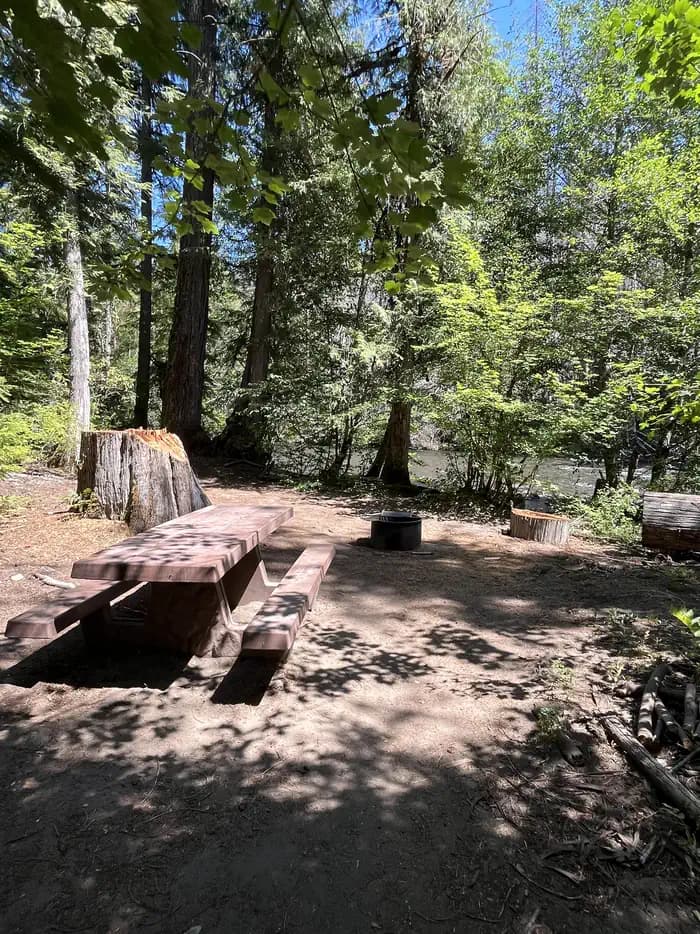
Overview Cleator Bend Group Campground, located on a bend of the Breitenbush River, is a popular destination for camping. The group area provides an ideal base camp for fishing, hiking, biking and more. There is 1 group site which can accommodate up to 45 people. Amenities include 8 campfire rings, 8 picnic tables, and 1 vault toilet. Drinking water is temporarily unavailable within campground. Trash receptacles are located in the campground. Campfires allowed until and unless otherwise posted. Fire bans are common during summer months. Please plan accordingly. Reservations for this site can be made up to 12 months in advance of arrival date by reserving online at RECREATION.GOV or by calling 877-444-6777. Recreation The river is a popular spot for wading, swimming and rainbow trout fishing. Facilities The river is a popular spot for wading, swimming and rainbow trout fishing. Natural Features The Breitenbush River is a tributary of the North Santiam River. The clean waters flow from snow melt in the Mount Jefferson Wilderness. The campground lies in the Willamette National Forest, which stretches 110 miles along the western slopes of the Cascade Range. contact_info For facility specific information, please call (541) 967-3917. Nearby Attractions The South Breitenbush Gorge Trail is three miles from the campground. Here, hikers can view the river passing through basalt narrows. During the hike, look for a log footbridge that crosses Roaring Creek's cascading waters.
View details →
Overview Breitenbush Campground is nestled along the banks of its namesake river in the forests of western Oregon. The peaceful flow of the river can be heard throughout the campground, providing a peaceful getaway for campers. The campground lies in the Willamette National Forest, which stretches for 110 miles along the western slopes of the Cascade Range. The varied landscape of high mountains, narrow canyons, cascading streams and wooded slopes offer varied recreational opportunities for visitors. The Breitenbush River is a tributary of the North Santiam River, and its clean waters flow from snow melt in the Mount Jefferson Wilderness. A variety of plants and foliage separate the spacious campsites and provide privacy from other sites. Located nearly 10 miles east of Detroit, Oregon, at an elevation of 2,100 feet. Visitors can reach the site from Detroit by traveling north on state highway OR-22 before turning right (northeast) onto Breitenbush Road. After approximately 9.5 miles the turnoff for the campground will be on the right (south) side of the road. There are 29 campsites, for which 23 are reservable, that can accommodate vehicles and trailers up to 24 feet in length. Each site has a picnic table and firepit. There are four vault toilets. Trash receptacles are located in the campground. Scan and Pay is offered at this campground; you may also pay by cash or check for FCFS campsites. There are no refunds, modifications, cancellations, or other fee changes allowed with Scan and Pay payments. This system is the same as putting cash into a fee tube and cannot be refunded. Please download the Rec.Gov app prior to arriving at the campground as there may be no cellular service or very limited service at the campground. Campfires are allowed until and unless otherwise posted. Common to have fire bans during summer season, please plan accordingly. Wading and fishing are popular activities in the Breitenbush River, and rainbow trout is the most common catch for anglers. Reservations for this site can be made up to 6 months in advance of arrival date by reserving online at RECREATION.GOV or by calling 877-444-6777. Recreation Wading and fishing are popular activities in the Breitenbush River, and rainbow trout is the most common catch for anglers. The Willamette National Forest has about 1,700 miles of trail. While many are in wilderness areas, a number of trails are low-elevation, easy-access trails for year-round hiking. Facilities Wading and fishing are popular activities in the Breitenbush River, and rainbow trout is the most common catch for anglers. The Willamette National Forest has about 1,700 miles of trail. While many are in wilderness areas, a number of trails are low-elevation, easy-access trails for year-round hiking. Natural Features The campground lies in the Willamette National Forest, which stretches for 110 miles along the western slopes of the Cascade Range. The varied landscape of high mountains, narrow canyons, cascading streams and wooded slopes offer varied recreational opportunities for visitors. The Breitenbush River is a tributary of the North Santiam River, and its clean waters flow from snow melt in the Mount Jefferson Wilderness. A variety of plants and foliage separate the spacious campsites and provide privacy from other sites. contact_info For facility specific information, please call (541) 967-3917. Nearby Attractions Nearby attractions include: The Willamette National Forest has approximately 1,700 miles of trails. While many are in wilderness areas, a number of trails are low-elevation, easy-access trails for year-round hiking. Detroit Lake provides ample opportunity for water recreation like boating, water skiing and kayaking.
View details →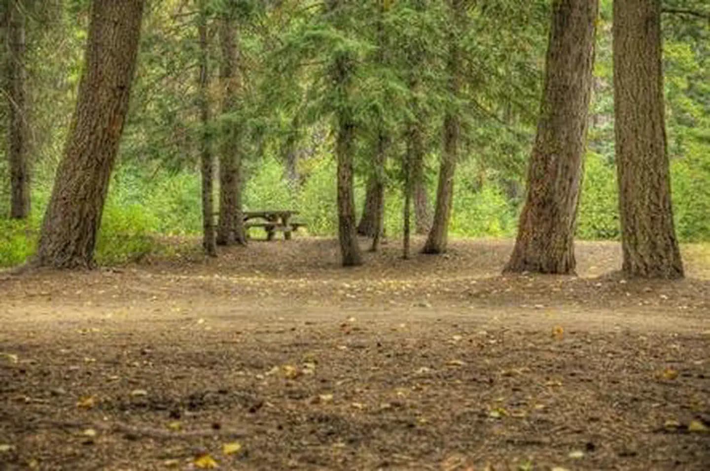
Overview Spring Drive RV Campground is a popular camping spot with access to a variety of recreational activities. It offers full hookups and spacious campsites, amid a forest of towering trees. The campground is an ideal destination for families that enjoy the great outdoors in the beautiful Pacific Northwest. It is not far from some great wilderness spots, including mountain lakes and streams, as well as trails and historic sites. Recreation A variety of short hiking trails are available nearby for exploration. The Mt. Hood area and Government Camp, as well as a variety of mountain lakes and streams, are within a short drive from the campground. Picnicking is also a popular activity. Facilities A variety of short hiking trails are available nearby for exploration. The Mt. Hood area and Government Camp, as well as a variety of mountain lakes and streams, are within a short drive from the campground. Picnicking is also a popular activity. Natural Features The campground is located on the southeastern edge of Mt. Hood National Forest an at elevation of 3,200 feet. It is situated among towering pine and fir trees, but the beauty of the campground is its secluded feel, along with some luxuries of RV camping. Deer and other wildlife are common in the area. contact_info For facility specific information, please call (541) 467-2291. Nearby Attractions Spring Drive is near the Warm Springs Tribal Lands and is approximately 19 miles from Government Camp, where visitors may enjoy summertime snow skiing.
View details →
Overview Slide Creek Campground is a unique camping destination just 50 miles from Eugene, Oregon. Located on the east bank of the Cougar Reservoir, it is known for handy access to boating and many water activities. It is also near Terwilliger Hot Springs, a pristine area with 5 soaking pools fed by the Rider Creek waterfall. Recreation Activities on the reservoir include water skiing, swimming, fishing and canoeing. Anglers might catch some quality rainbow trout. The campground is close to a large network of hiking trails in the Olallie Trail Area. Half of the trails are open to biking as well. Facilities Activities on the reservoir include water skiing, swimming, fishing and canoeing. Anglers might catch some quality rainbow trout. The campground is close to a large network of hiking trails in the Olallie Trail Area. Half of the trails are open to biking as well. Natural Features The Willamette National Forest stretches for 110 miles with varied landscapes of high mountains, narrow canyons, cascading streams, and wooded slopes. Native wildlife includes Roosevelt elk, black bear, bald eagles, black tail deer and bobcats. Cougar Reservoir sits at 1,700 feet in elevation and is an estimated 1,280 acres. Some campsites have views of Cougar Reservoir and all sites are an easy walk to the swimming area.
View details →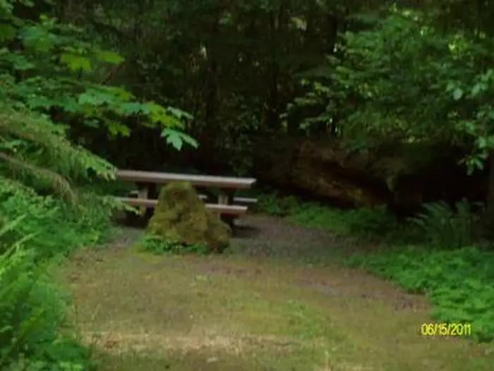
Overview Known for its access to rafting and drift boat fishing on the McKenzie River, Delta campground, located along a portion of the West Cascades National Scenic Byway, is one of the largest and most scenic campgrounds on the McKenzie District. Access to the river, hiking and mountain biking trails are nearby. Reservations are available May through Mid-September, they can be made at least six months in advance, but must be made at least 4 days prior to your intended arrival date. Recreation Cougar Reservoir and Terwilliger Hot Springs make this campground a great spot for camping and exploring the area. Visitors can also enjoy a short botanical walk on the Delta Old Growth Nature Trail. A Day Use area and amphitheater are also available at the campground. Facilities Cougar Reservoir and Terwilliger Hot Springs make this campground a great spot for camping and exploring the area. Visitors can also enjoy a short botanical walk on the Delta Old Growth Nature Trail. A Day Use area and amphitheater are also available at the campground. Nearby Attractions There is a non-motorized boat launch within one mile. Within ten miles there is a motorized boat launch and access to flat water. Hiking and biking trails and Terwilliger Hot Springs are also within ten miles.
View details →
Overview Known for fishing, boating, canoeing and other water sports, Mona campground is located on the northwest shore of Blue River Reservoir. The campground is situated on a long, narrow strip of mixed conifers along the shore, the thick vegetation secludes each campsite, allowing for privacy. Slopes of mixed conifers and other trees surround the area. Reservations are available May through mid-September. They can be made up to six months in advance, but must be made at least four days prior to your intended arrival date. Recreation Fishing, boating, swimming, and water skiing on Blue River Reservoir draw campers here. There is hiking on Buck Mountain Trail and Lookout Creek Old Growth Trail. Sightseeing is popular on the West Cascades National Scenic Byway. Facilities Fishing, boating, swimming, and water skiing on Blue River Reservoir draw campers here. There is hiking on Buck Mountain Trail and Lookout Creek Old Growth Trail. Sightseeing is popular on the West Cascades National Scenic Byway. Natural Features The campground sits on the northeastern shore of Blue River Reservoir and can be accessed by driving the West Cascades National Scenic Byway. It is located in the Willamette National Forest on the western slopes of the Cascade Mountains. Nearby Attractions Come for water play or fishing at Blue River Reservoir or for exploring the nearby trails and Scenic Byway.
View details →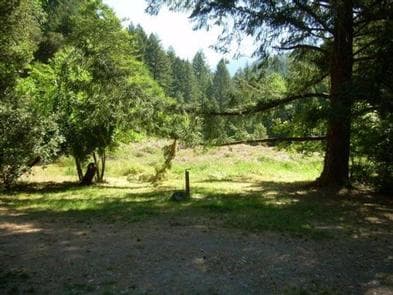
Overview The Chinquapin Group Campground is located at the former site of the Camp Oregon Caves Civilian Conservation Corps (CCC) camp. During the Great Depression from 1933- 1941 the Camp Oregon Caves Civilian Conservation Corps (CCC) camp was home to over 200 men who worked on projects in the Siskiyou National Forest and the Oregon Caves National Monument. Today, the only structure currently remaining at the site is the historic Grayback Ranger Station, constructed by CCC crews around 1936 and located immediately adjacent to the Chinquapin Group Campground. The large Port- Orford cedar tree located near the back of the parking area was dedicated in 2011 as the 56th Oregon State Heritage Tree and is a living reminder of the Civilian Conservation Corps (CCC) and Camp Oregon Caves CCC camp. The large meadow at the Chinquapin Group Campground makes a great location for group events such as reunions, church camps, school field trips and scouting events. Water, picnic tables and fire rings are readily available at three locations in the campground and a restroom is located at the back of the parking area. Within a short walking distance there are swimming areas in Grayback Creek and creek side trails with meadows, marshes, spring wildflowers, wildlife and berry picking. No electricity is available at the Chinquapin Group Campground. Visitors can continue 10 miles east on Hwy 46 and visit Oregon Caves National Monument for a tour of one of the few marble caves in the world. Recreation The Grayback Interpretive #1204 follows Grayback Creek adjacent to Chinquapin Group Campground and is open to hikers who occasionally may use the toilet in the campground. Facilities The Grayback Interpretive #1204 follows Grayback Creek adjacent to Chinquapin Group Campground and is open to hikers who occasionally may use the toilet in the campground.
View details →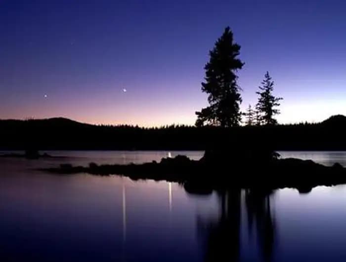
Overview Waldo Lake is one of the largest natural lakes in Oregon. It offers a uniquely peaceful setting on the water and along remote shorelines, surrounded by forests of Douglas fir and mountain hemlock. Recreation in the area is abundant with the lake an ideal location for water activities like sailing, canoeing and swimming. Recreation Waldo Lake is circled by the Jim Weaver Loop, 20 miles of trail for hiking and biking. Bikes are allowed on the trails, but not in the nearby Waldo Lake Wilderness. There is also easy access to the Pacific Crest Trail and North Waldo is also a popular starting point for many wilderness trails and lakes, most notably the Rigdon, Wahanna and Torrey Lakes. There is a 1-mile Shoreline Trail between North Waldo Campground and Islet Campground which provides a short and pleasant hike along the lakeshore. Facilities Waldo Lake is circled by the Jim Weaver Loop, 20 miles of trail for hiking and biking. Bikes are allowed on the trails, but not in the nearby Waldo Lake Wilderness. There is also easy access to the Pacific Crest Trail and North Waldo is also a popular starting point for many wilderness trails and lakes, most notably the Rigdon, Wahanna and Torrey Lakes. There is a 1-mile Shoreline Trail between North Waldo Campground and Islet Campground which provides a short and pleasant hike along the lakeshore. Natural Features Situated high on the western slopes of the Oregon Cascades at 5,400 feet in elevation, Waldo Lake is one of the purest lakes in Oregon (9.8 square miles with a maximum depth of 427 feet). It has no permanent inlet to bring nutrients into the lake for plant growth. The lack of plant life contributes to its purity, allowing you to see to depths of 120 feet on a calm day.
View details →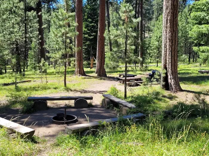
Overview The Ochoco Divide Group Site is a convenient place to camp while traveling across scenic State Highway 26 by bicycle or car. Resting at the top of the Ochoco Divide at an elevation of 4,700 ft., the group site is set on a hill away from the road as an extension of the general campground. Summertime in the Ochoco National Forest brings pleasant temperatures; the campground is closed during winter. Recreation The group site of the Ochoco Divide Campground is mainly used by touring cyclists. It is also a good place to take a relaxing stroll through the woods. There are opportunities for hunting, mountain biking and hiking in the national forest surrounding the facility. Several trailheads begin at the Bandit Springs rest stop about one mile from the campground on Highway 26. Facilities The group site of the Ochoco Divide Campground is mainly used by touring cyclists. It is also a good place to take a relaxing stroll through the woods. There are opportunities for hunting, mountain biking and hiking in the national forest surrounding the facility. Several trailheads begin at the Bandit Springs rest stop about one mile from the campground on Highway 26. Natural Features The scenery surrounding the campground alternates between thick Ponderosa pine forests and grassy meadows, though shortly beyond the campground the road descends into lower-elevation, arid canyon lands. One of the most unique geologic features of the Ochoco National Forest is the 'thunder egg,' Oregon's official state rock. Thunder eggs are small, colorful, round volcanic rocks similar to geodes that have been exposed over time. The U.S. Forest Service has designated specific sites for rock hounding. Nearby Attractions John Day Fossil Beds National Monument is less than an hour away. Hike amongst the Painted Hills and famed fossils, take a journey through time at the museum at Sheep Rock or picnic beneath the beautiful mountain scenery. John Day Fossil Beds National Monument
View details →
Overview LePage Park is located at the confluence of the John Day and Columbia Rivers just five miles from Rufus, Oregon, and the John Day Dam. Popular activities include river fishing, swimming, water skiing and boating. Recreation Visitors enjoy boating, water sports and swimming in the river. Anglers fish for smallmouth bass, catfish, and abundant sunfish. A boat ramp is located at the campground for convenient river access. Facilities Visitors enjoy boating, water sports and swimming in the river. Anglers fish for smallmouth bass, catfish, and abundant sunfish. A boat ramp is located at the campground for convenient river access. Natural Features The park is situated in a river basin with a high desert climate. Mature shade trees line the edges of this open grassy park on the banks of the John Day River. Wildlife is abundant in the area, such as mule deer, waterfowl, and birds of prey. contact_info Between 04/15/2024 and 10/15/2024 this location is staffed. Please call (541) 739-2713 to speak with local staff. From 10/16/2024 to 10/31/2030 this location is unstaffed. Please call (541) 739-1135 for general information.
View details →
Overview Pine Meadows Campground is located on Cottage Grove Lake in Oregon's southern Willamette Valley. Recreation Cottage Grove Lake and its shoreline, set in the gently rolling hills of the Willamette Valley, are used for numerous outdoor activities both on land and on water. There are boat ramps at Lakeside Park and Wilson Creek Park nearby, giving visitors easy access to the lake for boating and fishing. Families can use the swim beach or picnic along the shore. The lake is also a designated stop along the Big River Loop of the Willamette Valley Birding Trail, a self-guided driving tour that includes 138 birding hotspots. Facilities Cottage Grove Lake and its shoreline, set in the gently rolling hills of the Willamette Valley, are used for numerous outdoor activities both on land and on water. There are boat ramps at Lakeside Park and Wilson Creek Park nearby, giving visitors easy access to the lake for boating and fishing. Families can use the swim beach or picnic along the shore. The lake is also a designated stop along the Big River Loop of the Willamette Valley Birding Trail, a self-guided driving tour that includes 138 birding hotspots. Natural Features Located in the low foothills of the Calapooya Mountains, Pine Meadows is surrounded by a diverse mixture of marshland, coniferous forests, and grasslands. The area is managed to provide habitat for a wide variety of wildlife species, including waterfowl, black-tailed deer, upland game birds, songbirds, bald eagles, osprey, and many other species. Visitors can see rare birds like the purple martin, the willow flycatcher, and the yellow-breasted chat in the lake area. Osprey and purple martins nest in nearby structures. Charges & Cancellations Reservation changes or cancellations can be made through Recreation.gov or by calling 1-877-444-6777. Cancelling/Changing a Reservation A $10.00 service fee will apply if you change or cancel your reservation. The $10.00 service fee will be deducted from the refund amount. Depending on when you cancel in relation to your arrival day, it may be considered a late cancellation (see below). Late Cancellations Individual Campsites: A customer who cancels a reservation the day before or on the day of arrival will pay a $10.00 service fee AND forfeit the first night's use fee (not to exceed the total paid for the original reservation). Cancellations for a one-night reservation will forfeit the entire amount paid and will not be subject to an additional service fee. Group Facility: Customers who cancel a group overnight facility reservation less than 14 days before the arrival date will pay a $10.00 service fee AND forfeit the first night's use fee. No-Shows A no-show customer is one who does not arrive at a campground and does not cancel the reservation by check-out time on the day after the scheduled arrival date. Staff will hold a campsite until 2pm on the day following the scheduled arrival date. No-shows are assessed $20.00 service fee and forfeit the first night’s recreation fee for a campsite. Early Departures If a customer departs prior to the scheduled check-out date, they may be eligible for a partial refund. Please notify staff at the facility if you depart early to allow others to use the site. Customers may notify the call center to request a refund of remaining unused nights. If a customer requests a refund for an early departure after the facility check-out time has passed, the customer will not be refunded for that night and is eligible for a refund on any additional nights that will not be used. Refunds Customers may submit a refund request through their Recreation.gov profile within 7 days of the end date of their reservation. Customers may also initiate a refund request through the call center at any time after their reservation has ended. Debit or Credit Card Purchases: Refunds for debit or credit card payments will be issued as a credit to the original card used to pay. Check or Cash Purchases: Recreation.gov will mail a Treasury check for refunds of cash, check, or money order payments to the address associated with the reservation. You may update the address at the time you request the refund. It may take up to 6-8 weeks for the Treasury check to arrive. Please make sure your address is up to date in your customer profile.
View details →
Overview Schwarz Campground is located below Dorena Lake in Oregon's Southern Willamette Valley. The campground is approximately five miles from the city of Cottage Grove. A variety of recreational opportunities are available, including fishing, boating, swimming and hiking. A number of historic covered bridges can also be found in the area. Recreation Dorena Lake is a great location for boating, water skiing, fishing and swimming. Nearby Baker Bay County Park offers a boat ramp and marina. The Row River Trail stretches 14 miles from downtown Cottage Grove, past the Dorena Dam and along the entire north side of the lake. This popular path is open tor hiking, biking and horseback riding. The Cottage Grove Scenic Byway Tour meanders past seven historic covered bridges in the area. The bridges were built in the 1920s and 30s, and some are still in use today. Facilities Dorena Lake is a great location for boating, water skiing, fishing and swimming. Nearby Baker Bay County Park offers a boat ramp and marina. The Row River Trail stretches 14 miles from downtown Cottage Grove, past the Dorena Dam and along the entire north side of the lake. This popular path is open tor hiking, biking and horseback riding. The Cottage Grove Scenic Byway Tour meanders past seven historic covered bridges in the area. The bridges were built in the 1920s and 30s, and some are still in use today. Natural Features Dorena Lake is situated in the low foothills of the Calapooya Mountains. The campground is surrounded by a diverse mix of marshland, coniferous forests and grasslands. The weather is generally mild during the recreation season with temperatures ranging from the low 50s to the upper 90s. Chances of precipitation are high from May through mid-June. Charges & Cancellations Reservation changes or cancellations can be made through Recreation.gov or by calling 1-877-444-6777. Cancelling/Changing a Reservation A $10.00 service fee will apply if you change or cancel your reservation. The $10.00 service fee will be deducted from the refund amount. Depending on when you cancel in relation to your arrival day, it may be considered a late cancellation (see below). Late Cancellations Individual Campsites: A customer who cancels a reservation the day before or on the day of arrival will pay a $10.00 service fee AND forfeit the first night's use fee (not to exceed the total paid for the original reservation). Cancellations for a one-night reservation will forfeit the entire amount paid and will not be subject to an additional service fee. Group Facility: Customers who cancel a group overnight facility reservation less than 14 days before the arrival date will pay a $10.00 service fee AND forfeit the first night's use fee. No-Shows A no-show customer is one who does not arrive at a campground and does not cancel the reservation by check-out time on the day after the scheduled arrival date. Staff will hold a campsite until 2pm on the day following the scheduled arrival date. No-shows are assessed $20.00 service fee and forfeit the first night’s recreation fee for a campsite. Early Departures If a customer departs prior to the scheduled check-out date, they may be eligible for a partial refund. Please notify staff at the facility if you depart early to allow others to use the site. Customers may notify the call center to request a refund of remaining unused nights. If a customer requests a refund for an early departure after the facility check-out time has passed, the customer will not be refunded for that night and is eligible for a refund on any additional nights that will not be used. Refunds Customers may submit a refund request through their Recreation.gov profile within 7 days of the end date of their reservation. Customers may also initiate a refund request through the call center at any time after their reservation has ended. Debit or Credit Card Purchases: Refunds for debit or credit card payments will be issued as a credit to the original card used to pay. Check or Cash Purchases: Recreation.gov will mail a Treasury check for refunds of cash, check, or money order payments to the address associated with the reservation. You may update the address at the time you request the refund. It may take up to 6-8 weeks for the Treasury check to arrive. Please make sure your address is up to date in your customer profile.
View details →
Overview The campground area offers 35 campsites, 25 single and 10 double sites, that can accommodate trailers up to 30 feet in length. The campsites are laid out in two main loops with sites #1-21 in one and sites #22-35 in the other. There are approximately 20 extra-vehicle parking spaces on the east side of the campground for overflow parking. *Extra vehicle fee. The group camp offers a group site composed of 6 individual campsites and a picnic shelter for groups of up to 70 people. The site can accommodate trailers up to 30 feet in length. All sites are equipped with picnic tables and fire rings. The day use area includes a boat launch, 2 courtesy docks, a separate fishing pier, and 2 lakeside viewing platforms. There are approximately 35 parking spaces for use at the boat ramp area, which have also been used as overflow parking (eg extra vehicle w/boat trailer) for the campground. * Day use parking fee for non campers. Water is available to visitors from faucet risers throughout the site. There are 2 double-flush toilets and 1 single vault toilet located in accessible locations within the site. The group site has two single vaults. Trash receptacles are located in the campground. There is one self-guided nature trail within the sites. Hoover sits among Douglas fir and maple trees and large ferns at an elevation of 1,600 feet. The campground is located in the North Santiam Travel Corridor of Willamette National Forest. The forest covers 1.6 million acres on the western slopes of the Cascade Mountains. This campground has reservable and FCFS campsites. Scan and Pay is offered at this campground; you may also pay by cash or check for FCFS campsites. There are no refunds, modifications, cancellations, or other fee changes allowed with Scan and Pay payments. This system is the same as putting cash into a fee tube and cannot be refunded. Please download the Rec.Gov app prior to arriving at the campground as there may be no cellular service or very limited service at the campground. Campfires allow until and unless otherwise posted. Fire bans are common during summer months. Please plan accordingly. Reservations for this site can be made up to 6 months in advance of reservation date for individual camp sites and 12 months in advance of arrival date for the group camp by reserving online at RECREATION.GOV or by calling 877-444-6777. Recreation Sailing, boating, water skiing and fishing are all excellent options for enjoying Detroit Lake. Catfish, rainbow trout and Kokanee salmon are among the most common species found in the lake. A convenient boat ramp is in the campground. Several hiking trails dot the area, including Stahlman Point Trail, which offers beautiful vistas of Detroit Lake and the surrounding area. The Hoover Nature Trail is a short footpath that delights many campers. Facilities Sailing, boating, water skiing and fishing are all excellent options for enjoying Detroit Lake. Catfish, rainbow trout and Kokanee salmon are among the most common species found in the lake. A convenient boat ramp is in the campground. Several hiking trails dot the area, including Stahlman Point Trail, which offers beautiful vistas of Detroit Lake and the surrounding area. The Hoover Nature Trail is a short footpath that delights many campers. Natural Features Hoover sits among Douglas fir and maple trees and large ferns at an elevation of 1,600 feet. The campground is located in the North Santiam Travel Corridor of Willamette National Forest. The forest covers 1.6 million acres on the western slopes of the Cascade Mountains. contact_info For facility specific information, please call (541) 967-3917. Nearby Attractions Detroit Lake provides the major attraction for recreation opportunities at this site. Detroit Lake provides countless water recreation opportunities abound such as boating, waterskiing, kayaking, fishing, etc. Additionally, there are numerous trails in the Mt. Jefferson Wilderness and adjacent National Forest that recreational users come to the area to enjoy. Catfish, rainbow trout and Kokanee salmon are among the most common species found in the lake. A convenient boat ramp is in the campground. Several hiking trails dot the area, including Stahlman Point Trail, which offers beautiful vistas of Detroit Lake and the surrounding area. The Hoover Nature Trail is a short footpath that delights many campers.
View details →
Overview The campground area offers 60 campsites, 55 single and 6 double sites, that can accommodate trailers up to 30 feet in length. There are both reservable and FCFS Campsites. The campsites are laid out in two main loops with sites #1-36 in one and sites #37-63 in the other. There is a designated host site (#1) near the entrance. The group camp offers individual campsites and a picnic shelter that can accommodate up to 70 people. 20 vehicles, and trailers up to 30 feet in length. All sites are equipped with picnic tables and fire rings. The day use area includes a boat launch and 2 courtesy docks for loading and unloading only; no mooring is allowed. *Day use parking fee for non campers. There are approximately 35 parking spaces for use at the day use area, which have also been used as overflow parking (eg extra vehicle w/boat trailer) for the campground. *Extra vehicle fee for campers. Campsites are surrounded by towering trees, which create a secluded atmosphere. Visitors enjoy exploring the area and discovering osprey hovering above or nesting in many trees. Water is available to visitors from faucet risers throughout the site. There are 4 double-flush toilets, 2 of which contain coin-operated showers, located throughout the site. Trash receptacles are located in the campground. Scan and Pay is offered at this campground; you may also pay by cash or check for FCFS campsites. There are no refunds, modifications, cancellations, or other fee changes allowed with Scan and Pay payments. This system is the same as putting cash into a fee tube and cannot be refunded. Please download the Rec.Gov app prior to arriving at the campground as there may be no cellular service or very limited service at the campground. Reservations for this site can be made up to 6 months in advance of arrival date for individual camp sites and 12 months in advance of arrival date for the group camp by reserving online at RECREATION.GOV or by calling 877-444-6777. Campfires allowed until and unless otherwise posted. Fire bans are common during summer months. Please plan accordingly. Recreation Detroit Lake is a popular destination for boating, jet skiing, swimming and fishing. Rainbow trout, Kokanee salmon and catfish are found in the lake. A boat ramp and dock are located next to the campground. The Stahlman Point Trail is a quarter-mile from the campground entrance road. The trail meanders through younger Douglas fir forests and offers some memorable views of Detroit Lake. Facilities Detroit Lake is a popular destination for boating, jet skiing, swimming and fishing. Rainbow trout, Kokanee salmon and catfish are found in the lake. A boat ramp and dock are located next to the campground. The Stahlman Point Trail is a quarter-mile from the campground entrance road. The trail meanders through younger Douglas fir forests and offers some memorable views of Detroit Lake. Natural Features A mix of wooded and open sites are provided at the campground. Its location is near enough to the Detroit Reservoir to hear passing boats, but a little too far for unobstructed views of the lake. The reservoir covers 3,500 acres and is surrounded by groves of Douglas fir. contact_info For facility specific information, please call (541) 967-3917. Nearby Attractions Additional hiking trails can be found across the lake, including those that lead to Dome Rock and Needle Rock.
View details →
Overview Sunset Campground is located on the banks of scenic Lake of the Woods, in close proximity to several wilderness areas, offering visitors opportunities to experience both the serene and wild aspects of south central Oregon. Set beneath a towering conifer forest, the sites in this campground are widely spaced and offer lakefront views, showcasing the stunning Mt. McLoughlin. Recreation Sunset Campground is a wonderful location for hiking, fishing, hunting, horseback riding and biking in summer and early fall. In the winter months visitors can take advantage of skiing, snowshoeing and snowmobiling. Anglers enjoy fishing by boat or along the shore for rainbow and brown trout, Kokanee salmon, bass and perch. Swimming, kayaking and canoeing are wonderful ways to spend a warm afternoon along the waterfront as well. A boat ramp and swimming beach are provided. Facilities Sunset Campground is a wonderful location for hiking, fishing, hunting, horseback riding and biking in summer and early fall. In the winter months visitors can take advantage of skiing, snowshoeing and snowmobiling. Anglers enjoy fishing by boat or along the shore for rainbow and brown trout, Kokanee salmon, bass and perch. Swimming, kayaking and canoeing are wonderful ways to spend a warm afternoon along the waterfront as well. A boat ramp and swimming beach are provided. Natural Features Fremont National Forest is hemmed in by towering snow-capped peaks and wide-open sage basins. The nearby Sky Lakes Wilderness, designated by Congress in 1984, is a land of lakes, rocky ridges and timbered slopes. It is approximately 6 miles wide and 27 miles long, with elevations ranging from 3,800 feet in the canyon of the Middle Fork of the Rogue River to a lofty 9,495 feet at the top of Mount McLoughlin. More than 200 pools of water, from mere ponds to lakes of 30 to 40 acres, dot the landscape. Wildlife viewing is plentiful in the area, as diverse habitats support a variety of species. Large mammals, such as mule deer, Rocky Mountain elk and pronghorn antelope, find homes in the the forests, while several varieties of trout inhabit lakes and streams. In the spring and fall, migrating geese, ducks and swans frame the Oregon sky. Black bears, mountain lions and bobcats also find homes in the forest. contact_info Between 05/15/2021 and 09/15/2021 this location is staffed. Please call (541) 274-0386 to speak with local staff. From 09/16/2021 to 05/14/2022 this location is unstaffed. Please call (866) 201-4194 for general information. Nearby Attractions The Crater Lake National Park is a popular attraction, where visitors can learn about its unique natural and cultural history. At 1,943 feet deep, Crater Lake is the deepest lake in the United States and one of the ten deepest lakes in the world. Visitors also enjoy the 172 miles of diverse river and mountain landscapes along the Rogue-Umpqua National Scenic Byway. The scenic drive travels from rolling oak-covered hills and towering coniferous forests to roaring white water rapids and incised intercanyon lava flows. The highway travels alongside the Upper Rogue and North Umpqua Wild and Scenic Rivers that contain world-class fisheries.
View details →
Overview Aspen Point, located on the banks of scenic Lake of the Woods, is a single-loop campground that offers visitors opportunities to experience both the serene and wild aspects of south central Oregon. Visitors enjoy hiking on trails leading into towering conifer forests or paddling a canoe along the shore at sunset. Recreation Aspen Point Campground is a wonderful location for hiking, fishing, hunting, horseback riding and biking in summer and early fall. In the winter months, visitors can take advantage of skiing, snowshoeing, and snowmobiling. Adjacent to Lake of the Woods, anglers may want to cast a line out from boat or shore to reel in rainbow or brown trout. Kokanee salmon, bass, and perch, also thrive in the lake. Swimming, kayaking, and canoeing are wonderful ways for visitors to spend a warm afternoon along the waterfront. Facilities Aspen Point Campground is a wonderful location for hiking, fishing, hunting, horseback riding and biking in summer and early fall. In the winter months, visitors can take advantage of skiing, snowshoeing, and snowmobiling. Adjacent to Lake of the Woods, anglers may want to cast a line out from boat or shore to reel in rainbow or brown trout. Kokanee salmon, bass, and perch, also thrive in the lake. Swimming, kayaking, and canoeing are wonderful ways for visitors to spend a warm afternoon along the waterfront. Natural Features Fremont National Forest is hemmed in by towering snow-capped peaks, volcanic landscapes and wide-open sage basins. The nearby Sky Lakes Wilderness, designated by Congress in 1984, is a land of lakes, rocky ridges and timbered slopes. It is approximately 6 miles wide and 27 miles long, with elevations ranging from 3,800 feet in the canyon of the Middle Fork of the Rogue River to a lofty 9,495 feet at the top of Mount McLoughlin. More than 200 pools of water, from mere ponds to lakes of 30 to 40 acres, dot the landscape. Large mammals, such as mule deer, Rocky Mountain elk, and pronghorn antelope, find homes in the the forests, while several varieties of trout inhabit lakes and streams. In the spring and fall, migrating geese, ducks and swans frame the Oregon sky. Black bears, mountain lions, and bobcats, also find homes in the forest. contact_info Between 05/15/2021 and 09/15/2021 this location is staffed. Please call (541) 274-0386 to speak with local staff. From 09/16/2021 to 05/14/2022 this location is unstaffed. Please call (866) 201-4194 for general information. Nearby Attractions The Crater Lake National Park is a popular attraction, where visitors can learn about its unique natural and cultural history. At 1,943 feet deep, Crater Lake is the deepest lake in the United States and one of the ten deepest lakes in the world. Visitors also enjoy the 172 miles of diverse river and mountain landscapes along the Rogue-Umpqua National Scenic Byway. The scenic drive travels from rolling oak-covered hills and towering coniferous forests to roaring white water rapids and incised intercanyon lava flows. The highway travels alongside the Upper Rogue and North Umpqua Wild and Scenic Rivers that contain world-class fisheries.
View details →
Overview Sheep Springs Horse Campground sits in the spectacular Metolius River Basin area in Deschutes National Forest. In close proximity to snow-capped peaks, high elevation lakes, scenic rivers and several wilderness areas, this campground offers a variety of scenery and recreational opportunities for visitors. Recreation A favorite among horse enthusiasts, the campground provides visitors access to a variety of trails. Lakes, lava flows and thick forests provide the backdrop for horseback riding and hiking. The Metolius-Windigo Trail, which offers a trailhead at the campground, is a long-distance trail open to horseback riders, hikers and bicyclists. More than 100 miles long, this trail begins near the Metolius River headwaters and runs south to Windigo Pass near Crescent Lake. Because of its lower elevation, this trail remains snow-free for longer than other nearby trails. Facilities A favorite among horse enthusiasts, the campground provides visitors access to a variety of trails. Lakes, lava flows and thick forests provide the backdrop for horseback riding and hiking. The Metolius-Windigo Trail, which offers a trailhead at the campground, is a long-distance trail open to horseback riders, hikers and bicyclists. More than 100 miles long, this trail begins near the Metolius River headwaters and runs south to Windigo Pass near Crescent Lake. Because of its lower elevation, this trail remains snow-free for longer than other nearby trails. Natural Features Located at an elevation of approximately 3,200 feet, campsites are interspersed among a towering canopy of old-growth Ponderosa pine and a variety of spruce and fir. The Metolius River flows nearby, making its headwaters at Metolius Springs at the base of nearby Black Butte, a 3,076-foot cinder cone. The clear, cold river flows north from the springs through diverse coniferous forest and a landscape of volcanic activity. The surrounding undeveloped wilderness, clean streams and diverse forests support an abundance of wildlife, including mule deer, coyote, and cougar. Migratory birds and native fish also call the area home. Nearby Attractions Visitors can explore wilderness areas, rivers, lakes, reservoirs, and approximately 1,600 miles of trails that comprise nearly 2.5 million acres the Deschutes National Forest and the adjacent Ochoco National Forest. Lava Lands Visitor Center in nearby Bend, Oregon, is a great starting point for visitors to learn about the diverse landscape and history of the area through interpretive programs and exhibits. Visitors can explore the Lava River Cave, also located in the Newberry National Volcanic Monument. At 5,211 feet in length, the northwest section of the cave is the longest continuous lava tube in Oregon. The nearby town of Camp Sherman has basic supplies and restaurants available. Charges & Cancellations Once your reservation start date has begun, neither the Recreation.gov Contact Center nor the campground manager will be able to modify your reservation.
View details →
Overview Little Fawn Group Camp, 37 miles southwest of the town of Bend, is located on the southeastern shores of Elk Lake. Recreation Elk Lake provides the opportunity for boating, windsurfing, water skiing, fishing and swimming. A nice beach and large day-use area provide plenty of shoreline for swimming. A boat ramp is located within the campground. Facilities Elk Lake provides the opportunity for boating, windsurfing, water skiing, fishing and swimming. A nice beach and large day-use area provide plenty of shoreline for swimming. A boat ramp is located within the campground. Natural Features From various points around Elk Lake you can catch glimpses of South Sister and Mt. Bachelor. Wetlands, diverse forests and rocky slopes near the campground provide habitat for shorebirds, porcupine, deer, bats and the occasional black bear. Nearby Attractions Lava Lands Visitor Center in nearby Bend, Oregon, and the unique geological landscape of Newberry National Volcanic Monument, draw visitors to the region as well. Visitors enjoy traveling the Cascade Lakes Scenic Byway which climbs through the Cascades on a 66-mile drive weaving past snow-capped peaks and alpine lakes.
View details →
Overview Clark Creek, located 12 miles northeast of Lowell, Oregon, is a fantastic group campground built by the Civilian Conservation Corps. It features five sleeping structures with platform sleeping bunks, plus a large field to pitch tents, play baseball and volleyball or throw a Frisbee. Several hiking and biking trails, swimming areas and open fields offer fun opportunities for large groups with varied interests. Recreation The campground offers a baseball field and horseshoe pits, and a volleyball net can be set up on the field. A few footpaths meander through the recreation area. One connects the sleeping shelters to Big Falls Creek and another links to the Ta-Wa-Si Chapel. The Fall Creek Trail Area is worth exploring, including the Clark Creek Nature Trail. Facilities The campground offers a baseball field and horseshoe pits, and a volleyball net can be set up on the field. A few footpaths meander through the recreation area. One connects the sleeping shelters to Big Falls Creek and another links to the Ta-Wa-Si Chapel. The Fall Creek Trail Area is worth exploring, including the Clark Creek Nature Trail. Natural Features Clark Creek runs through the campground and connects with Big Fall Creek in the Willamette Valley. Willamette National Forest spans 1.6 million acres on the western slopes of the Cascade Mountains.
View details →
Overview Spinreel Campground is an off-road vehicle rider's dream, located within the Oregon Dunes National Recreation Area along Tenmile Creek. Campers can rely on conveniences like drinking water and paved roads, with prime access to expansive off-road riding opportunities along the sandy dunes. The campground also provides a boat launch for visitors seeking to float Tenmile Creek. Recreation Spinreel is an outstanding location for off-road vehicle enthusiasts. Thrill seekers have a choice of riding on designated routes (such as the Coast Guard Trail) or cruising in the open riding zones. Elsewhere, the Pacific Ocean beaches provide opportunities for beachcombing, viewing wildlife, and playing in the surf. To the north of the Spinreel Staging Area, there is a beach section open for horseback riders and hikers only (no motorized use). Other portions of the beach are open to off-road vehicles. Fishing and boating opportunities are also available in Tenmile Creek and Tenmile Lake. Facilities Spinreel is an outstanding location for off-road vehicle enthusiasts. Thrill seekers have a choice of riding on designated routes (such as the Coast Guard Trail) or cruising in the open riding zones. Elsewhere, the Pacific Ocean beaches provide opportunities for beachcombing, viewing wildlife, and playing in the surf. To the north of the Spinreel Staging Area, there is a beach section open for horseback riders and hikers only (no motorized use). Other portions of the beach are open to off-road vehicles. Fishing and boating opportunities are also available in Tenmile Creek and Tenmile Lake. Natural Features Spinreel Campground is located in the heart of the Oregon Dunes National Recreation Area, near a large section of open dunes. The towering dunes provide expansive vistas of the nearby terrain, and the dune field is surrounded by coastal forest. The Pacific Ocean lies a short distance to the west. Tenmile Creek begins at Tenmile Lake, flows past the campground, and empties into the Pacific Ocean. Nearby Attractions The John Dellenback Dunes Trail is located two miles north of Spinreel Campground. This is a non-motorized trail that traverses a section of tall and open sand dunes on the way to the beach. Off-road vehicle riders can check out other nearby riding opportunities in the Hauser and Horsfall areas. contact_info For facility specific information, please call (541) 271-6000. Charges & Cancellations Campsites that are not occupied after 24 hours of arrival time will be considered as a "no show" and sites will be released for others to reserve. If campers will be arriving after 24 hours of their arrival time, they are encouraged to call the ranger station at 541-271-6000 to let staff know.
View details →
Overview Sutton Campground is located just off the Pacific Coast in Oregon, 1.5 miles from Sutton Beach and 2 miles from Sutton Lake. Hiking is the most popular activity, but visitors also enjoy swimming in Sutton Creek, and fishing and boating on Sutton Lake. Recreation Hiking is Sutton Campground's main draw. A number of trails provide access to nearby Alder Dunes and Sutton Lake. Wild berries, vibrant rhododendrons and picturesque sand dunes are located along the trails. The Holman Vista Day Use Area and Holman Vista Trail are one mile west of the campground, providing an accessible viewing platform for memorable sunsets of the world's largest the ocean. Boating, canoeing and fishing are popular activities at Sutton Lake. Anglers cast for yellow perch, largemouth bass, cutthroat trout and stocked rainbow trout. A boat ramp is located 2 miles away. Facilities Hiking is Sutton Campground's main draw. A number of trails provide access to nearby Alder Dunes and Sutton Lake. Wild berries, vibrant rhododendrons and picturesque sand dunes are located along the trails. The Holman Vista Day Use Area and Holman Vista Trail are one mile west of the campground, providing an accessible viewing platform for memorable sunsets of the world's largest the ocean. Boating, canoeing and fishing are popular activities at Sutton Lake. Anglers cast for yellow perch, largemouth bass, cutthroat trout and stocked rainbow trout. A boat ramp is located 2 miles away. Natural Features The campground is set among scenic coastal pine, Douglas-fir, spruce, wax myrtle and huckleberry trees within the Siuslaw National Forest. The Siuslaw extends across the lush forests of the coastal mountains to the Oregon Dunes and beaches of the Pacific Ocean. Nearby Attractions Oregon Dunes National Recreation Area begins 15 minutes south of the campground visitors will find 40 miles of wind-sculpted, shifting sand dunes. The area is known for its off-road opportunities, but it also offers accessible trails and beach access. Enjoy Darlingtonia State Natural Site, Heceta Beach, Sea Lion Caves and old town Florence, all within 10 miles of the campground.
View details →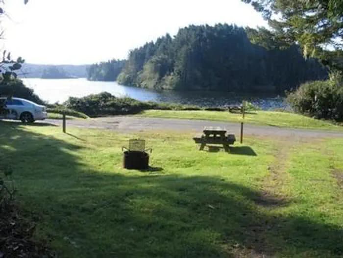
Overview Tahkenitch Landing Campground sits on the shores of Tahkenitch Lake. The campground is located within the Oregon Dunes National Recreation Area, 9 miles north of Reedsport and 13 miles south of Florence, Oregon. The lake welcomes boating, swimming, and fishing for bass and trout. Hiking trails are nearby, providing rewarding walks through the dunes to the Pacific Ocean. Recreation Bird watching, boating, and fishing are popular activities at the lake. Fishing may yield cutthroat and steelhead trout, largemouth bass, and yellow perch. For a change of scenery, campers can cross the road to the Tahkenitch Dunes Trail, which weaves through a conifer forest and across an open section of dunes to a beach along the Pacific. Facilities Bird watching, boating, and fishing are popular activities at the lake. Fishing may yield cutthroat and steelhead trout, largemouth bass, and yellow perch. For a change of scenery, campers can cross the road to the Tahkenitch Dunes Trail, which weaves through a conifer forest and across an open section of dunes to a beach along the Pacific. Natural Features Tahkenitch Lake spans 2,118 acres. Sites that fit tents or small campers sit on the rim of the lake, while larger sites that accommodate RVs are up the hill overlooking the lake. The grassy campground is hugged by coastal trees and shrubbery, including mixed pine and cedar. Wildlife watching is a popular pastime for campers. Portions of the nearby beaches are protected as nesting areas for the snowy plover, which is a small shorebird with a tan tail and snowy white underside. contact_info For facility specific information, please call (541) 271-6000. Nearby Attractions Nearby off-road vehicle trails at South Jetty provide hours of fun for off-road enthusiasts. Charges & Cancellations Campsites that are not occupied after 24 hours of arrival time will be considered as a "no show" and sites will be released for others to reserve. If campers will be arriving after 24 hours of their arrival time, they are encouraged to call the ranger station at 541-271-6000 to let staff know.
View details →
Overview Ochoco Forest Camp is nestled in the Ochoco Mountain range near the 6,926-foot Lookout Mountain, which is known for its unusual rock formations. The pavilion offers a large group picnic area and several campsites. A small meadow and group fire ring with BBQ is popular for weddings and family reunions. Wild horses are sometimes seen near the camp and surrounding area. Recreation The shelter is close to the Lookout Mountain Trail, which climbs to the top of the mountain and offers terrific views of the Cascades and meadow wildflowers in the spring. This trail is open to hikers, mountain bikers and horse riders. However, horses are not allowed at the pavilion and campground. Anglers can also go fishing for trout in nearby Walton Lake. Facilities The shelter is close to the Lookout Mountain Trail, which climbs to the top of the mountain and offers terrific views of the Cascades and meadow wildflowers in the spring. This trail is open to hikers, mountain bikers and horse riders. However, horses are not allowed at the pavilion and campground. Anglers can also go fishing for trout in nearby Walton Lake. Natural Features Much of the area is dominated by old-growth Ponderosa pine. Wildlife include Rocky Mountain elk and mule deer, as well as several bird species that include white-headed woodpecker, belted kingfisher, spotted sandpiper, cinnamon teal, American coot, Steller's jay, yellow-headed blackbird and Brewer's blackbird. Wild horses are commonly seen in the area. Excellent hiking, mt biking, and horse riding is available on the trails nearby. Nearby Attractions Walton Lake offers a variety of activities for day-use visitors. There is a swimming beach, fishing pier and boat ramp, and the lake is stocked with rainbow trout. There is exellent trail hiking and mt. biking at Lookout Mt and Round Mt. trails.
View details →
Overview Walton Lake Campground may be the best-known location in the Ochoco National Forest, offering a serene setting among old-growth Ponderosa pine and mountain meadows. Most sites offer sweeping lake views. Recreation Visitors can choose to spend their vacation relaxing by fishing on the shore of Walton Lake, or swimming and paddling in the water. There is a swimming beach, fishing pier and boat ramp for small self powered craft, and the lake is stocked with rainbow trout. There are also many trails nearby for those who would like to explore on foot or mountain bike. This includes the 7.5-mile multi-use Round Mountain Trail as well as the 1-mile Walton Lake Trail, which offers many scenic views around the lake. Facilities Visitors can choose to spend their vacation relaxing by fishing on the shore of Walton Lake, or swimming and paddling in the water. There is a swimming beach, fishing pier and boat ramp for small self powered craft, and the lake is stocked with rainbow trout. There are also many trails nearby for those who would like to explore on foot or mountain bike. This includes the 7.5-mile multi-use Round Mountain Trail as well as the 1-mile Walton Lake Trail, which offers many scenic views around the lake. Natural Features Walton Lake is a blue sparkling jewel hidden within the dense forest. A small dam impounds spring-fed water that seeps from surrounding sloped meadows. Fishing is a favorite activity while hiking is very popular as is simply enjoying a picnic at the lake. Aspen and tall willows add habitat diversity to make this place especially attractive to wildlife. This is a place to find white-headed woodpecker, belted kingfisher, spotted sandpiper, cinnamon teal, American coot, Steller's jay, yellow-headed blackbird and Brewer's blackbird. Nearby Attractions For visitors seeking a bit of civilization, the city of Prineville is nearby. There are opportunities to shop, dine out, golf, attend events and visit the localmuseum. For those wanting to explore the Ochoco National Forest, Lookout Mt and Round Mt are great places to hike and Mt bike. Wild flowers are abundant at the Big Summit Prairie where occasional antelope, elk and deer are sometimes seen.
View details →
Overview Cape Perpetua Campground is nestled along the banks of Cape Creek, within reach of the beautiful Oregon Coast. The campground is esteemed for its incredible location between the forest and the beach, and for its easy access to impressive hiking trails and prime ocean views. Recreation Visitors enjoy relaxing on the shore and exploring tide pools. A 23-mile trail system surrounds the campground. Several paths lead through dense, old-growth forests and to rocky coastal overlooks. Facilities Visitors enjoy relaxing on the shore and exploring tide pools. A 23-mile trail system surrounds the campground. Several paths lead through dense, old-growth forests and to rocky coastal overlooks. Natural Features The campground is surrounded by large Sitka spruce, Douglas fir and alder trees within the Siuslaw National Forest. When exploring the area, visitors will find steep cliffs, rolling hills, sand dunes and lush forests. Siuslaw is one of only two national forests bordering the Pacific Ocean. Nearby Attractions Heceta Beach is located nearby, giving visitors the opportunity to enjoy the Pacific Ocean.
View details →
Overview River Edge is a group campground nestled on the banks of the Alsea River, surrounded by large Sitka spruce, Douglas fir, alder trees and blackberries. Groups of families and friends enjoy the area for its great fishing opportunities, as well as its scenic beauty. Recreation The campground's open play field is ideal for games like Frisbee and soccer, so campers are encouraged to bring sports equipment to make use of the space. The river beckons visitors for canoeing and swimming. Anglers cast for Coho and Chinook salmon and Steelhead trout. Facilities The campground's open play field is ideal for games like Frisbee and soccer, so campers are encouraged to bring sports equipment to make use of the space. The river beckons visitors for canoeing and swimming. Anglers cast for Coho and Chinook salmon and Steelhead trout. Natural Features River Edge is located in the eastern part of the Siuslaw National Forest, which encompasses over 630,000 acres as it stretches from the lush forests of the coastal mountains to the Oregon Dunes and Pacific Coast. The Alsea River flows 48.5 miles from the town of Alsea out to the Pacific Coast at Waldport and Alsea Bay. Nearby Attractions Sandy beaches stretch north and south of Waldport, about 25 minutes from the campground. Beautiful Cape Perpetua Scenic Area, where whale watching is a popular activity, is another 15 minutes south of Waldport. Mary's Peak is the highest point in Oregon's Coast Range and has been designated a Scenic Botanical Area because of its rich, unique scenery and plants.
View details →
Overview Canal Creek is a group campground where campers can truly get away from the hustle and bustle of the city and immerse themselves in nature. The facility is comprised of two group campsites, each providing a tranquil, scenic setting. Recreation Canal Creek Group Site has a large open space that provides room for sports like soccer, Frisbee and football. Campers are encouraged to bring sports equipment, as none is provided. Other activities include fishing and crawfishing, hiking, tubing and swimming. Cutthroat trout inhabit Canal Creek. Facilities Canal Creek Group Site has a large open space that provides room for sports like soccer, Frisbee and football. Campers are encouraged to bring sports equipment, as none is provided. Other activities include fishing and crawfishing, hiking, tubing and swimming. Cutthroat trout inhabit Canal Creek. Natural Features Canal Creek flows through the campground, dividing the two sites, which are shaded by Douglas fir and spruce trees. Huckleberry bushes dot the forest floor. Roosevelt elk and bald eagles make their homes in the surrounding area. The campground is part of Siuslaw National Forest, which extends across the lush forests of the coastal mountains to the Oregon Dunes and beaches of the Pacific Ocean. Nearby Attractions Sandy beaches stretch north and south of Waldport, about 20 minutes from the campground. Beautiful Cape Perpetua Scenic Area is another 15 minutes south of Waldport. Mary's Peak is the highest point in Oregon's Coast Range and has been designated a Scenic Botanical Area because of its rich, unique scenery and plants.
View details →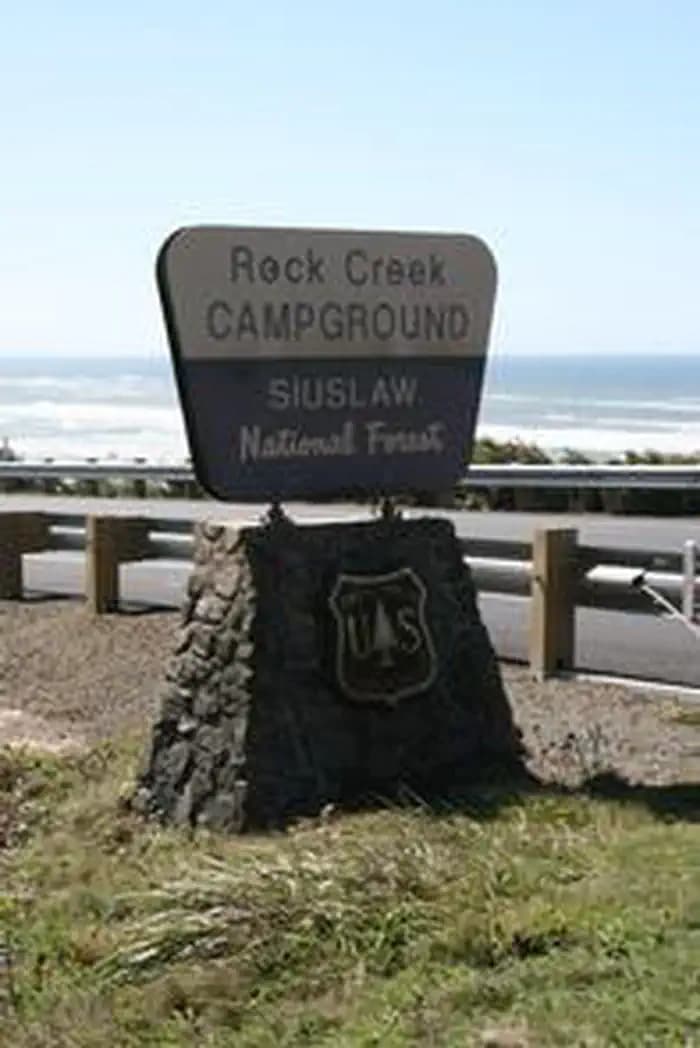
Overview Rock Creek Campground is nestled in a grove of large spruce and Douglas fir trees, near a beach on the Oregon Coast. Visitors enjoy relaxing on the beach, admiring colorful sunsets and hiking many trails in the area. Recreation Rock Creek offers great birding and fishing opportunities. Anglers cast for cutthroat trout and salmon. The beach and a day-use parking area can be accessed within a half-mile from the campground. The Rock Creek Wilderness Area, within the Siuslaw National Forest, encompasses about 7,500 acres. The area is comprised of a dense coniferous rainforest, where bigleaf maple and red alder trees line the creeks, and rhododendrons dot the forest floor. Facilities Rock Creek offers great birding and fishing opportunities. Anglers cast for cutthroat trout and salmon. The beach and a day-use parking area can be accessed within a half-mile from the campground. The Rock Creek Wilderness Area, within the Siuslaw National Forest, encompasses about 7,500 acres. The area is comprised of a dense coniferous rainforest, where bigleaf maple and red alder trees line the creeks, and rhododendrons dot the forest floor. Natural Features Campsites are situated along Rock Creek, just off the Pacific Coast of Oregon in the Siuslaw National Forest, where mosses drape the branches and ferns cover the forest floor, lending a rain forest appearance. The Siuslaw stretches from the lush forests of the coastal mountains to the Oregon Dunes and beaches of the Pacific. Siuslaw is one of only two national forests that border the Pacific Ocean. The campground's close proximity to the beach provides opportunities to view awe-inspiring Pacific sunsets, which often leave lasting impressions on visitors. A variety of wildlife can often be viewed on the coast, including pelicans and other shorebirds, sea lions and migrating whales. Nearby Attractions The Cape Perpetua Visitor Center is a few miles north. The center has a phenomenal view of the ocean. A variety of short film are shown in the theater, and whale watch volunteers are posted in March to help visitors spot the beautiful, migrating creatures. Visitors also enjoy exploring tide pools at Cape Perpetua, and hiking along the area' 23-mile trail system. Several paths lead through dense, old-growth forests and to rocky coastal overlooks.
View details →
Overview Tillicum Beach Campground is popular for many reasons, but the number one and most obvious is its location right on the beach. Campers are lulled to sleep by the sound of the ocean waves, then wake to sweeping views of the Pacific. The campground offers an ideal location for whale watching. Most campsites have beachfront views, and sunsets are not to be missed. Fishing, swimming and playing in the sand are the campground's most popular activities. Recreation Campers enjoy Tillicum for its expansive sandy beach. Surfers and swimmers play in the waves just off-shore. Children love building sandcastles on the beach. Walking along the beach is a great way to explore the area. Cape Perpetua is 6 miles south, where visitors can wander through old-growth Sitka spruce, experience the crashing surf, investigate tide pools, whale watch or take a guided hike. Waldport, just 4 miles north, provides access to fishing, crabbing, clamming and shrimping in the Alsea Bay and River. Facilities Campers enjoy Tillicum for its expansive sandy beach. Surfers and swimmers play in the waves just off-shore. Children love building sandcastles on the beach. Walking along the beach is a great way to explore the area. Cape Perpetua is 6 miles south, where visitors can wander through old-growth Sitka spruce, experience the crashing surf, investigate tide pools, whale watch or take a guided hike. Waldport, just 4 miles north, provides access to fishing, crabbing, clamming and shrimping in the Alsea Bay and River. Natural Features The coastal campground lies a couple miles south of where the Alsea River meets the Pacific Ocean. Tillicum is perfectly perched on the sandy beach yet it still offers some shade. The campground offers views of both the ocean and the Coastal Range. Nearby Attractions Heceta Beach is located nearby, giving visitors the opportunity to enjoy the Pacific Ocean. Mary's Peak is the highest point in Oregon's Coast Range and has been designed a Scenic Botanical Area because of its rich, unique scenery and plants.
View details →
Overview Acorn Womans Lake Campground is nestled in the deep shade of a mixed-conifer forest on the banks of Acorn Womans Lake. The facility provides tent-only campsites that are reachable via foot trails. The unique, remote setting offers visitors stunning scenery and access to a multitude of recreational opportunities. Recreation Hiking and fishing top the list of recreational opportunities at Acorn Womans Lake Campground. Two mountain lakes, a river and a handful of hiking trails are accessible from the campground. Anglers enjoy the remote location and scenic backdrop of two natural lakes, providing excellent fishing opportunities for coldwater and warmwater species. Acorn Womans Lake sustains rainbow and cutthroat trout, yellow perch, brown bullhead and black bass. The smaller Lake provides a rare fishery for 8-11" wild, native coastal cutthroat trout. A 0.25-mile hiking trail connects the lakes. Motors are not permitted on the lakes. From the campground, Acorn Womans Lake Trail is a 1-mile interpretive hike that provides visitors with many opportunities for picnicking and swimming. The 2-mile Summit Lake Trail travels through a mixed conifer forest and small water crossings. Facilities Hiking and fishing top the list of recreational opportunities at Acorn Womans Lake Campground. Two mountain lakes, a river and a handful of hiking trails are accessible from the campground. Anglers enjoy the remote location and scenic backdrop of two natural lakes, providing excellent fishing opportunities for coldwater and warmwater species. Acorn Womans Lake sustains rainbow and cutthroat trout, yellow perch, brown bullhead and black bass. The smaller Lake provides a rare fishery for 8-11" wild, native coastal cutthroat trout. A 0.25-mile hiking trail connects the lakes. Motors are not permitted on the lakes. From the campground, Acorn Womans Lake Trail is a 1-mile interpretive hike that provides visitors with many opportunities for picnicking and swimming. The 2-mile Summit Lake Trail travels through a mixed conifer forest and small water crossings. Natural Features The Rogue River-Siskiyou National Forest is composed of two distinct geological provinces: the Cascade Range and the Siskiyou Mountains. The Cascade Range is dominated by snow-capped volcanic peaks such as 9,495 foot Mt. McLoughlin within the Sky Lakes Wilderness. The Siskiyou area embodies world-class rivers, remarkable fisheries and the most complex and treasured plant communities in the Pacific Northwest. Diverse landscapes provide habitat for a wide-range of wildlife, from spotted owls and elk to salamanders and sandhill cranes. Charges & Cancellations Please see the recreation.gov rules & regulation policies. These policies are system-wide, and not specific to each facility. We are NOT staffed to handle or manage cancellations and/or changes via telephone. Please do not call or leave any messages for these issues. Please NOTE: In Southern Oregon, we unfortunately get difficult conditions due to forest fire smoke. The USFS has the difficult decisions as to whether to temporarily close these facilities, or for them to remain open. If the facilities are closed, refunds will be honored. If the facilities remain open, the sites will be maintained, and reservations will be honored. If you have any specific questions regarding cancellations/changes or mofications to your existing reservation, it may be evaluated on a case-by-case basis. Please email us at applegatelake@gmail.com.
View details →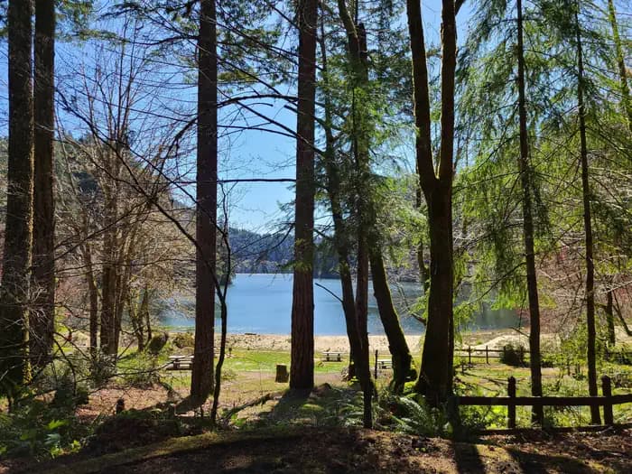
Overview The Bureau of Land Management's Loon Lake Recreation Site is located in the heart of Oregon's Coast Range at an elevation of 392 feet, just 20 miles east-southeast of Reedsport, Oregon. Loon Lake Recreation Site is one of the Coast Range's few recreation areas with a warm, sandy beach. The lake is perfect for swimming, fishing, boating, and other water activities. The site offers a campground and day use area. Loon Lake Recreation Site's operating season is from Memorial Day weekend to September 30th. The Coos Bay District Office in North Bend, OR manages Loon Lake Recreation Site. Please visit the BLM Loon Lake Recreation Site website for more information. Recreation Loon Lake is a family-oriented recreation site, treasured by locals for generations. The site offers a myriad of recreational opportunities, including camping, boating, kayaking, paddleboarding, fishing, swimming, and waterplay. Visitors can also enjoy relaxing on the warm, sandy beach. Other popular activities at Loon Lake include picnicking, hiking, birding, horseshoe tossing, and barbecuing. Campsites have paved parking pads and ample shade from old growth trees. The day use area boasts picnic tables, barbecue grills, swim area, fishing dock, and boat launch. A short, 1/4 mile trail to a waterfall on Elliott State Forest land begins at the south end of the day use area and takes hikers through a quiet and serene segment of old growth forest. Facilities Loon Lake is a family-oriented recreation site, treasured by locals for generations. The site offers a myriad of recreational opportunities, including camping, boating, kayaking, paddleboarding, fishing, swimming, and waterplay. Visitors can also enjoy relaxing on the warm, sandy beach. Other popular activities at Loon Lake include picnicking, hiking, birding, horseshoe tossing, and barbecuing. Campsites have paved parking pads and ample shade from old growth trees. The day use area boasts picnic tables, barbecue grills, swim area, fishing dock, and boat launch. A short, 1/4 mile trail to a waterfall on Elliott State Forest land begins at the south end of the day use area and takes hikers through a quiet and serene segment of old growth forest. Natural Features Loon Lake Recreation Site is situated in the Coast Mountain Range in southwestern Oregon. Douglas-fir, western hemlock, red alder, and bigleaf maple trees forest this beautiful site and offer an abundance of shade. The forest understory features a host of native plants including rhododendron, salal, salmon berry, thimble berry, vine maple, trailing blackberry, and several fern species. A diverse variety of bird life, from the seldom seen Marbled Murrelet and Spotted Owl, to the ever-present Steller's Jay and Osprey, frequent this area. Signs of larger animals, such as raccoon, bear, elk, deer, and bobcat are evident. Loon Lake is part of the Umpqua River watershed that drains water from the Coast Range to the Pacific Ocean. Formed by a landslide of large sandstone blocks and boulders, Loon Lake is a naturally dammed lake that covers 260 acres, is 2 miles long, and 190' deep. contact_info This location has limited staffing. Please call (541) 756-0100 for general information. Nearby Attractions The Oregon Coast Range offers a myriad of exciting recreational activities, including hiking, fishing, scenic driving, tidepooling, expansive beaches, and wildlife viewing. BLM's Dean Creek Elk Viewing Area , also managed by the Coos Bay District Office, is a short drive from Loon Lake and offers visitors the chance to see one of Oregon's largest mammal, Roosevelt Elk, up close. Loon Lake is less than an hour from charming Winchester Bay on the Pacific Ocean. The town of Reedsport is just 20 miles away and lies near the confluence of three rivers, including the scenic Umpqua and Smith rivers. Reedsport is the gateway town to the vast Oregon Dunes National Recreation Area, where visitors enjoy hiking, paddling, wildlife viewing, camping, picnicking, sand play, beach access, and OHV riding. Charges & Cancellations
View details →
Overview Crane Prairie Campground is located on the east shore of its namesake reservoir on Deschutes National Forest just off the scenic Cascade Lakes Scenic Byway. Crane Prairie Reservoir offers a variety of recreation opportunities, including fishing, boating and swimming with glimpses of South Sister and Mt. Bachelor on the horizon. Recreation Crane Prairie Reservoir is a prime location for boating and fishing. Fisheries in close proximity to the site also add to its popularity among anglers. The Oregon Department of Fish and Wildlife manages populations of rainbow trout, mountain whitefish, brook trout and largemouth bass. Fish cleaning stations and a boat ramp are within the campground. Hiking and hunting are popular activities in the surrounding area. Facilities Crane Prairie Reservoir is a prime location for boating and fishing. Fisheries in close proximity to the site also add to its popularity among anglers. The Oregon Department of Fish and Wildlife manages populations of rainbow trout, mountain whitefish, brook trout and largemouth bass. Fish cleaning stations and a boat ramp are within the campground. Hiking and hunting are popular activities in the surrounding area. Natural Features Crane Prairie Reservoir hosts a number of waterfowl, including Sandhill cranes, Canada geese, bald eagles and osprey The adjacent forest is home to black-backed woodpecker, Williamson's sapsucker and mountain chickadee. Deer, squirrel, beaver and an occasional black bear also find habitat in the surrounding forest. Nearby Attractions Nearby Osprey Point is a unique interpretive area for visitors to learn about local fauna and observe osprey nesting platforms erected after natural snags toppled from age. Crane Prairie Campground offers easy access to the Cascade Lakes Scenic Byway which weaves through multiple high lakes with views of South Sister, Broken Top and Mt. Bachelor. Newberry National Volcanic Monument offers a glimpse into Central Oregon's rich geologic history. Travel 25 miles to Lava Lands Visitor Center to explore exhibits at the interpretive center, attend a ranger talk, take in scenic views from the top of Lava Butte and travel one-mile underground through Lava River Cave. Travel 40 miles to Newberry Caldera to visit Paulina and East Lake, Paulina Peak and Paulina Falls.
View details →
Overview Located in the high desert region of central Oregon, Perry South Campground sits on the shores of Lake Billy Chinook in the Deschutes National Forest. It is a popular destination for outdoor enthusiasts to enjoy the area's scenic beauty and year-round recreational activities. Recreation Fishing and motorized boating top the list of recreational activities for visitors. Hikers should be sure to check out nearby Balancing Rocks Overlook, just west of Perry South Campground. Water enthusiasts of all types will enjoy the opportunities available. Motorized and non-motorized boats share the vicinity with swimmers and water skiers braving the cold, clear waters of Lake Billy Chinook. The day use are is a parking fee area; daily parking passes are $5. PGE also honors the NW Forest Pass and the America the Beautiful Passes. Boat slips are reservable with your campsite reservation. Facilities Fishing and motorized boating top the list of recreational activities for visitors. Hikers should be sure to check out nearby Balancing Rocks Overlook, just west of Perry South Campground. Water enthusiasts of all types will enjoy the opportunities available. Motorized and non-motorized boats share the vicinity with swimmers and water skiers braving the cold, clear waters of Lake Billy Chinook. The day use are is a parking fee area; daily parking passes are $5. PGE also honors the NW Forest Pass and the America the Beautiful Passes. Boat slips are reservable with your campsite reservation. Natural Features Lake Billy Chinook is the highlight of the area. The lake, created by Round Butte Dam, fills the canyons of the Crooked, Metolius and Deschutes Rivers. Within these three large arms is 72 miles of shoreline, supporting fish habitats for bass, trout, salmon, whitefish, suckers, minnows and dace. Rugged hills and a diverse evergreen forest surround the lake, providing homes for mammals such as mule deer, coyote, black-tailed jackrabbit and cougars. contact_info Between 05/24/2024 and 09/29/2024 this location is staffed. Please call (541) 325-5315 to speak with local staff. From 09/30/2024 to 05/23/2025 this location is unstaffed. Please call (541) 325-5292 for general information. Nearby Attractions Visitors may want to explore the Tam-a-lau Trail, a scenic hike that starts on a peninsula at the confluence of the Crooked River and the Deschutes River in Cove Palisades State Park. Under the designation of a Wild and Scenic River, nearby Metolius River is nestled in a forested valley west of Mt. Jefferson. Its clear, cold and constant waters support flyfishing and whitewater boating. Lava Lands Visitor Center in nearby Bend, Oregon, offers visitors the opportunity to learn about the diverse landscape and history of the area through interpretive programs and exhibits. Charges & Cancellations A service fee will apply if you change or cancel your reservation. Late cancellations are subject to additional fees. For full details see the Recreation.Gov, Rules & Reservation Policies.
View details →
Overview Steamboat Ball Field Group Site sits near the banks of the North Umpqua River under a canopy of forest. With access to a multitude of recreational opportunities, including a ball field, river access and a handful of trailheads within the area, this campsite offers an ideal setting for group camping and recreation excursions. Recreation Fishing, hiking and swimming top the list of activities at this site. With wide open spaces, along with a ball field and horseshoe pits, this campground offers visitors plenty of recreational opportunities. A forested bank and mountainous backdrop to the North Umpqua River is a perfect setting for both swimmers braving its cold, refreshing waters, and for anglers fishing for rainbow, steelhead and cutthroat trout. A picnic shelter and large grill provide the perfect setting for gathering after a day of activity or relaxation. Facilities Fishing, hiking and swimming top the list of activities at this site. With wide open spaces, along with a ball field and horseshoe pits, this campground offers visitors plenty of recreational opportunities. A forested bank and mountainous backdrop to the North Umpqua River is a perfect setting for both swimmers braving its cold, refreshing waters, and for anglers fishing for rainbow, steelhead and cutthroat trout. A picnic shelter and large grill provide the perfect setting for gathering after a day of activity or relaxation. Natural Features Visitors to Umpqua National Forest are often taken aback by the unique landscapes of southwestern Oregon. Explosive geologic events have shaped the distinctive landscape on the nearly 1 million-acre forest, and provide spectacular scenery as well as an abundance of natural and cultural resources. Flowing adjacent to this campground is the North Umpqua River, a tributary of the Umpqua River, and a designated National Wild and Scenic River. Possessing remarkable values related to fisheries, culture, recreation and scenery, the North Umpqua River is renowned for its emerald green waters and fly fishing. Several designated wilderness areas provide undisturbed solitude for visitors. Encompassing 19,100 acres, Boulder Creek Wilderness offers dense old-growth forests and steep terrain that tower above Boulder Creek, which runs through the heart of the wilderness. Diverse ecosystems support a wide range of habitat for wildlife common to the area. From eagles and owls, to salamanders and salmon, these species, along with many others, depend on surrounding undeveloped wilderness, clean streams, and diverse forests to live. Nearby Attractions Hikers will enjoy the 79-mile North Umpqua Trail which begins in the Mount Thielsen Wilderness at Maidu Lake and follows the river to the confluence with Rock Creek. Sections of this trail are also open to mountain bikes and stock. There are opportunities for fishing within 1 mile of the campground, and within 10 miles a non-motorized boat ramp, and places for swimming and berry picking.
View details →
Overview Wolf Creek Group Campground is set near the banks of Little River with a large open area hemmed in by a canopy of forest, providing a perfect setting for family reunions, celebrations or group getaways. Recreation Running nearly parallel to the North Umpqua River is the popular North Umpqua Trail. This 79 mile National Recreation Trail offers a trek for every ability. Mountain bikers won't feel left out as there are many opportunities to test your riding skills. Several trailheads can be accessed in the vicinity of the campground. In most places the trail travels near the river, allowing you to hike or ride with the sound of rapids and picturesque views spurring you on. Passing through lush forests, old-growth trees, and rocky bluffs, you will also occasionally get a bird's eye view of the river. Facilities Running nearly parallel to the North Umpqua River is the popular North Umpqua Trail. This 79 mile National Recreation Trail offers a trek for every ability. Mountain bikers won't feel left out as there are many opportunities to test your riding skills. Several trailheads can be accessed in the vicinity of the campground. In most places the trail travels near the river, allowing you to hike or ride with the sound of rapids and picturesque views spurring you on. Passing through lush forests, old-growth trees, and rocky bluffs, you will also occasionally get a bird's eye view of the river. Natural Features Visitors to Umpqua National Forest are often taken aback by the unique landscapes of southwestern Oregon. Explosive geologic events have shaped the distinctive landscape on the nearly 1 million-acre forest, and provide spectacular scenery as well as an abundance of natural and cultural resources. Diverse ecosystems support a wide range of habitat for wildlife common to the area. From eagles and owls, to salamanders and salmon, these species, along with many others, depend on surrounding undeveloped wilderness, clean streams and diverse forests to live. Nearby Attractions Visitors may want to take some time to visit nearby Yakso Falls and Grotto Falls; both are easy hikes which show how varied waterfalls can be. Visitors also enjoy the 172 miles of diverse river and mountain landscapes along the Rogue-Umpqua National Scenic Byway. The scenic drive travels from rolling oak-covered hills and towering coniferous forests to roaring white water rapids and incised intercanyon lava flows. The highway travels alongside the Upper Rogue and North Umpqua Wild and Scenic Rivers that contain world-class fisheries.
View details →
Overview Deer Flat Group Campground is situated in a stand of old growth Douglas fir, sugar pine and deciduous trees, near the banks of the scenic North Umpqua River. The campground offers a perfect setting for large family and group camping excursions. Recreation Deer Flat is a prime location for hiking, fishing, biking, and boating in summer and early fall. The North Umpqua River, adjacent to this campground, drains portions of the western side of the Cascade Range. Almost 34 miles of this river have been designated as a Wild and Scenic River. Renowned for outstanding salmon and steelhead fishing and exhilarating whitewater challenges, the North Umpqua River offers an ideal setting for many recreational pursuits. The Illahee Flat Trail descends from the nearby Horseshoe Bend Campground and continues from Illahee Flat to the Jessie Wright Segment of the North Umpqua Trail. The 79 mile North Umpqua Trail parallels the river and offers visitors challenging hiking and mountain biking experiences. Facilities Deer Flat is a prime location for hiking, fishing, biking, and boating in summer and early fall. The North Umpqua River, adjacent to this campground, drains portions of the western side of the Cascade Range. Almost 34 miles of this river have been designated as a Wild and Scenic River. Renowned for outstanding salmon and steelhead fishing and exhilarating whitewater challenges, the North Umpqua River offers an ideal setting for many recreational pursuits. The Illahee Flat Trail descends from the nearby Horseshoe Bend Campground and continues from Illahee Flat to the Jessie Wright Segment of the North Umpqua Trail. The 79 mile North Umpqua Trail parallels the river and offers visitors challenging hiking and mountain biking experiences. Natural Features Visitors to Umpqua National Forest are often taken aback by the unique landscapes of southwestern Oregon. Explosive geologic events have shaped the distinctive landscape on the nearly 1 million-acre forest, and provide spectacular scenery as well as an abundance of natural and cultural resources. The translation of the word, "Umpqua," meaning "thundering waters," defines the area. High mountain lakes, heart-stopping rapids, peaceful ponds and thundering waterfalls, including the 272-foot Watson Falls on the North Umpqua Highway, offer visitors plenty of pastimes. Diverse ecosystems support a wide range of habitat for wildlife common to the area. From eagles and owls, to salamanders and salmon, these species, along with many others, depend on surrounding undeveloped wilderness, clean streams and diverse forests to live. Nearby Attractions Opportunities for hiking, mountain biking, boating and fishing are within 1 mile of the campground. Access to climbing routes is within 10 miles. Visitors may want to take some time to visit nearby Crater Lake National Park, the only national park in Oregon! The amazing Crater Lake area offers a glimpse into the volcanic history of the area. Experience 172 miles of diverse river and mountain landscapes along the Rogue-Umpqua National Scenic Byway. Travel from rolling oak-covered hills and towering coniferous forests, to roaring white water rapids and incised intercanyon lava flows. The highway travels alongside the Upper Rogue and North Umpqua Wild and Scenic Rivers that contain world-class fisheries.
View details →
Overview Willow Prairie Cabin is located in the southwest portion of the Cascade Mountain Range at the foot of Mt. McLoughlin, at an elevation of 4,300 feet. The Willow Prairie Guard Station cabin was constructed on the edge of the meadow in 1924 by a Forest Service road crew. Its main purpose at that time was as a firefighter guard station. In 1990, the cabin was converted to a horse camp and was recently restored by local volunteers and employees of the Butte Falls Ranger District. Today it is available for rent by groups with or without horses. Recreation The cabin is adjacent to the Willow Prairie Campground , and surrounded by 19 plus miles of horse trails. The wetlands adjacent to the cabin provide an excellent area for birding enthusiasts to watch for sandhill cranes, great blue herons, Canada geese, ducks and red-tailed hawks. Facilities The cabin is adjacent to the Willow Prairie Campground , and surrounded by 19 plus miles of horse trails. The wetlands adjacent to the cabin provide an excellent area for birding enthusiasts to watch for sandhill cranes, great blue herons, Canada geese, ducks and red-tailed hawks. Natural Features The Rogue River-Siskiyou National Forest is composed of two distinct geological provinces - the Cascade Range and the Siskiyou Mountains. The Cascade Range is dominated by snow-capped volcanic peaks such as 9,495 foot Mt. McLoughlin located within the Sky Lakes Wilderness. The Siskiyou area embodies the most complex and treasured plant communities in the Pacific Northwest. Wild rivers, biological diversity, remarkable fisheries resources, and complex watersheds define the Siskiyou. Adjacent to the cabin and camp is a wetland area featuring a beaver swamp and several large ponds where wildlife abounds. From majestic sandhill cranes and Canada geese, to bull elk and deer, these species, along with many others, depend on the surrounding undeveloped wilderness, undisturbed wetlands, clean streams, and diverse forests to live.
View details →
Overview Old Miner's Meadow is a two-acre, fenced-in group use area, located in an open meadow surrounded by forests along the Quartzville Creek National Wild and Scenic River and upstream from the Green Peter Reservoir. It is available by reservation only. The area is popular for gold panning, fishing, scenic touring and kayaking. Weekends tend to be busy, so campers should book early. Summer weather is comfortable, but can be cool. Visitors should come prepared for lower temperatures at night. Recreation The creek is popular for gold panning and kayaking, while the reservoir offers great fishing, swimming, sailing and water skiing. Within a short drive along the creek, campers can find deep pools, waterfalls and swimming areas. Visitors can also drive the Quartzville National Back Country Byway, which meanders along the creek, two lakes and scenic mountain views. There are hiking trails in the nearby national forests. Facilities The creek is popular for gold panning and kayaking, while the reservoir offers great fishing, swimming, sailing and water skiing. Within a short drive along the creek, campers can find deep pools, waterfalls and swimming areas. Visitors can also drive the Quartzville National Back Country Byway, which meanders along the creek, two lakes and scenic mountain views. There are hiking trails in the nearby national forests. Natural Features The section of Quartzville Creek adjacent to the campground is registered as a National Wild and Scenic River for its recreation and resource opportunities. The nearby Green Peter Reservoir has emerald-colored waters, mountain views and plenty of space for water activities. Though some areas of the surrounding forests have been logged, groves of old growth trees are a short drive away from the campground. This facility is in a meadow dotted with trees, and has both shaded and sunny sites. Though campers may not see them in the campground, elk frequent the area. Nearby Attractions Campers can visit the East Linn Museum in the town of Sweet Home to learn about the history of the area. The campground is also adjacent to the Willamette National Forest, which stretches for 110 miles along the western slopes of the Cascade Range in western Oregon. Willamette National Forest contact_info This location is unstaffed. To speak with our main office for general information, please call: (503) 375-5646. Charges & Cancellations Standard fees apply and are non-refundable. Visit https://www.recreation.gov/rules-reservation-policies for more information.
View details →
Overview Situated along the rocky banks of the Applegate River, the McKee Bridge Community Kitchen is a fantastic day-use picnic shelter and registered National Historic Site. The shelter is constructed with large pine timber and features Civilian Conservation Corps (CCC) masonry, including a beautiful stone fireplace. Located in southwest Oregon in the Rogue River-Siskiyou National Forest at an elevation of 1,600 feet, this day-use area boasts nearby volcanic peaks, scenic rivers and fantastic old-growth forests. Recreation The area surrounding this day-use area offers outdoor enthusiasts the opportunity to hike, fish, swim, ski and enjoy a multitude of outdoor activities throughout the year. Nearby Applegate Lake is a recreation lake located north of the spectacular Red Buttes Wilderness Area. The lake is popular for swimming, cycling, boating, canoeing, fishing and hiking the various trails. Mule Mountain Trail offers visitors a special opportunity to access the hillsides above the Applegate Valley and witness the seasonal changes in wildlife activity. It is a long distance hike winding up and around the arid ridges of the Siskiyou Mountains. In the spring time, dwarf star tulips, lilies, shooting stars, larkspurs and buttercups puncture the needle and leaf mat and adorn the grass floor. Facilities The area surrounding this day-use area offers outdoor enthusiasts the opportunity to hike, fish, swim, ski and enjoy a multitude of outdoor activities throughout the year. Nearby Applegate Lake is a recreation lake located north of the spectacular Red Buttes Wilderness Area. The lake is popular for swimming, cycling, boating, canoeing, fishing and hiking the various trails. Mule Mountain Trail offers visitors a special opportunity to access the hillsides above the Applegate Valley and witness the seasonal changes in wildlife activity. It is a long distance hike winding up and around the arid ridges of the Siskiyou Mountains. In the spring time, dwarf star tulips, lilies, shooting stars, larkspurs and buttercups puncture the needle and leaf mat and adorn the grass floor. Natural Features The unique character of the Rogue River-Siskiyou National Forest is composed of two distinct geological provinces; the Cascade Range and the Siskiyou Mountains. The Cascade Range is dominated by snow-capped volcanic peaks, such as 9,495 foot Mt. McLoughlin, located within the Sky Lakes Wilderness. The Siskiyou area embodies the most complex and treasured plant communities in the Pacific Northwest. World-class wild rivers, biological diversity, remarkable fisheries resources and complex watersheds define the Siskiyou. Diverse landscapes provide habitat for a wide-range of wildlife, from spotted owls and bull elk to salamanders and sandhill cranes. Nearby Attractions The United States Congress designated the Red Buttes Wilderness in 1984 and it now includes a total of 19,940 acres. Management of the Red Buttes Wilderness, located on the California/Oregon border, is shared by the Klamath National Forest and the Rogue River - Siskiyou National Forest. Several, nearby lakes are close to McKee. Acorn Woman Peak looks south to Acorn Woman Lakes, a semi-primitive developed recreation area that accepts camping reservations from May through October. Applegate lake is a large reservoir with boat ramps, campgrounds, viewpoints and a developed recreation area named Hart tish. Both Acorn Woman Lakes and Applegate Lake are open for fishing year-round.
View details →
Overview Nestled in the deep shade of a mixed-conifer forest on the banks of bubbling Beaver Creek, Beaver Sulphur Group Campground offers an ideal setting for groups and large family gatherings. Located in southwest Oregon in the Rogue River-Siskiyou National Forest, the campground's proximity to a hiking trails and scenic waterways provides visitors with access to a multitude of recreational activities. Recreation Beaver Sulphur Group Campground offers outdoor enthusiasts the opportunity to hike, fish, hunt and enjoy a multitude of outdoor activities throughout the year. A handful of hiking trails are accessible from the campground and in the surrounding areas. The nearby Mule Mountain Trail offers a special opportunity to access the hillsides above Applegate Valley and witness the seasonal changes in wildlife activity. It is a long-distance hike, winding up and around the arid ridges of the Oregon Siskiyous. In the spring, dwarf star tulips, lilies, shooting stars, larkspurs and buttercups puncture the needle and leaf mat and adorn the grass floor. Nearby Applegate Lake is a popular recreation lake, located north of the spectacular Red Buttes Wilderness Area. The lake is popular for swimming, cycling, boating, canoeing, fishing and hiking the various trails near the lake. Facilities Beaver Sulphur Group Campground offers outdoor enthusiasts the opportunity to hike, fish, hunt and enjoy a multitude of outdoor activities throughout the year. A handful of hiking trails are accessible from the campground and in the surrounding areas. The nearby Mule Mountain Trail offers a special opportunity to access the hillsides above Applegate Valley and witness the seasonal changes in wildlife activity. It is a long-distance hike, winding up and around the arid ridges of the Oregon Siskiyous. In the spring, dwarf star tulips, lilies, shooting stars, larkspurs and buttercups puncture the needle and leaf mat and adorn the grass floor. Nearby Applegate Lake is a popular recreation lake, located north of the spectacular Red Buttes Wilderness Area. The lake is popular for swimming, cycling, boating, canoeing, fishing and hiking the various trails near the lake. Natural Features The unique character of the landscapes comprising the Rogue River-Siskiyou National Forest has led to the designation of over 340,000 acres of the forest as Wilderness, and over 200 miles of streams as National Wild and Scenic Rivers. The forest itself is composed of two distinct geological provinces, the Cascade Range and the Siskiyou Mountains. The Cascade Range is dominated by snow-capped volcanic peaks, such as 9,495 foot Mt. McLoughlin, located within the Sky Lakes Wilderness. The Siskiyou area embodies the most complex and treasured plant communities in the Pacific Northwest. World-class wild rivers, biological diversity, remarkable fisheries resources and complex watersheds define the Siskiyou. Diverse landscapes provide habitat for a wide-range of wildlife, from spotted owls and bull elk to salamanders and sandhill cranes. Nearby Attractions The United States Congress designated the Red Buttes Wilderness in 1984 and it now includes a total of 19,940 acres. Management of the Red Buttes Wilderness, located on the California/Oregon border, is shared by the Klamath National Forest and the Rogue River - Siskiyou National Forest. The majority of the Wilderness lies within the boundaries of the Rogue River-Siskiyou National Forest. Several lakes are accessible in the forest. Squaw Peak looks south to Squaw Lakes, a semi-primitive developed recreation area that accepts camping reservations from May through September. Applegate lake is a large reservoir with boat ramps, campgrounds, viewpoints and a developed recreation area named Hart tish. Both Squaw Lakes and Applegate lake are open for fishing year-round.
View details →
Overview Black Canyon Campground in Oregon rests next to the Middle Fork of the Willamette River. This scenic campground is heavily shaded by towering hemlock, cedar and Douglas fir. Fishing and kayaking are a popular pastimes. Recreation A 1-mile interpretive nature trail winds through the campground, and Lookout Point Lake is less than a mile away, with opportunities for boating and fishing. A boat ramp is located on the lake. The Willamette National Forest has about 1,700 miles of trails. While many are located in wilderness areas, a number of trails are situated at lower elevations and provide easy, year-round hiking. Black Canyon is within the Winberry Trail Area, with excellent terrain like the Tire Mountain Trail for mountain biking and horseback riding, and the Clover Patch Trail for hiking. Facilities A 1-mile interpretive nature trail winds through the campground, and Lookout Point Lake is less than a mile away, with opportunities for boating and fishing. A boat ramp is located on the lake. The Willamette National Forest has about 1,700 miles of trails. While many are located in wilderness areas, a number of trails are situated at lower elevations and provide easy, year-round hiking. Black Canyon is within the Winberry Trail Area, with excellent terrain like the Tire Mountain Trail for mountain biking and horseback riding, and the Clover Patch Trail for hiking. Natural Features The Willamette National Forest stretches 110 miles along the western slope of the Cascade Range in western Oregon. Elevations on the forest range from about 1,500 feet above sea level to 10,495 feet at the snowcapped summit of Mt. Jefferson, Oregon's second highest peak. Wildlife in the region includes black tail deer, Roosevelt elk, bobcats and bald eagles. Nearby Attractions Visitors enjoy sightseeing along the West Cascades Scenic Byway. The drive begins at Westfir and stretches 220 miles past waterfalls, ancient forests and numerous rivers, creeks and lakes.
View details →
Overview Hard Rock Campground is a small, primitive group site along the South Fork of the McKenzie River in Oregon. Many hiking trails are available in the surrounding area and the river offers fishing opportunities. Recreation The river offers good catch-and-release fishing for wild redside and cutthroat trout. Cougar Reservoir is open to motorized boating and offers a beautiful setting. Facilities The river offers good catch-and-release fishing for wild redside and cutthroat trout. Cougar Reservoir is open to motorized boating and offers a beautiful setting. Natural Features The campground sits just south of Cougar Reservoir, near where Balm Creek feeds into the South Fork, at an elevation of 1,800 feet. Hard Rock is set on the western slopes of the Cascade Mountains, where gorgeous, lush mountain landscapes abound. Nearby Attractions Just east of Cougar Reservoir, the Castle Rock Trail leads through a dense Douglas-fir forest to the top of Castle Rock. Once on top, hikers enjoy impressive views of the McKenzie River Valley below.
View details →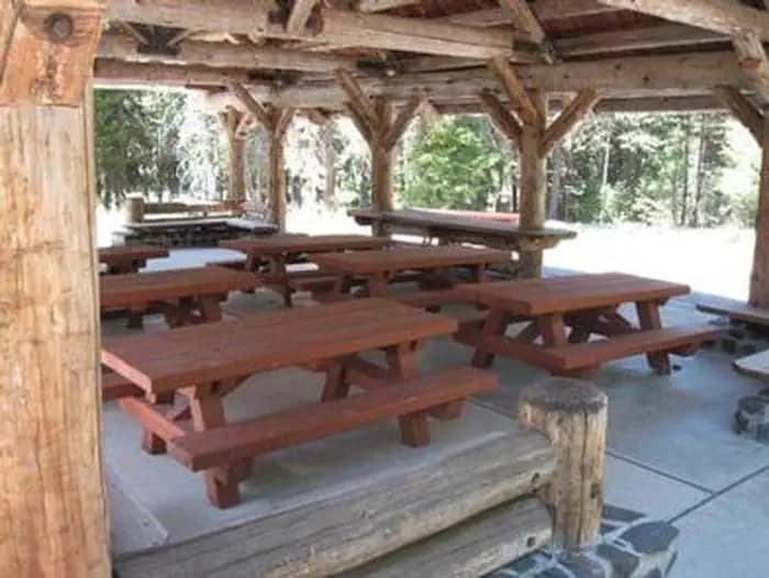
Overview Idlewild Campground is the perfect place for large gatherings in any weather. In sun, rain or snow, there are plenty of ways to enjoy the outdoors while spending time with friends and family. The campground is situated along Highway 395 north of Burns, Oregon. In the summer, it is popular with hikers and mountain bikers. In the winter, visitors can snowmobile and cross-country ski. Recreation Idlewild offers opportunities for camping, picnicking, hiking and mountain biking. Devine Summit Trail begins within the campground. Snowmobiling and cross-country skiing bring visitors to the area in the winter. Facilities Idlewild offers opportunities for camping, picnicking, hiking and mountain biking. Devine Summit Trail begins within the campground. Snowmobiling and cross-country skiing bring visitors to the area in the winter. Natural Features The campground is situated at an elevation of 5,000 feet in a large stand of Ponderosa pines. The group shelter sits near a meadow within Idlewild Campground. The Malheur National Forest encompasses 1.46 million acres in the Blue Mountains of eastern Oregon. The forest's dramatic landscapes include the Strawberry Mountain Wilderness, with 9,038' Strawberry Mountain, which extends east to west through the heart of the forest, and the Monument Rock Wilderness along the eastern boundary. Nearby Attractions The campground is located a short drive from Burns, Oregon. There are horse trails and equestrian camping within 10 miles of Idlewild.
View details →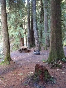
Overview Camping groups looking for a more rustic riverside experience will enjoy Red Diamond in Willamette National Forest. The campground can accommodate up to 25 guests and provides plenty of shade for warm, summer days. The South Fork McKenzie River and many fishing holes can be accessed from the site. Hiking trails can be found in the surrounding area and the Cougar Reservoir is just a short drive north. Recreation Fishing and kayaking are popular activities on the river. Nearby is the Box Canyon Trail with excellent opportunities for mountain biking, hiking and horseback riding. Chucksney Mountain Trail, Grasshopper Mountain Trail and Roaring Ridge are also in the area. Facilities Fishing and kayaking are popular activities on the river. Nearby is the Box Canyon Trail with excellent opportunities for mountain biking, hiking and horseback riding. Chucksney Mountain Trail, Grasshopper Mountain Trail and Roaring Ridge are also in the area. Natural Features The campground is nicely shaded by Douglas fir, maple and alder trees, within the midsection of the Cascade Range in western Oregon. The South Fork of the McKenzie flows nearby. The McKenzie River is a tributary of the Willamette River that runs for 90 miles, flowing into the southernmost end of the Willamette Valley. The Willamette National Forest stretches for 110 miles with varied landscapes of high mountains, narrow canyons, cascading streams and wooded slopes. Nearby Attractions Head to the Three Sisters Wilderness Area to hike a part of the 260 miles of trail through 286,708 acres of wild, rugged mountains and meadows. There are also bike and horse trails within 10 miles of the campground.
View details →
Overview Shadow Bay Campground rests on the shores of Waldo Lake in a forest of towering conifers. This large recreation area provides plenty of things to see and do like sailing, canoeing, fishing and swimming. Recreation Waldo Lake is circled by the Jim Weaver Loop, a 22-mile hiking and biking trail. The Shoreline Trail lines the lakeside of the campground and takes hikers and bikers to a network of other trails. From there, hikers can continue into the Waldo Lake Wilderness, but mountain bikers are not allowed in Wilderness. The lake offers boating and swimming. A boat ramp is located on-site. Facilities Waldo Lake is circled by the Jim Weaver Loop, a 22-mile hiking and biking trail. The Shoreline Trail lines the lakeside of the campground and takes hikers and bikers to a network of other trails. From there, hikers can continue into the Waldo Lake Wilderness, but mountain bikers are not allowed in Wilderness. The lake offers boating and swimming. A boat ramp is located on-site. Natural Features Shadow Bay Campground is located on a large bay at the south end of Waldo Lake. It is considerably wetter than either North Waldo or Islet Campground, supporting a more diverse and prolific ground cover, and also more mosquitos. Situated high on the western slopes of the Oregon Cascades at 5,400 feet in elevation, Waldo Lake is one of the purest lakes in Oregon (9.8 square miles with a maximum depth of 427 feet). It has no permanent inlet to bring nutrients into the lake for plant growth. The lack of plant life contributes to its purity, allowing you to see to depths of 120 feet on a calm day. Nearby Attractions Explore Waldo Lake and surrounding hiking trails for views of the snow-capped North, Middle and South Sisters, three of the seven major peaks in Willamette National Forest.
View details →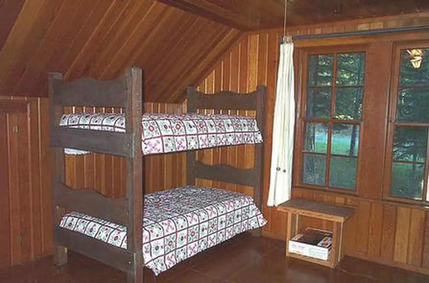
Overview Clackamas Lake Historic Cabin gives campers an old-fashioned cabin experience with its well-preserved features, including a massive rock chimney, knot-free interior paneling and hand-wrought iron work. It provides access to a number of outdoor recreation opportunities as well as its namesake lake. Recreation Clackamas Lake is a great place for fishing, swimming and non-motorized boating. Anglers can expect a catch of cutthroat, brook, rainbow and some German brown trout. A variety of wildlife make its home in the area as well. Nearby, the 1,400-acre Timothy Lake provides opportunities for picnicking as well as water-related recreation, including the use of power boats. Hiking, mountain biking and horseback riding are also enjoyed by visitors to the area. The 2.2-mile Miller Trail begins in the neighboring campground and connects trekkers to the lengthy but scenic Pacific Crest Trail, which extends more than 2,650 miles, from Canada to Mexico. Additional trails, to scenic Little Crater Lake and to the Mt. Jefferson Wilderness area, are also available in the area. A Northwest Forest Pass or Mount Hood Recreation day use fees are in effect at nearby trails and sites. Facilities Clackamas Lake is a great place for fishing, swimming and non-motorized boating. Anglers can expect a catch of cutthroat, brook, rainbow and some German brown trout. A variety of wildlife make its home in the area as well. Nearby, the 1,400-acre Timothy Lake provides opportunities for picnicking as well as water-related recreation, including the use of power boats. Hiking, mountain biking and horseback riding are also enjoyed by visitors to the area. The 2.2-mile Miller Trail begins in the neighboring campground and connects trekkers to the lengthy but scenic Pacific Crest Trail, which extends more than 2,650 miles, from Canada to Mexico. Additional trails, to scenic Little Crater Lake and to the Mt. Jefferson Wilderness area, are also available in the area. A Northwest Forest Pass or Mount Hood Recreation day use fees are in effect at nearby trails and sites. Natural Features This historically significant, two-story cabin was built by the Civilian Conservation Corps in 1933 to house workers. It is a classic example of the Forest Service rustic architectural style of Depression Era administration buildings. Across the road is the old District Ranger's office, which is now a two-room visitor center. The cabin is located a quarter-mile from the small, 3-acre Clackamas Lake and just 3 miles from the larger Timothy Lake, at an elevation of 3,400 feet. It is surrounded by tall trees and is part of a 4-acre compound and is listed on the National Register of Historic Places. contact_info For facility specific information, please call (503) 622-3191. Nearby Attractions The cabin is less than 40 miles from Mt. Hood, where a historic lookout provides scenic views of the snow-capped mountain. Hiking and year-round skiing is also available there. The nearest store is in the town of Wapinitia, which is 15 miles away on Highway 26.
View details →
Overview Anthony Lake forms the source of Anthony Creek, named for William 'Doc' Anthony, an ambitious homesteader who came to Baker County in 1864. He was a farmer and a doctor, collected tolls on the Dealy Wagon Road for a time, and ran his ranch until he died in 1914 at age 85. Anthony Lake Guard Station is a historic Civilian Conservation Corps log cabin built in the 1930s - one of only a few Forest Service cabins built of logs. For questions for Anthony Lake, Grande Ronde Lake, Mud Lake, Peavey Cabin, and Anthony Lake Guard Station call (541) 856-3277 ext. 114 Guests at Anthony Lake Guard Station will find many modern comforts to help make their stay enjoyable. It's located at a popular recreation area and adjacent to the Anthony Lake Campground, and is easily accessible by car. Recreation A boat ramp is located on the lake. Activities include boating, canoeing and kayaking. Anglers can fly fish for trout. Trails in the area include the 22.6-mile Elkhorn Crest (foot and equestrian), 1-mile Black Lake (foot and equestrian) and the 1-mile Shoreline (foot). Facilities A boat ramp is located on the lake. Activities include boating, canoeing and kayaking. Anglers can fly fish for trout. Trails in the area include the 22.6-mile Elkhorn Crest (foot and equestrian), 1-mile Black Lake (foot and equestrian) and the 1-mile Shoreline (foot). Natural Features The guard station is situated on the north shore of Anthony Lake, providing a stunning view of the lake and the glacial peaks of the nearby Elkhorn Mountains. The most prominent of these peaks is 8,342-foot Gunsight Mountain. This area is known for conifer forests, wildflower meadows and the resident mountain goats. The elevation is approximately 7,000 feet, and snow can be expected into July. Anthony Lake is sometimes frozen until mid-June. Nearby Attractions The Elkhorn Scenic Byway is a 106-mile drive through the Elkhorn Mountains. Along this drive are ghost towns and an abundance of lakes and rivers. Anthony Lakes Recreation is nearby with mountain bike trails and a seasonal restaurant.
View details →
Overview Horsfall Beach Campground is located along the central Oregon Coast, about 2 miles north of North Bend. The campground is ideal for off-road vehicle riders and visitors looking to take it easy on the beach. Other activities in the area include hiking and horseback riding. Recreation The campground is an outstanding home base for off-road vehicle riding on the dunes. Off-road vehicle trails and open riding zones are located due north and northeast of the campground. Visitors can also take in outstanding views of the Pacific Ocean from the campground's accessible viewing platform. Meanwhile, the beach offers a great place for beachcombing, sunbathing, and swimming. Other nearby non-motorized opportunities include Bluebill Lake Trail and the Wild Mare Horse Trail (which is open to horseback riders and hikers). Facilities The campground is an outstanding home base for off-road vehicle riding on the dunes. Off-road vehicle trails and open riding zones are located due north and northeast of the campground. Visitors can also take in outstanding views of the Pacific Ocean from the campground's accessible viewing platform. Meanwhile, the beach offers a great place for beachcombing, sunbathing, and swimming. Other nearby non-motorized opportunities include Bluebill Lake Trail and the Wild Mare Horse Trail (which is open to horseback riders and hikers). Natural Features The campground sits on a beach along the Pacific Coast, within the Oregon Dunes National Recreation Area. Open sand dunes and extensive forested areas are located nearby. Horsfall Lake, Spirit Lake, Bluebill Lake, and a number of smaller ponds are also located to the east of the campground. contact_info For facility specific information, please call (541) 271-6000. Nearby Attractions Explore Coos Bay, a picturesque inlet where the Coos River flows into the Pacific Ocean. The Bay provides an outstanding habitat for sea birds. Charges & Cancellations Campsites that are not occupied after 24 hours of arrival time will be considered as a "no show" and sites will be released for others to reserve. If campers will be arriving after 24 hours of their arrival time, they are encouraged to call the ranger station at 541-271-6000 to let staff know.
View details →
Overview Magone Lake Campground is situated along its namesake lake in the northern reaches of Malheur National Forest in the Blue Mountains of eastern Oregon. Visitors enjoy fishing, canoeing, swimming and hiking. Recreation The Magone Lake area offers swimming, fishing, hiking and mountain biking opportunities. The lake contains eastern brook and rainbow trout. A boat ramp is available on-site. Visitors also enjoy viewing wildflowers and interesting geology throughout the region. Facilities The Magone Lake area offers swimming, fishing, hiking and mountain biking opportunities. The lake contains eastern brook and rainbow trout. A boat ramp is available on-site. Visitors also enjoy viewing wildflowers and interesting geology throughout the region. Natural Features The campground is set in a forest of Engelmann spruce and ponderosa pine. Magone Lake covers about 50 acres and features both deep holes of up to 100 feet and shoals on the north side. Geologists believe Magone Lake was created by a landslide in the early 1800s. It is located in the southern reaches of the Malheur National Forest. contact_info For facility specific information, please call (541) 575-3000.
View details →
Overview Contorta Point Group Campground is located on the south shore of Crescent Lake in Deschutes National Forest. It offers visitors the opportunity to experience scenic beauty and recreational activities throughout the Cascades region. Recreation Crescent Lake is a prime location for boating, fishing and swimming. The Summit Lake Trail is popular among hikers and mountain bikers, offering excellent views of Diamond Peak across Crescent Lake. Visitors can take advantage of skiing, snowshoeing and snowmobiling in the winter months. Crescent Lake Snowpark offers a base camp for exciting winter excursions. The Summit Lake Trail is open to snowmobiling. Facilities Crescent Lake is a prime location for boating, fishing and swimming. The Summit Lake Trail is popular among hikers and mountain bikers, offering excellent views of Diamond Peak across Crescent Lake. Visitors can take advantage of skiing, snowshoeing and snowmobiling in the winter months. Crescent Lake Snowpark offers a base camp for exciting winter excursions. The Summit Lake Trail is open to snowmobiling. Natural Features Cresent Lake is nestled in a glacier basin east of the towering Cascade Mountain Range. It boasts brilliant blue-green water and sandy beaches. A forest of lodgepole pine provide the backdrop to the area, with mountain hemlock, fir and spruce also in the mix. Wildlife found in the area includes deer, native fish and migratory birds. Nearby Attractions Visitors can explore wilderness areas, rivers, lakes and reservoirs, and approximately 1,600 miles of trails that comprise nearly 2.5 million acres within the Deschutes National Forest and the adjacent Ochoco National Forest. Lava Lands Visitor Center in nearby Bend, Oregon, and the unique geological landscape of Newberry National Volcanic Monument draw visitors to the region as well. Visitors enjoy traveling the Cascade Lakes Scenic Byway, known as Oregon's Highway in the Sky, which climbs into the clouds on a 66-mile drive through the Cascade Range, weaving past snow-capped peaks and alpine lakes. Charges & Cancellations Once your reservation start date has begun, neither the Recreation.gov Contact Center nor the campground manager will be able to modify your reservation.
View details →
Overview Eagle Creek Overlook Group Site is set on a forested bluff above the Columbia River, providing an ideal setting for family gatherings and group events. Developed by the Civilian Conservation Corps (CCC) in the 1930s as a place to view construction of the Bonneville Dam, this site features CCC masonry and offers expansive views of the Columbia River and mountains rising from the gorge. Recreation The Eagle Recreation Area, just a short walk or bike ride away, provides visitors with opportunities for picnicking, hiking and wildlife viewing. Bonneville Dam, about a mile west of the campground, features sturgeon ponds, fish viewing and a visitor's center. Visitors will find display ponds showcasing large rainbow trout and adult white sturgeon measuring more than ten feet long. Interpretive displays offer visitors insight into the history and construction of the dam and its impact on the surrounding areas. The Eagle Creek Trail* is the most popular trail in the Columbia Gorge, offering spectacular viewpoints and waterfalls. The relatively easy trail follows Eagle Creek through the forest and along paths carved into basalt cliffs. Notable stopping points include Punch Bowl Falls, where water spills 100 feet into a blue-green pool set in a large grotto, High Bridge, which traverses the gorge 150 feet above the creek and Tunnel Falls, where the trail passes through a tunnel behind the shower of falling water. This trail is part of a multi-day loop opportunity which continues into the Mark O. Hatfield Wilderness in the Mt. Hood National Forest. *Please check the CRGNSA website (https://www.fs.usda.gov/crgnsa) for the latest trail information. Facilities The Eagle Recreation Area, just a short walk or bike ride away, provides visitors with opportunities for picnicking, hiking and wildlife viewing. Bonneville Dam, about a mile west of the campground, features sturgeon ponds, fish viewing and a visitor's center. Visitors will find display ponds showcasing large rainbow trout and adult white sturgeon measuring more than ten feet long. Interpretive displays offer visitors insight into the history and construction of the dam and its impact on the surrounding areas. The Eagle Creek Trail* is the most popular trail in the Columbia Gorge, offering spectacular viewpoints and waterfalls. The relatively easy trail follows Eagle Creek through the forest and along paths carved into basalt cliffs. Notable stopping points include Punch Bowl Falls, where water spills 100 feet into a blue-green pool set in a large grotto, High Bridge, which traverses the gorge 150 feet above the creek and Tunnel Falls, where the trail passes through a tunnel behind the shower of falling water. This trail is part of a multi-day loop opportunity which continues into the Mark O. Hatfield Wilderness in the Mt. Hood National Forest. *Please check the CRGNSA website (https://www.fs.usda.gov/crgnsa) for the latest trail information. Natural Features Spanning southern Washington and northern Oregon, from the mouths of Sandy River to the Deschutes River, the Columbia River Gorge is unique in both its natural and cultural history, as well as its designation as a National Scenic Area. It is a spectacular river canyon, 80 miles long and up to 4,000 feet deep, cutting the only sea level route through the Cascade Mountain Range. Nearby Attractions A portion of the historic Columbia River Highway has been converted to a bike path. Access is just a few minutes from the Overlook and the trail runs 2 miles east to Cascade Locks and 4 miles west to John Yeon State Park. Visitors may want to traverse at least a portion of the spectacular Pacific Crest Trail (PCT), one of the world's premier National Scenic Trails. This trail showcases some of North America's most fantastic scenery, winding its way its way from Mexico to Canada through California, Oregon and Washington.
View details →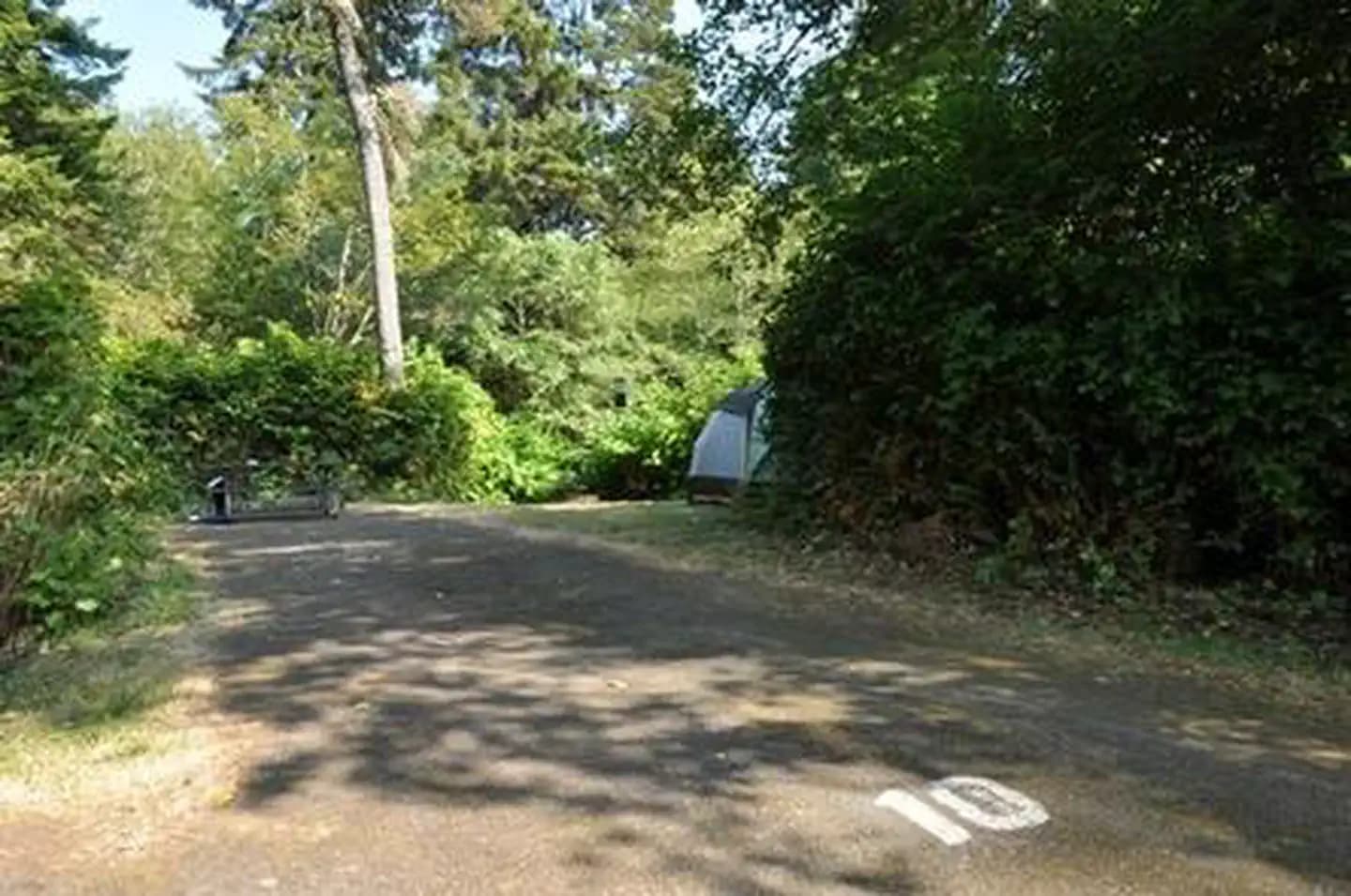
Overview Alder Dune Campground sits in a lush coastal forest between Alder and Dune Lakes in western Oregon. The campground, in the Central Coast Ranger District, boasts 39 campsites with privacy created by walls of beautiful native shrubbery. Recreation The quiet ambiance at the campground is ideal for wildlife viewing. Both Alder and Dune Lakes are stocked with rainbow trout several times a year for enjoyable fishing. A trail system starting at the day-use area leads guests through an easy to moderate journey around Alder Lake and over sand dunes, where it connects to Sutton Trail and heads to a Pacific Coast beach. Facilities The quiet ambiance at the campground is ideal for wildlife viewing. Both Alder and Dune Lakes are stocked with rainbow trout several times a year for enjoyable fishing. A trail system starting at the day-use area leads guests through an easy to moderate journey around Alder Lake and over sand dunes, where it connects to Sutton Trail and heads to a Pacific Coast beach. Natural Features Alder Dune sits in the Siuslaw National Forest. The forest is located in the coast mountain range of Oregon and is one of the two forests in the continental United States bordering the Pacific Ocean. Thick Douglas fir forests contrast sharply with miles of open sand dunes, beaches and freshwater lakes. Nearby Attractions Heceta Beach is located nearby, giving visitors the opportunity to enjoy the Pacific Ocean.
View details →
Overview Lagoon Campground is located about 8 miles south of Florence within the Oregon Dunes National Recreation Area. Most of the campground's sites are surrounded by beautiful coastal shrubbery. Fishing and hiking are popular here, with the Lagoon Trail providing a short but scenic hiking loop around the perimeter of the campground. A beach along the Pacific Ocean is also within walking distance. Recreation The Lagoon Trail is an accessible loop that provides wetland wildlife viewing on boardwalks. On the south side of the Siltcoos River, the 1.3-mile Waxmyrtle Trail offers outstanding views of the lower Siltcoos estuary and the Pacific Ocean. The Chief Tsiltcoos Trail is also nearby. Anglers can find rainbow trout in the lagoon in winter and spring. In Siltcoos Lake, bass, steelhead, cutthroat trout, yellow perch, and bluegill may take the bait. Facilities The Lagoon Trail is an accessible loop that provides wetland wildlife viewing on boardwalks. On the south side of the Siltcoos River, the 1.3-mile Waxmyrtle Trail offers outstanding views of the lower Siltcoos estuary and the Pacific Ocean. The Chief Tsiltcoos Trail is also nearby. Anglers can find rainbow trout in the lagoon in winter and spring. In Siltcoos Lake, bass, steelhead, cutthroat trout, yellow perch, and bluegill may take the bait. Natural Features At an elevation of 100 feet, the campground sits among shore pine and huckleberry along the Siltcoos Lagoon and the Siltcoos River. The campground is part of the Oregon Dunes National Recreation Area, known for its wind-sculpted sand dunes towering to 500 feet above sea level. Wildlife is abundant in the campground and along the Lagoon Trail. Native animal inhabitants include beavers, ducks, herons, and bitterns (a waterfowl relative of the heron). contact_info For facility specific information, please call (541) 271-6000. Nearby Attractions Boating is available at Tahkenitch Lake and Siltcoos Lake. Off-road vehicle riding trails weave along the nearby dunes. Charges & Cancellations Campsites that are not occupied after 24 hours of arrival time will be considered as a "no show" and sites will be released for others to reserve. If campers will be arriving after 24 hours of their arrival time, they are encouraged to call the ranger station at 541-271-6000 to let staff know.
View details →
Overview Bluebill Campground is located in the Horsfall Area, which is known for its excellent off-road vehicle trails. The campground is conveniently located near the Wild Mare Horse Trail, Bluebill Lake, and the Pacific Ocean beaches. With such an ideal location for recreation, it's no wonder families love this site. Recreation Bluebill Lake is an excellent location for fishing. The campground provides easy access to the Bluebill Trail, which is a 1.2-mile loop around the lake. Off-road vehicle enthusiasts flock to the campground to cruise the surrounding dunes. Other parts of the nearby dunes are designated for hiking and horseback riding only. Facilities Bluebill Lake is an excellent location for fishing. The campground provides easy access to the Bluebill Trail, which is a 1.2-mile loop around the lake. Off-road vehicle enthusiasts flock to the campground to cruise the surrounding dunes. Other parts of the nearby dunes are designated for hiking and horseback riding only. Natural Features Bluebill Campground lies just northwest of Bluebill Lake and less than 1 mile from the Pacific Coast. The campground is within the Oregon Dunes National Recreation Area, which is known for its wind-sculpted sand dunes towering up to 500 feet above sea level. contact_info For facility specific information, please call (541) 271-6000. Nearby Attractions Scenic waterways can be found in every direction: Head south to Coos Bay, west to the Pacific, and northeast to Horsfall Lake. There are two off-highway vehicle staging areas along Horsfall Beach Road. The nearby Wild Mare Trail offers an excellent location for horseback riding. Charges & Cancellations Campsites that are not occupied after 24 hours of arrival time will be considered as a "no show" and sites will be released for others to reserve. If campers will be arriving after 24 hours of their arrival time, they are encouraged to call the ranger station at 541-271-6000 to let staff know.
View details →
Overview With a history that dates back to 1907, Big Elk Guard Station is the oldest continuously used administrative site within the Rogue River-Siskiyou National Forest, and a delightful setting for guests seeking a unique getaway. For many decades the guard station served as summer headquarters for solitary forest "guards" who built trails, fought forest fires and patrolled the land on horseback. Most recently the site was used to house Forest Service seasonal fire crews. The cabin is one of the few remaining examples of Forest Service log construction in the Forest and is listed on the National Register of Historic Places. Recreation Nearby Fish Lake offers biking, fishing, swimming, paddle / motor boating and hiking opportunities. Fish Lake Trail, High Lakes Trail, Brown Mountain Trail, the Pacific Crest Trail, Sky Lakes Wilderness and Mount McLoughlin Trail system are all less than an hour drive away. Facilities Nearby Fish Lake offers biking, fishing, swimming, paddle / motor boating and hiking opportunities. Fish Lake Trail, High Lakes Trail, Brown Mountain Trail, the Pacific Crest Trail, Sky Lakes Wilderness and Mount McLoughlin Trail system are all less than an hour drive away. Natural Features Big Elk Guard Station sits on the fringe of Big Elk Meadow, a grassy expanse that floods in spring and dries out in the summer. Just a short stroll across the meadow, guests are treated to views of Mt. McLoughlin and the edge of a 20,000 year old lava flow from Brown Mountain. The surrounding forest includes lodgepole pine, quaking aspen, Shasta red fir and Douglas fir. A variety of wildlife ranging from blacktail deer, elk, mountain lion, black bear, bald eagle and other bird species can be found in the area. Nearby Attractions Campgrounds nearby includes Fish Lake Campground, Doe Point Campground and North Fork Campground. Fish lake Resort is 5 miles from the cabin and provides dining, boat rentals, firewood sales, small store and boat launch. the south entrance to Crater Lake National Park is 57 miles north of Big Elk Cabin. contact_info For facility specific information, please call (541) 560-3400.
View details →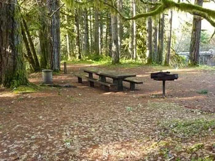
Overview Rujada Day Use Picnic Area is set along the banks of Layng Creek, with a large, open grassy area amidst a scattering of Douglas fir. Rujada is a perfect setting for family reunions, parties or group getaways. Recreation In addition to being a prime location for hiking and biking in summer and early fall. The large grassy field is perfect for group activities or sports, and a playground and horseshoe pit are also provided on-site. Hikers will enjoy a moderately challenging hike on Swordfern Trail, leaving from the historic Civilian Conservation Corps Campground Register booth, located in the Rujada Picnic Area. The trail parallels the south side of Layng Creek, traveling through a stand of second growth Douglas fir and lush swordfern understory, then climbs to an abandoned logging road. Eventually it loops back to the Rujada Picnic area, or continues on the logging road and back into the camping loop. In autumn, visitors will be treated to the brilliant fall colors of the hardwood trees along Layng Creek. Facilities In addition to being a prime location for hiking and biking in summer and early fall. The large grassy field is perfect for group activities or sports, and a playground and horseshoe pit are also provided on-site. Hikers will enjoy a moderately challenging hike on Swordfern Trail, leaving from the historic Civilian Conservation Corps Campground Register booth, located in the Rujada Picnic Area. The trail parallels the south side of Layng Creek, traveling through a stand of second growth Douglas fir and lush swordfern understory, then climbs to an abandoned logging road. Eventually it loops back to the Rujada Picnic area, or continues on the logging road and back into the camping loop. In autumn, visitors will be treated to the brilliant fall colors of the hardwood trees along Layng Creek. Natural Features Visitors to Umpqua National Forest are often taken aback by the unique landscapes of southwestern Oregon. Explosive geologic events have shaped the distinctive landscape on the nearly 1 million-acre forest, and provide spectacular scenery as well as an abundance of natural and cultural resources. The translation of the word, "Umpqua," meaning "thundering waters," defines the area. High mountain lakes, heart-stopping rapids, peaceful ponds and thundering waterfalls, including the 272-foot Watson Falls on the North Umpqua Highway, provide plenty of pastimes for visitors. Diverse ecosystems support a wide range of habitat for wildlife common to the area. From eagles and owls, to salamanders and salmon, these species, along with many others, depend on surrounding undeveloped wilderness, clean streams and diverse forests to live. Nearby Attractions Nearby are three spectacular waterfall trails. Spirit Falls is a short 0.4-mile, more difficult hike to a 60’ waterfall. Moon Falls is an easy, 0.5-mile hike to a 125’ cascading waterfall. Pinard Falls is a 0.6-mile, more difficult hike to a 105’ waterfall. All three hikes are within 10 miles of the campground and can be done within a single day. Visitors enjoy taking a picnic lunch and eating at the base of Moon Falls at a picnic table made and installed by a modern day Conservation Corps crew.
View details →
Overview Crescent Lake Campground is located on a hill overlooking beautiful Crescent Lake in Deschutes National Forest. It offers visitors the opportunity to experience the beauty and recreational opportunities of the eastern Cascade Range. Crescent Lake is the first campground in the Deschutes National Forest to offer yurts in a scenic location, great for individuals and groups alike. Recreation Crescent Lake is a prime location for boating, fishing and swimming. The Summit Lake Trail is popular among hikers and mountain bikers, offering excellent views of Diamond Peak across Crescent Lake. A boat ramp is located on-site. Visitors can take advantage of skiing, snowshoeing and snowmobiling in the winter months. Crescent Lake Snowpark offers a base camp for exciting winter excursions. The Summit Lake Trail is open to snowmobiling. Facilities Crescent Lake is a prime location for boating, fishing and swimming. The Summit Lake Trail is popular among hikers and mountain bikers, offering excellent views of Diamond Peak across Crescent Lake. A boat ramp is located on-site. Visitors can take advantage of skiing, snowshoeing and snowmobiling in the winter months. Crescent Lake Snowpark offers a base camp for exciting winter excursions. The Summit Lake Trail is open to snowmobiling. Natural Features Cresent Lake is nestled in a glacier basin east of the towering Cascade Mountain Range. It boasts brilliant blue-green water and sandy beaches. A forest of lodgepole pine provides the backdrop to this area, with mountain hemlock, fir and spruce also in the mix. Wildlife found in the area includes deer, native fish and migratory birds. Nearby Attractions Visitors can explore wilderness areas, rivers, lakes and reservoirs, and approximately 1,600 miles of trails that comprise nearly 2.5 million acres within the Deschutes National Forest and the adjacent Ochoco National Forest. Lava Lands Visitor Center in nearby Bend, Oregon, and the unique geological landscape of Newberry National Volcanic Monument draw visitors to the region as well. Visitors enjoy traveling the Cascade Lakes Scenic Byway, known as Oregon's Highway in the Sky, which climbs into the clouds on a 66-mile drive through the Cascade Range, weaving past snow-capped peaks and alpine lakes. Charges & Cancellations Once your reservation start date has begun, neither the Recreation.gov Contact Center nor the campground manager will be able to modify your reservation.
View details →
Overview Bear Springs Campground is an ideal destination for families and groups that enjoy the outdoors in the beautiful Pacific Northwest. It offers spacious group sites, single-family sites, and a day use area with a picnic shelter amid a forest of towering trees. Recreation Bear Springs is not far from some great wilderness spots, including mountain lakes and streams, as well as trails and historic sites. A variety of short hiking and off-highway vehicle trails are available nearby for exploration. The Mt. Hood area and Government Camp are within a short drive from the campground. For water enthusiasts, rafting and kayaking opportunities abound on the nearby Deschutes River. Picnicking is also a popular activity. Facilities Bear Springs is not far from some great wilderness spots, including mountain lakes and streams, as well as trails and historic sites. A variety of short hiking and off-highway vehicle trails are available nearby for exploration. The Mt. Hood area and Government Camp are within a short drive from the campground. For water enthusiasts, rafting and kayaking opportunities abound on the nearby Deschutes River. Picnicking is also a popular activity. Natural Features The campground is located on the southeastern edge of Mt. Hood National Forest at an elevation of 3,000 feet. It is situated among towering pine and fir trees, but the beauty of the campground is its secluded feel. Deer and other wildlife are common in the area. Nearby Attractions Bear Springs is near the Warm Springs Tribal Lands and is approximately 19 miles from Government Camp, where visitors may enjoy summertime snow skiing. It is also approximately 24 miles from the Deschutes River and less than one mile to Spring Drive RV Campground. contact_info For facility specific information, please call (541) 467-2291.
View details →
Overview Big Lake West Campground offers sites located on the shores of Big Lake, situated at the top of the Santiam Pass. Opportunities to enjoy the outdoors are numerous and range from off-highway vehicle exploring, boating, swimming and hiking. There are 11 tent only double campsites. There is one single and one double vault toilet. Drinking water is available through the system shared with Big Lake Campground. There are no parking spurs; vehicles must park along the road's edge. Each campsite is equipped with a picnic table and campfire ring. All sites are by reservation. Campfires allowed until and unless otherwise posted. Fire bans are common during summer months. Please plan accordingly. Reservations may be made up to 6 months in advance of arrival date by reserving online at RECREATION.GOV or by calling 877-444-6777. Recreation Facilities Natural Features contact_info For facility specific information, please call (541) 967-3917. Nearby Attractions The major activities in the Big Lake area revolve around motorized use. Boats frequent the lake and off highway vehicles (OHVs) us the adjacent Santiam Pass Motorized Recreation Area. Other attractions include Mt. Washington Wilderness and associated access trails, historic Santiam Wagon Road, McKenzie Pass-Santiam Pass National Scenic Byway, Pacific Crest Trail, and Sand Mountain Lookout.
View details →
Overview French Pete Campground sits at an elevation of 1,800 feet in the Willamette National Forest. This popular escape from summer heat is heavily shaded by a thick canopy of conifers. There are numerous opportunities for hiking and fishing in the area. Recreation The area offers excellent opportunities for fishing, hiking, boating, swimming, camping, picnicking, and scenic drives. Fishing in the McKenzie River is catch and release only for trout. The Three Sisters Wilderness Area as well as French Pete Creek and Box Canyon Trail Areas offer several miles of hiking. Additional hiking trailheads are a short drive away. Terwilliger (Cougar) Hot Springs are nearby for a nice soak. Cougar Reservoir and Hidden Lake are also in the vicinity, offering additional recreation options. Facilities The area offers excellent opportunities for fishing, hiking, boating, swimming, camping, picnicking, and scenic drives. Fishing in the McKenzie River is catch and release only for trout. The Three Sisters Wilderness Area as well as French Pete Creek and Box Canyon Trail Areas offer several miles of hiking. Additional hiking trailheads are a short drive away. Terwilliger (Cougar) Hot Springs are nearby for a nice soak. Cougar Reservoir and Hidden Lake are also in the vicinity, offering additional recreation options. Natural Features French Pete Campground sits at the confluence of the South Fork of the McKenzie River and French Pete Creek. The area is heavily wooded with Douglas fir trees and vine maple. Nearby Attractions Mountain bike trails, hot springs, a boat ramp and lake accesss are within 10 miles of the campground.
View details →
Overview This beautiful and quiet campground lies on the South Fork of the McKenzie River and was originally constructed in 1934 by the Civilian Conservation Corps. It is located well away from the main road and some of the sites spread around an open meadow. Recreation Opportunities abound in this beautiful forest setting for hiking, biking, fishing, swimming and nature viewing. The Three Sisters Wilderness Area, Box Canyon Trail, Mink Lake Basin Trail, Box Canyon Horse Camp, Terwilliger Hot Springs, and Cougar Lake Reservoir are of the many assets to this area. Facilities Opportunities abound in this beautiful forest setting for hiking, biking, fishing, swimming and nature viewing. The Three Sisters Wilderness Area, Box Canyon Trail, Mink Lake Basin Trail, Box Canyon Horse Camp, Terwilliger Hot Springs, and Cougar Lake Reservoir are of the many assets to this area. Natural Features Located on the Willamette National Forest, Frissell Crossing campground resides at 2,600 feet in elevation with creek access. Douglas fir, rhododendrons, and vine maple surround this serene retreat. Nearby Attractions Hot springs and trailheads with opportunities for hiking and mountain biking are within 10 miles of the campground.
View details →
Overview After a fun filled day exploring the area, relax and fall asleep to the sound of the babbling Lost Creek at this secluded and quiet Group site that's made up of 12 sites. Towering Douglas fir and cedar trees surround this small, rustic and compact campground. The campground’s name was derived from "Girl of the Limberlost," a classic novel by American writer and naturalist, Gene Stratton-Porter. The campground offers vault toilets and garbage service. Each campsite includes a fire ring and picnic table. There is no drinking water available at the campground. Firewood is available at Olallie Campground. Hikers, swimmers, and anglers alike will delight with nearby Three Sisters Wilderness Area, Mt. Washington Wilderness, and Lost Creek. Those interested in relaxing will enjoy a soak in nearby Belknap Hot Springs. If you have an interest in biking, several trails outside of the Wilderness areas are available. Recreation Hikers, swimmers, and anglers alike will delight with nearby Three Sisters Wilderness Area, Mt. Washington Wilderness, and Lost Creek. Those interested in relaxing will enjoy a soak in nearby Belknap Hot Springs. If you have an interest in biking, several trails outside of the Wilderness Areas are available. Facilities Hikers, swimmers, and anglers alike will delight with nearby Three Sisters Wilderness Area, Mt. Washington Wilderness, and Lost Creek. Those interested in relaxing will enjoy a soak in nearby Belknap Hot Springs. If you have an interest in biking, several trails outside of the Wilderness Areas are available. Natural Features Located near the Three Sisters Wilderness Area, Limberlost is surrounded by fir and cedar forest. The vine maples and thimbleberry in the area help provide privacy and shade for some sites. With the babbling Lost Creek in the background, Limberlost will not disappoint. Nearby Attractions Both general stores and restaurants are nearby in the towns of McKenzie Bridge and Blue River.
View details →
Overview Sunnyside Campground is located along the southeast side of Cougar Reservoir at 1,700 feet in elevation. A large grove of conifers provides shade to these campsites. Motorhomes and trailers not recommended due to the steep entrance into the campground. Recreation Hiking in the area is outstanding in nearby Three Sisters Wilderness, along Rebel Creek. Hikers will enjoy exploring other trails including the French Pete Trail, Box Canyon Trail, Indian Ridge Lookout, and several day hikes within the Cougar Recreation Area. After a fun day on the lake, relax and enjoy Terwilliger Hot Springs, a day use area along Rider Creek. Facilities Hiking in the area is outstanding in nearby Three Sisters Wilderness, along Rebel Creek. Hikers will enjoy exploring other trails including the French Pete Trail, Box Canyon Trail, Indian Ridge Lookout, and several day hikes within the Cougar Recreation Area. After a fun day on the lake, relax and enjoy Terwilliger Hot Springs, a day use area along Rider Creek. Natural Features Situated near the South fork of the McKenzie River on the Willamette National Forest, Cougar Reservoir is part of the Cougar Recreation Area. Wildflower and wildlife viewing are abundant.
View details →
Overview Jim Creek Group Campground provides your group with a peaceful camping experience in the Rogue River-Siskiyou National Forest. Recreation Woodruff Bridge picnic area is nearby and provides access to the Upper Rogue River Trail. The Upper Rogue River Trail (USFS #1034) mostly parallels the Rogue River for about 47 miles from near the river’s headwaters at Boundary Springs in Crater Lake National Park to the North Fork Dam outside Prospect, Oregon. A managed off-highway vehicle (OHV) trail system with two play areas and an OHV friendly campground are within a few minutes drive of this group campground. Facilities Woodruff Bridge picnic area is nearby and provides access to the Upper Rogue River Trail. The Upper Rogue River Trail (USFS #1034) mostly parallels the Rogue River for about 47 miles from near the river’s headwaters at Boundary Springs in Crater Lake National Park to the North Fork Dam outside Prospect, Oregon. A managed off-highway vehicle (OHV) trail system with two play areas and an OHV friendly campground are within a few minutes drive of this group campground. Natural Features This campground is very secluded and is set in an old growth grove of Douglas-fir trees adjacent to Abbott Creek, a tributary of the Rogue River. Nearby Attractions Visit Crater Lake National Park and learn about its unique natural and cultural history. At a depth of 1,943 feet, Crater Lake is the deepest lake in the United States and one of the ten deepest lakes in the world. Experience 172 miles of river and mountain landscapes along the Rogue-Umpqua Scenic Byway. Travel from rolling oak-covered hills and towering coniferous forests, to roaring white water rapids and incised inter-canyon lava flows.
View details →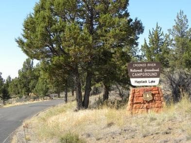
Overview Haystack Campground (East Shore) is located in central Oregon's scenic Crooked River National Grassland. With a view of Mt. Jefferson in the distance, visitors can enjoy the beautiful vistas while relaxing in the high desert. Recreation Fishing is a popular pastime at the reservoir, which is regularly stocked. Largemouth bass, rainbow trout, kokanee, along with crappie and catfish are some of the species that inhabit the water. Recreational boating is also popular with paved boat ramps available at Haystack Campground as well as at the West Shore Campground. Swimming is also permitted. Nearby areas provide other activities such as rock climbing, hiking, horseback riding, mountain biking, and ATV use. Facilities Fishing is a popular pastime at the reservoir, which is regularly stocked. Largemouth bass, rainbow trout, kokanee, along with crappie and catfish are some of the species that inhabit the water. Recreational boating is also popular with paved boat ramps available at Haystack Campground as well as at the West Shore Campground. Swimming is also permitted. Nearby areas provide other activities such as rock climbing, hiking, horseback riding, mountain biking, and ATV use. Natural Features Near Madras, Oregon, Haystack Reservoir's 240 surface-acres are surrounded by a high desert landscape of juniper trees and sagebrush. The expanse of water attracts waterfowl such as common loon, horned grebe, red-necked grebe, and eared grebe for a respite during migration. Rarities that have been reported are trumpeter swan, surf scoter, black-necked stilt, sanderling, bald eagle, osprey, and eastern kingbird. The spring breeding season in April through May produces nature's own concert from Pacific chorus frog. Nearby Attractions Smith Rock State Park, a very popular area for rock climbing is about a 20-minute drive to the south. Also, a spectacular view of the Crooked River Gorge is available from an old highway bridge, now accessible by a short walk from a rest area just off Hwy 97 about 15 minutes south of the campground.
View details →
Overview Bull Prairie Campground is a local gem; a beautiful, woodsy place to enjoy a vacation, host a family reunion or social event, and to enjoy multiple recreational pursuits. This moderate-sized campground is located adjacent to 28-acre Bull Prairie Lake, which is stocked annually with trout. An accessible, family-friendly paved trail along the lake is ideal for morning jogs, bicycle rides, picnicking, and shore or dockside fishing. The lake has a boat ramp, dock and trailer parking area, but only non-motorized boating is allowed. Nearby trails connect the campground and lake with the Morrow County OHV Park, 8 miles away. Note: ATVs are only allowed at the dump station and in the north part of the campground (sites 25-28). While this campground offers potable water, there is no garbage service so please pack out all garbage and dispose of it at home. Recreation An accessible, family-friendly paved trail around the lake is designed for people who enjoy morning jogs, bicycle rides, picnicking, and shoreline or dock fishing. Non-motorized boating is allowed with a boat ramp, dock, and parking area for trailers. Within the campground adjacent to the lake is a large day-use picnic area with accessible facilities. Besides beautiful scenery, the lake offers many opportunities for wildlife viewing and photography. Hunting activities can be undertaken nearby, but not within this recreation site. Facilities An accessible, family-friendly paved trail around the lake is designed for people who enjoy morning jogs, bicycle rides, picnicking, and shoreline or dock fishing. Non-motorized boating is allowed with a boat ramp, dock, and parking area for trailers. Within the campground adjacent to the lake is a large day-use picnic area with accessible facilities. Besides beautiful scenery, the lake offers many opportunities for wildlife viewing and photography. Hunting activities can be undertaken nearby, but not within this recreation site. Natural Features This campground is fully forested with Ponderosa pine, Douglas-fir, grand fir, and spruce. Trout are stocked in the nearby lake. Deer, chipmunks, squirrels, and rabbits frequent the campground and waterfowl inhabit the lake and shore. It is also possible to sight an occasional elk in the nearby area. Bears and cougars live in the surrounding forest, but rarely enter the campground and bear-proof storage is not required. Mushroom and berry picking occur seasonally. contact_info For facility specific information, please call (541) 676-2155. Nearby Attractions The Morrow County OHV Park is located 8 miles north of the campground. Heppner, OR, located 41.5 miles to the north, is the closest town for supplies and gasoline. Charges & Cancellations Cancelling a Reservation: Customers may cancel their reservation prior to arrival either online or through the call center. A $10 service fee will be withheld from any refund for a cancellation. Depending on when you cancel in relation to your arrival day, it may be considered a late cancellation (see below). Individual Campsites: A customer who cancels a reservation the day before or on the day of arrival will pay a $10.00 service fee AND forfeit the first night's use fee (not to exceed the total paid for the original reservation). Cancellations for a one-night reservation will forfeit the entire amount paid and will not be subject to an additional service fee. Group Facility (including Cabins and Lookouts): Customers who cancel a group overnight facility reservation less than 14 days before the arrival date will pay a $10.00 service fee AND forfeit the first night's use fee.
View details →
Overview Nestled on the edge of a lake, high in the Blue Mountains of Eastern Oregon, this popular campground is only 8 miles west of the historic Fremont Powerhouse and 12 miles west of the old mining town of Granite. The campground features 28 campsites and 7 accessible toilet facilities. Other features include a 2-mile hiking trail around the lake with nearby access to wilderness and scenic area trails, a boat ramp and 2 docks. There is no potable water or garbage service, so please pack your garbage home. Besides beautiful scenery, the lake offers many opportunities for wildlife viewing--particularly a nesting pair of osprey that return annually. Activities in this area include fishing, boating, swimming, hiking, hunting, and photography. Within 20 miles are several historic sites. Recreation A 2-mile hiking trail encircles the lake, providing access to more secluded spots where solitude can be enjoyed. Bicyclists can also enjoy the trail although there are a couple of spots bikes might need to be walked, depending on skill level. Anglers can fish for rainbow trout, cutthroat trout, brook trout, and kokanee and crawfish boils are a popular dinner option. There are 2 boat docks adjacent to the campground, as well as a boat ramp and trailer parking. Motorized boats are allowed on the lake, but wakes and jet skis are not allowed. There are opportunities for viewing wildlife such as deer, elk, bear, river otters, and osprey. Mushroom and berry picking are available in season. Other nearby trails access the North John Day Wilderness Area and Vinegar Hill Scenic Area. An interpretive sign about the beetle infestation is located in a few spots within the campground. Facilities A 2-mile hiking trail encircles the lake, providing access to more secluded spots where solitude can be enjoyed. Bicyclists can also enjoy the trail although there are a couple of spots bikes might need to be walked, depending on skill level. Anglers can fish for rainbow trout, cutthroat trout, brook trout, and kokanee and crawfish boils are a popular dinner option. There are 2 boat docks adjacent to the campground, as well as a boat ramp and trailer parking. Motorized boats are allowed on the lake, but wakes and jet skis are not allowed. There are opportunities for viewing wildlife such as deer, elk, bear, river otters, and osprey. Mushroom and berry picking are available in season. Other nearby trails access the North John Day Wilderness Area and Vinegar Hill Scenic Area. An interpretive sign about the beetle infestation is located in a few spots within the campground. Nearby Attractions The area around Olive Lake is rich in history. The dam and gates on the north side of the lake were constructed as part of a hydroelectric system to support gold mining activities within the northern Blue Mountain Region. Historically, water from the lake flowed through a wooden pipeline to the Fremont Powerhouse, where it was used to produce electricity for mines and towns in the area. Fremont Powerhouse is located approximately 7 miles east and the historic moning town of Granite is 12 miles east of Olive Lake along Forest Road 73.
View details →
Overview Edson Creek Campground features open meadow style camping. It is located near a beautiful meandering creek that flows into the Sixes River. Recreation Camping, fishing, boating, sightseeing, and water play are all popular activities at the campground. A day use area and boat ramp are located across the road from the main campground, providing a place to launch boats and fish the Sixes River. Facilities Camping, fishing, boating, sightseeing, and water play are all popular activities at the campground. A day use area and boat ramp are located across the road from the main campground, providing a place to launch boats and fish the Sixes River. Natural Features Tall red alder and myrtlewood trees flank the open meadows at Edson. The water and forest that surrounds the campground are home to many fish and wildlife species. Nearby Attractions The area provides warm temperatures and easy access to nearby coastal attractions. Cape Blanco Lighthouse, New River Nature Center, Oregon State Parks, and several coastal beaches are nearby.
View details →
Overview Nestled high in the Cascade Mountains among towering firs and pines, the Hyatt Lake Recreation Area is located in the northern corner of Cascade-Siskiyou National Monument on the shores of beautiful Hyatt Lake. At just above 5,000 feet of elevation, the 745-acre Hyatt Lake Recreation Area provides options for summertime camping, picnicking, hiking, horseback riding, biking, fishing, swimming, boating, and many other recreation opportunities. The recreation area offers dramatic views of Mt. McLoughlin and serves as a great basecamp for access to the Monument and the Pacific Crest National Scenic Trail. Day-use is on a first-come, first-served basis and permits may be obtained at the self-service pay stations located at the main campground entrance and Wildcat Campground. Recreation Hyatt Lake is a 10 mph "no-wake" lake. During spring and summer months, Hyatt offers excellent lake trout and small mouth bass fishing. Other recreation activities are available including hiking, swimming, horseshoes and a sand volleyball court. Access points for the Pacific Crest National Scenic Trail are easily accessible starting from the campground. Although the campground is closed during winter months, great winter activities are available such as cross-country skiing, sledding and snowshoeing. Facilities Hyatt Lake is a 10 mph "no-wake" lake. During spring and summer months, Hyatt offers excellent lake trout and small mouth bass fishing. Other recreation activities are available including hiking, swimming, horseshoes and a sand volleyball court. Access points for the Pacific Crest National Scenic Trail are easily accessible starting from the campground. Although the campground is closed during winter months, great winter activities are available such as cross-country skiing, sledding and snowshoeing. Natural Features Hyatt Lake is located 20 miles east of Ashland in Oregon's beautiful Cascade Mountains. At 5,200 feet in elevation, Hyatt Lake offers a cool respite from the summer heat and also serves as a gateway for winter recreation enthusiasts. Hyatt Lake is located inside the boundary of the Cascade-Siskiyou National Monument. The Monument was established in recognition of its remarkable ecology and to protect a diverse range of biological, geological, aquatic, archaeological, and historic objects. contact_info For facility specific information, please call (541) 618-2200. Nearby Attractions Adjacent to the Hyatt Lake Recreation Area is public shoreline and adjacent lands. The Pacific Crest National Scenic Trail intersects the campground and Little Hyatt Lake is within 6 miles of location.
View details →
Overview Susan Creek Campground is well known for its beautiful setting along the emerald-green waters of the North Umpqua Wild and Scenic River. Nestled under the canopy of a mature forest, the campsites are surrounded by trees up to seven feet in diameter. It is a short drive from the Umpqua National Forest, which boasts incredible glacial-cut mountain slopes across 984,602 acres of forest. The campground features 29 campsites, all sites are reservation only until further notice. Reservations can be made at Recreation.gov or by calling the reservation line 1-877-444-6777 Recreation Hiking, picnicking, and relaxing are the primary activities at the campground. Well-developed trails on both the east and the west ends of the campground wind through tall trees and lush green understory providing views of wildlife such as the resident blacktail deer and soaring osprey. In spring and fall, salmon and steelhead trout come upriver to spawn, providing good fishing opportunities. Fishing on this stretch of the river is limited to fly-fishing only. The river also attracts swimmers and whitewater rafters and kayakers. Facilities Hiking, picnicking, and relaxing are the primary activities at the campground. Well-developed trails on both the east and the west ends of the campground wind through tall trees and lush green understory providing views of wildlife such as the resident blacktail deer and soaring osprey. In spring and fall, salmon and steelhead trout come upriver to spawn, providing good fishing opportunities. Fishing on this stretch of the river is limited to fly-fishing only. The river also attracts swimmers and whitewater rafters and kayakers. Natural Features Susan Creek is on the western edge of the Cascade Mountains, set along the famous North Umpqua River. You will be treated to sounds of the rushing river as it weaves its way through volcanic bedrock. majestic fir, cedar, and hemlock trees dominate the mountainous region. Nearby Attractions The campground is centrally located, with easy access to nearby rafting, fly-fishing, mountain biking, picnicking and waterfall viewing. The 79-mile long North Umpqua Trail is a great place to hike or mountain bike, and can be reached from the campground by either trail or road. The Susan Creek Falls trail winds through a forest of diverse tree and plant species, ending at the stunning Susan Creek Falls. Take a drive along the Rogue-Umpqua National Scenic Byway yielding gorgeous views of mountain peaks, forested canyons, and alpine lakes.
View details →
Overview Tyee Campground is situated between the Pacific Coast and the city of Roseburg, Oregon. Perched on the banks of the Umpqua River, its location appeals to avid anglers and water sport enthusiasts. The name, Umpqua, is a surviving term of the Native American Umpqua language, and translates to "thundering waters," "satisfied," or "across the waters." For awareness when making reservations: There are two Tyee Campgrounds in Oregon. This location is on the Umpqua River, and another is located near the Oregon Dunes. Recreation Fishing enthusiasts will enjoy the chance to catch chinook and coho salmon, steelhead, or bass depending on the season. A round of horseshoe on the grounds or a walk down to the river will appeal to those looking for a more casual day. Facilities Fishing enthusiasts will enjoy the chance to catch chinook and coho salmon, steelhead, or bass depending on the season. A round of horseshoe on the grounds or a walk down to the river will appeal to those looking for a more casual day. Natural Features Tyee is located along the Umpqua River in southwestern Oregon. It is only one of two rivers in Oregon with headwaters that begin high up in the Cascade Mountains and meanders on down to the Pacific Ocean. The campground lies in a broad river canyon surrounded by deeply forested mountainsides. Nearby Attractions The Umpqua River Scenic Byway offers breathtaking views and outstanding scenery. Along the byway lies the town of Elkton, well-known for its wineries and butterfly pavilion. West of Elkton is the Dean Creek Elk Viewing Area, where spotting majestic Roosevelt Elk near the roadway is almost guaranteed. The Pacific Coast is roughly 50 miles from Tyee.
View details →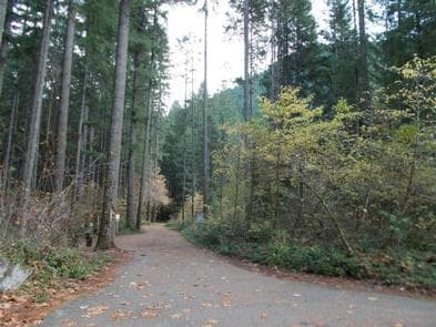
Overview Bogus Creek Campground is situated in a stand of old growth Douglas fir, cedars, and deciduous trees, among many flowering shrubs and native species. Its proximity to the Wild & Scenic North Umpqua River makes this campground the perfect get away. Recreation Bogus Creek Campground is located in a prime location to participate in many outdoor endeavors such as hiking, mountain biking, fly fishing, and whitewater rafting to name a few. If nature photography or wildlife viewing are your passion, you will be in no better place to capture Mother Nature's splendor through your lens or sit along the river to see the flight of the majestic bald eagles that call the North Umpqua River home. The North Umpqua River, just across the highway from this campground, offers many recreational pursuits and river access is made easy with a raft launch located across from the campground as well. Renowned for outstanding salmon and steelhead fishing and exhilarating whitewater challenges, the North Umpqua River offers an ideal setting for many recreational pursuits. Facilities Bogus Creek Campground is located in a prime location to participate in many outdoor endeavors such as hiking, mountain biking, fly fishing, and whitewater rafting to name a few. If nature photography or wildlife viewing are your passion, you will be in no better place to capture Mother Nature's splendor through your lens or sit along the river to see the flight of the majestic bald eagles that call the North Umpqua River home. The North Umpqua River, just across the highway from this campground, offers many recreational pursuits and river access is made easy with a raft launch located across from the campground as well. Renowned for outstanding salmon and steelhead fishing and exhilarating whitewater challenges, the North Umpqua River offers an ideal setting for many recreational pursuits. Natural Features Visitors to the Umpqua National Forest are often taken aback by the unique landscapes of southwestern Oregon. Explosive geologic events have shaped the distinctive landscape on the nearly 1 million-acre forest, and provide spectacular scenery as well as an abundance of natural and cultural resources. The translation of the word "Umpqua," meaning "thundering waters," defines the area. High mountain lakes, heart stopping rapids, peaceful ponds and thundering waterfalls, including the beautiful Toketee Falls, offer visitors plenty to see and do. Nearby Attractions The popular 79 mile North Umpqua Trail is nearby and can be accessed easily from the campground from the Wright Creek or Mott Trailheads. Within the campground, you can walk along the Riverview Trail and treat yourself to amazing views of the river. Opportunities for mountain biking and whitewater rafting are within 10 miles. This campground sits along the route of the Rogue-Umpqua National Scenic Byway. The Byway offers 172 miles of diverse river and mountain landscapes that traverses through the Umpqua and Rogue River valleys. Travel from rolling oak covered hills and towering coniferous forests, to roaring white water rapids and incised inter-canyon lava flows. The highway travels alongside the Upper Rogue and the Wild & Scenic North Umpqua River.
View details →
Overview Horseshoe Bend Campground is situated in a stand of old growth Douglas fir, sugar pine, and deciduous trees, on the banks of the Wild & Scenic North Umpqua River. The campground offers the perfect setting for families, anglers, whitewater enthusiasts, and anyone who wants to escape and relax in their natural surroundings. Recreation Horseshoe Bend Campground is in a prime location for many outdoor activities including hiking, fly fishing, mountain biking, swimming, and whitewater rafting to name a few. Nature photographers find no shortage of amazing scenery to photograph and if wildlife viewing and sightseeing is your thing, look no further! The North Umpqua River, which runs adjacent to this campground, drains portions of the western side of the Cascade Range. Almost 34 miles of this river has been designated Wild & Scenic for its outstanding fisheries, recreational offerings, water quality and quantity, cultural resources, and scenery. Renowned for world-class salmon and steelhead fishing, and exhilarating whitewater challenges, the North Umpqua River offers an ideal setting for many recreational pursuits. Running nearly parallel to the North Umpqua River is the popular North Umpqua Trail. This 79 mile National Recreation Trail offers a trek for every ability. Mountain bikers won't feel left out as there are many opportunities to test your riding skills. Several trailheads can be accessed in the vicinity of the campground. In most places the trail travels near the river, allowing you to hike or ride with the sound of rapids and picturesque views spurring you on. Passing through lush forests, old-growth trees, and rocky bluffs, you will also occasionally get a bird's eye view of the river. This trail will not disappoint! Facilities Horseshoe Bend Campground is in a prime location for many outdoor activities including hiking, fly fishing, mountain biking, swimming, and whitewater rafting to name a few. Nature photographers find no shortage of amazing scenery to photograph and if wildlife viewing and sightseeing is your thing, look no further! The North Umpqua River, which runs adjacent to this campground, drains portions of the western side of the Cascade Range. Almost 34 miles of this river has been designated Wild & Scenic for its outstanding fisheries, recreational offerings, water quality and quantity, cultural resources, and scenery. Renowned for world-class salmon and steelhead fishing, and exhilarating whitewater challenges, the North Umpqua River offers an ideal setting for many recreational pursuits. Running nearly parallel to the North Umpqua River is the popular North Umpqua Trail. This 79 mile National Recreation Trail offers a trek for every ability. Mountain bikers won't feel left out as there are many opportunities to test your riding skills. Several trailheads can be accessed in the vicinity of the campground. In most places the trail travels near the river, allowing you to hike or ride with the sound of rapids and picturesque views spurring you on. Passing through lush forests, old-growth trees, and rocky bluffs, you will also occasionally get a bird's eye view of the river. This trail will not disappoint! Natural Features Visitors to the Umpqua National Forest are often taken aback by the unique landscape of southwestern Oregon. Explosive events have shaped the distinctive landscape on the nearly 1 million-acre forest, and provide spectacular scenery as well as an abundance of natural and cultural resources. The translation of the word "Umpqua" meaning "thundering waters" defines the area. High mountain lakes, heart stopping rapids, peaceful ponds, and thundering waterfalls offer visitors many options to play in nature. Diverse ecosystems support a wide range of habitat for wildlife common to the area. From eagles and owls, to salamanders and salmon, these species, along with many others, depend on surrounding undeveloped wilderness, clean streams and diverse forests to live. Nearby Attractions In addition to the hiking and mountain biking opportunities nearby, there is also a non-motorized boat ramp and whitewater rafting available on the river. Visitors may want to take some time to visit nearby Crater Lake National Park, the only national park in Oregon! The amazing Crater Lake area offers a glimpse into the volcanic history of the area. Experience 172 miles of diverse river and mountain landscapes along the Rogue-Umpqua National Scenic Byway. Travel from rolling oak-covered hills and towering coniferous forests, amid some of the most unique geologic features. From roaring white water rapids to inter-canyon lava flows, this drive will take your breath away. The highway travels alongside the Upper Rogue and North Umpqua Wild & Scenic Rivers that contain world class fisheries.
View details →
Overview Lost Lake Campground is nestled between beautiful Lost Lake and Mount Hood. From Lost Lake Butte, the valley view is breathtaking, and from the viewpoint, guests can revel in the most majestic view of Mt. Hood, its glaciers and Lost Lake. Another one of the many attractions at Lost Lake Campground is the old growth boardwalk, an interpretive trail that meanders through one of Oregon's large old growth stands. Recreation Lost Lake Campground offers an abundance of activities. Campers have access to a general store, which offers: canoe, kayak, historic wooden row boats, metal fishing boats and stand-up paddleboard rentals. Whether you are a professional angler looking to catch that prized German Brown or a first-timer, there is something for everyone. Additionally, there are a number of hiking trails near the campground ranging in length from 1/4 mile to over 100 miles resulting in numerous hiking and biking opportunities. Other activities include bird watching, berry picking, swimming, waterfall finding and more. Facilities Lost Lake Campground offers an abundance of activities. Campers have access to a general store, which offers: canoe, kayak, historic wooden row boats, metal fishing boats and stand-up paddleboard rentals. Whether you are a professional angler looking to catch that prized German Brown or a first-timer, there is something for everyone. Additionally, there are a number of hiking trails near the campground ranging in length from 1/4 mile to over 100 miles resulting in numerous hiking and biking opportunities. Other activities include bird watching, berry picking, swimming, waterfall finding and more. Natural Features Mother Nature went the extra mile when it came to Lost Lake. The surrounding topography is rugged, mountainous and magical. The flora and fauna is abundant and easily accessible. These attributes culminate in making Lost Lake Campground one of the most popular in Oregon. Nearby Attractions Nearby Wahtum Lake offers a great daily excursion or hike to one of the four surrounding waterfalls. On the way up to Lost Lake or on the way down, try stopping at one of the many fruit stands that blanket the Hood River Valley.
View details →
Overview Lava Lake Campground is located along the Cascade Lakes National Scenic Byway within the heart of Central Oregon's Cascade Range. Recreation Lava Lake Campground offers access to hiking, mountain biking, horseback riding, fishing and scenic driving. Facilities Lava Lake Campground offers access to hiking, mountain biking, horseback riding, fishing and scenic driving. Natural Features Lava Lake is located on the eastern slopes of the Cascade Mountain Range at an elevation of 4,740 feet surrounded by mature pine forests with bull rushes and lava outcroppings lining its shores.. Nearby Attractions Visitors can explore wilderness areas, wild and scenic rivers, lakes and reservoirs and approximately 1,600 miles of trails within the Deschutes National Forest. Lava Lands Visitor Center in nearby Bend, Oregon, and the unique geological landscape of Newberry National Volcanic Monument draw visitors to the region as well. Visitors will also enjoy traveling the Cascade Lakes Scenic Byway which climbs into the Cascades from Central Oregon's high desert valley over a 66-mile drive weaving through snow-capped peaks and alongside alpine lakes. Charges & Cancellations Once your reservation start date has begun, neither the Recreation.gov Contact Center nor the campground manager will be able to modify your reservation.
View details →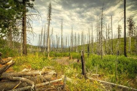
Overview Located eleven miles west of Sisters, Oregon, off Highway 242, Whispering Pine Horse Camp provides early season access to trails and is perfect for horse lovers who are visiting nearby friends. This rustic nine site horse camp offers great riding opportunities and trail access to the Three Sisters Wilderness Area. Recreation This campground offers many opportunities for horseback riding or hiking with the many trails nearby. The pine forest provides shade as well as the chance to go bird or nature watching. Facilities This campground offers many opportunities for horseback riding or hiking with the many trails nearby. The pine forest provides shade as well as the chance to go bird or nature watching. Natural Features Whispering Pine Horse Camp is nestled below a thick ponderosa pine forest mixed with birch in the wet areas. The pines provide nice shade and the chance to enjoy the quiet of nature. Nearby Attractions The close proximity to the town of Sisters offers many additional amenities and attractions, such as well as the nearby Camp Sherman RV Park as well as the Windigo Trail and Sisters Wilderness Trails. Charges & Cancellations Once your reservation start date has begun, neither the Recreation.gov Contact Center nor the campground manager will be able to modify your reservation.
View details →
Overview Whispering Falls Campground is an excellent outdoor retreat designed for campers more interested in a remote experience. Guests are greeted with grand, mature cedars and Douglas fir trees as they drive into the campground. Campfires allowed until and unless otherwise posted. Fire bans are common during summer months. Please plan accordingly. The Coffin Mountain Trail Area is located nearby, with splendid trails to explore like the Coffin Lookout and Bugaboo Ridge Trails. Scan and Pay is offered at this campground; you may also pay by cash or check for FCFS campsites. There are no refunds, modifications, cancellations, or other fee changes allowed with Scan and Pay payments. This system is the same as putting cash into a fee tube and cannot be refunded. Please download the Rec.Gov app prior to arriving at the campground as there may be no cellular service or very limited service at the campground. Recreation Anglers enjoy fishing for rainbow trout on the river. Among the many options for hiking and biking trails, the Mt. Jefferson-Pamelia Lake Trail Area is bound to please all types. Hikers looking for a challenging trail will enjoy the Minto Mountain Trail. Facilities Anglers enjoy fishing for rainbow trout on the river. Among the many options for hiking and biking trails, the Mt. Jefferson-Pamelia Lake Trail Area is bound to please all types. Hikers looking for a challenging trail will enjoy the Minto Mountain Trail. Natural Features Whispering Falls is located along the North Santiam River at an elevation of 2,000 feet. Surrounding vegetation includes hemlock, rhododendron and fern, among the towering conifers. The campground is in the North Santiam Travel Corridor of the Willamette National Forest. The forest covers 1.6 million acres on the western slopes of the Cascade Range. contact_info For facility specific information, please call (541) 967-3917. Nearby Attractions Detroit Lake provides plenty of opportunity for water recreation like boating, water skiing and kayaking. The Marion Forks Fish Hatchery down the highway, along Marion and Horn Creeks, is an interesting place to visit. Here, visitors can see rainbow trout, summer steelhead and spring chinook being harvested.
View details →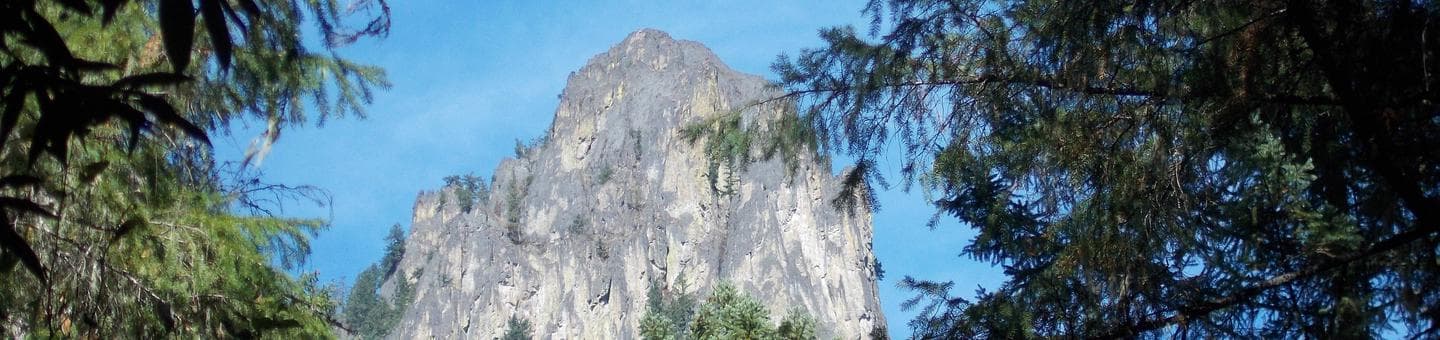
Overview Nestled along the bank of the Wild and Scenic North Umpqua River, Eagle Rock Campground offers an excellent setting for the perfect camping excursion. Popular with both fly anglers and whitewater enthusiasts, this campground is situated in a stand of old growth Douglas fir and deciduous trees. Recreation Eagle Rock Campground is in a prime location for hiking, mountain biking, fishing, and whitewater rafting in late spring and summer months. The North Umpqua River runs adjacent to the campground and drains portions of the western side of the Cascade Range. Renowned for outstanding salmon and steelhead fishing as well as exhilarating whitewater challenges, the river beckons to those staying at the campground. The popular 79-mile North Umpqua Trail, with multiple trailheads in the vicinity, offers hikers and bikers of all abilities the opportunity to gain some serious mileage or to just take a leisurely stroll or ride. Nearby Twin Lakes offers some of the most spectacular and breathtaking views in the area and makes for a great get-away to have a picnic or do some wildlife viewing. Facilities Eagle Rock Campground is in a prime location for hiking, mountain biking, fishing, and whitewater rafting in late spring and summer months. The North Umpqua River runs adjacent to the campground and drains portions of the western side of the Cascade Range. Renowned for outstanding salmon and steelhead fishing as well as exhilarating whitewater challenges, the river beckons to those staying at the campground. The popular 79-mile North Umpqua Trail, with multiple trailheads in the vicinity, offers hikers and bikers of all abilities the opportunity to gain some serious mileage or to just take a leisurely stroll or ride. Nearby Twin Lakes offers some of the most spectacular and breathtaking views in the area and makes for a great get-away to have a picnic or do some wildlife viewing. Natural Features Visitors to the Umpqua National Forest are often taken aback by the unique landscapes of southwestern Oregon. Explosive geologic events have shaped the distinctive landscape on the nearly 1 million-acre forest that provides spectacular scenery as well as an abundance of natural and cultural resources. The translation of the word "Umpqua" meaning "thundering waters," defines the area. High mountain lakes, heart-stopping rapids, peaceful ponds and thundering waterfalls, including the 272-foot Watson Falls on the North Umpqua Highway, offer visitors plenty of pastimes. Diverse ecosystems support a wide range of habitat for wildlife common to the area. From eagles and owls, to salamanders and salmon, these species, along with many others, depend on surrounding undeveloped wilderness, clean streams, and diverse forests to live and thrive. Nearby Attractions Opportunities for hiking and mountain biking are within 10 miles of the campground. Visitors may also want to take some time to visit nearby Crater Lake National Park, the only national park in Oregon! The amazing Crater Lake area offers a glimpse into the volcanic history of the area. Experience 172 miles of diverse river and mountain landscapes along the Rogue-Umpqua National Scenic Byway. Travel from rolling oak-covered hills and towering coniferous forests, amid some of the most unique geologic features. From roaring white water rapids to inter-canyon lava flows, this drive will take your breath away. The highway travels alongside the Upper Rogue and North Umpqua Wild and Scenic Rivers that contain world-class fisheries.
View details →
Overview Located six miles northwest of Sisters, Oregon, off Highway 20, Graham Corral Horse Camp provides early season access to trails and is perfect for horse lovers who are visiting nearby friends. Recreation This campground offers many opportunities for horseback riding or hiking on the many trails nearby. The pine forest provides shade as well as the chance to go bird or nature watching. Facilities This campground offers many opportunities for horseback riding or hiking on the many trails nearby. The pine forest provides shade as well as the chance to go bird or nature watching. Natural Features Graham Corral Horse Camp is nestled below a thick ponderosa pine forest mixed with birch in the wet areas. The pines provide nice shade and the chance to enjoy the quiet of nature. Nearby Attractions The close proximity to the town of Sisters offers many additional amenities and attractions, as well as the nearby Windigo Trail and numerous trail riding opportunities. Charges & Cancellations Once your reservation start date has begun, neither the Recreation.gov Contact Center nor the campground manager will be able to modify your reservation
View details →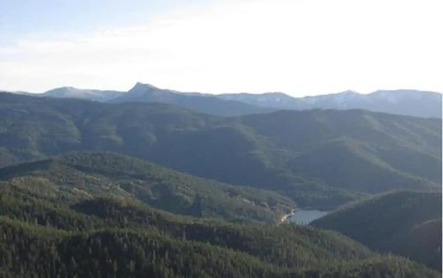
Overview Acorn Woman Peak Lookout was constructed in 1942. It is an L-4 style cabin, and is on the National Historic Site Registry. The lookout is surrounded by glass windows on all sides, providing visitors with an unparalleled view of the steep drop-offs and breath-taking views of the rugged Siskiyou Mountains. This historic lookout is available for rent during the snow-free season with a maximum length of stay being 5 consecutive nights. Guests must bring most of their own amenities. Recreation The lookout is also a prime spot for nature and scenic photography due to the stunning vistas provided. For visitors interested in astronomy, stargazing is a popular activity on clear nights. Facilities The lookout is also a prime spot for nature and scenic photography due to the stunning vistas provided. For visitors interested in astronomy, stargazing is a popular activity on clear nights. Natural Features From the lookout, guests are treated to expansive views of the Red Buttes Wilderness area, Acorn Woman Lake and the Little Applegate Valley. To the north are far views of the Rogue Valley and Mt. McLaughlin and to the east is Wagner Butte and Dutchman Peak. On a clear day, visitors can see the rim of Crater Lake, Mt. Bailey and Mt. Thielsen. Clear nights provide guests with a dazzling display of stars and planets. Nearby Attractions The United States Congress designated the Red Buttes Wilderness in 1984 and it now includes a total of 19,940 acres. Management of the Red Buttes Wilderness, located on the California/Oregon border, is shared by the Klamath National Forest and the Rogue River - Siskiyou National Forest. The majority of the Wilderness lies within the boundaries of the Rogue River-Siskiyou National Forest. Several lakes are accessible in the forest. Acorn Woman Peak looks south to Acorn Woman Lakes, a semi-primitive developed recreation area that accepts camping reservations from May through September. Applegate Lake is a large reservoir with boat ramps, campgrounds, viewpoints and a developed recreation area named Hart Tish. Both lakes are open for fishing year-round.
View details →
Overview In the shadow of majestic Mount Bailey on the west shore of Diamond Lake, this campground takes its name from the view of the unforgettable peak of Mt. Thielsen. Thielsen View Campground is a favorite with families and anglers. Recreation This campground is a great location for many recreational opportunities. Diamond Lake is stocked annually with 300,000 rainbow trout. If fishing is not your thing, the campground is on the John Dellenback trail. This paved trail is an 11-mile loop around the lake. If you prefer to travel by foot, Mount Bailey and Rodney Butte trails are less than a five-minute drive to the trailhead. Facilities This campground is a great location for many recreational opportunities. Diamond Lake is stocked annually with 300,000 rainbow trout. If fishing is not your thing, the campground is on the John Dellenback trail. This paved trail is an 11-mile loop around the lake. If you prefer to travel by foot, Mount Bailey and Rodney Butte trails are less than a five-minute drive to the trailhead. Natural Features The mixed conifer canopy generously shades most sites during the warm summer days. All campsites are very close to Diamond Lake, which offers great sunrises over Mount Thielsen. Nearby Attractions Mount Bailey, Mount Thielsen, Pacific Crest Trail, Dellenback Trail, Diamond Lake Resort, Diamond Lake Stables, and Lemolo Lake and Resort are all nearby. Visitors may also want to take some time to visit nearby Crater Lake National Park, the only national park in Oregon! The amazing Crater Lake area offers a glimpse into the volcanic history of the area.
View details →
Overview Pioneer Ford is one of the most popular of the campgrounds in the area since many of the sites are well suited to RVs and most of the sites are mostly private, shaded amongst a mixture of pine and cedar trees. As you travel north away from the first in a series of Metolius-area campgrounds and Camp Sherman, the facilities become more and more isolated which is why Pioneer Ford can be so quiet. Located on the Metolius River, this campground provides access to fishing and hiking trails. Recreation Hiking and fishing top the list of recreational activities for visitors. For anglers, the spring-fed Metolius River offers a stunning setting for fly-fishing. Its clear, cold water supports rainbow trout, whitefish, bull trout and kokanee salmon. For day hikers and backpackers, the area offers a wide variety of scenic terrain, ranging from riverside trails to routes in subalpine forests. Facilities Hiking and fishing top the list of recreational activities for visitors. For anglers, the spring-fed Metolius River offers a stunning setting for fly-fishing. Its clear, cold water supports rainbow trout, whitefish, bull trout and kokanee salmon. For day hikers and backpackers, the area offers a wide variety of scenic terrain, ranging from riverside trails to routes in subalpine forests. Natural Features The headwaters of the river are at Metolius Springs at the base of Black Butte, a 3,076-foot cinder cone. The clear, cold river flows north from the springs through diverse coniferous forest and a landscape of volcanic activity. The area provides habitat for mammals such as mule deer, coyote and cougar. Migratory birds and native fish also call the area home. Nearby Attractions The Metolius-Windigo Trail, open to hikers, bikers and horses, is more than 100 miles in length, and begins near the Metolius River headwaters west of the town of Sisters, Oregon. The trail was created in the 1980s primarily to serve long-distance horse riders seeking an alternative to the Pacific Crest Trail. Lava Lands Visitor Center in Bend, Oregon, offers visitors the opportunity to learn about the diverse landscape and history of the area through interpretive programs and exhibits. Charges & Cancellations Once your reservation start date has begun, neither the Recreation.gov Contact Center nor the campground manager will be able to modify your reservation.
View details →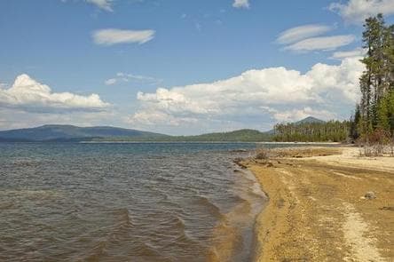
Overview Contorta Flat is an isolated, hidden gem on the far side of Crescent Lake at the top of the Willamette Pass. There are excellent tent sites right on the lake as well as many sites that are ideal for large RVs. You will need to go a little off the beaten path by taking a gravel road for the last few miles to find this nice quiet campground. The sites are all close to the lake and large, but not isolated from one another. This campground might be the best deal in the Oregon Cascades. Recreation Crescent Lake is a prime location for boating, fishing and swimming. The Summit Lake Trail is popular among hikers and mountain bikers, offering excellent views of Diamond Peak across Crescent Lake. Visitors can take advantage of skiing, snowshoeing and snowmobiling in the winter months. Crescent Lake Snowpark offers a base camp for exciting winter excursions. The Summit Lake Trail is open to snowmobiling. Facilities Crescent Lake is a prime location for boating, fishing and swimming. The Summit Lake Trail is popular among hikers and mountain bikers, offering excellent views of Diamond Peak across Crescent Lake. Visitors can take advantage of skiing, snowshoeing and snowmobiling in the winter months. Crescent Lake Snowpark offers a base camp for exciting winter excursions. The Summit Lake Trail is open to snowmobiling. Natural Features Cresent Lake is nestled in a glacier basin east of the towering Cascade Mountain Range. It boasts brilliant blue-green water and sandy beaches. A forest of lodgepole pine provides the backdrop to the area, with mountain hemlock, fir and spruce in the mix. Wildlife found in the area includes deer, native fish and migratory birds. Nearby Attractions Visitors can explore wilderness areas, rivers, lakes and reservoirs, and approximately 1,600 miles of trails that comprise nearly 2.5 million acres within the Deschutes National Forest and the adjacent Ochoco National Forest. Lava Lands Visitor Center in nearby Bend, Oregon, and the unique geological landscape of Newberry National Volcanic Monument draw visitors to the region as well. Visitors enjoy traveling the Cascade Lakes Scenic Byway, known as Oregon's Highway in the Sky, which climbs into the clouds on a 66-mile drive through the Cascade Range, weaving past snow-capped peaks and alpine lakes. Charges & Cancellations Once your reservation start date has begun, neither the Recreation.gov Contact Center nor the campground manager will be able to modify your reservation.
View details →
Overview A pleasant, small spring runs through the center of this popular, shaded campground. Located just southwest of Sisters, Oregon, Cold Springs Campground is nestled below a thick Ponderosa Pine forest mixed with aspen in the wet areas. This campground offers opportunities for hiking and bird watching and is a great option for the whole family. Recreation This campground offers many opportunities for hiking and biking with the many trails nearby. The ponderosa pine forest provides shade as well as the chance to go bird or nature watching. Facilities This campground offers many opportunities for hiking and biking with the many trails nearby. The ponderosa pine forest provides shade as well as the chance to go bird or nature watching. Natural Features Nestled in the forest with a pleasant, small spring running through the center of this facility, Cold Springs Campground is a great shady family spot with short hikes all around. Nearby Attractions The close proximity to the town of Sisters offers many additional amenities and attractions, as well as the nearby Sisters Wilderness Trails. Charges & Cancellations Once your reservation start date has begun, neither the Recreation.gov Contact Center nor the campground manager will be able to modify your reservation.
View details →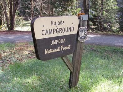
Overview Rujada Campground is located 21 miles east of Cottage Grove (45 minutes from Eugene) on a riverside terrace above Layng Creek. A favorite site for family picnics and camping, visitors will enjoy shaded campsites with privacy, access to swimming on the banks of Layng Creek and a hike through a rich riparian Douglas fir forest on the Swordfern trail. Check out a historic Civilian Conservation Corps (CCC) shelter and a kid's playground with obstacles, swing, teeter- totter and monkey bars both located within the campground. Recreation Recreational opportunities are plentiful and include hiking, biking, fishing, swimming, and nature viewing. Spirit Falls, Moon Falls, and Pinard Falls Trails are just a few of the local waterfall trails in the area. Facilities Recreational opportunities are plentiful and include hiking, biking, fishing, swimming, and nature viewing. Spirit Falls, Moon Falls, and Pinard Falls Trails are just a few of the local waterfall trails in the area. Natural Features This beautiful and quiet campground located in the Umpqua National Forest sits at approximately 1,200 feet in elevation among Douglas fir, hardwood trees and ferns. Nearby Attractions Rujada Day Use Picnic Area is located within the campground and may be reserved. Nearby are three spectacular waterfall trails. Spirit Falls is a short 0.4 mile, more difficult hike to a 60' waterfall. Moon Falls is an easy, 0.5 mile hike to a 125' cascading waterfall. Pinard Falls is a 0.6 mile, more difficult hike to a 105' waterfall. All three hikes are within 10 miles of the campground and can be done within a single day.
View details →
Overview Like the other campgrounds on the Metolius, Allen Springs is located amongst towering Ponderosa Pines, on a turn of the Metolius River that broadens the river view. Most of the campsites are better suited to tents rather than RV's. Recreation This campground offers many opportunities for hiking and biking with the many trails nearby. The ponderosa pine forest provides shade as well as the chance to go bird or nature watching. Facilities This campground offers many opportunities for hiking and biking with the many trails nearby. The ponderosa pine forest provides shade as well as the chance to go bird or nature watching. Natural Features Nestled in the forest with near the Metolius River. Allen Springs Campground is a great shady family spot with short hikes all around. Nearby Attractions The close proximity to the town of Sisters offers many additional amenities and attractions, as well as the nearby Sisters Wilderness Trails. Charges & Cancellations Once your reservation start date has begun, neither the Recreation.gov Contact Center nor the campground manager will be able to modify your reservation.
View details →
Overview Mallard Marsh Campground is located along the reed-lined shores of Hosmer Lake a popular destination for fly-fishing, paddling and birding. Recreation Nearby Hosmer Lake offers opportunities for fly fishing and boating as well as spectacular views. There are also trails and other opportunities for hiking and horseback riding nearby. Facilities Nearby Hosmer Lake offers opportunities for fly fishing and boating as well as spectacular views. There are also trails and other opportunities for hiking and horseback riding nearby. Natural Features At the north end of Hosmer Lake, water drains into a porous rim of lava. Hosmer is a “fly fishing only” lake well known for its breath taking views of Mt. Bachelor, South Sisters, Broken Top as well as wildlife viewing and the big Atlantic salmon, brook trout and rainbows that are quite visible in this shallow clear lake. The best way to experience this lake is by canoe or kayak as shore access is limited due to marshy vegetation. Nearby Attractions Visitors enjoy traveling the Cascade Lakes Scenic Byway which climbs 66-miles through the Cascade Range, weaving past snow-capped peaks and alpine lakes. Charges & Cancellations Once your reservation start date has begun, neither the Recreation.gov Contact Center nor the campground manager will be able to modify your reservation.
View details →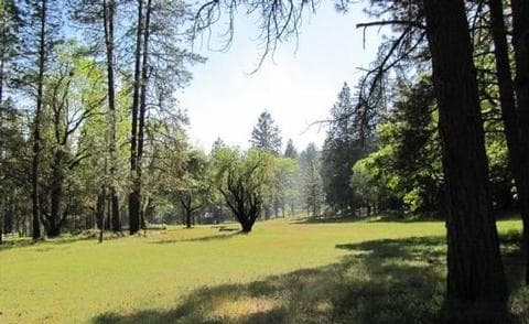
Overview The large meadow at the Flumet Flat Group Campground makes a great location for group events such as reunions, church camps, school field trips and scouting events. Located in southwest Oregon in the Rogue River-Siskiyou National Forest, the campground's proximity to a hiking trails and scenic waterways provides visitors with access to a multitude of recreational activities. Recreation Flumet Flat Group Campground offers outdoor enthusiasts the opportunity to hike, fish, hunt and enjoy a multitude of outdoor activities throughout the year. A handful of hiking trails are accessible from the campground and in the surrounding areas. The nearby Mule Mountain Trail offers a special opportunity to access the hillsides above Applegate Valley and witness the seasonal changes in wildlife activity. It is a long-distance hike, winding up and around the arid ridges of the Oregon Siskiyous. In the spring, dwarf star tulips, lilies, shooting stars, larkspurs and buttercups puncture the needle and leaf mat and adorn the grass floor. Nearby Applegate Lake is a popular recreation lake, located north of the spectacular Red Buttes Wilderness Area. The lake is popular for swimming, boating, canoeing, and fishing. In the area around the lake, visitors can enjoy cycling and hiking the various trails. Facilities Flumet Flat Group Campground offers outdoor enthusiasts the opportunity to hike, fish, hunt and enjoy a multitude of outdoor activities throughout the year. A handful of hiking trails are accessible from the campground and in the surrounding areas. The nearby Mule Mountain Trail offers a special opportunity to access the hillsides above Applegate Valley and witness the seasonal changes in wildlife activity. It is a long-distance hike, winding up and around the arid ridges of the Oregon Siskiyous. In the spring, dwarf star tulips, lilies, shooting stars, larkspurs and buttercups puncture the needle and leaf mat and adorn the grass floor. Nearby Applegate Lake is a popular recreation lake, located north of the spectacular Red Buttes Wilderness Area. The lake is popular for swimming, boating, canoeing, and fishing. In the area around the lake, visitors can enjoy cycling and hiking the various trails. Natural Features Within a short walking distance, there are swimming and fishing areas on the Applegate River. The Gin Lin National Recreation Trail, with a self-guided tour of 19th century mining, is located just south of Flumet Flat. It offers a 3/4 mile loop with trail markers that correspond to the information in the brochure. History, spring wildflowers, wildlife, and a view looking down on the Applegate River make this a popular year-round attraction. Beware of rattlesnakes and ticks, which commonly occur in the Applegate Valley. Nearby Attractions The United States Congress designated the Red Buttes Wilderness in 1984 and it now includes a total of 19,940 acres. Management of the Red Buttes Wilderness, located on the California/Oregon border, is shared by the Klamath National Forest and the Rogue River - Siskiyou National Forest. The majority of the Wilderness lies within the boundaries of the Rogue River-Siskiyou National Forest. Several lakes are accessible in the forest. Squaw Peak looks south to Squaw Lakes, a semi-primitive developed recreation area that accepts camping reservations from May through September. Applegate lake is a large reservoir with boat ramps, campgrounds, viewpoints and a developed recreation area named Hart tish. Both Squaw Lakes and Applegate lake are open for fishing year-round.
View details →
Overview Fourmile Lake is located off Highway 140 near Lake of the Woods. The campground and day use area is at the southern end of Sky Lakes Wilderness area. This rustic campground with few amenities is the place to get away from the modern world. Horse corrals are available in the upper portion of the campground and the proximity to the wilderness and Pacific Crest Trail make it ideal for the backcountry enthusiast. Recreation Visitors to the area will enjoy a variety of activities including hiking, backpacking, climbing, kayaking, canoeing, rafting, horse packing, bird watching, stargazing, fishing, and horse camping. Facilities Visitors to the area will enjoy a variety of activities including hiking, backpacking, climbing, kayaking, canoeing, rafting, horse packing, bird watching, stargazing, fishing, and horse camping. Natural Features The 113,400-acre Sky Lakes Wilderness occupies the crest of the High Cascades, extending south from the boundary of Crater Lake National Park to Fourmile Lake. The wilderness has gentle, densely forested terrain with occasional steep areas. The name derives from the many small lakes, most of them clustered in several glacial basins near the crest of the Cascade Range. Several species of trees including Shasta red fir, western white pine, mountain hemlock, lodgepole pine, Engelmann spruce and whitebark pine are found throughout the area. The forest's understory is dominated by species of huckleberry, as well as manzanita, snowbrush, and heather. Nearby Attractions Lake of the Woods is another nearby lake with USFS facilities and a full service family oriented resort just six miles down the road. Travel along the Volcanic Scenic Byway as you explore the surrounding area. Other stops of interest may include Kla-Mo-Ya Casino (57 miles), Fort Klamath Museum (35 miles), Collier Memorial State Logging Museum (60 miles), Pacific Crest Trail (within 2 miles) and Crater Lake (55 miles).
View details →
Overview Little Cultus Lake Campground is located on Little Cultus Lake just south of Cultus Lake proper. Recreation Little Cultus Lake has a gentle sloping bottom making it ideal for wading and swimming while nearby hiking offer acces to the Three Sisters Wilderness. There is a boat launch area within this campground. Facilities Little Cultus Lake has a gentle sloping bottom making it ideal for wading and swimming while nearby hiking offer acces to the Three Sisters Wilderness. There is a boat launch area within this campground. Natural Features The lake spans 175 acres hosting rainbow and brook trout. Charges & Cancellations Once your reservation start date has begun, neither the Recreation.gov Contact Center nor the campground manager will be able to modify your reservation.
View details →
Overview This campground and trailhead is located along the Wild and Scenic North Umpqua River. Visitors will experience the river's rushing waters as they pass through lush high Cascade meadows. Spring arrives late in the high country and it is welcomed here with an explosion of colors. Purples, reds, yellows, greens, and white are arranged in a riotous bouquet. This site is designed to accommodate pack and saddle use as well as standard camping. Recreation The campground serves as a base camp for many trailheads that are local favorites for horse riding. Please be courteous and only reserve equestrian site(s) if you bring a horse. Campers in equestrian site(s) without pack or riding horses may be turned away or directed to another campground. Facilities The campground serves as a base camp for many trailheads that are local favorites for horse riding. Please be courteous and only reserve equestrian site(s) if you bring a horse. Campers in equestrian site(s) without pack or riding horses may be turned away or directed to another campground. Natural Features Umpqua National Forest visitors are often taken aback by unique and surprising landscapes shaped by explosive geologic events. The 984,602-acre forest provides spectacular scenery and an abundance of natural and cultural resources. The translation of the word, "Umpqua," meaning "thundering waters," defines the area. High mountain lakes, heart-stopping rapids, peaceful ponds and thundering waterfalls, including the 272-foot Watson Falls on the North Umpqua Highway, offer visitors a renewed sense of spirit. Diverse ecosystems support a wide range of habitat for wildlife. From eagles and owls to salamanders and salmon, these species, along with many others, depend on surrounding undeveloped wilderness, clean streams and diverse forests to live. Nearby Attractions This site provides access to Porcupine Connect Trail 1412A , which connects to the North Umpqua Trail 1414 and Windigo Pass Trail 1412 . The North Umpqua Trail heads southeast to enter Mount Thielsen Wilderness where it connects with the Tolo Creek Trail #1466 , Lucile Lake Trail #1459 , Maidu Lake Loop Trail, and the Pacific Crest National Scenic Trail #2000 . In addition, Lemolo Lake and Resort are just a short drive away.
View details →
Overview Canton Creek Campground is a quaint little campground that sits along the banks of Steamboat Creek near the confluence with the Wild and Scenic North Umpqua River. Although small in size, it packs big fun and is easily accessible for those quick weekend getaways! Recreation Canton Creek Campground is in a prime location for hiking, mountain biking, fishing, and whitewater rafting, or simply relaxing at your site listening to the soothing sounds of Steamboat Creek. Or better yet, cool off in the pristine waters of the creek that is easily accessed from the campground. The popular 79-mile North Umpqua Trail, with multiple trailheads in the vicinity, offers hikers and bikers of all abilities the opportunity to gain some serious mileage or to just take a leisurely stroll or ride. Fly fish in the renowned Wild and Scenic North Umpqua River, alone or with a guide. Whatever you choose, there is definitely plenty of activities to keep you busy. Facilities Canton Creek Campground is in a prime location for hiking, mountain biking, fishing, and whitewater rafting, or simply relaxing at your site listening to the soothing sounds of Steamboat Creek. Or better yet, cool off in the pristine waters of the creek that is easily accessed from the campground. The popular 79-mile North Umpqua Trail, with multiple trailheads in the vicinity, offers hikers and bikers of all abilities the opportunity to gain some serious mileage or to just take a leisurely stroll or ride. Fly fish in the renowned Wild and Scenic North Umpqua River, alone or with a guide. Whatever you choose, there is definitely plenty of activities to keep you busy. Natural Features Visitors to the Umpqua National Forest are often taken aback by the unique landscapes of southwestern Oregon. Explosive geologic events have shaped the distinctive landscape on the nearly 1 million acre forest that provides spectacular scenery as well as an abundance of natural and cultural resources. The translation of the word "Umpqua" meaning "thundering waters," defines the area. High mountain lakes, heart-stopping rapids, peaceful ponds and thundering waterfalls, including the 272 foot Watson Falls on the North Umpqua Highway, offer visitors plenty of pastimes. Diverse ecosystems support a wide range of habitat for wildlife common to the area. From eagles and owls, to salamanders and salmon, these species, along with many others, depend on surrounding undeveloped wilderness, clean streams, and diverse forests to live and thrive. Nearby Attractions Opportunities for biking, hiking, mountain biking, whitewater rafting, fishing, wildlife viewing, and a boat ramp are located withing 10 miles of the campground. Visitors may want to take some time to visit nearby Crater Lake National Park, the only national park in Oregon! The amazing Crater Lake area offers a glimpse into the volcanic history of the area. Experience 172 miles of diverse river and mountain landscapes along the Rogue-Umpqua National Scenic Byway. Travel from rolling oak-covered hills and towering coniferous forests, amid some of the most unique geologic features. From roaring white water rapids to inter canyon lava flows, this drive will take your breath away. The highway travels alongside the Upper Rogue and North Umpqua Wild and Scenic Rivers that contain world class fisheries.
View details →
Overview Inlet Campground is nestled along the North Umpqua River where the forest of lodgepole pine, mountain hemlock and Shasta red fir meet Lemolo Lake, the highest reservoir on the North Umpqua River at an elevation of 4,150 feet. Recreation Boating, fishing, swimming, kayaking, canoeing and water skiing top the list of recreational activities near the campground. Lemolo Lake provides outdoor enthusiasts with a multitude of recreational opportunities year round. The forested shoreline and mountainous backdrop provide a perfect setting for both swimmers braving the lake's cold, refreshing waters, and for anglers casting lines from boat or beach. Populations of German brown trout, Eastern brook trout, rainbow trout and kokanee salmon thrive in the lake which reaches depths of up to 100 feet in places. For waterfall seekers, nearby Lemolo Falls Trail is a steep traverse that drops down into North Umpqua Canyon for a view of Lemolo Falls as it cascades 150 feet to the canyon bottom. A spur trail accesses the bottom of the canyon below the falls. Facilities Boating, fishing, swimming, kayaking, canoeing and water skiing top the list of recreational activities near the campground. Lemolo Lake provides outdoor enthusiasts with a multitude of recreational opportunities year round. The forested shoreline and mountainous backdrop provide a perfect setting for both swimmers braving the lake's cold, refreshing waters, and for anglers casting lines from boat or beach. Populations of German brown trout, Eastern brook trout, rainbow trout and kokanee salmon thrive in the lake which reaches depths of up to 100 feet in places. For waterfall seekers, nearby Lemolo Falls Trail is a steep traverse that drops down into North Umpqua Canyon for a view of Lemolo Falls as it cascades 150 feet to the canyon bottom. A spur trail accesses the bottom of the canyon below the falls. Natural Features Umpqua National Forest visitors are often taken aback by unique and surprising landscapes shaped by explosive geologic events. The 984,602-acre forest provides spectacular scenery and an abundance of natural and cultural resources. The translation of the word, "Umpqua," meaning "thundering waters," defines the area. High mountain lakes, heart-stopping rapids, peaceful ponds and thundering waterfalls, including the 272-foot Watson Falls on the North Umpqua Highway, offer visitors a renewed sense of spirit. Diverse ecosystems support a wide range of habitat for wildlife. From eagles and owls to salamanders and salmon, these species, along with many others, depend on surrounding undeveloped wilderness, clean streams and diverse forests to live. Nearby Attractions Experience 172 miles of diverse river and mountain landscapes along the Rogue-Umpqua National Scenic Byway. Travel from rolling oak-covered hills and towering coniferous forests, to roaring whitewater rapids and ancient lava flows. The highway travels alongside the Upper Rogue and North Umpqua Wild and Scenic Rivers that contain world-class fisheries.
View details →
Overview Situated along the upper reaches of the Wild and Scenic North Umpqua River, Boulder Flat Campground is an enchanting site, lush with greenery from end to end. Popular with whitewater enthusiasts, this campground offers a raft put-in that is the start of many memorable raft trips. Recreation Boulder Flat Campground is in a prime location for hiking, mountain biking, fishing, and whitewater rafting, often times seeing die hard rafters all year long. The concrete raft launch is busy throughout the spring and summer, and changing rooms provide privacy for those needing to prepare for their whitewater adventures. The popular 79-mile North Umpqua Trail, with multiple trailheads in the vicinity, offers hikers and bikers of all abilities the opportunity to gain some serious mileage or to just take a leisurely stroll or ride. Nearby Twin Lakes offers some of the most spectacular and breathtaking views in the area and makes for a great get-away to have a picnic or do some wildlife viewing. Just up the highway is the popular Toketee Falls. Facilities Boulder Flat Campground is in a prime location for hiking, mountain biking, fishing, and whitewater rafting, often times seeing die hard rafters all year long. The concrete raft launch is busy throughout the spring and summer, and changing rooms provide privacy for those needing to prepare for their whitewater adventures. The popular 79-mile North Umpqua Trail, with multiple trailheads in the vicinity, offers hikers and bikers of all abilities the opportunity to gain some serious mileage or to just take a leisurely stroll or ride. Nearby Twin Lakes offers some of the most spectacular and breathtaking views in the area and makes for a great get-away to have a picnic or do some wildlife viewing. Just up the highway is the popular Toketee Falls. Natural Features Visitors to the Umpqua National Forest are often taken aback by the unique landscapes of southwestern Oregon. Explosive geologic events have shaped the distinctive landscape on the nearly 1 million acre forest that provides spectacular scenery as well as an abundance of natural and cultural resources. The translation of the word "Umpqua" meaning "thundering waters," defines the area. High mountain lakes, heart-stopping rapids, peaceful ponds and thundering waterfalls, including the 272 foot Watson Falls on the North Umpqua Highway, offer visitors plenty of pastimes. Diverse ecosystems support a wide range of habitat for wildlife common to the area. From eagles and owls, to salamanders and salmon, these species, along with many others, depend on surrounding undeveloped wilderness, clean streams, and diverse forests to live and thrive. Nearby Attractions Opportunities for hiking, mountain biking, wildlife viewing and climbing access are within 10 miles of the campground. Visitors may want to take some time to visit nearby Crater Lake National Park, the only national park in Oregon! The amazing Crater Lake area offers a glimpse into the volcanic history of the area. Experience 172 miles of diverse river and mountain landscapes along the Rogue-Umpqua National Scenic Byway. Travel from rolling oak-covered hills and towering coniferous forests, amid some of the most unique geologic features. From roaring white water rapids to inter canyon lava flows, this drive will take your breath away. The highway travels alongside the Upper Rogue and North Umpqua Wild & Scenic Rivers that contain world class fisheries. Located seven miles east on the highway you will find the popular Toketee Falls and Toketee Lake and campground.
View details →
Overview East Lemolo is on the banks of Lemolo Lake, the highest reservoir on the North Umpqua River at an elevation of 4,150 feet. Recreation Boating, fishing, swimming, kayaking, canoeing and water skiing top the list of recreational activities at the campground. Lemolo Lake provides outdoor enthusiasts with a multitude of recreational opportunities year round. The forested shoreline and mountainous backdrop provide a perfect setting for both swimmers braving the lake's cold, refreshing waters, and for anglers casting lines from boat or beach. Populations of German brown trout, Eastern brook trout, rainbow trout and kokanee salmon thrive in the lake which reaches depths of up to 100 feet in places. For waterfall seekers, nearby Lemolo Falls Trail is a steep traverse that drops down into North Umpqua Canyon for a view of Lemolo Falls as it cascades 150 feet to the canyon bottom. A spur trail accesses the bottom of the canyon below the falls. Facilities Boating, fishing, swimming, kayaking, canoeing and water skiing top the list of recreational activities at the campground. Lemolo Lake provides outdoor enthusiasts with a multitude of recreational opportunities year round. The forested shoreline and mountainous backdrop provide a perfect setting for both swimmers braving the lake's cold, refreshing waters, and for anglers casting lines from boat or beach. Populations of German brown trout, Eastern brook trout, rainbow trout and kokanee salmon thrive in the lake which reaches depths of up to 100 feet in places. For waterfall seekers, nearby Lemolo Falls Trail is a steep traverse that drops down into North Umpqua Canyon for a view of Lemolo Falls as it cascades 150 feet to the canyon bottom. A spur trail accesses the bottom of the canyon below the falls. Natural Features Umpqua National Forest visitors are often taken aback by unique and surprising landscapes shaped by explosive geologic events. The 984,602-acre forest provides spectacular scenery and an abundance of natural and cultural resources. The translation of the word, "Umpqua," meaning "thundering waters," defines the area. High mountain lakes, heart-stopping rapids, peaceful ponds and thundering waterfalls, including the 272-foot Watson Falls on the North Umpqua Highway, offer visitors a renewed sense of spirit. Diverse ecosystems support a wide range of habitat for wildlife. From eagles and owls to salamanders and salmon, these species, along with many others, depend on surrounding undeveloped wilderness, clean streams and diverse forests to live. Nearby Attractions Access to hiking, mountain biking and OHV trails is within ten miles of the campground. For a scenic driving experience there are 172 miles of diverse river and mountain landscapes along the Rogue-Umpqua National Scenic Byway. Travel from rolling oak-covered hills and towering coniferous forests, to roaring whitewater rapids and ancient lava flows. The highway travels alongside the Upper Rogue and North Umpqua Wild and Scenic Rivers that contain world-class fisheries.
View details →
Overview This campground clings to the northwest shore of Lemolo Lake beneath the heavily wooded Bunker Hill. Bald eagles often soar above the lodgepole pine forest. Bunker Hill Campground is popular with fishermen. Recreation Boating, fishing, swimming, kayaking, canoeing and water skiing top the list of recreational activities at the campground. Lemolo Lake provides outdoor enthusiasts with a multitude of recreational opportunities year round. The forested shoreline and mountainous backdrop provide a perfect setting for both swimmers braving the lake's cold, refreshing waters, and for anglers casting lines from boat or beach. Populations of German brown trout, Eastern brook trout, rainbow trout and kokanee salmon thrive in the lake which reaches depths of up to 100 feet in places. For waterfall seekers, nearby Lemolo Falls Trail is a steep traverse that drops down into North Umpqua Canyon for a view of Lemolo Falls as it cascades 150 feet to the canyon bottom. Facilities Boating, fishing, swimming, kayaking, canoeing and water skiing top the list of recreational activities at the campground. Lemolo Lake provides outdoor enthusiasts with a multitude of recreational opportunities year round. The forested shoreline and mountainous backdrop provide a perfect setting for both swimmers braving the lake's cold, refreshing waters, and for anglers casting lines from boat or beach. Populations of German brown trout, Eastern brook trout, rainbow trout and kokanee salmon thrive in the lake which reaches depths of up to 100 feet in places. For waterfall seekers, nearby Lemolo Falls Trail is a steep traverse that drops down into North Umpqua Canyon for a view of Lemolo Falls as it cascades 150 feet to the canyon bottom. Natural Features Umpqua National Forest visitors are often taken aback by unique and surprising landscapes shaped by explosive geologic events. The 984,602-acre forest provides spectacular scenery and an abundance of natural and cultural resources. The translation of the word, "Umpqua," meaning "thundering waters," defines the area. High mountain lakes, heart-stopping rapids, peaceful ponds and thundering waterfalls, including the 272-foot Watson Falls on the North Umpqua Highway, offer visitors a renewed sense of spirit. Diverse ecosystems support a wide range of habitat for wildlife. From eagles and owls to salamanders and salmon, these species, along with many others, depend on surrounding undeveloped wilderness, clean streams and diverse forests to live. Nearby Attractions Experience 172 miles of diverse river and mountain landscapes along the Rogue-Umpqua National Scenic Byway. Travel from rolling oak-covered hills and towering coniferous forests, to roaring whitewater rapids and ancient lava flows. The highway travels alongside the Upper Rogue and North Umpqua Wild and Scenic Rivers that contain world-class fisheries.
View details →
Overview The North Umpqua Wild and Scenic River pauses at Toketee Lake providing a secure home for a wide variety of wildlife. Here beaver and otter make their homes. Great blue heron and kingfishers are joined in fall and winter by ducks, geese, and bald eagles. Recreation Many people enjoy some of the state's best German brown trout fishing. Currently Toketee Lake is 2-3 feet lower than the boat ramp, so small non-powered boats are best. Toketee group site is located next to one of the trailheads for the famous North Umpqua Trail. This trail is a favorite for hiking, biking and horseback riding. Facilities Many people enjoy some of the state's best German brown trout fishing. Currently Toketee Lake is 2-3 feet lower than the boat ramp, so small non-powered boats are best. Toketee group site is located next to one of the trailheads for the famous North Umpqua Trail. This trail is a favorite for hiking, biking and horseback riding. Natural Features This campground offers a picturesque spot for families to relax and slow down. Lined with willow and mixed with maples and alders, this section of the river is very tranquil. The nearby footbridge offers great views of the river and lake. Nearby Attractions There are two spectacular waterfalls within a five-minute drive of the site. Watson Falls is 272 feet high and has a short trail to the base of the falls. During wetter months be prepared to get a cool shower of fresh mountain water. Toketee Falls is an amazing two level falls flowing out of a basalt column wall. The viewing platform is less than a half mile down the trail. If you need a little faster paced recreation, there is the North Umpqua Trail. This is a very popular trail for mountain biking. Many bikers use Toketee as a base camp for exploring the North Umpqua Trail.
View details →
Overview South Shore Group Campground reservations are no longer accepted through Recreation.gov as of March 2019. Please contact the new managing agency, Crook County Parks and Recreation District, at 541-447-2599 to make your reservations for Willow, Juniper, and Cottonwood campsites at South Shore Campground. Thank you for visiting Haystack Reservoir. South Shore Group Campground is the only designated group campground at Haystack Reservoir in Central Oregon near Madras, Oregon. There are three group campsites to reserve which can hold 50 people per group site. Each site is primitive so they do not have water, electricity or sewer available. Two vault toilets are located in the campground, and each site has picnic tables and a firering. All campfires are required to be in the firerings at all times. Water is available about .5 miles away at West Shore Campground up the road. Each campsite is private from the other group sites. All roads and campsites are gravel. These campsites are located near the lake with beautiful views of the reservoir and Cascade Mountains. Sites are surrounded by juniper trees, sagebrush and bitterbrush and are an ideal quiet setting for small or large groups wanting a private natural setting on Haystack Lake. Upon arrival, visit the Campground Host at West Shore Campground .5 miles up the road so they can give you check-in instructions, since there is a locked gate at South Shore Campground. The campground is open March through November. Recreation Haystack Reservoir is a small and intimate lake very popular for fishing and camping with local visitors along with many traveling and recreating through the sunny Central Oregon area. Haystack Reservoir offers boating, fishing, camping and sightseeing and is easy access only a few miles off of Highway 97. Small motorized boating is allowed. Non-motorized boating is popular for those with canoes and kayaks. Two boat ramps are located nearby at West and East Shore Campgrounds across the lake from South Shore Group Campground. The surrounding Central Oregon area is a destination for a variety of favorite recreation opportunities such as boating, hiking, fishing, camping, mountain biking, rock climbing, horseback riding, hunting and designated Off Highway Vehicle (OHV) trails. Several premier Oregon State Parks are nearby for recreation use such as Smith Rock State Park offering world known rock climbing, and Lake Billy Chinook offering popular camping, boating, fishing, hiking, picnicking, swimming, and water and jet skiing. The Lower Deschutes Wild and Scenic River is located about 30 minutes away, and provides world known fishing and whitewater boating. Facilities Haystack Reservoir is a small and intimate lake very popular for fishing and camping with local visitors along with many traveling and recreating through the sunny Central Oregon area. Haystack Reservoir offers boating, fishing, camping and sightseeing and is easy access only a few miles off of Highway 97. Small motorized boating is allowed. Non-motorized boating is popular for those with canoes and kayaks. Two boat ramps are located nearby at West and East Shore Campgrounds across the lake from South Shore Group Campground. The surrounding Central Oregon area is a destination for a variety of favorite recreation opportunities such as boating, hiking, fishing, camping, mountain biking, rock climbing, horseback riding, hunting and designated Off Highway Vehicle (OHV) trails. Several premier Oregon State Parks are nearby for recreation use such as Smith Rock State Park offering world known rock climbing, and Lake Billy Chinook offering popular camping, boating, fishing, hiking, picnicking, swimming, and water and jet skiing. The Lower Deschutes Wild and Scenic River is located about 30 minutes away, and provides world known fishing and whitewater boating. Natural Features South Shore Campground is located in a High Desert landscape with gorgeous views of the lake, Mt. Jefferson and Mt. Hood as a scenic backdrop. High desert weather is mostly sunny and warm a majority of the time with juniper trees, sage brush and bitter brush throughout the campground. Lakeside views and access to this small, intimate reservoir make it a beautiful spot in Central Oregon to relax and view waterfowl, deer, eagles, osprey and Great Blue Herons. The combination of a low forest canopy and 3,000' elevation make this a perfect location for stargazing at the wide open sky on clear nights. Nearby Attractions There are several state parks within 30 minutes away to include Smith Rock and Cove Palisades State Parks. Smith Rock State Park features world class rock climbing and hiking along the Crooked River. The Cove Palisades State Park offers many lake opportunities such as boating, swimming, hiking, water and jet skiing. The Lower Deschutes Wild and Scenic River is a popular destination for both whitewater boating and fishing only 30 minutes away. The nearby U.S. National Forest Service Grasslands feature designated Off Highway Vehicles (OHV) trails, horseback riding, hiking and primitive camping. Charges & Cancellations Please contact the new managing agency, Crook County Parks and Recreation District, at 541-447-2599 for cancellation policy.
View details →
Overview North Fork Campground is a small campground is in the midst of old growth forest located off Forest Road 37 from Highway 140. Recreation Nearby hiking include Sky Lakes Wilderness, Brown Mountain, Pacific Crest Trail, Mount McCloughlin Trail and Fish Lake Trail. Facilities Nearby hiking include Sky Lakes Wilderness, Brown Mountain, Pacific Crest Trail, Mount McCloughlin Trail and Fish Lake Trail. Natural Features North Fork Campground offers easy access to Fish Lake, a premier fishing site supplied by over 45 underground volcanic streams. Nearby Attractions A boat launch for Fish Lake which has a 10 m.p.h. speed limit, is within a few miles from this campground and a great location for fishing, kayaking, canoeing and paddle boarding . Amenities offered at nearby Fish Lake Resort include a cafe, small store and firewood. contact_info For facility specific information, please call (541) 560-3400.
View details →
Overview Whiskey Springs Campground is nestled within the forest providing shady campsites that are flat and located along a loop . This campground has a classic "forest feel" to it. Recreation A one mile interpretive loop trail is located within this campground. Facilities A one mile interpretive loop trail is located within this campground. Natural Features This campground is located on the site of the original supply road (Old Military Road) for Fort Klamath. contact_info For facility specific information, please call (541) 560-3400. Nearby Attractions Nearby Willow Lake is located off of the Butte Falls highway with an expansive 927 acres of recreational activities including hiking trails, swimming, fishing, camping and boating,
View details →
Overview Fourbit Ford Campground is situated near Fourbit Creek about a mile off of Butte Falls Highway in a pine dominated forest setting. Recreation Numerous hiking trails are within easy access, including the Mt. McLaughlin Trail #3716. Facilities Numerous hiking trails are within easy access, including the Mt. McLaughlin Trail #3716. Natural Features Quiet and secluded this campground is located on the site of the original supply road (Old Military Road) for Fort Klamath. Nearby Attractions Nearby Willow Lake is located off of the Butte Falls highway with an expansive 927 acres of recreational activities including hiking trails, swimming, fishing, camping and boating, contact_info For facility specific information, please call (541) 560-3400.
View details →
Overview Waldo Lake is one of the largest natural lakes in Oregon. It offers a uniquely peaceful setting on the water and along remote shorelines, surrounded by forests of Douglas fir and mountain hemlock. Recreation in the area is abundant with the lake an ideal location for water activities like sailing, canoeing and swimming. Recreation Waldo Lake is circled by the Jim Weaver Loop, 22 miles of trail for hiking and biking. Bikes are allowed on the trails, but not in the nearby Waldo Lake Wilderness. There is also easy access to the Pacific Crest Trail. Facilities Waldo Lake is circled by the Jim Weaver Loop, 22 miles of trail for hiking and biking. Bikes are allowed on the trails, but not in the nearby Waldo Lake Wilderness. There is also easy access to the Pacific Crest Trail. Natural Features Situated high on the western slopes of the Oregon Cascades at 5,400 feet in elevation, Waldo Lake is one of the purest lakes in Oregon (9.8 square miles with a maximum depth of 427 feet). It has no permanent inlet to bring nutrients into the lake for plant growth. The lack of plant life contributes to its purity, allowing you to see to depths of 120 feet on a calm day. Nearby Attractions The north end of Waldo Lake is a popular starting point for many wilderness trails and lakes, most notably the Rigdon, Wahanna and Torrey Lakes. The 1-mile Shoreline Trail between Islet and North Waldo campgrounds provides a short and pleasant hike along the lakeshore.
View details →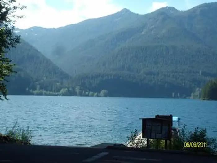
Overview Southshore Campground provides 30 campsites, 25 single and 5 double sites, in two main loops. There are both reservable and FCFS campsites. The sites can accommodate trailers up to 30 feet in length. Campsites 4 -11 are walk in, tent only sites. No RV's or trailers allowed for these sites. All sites are equipped with picnic tables and fire rings. The Boat Launch area includes the launch and two courtesy docks. *Day Use Fee for non-campers/day users. Drinking water is available to both sites via individual faucet risers located throughout the campground. There are two double-vault toilets, and two single-vault toilets located in accessible locations throughout the sites. Trash receptacles are located in the campground. There are approximately 43 parking spaces for use at the boat ramp area, which have also been used as overflow parking (ex. extra vehicle w/boat trailer) or the campground. *Extra Vehicle Fee for campers. Campfires allowed until and unless otherwise posted. Fire bans are common during summer months. Please plan accordingly. A mix of wooded and open sites are available, located a little further away from the busier portions of Detroit Lake. You'll find quiet camping on all but the busiest weekends. Detroit Lake covers 3,500 acres and is surrounded by groves of Douglas fir. Scan and Pay is offered at this campground; you may also pay by cash or check for FCFS campsites. There are no refunds, modifications, cancellations, or other fee changes allowed with Scan and Pay payments. This system is the same as putting cash into a fee tube and cannot be refunded. Please download the Rec.Gov app prior to arriving at the campground as there may be no cellular service or very limited service at the campground. Reservations for this site can be made up to 6 months in advance of arrival date by reserving online at RECREATION.GOV or by calling 877-444-6777. Recreation Detroit Lake is a popular destination for boating, jet skiing, swimming and fishing. Rainbow trout, Kokanee salmon and catfish are found in the lake. A boat ramp and dock are located next to the campground. Facilities Detroit Lake is a popular destination for boating, jet skiing, swimming and fishing. Rainbow trout, Kokanee salmon and catfish are found in the lake. A boat ramp and dock are located next to the campground. Natural Features A mix of wooded and open sites are available, located a little further away from the busier portions of Detroit Lake. You'll find quiet camping on all but the busiest weekends. Detroit Lake covers 3,500 acres and is surrounded by groves of Douglas fir. contact_info For facility specific information, please call (541) 967-3917. Nearby Attractions Additional hiking trails can be found across the lake, including those that lead to Dome Rock and Needle Rock. The town of Detroit is across the lake with hometown activities. The Cascading Rivers Bikeway is available for cyclists of all ages.
View details →
Overview Page Springs Campground is located at the base of Steens Mountain, just three miles from the town of Frenchglen, Oregon. Thrity-six roomy campsites situated under cottonwood and juniper trees and near the Donner and Blitzen River welcome visitors year-round. The campground serves as the trailhead for two short hikes: the Blitzen River Trail meanders four miles up the river, while the Wilderness Nature Trail climbs gradually to the top of the bluff overlooking the valley floor and looping one total mile. Page Springs also offers a large, covered picnic area for no-fee day use, mulitple vault restrooms, trash cans for public use, and drinking water. contact_info For facility specific information, please call (541) 573-4400. Charges & Cancellations All sites are available on a first-come, first-served basis. No reservations accepted. Site must be physically occupied before payment to ensure site availability. No refunds issued.
View details →
Overview Reserve a site at Alsea Falls on recreation.gov or pay when you arrive for non-reserved campsites using the Recreation.gov Mobile App . You must download before you reach the site since there is no cell reception in the drainage. Alsea Falls Recreation Site is located along a Bureau of Land Management National Back Country Byway, located in the Oregon Coast Range, 13 miles west of Monroe, Oregon, in Benton County. Alsea Falls is open for camping the first weekend in May through the end of September of each year. Day use is open year round. The South Fork of the Alsea River flows through the Alsea Falls Recreation Site, cascading down 30 feet to form Alsea Falls in the day use area. Recreation The beautiful surroundings of Alsea Falls can be enjoyed by exploring the trails that wander through the area and lead to the picnic grounds and beyond. On a warm day, Alsea Falls Recreation Site offers cool relief along the river. During the winter months, the South Fork of the Alsea River provides excellent salmon and steelhead fishing. Be sure to check with the Oregon Department of Fish and Wildlife for current fishing regulations. Facilities The beautiful surroundings of Alsea Falls can be enjoyed by exploring the trails that wander through the area and lead to the picnic grounds and beyond. On a warm day, Alsea Falls Recreation Site offers cool relief along the river. During the winter months, the South Fork of the Alsea River provides excellent salmon and steelhead fishing. Be sure to check with the Oregon Department of Fish and Wildlife for current fishing regulations. Natural Features Forests in all stages of growth line South Fork Alsea National Back Country Byway. The nearby South Fork Alsea River offers painters and photographers endless opportunities to capture the natural beauty of Alsea Falls and the surrounding area. Old growth Douglas fir and western red cedar forests can be seen on the nearby ridges, while younger Douglas fir and vine maples provide a pleasant atmosphere at the Alsea Falls Recreation Site. contact_info This location has limited staffing. Please call (503) 375-5646 for general information. Nearby Attractions The Fall Creek Day-Use Trailhead offers over 12 miles of mountain bike specific trails. Hikers can use these trails as well. Green Peak Falls with a drop of 45 feet is accessed by road or trail through the private campground of McBee Park. Follow the markers along the trail and road. Alsea Trout Hatchery is north of the town of Alsea. Charges & Cancellations Standard fees apply and are non-refundable. Visit https://www.recreation.gov/rules-reservation-policies for more information.
View details →
Overview Located along Three Rivers, this group campground is ideal for family gatherings and group arrangements. Conveniently located on Highway 22 and surrounded by forest, this campground provides a picturesque setting to enjoy a fun-filled, group camping experience. Recreation The campground offers an open-space style group camping experience, featuring a recently completed picnic shelter. The river provides opportunities for fishing or summer swimming, and hiking trails are within a few miles of the campground. Facilities The campground offers an open-space style group camping experience, featuring a recently completed picnic shelter. The river provides opportunities for fishing or summer swimming, and hiking trails are within a few miles of the campground. Natural Features Open grassy meadow surrounded by forests, rivers, and coastal mountains, this campground offers a picturesque setting to gather, camp, fish, and play. contact_info For facility specific information, please call (503) 392-5100.
View details →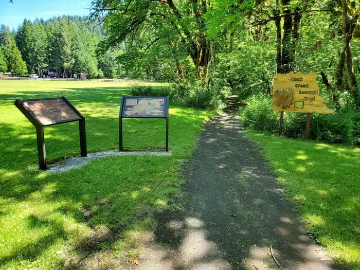
Overview THIS LOCATION IS CLOSED UNTIL FURTHER NOTICE DUE TO WILDFIRE DAMAGE. Nestled along the clear waters of Rock Creek, Millpond’s lush forest gives way to spacious grassy areas, great for day-use and running the kids and dogs. A children's play area, a large ball-field, interpretive panels, and swimming areas are all available at Millpond. There is a short nature trail on the west end of the campground and the mile-long Sawmill Trail to the east. In 1988 congress designated the North Umpqua River as a National Wild and Scenic River, preserving and protecting it for outdoor enthusiasts. The river is a tributary of the Umpqua River, which runs for over 200 miles from the Cascade Range of southwestern Oregon to the Pacific Ocean. Recreation Guests can play kickball, softball or other sports in the field that's on the other side of day use parking area. Adjacent to the pavilion are horseshoe pits and a playground to entertain young ones. From the pavilion, visitors can follow a 1-mile interpretive trail that passes through the site of an old lumber mill. Between the pavilion and campground there is a swimming hole for the whole family to enjoy with a beach, picninc tables, and grills. Facilities Guests can play kickball, softball or other sports in the field that's on the other side of day use parking area. Adjacent to the pavilion are horseshoe pits and a playground to entertain young ones. From the pavilion, visitors can follow a 1-mile interpretive trail that passes through the site of an old lumber mill. Between the pavilion and campground there is a swimming hole for the whole family to enjoy with a beach, picninc tables, and grills. Natural Features Millpond is just west of the Umpqua National Forest, in a lush region full of Douglas fir trees, western red cedar and sugar pines. The campground is in the foothills of the Cascade Mountains at an elevation of 1,170 feet. Nearby Attractions Visitors can get their adventure fix with kayaking and whitewater rafting and fishing in the North Umpqua River, just five miles away. The incredibly scenic 79-mile North Umpqua Trail is ideal for mountain biking and hiking. And for a family-friendly destination, the nearby Rock Creek Fish Hatchery allows visitors to view salmon and steelhead.
View details →
Notice: Topsy Campground will be temporarily closed January 2, 2024, through the winter of 2025. Set on the rugged shoreline of the JC Boyle reservoir, Topsy Campground provides a quiet location for relaxing recreation. The area is set in an open Ponderosa Pine forest with nearby views of Mt McLaughlin, an icon of the southern Oregon Cascade Mountains. Topsy offers opportunities for camping, picnicking, fishing, and boating on Boyle reservoir. The day-use area features a concrete boat ramp and dock, and an accessible fishing pier. Know Before You Go: Open Season Topsy Campground is open seasonally from May through October. 13 Campsites with picnic tables, fire rings, and tent pads; first come, first serve. Universal Access Restrooms available. Drinking Water available. RV Dump Station available. America the Beautiful Pass accepted. Campground Host on site. Boat Launch and Boarding Dock located in day-use area. Pets must be kept on a leash. Point of Interest: Topsy Campground is well situated as a base camp for a jeep excursion into the remote Upper Klamath River canyon. It is also a scenic 30 mile drive to the High Lakes region in the Fremont-Winema National Forest.
View details →FAQ
Camping in Oregon
How many campgrounds are listed in Oregon?
TheCampVerse currently lists 200 campgrounds in Oregon.
What campground types are most common in Oregon?
The most common campground types are Campground, Facility.
How can I compare campgrounds in Oregon?
Use the campground cards and featured links on this page to compare descriptions, amenities, and details before opening each campground profile.
Keep exploring