
Campgrounds in Virginia
Explore diverse camping from the Blue Ridge Mountains to coastal areas in the Old Dominion
43
Campgrounds listed
100%
With photos
100%
Detailed descriptions
Campground
Top campground type
Highlights
Featured campgrounds in Virginia
Explore by campground name letter
Jump to A-Z landing hubs for stronger discovery paths beyond Virginia.
All campgrounds
Showing 43 campgrounds

Overview Deer Island is a boat-access only campground with 21 primitive sites available by reservation only. The sites are non-site specific. The closest launch ramp for Deer Island, from April 1st through October 31st, is located in the Salthouse Branch campground. During our non-peak season, from November 1st until March 31st, you may launch from Twin Ridge, Goose Point, or Ramp 1. Potable water and pit toilets are located on the island. Philpott Lake Virtual Tour: https://corpslakes.erdc.dren.mil/visitors/virtual/philpott/tour.html Recreation The lake provides visitors with great boating and swimming opportunities. Anglers enjoy fishing for large and smallmouth bass, walleye, bluegill, crappie and catfish. Many miles of hiking and biking trails surround Philpott Lake, allowing visitors to get out and explore this scenic area. Facilities The lake provides visitors with great boating and swimming opportunities. Anglers enjoy fishing for large and smallmouth bass, walleye, bluegill, crappie and catfish. Many miles of hiking and biking trails surround Philpott Lake, allowing visitors to get out and explore this scenic area. Natural Features Philpott Lake covers 2,900 acres and has 100 miles of shoreline. The lake's steep, rocky banks meet beautiful mixed forests of oak, maple, hickory, pine and cedar. Wildlife is abundant throughout the area: Deer, turkeys, squirrels, raccoons, and a variety of songbirds and waterfowl are commonly viewed. Nearby Attractions The lake is adjacent to Fairystone State Park and Fairystone Farms Wildlife Management Area, which includes 5,300 acres of public recreational lands.
View details →
Overview Collins Cove is a first-come, first-served, primitive campground. Each of the 10 camping units have a wooden picnic table, fire ring, and hitching rails. This grassy campground is shaded with hardwoods, hemlocks, and pines and offers direct access to horse trails. Centrally located garbage bins and a vault toilet are available. A creek is located adjacent to the campground as a source of water for horses, but potable water is not available. Horse owners need to have a current negative Coggins test certificate for any horse they take to a public place for recreation use in Virginia. Recreation Collins Cove is in the watershed of Cripple Creek that offers fishing and wading. The camp provides access to several trails: (4614) Ewing Mountain, (4504) Mike’s Gap, (4615) Moore, (4601) Raven Cliff and (337) Highlands Horse Trail. Facilities Collins Cove is in the watershed of Cripple Creek that offers fishing and wading. The camp provides access to several trails: (4614) Ewing Mountain, (4504) Mike’s Gap, (4615) Moore, (4601) Raven Cliff and (337) Highlands Horse Trail. Natural Features The Collins Cove area is shaded with hardwoods, hemlocks, and pines. The elevation is approximately 2,000 feet. Summer days are warm with temperatures in the upper 70’s to low 90’s, and evenings cool down typically into the 60’s. contact_info For facility specific information, please call (276) 783-5196.
View details →
Overview Rock Castle Gorge Backcountry Campground is a primitive camp located along the Rock Castle Gorge Trail in the Rocky Knob Recreational Area which is part of the Blue Ridge Parkway. The Rock Castle Gorge Backcountry Campsites can be reached from various points ranging in distance from 1/2 mile to 8 miles. The complete Rock Castle Gorge Trail is a 10.8 mile loop, there are several other loop trails that connect to it. Rock Castle Creek, Little Rock Castle Creek and many other streams and creeks meander along the trail and run right by the campground. Fishing requires a Virginia Fishing License, and the State of Virginia laws and regulations apply. The year-round campground has eight campsites. Each has a fire ring/pad and food storage lockers. A Portable Toilet is available. Plan to pack in your water for safety. Summers are hot (70 to 88 Degrees) and humid as Rock Castle Creek is adjacent to the campground. Winter temperatures (Daytime 30 to 50 Degrees) can easily drop below freezing at night. Recreation Hiking, sightseeing, majestic Blue Ridge Parkway views and simple relaxation are all in store in the Rocky Knob Recreational Area. Facilities Hiking, sightseeing, majestic Blue Ridge Parkway views and simple relaxation are all in store in the Rocky Knob Recreational Area. Natural Features Venture into one of the Parkway’s more rugged areas at Rocky Knob. Hike through forests, explore mountain ridges, or enjoy spring wildflowers and rhododendrons. Rock Castle Creek, Little Rock Castle Creek and many other streams and creeks abound. Bare Rocks and other geological outcrops and long distance views from the upper elevations of the Rock Castle Gorge Trail are sure to please. Plenty of wildlife including black bears. contact_info For facility specific information, please call (828) 276-2300. Nearby Attractions Floyd, VA is less than 8 miles away, known for eclectic shops, mountain music venues and great places to eat along with grocery stores, variety stores and pharmacies. Visit Floyd Virginia
View details →
Overview Morris Hill is a peaceful, rustic campground for groups of family and friends. The family campground is a family-friendly destination perched on a ridge above Lake Moomaw. Kids can have fun at the playground while older generations sit back and relax in the shade. The group sites accommodate up the 25 guests with space for up to eight tents. Campers can enjoy the wonders of camping with simple pleasures like s'mores on the campfire, berry picking in the woods, and watching for waterfowl and wildlife like deer. The convenient location near Lake Moomaw and sandy swim beaches, a fishing pier, boat ramp, and hiking and biking trails makes Morris Hill a popular spot. Recreation An inviting swimming beach at Coles Point attracts many visitors. About less than a mile from the campground is a fishing pier where anglers seek brown and rainbow trout, bass and crappie. Back Creek is also nice for trout fishing. Hikers enjoy the Morris Hill Bike Trail and Fortney Loop Trail. Facilities An inviting swimming beach at Coles Point attracts many visitors. About less than a mile from the campground is a fishing pier where anglers seek brown and rainbow trout, bass and crappie. Back Creek is also nice for trout fishing. Hikers enjoy the Morris Hill Bike Trail and Fortney Loop Trail. Natural Features The campground sits on a ridge overlooking Lake Moomaw. It is about a half-mile from the south end of the lake. Lake Moomaw, which flows from the Jackson River, is a cold-water 2,530-acre lake with an inviting swimming beach. Morris Hill is part of the George Washington and Jefferson National Forests which spans across Virginia and parts of West Virginia and Kentucky. These forests protect 40 species of trees that are mostly Appalachian hardwood and mixed pine-hardwood forests, 60 species of mammals and 200 species of birds. Nearby Attractions Head downstream of the Jackson River for fly fishing, canoeing, rafting and kayaking. A half hour east of the lake is Hot Springs, Virginia, a quaint village known as a rural resort town. Charges & Cancellations Due to Covid-19 restrictions group camping will not be open this season. We apologize for any inconvenience. Please visit www.cdc.gov for the latest information on the virus.
View details →
Overview Grindstone Campground is tucked in the Fairwood Valley among pastures and wooded hillsides. The surrounding Mount Rogers National Recreation Area provides endless opportunities for fun and relaxation in the nature setting. The Campground will be closed until further notice due to facility repair needs. Opossum Loop will be open for tent campers. There will be no available water. No Dump Station available. Recreation The area offers excellent hiking, mountain biking, horseback riding and hunting. Recommended hiking trails include the Mount Rogers Trail at 7.5 miles and the Whispering Waters Nature Trail at 0.6 miles. Several streams pass by just beyond the campground, with trout fishing available in abundance. The campground boasts a water play area in the creek, an amphitheater, a playground and volleyball courts to entertain families. Facilities The area offers excellent hiking, mountain biking, horseback riding and hunting. Recommended hiking trails include the Mount Rogers Trail at 7.5 miles and the Whispering Waters Nature Trail at 0.6 miles. Several streams pass by just beyond the campground, with trout fishing available in abundance. The campground boasts a water play area in the creek, an amphitheater, a playground and volleyball courts to entertain families. Natural Features At 3,800 feet, Grindstone is surrounded by mixed hardwoods, hemlock and rhododendrons. The Mount Rogers National Recreation Area spans 200,000 acres of National Forest, with four wildlife-rich wilderness areas. Nearby Attractions The Mount Rogers Scenic Byway, which traverses more than 50 miles with views of forestland and open rural countryside, is accessible nearby. contact_info This location is unstaffed. To speak with our main office for general information, please call: (276) 783-5196.
View details →
Overview Beartree offers a relaxing, family-friendly atmosphere and a variety of recreational activities. Located in the Mount Rogers National Recreation Area, the campground boasts a sprawling layout with both group and individual campsites. A small creek flows through the campground, offering a refreshing spot to wade and fish. Beartree Lake is also located within the recreation area, providing an ideal spot for fishing. Recreation The campground offers a 14-acre lake with two fishing piers. Smallmouth bass, sunfish, rainbow and brown trout are all possible catches. Self-propelled or electric trolling-motor boats only. State fishing and boating regulations and licensing requirements apply. The Beartree Lake Trail, which circles the lake, is excellent for hiking. Half of the trail is paved for an easier walk. Facilities The campground offers a 14-acre lake with two fishing piers. Smallmouth bass, sunfish, rainbow and brown trout are all possible catches. Self-propelled or electric trolling-motor boats only. State fishing and boating regulations and licensing requirements apply. The Beartree Lake Trail, which circles the lake, is excellent for hiking. Half of the trail is paved for an easier walk. Natural Features The campground is located in diverse vegetation, and Beartree Lake is surrounded by dense trees that meet the shoreline. The Mount Rogers Scenic Byway passes near the campground, highlighting the impressive valleys, mountains, forests and rural countrysides of western Virginia. contact_info For facility specific information, please call (800) 628-7202. Nearby Attractions Hike the Appalachian Trail, which extends more than 2,175 miles throughout the Appalachian Mountains across 14 states. The trail was designated as the first National Scenic Trail. The Virginia Creeper Trail, Hungry Mother State Park and Grayson Highlands State Park are nearby.
View details →
Overview Secluded in the thick trees and rolling hills of the Shenandoah National Park, Mathews Arm Campground is the ideal spot for a camping getaway. Recreation Shenandoah National Park has over 500 miles of trails, including 101 miles of the Appalachian Trail. Some trails lead to a waterfall or viewpoint while others wind deep into the forests and wilderness. Mathews Arm Campground is located near Overall Run Falls, which, at 93 feet, has the highest drop of all the falls in Shenandoah National Park. A moderately difficult hiking trail, which leads to the falls, is accessible from the campground. Once at the falls, visitors can enjoy views of the entire Shenandoah Valley and Massanutten Mountain. Wildlife viewing is a also a popular pastime, with black bears, wild turkey, deer, birds and countless other animals abundant across the park. The campground is located right off of Milepost 22 on the famous Skyline Drive, which runs 105 miles north and south along the crest of the Blue Ridge Mountains. Stunning views are available from any of the 75 scenic overlooks. Facilities Shenandoah National Park has over 500 miles of trails, including 101 miles of the Appalachian Trail. Some trails lead to a waterfall or viewpoint while others wind deep into the forests and wilderness. Mathews Arm Campground is located near Overall Run Falls, which, at 93 feet, has the highest drop of all the falls in Shenandoah National Park. A moderately difficult hiking trail, which leads to the falls, is accessible from the campground. Once at the falls, visitors can enjoy views of the entire Shenandoah Valley and Massanutten Mountain. Wildlife viewing is a also a popular pastime, with black bears, wild turkey, deer, birds and countless other animals abundant across the park. The campground is located right off of Milepost 22 on the famous Skyline Drive, which runs 105 miles north and south along the crest of the Blue Ridge Mountains. Stunning views are available from any of the 75 scenic overlooks. Natural Features Shenandoah National Park includes 300 square miles of the Blue Ridge Mountains in the southern Appalachians. The park rises above the Virginia Piedmont to its east and the Shenandoah Valley to its west. Nearby Attractions Elkwallow Wayside is located just two miles away, offering camping supplies, a limited menu restaurant, prepared sandwiches, beverages, souvenirs, and more. Two visitor centers are located along Skyline Drive. Dickey Ridge Visitor Center, 18 miles North, and The Harry F Byrd Sr. Visitor Center, 29 miles South. Bookstores, restaurants and exhibits are scattered throughout the Shenandoah National Park. Click here for more information. contact_info Between 06/12/2024 and 10/26/2024 this location is staffed. Please call (540) 999-3132 to speak with local staff. From 04/18/2024 to 06/12/2024 this location is unstaffed. Please call (540) 999-3500 for general information. Charges & Cancellations Changing Reservations: There is no change fee if a visitor extends or shortens a reservation, as long as the change includes dates from the original reservation. Additionally, there is no change fee if the visitor wants to switch sites that are the same price with the same reservation dates in the same facility. If a visitor wants to switch dates that are entirely outside of the original reservation dates, there is a $10 change fee. If a reservation is made that includes dates beyond the maximum booking window, that reservation cannot be changed until 18 days have passed from the original booking date. Once a reservation date has begun, visitors cannot change a reservation using the online system or through the Call Center. Onsite staff will assist with changes or cancellations. Cancellations: Visitors may cancel their reservation prior to arrival both on-line and through the call center. A $10 service fee will be withheld from any refund for a cancellation. A visitor who cancels a reservation the day before or on the day of arrival will pay a $10.00 service fee AND forfeit the first night's approved rate including tax and applicable add-on. Cancellations for a one-night reservation will forfeit the entire amount paid and will not be subject to an additional service fee. Visitors who cancel a group overnight facility reservation less than 14 days prior to arrival date will pay a $10 service fee AND forfeit the first night’s rate. No-Shows: A no-show visitor is one who does not arrive at a campground and does not cancel the reservation by check-out time on the day after the scheduled arrival date. Staff will hold a campsite until check-out time on the day following the arrival date. No-shows are assessed $20.00 service fee and forfeit the first night's rate, taxes and applicable add-on for a campsite. Early Departures: Visitors are requested to notify staff at the facility if they depart early to allow others to use the site. If the visitor chooses to depart early, they may forfeit the approved rate and applicable tax and applicable add-on for the day of departure. If a visitor departs prior to the scheduled check-out date, they may be eligible for a partial refund. Visitors may notify the Recreation.gov call center to request a refund of remaining unused nights. If a visitor requests a refund for an early departure after the facility check-out time (12 noon) has passed, the visitor will not be refunded for that night and is eligible for a refund on any additional nights that will not be used. Refunds: Visitors may submit a refund request through their Recreation.gov profile within 7 days of the end date of their reservation. Visitors may also initiate a refund request through the call center at any time after their reservation has ended. Refunds for debit or credit card payments will be issued as a credit to the original bank or credit card used to pay. For check or cash purchases, Recreation.gov will mail a Treasury check for refunds of cash, check, or money order payments to the address associated with the reservation. Treasury check refunds may take up to 6-8 weeks to arrive. In the event of an emergency closure, the Recreation.gov team or facility manager will refund all fees and will attempt to notify you using the contact information within the Recreation.gov visitor profile.
View details →
Overview Perched on top of Big Flat Mountain, this is one of the largest campgrounds in the park. Loft Mountain is a popular destination for outdoor enthusiasts, providing a wilderness getaway in the historic Blue Ridge mountains of Virginia. Recreation Shenandoah National Park has over 500 miles of trails, including 101 miles of the Appalachian Trail. Some trails lead to a waterfall or lookout, while others wind deep into the forest and wilderness. Trails to the Big Run Wilderness area are accessible from the campground, and pristine waterfalls are a common site along the popular trails. Wildlife viewing is also a popular pastime, with black bears, wild turkey, deer, birds and countless other animals abundant across the park. The campground is located right off of Milepost 80 on the famous Skyline Drive, which runs 105 miles north and south along the crest of the Blue Ridge Mountains. Stunning views are available from any of the 75 scenic overlooks. Facilities Shenandoah National Park has over 500 miles of trails, including 101 miles of the Appalachian Trail. Some trails lead to a waterfall or lookout, while others wind deep into the forest and wilderness. Trails to the Big Run Wilderness area are accessible from the campground, and pristine waterfalls are a common site along the popular trails. Wildlife viewing is also a popular pastime, with black bears, wild turkey, deer, birds and countless other animals abundant across the park. The campground is located right off of Milepost 80 on the famous Skyline Drive, which runs 105 miles north and south along the crest of the Blue Ridge Mountains. Stunning views are available from any of the 75 scenic overlooks. Natural Features Shenandoah National Park includes 300 square miles of the Blue Ridge Mountains in the southern Appalachians. The park rises above the Virginia Piedmont to its east and the Shenandoah Valley to its west. Loft Mountain's location on the mountain top offers easy access to Skyline Drive which offers sweeping views of the Blue Ridge Mountains and the surrounding rolling hills and open meadows. Nearby Attractions Two visitor centers with bookstores and exhibits are located in the park (milepost 5 and milepost 51). There are concession managed restaurants, gift shops and lodging facilities scattered throughout the park. Charges & Cancellations Changing Reservations: There is no change fee if a visitor extends or shortens a reservation, as long as the change includes dates from the original reservation. Additionally, there is no change fee if the visitor wants to switch sites that are the same price with the same reservation dates in the same facility. If a visitor wants to switch dates that are entirely outside of the original reservation dates, there is a $10 change fee. If a reservation is made that includes dates beyond the maximum booking window, that reservation cannot be changed until 18 days have passed from the original booking date. Once a reservation date has begun, visitors cannot change a reservation using the online system or through the Call Center. Onsite staff will assist with changes or cancellations. Cancellations: Visitors may cancel their reservation prior to arrival both on-line and through the call center. A $10 service fee will be withheld from any refund for a cancellation. A visitor who cancels a reservation the day before or on the day of arrival will pay a $10.00 service fee AND forfeit the first night's approved rate including tax and applicable add-on. Cancellations for a one-night reservation will forfeit the entire amount paid and will not be subject to an additional service fee. Visitors who cancel a group overnight facility reservation less than 14 days prior to arrival date will pay a $10 service fee AND forfeit the first night’s rate. No-Shows: A no-show visitor is one who does not arrive at a campground and does not cancel the reservation by check-out time on the day after the scheduled arrival date. Staff will hold a campsite until check-out time on the day following the arrival date. No-shows are assessed $20.00 service fee and forfeit the first night's rate, taxes and applicable add-on for a campsite. Early Departures: Visitors are requested to notify staff at the facility if they depart early to allow others to use the site. If the visitor chooses to depart early, they may forfeit the approved rate and applicable tax and applicable add-on for the day of departure. If a visitor departs prior to the scheduled check-out date, they may be eligible for a partial refund. Visitors may notify the Recreation.gov call center to request a refund of remaining unused nights. If a visitor requests a refund for an early departure after the facility check-out time (12 noon) has passed, the visitor will not be refunded for that night and is eligible for a refund on any additional nights that will not be used. Refunds: Visitors may submit a refund request through their Recreation.gov profile within 7 days of the end date of their reservation. Visitors may also initiate a refund request through the call center at any time after their reservation has ended. Refunds for debit or credit card payments will be issued as a credit to the original bank or credit card used to pay. For check or cash purchases, Recreation.gov will mail a Treasury check for refunds of cash, check, or money order payments to the address associated with the reservation. Treasury check refunds may take up to 6-8 weeks to arrive. In the event of an emergency closure, the Recreation.gov team or facility manager will refund all fees and will attempt to notify you using the contact information within the Recreation.gov visitor profile.
View details →
Overview Secluded in the thick trees and rolling hills of Shenandoah National Park, the Big Meadows Campground is the ideal spot for an outdoor family getaway. Recreation Shenandoah National Park has over 500 miles of trails, including 101 miles of the Appalachian Trail. Some trails lead to a waterfall or viewpoint while others wind deep into the forest and wilderness. Big Meadows is near many of the major facilities and popular hiking trails in the park. Three waterfalls are within walking distance, and the Meadow, with its abundant plant growth and wildlife, is an ideal nearby attraction. Wildlife viewing is also a popular pastime, with black bears, wild turkey, deer, birds and countless other animals thriving in the park. The campground is also located right off the famous Skyline Drive, which runs 105 miles north and south along the crest of the Blue Ridge Mountains. Stunning views are visible from any of the 75 scenic overlooks. Facilities Shenandoah National Park has over 500 miles of trails, including 101 miles of the Appalachian Trail. Some trails lead to a waterfall or viewpoint while others wind deep into the forest and wilderness. Big Meadows is near many of the major facilities and popular hiking trails in the park. Three waterfalls are within walking distance, and the Meadow, with its abundant plant growth and wildlife, is an ideal nearby attraction. Wildlife viewing is also a popular pastime, with black bears, wild turkey, deer, birds and countless other animals thriving in the park. The campground is also located right off the famous Skyline Drive, which runs 105 miles north and south along the crest of the Blue Ridge Mountains. Stunning views are visible from any of the 75 scenic overlooks. Natural Features Shenandoah National Park spans 300 square miles of the Blue Ridge Mountains in the southern Appalachians. The park rises above the Virginia Piedmont to its east and the Shenandoah Valley to its west. The scenery at Big Meadows Campground never disappoints, with a stunning array of colors in the fall and a blanket of bright wildflowers in the spring. This green and shady campground is a wilderness paradise for outdoor enthusiasts. contact_info For facility specific information, please call (540) 999-3231. Nearby Attractions Two visitor centers with bookstores and exhibits are located in the park (milepost 5 and milepost 51). Byrd Visitor Center is a short one mile walk by either trail or sidewalk if you choose not to drive. There are concession managed restaurants, gift shops and lodging facilities scattered throughout the park. Big Meadows Lodge and Restaurant is a 5 minute walk from the campground and Big Meadows Wayside is located beside Byrd Visitor Center. Charges & Cancellations Changing Reservations: There is no change fee if a visitor extends or shortens a reservation, as long as the change includes dates from the original reservation. Additionally, there is no change fee if the visitor wants to switch sites that are the same price with the same reservation dates in the same facility. If a visitor wants to switch dates that are entirely outside of the original reservation dates, there is a $10 change fee. If a reservation is made that includes dates beyond the maximum booking window, that reservation cannot be changed until 18 days have passed from the original booking date. Once a reservation date has begun, visitors cannot change a reservation using the online system or through the Call Center. Onsite staff will assist with changes or cancellations. Cancellations: Visitors may cancel their reservation prior to arrival both on-line and through the call center. A $10 service fee will be withheld from any refund for a cancellation. A visitor who cancels a reservation the day before or on the day of arrival will pay a $10.00 service fee AND forfeit the first night's approved rate including tax and applicable add-on. Cancellations for a one-night reservation will forfeit the entire amount paid and will not be subject to an additional service fee. Visitors who cancel a group overnight facility reservation less than 14 days prior to arrival date will pay a $10 service fee AND forfeit the first night’s rate. No-Shows: A no-show visitor is one who does not arrive at a campground and does not cancel the reservation by check-out time on the day after the scheduled arrival date. Staff will hold a campsite until check-out time on the day following the arrival date. No-shows are assessed $20.00 service fee and forfeit the first night's rate, taxes and applicable add-on for a campsite. Early Departures: Visitors are requested to notify staff at the facility if they depart early to allow others to use the site. If the visitor chooses to depart early, they may forfeit the approved rate and applicable tax and applicable add-on for the day of departure. If a visitor departs prior to the scheduled check-out date, they may be eligible for a partial refund. Visitors may notify the Recreation.gov call center to request a refund of remaining unused nights. If a visitor requests a refund for an early departure after the facility check-out time (10 am) has passed, the visitor will not be refunded for that night and is eligible for a refund on any additional nights that will not be used. Refunds: Visitors may submit a refund request through their Recreation.gov profile within 7 days of the end date of their reservation. Visitors may also initiate a refund request through the call center at any time after their reservation has ended. Refunds for debit or credit card payments will be issued as a credit to the original bank or credit card used to pay. For check or cash purchases, Recreation.gov will mail a Treasury check for refunds of cash, check, or money order payments to the address associated with the reservation. Treasury check refunds may take up to 6-8 weeks to arrive. In the event of an emergency closure, the Recreation.gov team or facility manager will refund all fees and will attempt to notify you using the contact information within the Recreation.gov visitor profile.
View details →
Overview Hopper Creek Group Camp offers a rustic atmosphere under the trees for group camping. Nestled in the Blue Ridge Mountains, the area welcomes visitors to enjoy the natural beauty and relaxing atmosphere. Recreation A mowed, grassy area is available for games and organized activities. Hiking trails surround the area, offering everything from short walks in and around Cave Mountain Lake Recreation Area to a full day hike along the nearby ridges. Backpacking opportunities are also available on the nearby Appalachian National Scenic Trail, in the James River Face Wilderness or in the Thunder Ridge Wilderness. Facilities A mowed, grassy area is available for games and organized activities. Hiking trails surround the area, offering everything from short walks in and around Cave Mountain Lake Recreation Area to a full day hike along the nearby ridges. Backpacking opportunities are also available on the nearby Appalachian National Scenic Trail, in the James River Face Wilderness or in the Thunder Ridge Wilderness. Natural Features A small stream gurgles past the camping area flowing downstream into Hopper Creek on its way to the James River. The campground sits at an approximate elevation of 1,100 feet at the base of Thunder Ridge. Nearby Attractions Hopper Creek is 3 miles from Cave Mountain Lake Recreation Area, which offers a day use area with sandy beach, designated swimming area and covered picnic shelter. Natural Bridge State Park is within an 8 mile drive and offers visitors views of the 215 foot tall Natural Bridge and limestone gorge, 6 miles of hiking trails, a Monacan Indian village and the 30 foot cascades of Lace Falls. Natural Bridge State Park is also a great place for unobstructed sky views and star gazing on mowed paths. Canoeing, kayaking and fishing are available in the nearby James River.
View details →
Overview Elizabeth Furnace Recreation Area offers forested trails, campsites and open grassy picnic areas along the tranquil Passage Creek. Enjoy hiking the Pig Iron and Charcoal trail and learn how iron was historically mined and smelted. Spend the day fishing from a stocked trout stream, grilling out at a picnic spot, or taking a stroll across the swinging bridge to view the historic cabin. Recreation Enjoy hiking the Pig Iron and Charcoal Trail to learn how iron was made in the area. Another great hike heads up to Buzzard Rock. Passage Creek is seasonally stocked with trout to keep anglers entertained. Facilities Enjoy hiking the Pig Iron and Charcoal Trail to learn how iron was made in the area. Another great hike heads up to Buzzard Rock. Passage Creek is seasonally stocked with trout to keep anglers entertained. Natural Features The charming group campground sits in the Shenandoah Valley along Passage Creek, a tributary of the North Fork Shenandoah River. The area is part of the George Washington and Jefferson National Forests which spans across Virginia and parts of West Virginia and Kentucky. These forests protect 40 species of trees that are mostly Appalachian hardwood and mixed pine-hardwood forests, 60 species of mammals and 200 species of birds.
View details →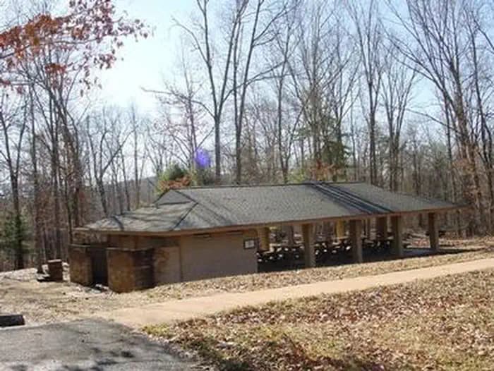
Overview Coles Point Picnic Shelters are tucked in a small opening surrounded by a hardwood forest. Opportunities abound for hiking, photography, nature study, birding and viewing wildlife. Best of all, Coles Point is perched along Moomaw Lake, providing convenient access to boating, fishing, swimming and relaxing on the beach. Recreation An inviting swimming beach within the recreation area lures crowds, and the picnic area has an open field for games like Frisbee and soccer. The park offers boating and fishing for large and smallmouth bass, brown trout, bluegill, crappie, shad, catfish, sunfish and chain pickerel. Two fishing docks, two boat ramps and a swimming beach with a bathhouse are located on-site. Back Creek is nearby, also a nice stream for trout fishing. The 1-mile Morris Hill Bike Trail is popular among hikers and bikers. The 3-mile Fortney Loop Trail is open to hiking along a path with several switchbacks. Facilities An inviting swimming beach within the recreation area lures crowds, and the picnic area has an open field for games like Frisbee and soccer. The park offers boating and fishing for large and smallmouth bass, brown trout, bluegill, crappie, shad, catfish, sunfish and chain pickerel. Two fishing docks, two boat ramps and a swimming beach with a bathhouse are located on-site. Back Creek is nearby, also a nice stream for trout fishing. The 1-mile Morris Hill Bike Trail is popular among hikers and bikers. The 3-mile Fortney Loop Trail is open to hiking along a path with several switchbacks. Natural Features The shelters are situated on a wooded peninsula on the south end of Lake Moomaw in Alleghany County. The manmade lake, at 2,530 acres, sits on the Jackson River and has 43 miles of wooded shoreline. Coles Point is part of the George Washington and Jefferson National Forests which span across Virginia and parts of West Virginia and Kentucky. These forests protect 40 species within mostly Appalachian hardwood and mixed pine-hardwood forests, 60 species of mammals and 200 species of birds. Nearby Attractions Head downstream on the Jackson River for fly-fishing, canoeing, rafting and kayaking. A half-hour east of the lake is Hot Springs, Virginia, a quaint and small rural resort town. The nearest groceries and gas are located in Covington, Virginia about 30 minutes from the lake. A pay phone is located at the nearby Morris Hill Campground.
View details →
Overview Hurricane Campground is one of the best kept secrets in southwest Virginia. Located along a rushing mountain stream under the shade of hemlock and rhododendron, this campground offers a peaceful setting for those looking to relax as well as visitors looking for outdoor adventure. From the campsite, hikers can access many trails including the Appalachian Trail. This well-known trail extends more than 2,189 miles throughout the Appalachian Mountains across 14 states. It is a protected greenway and owns the title as the first National Scenic Trail. Recreation Visitors frequently explore the Hurricane Knob Trail. The loop trail, at 1.1 miles, parallels Hurricane Creek for about half a mile, crosses two wooden bridges and ascends to the picturesque Hurricane Knob. The creeks are stocked with trout for a relaxing day of fishing. Facilities Visitors frequently explore the Hurricane Knob Trail. The loop trail, at 1.1 miles, parallels Hurricane Creek for about half a mile, crosses two wooden bridges and ascends to the picturesque Hurricane Knob. The creeks are stocked with trout for a relaxing day of fishing. Natural Features The campground is perched along Hurricane Branch and Comers Creek, among colorful rhododendron. Several groomed, grassy fields unfold at the campground, but the campsites are nicely shaded by mixed woods of oak and hemlock. Hurricane Knob is nearby with an elevation from 2800 to 3050 feet. contact_info For facility specific information, please call (276) 783-5196. Nearby Attractions Hurricane and Comers creeks run through the campground and surrounding areas for wading and trout fishing. Additional fishing options and excellent hunting opportunities are available near the campground. State fishing and hunting regulations and licensing requirements apply. Hurricane Knob Nature Trail offers a brisk 1-mile loop hike and there is easy access to the Appalachian Trail within ½ mile. The entire campground has a relaxing, rustic atmosphere and an open field allows for games and family fun.
View details →
Overview Oak Ridge Campground is a 100-site, wooded campground located in Prince William Forest Park, 35 miles southwest of Washington, DC. The park's land was set aside during the Great Depression, and in 1935 the Civilian Conservation Corps (CCC) began restoring the previously over-farmed acreage, converting it to recreational lands for public use. The CCC built trails, dams and cabins, making the park a wonderful place for recreation and relaxation. Large group camping is not permitted at Oak Ridge Campground. Please read the need to know section for additional information. Recreation The park offers many recreational activities, including hiking, biking, orienteering and fishing. Hikers enjoy exploring the park's 37 miles of foot trails. The South Valley, Oak Ridge and Farms to Forest Trails all begin at the campground entrance. Bicyclists will find 21 miles of paved roads within the park, including the 12-mile Scenic Drive. Little traffic and a 25 m.p.h. speed limit make this a popular biking spot. A 3-mile, family-friendly paved bike lane leads to the campground. Mountain biking is also available on 10 miles of gravel fire roads. The park boasts 30 orienteering courses with picturesque settings. Orienteering is a 19th century Scandinavian sport primarily used as military training. The courses were developed in 1972 and continue to provide hours of entertainment and exploration for park visitors. Approximately 18 miles of streams and two small lakes are open to the public for fishing. The water quality of Quantico Creek supports numerous fish species and other aquatic life. The most common fish species are bluegill, pumpkinseed, largemouth bass and channel catfish. Facilities The park offers many recreational activities, including hiking, biking, orienteering and fishing. Hikers enjoy exploring the park's 37 miles of foot trails. The South Valley, Oak Ridge and Farms to Forest Trails all begin at the campground entrance. Bicyclists will find 21 miles of paved roads within the park, including the 12-mile Scenic Drive. Little traffic and a 25 m.p.h. speed limit make this a popular biking spot. A 3-mile, family-friendly paved bike lane leads to the campground. Mountain biking is also available on 10 miles of gravel fire roads. The park boasts 30 orienteering courses with picturesque settings. Orienteering is a 19th century Scandinavian sport primarily used as military training. The courses were developed in 1972 and continue to provide hours of entertainment and exploration for park visitors. Approximately 18 miles of streams and two small lakes are open to the public for fishing. The water quality of Quantico Creek supports numerous fish species and other aquatic life. The most common fish species are bluegill, pumpkinseed, largemouth bass and channel catfish. Natural Features Prince William Forest Park preserves approximately 15,000 acres of Piedmont forest covering a major portion of the Quantico Creek watershed. The park represents one of the largest parcels of undeveloped land in the area and is the third largest unit of the National Park System in Virginia. The area is the largest example of a Piedmont forest ecosystem in the National Park Service, makeing it a significant natural resource. Various geological outcroppings, winding creeks, gently rolling slopes and man-made lakes make wonderful destinations for any adventurous visitor. The park is home to 46 species of mammals, 22 species of amphibians, 25 species of reptiles, more than 129 species of birds, 26 species of fish and an unknown number of invertebrates. More than 900 plant species exist in Prince William Forest Park. From the smallest wildflower to the tallest tree, each species has a special role to play in this forest ecosystem. From tree bark in winter, wildflowers in spring, canopy cover in summer and autumn colors in fall, Prince William Forest Park offers beautiful scenery year-round. Nearby Attractions Prince William Forest Park is centrally located, with easy access to all of the attractions the Northern Virginia and Washington, D.C., area have to offer. From the park entrance, the National Museum of the Marine Corps and the main gate of the United States Marine Corps Base Quantico are just a mile away. The park is located directly between historic Fredericksburg and Spotsylvania National Military Park and Manassas National Battlefield Park.
View details →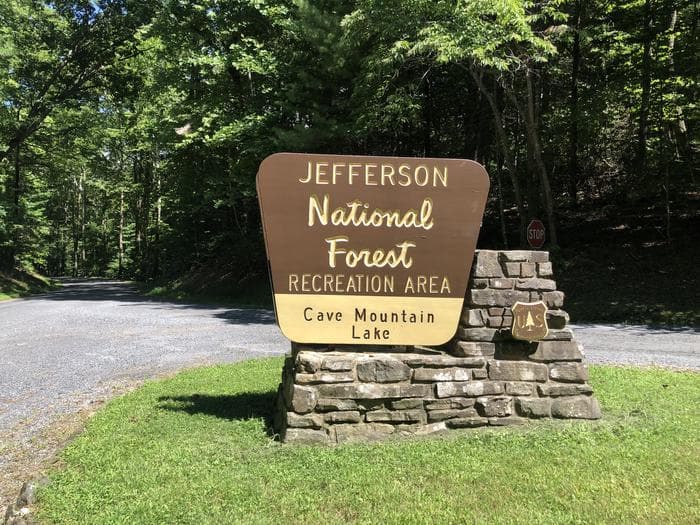
Overview Cave Mountain Lake Family Camp is nestled in the Blue Ridge Mountains of Virginia, and welcomes visitors to enjoy the rustic and peaceful getaway. Easy access from the interstate and close proximity to historic Lexington and the Natural Bridge State Park make Cave Mountain Lake an ideal destination. Recreation The 7 acre lake offers opportunities for swimming in a designated area which includes a sand beach. Fishing for youth only (ages 15 and under) is open from April 1st through June 15th, then fishing is open to anglers of all ages with a valid Virginia fishing license, trout stamp and National Forest stamp for the remainder of the season. There are several piers around the lake for better fishing access. A number of opportunities for photography, birding, and wildlife viewing are available along the trails and water's edge. Hiking trails surround the area, offering everything from a short walk around the lake to an all-day hike along the nearby ridges. The Panther Knob Trail starts beside the group picnic shelter and skirts the edge of the lake to the dam. The Wildcat Trail starts above campsites #41-42, climbs the mountain, then loops back to the campground above the volunteer host site in the upper camping loop. Visitors may also enjoy a day hike or backpacking trip on the Appalachian National Scenic Trail, in the James River Face Wilderness, or in the Thunder Ridge Wilderness. Facilities The 7 acre lake offers opportunities for swimming in a designated area which includes a sand beach. Fishing for youth only (ages 15 and under) is open from April 1st through June 15th, then fishing is open to anglers of all ages with a valid Virginia fishing license, trout stamp and National Forest stamp for the remainder of the season. There are several piers around the lake for better fishing access. A number of opportunities for photography, birding, and wildlife viewing are available along the trails and water's edge. Hiking trails surround the area, offering everything from a short walk around the lake to an all-day hike along the nearby ridges. The Panther Knob Trail starts beside the group picnic shelter and skirts the edge of the lake to the dam. The Wildcat Trail starts above campsites #41-42, climbs the mountain, then loops back to the campground above the volunteer host site in the upper camping loop. Visitors may also enjoy a day hike or backpacking trip on the Appalachian National Scenic Trail, in the James River Face Wilderness, or in the Thunder Ridge Wilderness. Natural Features Cave Mountain Lake covers seven acres and was built in the late 1930's by the Civilian Conservation Corps, using existing buttresses of natural rock to form a 35-foot dam. A grassy field extends from the lake's sandy beach to forested hills that paint a scenic backdrop. contact_info This location has limited staffing. Please call (540) 291-2188 for general information. Nearby Attractions Lexington, Virginia, just 20 minutes away, is home to several historic sites including the Stonewall Jackson House, George C. Marshall Museum and the Virginia Military Institute Museum. It's a charming town with horse drawn carriage rides through the streets. Ice and other sundries can be found at small stores along State Route 759 as you drive to Cave Mountain Lake Recreation Area. Natural Bridge State Park is a short 8 mile drive away and offers visitors views of the 215 foot tall Natural Bridge and limestone gorge, 6 miles of hiking trails, a Monacan Indian Village, and the 30 foot cascade of Lace Falls.
View details →
Overview Buffalo Park is a small day use and campground park, located on John H. Kerr Reservoir. The campground is open May 1 - September 30. The Day Use Park is open year-around. Kerr, also known as Buggs Island Lake, is a 50,000-acre lake that extends 39 miles up the wooded, cove-studded shoreline of the Roanoke River in Virginia and North Carolina. Kerr Reservoir was created with the construction of the John H. Kerr Dam in 1952. Its 800 miles of wooded shoreline stretch across six counties in two states and offer countless recreation opportunities for visitors. Recreation Public lands around the lake are open to hunting with appropriate state licenses. Game species include whitetail deer, wild turkey, bobwhite quail, mourning dove, gray squirrel, cottontail rabbit, fox and raccoon. Resident waterfowl species include wood duck, black duck, mallard and Canadian geese. The Army Corps of Engineers manages 26 Wildlife Management Areas around the lake that provide year-round opportunities for hiking, wildlife viewing, birding and more. Kerr Lake is widely known for fishing, with large-mouth bass, striped bass, crappie and catfish caught. Fishing and hunting are regulated by the Virginia Department of Game and Inland Fisheries on the Virginia side of the lake. Facilities Public lands around the lake are open to hunting with appropriate state licenses. Game species include whitetail deer, wild turkey, bobwhite quail, mourning dove, gray squirrel, cottontail rabbit, fox and raccoon. Resident waterfowl species include wood duck, black duck, mallard and Canadian geese. The Army Corps of Engineers manages 26 Wildlife Management Areas around the lake that provide year-round opportunities for hiking, wildlife viewing, birding and more. Kerr Lake is widely known for fishing, with large-mouth bass, striped bass, crappie and catfish caught. Fishing and hunting are regulated by the Virginia Department of Game and Inland Fisheries on the Virginia side of the lake. Natural Features Kerr Reservoir has approximately 48,000 acres of hardwood and pine forest and 50,000 acres of water. Buffalo Park has both shady sites and open field sites. The picnic shelter in the park has a spectacular view of the lake, where the Roanoke (Staunton) River meets the Dan. Nearby Attractions Buffalo Springs Park is on the Virginia State and National Historic Sites, and is located approximately 7 miles from Buffalo Park. Once a world-renowned source of bottled lithia waters, the little park now offers a picnic pavilion and solitude. People still get their water from the fountain there. Gas and groceries are available in Clarksville, Virginia, about 15 minutes away. Clarksville holds the distinction of being the only town on Kerr (Buggs Island) Lake. contact_info Between 05/01/2021 and 09/30/2021 this location is staffed. Please call (434) 374-2063 to speak with local staff. From 10/01/2021 to 04/30/2022 this location is unstaffed. Please call (434) 738-6143 for general information. Charges & Cancellations Changing Reservations: There is no change fee if a visitor extends or shortens a reservation, as long as the change includes dates from the original reservation. Additionally, there is no change fee if the visitor wants to switch sites that are the same price with the same reservation dates in the same facility. If a visitor wants to switch dates that are entirely outside of the original reservation dates, there is a $10 change fee. If a reservation is made that includes dates beyond the maximum booking window, that reservation cannot be changed until 18 days have passed from the original booking date. Once a reservation date has begun, visitors cannot change a reservation using the online system or through the Call Center. Onsite staff will assist with changes or cancellations. Cancellations: Visitors may cancel their reservation prior to arrival both on-line and through the call center. A $10 service fee will be withheld from any refund for a cancellation. A visitor who cancels a reservation the day before or on the day of arrival will pay a $10.00 service fee AND forfeit the first night's approved rate including tax and applicable add-on. Cancellations for a one-night reservation will forfeit the entire amount paid and will not be subject to an additional service fee. Visitors who cancel a group overnight facility reservation less than 14 days prior to arrival date will pay a $10 service fee AND forfeit the first night’s rate. No-Shows: A no-show visitor is one who does not arrive at a campground and does not cancel the reservation by check-out time on the day after the scheduled arrival date. Staff will hold a campsite until check-out time on the day following the arrival date. No-shows are assessed $20.00 service fee and forfeit the first night's rate, taxes and applicable add-on for a campsite. Early Departures: Visitors are requested to notify staff at the facility if they depart early to allow others to use the site. If the visitor chooses to depart early, they may forfeit the approved rate and applicable tax and applicable add-on for the day of departure. If a visitor departs prior to the scheduled check-out date, they may be eligible for a partial refund. Visitors may notify the Recreation.gov call center to request a refund of remaining unused nights. If a visitor requests a refund for an early departure after the facility check-out time (3 pm) has passed, the visitor will not be refunded for that night and is eligible for a refund on any additional nights that will not be used. Refunds: Visitors may submit a refund request through their Recreation.gov profile within 7 days of the end date of their reservation. Visitors may also initiate a refund request through the call center at any time after their reservation has ended. Refunds for debit or credit card payments will be issued as a credit to the original bank or credit card used to pay. For check or cash purchases, Recreation.gov will mail a Treasury check for refunds of cash, check, or money order payments to the address associated with the reservation. Treasury check refunds may take up to 6-8 weeks to arrive. In the event of an emergency closure, the Recreation.gov team or facility manager will refund all fees and will attempt to notify you using the contact information within the Recreation.gov visitor profile.
View details →
Overview Horseshoe Point Campground is nestled on the shores of Philpott Lake in the rugged foothills of Virgina's Blue Ridge Mountains. The park is located in a rural and sparsely populated part of Franklin County near the small community of Henry. Philpott Lake's clear water and natural shoreline make it a unique place for visitors to enjoy boating, fishing, hiking, picnicking and camping. Click here for the Philpott Lake Virtual Tour: https://corpslakes.erdc.dren.mil/visitors/virtual/philpott/tour.html Recreation The lake provides visitors with great boating and swimming opportunities. Anglers enjoy fishing for large and smallmouth bass, walleye, bluegill, crappie and catfish. Many miles of hiking and biking trails surround Philpott Lake, allowing visitors to get out and explore this scenic area. Facilities The lake provides visitors with great boating and swimming opportunities. Anglers enjoy fishing for large and smallmouth bass, walleye, bluegill, crappie and catfish. Many miles of hiking and biking trails surround Philpott Lake, allowing visitors to get out and explore this scenic area. Natural Features Philpott Lake covers 2,900 acres and has 100 miles of shoreline. The lake's steep, rocky banks meet beautiful mixed forests of oak, maple, hickory, pine and cedar. Wildlife is abundant throughout the area: Deer, turkeys, squirrels, raccoons, and a variety of songbirds and waterfowl are commonly viewed. Nearby Attractions The lake is adjacent to Fairystone State Park and Fairystone Farms Wildlife Management Area, which includes 5,300 acres of public recreational lands.
View details →
Overview Longwood Park is located on John H. Kerr Reservoir, a 50,000-acre lake that extends 39 miles up the wooded, cove-studded shoreline of the Roanoke River in Virginia and North Carolina. Kerr Reservoir, also known as Buggs Island Lake, was created with the construction of the John H. Kerr Dam in 1952. Its 800 miles of wooded shoreline stretch across six counties and two states and offer countless recreation opportunities for visitors. Recreation Public lands around the lake are open to hunting with appropriate state licenses. Game species include whitetail deer, wild turkey, bobwhite quail, mourning dove, gray squirrel, cottontail rabbit, fox and raccoon. Resident waterfowl species include wood duck, black duck, mallard and Canadian geese. There are 26 Wildlife Management Areas around the lake that provide year-round opportunities for hiking, wildlife viewing, birding and more. The lake is widely known for fishing, with large-mouth bass, striped bass, crappie and flathead catfish available. Viriginia Dept of Game and Inland Fisheries regulate hunting and fishing on Kerr Lake on the Virginia side (which is known as Buggs Island Lake). Facilities Public lands around the lake are open to hunting with appropriate state licenses. Game species include whitetail deer, wild turkey, bobwhite quail, mourning dove, gray squirrel, cottontail rabbit, fox and raccoon. Resident waterfowl species include wood duck, black duck, mallard and Canadian geese. There are 26 Wildlife Management Areas around the lake that provide year-round opportunities for hiking, wildlife viewing, birding and more. The lake is widely known for fishing, with large-mouth bass, striped bass, crappie and flathead catfish available. Viriginia Dept of Game and Inland Fisheries regulate hunting and fishing on Kerr Lake on the Virginia side (which is known as Buggs Island Lake). Natural Features Longwood Park is forested and offers plenty of shade. It is located on the Grassy Creek part of Kerr Reservoir. contact_info Between 04/01/2024 and 10/31/2024 this location is staffed. Please call (434) 374-2711 to speak with local staff. From 11/01/2024 to 03/31/2025 this location is unstaffed. Please call (434) 738-6143 for general information. Nearby Attractions Longwood Park is located only 10 minutes from Clarksville, Virginia. Shopping, gas, and groceries are available. Clarksville Marina is about 15 minutes away by highway; approximately 30 minutes by water. Charges & Cancellations Changing Reservations: There is no change fee if a visitor extends or shortens a reservation, as long as the change includes dates from the original reservation. Additionally, there is no change fee if the visitor wants to switch sites that are the same price with the same reservation dates in the same facility. If a visitor wants to switch dates that are entirely outside of the original reservation dates, there is a $10 change fee. If a reservation is made that includes dates beyond the maximum booking window, that reservation cannot be changed until 18 days have passed from the original booking date. Once a reservation date has begun, visitors cannot change a reservation using the online system or through the Call Center. Onsite staff will assist with changes or cancellations. Cancellations: Visitors may cancel their reservation prior to arrival both on-line and through the call center. A $10 service fee will be withheld from any refund for a cancellation. A visitor who cancels a reservation the day before or on the day of arrival will pay a $10.00 service fee AND forfeit the first night's approved rate including tax and applicable add-on. Cancellations for a one-night reservation will forfeit the entire amount paid and will not be subject to an additional service fee. Visitors who cancel a group overnight facility reservation less than 14 days prior to arrival date will pay a $10 service fee AND forfeit the first night’s rate. No-Shows: A no-show visitor is one who does not arrive at a campground and does not cancel the reservation by check-out time on the day after the scheduled arrival date. Staff will hold a campsite until check-out time on the day following the arrival date. No-shows are assessed $20.00 service fee and forfeit the first night's rate, taxes and applicable add-on for a campsite. Early Departures: Visitors are requested to notify staff at the facility if they depart early to allow others to use the site. If the visitor chooses to depart early, they may forfeit the approved rate and applicable tax and applicable add-on for the day of departure. If a visitor departs prior to the scheduled check-out date, they may be eligible for a partial refund. Visitors may notify the Recreation.gov call center to request a refund of remaining unused nights. If a visitor requests a refund for an early departure after the facility check-out time (3 pm) has passed, the visitor will not be refunded for that night and is eligible for a refund on any additional nights that will not be used. Refunds: Visitors may submit a refund request through their Recreation.gov profile within 7 days of the end date of their reservation. Visitors may also initiate a refund request through the call center at any time after their reservation has ended. Refunds for debit or credit card payments will be issued as a credit to the original bank or credit card used to pay. For check or cash purchases, Recreation.gov will mail a Treasury check for refunds of cash, check, or money order payments to the address associated with the reservation. Treasury check refunds may take up to 6-8 weeks to arrive. In the event of an emergency closure, the Recreation.gov team or facility manager will refund all fees and will attempt to notify you using the contact information within the Recreation.gov visitor profile.
View details →
Overview North Bend Park is located on John H. Kerr Reservoir, a 50,000-acre lake that extends 39 miles up the wooded, cove-studded shoreline of the Roanoke River in Virginia and North Carolina. North Bend is the largest park on Kerr Lake and is located near Kerr Dam and the Corps Visitor Assistance Center. Kerr Reservoir, also known as Buggs Island Lake, was created with the construction of the John H. Kerr Dam in 1952. Its 800 miles of wooded shoreline stretch across six counties and two states and offer countless recreation opportunities for visitors. Recreation Public lands around the lake are open to hunting with appropriate state licenses. Game species include whitetail deer, wild turkey, bobwhite quail, mourning dove, gray squirrel, cottontail rabbit, fox and raccoon. Resident waterfowl species include wood duck, black duck, mallard and Canadian geese. There are 26 Wildlife Management Areas around the lake that provide year-round opportunities for hiking, wildlife viewing, birding and more. Buggs Island, located immediately below the dam, attracts migrating bald eagles in the winter and osprey in the summer, as well as gulls, great blue herons, waterfowl and the occasional river otter. Several trails are available for hiking and biking. The 1.5-mile Liberty Nature Trail and 5.5-mile Robert Munford Trail both offer hikes within a short drive from the campground. The lake is widely known for fishing, with large-mouth bass, striped bass, crappie and flathead catfish available. Virginia Department of Wildlife Resources regulate hunting and fishing on the Virginia side of Kerr Lake. Facilities Public lands around the lake are open to hunting with appropriate state licenses. Game species include whitetail deer, wild turkey, bobwhite quail, mourning dove, gray squirrel, cottontail rabbit, fox and raccoon. Resident waterfowl species include wood duck, black duck, mallard and Canadian geese. There are 26 Wildlife Management Areas around the lake that provide year-round opportunities for hiking, wildlife viewing, birding and more. Buggs Island, located immediately below the dam, attracts migrating bald eagles in the winter and osprey in the summer, as well as gulls, great blue herons, waterfowl and the occasional river otter. Several trails are available for hiking and biking. The 1.5-mile Liberty Nature Trail and 5.5-mile Robert Munford Trail both offer hikes within a short drive from the campground. The lake is widely known for fishing, with large-mouth bass, striped bass, crappie and flathead catfish available. Virginia Department of Wildlife Resources regulate hunting and fishing on the Virginia side of Kerr Lake. Natural Features North Bend Park is forested and offers plenty of shade. Wildlife viewing is popular just below Kerr Dam, where waterfowl and Bald Eagles can be observed year around. This area, called Tailrace Park, has a wheelchair accessible canoe/kayak launch into the river, and is part of the Virginia Blueways Trail. contact_info Between 04/01/2024 and 10/31/2024 this location is staffed. Please call (434) 738-0059 to speak with local staff. From 11/01/2024 to 03/31/2025 this location is unstaffed. Please call (434) 738-6143 for general information. Nearby Attractions About a half-mile away, at the intersection of Mays Chapel Road and State Route 4, visitors will find the Joseph S.J. Tanner II Environmental Education Center. The center has interpretive programs and exhibits for the public from Memorial Day through Labor Day, on Saturdays and Sundays. Gas, groceries, firewood and restaurants are located within 2 miles and also within 20 minutes in Boydton and South Hill, Virginia. Charges & Cancellations Changing Reservations: There is no change fee if a visitor extends or shortens a reservation, as long as the change includes dates from the original reservation. Additionally, there is no change fee if the visitor wants to switch sites that are the same price with the same reservation dates in the same facility. If a visitor wants to switch dates that are entirely outside of the original reservation dates, there is a $10 change fee. If a reservation is made that includes dates beyond the maximum booking window, that reservation cannot be changed until 18 days have passed from the original booking date. Once a reservation date has begun, visitors cannot change a reservation using the online system or through the Call Center. Onsite staff will assist with changes or cancellations. Cancellations: Visitors may cancel their reservation prior to arrival both on-line and through the call center. A $10 service fee will be withheld from any refund for a cancellation. A visitor who cancels a reservation the day before or on the day of arrival will pay a $10.00 service fee AND forfeit the first night's approved rate including tax and applicable add-on. Cancellations for a one-night reservation will forfeit the entire amount paid and will not be subject to an additional service fee. Visitors who cancel a group overnight facility reservation less than 14 days prior to arrival date will pay a $10 service fee AND forfeit the first night’s rate. No-Shows: A no-show visitor is one who does not arrive at a campground and does not cancel the reservation by check-out time on the day after the scheduled arrival date. Staff will hold a campsite until check-out time on the day following the arrival date. No-shows are assessed $20.00 service fee and forfeit the first night's rate, taxes and applicable add-on for a campsite. Early Departures: Visitors are requested to notify staff at the facility if they depart early to allow others to use the site. If the visitor chooses to depart early, they may forfeit the approved rate and applicable tax and applicable add-on for the day of departure. If a visitor departs prior to the scheduled check-out date, they may be eligible for a partial refund. Visitors may notify the Recreation.gov call center to request a refund of remaining unused nights. If a visitor requests a refund for an early departure after the facility check-out time (3 pm) has passed, the visitor will not be refunded for that night and is eligible for a refund on any additional nights that will not be used. Refunds: Visitors may submit a refund request through their Recreation.gov profile within 7 days of the end date of their reservation. Visitors may also initiate a refund request through the call center at any time after their reservation has ended. Refunds for debit or credit card payments will be issued as a credit to the original bank or credit card used to pay. For check or cash purchases, Recreation.gov will mail a Treasury check for refunds of cash, check, or money order payments to the address associated with the reservation. Treasury check refunds may take up to 6-8 weeks to arrive. In the event of an emergency closure, the Recreation.gov team or facility manager will refund all fees and will attempt to notify you using the contact information within the Recreation.gov visitor profile.
View details →
Overview Rudds Creek Park is located on John H. Kerr Reservoir, a 50,000-acre lake that extends 39 miles up the wooded, cove-studded shoreline of the Roanoke River in Virginia and North Carolina. Rudd's Creek Campground is open April 1 - October 31. The Day Use Park, located across Hwy 58, is open year-around. Kerr Reservoir, also known as Buggs Island Lake, was created with the construction of the John H. Kerr Dam in 1952. Its 800 miles of wooded shoreline stretch across six counties in two states and offer countless recreation opportunities for visitors. Recreation Public lands around the lake are open to hunting with appropriate state licenses. Game species include whitetail deer, wild turkey, bobwhite quail, mourning dove, gray squirrel, cottontail rabbit, fox and raccoon. Resident waterfowl species include wood duck, black duck, mallard and Canadian geese. There are 26 Wildlife Management Areas around the lake that provide year-round opportunities for hiking, wildlife viewing, birding and more. The Robert Munford Trail is about 5.5 miles long and is multipurpose. A trailhead is located within 7 miles of Rudd's Campground, at Eagle Point Landing. The lake is widely known for fishing, with large-mouth bass, striped bass, crappie and catfish available. Virginia Dept of Game and Inland Fisheries regulate fishing and hunting on the Virginia side. Facilities Public lands around the lake are open to hunting with appropriate state licenses. Game species include whitetail deer, wild turkey, bobwhite quail, mourning dove, gray squirrel, cottontail rabbit, fox and raccoon. Resident waterfowl species include wood duck, black duck, mallard and Canadian geese. There are 26 Wildlife Management Areas around the lake that provide year-round opportunities for hiking, wildlife viewing, birding and more. The Robert Munford Trail is about 5.5 miles long and is multipurpose. A trailhead is located within 7 miles of Rudd's Campground, at Eagle Point Landing. The lake is widely known for fishing, with large-mouth bass, striped bass, crappie and catfish available. Virginia Dept of Game and Inland Fisheries regulate fishing and hunting on the Virginia side. Natural Features Rudds Creek Park is forested and offers plenty of shade. It is located 2 miles from the town of Boydton, VA, and has a marina less than a mile away. The campground road has very little shoulder, so care should be taken with bicycle riders and children. Nearby Attractions The Corps Visitor Assistance Center is located about 30 minutes away at Kerr Dam. Gas, groceries and shopping are available just minutes away, in Boydton. The park is about 20 minutes from Clarksville, Virginia and 30 minutes from South Hill, VA. contact_info Between 04/01/2021 and 10/31/2021 this location is staffed. Please call (434) 738-6827 to speak with local staff. From 11/01/2021 to 03/31/2022 this location is unstaffed. Please call (434) 738-6143 for general information. Charges & Cancellations Changing Reservations: There is no change fee if a visitor extends or shortens a reservation, as long as the change includes dates from the original reservation. Additionally, there is no change fee if the visitor wants to switch sites that are the same price with the same reservation dates in the same facility. If a visitor wants to switch dates that are entirely outside of the original reservation dates, there is a $10 change fee. If a reservation is made that includes dates beyond the maximum booking window, that reservation cannot be changed until 18 days have passed from the original booking date. Once a reservation date has begun, visitors cannot change a reservation using the online system or through the Call Center. Onsite staff will assist with changes or cancellations. Cancellations: Visitors may cancel their reservation prior to arrival both on-line and through the call center. A $10 service fee will be withheld from any refund for a cancellation. A visitor who cancels a reservation the day before or on the day of arrival will pay a $10.00 service fee AND forfeit the first night's approved rate including tax and applicable add-on. Cancellations for a one-night reservation will forfeit the entire amount paid and will not be subject to an additional service fee. Visitors who cancel a group overnight facility reservation less than 14 days prior to arrival date will pay a $10 service fee AND forfeit the first night’s rate. No-Shows: A no-show visitor is one who does not arrive at a campground and does not cancel the reservation by check-out time on the day after the scheduled arrival date. Staff will hold a campsite until check-out time on the day following the arrival date. No-shows are assessed $20.00 service fee and forfeit the first night's rate, taxes and applicable add-on for a campsite. Early Departures: Visitors are requested to notify staff at the facility if they depart early to allow others to use the site. If the visitor chooses to depart early, they may forfeit the approved rate and applicable tax and applicable add-on for the day of departure. If a visitor departs prior to the scheduled check-out date, they may be eligible for a partial refund. Visitors may notify the Recreation.gov call center to request a refund of remaining unused nights. If a visitor requests a refund for an early departure after the facility check-out time (3 pm) has passed, the visitor will not be refunded for that night and is eligible for a refund on any additional nights that will not be used. Refunds: Visitors may submit a refund request through their Recreation.gov profile within 7 days of the end date of their reservation. Visitors may also initiate a refund request through the call center at any time after their reservation has ended. Refunds for debit or credit card payments will be issued as a credit to the original bank or credit card used to pay. For check or cash purchases, Recreation.gov will mail a Treasury check for refunds of cash, check, or money order payments to the address associated with the reservation. Treasury check refunds may take up to 6-8 weeks to arrive. In the event of an emergency closure, the Recreation.gov team or facility manager will refund all fees and will attempt to notify you using the contact information within the Recreation.gov visitor profile.
View details →
Overview Salthouse Branch Campground is nestled on the shores of Philpott Lake in the rugged foothills of Virginia's Blue Ridge Mountains. The park is located in a rural and sparsely populated part of Franklin County near the small community of Henry. Philpott Lake's clear water and natural shoreline make it a unique place for visitors to enjoy boating, fishing, hiking, picnicking and camping. Click here for the Philpott Lake Virtual Tour: https://corpslakes.erdc.dren.mil/visitors/virtual/philpott/tour.html Recreation The lake provides visitors with great boating and swimming opportunities. Anglers enjoy fishing for large and smallmouth bass, walleye, bluegill, crappie and catfish. There are two hiking trails accessible from the park. The Dogwood Glen trail is a 4.5 mile out-and-back, multi-use trail open to hikers, mountain bikers, and equestrians. The trail is moderate to strenuous in difficulty and connects Salthouse Branch Park to the Philpott Dam Tailrace. The Laurel Ridge trail is 2.25 miles out-and-back trail open to hikers and mountain bikers. It is moderate in difficulty and connects Salthouse Branch Park to Twin Ridge Park. Facilities The lake provides visitors with great boating and swimming opportunities. Anglers enjoy fishing for large and smallmouth bass, walleye, bluegill, crappie and catfish. There are two hiking trails accessible from the park. The Dogwood Glen trail is a 4.5 mile out-and-back, multi-use trail open to hikers, mountain bikers, and equestrians. The trail is moderate to strenuous in difficulty and connects Salthouse Branch Park to the Philpott Dam Tailrace. The Laurel Ridge trail is 2.25 miles out-and-back trail open to hikers and mountain bikers. It is moderate in difficulty and connects Salthouse Branch Park to Twin Ridge Park. Natural Features Philpott Lake covers 2,900 acres and has 100 miles of shoreline. The lake's steep, rocky banks meet beautiful mixed forests of oak, maple, hickory, pine and cedar. Wildlife is abundant throughout the area. Deer, turkeys, squirrels, raccoons, and a variety of songbirds and waterfowl are commonly viewed. Nearby Attractions The lake is adjacent to Fairystone State Park and Fairystone Farms Wildlife Management Area, which includes 5,300 acres of public recreational lands.
View details →
Overview Goose Point Campground is nestled on the shores of Philpott Lake in the rugged foothills of Virginia's Blue Ridge Mountains. The clear water and natural shoreline make Philpott Lake a unique place for visitors. Philpott Lake Virtual Tour: https://corpslakes.erdc.dren.mil/visitors/virtual/philpott/tour.html Recreation The lake provides visitors with great boating and swimming opportunities. Anglers enjoy fishing for large and smallmouth bass, walleye, bluegill, crappie and catfish. Many miles of hiking and biking trails surround Philpott Lake, allowing visitors to get out and explore this scenic area. Facilities The lake provides visitors with great boating and swimming opportunities. Anglers enjoy fishing for large and smallmouth bass, walleye, bluegill, crappie and catfish. Many miles of hiking and biking trails surround Philpott Lake, allowing visitors to get out and explore this scenic area. Natural Features Philpott Lake covers 2,900 acres and has 100 miles of shoreline. The lake's steep, rocky banks meet beautiful mixed forests of oak, maple, hickory, pine and cedar. Wildlife is abundant throughout the area: Deer, turkeys, squirrels, raccoons, and a variety of songbirds and waterfowl are commonly viewed. Nearby Attractions The lake is adjacent to Fairystone State Park and Fairystone Farms Wildlife Management Area, which includes 5,300 acres of public recreational lands.
View details →
Overview Old Virginia Group Horse Camp provides group equestrian camping just minutes from a large network of horse trails in the Mount Rogers National Recreation Area. Old Virginia is a secluded, picturesque campground that can accommodate up to 25 guests and 25 horses. The picturesque views of the mountains and the trickling sounds of the stream create a relaxing, serene vibe for visitors at the primitive camping site. Recreation Old Virginia offers easy access to the Virginia Highlands Horse Trail, which connects to the Iron Mountain Trail. From the Iron Mountain Trail, riders can also access the Virginia Creeper Trail to the west or the New River Trail to the east. The Virginia Creeper Trail boasts 33.4 miles of scenery with about 100 trestles and bridges. Facilities Old Virginia offers easy access to the Virginia Highlands Horse Trail, which connects to the Iron Mountain Trail. From the Iron Mountain Trail, riders can also access the Virginia Creeper Trail to the west or the New River Trail to the east. The Virginia Creeper Trail boasts 33.4 miles of scenery with about 100 trestles and bridges. Natural Features The campground sits in the Fairwood Valley along a stream that flows into Fox Creek. The valley is part of the George Washington and Jefferson National Forests in western Virginia. The forests span 1.8 million acres of rugged Appalachians through Virginia and parts of West Virginia and Kentucky. Nearby Attractions Mount Rogers National Recreation Area high country trails, Virginia Creeper Trail, Grayson Highlands State Park, Hungry Mother State Park
View details →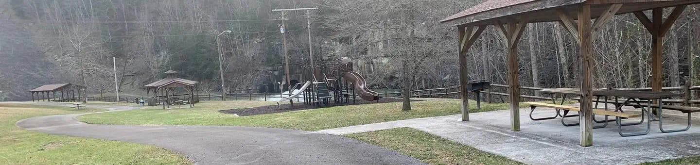
Overview The John W. Flannagan Day Use Area boasts an expansive lake nestled in the rolling green Cumberland Mountains of southwest Virginia, offering visitors an oasis of recreation in the summer months. The nearby dam, built primarily for flood control for the Cranesnest and Pound Rivers, creates a breathtaking lake that is maintained at nearly 1,400 feet above sea level. This day-use facility is an ideal spot for picnicking, water activities, and hiking. Recreation Flannagan's reputation as a fisherman's paradise is well-known. Visitors can enjoy secluded coves of deep, clean water that are well-stocked with bass, bream, walleye and trout. Boating, canoeing, whitewater rafting, and biking top the long list of activities available nearby. Facilities Flannagan's reputation as a fisherman's paradise is well-known. Visitors can enjoy secluded coves of deep, clean water that are well-stocked with bass, bream, walleye and trout. Boating, canoeing, whitewater rafting, and biking top the long list of activities available nearby. Natural Features The John W. Flannagan Dam, completed in 1964, carves out a 1,145-acre lake with nearly 40 miles of beautiful shoreline in the lush Virginia terrain. Nearby Attractions The Lower Twin, Cranes Nest and Pound River Campgrounds, located near the day-use area, offer overnight camping. Breaks Interstate Park is nearby, offering lodging, dining, a museum, gift shop, rafting, canoeing, and other outdoor activities.
View details →
Overview Blue Springs Gap Cabin is located high on a mountaintop near Camp, Virginia, giving visitors the feeling of being on top of the world. The space has three comfortable bedrooms, a kitchen and a living room. Electricity and flush toilet add modern comfort to this rustic mountain setting. Accessible hiking and biking trails pass near the cabin and Hale Lake is just 2 miles away, providing combined opportunities for bird watching, hiking, biking, fishing and picnicking. Recreation The Mount Rogers National Recreation Area features four Congressionally designated wilderness areas; the Virginia Creeper Trail; the Mount Rogers Scenic Byway; the 5,000 acre Crest Zone, featuring elevations over 4,000 feet, large rock formations and a herd of wild, free-ranging ponies; and last but not least, the highest elevated road in the state of Virginia leading to the summit of Whitetop Mountain. A trout stream is located nearby and Hale Lake is about 2 miles away. Hale Lake is popular among anglers who come to these quiet mountainside waters in search of a good day of fishing. State hunting and fishing regulations and licensing requirements apply. The Hale Lake Trail, 0.58-mile loop trail is an easy hike around that lake, occasionally veering away from the shoreline and into the surrounding hardwood forests. Birders will probably find this site most productive during migration. In spring, it should be easy to spot several species of warblers and flycatchers. In fall, the lake is likely to invite migrating waterfowl and shorebirds. Wood duck breed in the area and can occasionally be seen on the lake. White-tailed deer and wild turkey roam through the surrounding woodlands, and might be found approaching the lake to quench a thirst. Facilities The Mount Rogers National Recreation Area features four Congressionally designated wilderness areas; the Virginia Creeper Trail; the Mount Rogers Scenic Byway; the 5,000 acre Crest Zone, featuring elevations over 4,000 feet, large rock formations and a herd of wild, free-ranging ponies; and last but not least, the highest elevated road in the state of Virginia leading to the summit of Whitetop Mountain. A trout stream is located nearby and Hale Lake is about 2 miles away. Hale Lake is popular among anglers who come to these quiet mountainside waters in search of a good day of fishing. State hunting and fishing regulations and licensing requirements apply. The Hale Lake Trail, 0.58-mile loop trail is an easy hike around that lake, occasionally veering away from the shoreline and into the surrounding hardwood forests. Birders will probably find this site most productive during migration. In spring, it should be easy to spot several species of warblers and flycatchers. In fall, the lake is likely to invite migrating waterfowl and shorebirds. Wood duck breed in the area and can occasionally be seen on the lake. White-tailed deer and wild turkey roam through the surrounding woodlands, and might be found approaching the lake to quench a thirst. Natural Features Blue Springs Gap is situated in a grassy clearing atop a mountain peak in southwest Virginia. From the cabin's front porch campers have views of the impressive Appalachian peaks and valleys. Beyond the clearing is a dense stand of mixed hardwoods and pines. The cabin is located in the Mount Rogers National Recreation Area, a 200,000-acre stretch of land that includes two lakes, 50 miles of streams and multiple historic sites. During the fall months, visitors are treated to an incredible showing of autumn colors, as the foliage display in the area is known as some of the best in the region. Nearby Attractions The nearest access to drinking water is 4 miles east at Comers Rock Campground. The nearest phone is 12 miles in Speedwell, Virginia.
View details →
Overview Stony Fork Cabin is a cozy one-bedroom hideaway with most of the comforts of home. Visitors can hike, mountain bike, explore the many nearby creeks, or simply relax on the cabin's private patio. The cabin is located within the Stony Fork Campground along the Big Walker Mountain Scenic Byway. The Appalachian Trail, Seven Sisters Trail, and stocked fishing streams are all within a close proximity, and the site is easily accessed from I-77. State hunting and fishing regulations and licensing requirements apply. Recreation The Big Walker Mountain Scenic Byway is an incredible drive for viewing the blooms of rhododendron, azalea and mountain laurel in spring, and fiery red and gold foliage in fall. Scenic overlooks highlights include views of Mount Rogers and the many ridges and valleys. Experienced hikers love the Seven Sisters Trail, which leads from the campground to the top of Little Walker Mountain, then onto the Scenic Byway. The creek offers trout fishing for campers. State fishing regulations and licensing requirements apply. Facilities The Big Walker Mountain Scenic Byway is an incredible drive for viewing the blooms of rhododendron, azalea and mountain laurel in spring, and fiery red and gold foliage in fall. Scenic overlooks highlights include views of Mount Rogers and the many ridges and valleys. Experienced hikers love the Seven Sisters Trail, which leads from the campground to the top of Little Walker Mountain, then onto the Scenic Byway. The creek offers trout fishing for campers. State fishing regulations and licensing requirements apply. Natural Features Stony Fork Cabin sits at the foot of Big Walker Mountain at an elevation of 2,400 feet. Its creekside setting provides a peaceful soundtrack of running water. In springtime, wildflowers and rhododendron dot the region with spectacular colors, and fall is reliably scenic with its red and yellow foliage. Nearby Attractions Stony Fork is in a natural forest setting at the foot of Big Walker Mountain and adjacent to the Big Walker Scenic Byway. The East Fork of Stony Fork Creek winds through the campground and provides water play and trout fishing. A one-mile nature trail will take campers through stands of pine and hardwoods, while the campground loop road itself is popular with walkers. For the more experienced hiker, Seven Sisters Trail leads from the campground to the top of Little Walker Mountain and back to the Scenic Byway. Located within 10 miles of the cabin, the legendary Appalachian Trail extends for more than 2,175 miles through the Appalachian Mountains across 14 states. It was the first trail to be designated as a National Scenic Trail.
View details →
Overview Enjoy the easygoing, peaceful vibe of McClintic Point's rustic campground set among scattered trees and open fields. This angler's paradise provides plentiful shoreline fishing and some lakefront campsites. Recreation Boating, canoeing, water skiing and and fishing are popular activities on the lake. Brown and rainbow trout, bass and crappie are some of the popular species anglers catch. The campground's open spaces are also handy for running around of stretching out on the grass. Facilities Boating, canoeing, water skiing and and fishing are popular activities on the lake. Brown and rainbow trout, bass and crappie are some of the popular species anglers catch. The campground's open spaces are also handy for running around of stretching out on the grass. Natural Features The campground sits on the northern end of Lake Moomaw. The lake boasts 2,530 surface acres with 43.5 miles of shore line and a maximum depth of 150 feet. Nearby Attractions Head to the quaint town of Warm Springs for restaurants or to visit the Bath County Historical Society.
View details →
Overview Raccoon Branch Campground, nestled at the base of Dickey Knob, offers scenic mountain views, hiking trail access from campsites and cool mountain streams. Campers can access Dickey Creek and the Raccoon Branch from the campground. The most notable time to visit is fall, when the trees boast gorgeous fall foliage. With a location just 11 miles from Interstate 81, the beautiful campground is easily reached by drivers heading out from one of the surrounding cities. Recreation The beautiful Dickey Knob Trail takes hikers through a Wilderness to the top of Dickey Knob for spectacular views of Sugar Grove and Rye Valley. The creek provides a setting for wading and fishing. Facilities The beautiful Dickey Knob Trail takes hikers through a Wilderness to the top of Dickey Knob for spectacular views of Sugar Grove and Rye Valley. The creek provides a setting for wading and fishing. Natural Features The campground is at an elevation of 2,880 ft., along a large grassy area, surrounded by pines, hardwoods and rhododendrons. Perched in the Appalachian Mountains, Raccoon Branch is part of the Mount Rogers National Recreation Area, a 200,000-acre stretch of designated wilderness areas. Nearby Attractions Hike the Appalachian Trail, which extends more than 2,175 miles throughout the Appalachian Mountains across 14 states. The trail was designated as the first National Scenic Trail. The Virginia Creeper Trail, Hungry Mother State Park and Grayson Highlands State Park are nearby.
View details →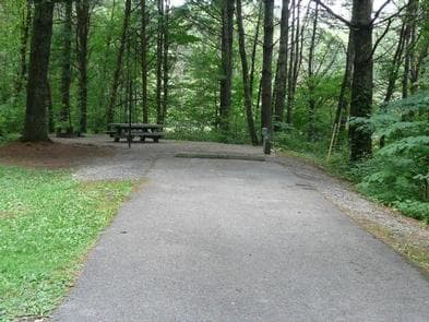
Overview Stony Fork, tucked in a dense forest setting, is located at the foot of Big Walker Mountain beside the Big Walker Mountain Scenic Byway. The East Fork of Stony Fork Creek winds through the campground, providing a serene setting for trout fishing and water play for visitors at the welcoming campground. The 1 mile Stony Fork Nature Trail takes campers through groves of pine and hardwoods, and the campground loop road makes for a scenic walk, too. Recreation The Big Walker Mountain Scenic Byway is an incredible drive for viewing blooms of rhododendron, azalea and mountain laurel in spring, and fiery red and gold foliage in fall. Scenic overlooks highlight views of Mount Rogers and many ridges and valleys. A horseshoe pit at the campground provides hours of fun for families. Experienced hikers love the Seven Sisters Trail, approximately 5 miles, which leads from the campground to the top of Little Walker Mountain, then onto the Scenic Byway. Facilities The Big Walker Mountain Scenic Byway is an incredible drive for viewing blooms of rhododendron, azalea and mountain laurel in spring, and fiery red and gold foliage in fall. Scenic overlooks highlight views of Mount Rogers and many ridges and valleys. A horseshoe pit at the campground provides hours of fun for families. Experienced hikers love the Seven Sisters Trail, approximately 5 miles, which leads from the campground to the top of Little Walker Mountain, then onto the Scenic Byway. Natural Features Stony Fork sits in a valley of the Appalachians at a 2,400 foot elevation. Its creekside setting provides a peaceful soundtrack of running water. In springtime, wildflowers and rhododendron dot the region with spectacular colors, and fall is reliably scenic with its red and yellow foliage. Nearby Attractions Stony Fork is in a natural forest setting at the foot of Big Walker Mountain and adjacent to the Big Walker Scenic Byway. The East Fork of Stony Fork Creek winds through the campground and provides water play and trout fishing. A one-mile nature trail will take campers through stands of pine and hardwoods, while the campground loop road itself is popular with walkers. For the more experienced hiker, Seven Sisters Trail leads from the campground to the top of Little Walker Mountain and back to the Scenic Byway. Within 10 miles of the campground, hike the popular Appalachian Trail, which extends more than 2,175 miles throughout the Appalachian Mountains across 14 states. It is the first trail designated as a National Scenic Trail. There is an outdoor shooting range a few miles from the campground.
View details →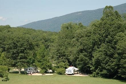
Overview Sherando Lake Recreation Area's Family Campground provides an ideal camping destination. It is situated in the Blue Ridge Mountains and is known locally as the jewel of the Blue Ridge Mountains, where visitors enjoy hiking, picnicking in the shade, fishing in the lakes, or swimming and relaxing on the sandy beach. Recreation The 25 acre Lower Lake offers opportunities for swimming in a designated area with a sand beach, accessible ramp to the water's edge, and a beach bathhouse with changing and shower facilities. Fishing and boating are also available outside the designated swimming area of the lake. Fishing is in stocked trout waters during the spring and fall seasons. Visitors will need to have the appropriate Virginia fishing license, National Forest stamp, and trout stamp. Boats with gasoline motors are not permitted on the lower lake - electric troll motors, canoes, kayaks, or similar boats only. A hand-carry ramp is available for access to the lake adjacent to the parking area. Fishing only is available at the 7 acre Upper Lake. This lake is also stocked during the spring and fall seasons and the appropriate licenses are required. Boats are allowed, but there is no launch access - hand carry only. Parking is available at a small area below the group camp area and a walking trail will lead you to the lake. Swimming is not allowed in the upper lake. Hiking trails surround the area offering everything from a short walk around the lake on the Lakeside and Cliff Trails to a day hike up the mountain on the White Rock Trail and the Blue Ridge Parkway. For the more adventurous hiker, more challenging day hikes and backpacking trips are available by heading up the Blue Loop Trail to the Torry Ridge Trail to Bald Mountain and beyond. Facilities The 25 acre Lower Lake offers opportunities for swimming in a designated area with a sand beach, accessible ramp to the water's edge, and a beach bathhouse with changing and shower facilities. Fishing and boating are also available outside the designated swimming area of the lake. Fishing is in stocked trout waters during the spring and fall seasons. Visitors will need to have the appropriate Virginia fishing license, National Forest stamp, and trout stamp. Boats with gasoline motors are not permitted on the lower lake - electric troll motors, canoes, kayaks, or similar boats only. A hand-carry ramp is available for access to the lake adjacent to the parking area. Fishing only is available at the 7 acre Upper Lake. This lake is also stocked during the spring and fall seasons and the appropriate licenses are required. Boats are allowed, but there is no launch access - hand carry only. Parking is available at a small area below the group camp area and a walking trail will lead you to the lake. Swimming is not allowed in the upper lake. Hiking trails surround the area offering everything from a short walk around the lake on the Lakeside and Cliff Trails to a day hike up the mountain on the White Rock Trail and the Blue Ridge Parkway. For the more adventurous hiker, more challenging day hikes and backpacking trips are available by heading up the Blue Loop Trail to the Torry Ridge Trail to Bald Mountain and beyond. Natural Features The campground sits between Lower Sherando Lake and Upper Sherando Lake at an elevation of about 1,800 feet in the shadows of Torry Ridge. The Upper Lake is 7 acres and is fed by the waters of the North Fork of Back Creek. The Lower Lake is 25 acres and is fed by springs, the North Fork of Back Creek, and Williams Branch, so the water stays refreshingly cool all summer long. Nearby Attractions There are opportunities for gas, groceries, and firewood at convenience stores and local vendors along the state road to Sherando Lake. Ice can be purchased at the Sherando Lake Visitor Center during operating hours, which vary seasonally. Additional supplies can be obtained in Stuarts Draft, about a 15 minute drive away. The Blue Ridge Parkway, with its scenic overlooks and ridgetop views, is a short 3 mile drive up State Route 664 from the Sherando Lake entrance. The Wintergreen Resort offers a golf course and ski area within 10 miles of Sherando Lake. Cabin rentals are available near Sherando Lake from local private vendors.
View details →
Overview Telegraph Picnic Pavilion is a covered pavilion with twelve picnic tables located in Prince William Forest Park, 35 miles southwest of Washington, D.C. The park's land was set aside during the Great Depression, and in 1935 the Civilian Conservation Corps (CCC) began restoring the previously over-farmed acreage, converting it to recreational lands for public use. The CCC built trails, dams and cabins, making the park a wonderful place for recreation and relaxation. Recreation The park offers many recreational activities, including hiking, biking, orienteering and fishing. Hikers enjoy exploring the park's 37 miles of foot trails. The South Valley, Oak Ridge and Farms to Forest Trails all begin at the campground entrance. Bicyclists will find 21 miles of paved roads within the park, including the 12-mile Scenic Drive. Little traffic and a 25 m.p.h. speed limit make this a popular biking spot. A 3-mile, family-friendly paved bike lane leads to the campground. Mountain biking is also available on 10 miles of gravel fire roads. The park boasts 30 orienteering courses with picturesque settings. Orienteering is a 19th century Scandinavian sport primarily used as military training. The courses were developed in 1972 and continue to provide hours of entertainment and exploration for park visitors. Approximately 18 miles of streams and two small lakes are open to the public for fishing. The water quality of Quantico Creek supports numerous fish species and other aquatic life. The most common fish species are bluegill, pumpkinseed, largemouth bass and channel catfish. Facilities The park offers many recreational activities, including hiking, biking, orienteering and fishing. Hikers enjoy exploring the park's 37 miles of foot trails. The South Valley, Oak Ridge and Farms to Forest Trails all begin at the campground entrance. Bicyclists will find 21 miles of paved roads within the park, including the 12-mile Scenic Drive. Little traffic and a 25 m.p.h. speed limit make this a popular biking spot. A 3-mile, family-friendly paved bike lane leads to the campground. Mountain biking is also available on 10 miles of gravel fire roads. The park boasts 30 orienteering courses with picturesque settings. Orienteering is a 19th century Scandinavian sport primarily used as military training. The courses were developed in 1972 and continue to provide hours of entertainment and exploration for park visitors. Approximately 18 miles of streams and two small lakes are open to the public for fishing. The water quality of Quantico Creek supports numerous fish species and other aquatic life. The most common fish species are bluegill, pumpkinseed, largemouth bass and channel catfish. Natural Features Prince William Forest Park preserves approximately 15,000 acres of Piedmont forest covering a major portion of the Quantico Creek watershed. The park represents one of the largest parcels of undeveloped land in the area and is the third largest unit of the National Park System in Virginia. The area is the largest example of a Piedmont forest ecosystem in the National Park System, makes it a significant natural resource. Various geologic outcroppings, winding creeks, gentle rolling slops and man-made lakes make wonderful destinations for any venturing visitor. The park is home to 38 species of mammals, 24 species of amphibians, 27 species of reptiles, more than 100 species of birds, 23 species of fish and an unknown number of invertebrates. More than 700 plant species exist in Prince William Forest Park. From the smallest wildflower to the tallest tree, each species has a special role to play in this forest ecosystem. From tree bark in winter, wildflowers in spring, canopy cover in summer and autumn colors in fall, Prince William Forest Park offers beautiful scenery year-round. Nearby Attractions Prince William Forest Park is centrally located, with easy access to all of the attractions the Northern Virginia and Washington, D.C., area have to offer. From the park entrance, the National Museum of the Marine Corps and the main gate of the United States Marine Corps Base Quantico are just a mile away. The park is located directly between historic Fredericksburg and Spotsylvania National Military Park and Manassas National Battlefield Park.
View details →
Overview Turkey Run Ridge Group Campground has nine wooded group campsites which can accommodate a maximum of 25 to 40 people per site. Located in Prince William Forest Park, 35 miles southwest of Washington, D.C., the park's land was set aside during the Great Depression. In 1935 the Civilian Conservation Corps (CCC) began restoring the previously over-farmed acreage, converting it to recreational lands for public use. The CCC built trails, dams, and cabins, making the park a wonderful place for recreation and relaxation. Parking is limited at Turkey Run Ridge Campground. It is recommended that visitors carpool when camping at Turkey Run Ridge Campground. Recreation The park offers many recreational activities, including hiking, biking, orienteering and fishing. Hikers enjoy exploring the park's 37 miles of foot trails. Bicyclists will find 21 miles of paved roads within the park, including the 12-mile Scenic Drive. Little traffic and a 25 m.p.h. speed limit make this a popular biking spot. A 3-mile, family-friendly paved bike lane leads to the Oak Ridge campground. Mountain biking is also available on 10 miles of gravel fire roads. The park boasts 30 orienteering courses within a forested setting. Orienteering is a 19th century Scandinavian sport primarily used as military training. The courses were developed in 1972 and continue to provide hours of entertainment and exploration for park visitors. Approximately 18 miles of streams and two small lakes are open to the public for fishing. The water quality of Quantico Creek supports numerous fish species and other aquatic life. The most common fish species are bluegill, pumpkinseed, largemouth bass, and channel catfish. Facilities The park offers many recreational activities, including hiking, biking, orienteering and fishing. Hikers enjoy exploring the park's 37 miles of foot trails. Bicyclists will find 21 miles of paved roads within the park, including the 12-mile Scenic Drive. Little traffic and a 25 m.p.h. speed limit make this a popular biking spot. A 3-mile, family-friendly paved bike lane leads to the Oak Ridge campground. Mountain biking is also available on 10 miles of gravel fire roads. The park boasts 30 orienteering courses within a forested setting. Orienteering is a 19th century Scandinavian sport primarily used as military training. The courses were developed in 1972 and continue to provide hours of entertainment and exploration for park visitors. Approximately 18 miles of streams and two small lakes are open to the public for fishing. The water quality of Quantico Creek supports numerous fish species and other aquatic life. The most common fish species are bluegill, pumpkinseed, largemouth bass, and channel catfish. Natural Features Prince William Forest Park preserves approximately 15,000 acres of Piedmont forest covering a major portion of the Quantico Creek watershed. The park represents one of the largest parcels of undeveloped land in the area and is the third largest unit of the National Park System in Virginia, the largest example of a Piedmont forest ecosystem in the National Park System, making it a significant natural resource. Various geologic outcroppings, winding creeks, gentle rolling hills and man-made lakes make wonderful destinations for any venturing visitor. The park is home to 38 species of mammals, 24 species of amphibians, 27 species of reptiles, more than 100 species of birds, 23 species of fish and an unknown number of invertebrates. More than 700 plant species exist in Prince William Forest Park. From the smallest wildflower to the tallest tree, each species has a special role to play in this forest ecosystem. From tree bark in winter, wildflowers in spring, canopy cover in summer, and autumn colors in fall, Prince William Forest Park offers beautiful scenery year-round. Nearby Attractions Prince William Forest Park is centrally located, with easy access to all of the attractions the Northern Virginia and Washington, D.C., area have to offer. From the park entrance, the National Museum of the Marine Corps and the main gate of the United States Marine Corps Base Quantico are just a mile away. The park is located directly between historic Fredericksburg and Spotsylvania National Military Park and Manassas National Battlefield Park.
View details →
Overview Fox Creek Horse Camp is a premiere destination for riding enthusiasts who are looking for the rare opportunity to ride from their campsite onto hundreds of miles of trails in the spectacular Mount Rogers National Recreation Area. Located at almost 4,000 feet, it serves as a welcome retreat for summer camping and horseback riding. Recreation While hiking and horseback riding are the primary attractions near the campground, there are also ample native trout streams, the Mount Rogers Scenic Byway, local festivals and music, the Appalachian Trail and the Virginia Creeper National Recreation Trail. Facilities While hiking and horseback riding are the primary attractions near the campground, there are also ample native trout streams, the Mount Rogers Scenic Byway, local festivals and music, the Appalachian Trail and the Virginia Creeper National Recreation Trail. Natural Features The campground is adjacent to Fox Creek, a small rocky trout stream with large boulders and rhododendron and northern hardwoods along the banks. The campsites are located in open fields on either side of the creek. Nearby Attractions The Mount Rogers High country offers opportunities for day trips and overnight pack trips. This open setting offers expansive views, summer rhododendron flowering, blueberry picking, and spectacular fall colors. The Mount Rogers National Recreation Headquarters is located about 20 minutes from the campground and offers maps, directions, and a variety of bookstore items.
View details →
Overview Craig Creek Recreation Area provides old-fashioned, rustic group camping for those that require few amenities. The large open field is great for groups that wish to picnic and tent camp together. There is a day-use area adjacent to the campground that is not reservable. Overnight camping is prohibited in the day-use area. Recreation Craig Creek has a small swimming hole and canoes may access the creek as well. The creek is stocked with trout and can provide good fishing opportunites for anglers. A two-mile loop trail is located within the recreation area. Facilities Craig Creek has a small swimming hole and canoes may access the creek as well. The creek is stocked with trout and can provide good fishing opportunites for anglers. A two-mile loop trail is located within the recreation area. Natural Features The recreation area is located in a narrow valley, flanked by National Forest land. The open field used for tent camping and is edged with large, shade trees. Nearby Attractions Craig Creek is located 20 minutes from New Castle, VA.
View details →
Overview Steel Bridge Group Campground provides old-fashioned, rustic group camping for those that require few amenities. There are three well shaded camping sites for available for small group camping. Recreation Steel Bridge Group Camping provides old-fashioned, rustic group and family camping. Visitors enjoy splashing in the cool water of Potts Creek that edges the campground. Potts Creek is a stocked trout stream and has a small swimming hole as well as many rock ledges and small falls to play in. Facilities Steel Bridge Group Camping provides old-fashioned, rustic group and family camping. Visitors enjoy splashing in the cool water of Potts Creek that edges the campground. Potts Creek is a stocked trout stream and has a small swimming hole as well as many rock ledges and small falls to play in. Natural Features The campground is set in a narrow valley, flanked by National Forest land. Potts Crees lies adjacent to the campground. Nearby Attractions Steel Bridge is located 5 minutes from Paint Bank, VA, and 25 minutes from New Castle, VA.
View details →
Overview The John W. Flannagan Dam & Reservoir Area boasts an expansive lake nestled in the rolling green Cumberland Mountains of southwest Virginia, offering visitors an oasis of recreation in the summer months. The nearby dam, built primarily for flood control for the Cranesnest and Pound Rivers, creates a breathtaking lake that is maintained at nearly 1,400 feet above sea level. This facility is an ideal spot for picnicking, water activities and hiking. Recreation Flannagan's reputation as a fisherman's paradise is well-known. Visitors can enjoy secluded coves of deep, clean water that are well-stocked with bass, walleye and trout. Boating, canoeing, whitewater rafting and biking top the long list of activities available nearby. Facilities Flannagan's reputation as a fisherman's paradise is well-known. Visitors can enjoy secluded coves of deep, clean water that are well-stocked with bass, walleye and trout. Boating, canoeing, whitewater rafting and biking top the long list of activities available nearby. Natural Features The John W. Flannagan Dam, completed in 1964, carves out a 1,145-acre lake with nearly 40 miles of beautiful shoreline in the lush Virginia mountains. Nearby Attractions Breaks Interstate Park is nearby, offering lodging, dining, a museum, gift shop, rafting, canoeing, rock climbing and other outdoor activities.
View details →
Overview The John W. Flannagan Dam & Reservoir Area boasts an expansive lake nestled in the rolling green Cumberland Mountains of southwest Virginia, offering visitors an oasis of recreation in the summer months. The nearby dam, built primarily for flood control for the Cranesnest and Pound Rivers, creates a breathtaking lake that is maintained at nearly 1,400 feet above sea level. This facility is an ideal spot for picnicking, water activities and hiking. Recreation Flannagan's reputation as a fisherman's paradise is well-known. Visitors can enjoy secluded coves of deep, clean water that are well-stocked with bass, walleye and trout. Boating, canoeing, whitewater rafting, and biking top the long list of activities available nearby. Facilities Flannagan's reputation as a fisherman's paradise is well-known. Visitors can enjoy secluded coves of deep, clean water that are well-stocked with bass, walleye and trout. Boating, canoeing, whitewater rafting, and biking top the long list of activities available nearby. Natural Features The John W. Flannagan Dam, completed in 1964, carves out a 1,145-acre lake with nearly 40 miles of beautiful shoreline in the lush Virginia mountains. Nearby Attractions Breaks Interstate Park is nearby, offering lodging, dining, a museum, gift shop, rafting, canoeing, rock climbing and other outdoor activities.
View details →
Overview Dundo Group Campground is a beautiful campground located at milepost 83.7 along the Skyline Drive with the Appalachian Trail passing through the site. The southern end is a picnic area and the northern end is the campground with three reservable group campsites. All Dundo check-ins are at Loft Mountain Campground, mile 79.5. Check out or re-register by noon. Group camping fees are non-refundable and there are no discounts. Camping is limited to 14 consecutive nights per year. Recreation Dundo provides a great base camp for group activities with easy access to the Appalachian Trail, Doyles River and many other popular hikes in the South District. Facilities Dundo provides a great base camp for group activities with easy access to the Appalachian Trail, Doyles River and many other popular hikes in the South District. Natural Features Dundo offers three large, grassy group tent sites shaded by native oaks and mature pines. It is illegal to approach, feed, frighten, or disturb wildlife. Hunting is prohibited. The laws in our national parks protect all resources such as wildflowers, plants, animals, and artifacts. Nearby Attractions Dundo is located at milepost 83.7 along the scenic Skyline Drive. The Loft Mountain Camp Store is located 3.7 miles north, at the Loft Mountain Campground (turn up the hill across from the Loft Mountain Wayside, the store is on the left). There are over 500 miles of trails located throughout the park. The closest visitor center is Byrd Visitor Center located at Milepost 51. On Friday and Saturday during the summer, park Interpretative staff schedules Ranger programs at the Loft Mountain Amphitheater. Charges & Cancellations Cancellations more than 14 days in advance of arrival date only incur a $10 transaction fee. Within 14 days, $10 and the first night's fee are charged.
View details →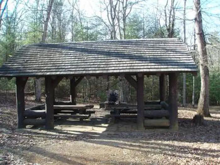
Overview This historic log picnic shelter was built by the Civilian Conservation Corps. It is located next to Comers Rock Campground in the heart of the Mount Rogers National Recreation Area. Recreation There are primitive campsites available in the adjoing campground for $5.00 per night (first-come, first-served) and vault toilets are available. There are hiking trails in the area, including into Dry Run Wilderness, which is within walking distance from the campground and shelter. Facilities There are primitive campsites available in the adjoing campground for $5.00 per night (first-come, first-served) and vault toilets are available. There are hiking trails in the area, including into Dry Run Wilderness, which is within walking distance from the campground and shelter. Natural Features Hale Lake is nearby for fishing, or stop at Comers Rock Overlook for breath taking long distance views of the valley. Nearby Attractions Hale Lake for fishing and Comers Rock Overlook for wonderful views.
View details →
Overview There are 20 camping units available on a first-come, first-served basis. Each unit has a gravel parking spur, picnic table and fire grill. Some sites have a pad for tents or pop-up trailers. Recreation vehicles up to 25 feet long can be accommodated in some sites. A day use picnic shelter with picnic tables and an open field for sports is available on a first-come, first-served basis. Toilets and garbage cans are provided in the campground and near the picnic shelter. Drinking water is not available. FEE: $5 per unit, per night (limit of 8 people and 2 vehicles per unit). Located in Raven Cliff Campground, enjoy a large shelter for your next gathering! Along with the amenities of the shelter, it adjoins a large field for games, the rushing waters of Cripple Creek for wading and fishing, hiking trails, and the historic Raven Cliff Furnace. Recreation Besides the available primitive campsites, Cripple Creek runs through the picnic area and is popular for fishing, wading, and tubing. There are large open fields that are great for sports and picnics. Facilities Besides the available primitive campsites, Cripple Creek runs through the picnic area and is popular for fishing, wading, and tubing. There are large open fields that are great for sports and picnics. Natural Features From the 200-foot sandstone Raven Cliff to the 1810 historic iron ore furnace, this recreation area is off the beaten path, but worth the effort. contact_info This location is unstaffed. To speak with our main office for general information, please call: (276) 783-5196. Nearby Attractions Cripple Creek runs through the area for fishing, wading, or tubing. State fishing regulations and licensing requirements apply. Raven Cliff Furnace Trail (4616) begins in Raven Cliff Campground and follows Cripple Creek until ending at the remains of the old 30-foot-tall Raven Cliff Iron Furnace made from local sandstone. Raven Cliff Trail (4601) a 1.2-mile trail from Raven Cliff Campground connects to Collins Cove Horse Campground or Ewing Mountain Trail (4614)
View details →
Overview Wilderness Road Campground is nestled in the lush forests of the Appalachian Mountains in Cumberland Gap National Historical Park , where Kentucky, Tennessee, and Virginia meet. You can access miles of forest and mountain trails directly from the campground. While in the park, drive up to the Pinnacle for a breathtaking view of the mountains or check out Civil War earthworks. Hike to the pale cliffs of White Rocks, the gaping mouth of Sand Cave, or the historic Hensley Settlement to see how mountain folk once lived. Stand in 3 states at the same time or immerse yourself in thousands of acres of proposed wilderness. Walk a path once traveled by the bison, Native American, longhunter, and pioneer. Stand in the narrow mountain gap where Daniel Boone stood and where thousands of people risked everything to reach and settle what would become America. Wilderness Road Campground includes 151 wooded sites open to tents, trailers, and RV campers. Electrical hookups (20-, 30-, or 50-amp) are available at 43 sites. Group sites are also available. The campground is open year-round with limited campsites, as well as the comfort station between loops C and D, open during the winter season (mid-November to mid-March). Recreation Over 85 miles of trails offer plenty of opportunities for Hiking and Backpacking adventures in the great outdoors. You can take an easy 1/4-mile stroll or go on a challenging 10-mile hike in the backcountry, the choice is yours. Several trails meander through over 14,000 acres of proposed wilderness. Backcountry Camping is allowed at 5 designated sites in the park with a permit. Experience the quiet beauty of the mountains and wilderness as you camp under the stars. Permits are free of charge and can be obtained at the park visitor center. Picnicking at one of several picnic areas in the park is a popular activity. Whether you are looking for a quiet lunch while enjoying nature or having a big family get-together in the great outdoors, we have limitless options. You can also reserve a picnic shelter for exclusive day use for a fee. Stop by the park visitor center to reserve a picnic shelter up to 3 months in advance. Horseback Riding is permitted on the 17-mile Ridge Trail, which extends from the Pinnacle to White Rocks. Guided Tours, Hikes, and Programs range from Pioneer and Civil War Living History demonstrations to guided tours of Gap Cave (formerly known as Cudjo's Cave), and from guided tours of the historic Hensley Settlement to Campfire Programs. Programs offered vary seasonally. Fees are charged for Gap Cave and Hensley Settlement tours. Stop by the park visitor center for program tickets and information. Facilities Over 85 miles of trails offer plenty of opportunities for Hiking and Backpacking adventures in the great outdoors. You can take an easy 1/4-mile stroll or go on a challenging 10-mile hike in the backcountry, the choice is yours. Several trails meander through over 14,000 acres of proposed wilderness. Backcountry Camping is allowed at 5 designated sites in the park with a permit. Experience the quiet beauty of the mountains and wilderness as you camp under the stars. Permits are free of charge and can be obtained at the park visitor center. Picnicking at one of several picnic areas in the park is a popular activity. Whether you are looking for a quiet lunch while enjoying nature or having a big family get-together in the great outdoors, we have limitless options. You can also reserve a picnic shelter for exclusive day use for a fee. Stop by the park visitor center to reserve a picnic shelter up to 3 months in advance. Horseback Riding is permitted on the 17-mile Ridge Trail, which extends from the Pinnacle to White Rocks. Guided Tours, Hikes, and Programs range from Pioneer and Civil War Living History demonstrations to guided tours of Gap Cave (formerly known as Cudjo's Cave), and from guided tours of the historic Hensley Settlement to Campfire Programs. Programs offered vary seasonally. Fees are charged for Gap Cave and Hensley Settlement tours. Stop by the park visitor center for program tickets and information. Natural Features Cumberland Gap National Historical Park protects 24,000 acres of Appalachian Mountain habitat stretching across Kentucky, Tennessee, and Virginia. Walk the trails that Daniel Boone and thirty axemen blazed to open the first great gateway to the West. Plan your visit today and experience the natural, historical, and cultural beauty of the park. Cumberland Gap , carved out over aeons by wind and water, forms a V-shaped notch or gap in the formidable wall of the Appalachian Mountains. This natural low point made crossing over the mountains easier and less dangerous for bison and other animals, then later for Native Americans, and still later for European explorers and early pioneers. Stand right in the Gap where over 300,000 settlers crossed the mountains on their journey to the west. The cliffs of White Rocks rise 500 feet above the surrounding wooded slopes at the east end of the park. Anyone up for a challenging hike to the top of the mountain will be rewarded with a breath-taking, 360-degree view of the surrounding area. A natural scenic area in Kentucky, Sand Cave is a half-domed chamber that is 250 feet across in front (open). The floor slopes from back to front and is 1.25 acres of fine, colorful sand. Relax and enjoy nature in this magical, enormous natural feature. Skylight Cave lies at the end of a steep, 1.9-mile hike in Ewing, Virginia. Start out on Lewis Hollow Trail, from the picnic area near Wilderness Road Campground. Hike through lush rhododendrons and along a river until you reach the cave. Gap Cave was first found by European explorers in 1750, when Dr. Thomas Walker found and named it Gap Cave. Located in Lee County, Virginia, the cave is 18.5 miles long and accessible only by guided tour. East of the Gap, the Cumberland Mountain Range includes 15,470 acres of roadless habitat extending 15 miles along the Cumberland and Brush Mountains. The ridge of Cumberland Mountain forms the Kentucky-Virginia state line. Both Cumberland and Brush Mountains are exceedingly steep and rugged with high cliffs in many areas. Chimney Rock is a geological formation shaped like a pillar. Located at the Pinnacle Overlook, this unique rock formation could have taken 535 million years to form. Gap Creek is a small cascade of water flowing out of Gap Cave. This peaceful natural feature is a great spot for capturing pictures and videos. Yellow Creek runs along the park boundary behind New Bartlett Park and Old Barlett Park picnic shelters. Enjoy time playing in the creek, or simply listen to the flow of the water. More than 14,000 acres of the park are managed as Wilderness , where visitors can experience the backcountry and nature in the purest way. contact_info For facility specific information, please call (606) 248-2817. Nearby Attractions Nearby National Park Service Areas: Big South Fork National River & Recreational Area 90mi Andrew Johnson National Historic Site 80mi Great Smoky Mountains National Park 120mi Mammoth Cave National Park 225mi Other Local Attractions: Kentucky Coal Mining Museum (606) 848-1530, 45mi Abraham Lincoln Museum (423) 869- 6235, 3mi Pine Mountain State Resort Park (276) 445-3065, 10mi Wilderness Road State Park (276) 445-3065, 10mi Regional Tourism Information: Southern & Eastern KY Tourism Development Association Kentucky Appalachians Visit Eastern Kentucky Bell County (KY) Historical Society Bell County (KY) Tourism Tennessee Regions: Middle East Claiborne County (TN) Tourism Virginia Regions: Heart of Appalachia Visit Southwest Virginia Charges & Cancellations Rules and Reservation Policies
View details →
Overview Looking for some peace and quiet? Want to get back to nature, listen to the sounds of the nocturnal world, or simplify your life? Then come experience primitive camping at Prince William Forest Park’s Chopawamsic Backcountry Area. Chopawamsic (chop-uh-WAHM-zik), Algonquian for “small, divided river flats”, consists of about 400 acres of backcountry with a wilderness-like feel in a remote area of Prince William Forest Park. Within this tract of land, there are eight designated hike in campsites available. Campsites are accessible from the two-mile loop trail. Camping is limited to four people or one family unit per site in the Chopawamsic Backcountry Area. Chopawamsic is not designed for group camping, which is available at Turkey Run Ridge Group Campground. Breckenridge Reservoir is accessible by trail from the Chopawamsic Backcountry Area for fishing. Recreation Prince William Forest Park offers many recreational activities, including hiking and fishing. Hikers enjoy exploring the park's 37 miles of foot trails. Since Chopawamsice Backcountry Area is a little remote, campers may access the rest of the park by driving to the park entrance and parking at any of the trailheads along the Scenic Drive. Chopawamsic Creek and Breckenridge Reservoir are open to the public for fishing. To access the reservior, visitors can hike down Breckenridge Road to Lykes Lane. The most common fish species are bluegill, pumpkinseed, largemouth bass and channel catfish. Facilities Prince William Forest Park offers many recreational activities, including hiking and fishing. Hikers enjoy exploring the park's 37 miles of foot trails. Since Chopawamsice Backcountry Area is a little remote, campers may access the rest of the park by driving to the park entrance and parking at any of the trailheads along the Scenic Drive. Chopawamsic Creek and Breckenridge Reservoir are open to the public for fishing. To access the reservior, visitors can hike down Breckenridge Road to Lykes Lane. The most common fish species are bluegill, pumpkinseed, largemouth bass and channel catfish. Natural Features Chopawamsic Backcountry Area is located in Prince William Forest Park, which preserves approximately 15,000 acres of Piedmont forest covering a major portion of the Quantico Creek watershed. The park represents one of the largest parcels of undeveloped land in the area and is the third largest unit of the National Park System in Virginia. The area is the largest example of a Piedmont forest ecosystem in the National Park Service, making it a significant natural resource. Various geological outcroppings, winding creeks, gently rolling slopes and man-made lakes make wonderful destinations for any adventurous visitor. The park is home to 46 species of mammals, 22 species of amphibians, 25 species of reptiles, more than 129 species of birds, 26 species of fish and an unknown number of invertebrates. More than 900 plant species exist in Prince William Forest Park. From the smallest wildflower to the tallest tree, each species has a special role to play in this forest ecosystem. From tree bark in winter, wildflowers in spring, canopy cover in summer and autumn colors in fall, Prince William Forest Park offers beautiful scenery year-round. Nearby Attractions Prince William Forest Park is centrally located, with easy access to all of the attractions the Northern Virginia and Washington, D.C., area have to offer. From the park entrance, the National Museum of the Marine Corps and the main gate of the United States Marine Corps Base Quantico are just a mile away. The park is located directly between historic Fredericksburg and Spotsylvania National Military Park and Manassas National Battlefield Park.
View details →FAQ
Camping in Virginia
How many campgrounds are listed in Virginia?
TheCampVerse currently lists 43 campgrounds in Virginia.
What campground types are most common in Virginia?
The most common campground types are Campground.
How can I compare campgrounds in Virginia?
Use the campground cards and featured links on this page to compare descriptions, amenities, and details before opening each campground profile.
Keep exploring