
Campgrounds in Washington
Camp among diverse landscapes from rainforests to mountains in the Evergreen State
139
Campgrounds listed
100%
With photos
99%
Detailed descriptions
Campground
Top campground type
Highlights
Featured campgrounds in Washington
Explore by campground name letter
Jump to A-Z landing hubs for stronger discovery paths beyond Washington.
All campgrounds
Showing 139 campgrounds

Overview Evans Campground, is located along the northeastern shoreline of Lake Roosevelt. The site is long and narrow, an orientation that allows for a fantastic, clear view of the lake from every vantage point. There are 44 individual campsites. Lake Roosevelt is a 130-mile lake on the Columbia River created by the Grand Coulee Dam. Named after President Franklin D. Roosevelt, it is part of the Lake Roosevelt National Recreation Area and managed by the National Park Service. Recreation The boat launch provides year-round access to the lake. Boating, fishing, swimming and water skiing are activities that can easily take place from the campground. Campers might also enjoy relaxing and taking in the beautiful view or attending educational ranger programs. Facilities The boat launch provides year-round access to the lake. Boating, fishing, swimming and water skiing are activities that can easily take place from the campground. Campers might also enjoy relaxing and taking in the beautiful view or attending educational ranger programs. Natural Features Evans provides ample shade with thick forests of ponderosa pine, douglas fir and maple trees. The lake area is abundant with wildlife, including moose, elk and deer. Quite a few bald eagles have been spotted around Evans, and dozens of species of fish inhabit the lake, such as walleye, bass, rainbow trout, salmon and sturgeon. Fishing for sturgeon is now allowed during a short season. Much of the water in the originates from glaciers and snow in the cold, high Canadian Rockies, though temperatures are pleasant to swim in during summer. Nearby Attractions The historic St. Paul's Mission, which is run by the National Park Service, is located about eleven south of the campground in the town of Kettle Falls. Also in the area are Fort Colville and the Hudson Bay Company Post on the Upper Columbia. St. Paul's Mission. Sherman drive, a scenic loop, is nearby. contact_info This location is unstaffed. To speak with our main office for general information, please call: (509) 754-7889. Charges & Cancellations All changes and cancellations need to be made through recreation.gov Late Cancellations or Cancellations within the Cut-off Window Individual Campsites: A customer who cancels a reservation the day before or on the day of arrival will pay a $10.00 service fee AND forfeit the first night's use fee (not to exceed the total paid for the original reservation). Cancellations for a one-night reservation will forfeit the entire amount paid and will not be subject to an additional service fee.
View details →
Overview Gifford Campground sits along the northern shoreline of Lake Roosevelt. The facility is popular among hunters and fishermen, but is also comfortable for families. There is a clear view of the lake from most sites in the campground. A boat launch and beach are located within the facility. Lake Roosevelt is a 130-mile lake on the Columbia River created by the Grand Coulee Dam. Named after President Franklin D. Roosevelt, it is part of the Lake Roosevelt National Recreation Area managed by the National Park Service. Recreation This campground is popular for hunters (hunting is allowed in certain areas of the park) and fishermen. The lake is abundant with walleye, bass, rainbow trout and salmon. Sturgeon also live in the lake; fishing for sturgeon is now allowed For a limited season. The boat launch is open year-round. Families and visitors can attend educational programs, enjoy a leisurely walk to the lake or relax by the beach. Facilities This campground is popular for hunters (hunting is allowed in certain areas of the park) and fishermen. The lake is abundant with walleye, bass, rainbow trout and salmon. Sturgeon also live in the lake; fishing for sturgeon is now allowed For a limited season. The boat launch is open year-round. Families and visitors can attend educational programs, enjoy a leisurely walk to the lake or relax by the beach. Natural Features The site is situated in a thick Ponderosa pine forest that provides plenty of shade. The lake area is abundant with wildlife, including moose, elk, deer osprey and bald eagles. Dozens of species of fish inhabit the lake. Much of the water in the lake originates from glaciers and snowmelt from the cold, high Canadian Rockies. Although, lake temperatures are pleasant to swim in during summer. contact_info This location is unstaffed. To speak with our main office for general information, please call: (509) 754-7889. Nearby Attractions The Gifford Ferry is a free ferry offered by the Colville Confederated Tribes that can take passengers across the river. It runs daily and departs every 15 minutes. Charges & Cancellations All changes and cancellations need to be made through recreation.gov Late Cancellations or Cancellations within the Cut-off Window Individual Campsites: A customer who cancels a reservation the day before or on the day of arrival will pay a $10.00 service fee AND forfeit the first night's use fee (not to exceed the total paid for the original reservation). Cancellations for a one-night reservation will forfeit the entire amount paid and will not be subject to an additional service fee.
View details →
Overview Hunters Campground sits along the northern shoreline of Lake Roosevelt. The facility is popular among hunters and fishermen, but is also comfortable for families. Although there is no view of the lake directly from the campground, a boat launch and beach are located within the facility. Lake Roosevelt is a 130-mile lake on the Columbia River created by the Grand Coulee Dam. Named after President Franklin D. Roosevelt, it is part of the Lake Roosevelt National Recreation Area managed by the National Park Service. Recreation This campground is popular for hunters (hunting is allowed in certain areas of the park) and fishermen. The lake is abundant with walleye, bass, rainbow trout and salmon. Sturgeon also live in the lake; fishing for sturgeon is now allowed For a limited season. The boat launch is open year-round. Families and visitors can attend educational programs, enjoy a leisurely walk to the lake or relax by the beach. Facilities This campground is popular for hunters (hunting is allowed in certain areas of the park) and fishermen. The lake is abundant with walleye, bass, rainbow trout and salmon. Sturgeon also live in the lake; fishing for sturgeon is now allowed For a limited season. The boat launch is open year-round. Families and visitors can attend educational programs, enjoy a leisurely walk to the lake or relax by the beach. Natural Features The site is situated in a thick Ponderosa pine forest that provides plenty of shade. The lake area is abundant with wildlife, including moose, elk, deer osprey and bald eagles. Dozens of species of fish inhabit the lake. Much of the water in the lake originates from glaciers and snowmelt from the cold, high Canadian Rockies. Although, lake temperatures are pleasant to swim in during summer. contact_info This location is unstaffed. To speak with our main office for general information, please call: (509) 754-7889. Charges & Cancellations All changes and cancellations need to be made through recreation.gov Late Cancellations or Cancellations within the Cut-off Window Individual Campsites: A customer who cancels a reservation the day before or on the day of arrival will pay a $10.00 service fee AND forfeit the first night's use fee (not to exceed the total paid for the original reservation). Cancellations for a one-night reservation will forfeit the entire amount paid and will not be subject to an additional service fee.
View details →
Overview This high elevation, spruce fir surrounded campground is the largest and most popular campground on the Umatilla National Forest. Jubilee Lake is nestled among the trees and the lake provides a beautiful setting for day-use as well as camping. This site is known for good fishing and swimming and is a wonderful way to escape the summer heat. Jubilee Lake campground offers a variety of recreational actitivies for visitors of all abilities, including fishing and hiking trails. Recreation Jubilee Lake campground offers a variety of recreational actitivies for visitors of all abilities, including fishing, crawfishing, a 2.8 mile hiking trail, boating (non-motorized or electric trolling motor only), and wildlife viewing. Facilities Jubilee Lake campground offers a variety of recreational actitivies for visitors of all abilities, including fishing, crawfishing, a 2.8 mile hiking trail, boating (non-motorized or electric trolling motor only), and wildlife viewing. Natural Features The Umatilla National Forest is located in the Blue Mountains of southeast Washington and northeast Oregon and offers a vast selection of majestic scenery and recreational opportunities. It covers 1.4 million acres of diverse landscapes and plant communities. The Forest has some mountainous terrain, but most of the Forest consists of v-shaped valleys separated by narrow ridges or plateaus. The landscape also includes heavily timbered slopes, grassland ridges and benches, and bold basalt outcroppings. Elevations range from 1,600 to 8,000 feet above sea level. Changes in weather are common, but summers are generally warm and dry with cool evenings. Cold, snowy winters and mild temperatures during spring and fall can be expected. Nearby Attractions The unincorporated town of Tollgate is located 11.5 miles southwest of the campground. It has a store/resteraunt with gas being available. The 177,423 acre Wenaha-Tucannon Wilderness Area is accessable, via the Timothy Springs Trailhead, 7.8 miles northeast of the campground.
View details →
Overview Three Creek Group Campground sits in forested, mountain terrain on the banks of the Entiat River in the Okanogan-Wenatchee National Forest in the Entiat Ranger District. Fishing is allowed on this stretch of the river and hiking/motorized trails are nearby. Recreation Three Creek Campground is a great base camp for a variety of outdoor recreational activities. Anglers enjoy casting a line into the Entiat River near the campground on the stretch of the river above Entiat Falls. Carving through a wide, U-shaped valley, the river is dominated by relatively shallow riffles interspersed with pools, plunge pools and glides where the trout fishing is quite good. Populations of rainbow, cutthroat and eastern brook trout are found in this tributary. Selective gear rules apply to fishing in the Entiat River. See Washington Department of Fish and Wildlife for fishing rules and regulations. Hiking and motorized trails are nearby that can take you into high meadows or along the river into the Glacier Peak wilderness. Facilities Three Creek Campground is a great base camp for a variety of outdoor recreational activities. Anglers enjoy casting a line into the Entiat River near the campground on the stretch of the river above Entiat Falls. Carving through a wide, U-shaped valley, the river is dominated by relatively shallow riffles interspersed with pools, plunge pools and glides where the trout fishing is quite good. Populations of rainbow, cutthroat and eastern brook trout are found in this tributary. Selective gear rules apply to fishing in the Entiat River. See Washington Department of Fish and Wildlife for fishing rules and regulations. Hiking and motorized trails are nearby that can take you into high meadows or along the river into the Glacier Peak wilderness. Natural Features The Okanogan-Wenatchee National Forest offers stunning scenic vistas, with high, glaciated alpine peaks, valleys of old growth forest and rugged shrub-steppe country making up the diverse landscape. Elevations range from below 1,000 feet to more than 9,000 feet. The surrounding forest provides excellent habitat for a wide range of wildlife. Visitors may catch glimpses of mule deer, elk, bald and golden eagles and a variety of woodpeckers and owls. Precipitation varies greatly throughout the area, ranging from approximately 140 inches along the Cascade Crest to only 10 inches along the eastern edge. Visitors can expect many days of warm, sunny weather in the summer, and winters with clear skies and plenty of snow.
View details →

Overview East Sullivan Campground is located at the north end of Sullivan Lake about five miles east of Metaline Falls, Washington. The campground provides a unique environment where campers can enjoy many recreational opportunities. Recreation The Sullivan Lake Basin provides campers with opportunities for swimming, biking, fishing, boating and hiking. Canoeing , kayaking, paddle boarding and power boating are among the water sports popular on the lake. Campers can walk directly from their campsite to a short nature trail, as well as the Lakeshore Trail, a National Scenic Trail that runs along the eastern shore of the lake. This 4.2 mile trail offers viewpoint of the lake and is a popular day-hike for all ages. Biking along local trails and roads is also popular. Common fish species include burbot and Kokanee salmon. Fishing in this deep mountain lake is most successful from a boat. Facilities The Sullivan Lake Basin provides campers with opportunities for swimming, biking, fishing, boating and hiking. Canoeing , kayaking, paddle boarding and power boating are among the water sports popular on the lake. Campers can walk directly from their campsite to a short nature trail, as well as the Lakeshore Trail, a National Scenic Trail that runs along the eastern shore of the lake. This 4.2 mile trail offers viewpoint of the lake and is a popular day-hike for all ages. Biking along local trails and roads is also popular. Common fish species include burbot and Kokanee salmon. Fishing in this deep mountain lake is most successful from a boat. Natural Features Sullivan Lake covers 1291 acres and has a depth of 320 feet. Hall Mountain rises abruptly from the eastern shore of the lake to a height of over 6000 feet. The densely wooded nature of the campground provides privacy at each campsite, and plenty of shade for warm summer days. Wildlife such as elk, moose, white-tailed deer, and black bears can be spotted in the area. In the fall, the surrounding forests are ablaze with the yellow foliage of western larch and aspen. Nearby Attractions The trail to the top of nearby Hall Mountain offers great views of the lake basin and surrounding mountains. Wildflowers canb abundant on this popular trail. A 20 mile drive will take you to the Salmo-Priest Wilderness area, which offers excellent hikes and rugged mountain scenery. Sullivan Lake is about four miles southeast of Metaline Falls, a quaint town with historic buildings. Crawford State Park is located on the west side of the Pend Oreille River near the U.S.- Canada border. In the summer, a park ranger conducts under-ground tours of Gardiner Cave, the main attraction at this park. Seattle City Light offers tours of their Boundary Hydroelectric Project, on the main-stem Pend Oreille River one mile from the international border.
View details →
Overview Noisy Creek Campground is located at the south end of Sullivan Lake. The campground is a perfect getaway just 20 miles from the US-Canada border. Campsites are set back from the lake. Beyond the campground are scenic mountains where hiking is popular. Fishing, swimming and boating are favorite activities. Recreation The Sullivan Lake Basin provides campers with opportunities for swimming, fishing, boating and hiking. Common fish species in the lake include burbot (ling cod) and Kokanee salmon. Fishing in this lake is most successful from a boat. Canoeing, kayaking and paddle boarding are among the water sports popular on the lake. Two major hiking trails can be accessed directly from the campground. The Lakeshore Trail is a designated National Scenic Trail that runs along the eastern shore of the lake. This 4.2 mile trail offers viewpoints of the lake and is a popular day-hike for all ages. The Noisy Creek Trail follows along the creek for two miles, and then veers sharply upslope to the top of Hall Mountain. There are rich opportunities for bird watching and wildlife viewing in general in the area. Individual animals from the Hall Mountain bighorn sheep herd sometimes pass through the campground. Cougars, bobcats and black bears can all be seen in the local area. Facilities The Sullivan Lake Basin provides campers with opportunities for swimming, fishing, boating and hiking. Common fish species in the lake include burbot (ling cod) and Kokanee salmon. Fishing in this lake is most successful from a boat. Canoeing, kayaking and paddle boarding are among the water sports popular on the lake. Two major hiking trails can be accessed directly from the campground. The Lakeshore Trail is a designated National Scenic Trail that runs along the eastern shore of the lake. This 4.2 mile trail offers viewpoints of the lake and is a popular day-hike for all ages. The Noisy Creek Trail follows along the creek for two miles, and then veers sharply upslope to the top of Hall Mountain. There are rich opportunities for bird watching and wildlife viewing in general in the area. Individual animals from the Hall Mountain bighorn sheep herd sometimes pass through the campground. Cougars, bobcats and black bears can all be seen in the local area. Natural Features Sullivan Lake covers 1,291 acres and has a depth of 320 feet. Hall Mountain rises abruptly from the eastern shore of the lake to a height of over 6000 feet. Abundant western larch, aspen and cottonwood trees create vibrant colors in the area during the fall. Nearby Attractions Sullivan Lake is about four miles southeast of Metaline Falls, a quaint town with historic buildings. Crawford State Park is located on the west side of the Pend Oreille River near the U.S.- Canada border. In the summer, a park ranger conducts under-ground tours of Gardiner Cave, the main attraction at this park. Seattle City Light offers tours of their Boundary Hydroelectric Project, on the main-stem Pend Oreille River one mile from the international border.
View details →
Overview Situated along at the banks of the tranquil Beckler River in Mt. Baker-Snoqualmie National Forest, this campground offers some of the most stunning scenery in the Northern Cascade Range of Washington. The spacious campsites are nestled in a dense old-growth forest of Douglas fir, cedar and western hemlock, and are within walking distance to the river. Campers will find a wide variety of recreational activities in the North Fork Skykomish, Beckler River and West Fork Foss River areas. Recreation In addition to being a prime location for hiking, biking and fishing in the summer and early fall, Beckler River offers excellent skiing and snowshoeing in the winter months. The Mt. Baker-Snoqualmie National Forest boasts 1,500 miles of trails. From smooth paths meandering through deep quiet forests to challenging ascents up boulder-studded mountains, opportunities abound for every skill level. Starting at the Jennifer Dunn Trailhead, the Beckler Peak Trail offers hikers the opportunity to view the diverse landscapes of the area from a variety of perspectives. Starting out on a decommissioned logging road, the trail climbs through young alder and vine maple to an expansive vista of the Skykomish Valley. The trail continues to switchback through massive trees and by the remains of a trapper's cabin. The final ridge affords hikers panoramic views of near and distant peaks. Facilities In addition to being a prime location for hiking, biking and fishing in the summer and early fall, Beckler River offers excellent skiing and snowshoeing in the winter months. The Mt. Baker-Snoqualmie National Forest boasts 1,500 miles of trails. From smooth paths meandering through deep quiet forests to challenging ascents up boulder-studded mountains, opportunities abound for every skill level. Starting at the Jennifer Dunn Trailhead, the Beckler Peak Trail offers hikers the opportunity to view the diverse landscapes of the area from a variety of perspectives. Starting out on a decommissioned logging road, the trail climbs through young alder and vine maple to an expansive vista of the Skykomish Valley. The trail continues to switchback through massive trees and by the remains of a trapper's cabin. The final ridge affords hikers panoramic views of near and distant peaks. Natural Features Hemmed in by several designated wilderness areas, the Mt. Baker-Snoqualmie National Forest showcases rugged peaks, sparkling alpine lakes and old-growth forests. Mt. Baker, the most prominent feature of the Mt. Baker Wilderness Area, dominates the landscape on a clear day. Rising to an elevation of 10,781 feet, this active volcano is perpetually snow-capped and mantled with an extensive network of creeping glaciers. Mt. Baker's summit, Grant Peak, is actually a 1,300-foot-deep mound of ice, which hides a massive volcanic crater. The undeveloped wilderness, clean streams and diverse forests support a variety of wildlife, including mountain goats, coyotes, pine marten, a variety of migratory birds and native fish. contact_info For facility specific information, please call (530) 932-0242. Nearby Attractions Visitors enjoy the North Cascades and Mt. Rainer National Parks, where interpretive programs and exhibits offer education about the diverse landscape and history of the area. The spectacular Pacific Crest Trail (PCT), one of the world's premier National Scenic Trails, showcases some of North America's most fantastic scenery, winding its way its way from Mexico to Canada through California, Oregon and Washington, and is accessible near the campground. Charges & Cancellations Once your reservation start date has begun, neither the Recreation.gov Contact Center nor the campground manager will be able to modify your reservation.
View details →
Overview Boulder Creek Campground sits along the banks of Boulder Creek in the stunning Mt. Baker-Snoqualmie National Forest. The unique setting offers many recreational activities and scenic views. Baker Lake is close by, and several hiking trails and climbing routes are within a short driving distance. Recreation The surrounding area is a prime location for hiking, climbing, boating, fishing, picnicking and horseback riding in summer and early fall, and snowmobiling in the winter months. Baker Lake is a popular destination for boating, water skiing, canoeing, fishing and swimming. Anglers cast for a variety of fish species. Boat ramps are available at Horseshoe Cove, Swift Creek and Shannon Creek Campgrounds. The nearby Baker Lake Trail is an easy family hike that begins in a majestic stand of Douglas fir. In 1843, a small eruption of Mt. Baker caused a forest fire, and visitors can still see the burned snags of virgin cedar trees that once dominated the area. The trail contours above the eastern shoreline of Baker Lake. The Shadow of the Sentinels Trail begins just south of the campground. This accessible interpretive trail winds through a 500-year old ancient forest. Displays along the path explain the dynamics of the forest. The trail is constructed of asphalt and boardwalks with grades no greater than 8%. Facilities The surrounding area is a prime location for hiking, climbing, boating, fishing, picnicking and horseback riding in summer and early fall, and snowmobiling in the winter months. Baker Lake is a popular destination for boating, water skiing, canoeing, fishing and swimming. Anglers cast for a variety of fish species. Boat ramps are available at Horseshoe Cove, Swift Creek and Shannon Creek Campgrounds. The nearby Baker Lake Trail is an easy family hike that begins in a majestic stand of Douglas fir. In 1843, a small eruption of Mt. Baker caused a forest fire, and visitors can still see the burned snags of virgin cedar trees that once dominated the area. The trail contours above the eastern shoreline of Baker Lake. The Shadow of the Sentinels Trail begins just south of the campground. This accessible interpretive trail winds through a 500-year old ancient forest. Displays along the path explain the dynamics of the forest. The trail is constructed of asphalt and boardwalks with grades no greater than 8%. Natural Features The Mt. Baker-Snoqualmie National Forest showcases rugged peaks, sparkling alpine lakes and old-growth forests, providing visitors with unique and surprising landscapes. Mt. Baker, the most prominent feature of the Mt. Baker Wilderness, dominates the landscape on a clear day. Rising to an elevation of 10,781 feet, the active volcano is perpetually snow-capped and mantled with an extensive network of creeping glaciers. Mt. Baker's summit, Grant Peak, is a 1,300-foot-deep mound of ice, which hides a massive volcanic crater. Wildlife in the area includes mountain goats traversing the higher elevations to squirrels and black bears in the forests. Migratory birds and native fish find ample habitat in the varied ecosystems as well. contact_info For facility specific information, please call (530) 932-0242. Nearby Attractions Hike in the mountains above the lake in the Mt. Baker National Recreation Area or Mt. Baker Wilderness or take some time to visit North Cascades National Park. This unique park features a deep blue lake surrounded by sheer, 2,000' cliffs, two picturesque islands and a violent volcanic past. Hiking trails, a visitor center and educational programs are available. Charges & Cancellations Once your reservation start date has begun, neither the Recreation.gov Contact Center nor the campground manager will be able to modify your reservation.
View details →
Overview Situated on the banks of the White River in Mt. Baker-Snoqualmie National Forest, Dalles Campground offers visitors stunning scenery and access to a multitude of recreational activities within the Cascade region. Scattered beneath a towering canopy of diverse forest, the sites in this campground are widely-spaced and many are at the water's edge. Recreation Hiking and fishing top the list of recreational activities in the area. For visitors wanting a glimpse at the wonders of the area, hikes for all levels and abilities abound. For a shorter hike, the John Muir Nature Trail is a half-mile, barrier-free nature trail that begins at the historic picnic shelter near the entrance of the campground. Marking the beginning of the Dalles River View trail at the west end of the campground loop is the "Big Tree," a 700 year-old Douglas fir that measures 9.5 feet in diameter. Anglers will enjoy fly fishing on the White River and its tributaries, as it sustains several species of salmon and trout. Facilities Hiking and fishing top the list of recreational activities in the area. For visitors wanting a glimpse at the wonders of the area, hikes for all levels and abilities abound. For a shorter hike, the John Muir Nature Trail is a half-mile, barrier-free nature trail that begins at the historic picnic shelter near the entrance of the campground. Marking the beginning of the Dalles River View trail at the west end of the campground loop is the "Big Tree," a 700 year-old Douglas fir that measures 9.5 feet in diameter. Anglers will enjoy fly fishing on the White River and its tributaries, as it sustains several species of salmon and trout. Natural Features Hemmed in by several designated wilderness areas, the Mt. Baker-Snoqualmie National Forest showcases rugged peaks, sparkling alpine lakes and old-growth forests, providing visitors with a variety of scenic landscapes. Mt. Rainer, the highest mountain in Washington and the Cascades range, dominates the landscape on a clear day. Rising to an elevation of 14,411 feet, the stratovolcano is perpetually snow-capped, boasting a total of 36-square miles of snowfields and glaciers. Two volcanic craters top the summit of this magnificent peak. Flowing water from ice caves at the base of Emmons Glacier in Mt. Rainer National Park is the source of the White River, which enters the forest and joins up with Huckleberry Creek just below the Dalles Campground. Wildlife in the area include mountain goats, coyotes, pine marten and a variety of migratory birds and native fish. contact_info For facility specific information, please call (530) 932-0242. Nearby Attractions Visitors enjoy the North Cascades and Mt. Rainer National Parks, where interpretive programs and exhibits offer education about the diverse landscape and history of the area. Charges & Cancellations Once your reservation start date has begun, neither the Recreation.gov Contact Center nor the campground manager will be able to modify your reservation.
View details →
Overview Situated near the south fork of the Snoqualmie River in Mt. Baker-Snoqualmie National Forest, Denny Creek Campground offers visitors stunning scenery and easy access to an abundance of recreational activities in the Northern Cascade Range. Campsites sit beneath a canopy of forest, and a few are sprinkled at the banks of Lodge Creek, which flows into the Snoqualmie. Recreation In addition to being a prime location for hiking, fishing, picnicking and horseback riding in summer and early fall, Denny Creek offers excellent skiing and snowshoeing in the winter months. The Asahel Curtis Nature Trail, named for one of Washington's most renowned nature photographers, is located nearby. This trail is a short, easy walk through one of the last remaining stands of old growth forest in the Snoqualmie Valley. The trail crosses Humpback Creek several times before rising gently into a grove of mature Douglas-fir, western hemlock and western red cedar. Mosses, ferns, orchids and a large variety of other wildflowers abound on the forest floor. Facilities In addition to being a prime location for hiking, fishing, picnicking and horseback riding in summer and early fall, Denny Creek offers excellent skiing and snowshoeing in the winter months. The Asahel Curtis Nature Trail, named for one of Washington's most renowned nature photographers, is located nearby. This trail is a short, easy walk through one of the last remaining stands of old growth forest in the Snoqualmie Valley. The trail crosses Humpback Creek several times before rising gently into a grove of mature Douglas-fir, western hemlock and western red cedar. Mosses, ferns, orchids and a large variety of other wildflowers abound on the forest floor. Natural Features Hemmed in by several designated wilderness areas, this national forest showcases rugged peaks, sparkling alpine lakes and old-growth forests, providing visitors with a variety of scenic landscapes. On a clear day visitors can spot Mt. Baker, the most prominent feature of the Mt. Baker Wilderness Area. Rising to an elevation of 10,781 feet, this active volcano is perpetually snow-capped and mantled with an extensive network of creeping glaciers. Mt. Baker's summit, Grant Peak, is actually a 1,300-foot-deep mound of ice, which hides a massive volcanic crater. Wildlife in the area include mountain goats, coyotes, pine marten and a variety of migratory birds and native fish. Nearby Attractions Denny Creek Road, a historic wagon route used by early settlers to cross Snoqualmie Pass, can be accessed from milepost 47. The Verlot Public Service Center, near the South Fork Stillaguamish River, was built by the Civilian Conservation Corps from 1933 to 1942. Verlot`s handsome buildings reflect the architectural style and fine craftsmanship of the era and are listed on the National Register of Historic Places. contact_info For facility specific information, please call (530) 932-0242. Charges & Cancellations Once your reservation start date has begun, neither the Recreation.gov Contact Center nor the campground manager will be able to modify your reservation.
View details →
Overview Situated on the banks of North Fork Nooksack River in Mt. Baker-Snoqualmie National Forest, Douglas Fir Campground offers stunning scenery and access to numerous recreational activities popular in the north Cascades Mountains in Washington. Recreation The campground provides a prime location for hiking and picnicking in summer and early fall. Horseshoe Bend Trail is an easy forest hike along the Mt. Baker Scenic Byway, highlighting old-growth forests, gushing whitewater and forest wildflowers. Whitewater rafting enthusiasts put in at the trailhead, and experienced kaykers can be seen on rapids as the trail follows the North Fork of the Nooksack River upstream past a stunning view of Church Mountain. Hikers and backpackers are especially fortunate to have access to a variety of trails near the campground and in the surrounding Mt. Baker Wilderness area. One of the most popular hikes in the Mt. Baker Ranger District is the Skyline Divide Trail. This trail climbs steadily for two miles through forest into lush, open meadows with sweeping views of glacier-draped Mt. Baker. The trail then wanders along Skyline Divide for another 2 miles, offering views of rivers, forests and countless peaks. Facilities The campground provides a prime location for hiking and picnicking in summer and early fall. Horseshoe Bend Trail is an easy forest hike along the Mt. Baker Scenic Byway, highlighting old-growth forests, gushing whitewater and forest wildflowers. Whitewater rafting enthusiasts put in at the trailhead, and experienced kaykers can be seen on rapids as the trail follows the North Fork of the Nooksack River upstream past a stunning view of Church Mountain. Hikers and backpackers are especially fortunate to have access to a variety of trails near the campground and in the surrounding Mt. Baker Wilderness area. One of the most popular hikes in the Mt. Baker Ranger District is the Skyline Divide Trail. This trail climbs steadily for two miles through forest into lush, open meadows with sweeping views of glacier-draped Mt. Baker. The trail then wanders along Skyline Divide for another 2 miles, offering views of rivers, forests and countless peaks. Natural Features Hemmed in by several designated wilderness areas, the Mt. Baker-Snoqualmie National Forest showcases rugged peaks, sparkling alpine lakes and old-growth forests, providing visitors with a variety of scenic landscapes. On a clear day visitors can spot Mt. Baker, the most prominent feature of the Mt. Baker Wilderness Area. Rising to an elevation of 10,781 feet, this active volcano is perpetually snow-capped and mantled with an extensive network of creeping glaciers. Mt. Baker's summit, Grant Peak, is actually a 1,300-foot-deep mound of ice, which hides a massive volcanic crater. Wildlife in the area include a variety of salmon species, elk, bald eagle and black tail deer. Migratory birds and black bears find ample habitat in the surrounding ecosystems. Nearby Attractions Visitors enjoy hiking, picnicking and photography in the Heather Meadows area located along the upper reaches of the Mt. Baker Scenic Byway, SR 542. Many popular hikes and climbing routes are located in the surrounding Mt. Baker Wilderness and backpackers enjoy visiting the northern reaches of North Cascades National Park. contact_info For facility specific information, please call (530) 932-0242. Charges & Cancellations Once your reservation start date has begun, neither the Recreation.gov Contact Center nor the campground manager will be able to modify your reservation.
View details →
Overview Located near the rushing Nooksack River in Mt. Baker-Snoqualmie National Forest, Excelsior Group Camp offers access to numerous recreational activities popular in the north Cascades Mountains in Washington state. Recreation The area surrounding the campground is prime location for hiking, fishing and picnicking in summer and early fall. Hikers and backpackers are especially fortunate to have access to a variety of trails near the campground and in the surrounding areas. Horseshoe Bend Trail is an easy forest hike along the Mt. Baker Scenic Byway, highlighting old-growth forests, gushing whitewater rapids and forest wildflowers. The trail follows the North Fork of the Nooksack River upstream to a stunning view of East Church Mountain. The trailhead can be accessed from the nearby Douglas Fir campground. Another popular hike in the Mt. Baker Ranger District is the Skyline Divide Trail. This trail climbs steadily for two miles through forest into lush, open, flower-filled meadows with stellar views of glacier-draped Mt. Baker. The trail then wanders along Skyline Divide for another 1.5 miles, offering views of rivers, forests and countless peaks. Facilities The area surrounding the campground is prime location for hiking, fishing and picnicking in summer and early fall. Hikers and backpackers are especially fortunate to have access to a variety of trails near the campground and in the surrounding areas. Horseshoe Bend Trail is an easy forest hike along the Mt. Baker Scenic Byway, highlighting old-growth forests, gushing whitewater rapids and forest wildflowers. The trail follows the North Fork of the Nooksack River upstream to a stunning view of East Church Mountain. The trailhead can be accessed from the nearby Douglas Fir campground. Another popular hike in the Mt. Baker Ranger District is the Skyline Divide Trail. This trail climbs steadily for two miles through forest into lush, open, flower-filled meadows with stellar views of glacier-draped Mt. Baker. The trail then wanders along Skyline Divide for another 1.5 miles, offering views of rivers, forests and countless peaks. Natural Features The Mt. Baker-Snoqualmie National Forest showcases rugged peaks, sparkling alpine lakes and old-growth forests. Mt. Baker, the most prominent feature of the nearby Mt. Baker Wilderness, rises to an elevation of 10,781 feet. This active volcano is perpetually snow-capped and mantled with an extensive network of creeping glaciers. Mt. Baker's summit, Grant Peak, is actually a 1,300-foot-deep mound of ice, which hides a massive volcanic crater. Fed by the high snowfields and glaciers of Mt. Baker, Mt.Shuksan and the Twin Sisters range, the Nooksack River system provides habitat for many species. Wildlife in the area includes five native salmon species, elk, bald eagles and black tailed deer. Migratory birds and black bears find ample habitat in the surrounding ecosystems. contact_info For facility specific information, please call (360) 386-8214. Nearby Attractions Visitors enjoy hiking, picnicking and photography in the Heather Meadows area located along the upper reaches of the Mt. Baker Scenic Byway, SR 542. Many popular hikes and climbing routes are located in the surrounding Mt. Baker Wilderness and backpackers enjoy visiting the northern reaches of North Cascades National Park.
View details →
Overview Gold Basin Group Campground sits near the banks of the tranquil South Fork of the Stillaguamish River, close to several wilderness areas and hiking trails, offering visitors opportunities to experience both the serene and wild aspects of the Cascade region. Gold Basin features 29 primitive campsites and vault toilets. Recreation In addition to being a prime location for hiking, biking, fishing, picnicking and horseback riding in summer and early fall, Gold Basin offers excellent skiing and snowshoeing in the winter months. A large, open field offers opportunities for sports and group activities. For visitors wanting to learn more about the natural and cultural history of the area, the Gold Basin Mill Pond interpretive trail is located across the street from the campground. This interpretive site includes a short, barrier-free trail that passes by mill relics and ends on a floating viewpoint. Interpretive signs discuss the history of the mill and the wildlife in the area. Facilities In addition to being a prime location for hiking, biking, fishing, picnicking and horseback riding in summer and early fall, Gold Basin offers excellent skiing and snowshoeing in the winter months. A large, open field offers opportunities for sports and group activities. For visitors wanting to learn more about the natural and cultural history of the area, the Gold Basin Mill Pond interpretive trail is located across the street from the campground. This interpretive site includes a short, barrier-free trail that passes by mill relics and ends on a floating viewpoint. Interpretive signs discuss the history of the mill and the wildlife in the area. Natural Features Old-growth forests of cedar, fir and hemlock line the wide, gently-flowing Stillaguamish River and tower over trails winding through moss-covered rocks. The surrounding undeveloped wilderness, clean streams and diverse forests support an abundance of wildlife. A multitude of mammals, birds, amphibians and reptiles make their homes here, and the area sustains more rare species like lynx, moose, wolves and wolverine. contact_info For facility specific information, please call (530) 932-0242. Nearby Attractions Visitors enjoy the North Cascades and Mt. Rainer National Parks, where interpretive programs and exhibits offer education about the diverse landscape and history of the area. The spectacular Pacific Crest Trail (PCT), one of the world's premier National Scenic Trails, showcases some of North America's most fantastic scenery, winding its way its way from Mexico to Canada through California, Oregon and Washington, and is accessible near the campground. Charges & Cancellations Once your reservation start date has begun, neither the Recreation.gov Contact Center nor the campground manager will be able to modify your reservation.
View details →
Overview Horseshoe Cove Campground is nestled under a canopy of forest along the banks of Baker Lake. Located in the Mt. Baker-Snoqualmie National Forest which stretches along the west side of the Cascade Mountains between the Canadian border and Mt. Rainier National Park, this area is one of the most spectacular in the country, showcasing glacier-covered peaks, wide mountain meadows and old-growth forests. Recreation In addition to being a prime location for boating, fishing, swimming, and picnicking , hikers and backpackers are especially fortunate to have access to a variety of spectacular trails along the lake and in the nearby Mt. Baker National Recreation Area.. The Baker Lake and Baker River Trails are family friendly hikes that are a short drive from the campground. The Baker Lake trail starts on the south end of the lake in a stand of Douglas fir and travels 13 miles above the eastern shoreline of Baker Lake. Anderson Point with views of Mt. Baker and Mt. Shuksan is 2.5 miles from the trailheadand is a popular boat in camp, backpacking destination and lunch spot. The Baker River Trail starts at the north end of the lake and follows the river 2.25 miles upstream, through large old-growth into North Cascades National Park. Facilities In addition to being a prime location for boating, fishing, swimming, and picnicking , hikers and backpackers are especially fortunate to have access to a variety of spectacular trails along the lake and in the nearby Mt. Baker National Recreation Area.. The Baker Lake and Baker River Trails are family friendly hikes that are a short drive from the campground. The Baker Lake trail starts on the south end of the lake in a stand of Douglas fir and travels 13 miles above the eastern shoreline of Baker Lake. Anderson Point with views of Mt. Baker and Mt. Shuksan is 2.5 miles from the trailheadand is a popular boat in camp, backpacking destination and lunch spot. The Baker River Trail starts at the north end of the lake and follows the river 2.25 miles upstream, through large old-growth into North Cascades National Park. Natural Features From the lake on a clear day visitors will see Mt. Baker, the most prominent feature of the Mt. Baker Wilderness. Rising to an elevation of 10,781 feet, the active volcano from which the forest takes its name is perpetually snow-capped and mantled with an extensive network of creeping glaciers. Mt. Baker's summit, Grant Peak, is actually a 1,300-foot-deep mound of ice, which hides a massive volcanic crater. Nearby Attractions Hike in the mountains above the lake in the Mt. Baker National Recreation Area, or take some time to visit North Cascades National Park. This unique park is like no other place on earth. It features a deep blue lake surrounded by sheer, 2,000' cliffs, two picturesque islands and a violent volcanic past. Hiking trails, a visitor center and educational programs are available. contact_info For facility specific information, please call (530) 932-0242. Charges & Cancellations Once your reservation start date has begun, neither the Recreation.gov Contact Center nor the campground manager will be able to modify your reservation.
View details →
Overview Kachess Campground sits just off the forested northwest shore of Kachess Lake in Okanogan-Wenatchee National Forest. Set in dense old-growth conifer forest and surrounded by high mountains, Kachess Campground is considered one of the most beautiful sites in the Cle Elum Ranger District. Recreation Kachess is a prime location for fishing, swimming, boating, paddling and mountain biking in summer and early fall. The campground is also a great base camp for day-hikers and overnight backpackers. Several access trails from the area give hikers the chance to create their own excursions, whether it be a day hike or an overnight trip. Starting at the campground, the Kachess Lake Trail is a short loop next to the lake, enjoyable for hikers of all levels. Anglers enjoy fishing for rainbow trout, cutthroat trout and kokanee salmon from boat or shoreline. Box Canyon Creek is closed to all fishing from the mouth, 2-miles up to the falls. Check current WDFW fishing regulations for additional restrictions. Facilities Kachess is a prime location for fishing, swimming, boating, paddling and mountain biking in summer and early fall. The campground is also a great base camp for day-hikers and overnight backpackers. Several access trails from the area give hikers the chance to create their own excursions, whether it be a day hike or an overnight trip. Starting at the campground, the Kachess Lake Trail is a short loop next to the lake, enjoyable for hikers of all levels. Anglers enjoy fishing for rainbow trout, cutthroat trout and kokanee salmon from boat or shoreline. Box Canyon Creek is closed to all fishing from the mouth, 2-miles up to the falls. Check current WDFW fishing regulations for additional restrictions. Natural Features Towering peaks, high-country lakes and old-growth forests provide visitors with a variety of landscapes. Kachess Lake, adjacent to the campground, is a reservoir that stores and provides water for irrigation for south-central Washington. The surrounding undeveloped wilderness, clean streams and diverse forests support an abundance of wildlife, including deer, porcupine, native fish and migratory birds. Nearby Attractions The spectacular Pacific Crest Trail (PCT) can be accessed near the campground. One of the world's premier National Scenic Trails, it showcases some of North America's most fantastic scenery as it winds its way from Mexico to Canada through California, Oregon and Washington. contact_info This location has limited staffing. Please call (661) 702-1420 for general information. Charges & Cancellations Cancellations Individual Campsites: Cancellations up to 2 days before a reservation start date incur a $10.00 cancellation fee. A visitor who cancels a reservation the day before or on the day of arrival will pay a $10.00 service fee AND forfeit the first night's use fee including tax and applicable add-on for a campsite. Cancellations for a one-night reservation will forfeit the entire amount paid and will not be subject to an additional service fee. Group Sites Group Facility (including Cabins and Lookouts): A visitor who cancels a group overnight facility reservation less than 14 days before the arrival date will pay a $10.00 service fee AND forfeit the first night's use fee. No-Shows A no-show visitor is one who does not arrive at a campground and does not cancel the reservation by check-out time on the day after the scheduled arrival date. Staff will hold a campsite until check-out time on the day following the arrival date. No-shows are assessed $20.00 service fee and forfeit the first night's rate, taxes and applicable add-on for a campsite. Refunds Visitors may submit a refund request through their Recreation.gov profile within 7 days of the end date of their reservation. Refunds will not be issued after the 7 days has ended. Refunds for debit or credit card payments will be issued as a credit to the original bank or credit card used to pay. For check or cash purchases, Recreation.gov will mail a Treasury check for refunds of cash, check, or money order payments to the address associated with the reservation. Treasury check refunds may take up to 6-8 weeks to arrive. In the event of an emergency closure, the Recreation.gov team or facility manager will refund all fees and will attempt to notify you using the contact information within the Recreation.gov visitor profile.
View details →
Overview Situated along the banks of the tranquil Miller River in Mt. Baker-Snoqualmie National Forest, the Miller River Group Campground offers some of the most stunning scenery in the northern Cascade Range in Washington. Nestled in a mixed conifer forest, the sites in this campground are widely spaced and within walking distance to the river, ideal for visitors wanting to enjoy the serenity of an isolated setting. The campground also a great jumpoff point for a multitude of recreational activities along either the Skykomish River, in the Alpine Lakes Wilderness or near Stevens Pass. Recreation In addition to being a prime location for hiking and fishing in summer and early fall, Miller River offers excellent skiing and snowshoeing in the winter months. The Mt. Baker-Snoqualmie National Forest's 1,500 miles of trails can entice any hiker to get outdoors. From smooth paths meandering through deep quiet forests to challenging ascents up boulder-studded mountains, opportunities abound for every skill level. The nearby Dorothy Lake Trail begins in a densely shaded forest for approximately 1.5 miles to the outlet of Dorothy Lake, then continues along the lake's eastern edge for another 2 miles to its inlet. From here the trail climbs steeply over a ridge and enters the Snoqualmie Ranger District. Permits are needed for both day-use hiking and overnight backpacking and camping in Wilderness Areas. Facilities In addition to being a prime location for hiking and fishing in summer and early fall, Miller River offers excellent skiing and snowshoeing in the winter months. The Mt. Baker-Snoqualmie National Forest's 1,500 miles of trails can entice any hiker to get outdoors. From smooth paths meandering through deep quiet forests to challenging ascents up boulder-studded mountains, opportunities abound for every skill level. The nearby Dorothy Lake Trail begins in a densely shaded forest for approximately 1.5 miles to the outlet of Dorothy Lake, then continues along the lake's eastern edge for another 2 miles to its inlet. From here the trail climbs steeply over a ridge and enters the Snoqualmie Ranger District. Permits are needed for both day-use hiking and overnight backpacking and camping in Wilderness Areas. Natural Features Hemmed in by several designated wilderness areas, the Mt. Baker-Snoqualmie National Forest showcases rugged peaks, sparkling alpine lakes and old-growth forests. Mt. Baker, the most prominent feature of the Mt. Baker Wilderness Area, dominates the landscape on a clear day. Rising to an elevation of 10,781 feet, the active volcano from which the forest takes its name is perpetually snow-capped and mantled with an extensive network of creeping glaciers. Mt. Baker's summit, Grant Peak, is actually a 1,300-foot-deep mound of ice, which hides a massive volcanic crater. More than 700 lakes and mountain ponds dot the glacier-carved terrain of nearby Alpine Lake Wilderness. Tree-covered valleys give way to rocky ridges and rugged peaks along the crest of the Cascades. Many peaks and slopes are permanently cloaked in snowfields. Congress designated the Alpine Lakes Wilderness in 1976 with a total of 362,789 acres, 117,862 of which lie in the Mt. Baker-Snoqualmie National Forest. contact_info For facility specific information, please call (530) 932-0242. Nearby Attractions Visitors enjoy the North Cascades and Mt. Rainer National Parks, where interpretive programs and exhibits offer education about the diverse landscape and history of the area. The Pacific Crest Trail (PCT), one of the world's premier National Scenic Trails, showcases some of North America's most fantastic scenery, winding its way its way from Mexico to Canada through California, Oregon and Washington, and is accessible near the campground. Charges & Cancellations Once your reservation start date has begun, neither the Recreation.gov Contact Center nor the campground manager will be able to modify your reservation.
View details →
Overview Situated on the banks of the South Fork Skykomish River in Mt. Baker-Snoqualmie National Forest, Money Creek campground offers some of the most stunning scenery in the northern Cascade Range in Washington. Scattered beneath a towering canopy of old-growth forest, the sites in this campground are widely spaced and several are at the river's edge, making it an ideal setting for visitors wanting to camp in a private, rustic setting. Recreation In addition to being a prime location for hiking, and fishing in summer and early fall, Money Creek offers excellent skiing and snowshoeing in the winter months. The Mt. Baker-Snoqualmie National Forest's 1,500 miles of trails can entice any hiker to get outdoors. From smooth paths meandering through deep quiet forests to challenging ascents up boulder-studded mountains, opportunities abound for every skill level. Nearby Barclay Creek Trail is an easier hike that follows Barclay Creek through diverse forest until reaching Barclay Lake at an elevation of 2,422 feet. Along the trail, hikers will encounter old growth trees, deer ferns, trillium, wood violets, bleeding hearts and salmon berries in season. Cedar boardwalks lead to a log bridge that crosses Barclay Creek. Once over the bridge, visitors will arrive at the lake and can take in an outstanding view of the north wall of Baring Mountain, dramatically rising 3,700 feet above the lake. Facilities In addition to being a prime location for hiking, and fishing in summer and early fall, Money Creek offers excellent skiing and snowshoeing in the winter months. The Mt. Baker-Snoqualmie National Forest's 1,500 miles of trails can entice any hiker to get outdoors. From smooth paths meandering through deep quiet forests to challenging ascents up boulder-studded mountains, opportunities abound for every skill level. Nearby Barclay Creek Trail is an easier hike that follows Barclay Creek through diverse forest until reaching Barclay Lake at an elevation of 2,422 feet. Along the trail, hikers will encounter old growth trees, deer ferns, trillium, wood violets, bleeding hearts and salmon berries in season. Cedar boardwalks lead to a log bridge that crosses Barclay Creek. Once over the bridge, visitors will arrive at the lake and can take in an outstanding view of the north wall of Baring Mountain, dramatically rising 3,700 feet above the lake. Natural Features Hemmed in by several designated wilderness areas, the Mt. Baker-Snoqualmie National Forest showcases rugged peaks, sparkling alpine lakes and old-growth forests. Mt. Baker, the most prominent feature of the Mt. Baker Wilderness Area, dominates the landscape on a clear day. Rising to an elevation of 10,781 feet, the active volcano from which the forest takes its name is perpetually snow-capped and mantled with an extensive network of creeping glaciers. Mt. Baker's summit, Grant Peak, is actually a 1,300-foot-deep mound of ice, which hides a massive volcanic crater. Wildlife in the area include mountain goats, coyotes, pine marten and a variety of migratory birds and native fish. contact_info For facility specific information, please call (530) 932-0242. Nearby Attractions The nearby Stevens Pass Historic District offers education on the area's colorful railroad and mining history. The slopes at Steven's Pass Ski Area are only a two hour drive from Money Creek campground. Visitors enjoy the North Cascades and Mt. Rainer National Parks, where interpretive programs and exhibits offer education about the diverse landscape and history of the area. Charges & Cancellations Once your reservation start date has begun, neither the Recreation.gov Contact Center nor the campground manager will be able to modify your reservation.
View details →
Overview Panorama Point campground is located on the western shore of Baker Lake in the stunning Mt. Baker-Snoqualmie National Forest. Situated on the west side of the Cascades in Washington, the surrounding area is one of the most spectacular in the country, showcasing glacier-covered peaks, wide mountain meadows and old-growth forests, rich in history and outdoor opportunities. Recreation In addition to being a prime location for boating, fishing, swimming, and picnicking , hikers and backpackers are especially fortunate to have access to a variety of spectacular trails along the lake and in the nearby Mt. Baker National Recreation Area. The Baker Lake and Baker River Trails are family friendly hikes that are a short drive from the campground. The Baker Lake trail starts on the south end of the lake in a stand of Douglas fir and travels 13 miles above the eastern shoreline of Baker Lake. Anderson Point with views of Mt. Baker and Mt. Shuksan is 2.5 miles from the trailheadand is a popular boat in camp, backpacking destination and lunch spot. The Baker River Trail starts at the north end of the lake and follows the river 2.25 miles upstream, through large old-growth into North Cascades National Park. Facilities In addition to being a prime location for boating, fishing, swimming, and picnicking , hikers and backpackers are especially fortunate to have access to a variety of spectacular trails along the lake and in the nearby Mt. Baker National Recreation Area. The Baker Lake and Baker River Trails are family friendly hikes that are a short drive from the campground. The Baker Lake trail starts on the south end of the lake in a stand of Douglas fir and travels 13 miles above the eastern shoreline of Baker Lake. Anderson Point with views of Mt. Baker and Mt. Shuksan is 2.5 miles from the trailheadand is a popular boat in camp, backpacking destination and lunch spot. The Baker River Trail starts at the north end of the lake and follows the river 2.25 miles upstream, through large old-growth into North Cascades National Park. Natural Features On a clear day, while driving to the campground, visitors will see Mt. Baker, the most prominent feature of the Mt. Baker Wilderness. Rising to an elevation of 10,781 feet, the active volcano from which the forest takes its name is perpetually snow-capped and mantled with an extensive network of creeping glaciers. Mt. Baker's summit, Grant Peak, is actually a 1,300-foot-deep mound of ice, which hides a massive volcanic crater. contact_info For facility specific information, please call (530) 932-0242. Nearby Attractions Hike in the mountains above the lake in the Mt. Baker National Recreation Area or Mt. Baker Wilderness, or take some time to visit North Cascades National Park. This unique park is like no other place on earth. It features a deep blue lake surrounded by sheer, 2,000' cliffs, two picturesque islands and a violent volcanic past. Hiking trails, a visitor center and educational programs are available. Charges & Cancellations Once your reservation start date has begun, neither the Recreation.gov Contact Center nor the campground manager will be able to modify your reservation.
View details →
Overview Park Creek Campground sits along the banks of Park Creek in the stunning Mt. Baker-Snoqualmie National Forest. The unique setting offers many recreational activities and scenic views. Baker Lake is close by, and many hiking trails and climbing routes are within a short driving distance. Recreation In addition to being a great basecamp for hiking, boating and fishing in summer and early fall, Park Creek can be a starting point for snowshoeing in the winter months. Trails in the area can entice any hiker to get outdoors. From smooth paths meandering through deep quiet forests to challenging ascents up boulder-studded mountains, opportunities abound for every skill level. Shadow of the Sentinels Trail, a barrier-free interpretive trail winding through dense forest growth, is a short drive away. Huge Douglas fir and cedar trees tower above a forest floor of ferns, moss and berry bushes, and interpretive signs along the route explain the dynamics of this 500-year-old ancient forest. The trail is constructed of asphalt and boardwalks with grades no greater than 8 percent. The nearby Baker Lake Trail is an easy family hike that begins in a majestic stand of Douglas fir. In 1843, a small eruption of Mt. Baker caused a forest fire, and visitors can still see the burned snags of virgin cedar trees that once dominated the area. The trail contours above the eastern shoreline of Baker Lake. Facilities In addition to being a great basecamp for hiking, boating and fishing in summer and early fall, Park Creek can be a starting point for snowshoeing in the winter months. Trails in the area can entice any hiker to get outdoors. From smooth paths meandering through deep quiet forests to challenging ascents up boulder-studded mountains, opportunities abound for every skill level. Shadow of the Sentinels Trail, a barrier-free interpretive trail winding through dense forest growth, is a short drive away. Huge Douglas fir and cedar trees tower above a forest floor of ferns, moss and berry bushes, and interpretive signs along the route explain the dynamics of this 500-year-old ancient forest. The trail is constructed of asphalt and boardwalks with grades no greater than 8 percent. The nearby Baker Lake Trail is an easy family hike that begins in a majestic stand of Douglas fir. In 1843, a small eruption of Mt. Baker caused a forest fire, and visitors can still see the burned snags of virgin cedar trees that once dominated the area. The trail contours above the eastern shoreline of Baker Lake. Natural Features The Mt. Baker-Snoqualmie National Forest showcases rugged peaks, sparkling alpine lakes and old-growth forests, providing visitors with unique and surprising landscapes. Mt. Baker, the most prominent feature of the Mt. Baker Wilderness, dominates the landscape on a clear day. Rising to an elevation of 10,781 feet, the active volcano is perpetually snow-capped and mantled with an extensive network of creeping glaciers. Mt. Baker's summit, Grant Peak, is a 1,300-foot-deep mound of ice, which hides a massive volcanic crater. Wildlife in the area includes mountain goats traversing the higher elevations to squirrels and black bears in the forests. Migratory birds and native fish find ample habitat in the surrounding ecosystems. contact_info For facility specific information, please call (530) 932-0242. Nearby Attractions Hike in the mountains above the lake in the Mt. Baker National Recreation Area or Mt. Baker Wilderness, or take some time to visit North Cascades National Park. This unique park is like no other place on earth. It features a deep blue lake surrounded by sheer, 2,000' cliffs, two picturesque islands and a violent volcanic past. Hiking trails, a visitor center and educational programs are available. Charges & Cancellations Once your reservation start date has begun, neither the Recreation.gov Contact Center nor the campground manager will be able to modify your reservation.
View details →
Overview Salmon La Sac Campground is bordered by the Cle Elum and Cooper Rivers in Okanogan-Wenatchee National Forest. This campground is a popular gathering place for individuals and families wanting to enjoy the mountains and a multitude of recreational activities at an elevation of 2,300 feet. Recreation In addition to being a prime location for hiking, fishing, swimming, horseback riding and mountain biking in summer and early fall, the area offers excellent cross country skiing and snowmobiling in the winter months. Snowmobiles are not allowed in the campground. Salmon la Sac is closed to camping October through April. Nearby Salmon la Sac Sno-Park offiers access to groomed ski trails through the campground December through March. Salmon la Sac Campground is also popular among anglers, with rainbow and cutthroat trout and kokanee salmon available in abundance. Hikers will enjoy traversing rugged terrain from the Waptus River Trail, located within walking distance of the campground. Forested and lined with an underbrush of blueberries, hikers reach Hour Creek after strolling 3 miles. Take your lunch next to this clear mountain stream and return to camp or continue another 6 miles along the Waptus River to stunning views of Waptus Lake and craggy peaks of Summit Chief Mountain. Facilities In addition to being a prime location for hiking, fishing, swimming, horseback riding and mountain biking in summer and early fall, the area offers excellent cross country skiing and snowmobiling in the winter months. Snowmobiles are not allowed in the campground. Salmon la Sac is closed to camping October through April. Nearby Salmon la Sac Sno-Park offiers access to groomed ski trails through the campground December through March. Salmon la Sac Campground is also popular among anglers, with rainbow and cutthroat trout and kokanee salmon available in abundance. Hikers will enjoy traversing rugged terrain from the Waptus River Trail, located within walking distance of the campground. Forested and lined with an underbrush of blueberries, hikers reach Hour Creek after strolling 3 miles. Take your lunch next to this clear mountain stream and return to camp or continue another 6 miles along the Waptus River to stunning views of Waptus Lake and craggy peaks of Summit Chief Mountain. Natural Features Okanogan-Wenatchee National Forest offers stunning scenic views, with high, glaciated alpine peaks, valleys of old growth forest and rugged shrub-steppe country making up the diverse landscape. Elevations range from below 1,000 feet to over 9,000 feet. Visitors to the area can expect many days of warm, sunny weather in the summer, and winters with clear skies and plenty of snow. The surrounding undeveloped wilderness, clean streams and diverse forests support an abundance of wildlife, including deer, porcupine, native fish and migratory birds. Nearby Attractions The spectacular Pacific Crest Trail (PCT) is accessible near the campground. The PCT is one of the world's premier National Scenic Trails, showcasing some of North America's most fantastic scenery as it winds its way its way from Mexico to Canada through California, Oregon and Washington. contact_info This location has limited staffing. Please call (661) 702-1420 for general information. Charges & Cancellations Cancellations Individual Campsites: Cancellations up to 2 days before a reservation start date incur a $10.00 cancellation fee. A visitor who cancels a reservation the day before or on the day of arrival will pay a $10.00 service fee AND forfeit the first night's use fee including tax and applicable add-on for a campsite. Cancellations for a one-night reservation will forfeit the entire amount paid and will not be subject to an additional service fee. No-Shows A no-show visitor is one who does not arrive at a campground and does not cancel the reservation by check-out time on the day after the scheduled arrival date. Staff will hold a campsite until check-out time on the day following the arrival date. No-shows are assessed $20.00 service fee and forfeit the first night's rate, taxes and applicable add-on for a campsite. Refunds Visitors may submit a refund request through their Recreation.gov profile within 7 days of the end date of their reservation. Refunds will not be issued after the 7 days has ended. Refunds for debit or credit card payments will be issued as a credit to the original bank or credit card used to pay. For check or cash purchases, Recreation.gov will mail a Treasury check for refunds of cash, check, or money order payments to the address associated with the reservation. Treasury check refunds may take up to 6-8 weeks to arrive. In the event of an emergency closure, the Recreation.gov team or facility manager will refund all fees and will attempt to notify you using the contact information within the Recreation.gov visitor profile.
View details →
Overview Shannon Creek Campground is nestled along the western shore of Baker Lake in the Mt. Baker-Snoqualmie National Forest on the west side of the Cascades. The area is one of the most spectacular in the country, showcasing glacier-covered peaks, broad mountain meadows and old-growth forests. Recreation The surrounding area is a prime location for hiking, climbing, boating, fishing, picnicking and horseback riding in summer and early fall, and snowmobiling in the winter months. Baker Lake is a popular destination for boating, water skiing, canoeing, fishing and swimming. Anglers cast for a number of fish species. The nearby Baker Lake and Baker River Trails are family friendly hikes that wind through majestic old growth Douglas Fir and western red cedar trees. The Baker Lake trail contours above the eastern shoreline of Baker Lake. The Baker River Trail leads to North Cascades National Park. Facilities The surrounding area is a prime location for hiking, climbing, boating, fishing, picnicking and horseback riding in summer and early fall, and snowmobiling in the winter months. Baker Lake is a popular destination for boating, water skiing, canoeing, fishing and swimming. Anglers cast for a number of fish species. The nearby Baker Lake and Baker River Trails are family friendly hikes that wind through majestic old growth Douglas Fir and western red cedar trees. The Baker Lake trail contours above the eastern shoreline of Baker Lake. The Baker River Trail leads to North Cascades National Park. Natural Features Rugged peaks, scenic rivers and abundant wildlife define the Mt. Baker-Snoqualmie National Forest and surrounding designated wilderness areas. On a clear day visitors can see Mt. Baker, which rises to an elevation of 10,781 feet. The active volcano is perpetually snow-capped. Mt. Baker's summit, Grant Peak, is actually a 1,300-foot-deep mound of ice, which hides a massive volcanic crater. Wildlife in the area ranges from mountain goats in the higher elevations to pine marten and porcupine on the forest floor. Migratory birds and native fish find ample habitat in the varied ecosystems as well. contact_info For facility specific information, please call (530) 932-0242. Nearby Attractions Hike in the mountains above the lake in the Mt. Baker National Recreation Area or Mt. Baker Wilderness, or take some time to visit North Cascades National Park. This unique park is like no other place on earth. It features a deep blue lake surrounded by sheer, 2,000' cliffs, two picturesque islands and a violent volcanic past. Hiking trails, a visitor center and educational programs are available. Charges & Cancellations Once your reservation start date has begun, neither the Recreation.gov Contact Center nor the campground manager will be able to modify your reservation.
View details →
Overview Silver Fir Campground is situated along the North Fork Nooksack River in Mt. Baker-Snoqualmie National Forest. The area offers stunning scenery and access to numerous recreational activities within the North Cascades in Washington. Recreation The campground provides a prime location for hiking and picnicking in summer and early fall and is a non-motorized Sno-Park in the winter. Hikers and backpackers are especially fortunate to have access to a variety of trails near the campground and in the surrounding Mt. Baker Wilderness area. Trails accessed from Hannegan Pass Road, less than a mile from the campground, lead into stunning scenery in the Mt. Baker Wilderness and North Cascades National Park. Facilities The campground provides a prime location for hiking and picnicking in summer and early fall and is a non-motorized Sno-Park in the winter. Hikers and backpackers are especially fortunate to have access to a variety of trails near the campground and in the surrounding Mt. Baker Wilderness area. Trails accessed from Hannegan Pass Road, less than a mile from the campground, lead into stunning scenery in the Mt. Baker Wilderness and North Cascades National Park. Natural Features The Mt. Baker-Snoqualmie National Forest showcases rugged peaks, sparkling alpine lakes and old-growth forests, providing visitors with unique and surprising landscapes. Mt. Baker, the most prominent feature of the Mt. Baker Wilderness, dominates the landscape on a clear day. Rising to an elevation of 10,781 feet, the active volcano is perpetually snow-capped and mantled with an extensive network of creeping glaciers. Mt. Baker's summit, Grant Peak, is a 1,300-foot-deep mound of ice, which hides a massive volcanic crater. Wildlife in the area includes mountain goats traversing the higher elevations to squirrels and black bears in the forests. Migratory birds and native fish find ample habitat in the varied ecosystems as well. contact_info For facility specific information, please call (530) 932-0242. Nearby Attractions Visitors enjoy hiking, picnicking and photography in the Heather Meadows area located along the upper reaches of the Mt. Baker Scenic Byway, SR 542. Many popular hikes and climbing routes are located in the surrounding Mt. Baker Wilderness and backpackers enjoy visiting the northern reaches of North Cascades National Park. Charges & Cancellations Once your reservation start date has begun, neither the Recreation.gov Contact Center nor the campground manager will be able to modify your reservation.
View details →
Overview Tinkham Campground is located along the South Fork Snoqualmie River in Mt. Baker-Snoqualmie National Forest. It offers some of the most stunning scenery in Washington's North Cascades, as well as easy access to an abundance of recreational activities. Recreation The surrounding area is a prime location for hiking, fishing, picnicking and horseback riding in summer and early fall. In winter, visitors can take advantage of skiing and snowshoeing opportunities. A handful of hiking trails lie within a short driving distance, making Tinkham an ideal setting for both individual and family camping excursions. The 0.5-mile Tinkham Discovery Trail is an easy, family-friendly nature path. It weaves through fallen, moss-covered trees to a small pond. Children love investigating the insects, wildflowers and fungi along the trail. Facilities The surrounding area is a prime location for hiking, fishing, picnicking and horseback riding in summer and early fall. In winter, visitors can take advantage of skiing and snowshoeing opportunities. A handful of hiking trails lie within a short driving distance, making Tinkham an ideal setting for both individual and family camping excursions. The 0.5-mile Tinkham Discovery Trail is an easy, family-friendly nature path. It weaves through fallen, moss-covered trees to a small pond. Children love investigating the insects, wildflowers and fungi along the trail. Natural Features The campground sits alongside the river, in a towering canopy of Douglas fir, cedar and western hemlock, providing abundant shade. Rugged peaks, scenic rivers and abundant wildlife define the Mt. Baker-Snoqualmie National Forest and surrounding designated wilderness areas. On a clear day visitors can see Mt. Baker, which rises to an elevation of 10,781 feet. The active volcano is perpetually snow-capped. Mt. Baker's summit, Grant Peak, is actually a 1,300-foot-deep mound of ice, which hides a massive volcanic crater. Wildlife in the area ranges from mountain goats in the higher elevations to coyotes and pine martens in the forests. Migratory birds and native fish find ample habitat in the varied ecosystems as well. contact_info For facility specific information, please call (530) 932-0242. Nearby Attractions Mount Rainier National Park is about an hour away. This beautiful park offers fantastic glimpses of glaciers, subalpine ecology and volcanic landscapes. Hiking and scenic driving are the area's most popular activities. Charges & Cancellations Once your reservation start date has begun, neither the Recreation.gov Contact Center nor the campground manager will be able to modify your reservation.
View details →
Overview Turlo Campground is located just off the Mountain Loop Highway in the Mt.Baker-Snoqualmie National Forest. The campground is nestled in tall firs, cedars and hemlocks, adjacent to the south fork of the Stillaguamish River. The location offers individuals and families a tranquil camping experience with plenty of opportunities to fish, enjoy the river or relax at their campsite. Recreation The Mt. Baker-Snoqualmie National Forest has 1,500 miles of trails, ranging from smooth paths through deep, quiet forests to challenging ascents up boulder-studded mountains. Hiking opportunities abound for every skill level. The Mt. Dickerman Trail, close to the campground, switchbacks steeply for 3 miles through a dark forest to an alpine meadow, which was replanted in 1915 after a major forest fire. From this point, the trail rises above the timberline to an alpine meadow alive with masses of wildflowers in July and August. The trail is generally in good condition, and spectacular views can be seen from all directions as the trail climbs to the 5,723 foot summit. Facilities The Mt. Baker-Snoqualmie National Forest has 1,500 miles of trails, ranging from smooth paths through deep, quiet forests to challenging ascents up boulder-studded mountains. Hiking opportunities abound for every skill level. The Mt. Dickerman Trail, close to the campground, switchbacks steeply for 3 miles through a dark forest to an alpine meadow, which was replanted in 1915 after a major forest fire. From this point, the trail rises above the timberline to an alpine meadow alive with masses of wildflowers in July and August. The trail is generally in good condition, and spectacular views can be seen from all directions as the trail climbs to the 5,723 foot summit. Natural Features Situated on the west side of the Cascades between the Canadian border and Mt. Rainier National Park, Mt. Baker-Snoqualmie National Forest is one of the most spectacular in the the country, showcasing glacier-covered peaks, wide mountain meadows and old-growth forests, rich in history and outdoor opportunities. On a clear day, visitors will see Mt. Baker, the most prominent feature of the Mt. Baker Wilderness Area. Rising to an elevation of 10,781 feet, the active volcano from which the forest takes its name, is perpetually snow-capped and mantled with an extensive network of creeping glaciers. Mt. Baker's summit, Grant Peak, is actually a 1,300-foot-deep mound of ice, which hides a massive volcanic crater. Old-growth forests line the wide, gently-flowing river, known for its salmon run. Salmon and other species including, chinook, coho, chum, pink, and sockeye salmon, steelhead trout, sea-run cutthroat, and bull trout, use the Stillaguamish and its tributaries for spawning. contact_info For facility specific information, please call (530) 932-0242. Nearby Attractions Visit or stay in one of the historic lookouts in the area. Lookouts are tangible symbols of Forest Service heritage, perched on high peaks with unobstructed views where they have been used throughout the years to detect and control fires in remote wildlands. Take some time to visit nearby Mount Rainer National Park. Considered a wonderland, the park offers a fantasic glimpse into glaciers, subalpine ecology, and volcanic landscapes typical in the region. Discover the Verlot Public Service Center, near the South Fork Stillaguamish River. Built by the Civilian Conservation Corps from 1933 to 1942, Verlot`s handsome buildings reflect the architectural style and fine craftsmanship of that era and are listed on the National Register of Historic Places. Charges & Cancellations Once your reservation start date has begun, neither the Recreation.gov Contact Center nor the campground manager will be able to modify your reservation.
View details →
Overview Verlot Campground is located just off the Mountain Loop Highway in the stunning Mt. Baker-Snoqualmie National Forest. Situated on the west side of the Cascades between the Canadian border and Mt. Rainier National Park, this area is one of the most spectacular in the the country, showcasing glacier-covered peaks, wide mountain meadows and old-growth forests, rich in history and outdoor opportunities. Verlot is a relatively quiet camp, and its close proximity to the South Fork Stillaguamish River offers an ideal setting for visitors wanting to enjoy the serenity of the flowing water or the easy access to fishing. Recreation The Mt. Baker-Snoqualmie National Forest has 1,500 miles of trails, ranging from smooth paths through deep, quiet forests to challenging ascents up boulder-studded mountains. Hiking opportunities abound for every skill level. The Mt. Dickerman Trail, located near the campground, switchbacks steeply for 3 miles through a dark forest to an alpine meadow, replanted in 1915 after a major forest fire. From this point, the trail rises above the timberline to an alpine meadow alive with wildflowers in July and August. The trail is in generally good condition, and spectacular views can be seen from all directions as the trail climbs to the 5723 foot summit. Facilities The Mt. Baker-Snoqualmie National Forest has 1,500 miles of trails, ranging from smooth paths through deep, quiet forests to challenging ascents up boulder-studded mountains. Hiking opportunities abound for every skill level. The Mt. Dickerman Trail, located near the campground, switchbacks steeply for 3 miles through a dark forest to an alpine meadow, replanted in 1915 after a major forest fire. From this point, the trail rises above the timberline to an alpine meadow alive with wildflowers in July and August. The trail is in generally good condition, and spectacular views can be seen from all directions as the trail climbs to the 5723 foot summit. Natural Features The Mt. Baker-Snoqualmie National Forest offers visitors the chance to discover, or rediscover nature on a personal level. Rugged peaks, scenic rivers, and interesting wildlife define the forest and surrounding designated wilderness areas. On a clear day visitors will see Mt. Baker, the most prominent feature of the Mt. Baker Wilderness Area. Rising to an elevation of 10,781 feet, the active volcano from which the forest takes its name is perpetually snow-capped and mantled with an extensive network of creeping glaciers. Mt. Baker's summit, Grant Peak, is actually a 1,300-foot-deep mound of ice, which hides a massive volcanic crater. On the banks of the Stillaguamish River, visitors can explore a unique ecosystem typical of the area. Old-growth forests line the wide, gently-flowing river, known for its salmon run. Populations of chinook, coho, chum, pink, and sockeye spawn in the river and its tributaries. Nearby Attractions Visit or stay in one of the historic lookouts in the area. Lookouts are tangible symbols of Forest Service heritage, perched on high peaks with unobstructed views, where they have been used throughout the years to detect and control fires in remote wildlands. Take some time to visit nearby Mount Rainer National Park. Considered a wonderland, the park offers a fantastic glimpse into glaciers, subalpine ecology, and volcanic landscapes typical in the region. Discover the Verlot Public Service Center, near the South Fork Stillaguamish River. Built by the Civilian Conservation Corps from 1933 to 1942, Verlot`s handsome buildings reflect the architectural style and fine craftsmanship of that era and are listed on the National Register of Historic Places. contact_info For facility specific information, please call (530) 932-0242. Charges & Cancellations Once your reservation start date has begun, neither the Recreation.gov Contact Center nor the campground manager will be able to modify your reservation.
View details →
Overview Silver Springs Campground is situated on the banks of the scenic White River in Mt. Baker-Snoqualmie National Forest, just outside Mt. Rainier National Park's North Arch entrance. Silver Springs offers visitors stunning scenery and access to a multitude of recreational activities. Recreation The White River sustains populations of salmon and trout, making it a great spot for fishing. A natural spring flows through the campground as well. Hiking and climbing top the list of recreational activities in the surrounding area. The 0.5-mile, accessible John Muir Nature Trail begins at nearby Dalles Campground. Visitors enjoy gazing up the "Big Tree," at an old-growth Douglas fir tree inside Dalles. This giant measures 9.5 feet in diameter and is over 700 years old. The tree stands at the beginning of the Dalles River View Trail, originating at the west end of the campground loop. Local Crystal Mountain Trail begins about five miles southwest of the campground. It climbs 1,600 feet in elevation through clear-cut areas and second-growth forest before breaking out to expansive views of the White River Valley and Mt. Rainier. The trail continues to climb along the ridge, showcasing wildflowers in early June and huckleberries in early August. Facilities The White River sustains populations of salmon and trout, making it a great spot for fishing. A natural spring flows through the campground as well. Hiking and climbing top the list of recreational activities in the surrounding area. The 0.5-mile, accessible John Muir Nature Trail begins at nearby Dalles Campground. Visitors enjoy gazing up the "Big Tree," at an old-growth Douglas fir tree inside Dalles. This giant measures 9.5 feet in diameter and is over 700 years old. The tree stands at the beginning of the Dalles River View Trail, originating at the west end of the campground loop. Local Crystal Mountain Trail begins about five miles southwest of the campground. It climbs 1,600 feet in elevation through clear-cut areas and second-growth forest before breaking out to expansive views of the White River Valley and Mt. Rainier. The trail continues to climb along the ridge, showcasing wildflowers in early June and huckleberries in early August. Natural Features The campground's widely-spaced sites are scattered in a beautiful section of old-growth forest, where many sit on the banks of the White River, which is sourced by flowing water from ice caves at the base of Emmons Glacier on Mt. Rainier. The Mt. Baker-Snoqualmie National Forest showcases rugged peaks, sparkling alpine lakes and old-growth forests. Several designated wilderness areas surround the forest. Mt. Rainier, the highest peak in Washington and the Cascades Range, dominates the landscape on clear days. The volcano rises to an elevation of 14,411 feet and is perpetually snow-capped, boasting a total of 36-square miles of snowfields and glaciers. Wildlife in the area ranges from mountain goats in the higher elevations to porcupines and pine martens in the forests. Migratory birds and native fish find ample habitat in the varied ecosystems. contact_info For facility specific information, please call (530) 932-0242. Nearby Attractions Mount Rainier National Park offers fantastic glimpses of glaciers, subalpine ecology and volcanic landscapes. Hiking trails and scenic drives crisscross the park. Visit or stay in one of the historic lookouts in the area. Lookouts are tangible symbols of Forest Service heritage, perched on high peaks with unobstructed views where they have been used throughout the years to detect fires in remote forest lands. Charges & Cancellations Once your reservation start date has begun, neither the Recreation.gov Contact Center nor the campground manager will be able to modify your reservation.
View details →
Overview This campground is located approximately 20 miles east of Index, Washington in the Mt. Baker-Snoqualmie National Forest. It offers guests a wonderful spot to take in the scenery and enjoy a multitude of recreational activities in the Northern Cascade Range. Sites are nestled in a mixed conifer forest on the banks of the scenic North Fork Skykomish River and its tributary, Troublesome Creek. Water is abundant in this area, offering visitors easy access to fishing, kayaking, and swimming. Guests will be lulled to sleep by its subtle, but ever-present gurgle. This campground is ideal for escaping the hustle of everyday life to enjoy time with friends and family. Recreation At the campground, Troublesome Creek is a delight for exploring. A footbridge crosses the bubbling creek beneath towering pine and fir trees. For guests wanting to relax at the water's edge, or children searching for newness in nature, this is an ideal spot without even leaving the campground. The adjacent North Fork Skykomish River offers fishing for steelhead and salmon. For those wanting to venture further, the Beckler Peak Trail may be included on the agenda. Located 10 miles from the town of Skykomish, this trail is challenging, but worth the effort, offering hikers the opportunity to view the diverse landscapes of the area from a variety of perspectives. At the Jennifer Dunn Trailhead, the trail starts out on a decommissioned logging road, and climbs through young alder and vine maple to an expansive vista of the Skykomish Valley. The trail continues to switchback through huge trees and by the remains of a trapper's cabin. Climbing higher, and upon reaching the final ridge top through steep alpine forest, hikers will be in awe of the panoramic view of near and distant peaks. Facilities At the campground, Troublesome Creek is a delight for exploring. A footbridge crosses the bubbling creek beneath towering pine and fir trees. For guests wanting to relax at the water's edge, or children searching for newness in nature, this is an ideal spot without even leaving the campground. The adjacent North Fork Skykomish River offers fishing for steelhead and salmon. For those wanting to venture further, the Beckler Peak Trail may be included on the agenda. Located 10 miles from the town of Skykomish, this trail is challenging, but worth the effort, offering hikers the opportunity to view the diverse landscapes of the area from a variety of perspectives. At the Jennifer Dunn Trailhead, the trail starts out on a decommissioned logging road, and climbs through young alder and vine maple to an expansive vista of the Skykomish Valley. The trail continues to switchback through huge trees and by the remains of a trapper's cabin. Climbing higher, and upon reaching the final ridge top through steep alpine forest, hikers will be in awe of the panoramic view of near and distant peaks. Natural Features The Mt. Baker-Snoqualmie National Forest showcases rugged peaks, sparkling alpine lakes, and old-growth forests, providing visitors with unique and surprising landscapes. Mt. Baker, the most prominent feature of the Mt. Baker Wilderness Area, dominates the landscape on a clear day. Rising to an elevation of 10,781 feet, the active volcano from which the forest takes its name is perpetually snow-capped and mantled with an extensive network of creeping glaciers. Mt. Baker's summit, Grant Peak, is actually a mound of ice 1,300 feet deep, which hides a massive volcanic crater. Wildlife in the area includes mountain goats traversing the higher elevations, to coyotes and pine marten in the forests. Migratory birds and native fish find ample habitat in the varied ecosystems as well. These species, along with many others, depend on surrounding undeveloped wilderness, clean streams, and diverse forests to live. contact_info For facility specific information, please call (530) 932-0242. Charges & Cancellations Once your reservation start date has begun, neither the Recreation.gov Contact Center nor the campground manager will be able to modify your reservation.
View details →
Overview Bumping Lake Campground sits just off the forested shore of Bumping Lake in the Cascade Mountains east of Mount Rainier National Park, about 45 miles northwest of Naches, Washington. Fantastic peaks, high-country lakes and old-growth forests provide visitors with unique and surprising landscapes, making the campground an ideal setting for both individual and family camping excursions. Recreation In addition to being a prime location for hiking, boating, fishing, hunting, horseback riding and mountain biking in summer and early fall, visitors can take advantage of skiing, snowshoeing and snowmobiling in the winter months. Bumping Lake is a popular destination for boating, water skiing, fishing and swimming. A boat ramp is located in the lower section of the campground. The American Ridge Trail is a popular among hikers and equestrians, meandering through more than 26 miles of towering forests, mountain meadows and past high elevation lakes from the Bumping River to the Pacific Crest Trail. Facilities In addition to being a prime location for hiking, boating, fishing, hunting, horseback riding and mountain biking in summer and early fall, visitors can take advantage of skiing, snowshoeing and snowmobiling in the winter months. Bumping Lake is a popular destination for boating, water skiing, fishing and swimming. A boat ramp is located in the lower section of the campground. The American Ridge Trail is a popular among hikers and equestrians, meandering through more than 26 miles of towering forests, mountain meadows and past high elevation lakes from the Bumping River to the Pacific Crest Trail. Natural Features Bumping Lake was created naturally by glaciers and is fed by snowmelt. It is surrounded by rugged mountain terrain, wetlands and old-growth conifer forests. The area supports wildlife such as deer, porcupine, native fish and migratory birds. Endangered and threatened species, including the Northern Bald Eagle, the Northern Spotted Owl, gray wolves and grizzly bears also find havens in nearby ecosystems. contact_info This location has limited staffing. Please call (661) 702-1420 for general information. Nearby Attractions Visitors enjoy making a day trip to nearby Mount Rainer National Park, which offers sublime views of glaciers, subalpine ecology and volcanic landscapes. Hikers may want to traverse a portion of the spectacular Pacific Crest Trail (PCT), one of the world's premier National Scenic Trails. This trail showcases some of North America's most fantastic scenery as it winds its way from Mexico to Canada through California, Oregon and Washington. Charges & Cancellations Cancellations Individual Campsites: Cancellations up to 2 days before a reservation start date incur a $10.00 cancellation fee. A visitor who cancels a reservation the day before or on the day of arrival will pay a $10.00 service fee AND forfeit the first night's use fee including tax and applicable add-on for a campsite. Cancellations for a one-night reservation will forfeit the entire amount paid and will not be subject to an additional service fee. No-Shows A no-show visitor is one who does not arrive at a campground and does not cancel the reservation by check-out time on the day after the scheduled arrival date. Staff will hold a campsite until check-out time on the day following the arrival date. No-shows are assessed $20.00 service fee and forfeit the first night's rate, taxes and applicable add-on for a campsite. Refunds Visitors may submit a refund request through their Recreation.gov profile within 7 days of the end date of their reservation. Refunds will not be issued after the 7 days has ended. Refunds for debit or credit card payments will be issued as a credit to the original bank or credit card used to pay. For check or cash purchases, Recreation.gov will mail a Treasury check for refunds of cash, check, or money order payments to the address associated with the reservation. Treasury check refunds may take up to 6-8 weeks to arrive. In the event of an emergency closure, the Recreation.gov team or facility manager will refund all fees and will attempt to notify you using the contact information within the Recreation.gov visitor profile.
View details →
Overview Beaver Creek campground is a popular group camp situated along the Stillaguamish River, with a spectacular view of Big Four Mountain. Visitors traversing the scenic Mountain Loop Road through Mt. Baker-Snoqualmie National Forest will find the campground about 12 miles east of the Verlot Public Service Center, just past the small town of Silverton, Washington. Fairly flat, surrounded by stands of old-growth forest and located near the bubbling Beaver Creek, this site is ideal for small group or family camping excursions. Recreation In addition to being a prime location for hiking, fishing, picnicking and horseback riding in summer and early fall, Beaver Creek offers excellent skiing and snowshoeing in the winter months. Hikers may want to explore the nearby Big Four Ice Caves Trail off of the Mountain Loop Highway. The trail ends with a view of the ice fields and the immense north face of the 6,153 foot Big Four Mountain. The caves are exposed during August and remain visible through October. The nearby Gold Basin Mill Pond interpretive trail is also accessible from the campground. This interpretive site includes a short, barrier-free trail that passes by mill relics and ends on a floating viewpoint looking across the old millpond. Interpretive signs discuss the history of the mill and the wildlife in the area. The trail is located directly across from the Gold Basin Campground. Facilities In addition to being a prime location for hiking, fishing, picnicking and horseback riding in summer and early fall, Beaver Creek offers excellent skiing and snowshoeing in the winter months. Hikers may want to explore the nearby Big Four Ice Caves Trail off of the Mountain Loop Highway. The trail ends with a view of the ice fields and the immense north face of the 6,153 foot Big Four Mountain. The caves are exposed during August and remain visible through October. The nearby Gold Basin Mill Pond interpretive trail is also accessible from the campground. This interpretive site includes a short, barrier-free trail that passes by mill relics and ends on a floating viewpoint looking across the old millpond. Interpretive signs discuss the history of the mill and the wildlife in the area. The trail is located directly across from the Gold Basin Campground. Natural Features Located in the majestic Cascade region of Washington, the Mt. Baker-Snoqualmie National Forest offers visitors the chance to explore the region's rugged peaks, scenic rivers and dense forest and wilderness areas. Old-growth forests of cedar, fir and hemlock line the wide, gently-flowing Stillaguamish River and tower over trails of moss-covered boulders. On a clear day visitors can spot Mt. Baker, the most prominent feature of the Wilderness Area. Rising to 10,781 feet, the active volcano is perpetually snow-capped and mantled with an extensive network of creeping glaciers. Mt. Baker's summit, Grant Peak, is actually a 1,300-foot-deep mound of ice, which hides a massive volcanic crater. The diverse forest provides an excellent habitat for a variety of wildlife. In addition to being home for a multitude of mammals, birds, amphibians and reptiles, the area sustains more rare species such as lynx, moose, wolves, and wolverine. Grizzly bear sightings have been confirmed in the Cascade region, though black bears are more common. contact_info For facility specific information, please call (530) 932-0242. Nearby Attractions Visitors enjoy the North Cascades and Mt. Rainer National Parks, where interpretive programs and exhibits offer opportunities to learn about the diverse landscape and history of the area. The Pacific Crest Trail (PCT), one of the world's premier National Scenic Trails, showcases some of North America's most fantastic scenery, winding its way its way from Mexico to Canada through California, Oregon and Washington. The trail is accessible a short drive from the campground. Charges & Cancellations Once your reservation start date has begun, neither the Recreation.gov Contact Center nor the campground manager will be able to modify your reservation.
View details →
Overview Esswine Group Campground is located on the banks of the tranquil Stillaguamish River in The Mt. Baker-Snoqualmie National Forest. The camp is close to several wilderness areas and offers visitors opportunities to experience both the serene and wild aspects of the Cascade region. Recreation In addition to being a prime location for hiking, fishing, picnicking and horseback riding in summer and early fall, Esswine offers excellent skiing and snowshoeing in the winter months. Anglers will enjoy fishing from the gently-flowing Stillaguamish River, which is known for its salmon run. Chinook, coho, chum, pink and sockeye salmon, steelhead trout, sea-run cutthroat and bull trout use the river and its tributaries for spawning. Facilities In addition to being a prime location for hiking, fishing, picnicking and horseback riding in summer and early fall, Esswine offers excellent skiing and snowshoeing in the winter months. Anglers will enjoy fishing from the gently-flowing Stillaguamish River, which is known for its salmon run. Chinook, coho, chum, pink and sockeye salmon, steelhead trout, sea-run cutthroat and bull trout use the river and its tributaries for spawning. Natural Features Old-growth forests of cedar, fir and hemlock line the wide, gently-flowing Stillaguamish River and tower over trails winding through moss-covered rocks. On a clear day visitors can spot Mt. Baker, the most prominent feature of the Mt. Baker Wilderness Area. Rising to an elevation of 10,781 feet, this active volcano is perpetually snow-capped and mantled with an extensive network of creeping glaciers. Mt. Baker's summit, Grant Peak, is actually a 1,300-foot-deep mound of ice, which hides a massive volcanic crater. The surrounding undeveloped wilderness, clean streams and diverse forests support an abundance of wildlife. In addition to being home for a multitude of mammals, birds, amphibians and reptiles, the area sustains more rare species such as lynx, moose, wolves and wolverine. Grizzly bear sightings have been confirmed in the Cascade region, though black bear sightings are more common. Nearby Attractions Visitors enjoy the North Cascades and Mt. Rainer National Parks, where interpretive programs and exhibits offer education about the diverse landscape and history of the area. The spectacular Pacific Crest Trail (PCT), one of the world's premier National Scenic Trails, showcases some of North America's most fantastic scenery, winding its way its way from Mexico to Canada through California, Oregon and Washington, and is accessible near the campground. contact_info For facility specific information, please call (530) 932-0242. Charges & Cancellations Once your reservation start date has begun, neither the Recreation.gov Contact Center nor the campground manager will be able to modify your reservation.
View details →
Overview Coal Creek Group Campground sits along the scenic Mountain Loop Road in the Mt. Baker-Snoqualmie National Forest. Surrounded by stands of old-growth forest and located near the confluence the of the tranquil Stillaguamish River and bubbling Coal Creek, this site is ideal for small group or family camping excursions. Recreation Coal Creek is a prime location for hiking, fishing, picnicking and horseback riding in summer and early fall, and offers excellent skiing and snowshoeing in the winter months. Hikers may want to explore the nearby Big Four Ice Caves Trail off of the Mountain Loop Highway. The trail ends with a view of the ice fields and the immense north face of the 6,153 foot Big Four Mountain. The caves are exposed during August and remain visible through October. The nearby Gold Basin Mill Pond interpretive trail is also accessible from the campground. This interpretive site includes a short, barrier-free trail that passes by mill relics and ends on a floating viewpoint looking across the old millpond. Interpretive signs discuss the history of the mill and the wildlife in the area. The trail is located directly across from the Gold Basin Campground. Facilities Coal Creek is a prime location for hiking, fishing, picnicking and horseback riding in summer and early fall, and offers excellent skiing and snowshoeing in the winter months. Hikers may want to explore the nearby Big Four Ice Caves Trail off of the Mountain Loop Highway. The trail ends with a view of the ice fields and the immense north face of the 6,153 foot Big Four Mountain. The caves are exposed during August and remain visible through October. The nearby Gold Basin Mill Pond interpretive trail is also accessible from the campground. This interpretive site includes a short, barrier-free trail that passes by mill relics and ends on a floating viewpoint looking across the old millpond. Interpretive signs discuss the history of the mill and the wildlife in the area. The trail is located directly across from the Gold Basin Campground. Natural Features Located in the majestic Cascade region of Washington, the Mt. Baker-Snoqualmie National Forest showcases rugged peaks, scenic rivers and lush forests. The banks of the Stillaguamish River are lined with old-growth forests of cedar, fir and hemlock. On a clear day visitors can spot Mt. Baker, the most prominent feature of the Mt. Baker Wilderness Area. Rising to an elevation of 10,781 feet, this active volcano is perpetually snow-capped and mantled with an extensive network of creeping glaciers. Mt. Baker's summit, Grant Peak, is actually a 1,300-foot-deep mound of ice, which hides a massive volcanic crater. The surrounding undeveloped wilderness, clean streams and diverse forests support an abundance of wildlife. In addition to being home for a multitude of mammals, birds, amphibians and reptiles, the area sustains more rare species such as lynx, moose, wolves and wolverine. Grizzly bear sightings have been confirmed in the Cascade region, though black bear sightings are more common. contact_info For facility specific information, please call (530) 932-0242. Nearby Attractions Visitors enjoy the North Cascades and Mt. Rainer National Parks, where interpretive programs and exhibits offer education about the diverse landscape and history of the area. The spectacular Pacific Crest Trail (PCT), one of the world's premier National Scenic Trails, showcases some of North America's most fantastic scenery, winding its way its way from Mexico to Canada through California, Oregon and Washington, and is accessible near the campground. Charges & Cancellations Once your reservation start date has begun, neither the Recreation.gov Contact Center nor the campground manager will be able to modify your reservation.
View details →
Overview Situated a short distance from the banks of the Stillaguamish River and in close proximity to several wilderness areas, Tulalip Group Campground offers visitors the opportunity to experience both the serene and wild aspects of the Cascade region in Mt. Baker-Snoqualmie National Forest. Surrounded by stands of diverse forest and located in an open, flat area along the scenic Mountain Loop Road, this site is ideal for small group camping excursions. Recreation In addition to being a prime location for hiking, fishing, picnicking, and horseback riding in summer and early fall, visitors can take advantage of skiing and snowshoeing in the winter months. Anglers will enjoy fishing from the gently-flowing Stillaguamish River or neighboring Old Mill Pond. The Stillaguamish sustains a large salmon and trout population including chinook, coho, chum, pink, and sockeye salmon, steelhead trout, sea-run cutthroat and bull trout. Fishing is best in the summer months, though crisp, autumn evenings provide a delightful backdrop for those looking to cast a line in greater solitude. Facilities In addition to being a prime location for hiking, fishing, picnicking, and horseback riding in summer and early fall, visitors can take advantage of skiing and snowshoeing in the winter months. Anglers will enjoy fishing from the gently-flowing Stillaguamish River or neighboring Old Mill Pond. The Stillaguamish sustains a large salmon and trout population including chinook, coho, chum, pink, and sockeye salmon, steelhead trout, sea-run cutthroat and bull trout. Fishing is best in the summer months, though crisp, autumn evenings provide a delightful backdrop for those looking to cast a line in greater solitude. Natural Features The Mt. Baker-Snoqualmie National Forest offers visitors the chance to explore the region's rugged peaks, scenic rivers, and exciting wildlife in the forest and surrounding designated wilderness areas. On banks of the Stillaguamish River, visitors can explore portions of the unique ecosystems typical of the area. Old-growth forests of cedar, fir, and hemlock line the wide, gently-flowing river and tower over trails of underbrush and spring flowers. On a clear day visitors will see Mt. Baker, the most prominent feature of the Mt. Baker Wilderness Area. Rising to an elevation of 10,781 feet, the active volcano from which the forest takes its name is perpetually snow-capped and mantled with an extensive network of creeping glaciers. Mt. Baker's summit, Grant Peak, is actually a 1,300-foot-deep mound of ice, which hides a massive volcanic crater. Undeveloped wilderness, clean streams and diverse forests provide important habitat for wildlife to thrive in this region, including lynx, moose, wolves and wolverine. contact_info For facility specific information, please call (530) 932-0242. Nearby Attractions Visit or stay in one of the historic lookouts in the area. Lookouts are tangible symbols of Forest Service heritage, perched on high peaks with unobstructed views, where they have been used throughout the years to detect and control fires in remote wildlands. Take some time to visit North Cascades National Park or Mt. Rainer National Park to learn about the diverse landscape and history of the area through interpretive programs and exhibits. Traverse at least a portion of the spectacular Pacific Crest Trail (PCT), one of the world's premier National Scenic Trails. This trail showcases some of North America's most fantastic scenery, winding its way its way from Mexico to Canada through California, Oregon and Washington. Charges & Cancellations Once your reservation start date has begun, neither the Recreation.gov Contact Center nor the campground manager will be able to modify your reservation.
View details →
Overview At an elevation of 2,500 feet, Mineral Springs Group Campground sits in the mountainous terrain of the Okanogan-Wenatchee National Forest in northern Washington. Nearby peaks and old-growth forests provide visitors with a variety of scenic landscapes. Recreation The area around Mineral Springs is a prime location for hiking, horseback riding and mountain biking in summer and early fall, and offers opportunities for skiing, snowshoeing and snowmobiling in the winter months. The campground is a great base camp for day-hikers and overnight backpackers, and several access trails are available from the area. Facilities The area around Mineral Springs is a prime location for hiking, horseback riding and mountain biking in summer and early fall, and offers opportunities for skiing, snowshoeing and snowmobiling in the winter months. The campground is a great base camp for day-hikers and overnight backpackers, and several access trails are available from the area. Natural Features The Okanogan-Wenatchee National Forest features high, glaciated alpine peaks towering along the Cascade Crest. Lush valleys of old growth forest define its western boundary, and at its eastern edge, rugged shrub-steppe country comprises a more arid region. Mount Stuart, a towering mass of granite located in the nearby Alpine Lakes Wilderness area, is the second highest non-volcanic peak in Washington, perched at an elevation of 9,415 feet. The surrounding undeveloped wilderness, clean streams and diverse forests support an abundance of wildlife, including deer, porcupine, native fish and migratory birds. contact_info This location has limited staffing. Please call (661) 702-1420 for general information. Nearby Attractions Nearby Red Top Mountain is a popular excursion for those wanting to reach a vista point after a short hike. Perched atop a basalt outcrop is Red Top Fire Lookout, where on a clear day visitors are treated to spectacular views of Mt. Stuart, Mt. Rainier and the Teanaway Valley. July through mid-September the historic lookout is often open to visitors. Charges & Cancellations Group Sites Group Facility (including Cabins and Lookouts): A visitor who cancels a group overnight facility reservation less than 14 days before the arrival date will pay a $10.00 service fee AND forfeit the first night's use fee. No-Shows A no-show visitor is one who does not arrive at a campground and does not cancel the reservation by check-out time on the day after the scheduled arrival date. Staff will hold a campsite until check-out time on the day following the arrival date. No-shows are assessed $20.00 service fee and forfeit the first night's rate, taxes and applicable add-on for a campsite. Refunds Visitors may submit a refund request through their Recreation.gov profile within 7 days of the end date of their reservation. Refunds will not be issued after the 7 days has ended. Refunds for debit or credit card payments will be issued as a credit to the original bank or credit card used to pay. For check or cash purchases, Recreation.gov will mail a Treasury check for refunds of cash, check, or money order payments to the address associated with the reservation. Treasury check refunds may take up to 6-8 weeks to arrive. In the event of an emergency closure, the Recreation.gov team or facility manager will refund all fees and will attempt to notify you using the contact information within the Recreation.gov visitor profile.
View details →
Overview Kalaloch Campground is on the reservation system May 16, 2025 - September 15, 2025. Important changes to the reservation booking windows : To better serve visitors, Kalaloch Campground will be releasing campsites in a series of three staggered block releases by loop. These block releases will be 6 months in advance, two weeks in advance, and 4 days in advance. A and B loop campsites will be available for reservation 6 months in advance. Campsites A14, A16, A18, and A19 will currently not be reservable due to substantial bluff erosion. If these sites are deemed safe for camping after assessment or repairs, they will be released for online reservations within the 6 month booking window. This can be as late as spring/summer of 2025. C and D loop campsites will be available for reservations two weeks in advance. Please be aware that D Loop has experienced substantial erosion damage to the road and campsites along the ocean bluff. It is possible some popular bluff sites may be closed for the summer 2024 reservation season. E and F loop campsites will be available for reservations 4 days in advance . During the rest of the year, it is on a first-come, first-served basis. During winter (November - April), some campground loops are closed, but camping is still available. Kalaloch Campground is located on the southwest coast of the Olympic Peninsula in Olympic National Park, on a high bluff adjacent to the Pacific Ocean. Although campsites are not directly on the beach, several of them overlook the water and there is beach access within the facility. The campground is large and set amidst a peaceful, coastal forest that thrives on the region's high annual rainfall. Rain or shine, it is one of the most visited areas of the park. Recreation Near the campground and lodge, trails and steps descend about 40 ft. to the beach. There are several beaches, tide pools, scenic overlooks and trails to explore. The Kalaloch Creek Nature Trail is a mile-long walk through the forest along Kalaloch Creek, which drains into the ocean. There are accessible lookout points at Ruby Beach and Beach 4. Kalaloch is known for birding; species such as western gulls and bald eagles are frequently sighted. Visitors may even spot a puffin. Fishing and shellfish harvesting is allowed under state and park regulations. Swimming is possible, however the Kalaloch area is known for large drifting logs that can pose a threat to swimmers as they wash ashore. Swimmers should also be aware of potentially dangerous rip tides. Facilities Near the campground and lodge, trails and steps descend about 40 ft. to the beach. There are several beaches, tide pools, scenic overlooks and trails to explore. The Kalaloch Creek Nature Trail is a mile-long walk through the forest along Kalaloch Creek, which drains into the ocean. There are accessible lookout points at Ruby Beach and Beach 4. Kalaloch is known for birding; species such as western gulls and bald eagles are frequently sighted. Visitors may even spot a puffin. Fishing and shellfish harvesting is allowed under state and park regulations. Swimming is possible, however the Kalaloch area is known for large drifting logs that can pose a threat to swimmers as they wash ashore. Swimmers should also be aware of potentially dangerous rip tides. Natural Features Kalaloch has no shortage of natural areas to explore. The Pacific shoreline just below provides ample habitat for marine life: tide pools reveal crabs and sea urchins at low tide; sea otters float on the surface of submerged kelp beds; shorebirds nest on beaches; and whales and dolphins occasionally emerge offshore. Beyond the national park's 73 miles of coastline lie three national wildlife refuges and one marine sanctuary. Nearby Attractions Olympic National Park has much to explore, including temperate rain forests, ocean shores, sub-alpine mountains, lakes and more. The lush Hoh Rain Forest, as well as the towns Quinault and Forks are within a 45-minute drive. Visiting the Hoh Rain Forest Olympic National Park
View details →
Overview Ohanapecosh Campground, on the southeast side of Mount Rainier National Park, is surrounded by old growth forest and crossed by an exceptionally beautiful snow-fed river. Close to Ohanapecosh are popular hikes to Silver Falls and the Grove of the Patriarchs. The main attraction at Mount Rainier National Park is the mountain itself, a glacier-clad volcano of immense proportions. At 14,411 ft., it dominates the skyline for hundreds of miles. Visitors travel through majestic old-growth forests, past tumbling waterfalls and historic buildings to reach sub-alpine meadows, where world-famous wildflower displays are seen in July and August. Popular activities in the park include sight-seeing, hiking, climbing and camping. Ohanapecosh campground has an elevation of 1,914 feet. Weather is dry, cool and sunny in the summer with daytime temperatures in the 60 to 80-degree range. Even though the eastern side of the park can be sunnier than other areas, weather can be variable and visitors should come prepared. Recreation The most popular campground in the park, Ohanapecosh is convenient to both the Paradise and Sunrise areas. Numerous hiking trails originate both in and nearby the facility, including the Grove of the Patriarchs trail, which leads hikers through stands of old growth forest, and several trails that lead to Silver Falls waterfall. For visitors who would like to learn more about natural and cultural history, the Ohanapecosh Visitor Center is close by as well. Facilities The most popular campground in the park, Ohanapecosh is convenient to both the Paradise and Sunrise areas. Numerous hiking trails originate both in and nearby the facility, including the Grove of the Patriarchs trail, which leads hikers through stands of old growth forest, and several trails that lead to Silver Falls waterfall. For visitors who would like to learn more about natural and cultural history, the Ohanapecosh Visitor Center is close by as well. Natural Features Ohanapecosh is thought to be a Taidnapam Indian word for "standing on the edge" of the Ohanapecosh River. The river itself is lined with mossy boulders and drains cold, clear water down from higher elevations. Its banks are lined with thick, old growth Douglas fir trees and other evergreens. There is no view of Mt. Rainier directly from the campground, though the mountain dominates the landscape in nearby areas of the park. Charges & Cancellations If a camper does not check-in at the Ohanapecosh Visitor Center at the campground window by 12:00pm check-out time the day after the scheduled arrival date, their reservation will be cancelled, the camper will incur a $10.00 service fee, and forfeit the first night's camping fee.
View details →
Overview Cougar Rock Campground, on the southwest side of Mt. Rainier National Park, is conveniently located near Paradise. Individual campsites are reservable on this page. Group campsite reservations can be made via Cougar Rock Group Campground . Paradise is the most popular destination in the park, with a lodge and visitor center, many miles of hiking trails and a commanding view of the mountain-the highest in the state and Cascade range. The main attraction at Mount Rainier National Park is the mountain itself, a massive glacier-clad volcano, peaking at 14,411 ft. and dominating the skyline for hundreds of miles. Visitors travel through majestic old-growth forests, past tumbling waterfalls and historic buildings to reach sub-alpine meadows, where world-famous wildflower displays bloom through July and August. Popular activities in the park include sight-seeing, hiking, rock climbing and camping. Cougar Rock campground is located at an elevation of 3,180 feet. Summers are dry and cool with daytime temperatures ranging from 60 to 80 degrees. Weather throughout the park can be variable, so visitors should come prepared. Recreation From the facility, experienced hikers and backpackers can access the well-known, strenuous and beautiful Wonderland Trail, which encircles the park for 93 miles. For those who enjoy learning more about the park's natural and cultural history, there is an on-site amphitheater where interpretive programs are held. Facilities From the facility, experienced hikers and backpackers can access the well-known, strenuous and beautiful Wonderland Trail, which encircles the park for 93 miles. For those who enjoy learning more about the park's natural and cultural history, there is an on-site amphitheater where interpretive programs are held. Natural Features Cougar Rock Campground has one lookout point from which campers can view Mt. Rainier. Although it is peaceful now, the still active volcano last erupted in the mid 1800s. The campground is adjacent to the Nisqually River and is surrounded by thick forests. A short drive to Paradise in summer reveals fields of lush wildflowers. Nearby Attractions Mount Rainier National Park is about 50 miles southeast of the Seattle-Tacoma metropolitan area. Charges & Cancellations If a camper does not check-in at the ranger station by 12:00pm check-out time the day after the scheduled arrival date, their reservation will be cancelled, the camper will incur a $10.00 service fee, and forfeit the first night's camping fee.
View details →
Overview This facility is the group site at Ohanapecosh Campground. Ohanapecosh, on the southeast side of Mount Rainier National Park, is surrounded by old growth forest and crossed by an exceptionally beautiful snow-fed river. Close to Ohanapecosh are popular hikes to Silver Falls and the Grove of the Patriarchs. The main attraction at Mount Rainier National Park is the mountain itself, a glacier-clad volcano of immense proportions. At 14,411 ft., it dominates the skyline for hundreds of miles. Visitors travel through majestic old-growth forests, past tumbling waterfalls and historic buildings to reach sub-alpine meadows, where world-famous wildflower displays are seen in July and August. Popular activities in the park include sight-seeing, hiking, climbing and camping. Ohanapecosh campground has an elevation of 1,914 feet. Weather is dry, cool and sunny in the summer with daytime temperatures in the 60 to 80-degree range. Even though the eastern side of the park can be sunnier than other areas, weather can be variable and visitors should come prepared. Recreation The most popular campground in the park, Ohanapecosh is convenient to both the Paradise and Sunrise areas. Numerous hiking trails originate both in and nearby the facility, including the Grove of the Patriarchs trail, which leads hikers through stands of old growth forest, and several trails that lead to Silver Falls waterfall. For visitors who would like to learn more about natural and cultural history, the Ohanapecosh Visitor Center is close by. Facilities The most popular campground in the park, Ohanapecosh is convenient to both the Paradise and Sunrise areas. Numerous hiking trails originate both in and nearby the facility, including the Grove of the Patriarchs trail, which leads hikers through stands of old growth forest, and several trails that lead to Silver Falls waterfall. For visitors who would like to learn more about natural and cultural history, the Ohanapecosh Visitor Center is close by. Natural Features Ohanapecosh is thought to be a Taidnapam Indian word for "standing on the edge" of the Ohanapecosh River. The river itself is lined with mossy boulders and drains cold, clear water from higher elevations. Its banks are lined with thick, old growth Douglas fir trees and other evergreens. There is no direct view of Mt. Rainier from the campground, but the mountain dominates the landscape in nearby areas of the park.
View details →
Overview Sitting just west of Washington's second largest mountain, Mt. Adams, Atkisson Group Camp is open for campers between May and September and becomes a sno-park for a variety of activities in winter. The flat, forested terrain makes Atkisson a popular spot for hikers, mountain bikers and winter sports enthusiasts. Recreation The flat terrain surrounding Atkisson is ideal for biking and hiking during the warmer months. Huckleberry and mushroom picking is permitted, and Nordic skiing and and snowmobiling are popular during the winter. Facilities The flat terrain surrounding Atkisson is ideal for biking and hiking during the warmer months. Huckleberry and mushroom picking is permitted, and Nordic skiing and and snowmobiling are popular during the winter. Natural Features Located in southwest Washington State, the Gifford Pinchot National Forest encompasses over 1.3 million acres, including the 110,000-acre Mount St. Helens National Volcanic Monument established by Congress in 1982. Atkisson is located in the Mount Adams Ranger District in the easternmost portion of the Gifford Pinchot National Forest. This Ranger District comprises 367,000 acres and includes Mt Adams Wilderness, Indian Heaven Wilderness and Trapper Creek Wilderness. Mt Adams, a potentially active stratovolcano and the second-tallest mountain in Washington state, is a prominent landmark of the District. Elevations here range between 1,200 feet at the Wind River Work Center (12 miles north of Carson, WA) and 12,276 feet at the summit of Mt. Adams. The District also features a great diversity of habitats, from old growth to second growth forest, wetland areas, low and high elevation meadows and lakes, as well as glaciers. Nearby Attractions Atkisson is a great base for exploring the region further, including the abundance of activities and sights around Mount Adams. The nearby town of Trout Lake offers restaurants and shopping. contact_info This location has limited staffing. Please call (509) 427-3677 for general information. Charges & Cancellations Group Sites Group Facility (including Cabins and Lookouts): A visitor who cancels a group overnight facility reservation less than 14 days before the arrival date will pay a $10.00 service fee AND forfeit the first night's use fee. No-Shows A no-show visitor is one who does not arrive at a campground and does not cancel the reservation by check-out time on the day after the scheduled arrival date. Staff will hold a campsite until check-out time on the day following the arrival date. No-shows are assessed $20.00 service fee and forfeit the first night's rate, taxes and applicable add-on for a campsite. Refunds Visitors may submit a refund request through their Recreation.gov profile within 7 days of the end date of their reservation. Refunds will not be issued after the 7 days has ended. Refunds for debit or credit card payments will be issued as a credit to the original bank or credit card used to pay. For check or cash purchases, Recreation.gov will mail a Treasury check for refunds of cash, check, or money order payments to the address associated with the reservation. Treasury check refunds may take up to 6-8 weeks to arrive. In the event of an emergency closure, the Recreation.gov team or facility manager will refund all fees and will attempt to notify you using the contact information within the Recreation.gov visitor profile.
View details →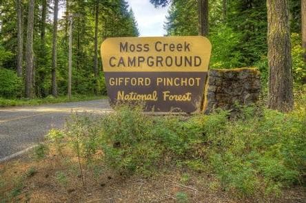
Overview Located in the southeast corner of the Gifford-Pinchot National Forest and close to Columbia River Gorge, Moss Creek Campground sits alongside the Little White Salmon River. At an elevation of 1,400 feet, the campground is shaded by a thick canopy of hemlock, cedars, firs and maples. Moss Creek is ideal for those wishing to escape the summer heat. Recreation The Little White Salmon River offers rainbow and brook trout for anglers. Visitors can enjoy wading in the cool waters. Facilities The Little White Salmon River offers rainbow and brook trout for anglers. Visitors can enjoy wading in the cool waters. Natural Features Located in southwest Washington State, the Gifford Pinchot National Forest encompasses 1.3 million acres and includes the 110,000-acre Mount St. Helens National Volcanic Monument, established by Congress in 1982. Moss Creek is located in the Mount Adams Ranger District in the easternmost portion of the Gifford Pinchot National Forest. Mount Adams is a prominent landmark on the District, where elevations range between 1,200 and 12,276 feet. The District features a great diversity of habitats, from old growth to second growth forest, wetland areas, low and high elevation meadows, glaciers and low and high elevation lakes. Nearby Attractions Moss Creek Campground is an excellent base for exploring the various sights around Mount Adams and the Columbia River Gorge. contact_info This location has limited staffing. Please call (509) 538-2060 for general information. Charges & Cancellations Cancellations Individual Campsites: Cancellations up to 2 days before a reservation start date incur a $10.00 cancellation fee. A visitor who cancels a reservation the day before or on the day of arrival will pay a $10.00 service fee AND forfeit the first night's use fee including tax and applicable add-on for a campsite. Cancellations for a one-night reservation will forfeit the entire amount paid and will not be subject to an additional service fee. No-Shows A no-show visitor is one who does not arrive at a campground and does not cancel the reservation by check-out time on the day after the scheduled arrival date. Staff will hold a campsite until check-out time on the day following the arrival date. No-shows are assessed $20.00 service fee and forfeit the first night's rate, taxes and applicable add-on for a campsite. Refunds Visitors may submit a refund request through their Recreation.gov profile within 7 days of the end date of their reservation. Refunds will not be issued after the 7 days has ended. Refunds for debit or credit card payments will be issued as a credit to the original bank or credit card used to pay. For check or cash purchases, Recreation.gov will mail a Treasury check for refunds of cash, check, or money order payments to the address associated with the reservation. Treasury check refunds may take up to 6-8 weeks to arrive. In the event of an emergency closure, the Recreation.gov team or facility manager will refund all fees and will attempt to notify you using the contact information within the Recreation.gov visitor profile.
View details →
Overview Oklahoma Campground is nestled in a lush grove of large hemlock, cedar, maple and fir trees alongside the Little White Salmon River, near the Columbia River Gorge. The campground is flat and is ideal for smaller groups to camp in clusters. Recreation Big Lava Bed is located just west of the campground. The trail takes hikers through a landscape marked by basalt lava formations and pine forest. The multi-use Monte Carlo Trail is also nearby and can be enjoyed by hikers, mountain bikers and horseback riders. Fishing and wading is permitted in the Little White Salmon River, where anglers can find brook and rainbow trout. Facilities Big Lava Bed is located just west of the campground. The trail takes hikers through a landscape marked by basalt lava formations and pine forest. The multi-use Monte Carlo Trail is also nearby and can be enjoyed by hikers, mountain bikers and horseback riders. Fishing and wading is permitted in the Little White Salmon River, where anglers can find brook and rainbow trout. Natural Features Located in southwest Washington State, the Gifford Pinchot National Forest encompasses 1.3 million acres and includes the 110,000-acre Mount St. Helens National Volcanic Monument established by Congress in 1982. Oklahoma Campground is located in the Mt. Adams Ranger District. Elevations here range between 1,200 feet at the Wind River Work Center, 12 miles north of Carson, WA and 12,276 feet at the summit of Mt. Adams. The Mount Adams Ranger District features largely diverse habitats and natural features, from old growth to second growth forest, wetland areas, low and high elevation meadows, glaciers, and low and high elevation lakes. contact_info This location has limited staffing. Please call (509) 427-3677 for general information. Nearby Attractions Oklahoma Campground's proximity to the Columbia River Gorge and Mount Adams, makes it an ideal base for exploring those areas. Charges & Cancellations Cancellations Individual Campsites: Cancellations up to 2 days before a reservation start date incur a $10.00 cancellation fee. A visitor who cancels a reservation the day before or on the day of arrival will pay a $10.00 service fee AND forfeit the first night's use fee including tax and applicable add-on for a campsite. Cancellations for a one-night reservation will forfeit the entire amount paid and will not be subject to an additional service fee. No-Shows A no-show visitor is one who does not arrive at a campground and does not cancel the reservation by check-out time on the day after the scheduled arrival date. Staff will hold a campsite until check-out time on the day following the arrival date. No-shows are assessed $20.00 service fee and forfeit the first night's rate, taxes and applicable add-on for a campsite. Refunds Visitors may submit a refund request through their Recreation.gov profile within 7 days of the end date of their reservation. Refunds will not be issued after the 7 days has ended. Refunds for debit or credit card payments will be issued as a credit to the original bank or credit card used to pay. For check or cash purchases, Recreation.gov will mail a Treasury check for refunds of cash, check, or money order payments to the address associated with the reservation. Treasury check refunds may take up to 6-8 weeks to arrive. In the event of an emergency closure, the Recreation.gov team or facility manager will refund all fees and will attempt to notify you using the contact information within the Recreation.gov visitor profile.
View details →
Overview North Fork Campground sits along the North fork of the Cispus River, shaded by a canopy of trees that include hemlock, maple and Douglas fir. This popular campground is typically open from mid-May through late September and offers standard sites in addition to the Bear, Beaver and Elk group sites. North Fork is situated between three of Washington's most impressive mountains: Mount St. Helens, Mt. Adams and Mt. Rainier. The variety of recreational activities and the diverse natural beauty draws many visitors to this area. Recreation North Fork Campground makes a great base camp for a variety of activities. Hikers, mountain bikers and OHV riders can access the nearby multi-use Valley Trail. From this trail, OHV riders can enjoy a network of over 50 miles of OHV trails. The North Fork Loop and River trails are open to foot traffic and can also be accessed in this area. Anglers can fish the Cispus River for brook trout, steelhead and salmon. Facilities North Fork Campground makes a great base camp for a variety of activities. Hikers, mountain bikers and OHV riders can access the nearby multi-use Valley Trail. From this trail, OHV riders can enjoy a network of over 50 miles of OHV trails. The North Fork Loop and River trails are open to foot traffic and can also be accessed in this area. Anglers can fish the Cispus River for brook trout, steelhead and salmon. Natural Features North Fork is part of the Cowlitz Valley Ranger District, which is located in the northernmost portion of the Gifford Pinchot National Forest. Located in southwest Washington state, the Gifford Pinchot National Forest encompasses 1.3 million acres and includes the 110,000-acre Mount St. Helens National Volcanic Monument established by Congress in 1982. This Ranger District manages four Wilderness Areas including the Goat Rocks Wilderness, Glacier View Wilderness, Tatoosh Wilderness and William O. Douglass Wilderness. Major River drainage includes the Cowlitz River, Clear Fork of the Cowlitz, and the Cispus River. A variety of wildlife may be spotted in this area, including elk, deer and bears. Nearby Attractions Randle is the closest town to North Fork, and offers access to the Windy Ridge Lookout at Mount St. Helens. Adventurous hikers who want to enjoy some spectacular views may be interested in the Tongue Mountain Trail, which climbs to an elevation of 4,838 feet. contact_info This location has limited staffing. Please call (360) 686-3008 for general information. Charges & Cancellations Cancellations Individual Campsites: Cancellations up to 2 days before a reservation start date incur a $10.00 cancellation fee. A visitor who cancels a reservation the day before or on the day of arrival will pay a $10.00 service fee AND forfeit the first night's use fee including tax and applicable add-on for a campsite. Cancellations for a one-night reservation will forfeit the entire amount paid and will not be subject to an additional service fee. No-Shows A no-show visitor is one who does not arrive at a campground and does not cancel the reservation by check-out time on the day after the scheduled arrival date. Staff will hold a campsite until check-out time on the day following the arrival date. No-shows are assessed $20.00 service fee and forfeit the first night's rate, taxes and applicable add-on for a campsite. Refunds Visitors may submit a refund request through their Recreation.gov profile within 7 days of the end date of their reservation. Refunds will not be issued after the 7 days has ended. Refunds for debit or credit card payments will be issued as a credit to the original bank or credit card used to pay. For check or cash purchases, Recreation.gov will mail a Treasury check for refunds of cash, check, or money order payments to the address associated with the reservation. Treasury check refunds may take up to 6-8 weeks to arrive. In the event of an emergency closure, the Recreation.gov team or facility manager will refund all fees and will attempt to notify you using the contact information within the Recreation.gov visitor profile.
View details →
Overview Iron Creek Campground sits near the confluence of Iron Creek and the Cispus River. This large campground winds through a forest of old-growth Douglas firs, cedars and hemlock. Lush vegetation and ample space between sites offers excellent privacy. Recreation Iron Creek provides great fishing for cutthroat trout, whitefish and rainbow trout. Visitors can stroll along the .3-mile Iron Creek Old Growth Trail and weave through the forest and along the Cispus River, or continue on a longer walk down the Iron Creek Campground Trail. This trail is barrier-free and designed to accommodate any age or skill level, with benches and plenty of places to stop along the way. Facilities Iron Creek provides great fishing for cutthroat trout, whitefish and rainbow trout. Visitors can stroll along the .3-mile Iron Creek Old Growth Trail and weave through the forest and along the Cispus River, or continue on a longer walk down the Iron Creek Campground Trail. This trail is barrier-free and designed to accommodate any age or skill level, with benches and plenty of places to stop along the way. Natural Features Located in southwest Washington State, the Gifford Pinchot National Forest encompasses 1.3 million acres and includes the 110,000-acre Mount St. Helens National Volcanic Monument established by Congress in 1982. Iron Creek is part of the Cowlitz Valley Ranger District, which is located in the northernmost portion of the Gifford Pinchot National Forest. This District is roughly located among three volcanic peaks: Mt. Rainier to the north, Mt. Adams to the east, and Mount St. Helens to the west. Nearby Attractions The Woods Creek Watchable Wildlife Interpretive Site is just up Forest Road 25 toward the town of Randle. Forest Road 25 is a popular scenic drive and provides excellent views of Mount St. Helens. The Windy Ridge Viewpoint at Mount St. Helens is approximately 20 miles away. contact_info This location has limited staffing. Please call (360) 686-3008 for general information. Charges & Cancellations Cancellations Individual Campsites: Cancellations up to 2 days before a reservation start date incur a $10.00 cancellation fee. A visitor who cancels a reservation the day before or on the day of arrival will pay a $10.00 service fee AND forfeit the first night's use fee including tax and applicable add-on for a campsite. Cancellations for a one-night reservation will forfeit the entire amount paid and will not be subject to an additional service fee. No-Shows A no-show visitor is one who does not arrive at a campground and does not cancel the reservation by check-out time on the day after the scheduled arrival date. Staff will hold a campsite until check-out time on the day following the arrival date. No-shows are assessed $20.00 service fee and forfeit the first night's rate, taxes and applicable add-on for a campsite. Refunds Visitors may submit a refund request through their Recreation.gov profile within 7 days of the end date of their reservation. Refunds will not be issued after the 7 days has ended. Refunds for debit or credit card payments will be issued as a credit to the original bank or credit card used to pay. For check or cash purchases, Recreation.gov will mail a Treasury check for refunds of cash, check, or money order payments to the address associated with the reservation. Treasury check refunds may take up to 6-8 weeks to arrive. In the event of an emergency closure, the Recreation.gov team or facility manager will refund all fees and will attempt to notify you using the contact information within the Recreation.gov visitor profile.
View details →
Overview Tower Rock Campground is named for the impressive pillar that looms nearby and offers semi-private sites shaded by a mix of cedar, Douglas fir and maple. Recreation A privately-owned trout pond offers fishing nearby, but anglers can also cast for brook trout in the Cispus River. The Burley Mountain trailhead is located off of Forest Road 28, about 4 miles from the Highway 23 intersection. From this trailhead, visitors can hike to multiple waterfalls, including Angel Falls. Facilities A privately-owned trout pond offers fishing nearby, but anglers can also cast for brook trout in the Cispus River. The Burley Mountain trailhead is located off of Forest Road 28, about 4 miles from the Highway 23 intersection. From this trailhead, visitors can hike to multiple waterfalls, including Angel Falls. Natural Features Tower Rock Campground is located about a quarter mile from the south bank of the Cispus River on the east side of Mount St. Helens. The terrain is mostly meadow and mountainside, as the campground is surrounded by mountains on almost every side. contact_info This location has limited staffing. Please call (360) 686-3008 for general information. Nearby Attractions Tower Rock Campground is just east of Mount St. Helens, making it a convenient base for exploring this volcanic monument. Layser Cave Interpretive Site, which has a short trail leading to the cave, is also nearby. Charges & Cancellations Cancellations Individual Campsites: Cancellations up to 2 days before a reservation start date incur a $10.00 cancellation fee. A visitor who cancels a reservation the day before or on the day of arrival will pay a $10.00 service fee AND forfeit the first night's use fee including tax and applicable add-on for a campsite. Cancellations for a one-night reservation will forfeit the entire amount paid and will not be subject to an additional service fee. No-Shows A no-show visitor is one who does not arrive at a campground and does not cancel the reservation by check-out time on the day after the scheduled arrival date. Staff will hold a campsite until check-out time on the day following the arrival date. No-shows are assessed $20.00 service fee and forfeit the first night's rate, taxes and applicable add-on for a campsite. Refunds Visitors may submit a refund request through their Recreation.gov profile within 7 days of the end date of their reservation. Refunds will not be issued after the 7 days has ended. Refunds for debit or credit card payments will be issued as a credit to the original bank or credit card used to pay. For check or cash purchases, Recreation.gov will mail a Treasury check for refunds of cash, check, or money order payments to the address associated with the reservation. Treasury check refunds may take up to 6-8 weeks to arrive. In the event of an emergency closure, the Recreation.gov team or facility manager will refund all fees and will attempt to notify you using the contact information within the Recreation.gov visitor profile.
View details →
Overview Nestled among tall conifers on the Adams Creek Fork of the Cispus River, Adams Fork Campground offers single sites for tent and RV camping, as well as three double sites, with several of the sites sitting along the banks of the river. Adams Fork Campground makes an excellent base from which to explore Mount St. Helens and the surrounding area. Nearby multi-use trails offer a myriad of recreational activities, in addition to trout fishing in the Cispus River. Recreation Part of the Randle Recreation Area, Adams Fork Campground is an ideal location for many recreational activities. The Valley Trail network, popular with dirt bikes and ATVs, offers 50 miles of multi-use trails close to this campground. Hikers, horseback riders and mountain bikers can also use the Valley Trail, which offers views of the Cispus River Valley and Tongue Mountain and anglers can fish for brook trout in the Cispus River. Facilities Part of the Randle Recreation Area, Adams Fork Campground is an ideal location for many recreational activities. The Valley Trail network, popular with dirt bikes and ATVs, offers 50 miles of multi-use trails close to this campground. Hikers, horseback riders and mountain bikers can also use the Valley Trail, which offers views of the Cispus River Valley and Tongue Mountain and anglers can fish for brook trout in the Cispus River. Natural Features Located in southwest Washington State, the Gifford Pinchot National Forest encompasses over 1.3 million acres, including the 110,000-acre Mount St. Helens National Volcanic Monument established by Congress in 1982. Adams Fork is part of the Cowlitz Valley Ranger District, which is located in the northernmost portion of the Gifford Pinchot National Forest in southwest Washington. This Ranger District manages four Wilderness Areas including the Goat Rocks Wilderness, Glacier View Wilderness, Tatoosh Wilderness and William O Douglass Wilderness. The Cispus River originates in a high glacial valley in the Goat Rocks Wilderness, and flows through heavily forested areas before before meeting the North Fork and flowing westerly past many trails and campgrounds. Nearby Attractions The nearby town of Randle offers an access point to the Windy Ridge viewpoint at Mount St. Helens. contact_info This location has limited staffing. Please call (360) 686-3008 for general information. Charges & Cancellations Cancellations Individual Campsites: Cancellations up to 2 days before a reservation start date incur a $10.00 cancellation fee. A visitor who cancels a reservation the day before or on the day of arrival will pay a $10.00 service fee AND forfeit the first night's use fee including tax and applicable add-on for a campsite. Cancellations for a one-night reservation will forfeit the entire amount paid and will not be subject to an additional service fee. No-Shows A no-show visitor is one who does not arrive at a campground and does not cancel the reservation by check-out time on the day after the scheduled arrival date. Staff will hold a campsite until check-out time on the day following the arrival date. No-shows are assessed $20.00 service fee and forfeit the first night's rate, taxes and applicable add-on for a campsite. Refunds Visitors may submit a refund request through their Recreation.gov profile within 7 days of the end date of their reservation. Refunds will not be issued after the 7 days has ended. Refunds for debit or credit card payments will be issued as a credit to the original bank or credit card used to pay. For check or cash purchases, Recreation.gov will mail a Treasury check for refunds of cash, check, or money order payments to the address associated with the reservation. Treasury check refunds may take up to 6-8 weeks to arrive. In the event of an emergency closure, the Recreation.gov team or facility manager will refund all fees and will attempt to notify you using the contact information within the Recreation.gov visitor profile.
View details →
Overview Walupt Lake Campground offers scenic views of Mt. Adams and the surrounding forest on the west end of Walupt Lake. The sites here provide plenty of privacy and ample shade form the surrounding hemlock, cedar and fir trees. Walupt Lake Campground is a great choice for visitors looking to fish, swim, boat or explore the numerous hiking, biking and horseback riding trails in the area. Recreation Anglers can fish for brook, rainbow and cutthroat trout in Walupt Lake. Swimming and the use of motorized and non-motorized boats is also permitted. Numerous trailheads can be accessed from this campground. Walupt Lake Trail, Nannie Ridge Trail and Coleman Weedpatch Trail are popular hiking and equestrian trails. Facilities Anglers can fish for brook, rainbow and cutthroat trout in Walupt Lake. Swimming and the use of motorized and non-motorized boats is also permitted. Numerous trailheads can be accessed from this campground. Walupt Lake Trail, Nannie Ridge Trail and Coleman Weedpatch Trail are popular hiking and equestrian trails. Natural Features Walupt Lake spans 384 acres and is the second largest lake in the Gifford Pinchot National Forest. The clear mountain waters are popular with anglers who come here to cast for Rainbow and Cutthroat Trout. This campground is surrounded by the Goat Rocks Wilderness, named for the rugged peaks where numerous mountain goats are found. Scattered throughout the area are alpine meadows, lakes and ponds. Nearby Attractions Walupt Lake's location between Mt. Adams, Mt. Rainier and Mount St. Helens makes it possible to explore any of these areas on a day trip. contact_info This location has limited staffing. Please call (360) 686-3008 for general information. Charges & Cancellations Cancellations Individual Campsites: Cancellations up to 2 days before a reservation start date incur a $10.00 cancellation fee. A visitor who cancels a reservation the day before or on the day of arrival will pay a $10.00 service fee AND forfeit the first night's use fee including tax and applicable add-on for a campsite. Cancellations for a one-night reservation will forfeit the entire amount paid and will not be subject to an additional service fee. No-Shows A no-show visitor is one who does not arrive at a campground and does not cancel the reservation by check-out time on the day after the scheduled arrival date. Staff will hold a campsite until check-out time on the day following the arrival date. No-shows are assessed $20.00 service fee and forfeit the first night's rate, taxes and applicable add-on for a campsite. Refunds Visitors may submit a refund request through their Recreation.gov profile within 7 days of the end date of their reservation. Refunds will not be issued after the 7 days has ended. Refunds for debit or credit card payments will be issued as a credit to the original bank or credit card used to pay. For check or cash purchases, Recreation.gov will mail a Treasury check for refunds of cash, check, or money order payments to the address associated with the reservation. Treasury check refunds may take up to 6-8 weeks to arrive. In the event of an emergency closure, the Recreation.gov team or facility manager will refund all fees and will attempt to notify you using the contact information within the Recreation.gov visitor profile.
View details →
Overview Paradise Creek sits at the confluence of Paradise Creek and the Wind River, nestled under an old-growth forest of cedars, firs, alder and maples. The sites by the river enjoy privacy from an abundance of lush undergrowth, while the other sites have a more open and spacious feel. The campground's remote location is ideal for campers seeking a quiet and relaxed environment. Recreation The Wind River provides excellent fishing, with a population of steelhead and Chinook salmon. Check state regulations for open season and boundries. Wading is permitted in Paradise Creek. Fishing is not permitted in the campground. Seasonal berry picking is a popular pastime and for visitors interested in hiking, there is access to the Lava Butte Trail 200 from the campground. Facilities The Wind River provides excellent fishing, with a population of steelhead and Chinook salmon. Check state regulations for open season and boundries. Wading is permitted in Paradise Creek. Fishing is not permitted in the campground. Seasonal berry picking is a popular pastime and for visitors interested in hiking, there is access to the Lava Butte Trail 200 from the campground. Natural Features Located in southwest Washington State, the Gifford Pinchot National Forest encompasses 1.3 million acres and includes the 110,000-acre Mount St. Helens National Volcanic Monument established by Congress in 1982. Paradise Creek Campground is located in the Mt. Adams Ranger District. Elevations here range between 1,200 feet at the Wind River Work Center, 12 miles north of Carson, WA and 12,276 feet at the summit of Mt. Adams. The Mount Adams Ranger District offers a large variety of habitats and natural features, from old growth to second growth forest, wetland areas, low and high elevation meadows, glaciers, and low and high elevation lakes. contact_info This location has limited staffing. Please call (360) 729-0018 for general information. Nearby Attractions Paradise Creek is an ideal base for exploring the different viewpoints around Mount St. Helens and Mt Adams. The nearest town is Carson, WA. Charges & Cancellations Cancellations Individual Campsites: Cancellations up to 2 days before a reservation start date incur a $10.00 cancellation fee. A visitor who cancels a reservation the day before or on the day of arrival will pay a $10.00 service fee AND forfeit the first night's use fee including tax and applicable add-on for a campsite. Cancellations for a one-night reservation will forfeit the entire amount paid and will not be subject to an additional service fee. No-Shows A no-show visitor is one who does not arrive at a campground and does not cancel the reservation by check-out time on the day after the scheduled arrival date. Staff will hold a campsite until check-out time on the day following the arrival date. No-shows are assessed $20.00 service fee and forfeit the first night's rate, taxes and applicable add-on for a campsite. Refunds Visitors may submit a refund request through their Recreation.gov profile within 7 days of the end date of their reservation. Refunds will not be issued after the 7 days has ended. Refunds for debit or credit card payments will be issued as a credit to the original bank or credit card used to pay. For check or cash purchases, Recreation.gov will mail a Treasury check for refunds of cash, check, or money order payments to the address associated with the reservation. Treasury check refunds may take up to 6-8 weeks to arrive. In the event of an emergency closure, the Recreation.gov team or facility manager will refund all fees and will attempt to notify you using the contact information within the Recreation.gov visitor profile.
View details →
Overview Beaver Campground is nestled among large, old maple and sycamore trees, offering a quiet and private family camping experience. Its location along the Wind River provides opportunities for anglers, but other recreational activities can be found in abundance here as well. On-site playground equipment and horseshoe games offer fun for all ages and the surrounding forest allows visitors the chance to discover many animal and plant species. Recreation The Wind River offers Chinook salmon and steelhead trout fishing for anglers.(check state regulations for season open/close) And the nearby Washington Department of Fish and Wildlife fish hatchery offers opportunities in the spring to view Chinook salmon. Kayaks and canoes are permitted on the Wind River and the surrounding area offers opportunities for hiking, horseback riding and biking. Berry picking is popular in season. Facilities The Wind River offers Chinook salmon and steelhead trout fishing for anglers.(check state regulations for season open/close) And the nearby Washington Department of Fish and Wildlife fish hatchery offers opportunities in the spring to view Chinook salmon. Kayaks and canoes are permitted on the Wind River and the surrounding area offers opportunities for hiking, horseback riding and biking. Berry picking is popular in season. Natural Features Located in southwest Washington State, the Gifford Pinchot National Forest encompasses over 1.3 million acres, including the 110,000-acre Mount St. Helens National Volcanic Monument established by Congress in 1982. Beaver Campground is located in the Mount Adams Ranger District, in the easternmost portion of the Gifford Pinchot National Forest. This district spans 367,000 acres and includes the Mt Adams Wilderness, Indian Heaven Wilderness and Trapper Creek Wilderness. Mt Adams, a potentially active stratovolcano and the second-tallest mountain in Washington state, is a prominent landmark of the District. Elevations here range between 1,200 feet at the Wind River Work Center (12 miles north of Carson, WA) and 12,276 feet at the summit of Mt. Adams. A great diversity of habitats and geological features are represented here, from old growth to second growth forests and wetland areas to low and high elevation meadows and lakes, as well as glaciers. contact_info This location has limited staffing. Please call (360) 729-0018 for general information. Nearby Attractions Beaver Campground is one of the closest Forest Service campsites to the Columbia River Gorge and Portland, Oregon. The nearby town of Carson is known for its hot springs, but visitors can also find the Wind River Arboretum, a golf course, restaurants and shopping. Charges & Cancellations Cancellations Individual Campsites: Cancellations up to 2 days before a reservation start date incur a $10.00 cancellation fee. A visitor who cancels a reservation the day before or on the day of arrival will pay a $10.00 service fee AND forfeit the first night's use fee including tax and applicable add-on for a campsite. Cancellations for a one-night reservation will forfeit the entire amount paid and will not be subject to an additional service fee. Group Sites Group Facility (including Cabins and Lookouts): A visitor who cancels a group overnight facility reservation less than 14 days before the arrival date will pay a $10.00 service fee AND forfeit the first night's use fee. No-Shows A no-show visitor is one who does not arrive at a campground and does not cancel the reservation by check-out time on the day after the scheduled arrival date. Staff will hold a campsite until check-out time on the day following the arrival date. No-shows are assessed $20.00 service fee and forfeit the first night's rate, taxes and applicable add-on for a campsite. Refunds Visitors may submit a refund request through their Recreation.gov profile within 7 days of the end date of their reservation. Refunds will not be issued after the 7 days has ended. Refunds for debit or credit card payments will be issued as a credit to the original bank or credit card used to pay. For check or cash purchases, Recreation.gov will mail a Treasury check for refunds of cash, check, or money order payments to the address associated with the reservation. Treasury check refunds may take up to 6-8 weeks to arrive. In the event of an emergency closure, the Recreation.gov team or facility manager will refund all fees and will attempt to notify you using the contact information within the Recreation.gov visitor profile.
View details →
Overview Indian Creek Campground is located at the edge of Rimrock Lake in the Wenatchee National Forest in Washington's North Cascades Range. The campground's proximity to high alpine lakes, lush forests and towering peaks in nearby wilderness areas make it a popular destination for outdoor enthusiasts. Recreation Indian Creek Campground offers outdoor enthusiasts the opportunity to hike, fish, ski, raft and enjoy a multitude of recreational activities throughout the year. Beautiful rivers and streams, high elevation lakes and reservoirs provide an endless number of fishing opportunities for the experienced and beginning angler. Opportunities abound to pursue or view the legendary salmon and steelhead, several species of trout or a variety of warm-water fish. River enthusiasts enjoy whitewater rafting trips on one of the many scenic rivers in the area. The Tieton River is especially exciting in September when the Bureau of Land Reclamation floods the Tieton Valley, releasing fast and furious water. Facilities Indian Creek Campground offers outdoor enthusiasts the opportunity to hike, fish, ski, raft and enjoy a multitude of recreational activities throughout the year. Beautiful rivers and streams, high elevation lakes and reservoirs provide an endless number of fishing opportunities for the experienced and beginning angler. Opportunities abound to pursue or view the legendary salmon and steelhead, several species of trout or a variety of warm-water fish. River enthusiasts enjoy whitewater rafting trips on one of the many scenic rivers in the area. The Tieton River is especially exciting in September when the Bureau of Land Reclamation floods the Tieton Valley, releasing fast and furious water. Natural Features Rimrock Lake, adjacent to the campground and along the course of the Tieton River, is surrounded by rugged mountain terrain, wetlands and diverse conifer forests. The area around the campground supports wildlife such as mountain goats, native fish and migratory birds. Endangered and threatened species, including American bald eagles, northern spotted owls, gray wolves and grizzly bears also find havens in nearby areas. Precipitation varies greatly thoughout the area, ranging from approximately 140 inches along the Cascade Crest to only 10 inches along the eastern edge. Visitors to the area can expect many days of warm, sunny weather in the summer, and plenty of snow in the winter. Nearby Attractions Boulder Cave National Recreation Trail is one of the most popular places in the Naches District. Visitors can walk the accessible trail along the river or explore Boulder Cave. Interpretive signs along the trail explain the geology, plants, animals and fire history of the area. Hikers may want to traverse a portion of the spectacular Pacific Crest Trail (PCT), one of the world's premier National Scenic Trails. This trail showcases some of North America's most fantastic scenery as it winds its way from Mexico to Canada through California, Oregon and Washington. contact_info This location has limited staffing. Please call (661) 702-1420 for general information. Charges & Cancellations Cancellations Individual Campsites: Cancellations up to 2 days before a reservation start date incur a $10.00 cancellation fee. A visitor who cancels a reservation the day before or on the day of arrival will pay a $10.00 service fee AND forfeit the first night's use fee including tax and applicable add-on for a campsite. Cancellations for a one-night reservation will forfeit the entire amount paid and will not be subject to an additional service fee. No-Shows A no-show visitor is one who does not arrive at a campground and does not cancel the reservation by check-out time on the day after the scheduled arrival date. Staff will hold a campsite until check-out time on the day following the arrival date. No-shows are assessed $20.00 service fee and forfeit the first night's rate, taxes and applicable add-on for a campsite. Refunds Visitors may submit a refund request through their Recreation.gov profile within 7 days of the end date of their reservation. Refunds will not be issued after the 7 days has ended. Refunds for debit or credit card payments will be issued as a credit to the original bank or credit card used to pay. For check or cash purchases, Recreation.gov will mail a Treasury check for refunds of cash, check, or money order payments to the address associated with the reservation. Treasury check refunds may take up to 6-8 weeks to arrive. In the event of an emergency closure, the Recreation.gov team or facility manager will refund all fees and will attempt to notify you using the contact information within the Recreation.gov visitor profile.
View details →
Overview Shaded by a dense canopy of pine, fir and cedar trees, North Fork Bear Group sits alongside the Cispus River in the North Fork Campground. Typically open from mid-May to late September, North Fork Bear Group is one of three popular group sites within the campground. North Fork is situated between three of Washington's most impressive mountains; Mount St. Helens, Mt. Adams and Mt. Rainier. The variety of recreational activities and the diverse natural beauty draws many visitors to this area. Recreation North Fork Bear Group makes a great base camp for a variety of activities. Hikers, mountain bikers and off-road vehicle riders can access the nearby multi-use Valley Trail. From this trail, riders can enjoy a network of over 50 miles of additional off-road vehicle trails. The North Fork Loop trail is open to foot traffic and can also be accessed in this area. Anglers can fish the Cispus River for brook trout, steelhead and salmon. Facilities North Fork Bear Group makes a great base camp for a variety of activities. Hikers, mountain bikers and off-road vehicle riders can access the nearby multi-use Valley Trail. From this trail, riders can enjoy a network of over 50 miles of additional off-road vehicle trails. The North Fork Loop trail is open to foot traffic and can also be accessed in this area. Anglers can fish the Cispus River for brook trout, steelhead and salmon. Natural Features Located in southwest Washington state, the Gifford Pinchot National Forest encompasses 1.3 million acres and includes the 110,000-acre Mount St. Helens National Volcanic Monument, established by Congress in 1982. North Fork is part of the Cowlitz Valley Ranger District, which is located in the northernmost portion of the Gifford Pinchot National Forest. This Ranger District manages four Wilderness Areas including the Goat Rocks, Glacier View, Tatoosh and William O. Douglass Wilderness. Nearby rivers include the Cowlitz River, Clear Fork of the Cowlitz and the Cispus River. A variety of wildlife may be spotted in this area, including elk, deer and bears. Nearby Attractions Randle is the closest town to North Fork, and it offers access to the Windy Ridge Lookout at Mount St. Helens. Adventurous hikers who want to enjoy some spectacular views may be interested in the Tongue Mountain Trail, which reaches an elevation of 4,838 feet. contact_info This location is unstaffed. To speak with our main office for general information, please call: (360) 686-3008. Charges & Cancellations Group Sites Group Facility (including Cabins and Lookouts): A visitor who cancels a group overnight facility reservation less than 14 days before the arrival date will pay a $10.00 service fee AND forfeit the first night's use fee. No-Shows A no-show visitor is one who does not arrive at a campground and does not cancel the reservation by check-out time on the day after the scheduled arrival date. Staff will hold a campsite until check-out time on the day following the arrival date. No-shows are assessed $20.00 service fee and forfeit the first night's rate, taxes and applicable add-on for a campsite. Refunds Visitors may submit a refund request through their Recreation.gov profile within 7 days of the end date of their reservation. Refunds will not be issued after the 7 days has ended. Refunds for debit or credit card payments will be issued as a credit to the original bank or credit card used to pay. For check or cash purchases, Recreation.gov will mail a Treasury check for refunds of cash, check, or money order payments to the address associated with the reservation. Treasury check refunds may take up to 6-8 weeks to arrive. In the event of an emergency closure, the Recreation.gov team or facility manager will refund all fees and will attempt to notify you using the contact information within the Recreation.gov visitor profile.
View details →
Overview North Fork Beaver Group sits alongside the Cispus River in the North Fork Campground, shaded by a dense canopy of pine, fir and cedar trees. Typically open from mid-May through late September, North Fork Beaver Group is one of three popular group sites within the compound. North Fork is situated between three of Washington's most impressive mountains: Mount St. Helens, Mt. Adams and Mt. Rainier. The variety of recreational activities and the diverse natural beauty draws many visitors to this area. Recreation North Fork Beaver Group makes a great base camp for a variety of activities. Hikers, mountain bikers and OHV riders can access the nearby multi-use Valley Trail. From this trail, OHV riders can enjoy a network of over 50 miles of OHV trails. The North Fork Loop trail is open to foot traffic and can also be accessed in this area. Anglers can fish the Cispus River for brook trout, steelhead and salmon. Facilities North Fork Beaver Group makes a great base camp for a variety of activities. Hikers, mountain bikers and OHV riders can access the nearby multi-use Valley Trail. From this trail, OHV riders can enjoy a network of over 50 miles of OHV trails. The North Fork Loop trail is open to foot traffic and can also be accessed in this area. Anglers can fish the Cispus River for brook trout, steelhead and salmon. Natural Features North Fork is part of the Cowlitz Valley Ranger District, which is located in the northernmost portion of the Gifford Pinchot National Forest. Located in southwest Washington state, the Gifford Pinchot National Forest encompasses 1.3 million acres and includes the 110,000-acre Mount St. Helens National Volcanic Monument established by Congress in 1982. This Ranger District manages four Wilderness Areas including the Goat Rocks Wilderness, Glacier View Wilderness, Tatoosh Wilderness and William O. Douglass Wilderness. Major River drainage includes the Cowlitz River, Clear Fork of the Cowlitz and the Cispus River. A variety of wildlife may be spotted in this area, including elk, deer and bears. contact_info This location is unstaffed. To speak with our main office for general information, please call: (360) 686-3008. Nearby Attractions Randle is the closest town to North Fork, and offers access to the Windy Ridge Lookout at Mount St. Helens. Adventurous hikers who want to enjoy some spectacular views may be interested in the Tongue Mountain Trail, which climbs to an elevation of 4,838 feet. Charges & Cancellations Group Sites Group Facility (including Cabins and Lookouts): A visitor who cancels a group overnight facility reservation less than 14 days before the arrival date will pay a $10.00 service fee AND forfeit the first night's use fee. No-Shows A no-show visitor is one who does not arrive at a campground and does not cancel the reservation by check-out time on the day after the scheduled arrival date. Staff will hold a campsite until check-out time on the day following the arrival date. No-shows are assessed $20.00 service fee and forfeit the first night's rate, taxes and applicable add-on for a campsite. Refunds Visitors may submit a refund request through their Recreation.gov profile within 7 days of the end date of their reservation. Refunds will not be issued after the 7 days has ended. Refunds for debit or credit card payments will be issued as a credit to the original bank or credit card used to pay. For check or cash purchases, Recreation.gov will mail a Treasury check for refunds of cash, check, or money order payments to the address associated with the reservation. Treasury check refunds may take up to 6-8 weeks to arrive. In the event of an emergency closure, the Recreation.gov team or facility manager will refund all fees and will attempt to notify you using the contact information within the Recreation.gov visitor profile.
View details →
Overview North Fork Elk Group sits alongside the Cispus River in the North Fork Campground, shaded by a dense canopy of pine, fir and cedar trees. The facility is typically open from mid-May through late September, and is one one of three group sites within the campground. North Fork is situated between three of Washington's most impressive mountains: Mount St. Helens, Mt. Adams and Mt. Rainier. The variety of recreational activities and the diverse natural beauty draws many visitors to this area. Recreation North Fork Elk Group makes a great base camp for a variety of activities. Hikers, mountain bikers and OHV riders can access the nearby multi-use Valley Trail. From this trail, OHV riders can enjoy a network of over 50 miles of OHV trails. The North Fork Loop trail is open to foot traffic and can also be accessed in this area. Anglers can fish the Cispus River for brook trout, steelhead and salmon. Facilities North Fork Elk Group makes a great base camp for a variety of activities. Hikers, mountain bikers and OHV riders can access the nearby multi-use Valley Trail. From this trail, OHV riders can enjoy a network of over 50 miles of OHV trails. The North Fork Loop trail is open to foot traffic and can also be accessed in this area. Anglers can fish the Cispus River for brook trout, steelhead and salmon. Natural Features North Fork is part of the Cowlitz Valley Ranger District, which is located in the northernmost portion of the Gifford Pinchot National Forest. Located in southwest Washington state, the Gifford Pinchot National Forest encompasses 1.3 million acres and includes the 110,000-acre Mount St. Helens National Volcanic Monument established by Congress in 1982. This Ranger District manages four Wilderness Areas including the Goat Rocks Wilderness, Glacier View Wilderness, Tatoosh Wilderness and William O. Douglass Wilderness. Major River drainage includes the Cowlitz River, Clear Fork of the Cowlitz, and the Cispus River. A variety of wildlife may be spotted in this area, including elk, deer and bears. Nearby Attractions Randle is the closest town to North Fork, and it offers access to the Windy Ridge Lookout at Mount St. Helens. Adventurous hikers who want to enjoy some spectacular views may be interested in the Tongue Mountain Trail, which climbs to an elevation of 4,838 feet. contact_info This location is unstaffed. To speak with our main office for general information, please call: (360) 686-3008. Charges & Cancellations Group Sites Group Facility (including Cabins and Lookouts): A visitor who cancels a group overnight facility reservation less than 14 days before the arrival date will pay a $10.00 service fee AND forfeit the first night's use fee. No-Shows A no-show visitor is one who does not arrive at a campground and does not cancel the reservation by check-out time on the day after the scheduled arrival date. Staff will hold a campsite until check-out time on the day following the arrival date. No-shows are assessed $20.00 service fee and forfeit the first night's rate, taxes and applicable add-on for a campsite. Refunds Visitors may submit a refund request through their Recreation.gov profile within 7 days of the end date of their reservation. Refunds will not be issued after the 7 days has ended. Refunds for debit or credit card payments will be issued as a credit to the original bank or credit card used to pay. For check or cash purchases, Recreation.gov will mail a Treasury check for refunds of cash, check, or money order payments to the address associated with the reservation. Treasury check refunds may take up to 6-8 weeks to arrive. In the event of an emergency closure, the Recreation.gov team or facility manager will refund all fees and will attempt to notify you using the contact information within the Recreation.gov visitor profile.
View details →
Overview The Campground sits along Panther Creek at the intersection of the Pacific Crest Trail. Driving on FR65, 4.7 miles upstream from the campground, visitors can enjoy an easy hike to Panther Falls. Campers can enjoy the privacy provided by a variety of shade-loving plants and a thick forest of cedars, ash, firs and alder. Recreation Hikers have close access to the Pacific Crest Trail, which spans 2,663 miles from Mexico to Canada. Outstanding scenic views are available all along this trail. Facilities Hikers have close access to the Pacific Crest Trail, which spans 2,663 miles from Mexico to Canada. Outstanding scenic views are available all along this trail. Natural Features Located in southwest Washington State, the Gifford Pinchot National Forest encompasses 1.3 million acres and includes the 110,000-acre Mount St. Helens National Volcanic Monument established by Congress in 1982. Panther Creek Campground is located in the Mt. Adams Ranger District. Elevations here range between 1,200 feet at the Wind River Work Center, 12 miles north of Carson, WA and 12,276 feet at the summit of Mt. Adams. The Mount Adams Ranger District offers a diverse array of habitats and natural features, from old growth to second growth forest, wetland areas, low and high elevation meadows, glaciers, and low and high elevation lakes. Nearby Attractions Panther Creek Campground makes a great base to explore Mount Adams and the Columbia River Gorge. The town of Carson is nearby, which is known for its hot springs. It also has a golf course, restaurants and shopping. contact_info This location has limited staffing. Please call (509) 427-3677 for general information. Charges & Cancellations Cancellations Individual Campsites: Cancellations up to 2 days before a reservation start date incur a $10.00 cancellation fee. A visitor who cancels a reservation the day before or on the day of arrival will pay a $10.00 service fee AND forfeit the first night's use fee including tax and applicable add-on for a campsite. Cancellations for a one-night reservation will forfeit the entire amount paid and will not be subject to an additional service fee. No-Shows A no-show visitor is one who does not arrive at a campground and does not cancel the reservation by check-out time on the day after the scheduled arrival date. Staff will hold a campsite until check-out time on the day following the arrival date. No-shows are assessed $20.00 service fee and forfeit the first night's rate, taxes and applicable add-on for a campsite. Refunds Visitors may submit a refund request through their Recreation.gov profile within 7 days of the end date of their reservation. Refunds will not be issued after the 7 days has ended. Refunds for debit or credit card payments will be issued as a credit to the original bank or credit card used to pay. For check or cash purchases, Recreation.gov will mail a Treasury check for refunds of cash, check, or money order payments to the address associated with the reservation. Treasury check refunds may take up to 6-8 weeks to arrive. In the event of an emergency closure, the Recreation.gov team or facility manager will refund all fees and will attempt to notify you using the contact information within the Recreation.gov visitor profile.
View details →
Overview Boardman Group Campground is located about 8 miles east of the Verlot Public Service Center along scenic Mountain Loop Scenic Byway through Mt. Baker-Snoqualmie National Forest. The campground is located on the banks of the tranquil Stillaguamish River, in close proximity to several wilderness areas. Recreation In addition to being a prime location for hiking, fishing, picnicking and horseback riding in summer and early fall, visitors can take advantage of skiing and snowshoeing in the winter months. Anglers enjoy fishing from the gently-flowing Stillaguamish River, which sustains populations chinook, coho, chum, pink and sockeye salmon, steelhead trout, sea-run cutthroat and bull trout. Facilities In addition to being a prime location for hiking, fishing, picnicking and horseback riding in summer and early fall, visitors can take advantage of skiing and snowshoeing in the winter months. Anglers enjoy fishing from the gently-flowing Stillaguamish River, which sustains populations chinook, coho, chum, pink and sockeye salmon, steelhead trout, sea-run cutthroat and bull trout. Natural Features The Mt. Baker-Snoqualmie National Forest offers visitors the chance to explore the region's rugged peaks, scenic rivers, and interesting wildlife within the forest and surrounding designated wilderness areas. Visitors will find unique ecosystems along the banks of the Stillaguamish River. Old-growth forests of cedar, fir and hemlock line the wide, gently-flowing river and tower over trails winding through moss-covered rocks. On a clear day visitors will see Mt. Baker, the most prominent feature of the Mt. Baker Wilderness Area. Rising to an elevation of 10,781 feet, the active volcano is perpetually snow-capped and mantled with an extensive network of creeping glaciers. Mt. Baker's summit, Grant Peak, is a 1,300-foot-deep mound of ice, which hides a massive volcanic crater. Undeveloped wilderness, clean streams and diverse forests provide important habitat for wildlife, including birds, amphibians, reptiles and more rare species such as lynx, moose, wolves, and wolverine. Grizzly bear sightings have been confirmed in the Cascade region, though black bears are more common. contact_info For facility specific information, please call (530) 932-0242. Nearby Attractions Traverse a portion of the spectacular Pacific Crest Trail (PCT), one of the world's premier National Scenic Trails. This trail showcases some of North America's most fantastic scenery as it winds its way from Mexico to Canada through California, Oregon and Washington. Charges & Cancellations Once your reservation start date has begun, neither the Recreation.gov Contact Center nor the campground manager will be able to modify your reservation.
View details →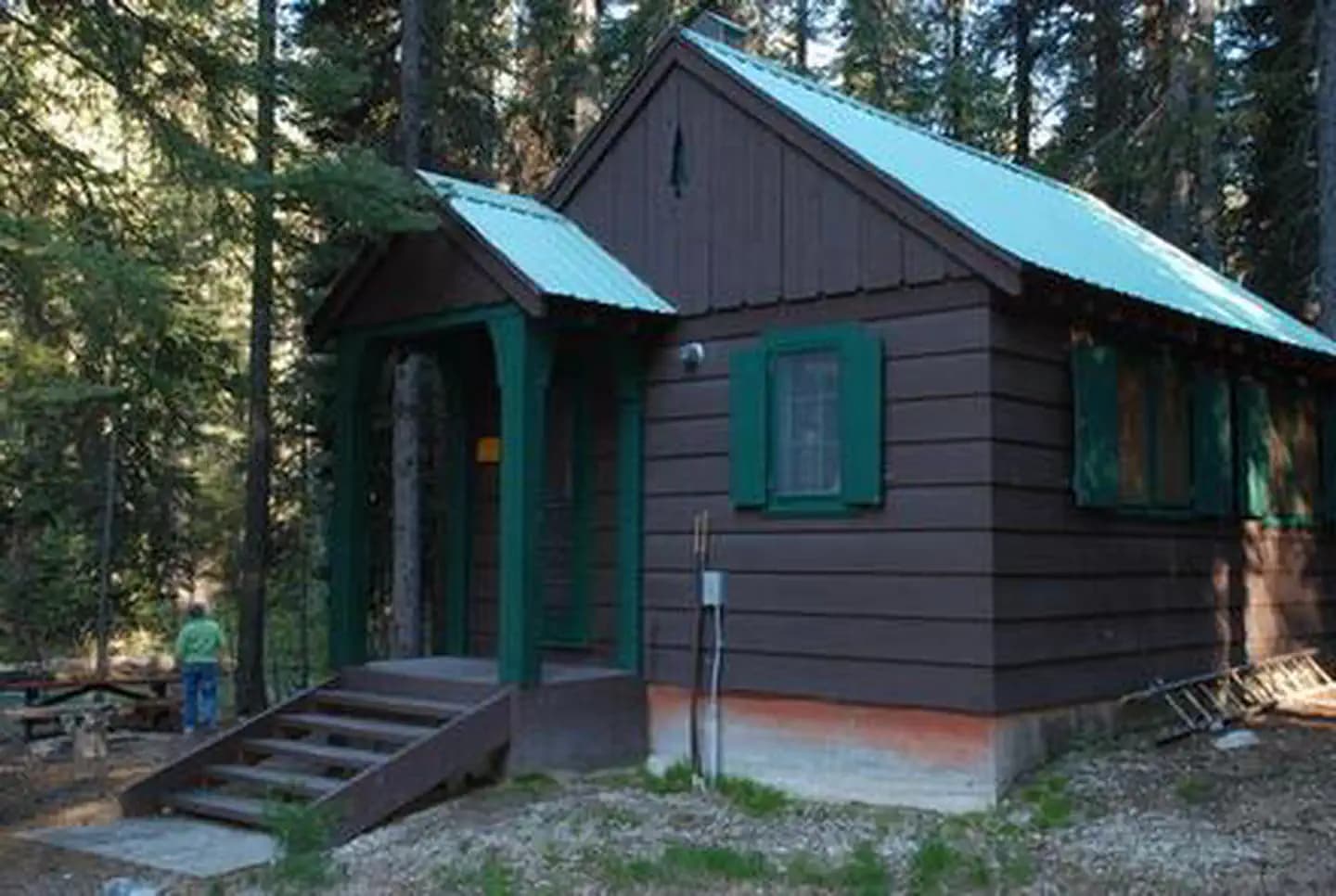
Overview Cottonwood Cabin is located in the Okanogan-Wenatchee National Forest, Entiat Ranger District in central Washington's Entiat Valley, on the banks of the Entiat River at an elevation of 3,100 feet. Constructed in the 1940s as administrative housing, the facility and on-site barn and corral were used seasonally by Forest Service fire, trail and campground crew personnel. Today the cabin offers visitors a wonderful setting for recreation and relaxation from June through October in the forested mountain terrain of the Entiat Ranger District. The cabin can be reached by standard passenger vehicles over gravel roads. Recreation Guests at Cottonwood Cabin will find that the surrounding area offers opportunities to hike, fish, mountain bike and enjoy a long list of outdoor recreational activities throughout the year. Anglers will enjoy casting a line into the Entiat River above Entiat Falls. The cabin is located four miles above the falls. Carving through a wide, U-shaped valley, the river is dominated by relatively shallow riffles interspersed with pools, plunge pools and glides where the trout fishing is quite good. Populations of rainbow trout, Cutthroat trout, and Eastern brook trout are found in this tributary. Selective gear rules apply to fishing in the Entiat River. See Washington Department of Fish and Wildlife for fishing rules and regulations. Facilities Guests at Cottonwood Cabin will find that the surrounding area offers opportunities to hike, fish, mountain bike and enjoy a long list of outdoor recreational activities throughout the year. Anglers will enjoy casting a line into the Entiat River above Entiat Falls. The cabin is located four miles above the falls. Carving through a wide, U-shaped valley, the river is dominated by relatively shallow riffles interspersed with pools, plunge pools and glides where the trout fishing is quite good. Populations of rainbow trout, Cutthroat trout, and Eastern brook trout are found in this tributary. Selective gear rules apply to fishing in the Entiat River. See Washington Department of Fish and Wildlife for fishing rules and regulations. Natural Features The Okanogan-Wenatchee National Forest offers stunning scenic vistas, with high, glaciated alpine peaks, valleys of old growth forest and rugged shrub-steppe country making up the diverse landscape. Elevations range from below 1,000 feet to more than 9,000 feet. The surrounding forest provides excellent habitat for a wide range of wildlife. Precipitation varies greatly throughout the area, ranging from approximately 140 inches along the Cascade Crest to only 10 inches along the eastern edge. Visitors can expect many days of warm, sunny weather in the summer, and winters with clear skies and plenty of snow. Nestled in a mature lodge pole pine and spruce forest, the area surrounding the cabin is home to abundant wildlife, including mule deer, cougars, native fish, black bears, pine marten, moose, bald and golden eagles and a variety of woodpeckers and owls. Nearby Attractions The Silver Falls National Recreation Trail is a 1.8 mile hike beneath towering cedar and pines, along Silver Creek to the base of Silver Falls. Along the way, hikers are treated to views of the 141-foot cascade, as well as the Entiat valley below, and the mountains above. Beautiful stone staircases and bridges along the trail offer many stopping points to take the perfect photograph. At Entiat River Road mile marker 27.8 is Box Canyon. This geological formation is about 65 million years in the making and the chasm spans a run of about 500 feet and ranges from 75-150 ft. deep. Fish Tail Falls can be observed from the view point running over, under and through a pile of large boulders, cascading another 15 feet. At times you can see salmon in this pool. At mile marker 32.2 on Entiat River Road is Entiat Falls. This broad 25 foot cascading natural waterfall makes quite a rejuvenating impression. Bring a picnic lunch or just stretch your legs and enjoy. Take precaution as river rock can be very slick. Cooper's Store and Cafe in Ardenvoir is approximately 28 miles down valley and is the nearest source of gasoline, groceries, miscellaneous camping supplies and telephone services.
View details →
Overview Swift Creek Campground is tucked into a mixed-conifer forest at the edge of Baker Lake in Mt. Baker-Snoqualmie National Forest. Recreation In addition to being a prime location for hiking, boating, fishing, picnicking, and horseback riding in summer and early fall, Swift Creek offers opportunities for snowshoeing in the winter months. With a small beach on-site and access to Baker Lake, visitors will have plenty of opportunities to fish, kayak, canoe and swim. The nearby Baker Lake Trail is a family friendly hike that begins in a majestic stand of Douglas fir. In 1843, a small eruption of Mt. Baker caused a forest fire, and visitors can still see the burned snags of virgin cedar trees that once dominated the area. The trail contours above the eastern shoreline of Baker Lake. Facilities In addition to being a prime location for hiking, boating, fishing, picnicking, and horseback riding in summer and early fall, Swift Creek offers opportunities for snowshoeing in the winter months. With a small beach on-site and access to Baker Lake, visitors will have plenty of opportunities to fish, kayak, canoe and swim. The nearby Baker Lake Trail is a family friendly hike that begins in a majestic stand of Douglas fir. In 1843, a small eruption of Mt. Baker caused a forest fire, and visitors can still see the burned snags of virgin cedar trees that once dominated the area. The trail contours above the eastern shoreline of Baker Lake. Natural Features The Mt. Baker-Snoqualmie National Forest showcases rugged peaks, sparkling alpine lakes and old-growth forests, providing visitors with unique and surprising landscapes. Mt. Baker, the most prominent feature of the Mt. Baker Wilderness, dominates the landscape on a clear day. Rising to an elevation of 10,781 feet, the active volcano is perpetually snow-capped and mantled with an extensive network of creeping glaciers. Mt. Baker's summit, Grant Peak, is a 1,300-foot-deep mound of ice, which hides a massive volcanic crater. Wildlife in the area includes mountain goats traversing the higher elevations to squirrels and black bears in the forests. Migratory birds and native fish find ample habitat in the varied ecosystems as well. contact_info For facility specific information, please call (530) 932-0242. Nearby Attractions Hike in the mountains above the lake in the Mt. Baker National Recreation Area or Mt. Baker Wilderness, or take some time to visit North Cascades National Park. This unique park is like no other place on earth. It features a deep blue lake surrounded by sheer, 2,000' cliffs, two picturesque islands and a violent volcanic past. Hiking trails, a visitor center and educational programs are available. Charges & Cancellations Once your reservation start date has begun, neither the Recreation.gov Contact Center nor the campground manager will be able to modify your reservation.
View details →
Overview Coho Campground is situated on the west shore of Wynoochee Lake, part of the emerald paradise that is Olympic National Forest. Evergreen conifers and hardwoods provide a beautiful wooded setting. Recreation Recreational opportunities abound, including picnicking, swimming, hiking, boating, hunting and fishing, all possible within the area. The Working Forest Nature Trail, an accessible trail beginning inside the campground, is a 1/2-mile interpretive journey into how the natural resources are hard at work providing opportunities and commodities for the American public. Facilities Recreational opportunities abound, including picnicking, swimming, hiking, boating, hunting and fishing, all possible within the area. The Working Forest Nature Trail, an accessible trail beginning inside the campground, is a 1/2-mile interpretive journey into how the natural resources are hard at work providing opportunities and commodities for the American public. Natural Features Olympic National Forest is located on the Olympic Peninsula in the northwest corner of Washington State, known as the Evergreen State. The Olympic Peninsula is an unique geographic province consisting of five major landscapes: temperate rain forest, rugged mountain terrain, large lowland lakes, cascading rivers and saltwater beaches. Here the flora and fauna provide interest beyond the imagination. Nearby Attractions Scenic Spoon Creek Falls and Wynoochee Falls are both accessed by short trails nearby. The 16-mile Wynoochee Lake Shore Trail circles the entire lake and is open to mountain bikes. At the nearby Wynoochee Dam, visitors can enjoy exhibits at the vista overlook and a dramatic view of the river gorge just below the dam. Swimming and picnicking facilities are available at the dam.
View details →
Overview Charbonneau Park in Eastern Washington was named one of America's Top 100 Family Campgrounds. It is located on Lake Sacajawea, formed by Ice Harbor Lock and Dam on the Lower Snake River. The park was named for Toussaint Charbonneau, an interpreter for Lewis and Clark and husband of Sacajawea, the famous Shoshone interpreter on the Corps of Discovery. The park provides excellent recreational opportunities for boaters, campers, upland and waterfowl hunters and anglers. Recreation The lake provides great boating and swimming opportunities, and a boat ramp is provided for guests. Fishing is also a popular pastime, and anglers will find excellent salmon and steelhead fishing on the lake. Facilities The lake provides great boating and swimming opportunities, and a boat ramp is provided for guests. Fishing is also a popular pastime, and anglers will find excellent salmon and steelhead fishing on the lake. Natural Features The campground is situated on the banks of Lake Sacajawea, and several of its waterfront sites have scenic views of the lake. The park is characterized by its open grassy areas dotted with a few large shade trees. contact_info For local information, please call (509) 547-2048 or call (877) 444-6777 for general information.
View details →
Overview Fishhook Park is located on the shores on Lake Sacajawea in Eastern Washington. The lake is formed by Ice Harbor Lock and Dam on the Lower Snake River. The park was named for Fishhook Rapids, which were once nearby, where Lewis and Clark spent time in October 1805. Today Fishhook is a fishing destination, as the name implies, attracting boaters and anglers alike to its black rock canyons. Visitors also enjoy camping, upland hunting, hiking, swimming and water sports. Recreation The lake provides great boating and swimming opportunities, and a boat ramp is provided for guests. Fishing is also a popular pastime, and anglers will find excellent salmon and steelhead fishing on the lake. Facilities The lake provides great boating and swimming opportunities, and a boat ramp is provided for guests. Fishing is also a popular pastime, and anglers will find excellent salmon and steelhead fishing on the lake. Natural Features The campground is situated on the waterfront. Visitors enjoy relaxing in the shade under the mature trees scattered throughout the park. contact_info For local information, please call (509) 547-2048 or call (877) 444-6777 for general information.
View details →
Overview Hood Park is located on Lake Wallula in eastern Washington. The lake is formed by McNary Lock and Dam on the Mid-Columbia River. Lewis and Clark camped two miles downstream at the confluence of the Snake and Columbia Rivers, which is now the location of Sacajawea State Park. Visitors enjoy camping, fishing, boating, hiking, picnicking and swimming. Recreation The lake provides great boating and swimming opportunities, and a boat ramp is provided for guests. Fishing is also a popular pastime, and anglers will find excellent salmon and steelhead fishing on the lake. Facilities The lake provides great boating and swimming opportunities, and a boat ramp is provided for guests. Fishing is also a popular pastime, and anglers will find excellent salmon and steelhead fishing on the lake. Natural Features The campground is situated along the banks of the lake, offering sweeping views. Campers enjoy relaxing in the shade of the mature trees throughout the park. contact_info For local information, please call (509) 547-2048 or call (877) 444-6777 for general information. Nearby Attractions The McNary National Wildlife Refuge is adjacent to the park. It provides habitat for migrating waterfowl, bald eagles, shorebirds and other wildlife. Nature trails and an environmental learning center are open to the public.
View details →
Overview Plymouth Campground is located by the small town of Plymouth, Washington. The day use area and boat launch are on a small island on Lake Umatilla on the Columbia River. Popular activities in the area include fishing, swimming, boating, water skiing and hunting. Recreation Visitors enjoy boating, water sports and swimming in the river. Anglers fish for Chinook, steelhead, walleye, sturgeon, and shad. The boat ramp is located at the day use area for convenient river access. Facilities Visitors enjoy boating, water sports and swimming in the river. Anglers fish for Chinook, steelhead, walleye, sturgeon, and shad. The boat ramp is located at the day use area for convenient river access. Natural Features The park is situated in a high desert environment on an island on the Columbia River. The island is covered with tall sage and Russian Olive trees, but shade is limited. Wildlife is abundant in the area, and mule deer, waterfowl and raptors are commonly seen. Nearby Attractions McNary Dam and Visitor Center and Lake Wallula are two miles upstream from the campground. The lake offers additional opportunities for boating, swimming and fishing.
View details →
Overview Windust Park is located on Lake Sacajawea in Eastern Washington. The lake is formed by Ice Harbor Dam on the Lower Snake River. The remoteness of this park is popular with regional visitors looking for a quiet area to get away from it all. The park provides recreational opportunities for boaters, campers, hikers and anglers alike. Natural Features: The campground is situated on the waterfront. Visitors enjoy relaxing in the shade under the mature trees scattered throughout the park. Recreation: The lake offers great boating and swimming opportunities, and a boat ramp is provided for guests. Fishing is also a popular pastime, and anglers will find excellent salmon and steelhead fishing on the lake. Facilities: The campground offers 24 primitive first come first served campsites
View details →
Overview Cle Elum River Group Campground is located within the Cle Elum River Campground situated just off its namesake river in Okanogan-Wenatchee National Forest. Set in a mixed-conifer forest at an elevation of 2,300 feet and surrounded by high mountains, this campground offers a large site suitable for large family and group camping excursions. Recreation In addition to being a prime location for hiking, fishing, swimming and birding in summer and early fall, the Cle Elum River area offers excellent skiing, snowshoeing and snowmobiling in the winter months. The campground is closed during the winter months. The adjacent French Cabin Creek Sno-Park accomodates skiers, snowshoers and snowmobilers. Anglers will find the waters teeming with rainbow trout, cutthroat trout and kokanee salmon in the river as well as the nearby reservoir. Facilities In addition to being a prime location for hiking, fishing, swimming and birding in summer and early fall, the Cle Elum River area offers excellent skiing, snowshoeing and snowmobiling in the winter months. The campground is closed during the winter months. The adjacent French Cabin Creek Sno-Park accomodates skiers, snowshoers and snowmobilers. Anglers will find the waters teeming with rainbow trout, cutthroat trout and kokanee salmon in the river as well as the nearby reservoir. Natural Features The Okanogan-Wenatchee National Forest offers stunning scenic views, with high, glaciated alpine peaks, valleys of old growth forest and rugged shrub-steppe country making up the diverse landscape. Elevations range from below 1,000 feet to more than 9,000 feet. Precipitation varies greatly throughout the area, ranging from approximately 140 inches along the Cascade Crest to only 10 inches along the eastern edge. Visitors can expect many days of warm, sunny weather in the summer, and winters with clear skies and plenty of snow. The surrounding undeveloped wilderness, clean streams and diverse forests support an abundance of wildlife, including deer, porcupine, native fish and migratory birds. contact_info This location has limited staffing. Please call (661) 702-1420 for general information. Nearby Attractions Speelyi Beach is a great place to spend the day. Featuring a wide sandy beach surrounded by conifer forest on Cle Elum Lake, visitors will have plenty of space to wade, swim and splash around. Those searching for deeper water will enjoy a kayak outing along the shore at sunset. The spectacular Pacific Crest Trail (PCT) is accessible near the campground. It is one of the world's premier National Scenic Trails and showcases some of North America's most fantastic scenery as it winds its way from Mexico to Canada through California, Oregon and Washington. Charges & Cancellations Group Sites Group Facility (including Cabins and Lookouts): A visitor who cancels a group overnight facility reservation less than 14 days before the arrival date will pay a $10.00 service fee AND forfeit the first night's use fee. No-Shows A no-show visitor is one who does not arrive at a campground and does not cancel the reservation by check-out time on the day after the scheduled arrival date. Staff will hold a campsite until check-out time on the day following the arrival date. No-shows are assessed $20.00 service fee and forfeit the first night's rate, taxes and applicable add-on for a campsite. Refunds Visitors may submit a refund request through their Recreation.gov profile within 7 days of the end date of their reservation. Refunds will not be issued after the 7 days has ended. Refunds for debit or credit card payments will be issued as a credit to the original bank or credit card used to pay. For check or cash purchases, Recreation.gov will mail a Treasury check for refunds of cash, check, or money order payments to the address associated with the reservation. Treasury check refunds may take up to 6-8 weeks to arrive. In the event of an emergency closure, the Recreation.gov team or facility manager will refund all fees and will attempt to notify you using the contact information within the Recreation.gov visitor profile.
View details →
Overview In a well-shaded location among maple trees and ferns, Blue Lake Creek Campground offers open, grassy spaces with sites that can accommodate both tents and RVs with a small brook that babbles through the campground. Both Blue Lake and the Cispus River can be reached from multi-use trails leaving the campground, making this location popular among hikers, mountain bikers and OHV riders. Recreation There is direct access to the Valley Trail, which is used by OHV riders, mountain bikers, hikers and horseback riders. Valley Trail offers a network of over 50 miles of OHV trails. The shorter High Log Trail is only open to foot traffic and connects with the Cispus River, where fishing and other water activities abound. Hikers looking to explore the stunning scenery of Blue Lake, can take the Valley Trail #270 to the Blue Lake Trail, which leads visitors on a trek of moderate difficulty to Blue Lake, where fishing and beautiful mountain landscapes await. Facilities There is direct access to the Valley Trail, which is used by OHV riders, mountain bikers, hikers and horseback riders. Valley Trail offers a network of over 50 miles of OHV trails. The shorter High Log Trail is only open to foot traffic and connects with the Cispus River, where fishing and other water activities abound. Hikers looking to explore the stunning scenery of Blue Lake, can take the Valley Trail #270 to the Blue Lake Trail, which leads visitors on a trek of moderate difficulty to Blue Lake, where fishing and beautiful mountain landscapes await. Natural Features Located in southwest Washington State, the Gifford Pinchot National Forest encompasses over 1.3 million acres, including the 110,000-acre Mount St. Helens National Volcanic Monument established by Congress in 1982. Blue Lake Creek Campground is located in the Cowlitz Valley Ranger District, which is in the northernmost portion of the Gifford Pinchot National Forest. This Ranger District manages four Wilderness Areas including the Goat Rocks Wilderness, Glacier View Wilderness, Tatoosh Wilderness and William O Douglass Wilderness. The Cispus River runs nearby the campground and can be accessed via a short hike. Blue Lake, a small mountain lake with beautiful turquoise waters, can also be reached by via a trail leaving the campground. contact_info This location has limited staffing. Please call (360) 686-3008 for general information. Charges & Cancellations Cancellations Individual Campsites: Cancellations up to 2 days before a reservation start date incur a $10.00 cancellation fee. A visitor who cancels a reservation the day before or on the day of arrival will pay a $10.00 service fee AND forfeit the first night's use fee including tax and applicable add-on for a campsite. Cancellations for a one-night reservation will forfeit the entire amount paid and will not be subject to an additional service fee. No-Shows A no-show visitor is one who does not arrive at a campground and does not cancel the reservation by check-out time on the day after the scheduled arrival date. Staff will hold a campsite until check-out time on the day following the arrival date. No-shows are assessed $20.00 service fee and forfeit the first night's rate, taxes and applicable add-on for a campsite. Refunds Visitors may submit a refund request through their Recreation.gov profile within 7 days of the end date of their reservation. Refunds will not be issued after the 7 days has ended. Refunds for debit or credit card payments will be issued as a credit to the original bank or credit card used to pay. For check or cash purchases, Recreation.gov will mail a Treasury check for refunds of cash, check, or money order payments to the address associated with the reservation. Treasury check refunds may take up to 6-8 weeks to arrive. In the event of an emergency closure, the Recreation.gov team or facility manager will refund all fees and will attempt to notify you using the contact information within the Recreation.gov visitor profile.
View details →
Overview The Taneum Cabin is located in the Okanogan-Wenatchee National Forest, approximately 20 miles from Ellensburg, Washington. The cabin is accessible by car and provides many of the same comforts of home. Guests only need to bring a few of their own amenities for an enjoyable stay. Recreation Guests at Taneum Cabin will find that the cabin is in a prime location for hiking, fishing, horseback riding and mountain biking in summer. Off-road vehicles, particularly motorbikes, share nearby trails with hikers and mountain bikers. Anglers will enjoy casting a line into Taneum Creek near the cabin. The creek is not particularly big, but flows through Forest Service lands, providing good opportunities for catching fair-sized trout in June and July. Facilities Guests at Taneum Cabin will find that the cabin is in a prime location for hiking, fishing, horseback riding and mountain biking in summer. Off-road vehicles, particularly motorbikes, share nearby trails with hikers and mountain bikers. Anglers will enjoy casting a line into Taneum Creek near the cabin. The creek is not particularly big, but flows through Forest Service lands, providing good opportunities for catching fair-sized trout in June and July. Natural Features The Okanogan-Wenatchee National Forest is defined by its diverse landscapes, boasting high, glaciated alpine peaks, lush valleys of old-growth forest and rugged shrub-steppe country. Nestled in pine and cottonwood along Taneum Creek, the area surrounding the cabin is home to abundant wildlife, including deer, squirrels and migratory birds. contact_info This location has limited staffing. Please call (661) 702-1420 for general information. Nearby Attractions Hiking, horseback riding, mountain biking and off-road vehicle trails are all available within 5 miles of the cabin. Charges & Cancellations Group Sites Group Facility (including Cabins and Lookouts): A visitor who cancels a group overnight facility reservation less than 14 days before the arrival date will pay a $10.00 service fee AND forfeit the first night's use fee. No-Shows A no-show visitor is one who does not arrive at a campground and does not cancel the reservation by check-out time on the day after the scheduled arrival date. Staff will hold a campsite until check-out time on the day following the arrival date. No-shows are assessed $20.00 service fee and forfeit the first night's rate, taxes and applicable add-on for a campsite. Refunds Visitors may submit a refund request through their Recreation.gov profile within 7 days of the end date of their reservation. Refunds will not be issued after the 7 days has ended. Refunds for debit or credit card payments will be issued as a credit to the original bank or credit card used to pay. For check or cash purchases, Recreation.gov will mail a Treasury check for refunds of cash, check, or money order payments to the address associated with the reservation. Treasury check refunds may take up to 6-8 weeks to arrive. In the event of an emergency closure, the Recreation.gov team or facility manager will refund all fees and will attempt to notify you using the contact information within the Recreation.gov visitor profile.
View details →
Overview Cayuse Horse Campground sits in the foothills of the Cascade mountains in Okanogan-Wenatchee National Forest. A favorite among horse enthusiasts, the campground is nestled in a mixed-conifer forest. In close proximity to snow-capped peaks, high elevation lakes, scenic rivers and several wilderness areas, this campground offers visitors opportunities to experience both the serene and wild aspects of the area. Recreation The Cayuse Horse Camp provides visitors access to a wide variety of trails. Rugged peaks, sparkling lakes and forested area provide the backdrop for many of these rides. Equestrians may want to traverse at least a portion of the spectacular Pacific Crest Trail (PCT), one of America's premier National Scenic Trails. The PCT showcases some of North America's most fantastic scenery as it winds its way its way from Mexico to Canada through California, Oregon and Washington. Wilderness passes (available at the trailhead) are required for this trail. Facilities The Cayuse Horse Camp provides visitors access to a wide variety of trails. Rugged peaks, sparkling lakes and forested area provide the backdrop for many of these rides. Equestrians may want to traverse at least a portion of the spectacular Pacific Crest Trail (PCT), one of America's premier National Scenic Trails. The PCT showcases some of North America's most fantastic scenery as it winds its way its way from Mexico to Canada through California, Oregon and Washington. Wilderness passes (available at the trailhead) are required for this trail. Natural Features Okanogan-Wenatchee National Forest offers stunning scenic views, with high, glaciated alpine peaks, valleys of old growth forest and rugged shrub-steppe country making up the diverse landscape. Elevations range from below 1,000 feet to over 9,000 feet. Visitors to the area can expect many days of warm, sunny weather in the summer, and winters with clear skies and plenty of snow. The surrounding undeveloped wilderness, clean streams and diverse forests support an abundance of wildlife, including deer, porcupine, native fish and migratory birds. contact_info This location is unstaffed. To speak with our main office for general information, please call: (661) 702-1420. Nearby Attractions Visitors enjoy farmers markets and antique shops in the nearby communities of Roslyn, Cle Elum, and Ellensburg. Popular events in the town of Ellensburg over Labor Day weekend include the Kittitas County Fair and Ellensburg Rodeo. Charges & Cancellations Cancellations Individual Campsites: Cancellations up to 2 days before a reservation start date incur a $10.00 cancellation fee. A visitor who cancels a reservation the day before or on the day of arrival will pay a $10.00 service fee AND forfeit the first night's use fee including tax and applicable add-on for a campsite. Cancellations for a one-night reservation will forfeit the entire amount paid and will not be subject to an additional service fee. No-Shows A no-show visitor is one who does not arrive at a campground and does not cancel the reservation by check-out time on the day after the scheduled arrival date. Staff will hold a campsite until check-out time on the day following the arrival date. No-shows are assessed $20.00 service fee and forfeit the first night's rate, taxes and applicable add-on for a campsite. Refunds Visitors may submit a refund request through their Recreation.gov profile within 7 days of the end date of their reservation. Refunds will not be issued after the 7 days has ended. Refunds for debit or credit card payments will be issued as a credit to the original bank or credit card used to pay. For check or cash purchases, Recreation.gov will mail a Treasury check for refunds of cash, check, or money order payments to the address associated with the reservation. Treasury check refunds may take up to 6-8 weeks to arrive. In the event of an emergency closure, the Recreation.gov team or facility manager will refund all fees and will attempt to notify you using the contact information within the Recreation.gov visitor profile.
View details →
Overview Situated on the banks of Buck Creek in Mt. Baker-Snoqualmie National Forest, Buck Creek campground offers stunning scenery and access to numerous recreational activities popular in the Northern Cascade Range in Washington. Scattered beneath a towering canopy of old-growth forest, the sites in this campground are secluded and within walking distance to the waterfront, making it an ideal setting for visitors wanting to camp in a private, rustic setting. Recreation Situated along Buck Creek in old growth forest where every campsite can hear the rushing water, activities in the area include fishing and hiking. Popular with those seeking a quiet getaway and an ideal base camp to access many area trails. Facilities Situated along Buck Creek in old growth forest where every campsite can hear the rushing water, activities in the area include fishing and hiking. Popular with those seeking a quiet getaway and an ideal base camp to access many area trails. Natural Features Hemmed in by several designated wilderness areas, the Mt. Baker-Snoqualmie National Forest showcases rugged peaks, sparkling alpine lakes and old-growth forests, providing visitors with a variety of scenic landscapes. Wildlife in the area includes mountain goats, porcupine, pine marten and a variety of migratory birds and native fish. Nearby Attractions contact_info For facility specific information, please call (530) 932-0242. Charges & Cancellations Once your reservation start date has begun, neither the Recreation.gov Contact Center nor the campground manager will be able to modify your reservation.
View details →
Overview Situated on the banks of the scenic Cascade River in Mt. Baker-Snoqualmie National Forest, Marble Creek campground offers some of the most stunning scenery in the northern Cascade Range. Campsites are scattered beneath a towering canopy of diverse forest. They are widely spaced and within walking distance to the waterfront, making it an ideal setting for visitors wanting to camp in a private, rustic setting. Recreation In addition to being a prime location for hiking, fishing, picnicking and horseback riding in summer and early fall, Marble Creek offers excellent skiing and snowshoeing in the winter months. The area surrounding the campground can accommodate anyone from the novice hiker to the most experienced outdoor enthusiast. Several trailheads for the overnight backpacker are located in the vicinity of the nearby town of Marblemount, including Hidden Lake Trail. Beginning in a forested setting, the trail climbs quickly to open meadows and grand views of the Cascade River. As it reaches higher elevations, it winds through angular slabs of granite and groupings of alpine fir. Hidden Lake and the Hidden Lake Lookout can be seen below from the pass. Facilities In addition to being a prime location for hiking, fishing, picnicking and horseback riding in summer and early fall, Marble Creek offers excellent skiing and snowshoeing in the winter months. The area surrounding the campground can accommodate anyone from the novice hiker to the most experienced outdoor enthusiast. Several trailheads for the overnight backpacker are located in the vicinity of the nearby town of Marblemount, including Hidden Lake Trail. Beginning in a forested setting, the trail climbs quickly to open meadows and grand views of the Cascade River. As it reaches higher elevations, it winds through angular slabs of granite and groupings of alpine fir. Hidden Lake and the Hidden Lake Lookout can be seen below from the pass. Natural Features Hemmed in by several designated wilderness areas, the Mt. Baker-Snoqualmie National Forest showcases rugged peaks, sparkling alpine lakes and old-growth forests. Mt. Baker, the most prominent feature of the area, dominates the landscape on a clear day. Rising to an elevation of 10,781 feet, the active volcano from which the forest takes its name is perpetually snow-capped and mantled with an extensive network of creeping glaciers. Mt. Baker's summit, Grant Peak, is actually a 1,300-foot-deep mound of ice, which hides a massive volcanic crater. Flowing adjacent to this campground is the Cascade River, a tributary of the Skagit River, designated as a National Scenic River. Wildlife in the area include mountain goats, coyotes, pine marten and a variety of migratory birds and native fish. contact_info For facility specific information, please call (530) 932-0242. Nearby Attractions Visitors enjoy the North Cascades and Mt. Rainer National Parks, where interpretive programs and exhibits offer education about the diverse landscape and history of the area. The Verlot Public Service Center, near the South Fork Stillaguamish River, is a popular attraction. Built by the Civilian Conservation Corps from 1933 to 1942, Verlot`s handsome buildings reflect the architectural style and fine craftsmanship of that era and are listed on the National Register of Historic Places. Charges & Cancellations Once your reservation start date has begun, neither the Recreation.gov Contact Center nor the campground manager will be able to modify your reservation.
View details →
Overview Sulphur Creek Campground is a primitive site in a beautiful forest along the banks of the scenic Suiattle River and Sulpher Creek. It is a remote haven set amongst towering old growth Douglas fir trees in the Mt. Baker-Snoquamie National Forest. Hikers frequently camp here to explore the many trails surrounding the facility. It has moderate, enjoyable summer temperatures throughout the camping season. Recreation The biggest draw to Sulphur Creek Campground is hiking. The well-known Suiattle Trail and numerous others begin within a few miles of the campground. The area is part of the North Cascades range. Facilities The biggest draw to Sulphur Creek Campground is hiking. The well-known Suiattle Trail and numerous others begin within a few miles of the campground. The area is part of the North Cascades range. Natural Features The Suiattle River is a federally designated National Wild and Scenic River. Though the glacier-fed water is too cold and the current too strong to swim in, the river creates a beautiful backdrop and soothing sounds for campers. Tall, old growth forest provide abundant shade for campers and habitat for black bears and other wildlife. contact_info For facility specific information, please call (530) 932-0242. Charges & Cancellations Once your reservation start date has begun, neither the Recreation.gov Contact Center nor the campground manager will be able to modify your reservation.
View details →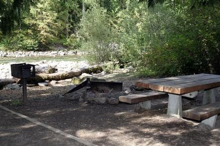
Overview Bedal Campground is located just off the Mountain Loop Highway in the stunning Mt. Baker-Snoqualmie National Forest. Nestled in canopy of forest along the rushing water of the Sauk River, this campground offers visitors a primitive camping experience and access to a wide range of recreational activities. Mt. Baker-Snoqualmie National Forest sits on the west side of the Cascades in Washington, showcasing glacier-covered peaks, wide mountain meadows and old-growth forests, rich in history and outdoor opportunities. Recreation The Mt. Baker-Snoqualmie National Forest boasts 1,500 miles of trails. From smooth paths meandering through deep quiet forests to challenging ascents up a boulder-studded mountain, opportunities abound for every skill level. Access to biking, rafting and fishing is also readily available. Within five miles of Bedal Campground are the spectacular North Fork Sauk Falls. A short hike descending 200 feet rewards visitors with views of cascading 45-foot waterfalls that flow into a deep pool surrounded by low-lying ferns and towering forest. For those interested in higher elevations, the popular Sauk Mountain Trail begins and ends in high mountain meadows, offering wildflowers and spectacular vistas the entire length. On a clear day, Mt. Rainier can be seen to the south, Puget Sound and the San Juan Islands to the west and the rugged Cascade peaks stretching to the east. Facilities The Mt. Baker-Snoqualmie National Forest boasts 1,500 miles of trails. From smooth paths meandering through deep quiet forests to challenging ascents up a boulder-studded mountain, opportunities abound for every skill level. Access to biking, rafting and fishing is also readily available. Within five miles of Bedal Campground are the spectacular North Fork Sauk Falls. A short hike descending 200 feet rewards visitors with views of cascading 45-foot waterfalls that flow into a deep pool surrounded by low-lying ferns and towering forest. For those interested in higher elevations, the popular Sauk Mountain Trail begins and ends in high mountain meadows, offering wildflowers and spectacular vistas the entire length. On a clear day, Mt. Rainier can be seen to the south, Puget Sound and the San Juan Islands to the west and the rugged Cascade peaks stretching to the east. Natural Features Along the banks of the Sauk River an outstanding show of wildflowers in July and August includes paintbrush, phlox, tiger lilies, aster, columbine and lupine. The surrounding undeveloped wilderness, clean streams and diverse forests support an abundance of wildlife. In addition to being home for a multitude of mammals, birds, amphibians and reptiles, the area sustains more rare species such as lynx, moose, wolves and wolverine. contact_info For facility specific information, please call (530) 932-0242. Nearby Attractions Visitors enjoy the North Cascades and Mt. Rainer National Parks, where interpretive programs and exhibits offer education about the diverse landscape and history of the area. Charges & Cancellations Once your reservation start date has begun, neither the Recreation.gov Contact Center nor the campground manager will be able to modify your reservation.
View details →
Overview Clear Creek Campground is located just off the Mountain Loop Highway in the stunning Mt. Baker-Snoqualmie National Forest. Nestled in a towering canopy of fir trees, this campground offers plenty of open spaces, making it perfect for small groups and family excursions. Mt. Baker-Snoqualmie National Forest sits on the west side of the Cascades in Washington, showcasing glacier-covered peaks, wide mountain meadows and old-growth forests, rich in history and outdoor opportunities. Recreation The Mt. Baker-Snoqualmie National Forest boasts 1,500 miles of trails. From smooth paths meandering through deep quiet forests to challenging ascents up boulder-studded mountains, opportunities abound for every skill level. Access to biking, rafting and fishing is also readily available. The nearby Frog Lake Trail is a short nature hike, climbing steadily up the side of the hill, with views of Clear Creek far below. The trail comes out at the road after nearly a mile, then makes a sharp turn back toward the lake, passing through dense forest, and eventually ending at the 1.5-acre Frog Lake. Old Sauk Trail winds along the banks of the Sauk River, providing a pleasant hike amongst the wildlife and waterfowl that frequent the area. Facilities Clear Creek Campground offers 13 standard sites. Picnic tables, tent pads, campfire rings, and vault toilets are provided for guests. Visitors can access the Sauk River from the campground. Natural Features Along the banks of the Sauk River an outstanding show of wildflowers in July and August includes paintbrush, phlox, tiger lilies, aster, columbine and lupine. During the summer salmon and steelhead appear in abundance as they head up the river to spawn. The surrounding undeveloped wilderness, clean streams and diverse forests support an abundance of wildlife. In addition to being home to a multitude of mammals, birds, amphibians and reptiles, the area sustains more rare species such as lynx, moose, wolves and wolverine. contact_info For facility specific information, please call (530) 932-0242. Nearby Attractions Visitors enjoy the North Cascades and Mt. Rainer National Parks, where interpretive programs and exhibits offer education about the diverse landscape and history of the area. Charges & Cancellations Once your reservation start date has begun, neither the Recreation.gov Contact Center nor the campground manager will be able to modify your reservation.
View details →
Overview Red Bridge Campground is located just off the Mountain Loop Highway along the pebble-strewn bank of the South Fork Stillaguamish River in the Mt. Baker-Snoqualmie National Forest. Red Bridge Campground is a beautiful camp, offering visitors access to fishing, kayaking and hiking opportunities. Recreation The Mt. Baker-Snoqualmie National Forest has 1,500 miles of trails. From smooth paths meandering through deep quiet forests to challenging ascents up a boulder-studded mountain, opportunities abound for every skill level. The Mt. Dickerman Trail switchbacks steeply for 3.0 miles through a dark forest of timber to an alpine meadow that was replanted in 1915 after a major forest fire. From this point, the trail rises above timberline to an alpine meadow full of wildflowers in July and August. The trail offers spectacular views in all directions as the trail climbs to the 5,723' summit. Facilities The Mt. Baker-Snoqualmie National Forest has 1,500 miles of trails. From smooth paths meandering through deep quiet forests to challenging ascents up a boulder-studded mountain, opportunities abound for every skill level. The Mt. Dickerman Trail switchbacks steeply for 3.0 miles through a dark forest of timber to an alpine meadow that was replanted in 1915 after a major forest fire. From this point, the trail rises above timberline to an alpine meadow full of wildflowers in July and August. The trail offers spectacular views in all directions as the trail climbs to the 5,723' summit. Natural Features Rugged peaks, scenic rivers and abundant wildlife define the Mt. Baker-Snoqualmie National Forest and surrounding designated wilderness areas. On a clear day visitors can see Mt. Baker, which rises to an elevation of 10,781 feet. The active volcano is perpetually snow-capped. Mt. Baker's summit, Grant Peak, is actually a 1,300-foot-deep mound of ice, which hides a massive volcanic crater. Old-growth forests line the wide, gently-flowing South Fork Stillaguamish River, known for its salmon run. Chinook, Coho, chum, pink and sockeye salmon, steelhead trout, sea-run cutthroat and bull trout use the river and its tributaries for spawning. Undeveloped wilderness, clean streams and diverse forests provide important habitat for wildlife. Many species of mammals, birds, amphibians and reptiles make their homes in the area, which also sustains rare species such as lynx, moose, wolves and wolverine. Nearby Attractions Visit or stay in one of the historic lookouts in the area. Lookouts are tangible symbols of Forest Service heritage, perched on high peaks with unobstructed views where they have been used to detect and control fires. Take some time to visit nearby North Cascades National Park or Mount Rainer National Park. Considered scenic wonderlands, the parks offer a fantasic glimpse of glaciers, subalpine ecology and volcanic landscapes. Discover the Verlot Public Service Center near the South Fork Stillaguamish River. Built by the Civilian Conservation Corps from 1933 to 1942, Verlot`s handsome buildings reflect the architectural style and fine craftsmanship of that era and are listed on the National Register of Historic Places. contact_info For facility specific information, please call (530) 932-0242. Charges & Cancellations Once your reservation start date has begun, neither the Recreation.gov Contact Center nor the campground manager will be able to modify your reservation.
View details →
Overview Situated at the confluence of three waterways near Mount Rainier, La Wis Wis is nestled under a canopy of towering Douglas firs and red cedars. The handful of sites that dot the riverbank enjoy the most sunshine. With an abundance of activities nearby, La Wis Wis is a popular destination for long-stay camping. Its proximity to Mount Rainier National Park makes it an excellent base for exploring all of the area's natural wonders. Recreation Hikers can easily access the Blue Hole Trail and Purcell Falls Trail from La Wis Wis. Anglers can fish for rainbow trout, cutthroat trout and whitefish at either Butter Creek or Skate Creek. Facilities Hikers can easily access the Blue Hole Trail and Purcell Falls Trail from La Wis Wis. Anglers can fish for rainbow trout, cutthroat trout and whitefish at either Butter Creek or Skate Creek. Natural Features Located in southwest Washington State, the Gifford Pinchot National Forest encompasses 1.3 million acres and includes the 110,000-acre Mount St. Helens National Volcanic Monument, established by Congress in 1982. La Wis Wis is located in the Tatoosh Wilderness area of the Cowlitz Valley Ranger District. The campground sits where the Ohanapecosh River, Cowlitz River and Purcell Creek meet. The campground features old-growth forest and opportunities to observe a variety of wildlife. Nearby Attractions La Wis Wis is located near the entrance to Mount Rainier National Park. The popular Henry M Jackson Memorial Visitor Center at Paradise within Mount Rainier National Park is 28 miles away. contact_info This location has limited staffing. Please call (360) 686-3008 for general information. Charges & Cancellations Cancellations Individual Campsites: Cancellations up to 2 days before a reservation start date incur a $10.00 cancellation fee. A visitor who cancels a reservation the day before or on the day of arrival will pay a $10.00 service fee AND forfeit the first night's use fee including tax and applicable add-on for a campsite. Cancellations for a one-night reservation will forfeit the entire amount paid and will not be subject to an additional service fee. Group Sites Group Facility (including Cabins and Lookouts): A visitor who cancels a group overnight facility reservation less than 14 days before the arrival date will pay a $10.00 service fee AND forfeit the first night's use fee. No-Shows A no-show visitor is one who does not arrive at a campground and does not cancel the reservation by check-out time on the day after the scheduled arrival date. Staff will hold a campsite until check-out time on the day following the arrival date. No-shows are assessed $20.00 service fee and forfeit the first night's rate, taxes and applicable add-on for a campsite. Refunds Visitors may submit a refund request through their Recreation.gov profile within 7 days of the end date of their reservation. Refunds will not be issued after the 7 days has ended. Refunds for debit or credit card payments will be issued as a credit to the original bank or credit card used to pay. For check or cash purchases, Recreation.gov will mail a Treasury check for refunds of cash, check, or money order payments to the address associated with the reservation. Treasury check refunds may take up to 6-8 weeks to arrive. In the event of an emergency closure, the Recreation.gov team or facility manager will refund all fees and will attempt to notify you using the contact information within the Recreation.gov visitor profile.
View details →
Overview Mineral Park Campground is situated near the confluence of the North and South Forks of the scenic Cascade River in Mt. Baker-Snoqualmie National Forest. Scattered beneath a towering canopy of diverse forest, the sites in this campground are widely spaced and within walking distance to the waterfront, making it an ideal setting for visitors wanting to camp in a more private, rustic setting. The campground is divided into two sections, Mineral Park East and Mineral Park West. Recreation In addition to being a prime location for hiking, fishing, picnicking, and horseback riding in summer and early fall, Mineral Park Campground offers excelent skiing and snowshoeing in the winter months. Several trailheads for the overnight backpacker are located in the vicinity of the nearby town of Marblemount, including Hidden Lake Trail. Beginning in a forested setting, this trail climbs quickly to open meadows and grand views of the Cascade River. As it reaches higher elevations, it winds through angular slabs of granite and groupings of alpine fir. Spectacular views of high, jagged Cascade peaks can be seen from these higher meadows. Hidden Lake and the Hidden Lake Lookout can be seen from the pass, and reached by traversing down a talus slope. Facilities In addition to being a prime location for hiking, fishing, picnicking, and horseback riding in summer and early fall, Mineral Park Campground offers excelent skiing and snowshoeing in the winter months. Several trailheads for the overnight backpacker are located in the vicinity of the nearby town of Marblemount, including Hidden Lake Trail. Beginning in a forested setting, this trail climbs quickly to open meadows and grand views of the Cascade River. As it reaches higher elevations, it winds through angular slabs of granite and groupings of alpine fir. Spectacular views of high, jagged Cascade peaks can be seen from these higher meadows. Hidden Lake and the Hidden Lake Lookout can be seen from the pass, and reached by traversing down a talus slope. Natural Features Hemmed in by several designated wilderness areas, the Mt. Baker-Snoqualmie National Forest showcases rugged peaks, sparkling alpine lakes and old-growth forests. Mt. Baker, the most prominent feature of the Mt. Baker Wilderness Area, dominates the landscape on a clear day. Rising to an elevation of 10,781 feet, the active volcano from which the forest takes its name is perpetually snow-capped and mantled with an extensive network of creeping glaciers. Mt. Baker's summit, Grant Peak, is actually a 1,300-foot-deep mound of ice, which hides a massive volcanic crater. Flowing adjacent to this campground is the Cascade River, designated as a National Scenic River. Possessing remarkable values related to wildlife, culture, recreation and scenery, the Cascade River is preserved in its free-flowing condition and cannot not dammed or impeded. Wildlife in the area include mountain goats, coyotes, pine marten and a variety of migratory birds and native fish. contact_info For facility specific information, please call (530) 932-0242. Nearby Attractions Visitors enjoy the North Cascades and Mt. Rainer National Parks, where interpretive programs and exhibits offer education about the diverse landscape and history of the area. The Pacific Crest Trail (PCT), one of the world's premier National Scenic Trails, showcases some of North America's most fantastic scenery, winding its way its way from Mexico to Canada through California, Oregon and Washington, and is accessible near the campground. Charges & Cancellations Once your reservation start date has begun, neither the Recreation.gov Contact Center nor the campground manager will be able to modify your reservation.
View details →
Overview Beneath a canopy of pine and fir on the banks of Chatter Creek, this campground offers a serene setting for groups and large gatherings. Recreation Chatter Creek Group Campground offers outdoor enthusiasts the opportunity to hike, fish, ski and enjoy a long list of outdoor recreational activities throughout the year. Anglers may want to cast a line into the pools lining the pebble-strewn shore of Chatter Creek. A variety of trout populations find habitat along the banks of this quaint creek. The trailhead for Icicle Gorge Loop Trail is close to camp. This valley-bottom trail has easy grades along both sides of Icicle Creek. On the other hand, Chatter Creek Trail, also nearby, offers a challenging steep trail with thick underbrush. Skiing, snowmobiling, tubing and skijouring are popular winter activities for visitors to the Wenatchee Ranger District. Both motorized and non-motorized Sno-Parks in the area offer access to both groomed trails and natural settings for those wanting to explore the winter wonderland. Facilities Chatter Creek Group Campground offers outdoor enthusiasts the opportunity to hike, fish, ski and enjoy a long list of outdoor recreational activities throughout the year. Anglers may want to cast a line into the pools lining the pebble-strewn shore of Chatter Creek. A variety of trout populations find habitat along the banks of this quaint creek. The trailhead for Icicle Gorge Loop Trail is close to camp. This valley-bottom trail has easy grades along both sides of Icicle Creek. On the other hand, Chatter Creek Trail, also nearby, offers a challenging steep trail with thick underbrush. Skiing, snowmobiling, tubing and skijouring are popular winter activities for visitors to the Wenatchee Ranger District. Both motorized and non-motorized Sno-Parks in the area offer access to both groomed trails and natural settings for those wanting to explore the winter wonderland. Natural Features Okanogan-Wenatchee National Forest offers stunning scenic views, with high, glaciated alpine peaks, valleys of old growth forest and rugged shrub-steppe country making up the diverse landscape. Elevations range from below 1,000 feet to over 9,000 feet. Precipitation varies greatly throughout the area, ranging from approximately 140 inches along the Cascade Crest to only 10 inches along the eastern edge. Visitors can expect many days of warm, sunny weather in the summer, and winters with clear skies and plenty of snow. More than 700 lakes and mountain ponds dot the glacier-carved terrain of nearby Alpine Lake Wilderness. Tree-covered valleys give way to rocky ridges and rugged peaks along the crest of the Cascades, and many peaks and slopes are permanently cloaked in snowfields. From wet forests of Douglas fir, cedar, and an understory of salal and berries, to firs and mountain hemlock, the landscape opens up to expansive meadows matted with low growth and ends with dry forestland of ponderosa pine and grasses. Congress designated the Alpine Lakes Wilderness in 1976 with a total of 362,789 acres. Prior to designation, aggressive mining and logging operations punched numerous access roads into the area, creating a wildly irregular boundary to this popular area. Nearby Attractions The Bavarian-themed town of Leavenworth provides wonderful opportunities for shopping, dining, and exploring its unique history. Visitors may want to take some time to visit nearby Mount Rainer National Park. Considered a wonderland, the park offers a fantasic glimpse into glaciers, subalpine ecology, and volcanic landscapes typical in the region. Goat Rocks Wilderness is a stunning adventure for those wanting to traverse higher elevations. Peaks within the area are remnants of an extinct volcano, taking the name "Goat Rocks," in honor of the numerous mountain goats traversing this isolated region. Gilbert Peak is the highest summit in this area at an elevation of 8,184 feet. contact_info This location has limited staffing. Please call (661) 702-1420 for general information. Charges & Cancellations Group Sites Group Facility (including Cabins and Lookouts): A visitor who cancels a group overnight facility reservation less than 14 days before the arrival date will pay a $10.00 service fee AND forfeit the first night's use fee. No-Shows A no-show visitor is one who does not arrive at a campground and does not cancel the reservation by check-out time on the day after the scheduled arrival date. Staff will hold a campsite until check-out time on the day following the arrival date. No-shows are assessed $20.00 service fee and forfeit the first night's rate, taxes and applicable add-on for a campsite. Refunds Visitors may submit a refund request through their Recreation.gov profile within 7 days of the end date of their reservation. Refunds will not be issued after the 7 days has ended. Refunds for debit or credit card payments will be issued as a credit to the original bank or credit card used to pay. For check or cash purchases, Recreation.gov will mail a Treasury check for refunds of cash, check, or money order payments to the address associated with the reservation. Treasury check refunds may take up to 6-8 weeks to arrive. In the event of an emergency closure, the Recreation.gov team or facility manager will refund all fees and will attempt to notify you using the contact information within the Recreation.gov visitor profile.
View details →Overview Bridge Creek Group Campground sits in Okanogan-Wenatchee National Forest in northwest Washington. Nestled in a mountainous forest near the confluence of Bridge Creek and Icicle Creek, the campground offers a delightful setting for groups and large gatherings. Recreation Bridge Creek Group Campground offers outdoor enthusiasts the opportunity to hike, fish, bike and enjoy a long list of outdoor recreational activities throughout the year. Icicle River, adjacent to the campground, offers a scenic backdrop for swimmers braving its cold, refreshing waters. Anglers may also want to cast a line into the deep pools lining the shore. Populations of rainbow and brown trout prevail in this waterway. The nearby Fourth of July Trail offers hikers expansive ridge line views and challenging terrain. Beginning in the forest at 4,000 feet, the trail quickly climbs in elevation, out of the trees into more open, arid landscapes. The trail continues through mountain meadows with spectacular views of the Stuart Mountain Range and Icicle Valley. At 10.6 miles, this is a solid day hike, though backpackers can hook up connecting trails to continue for multiple days though adjacent wilderness settings. Facilities Bridge Creek Group Campground offers outdoor enthusiasts the opportunity to hike, fish, bike and enjoy a long list of outdoor recreational activities throughout the year. Icicle River, adjacent to the campground, offers a scenic backdrop for swimmers braving its cold, refreshing waters. Anglers may also want to cast a line into the deep pools lining the shore. Populations of rainbow and brown trout prevail in this waterway. The nearby Fourth of July Trail offers hikers expansive ridge line views and challenging terrain. Beginning in the forest at 4,000 feet, the trail quickly climbs in elevation, out of the trees into more open, arid landscapes. The trail continues through mountain meadows with spectacular views of the Stuart Mountain Range and Icicle Valley. At 10.6 miles, this is a solid day hike, though backpackers can hook up connecting trails to continue for multiple days though adjacent wilderness settings. Natural Features Okanogan-Wenatchee National Forest offers stunning scenic views, with high, glaciated alpine peaks, valleys of old growth forest and rugged shrub-steppe country making up the diverse landscape. Elevations range from below 1,000 feet to over 9,000 feet. Precipitation varies greatly throughout the area, ranging from approximately 140 inches along the Cascade Crest to only 10 inches along the eastern edge. Visitors can expect many days of warm, sunny weather in the summer, and winters with clear skies and plenty of snow. Goat Rocks Wilderness is a stunning adventure for those wanting to traverse higher elevations. Peaks within the area are remnants of an extinct volcano, taking the name "Goat Rocks" in honor of the numerous mountain goats traversing this isolated region. Gilbert Peak is the highest summit in this area at an elevation of 8,184 feet. Nearby Attractions Visitors enjoy the North Cascades and Mt. Rainer National Parks, where interpretive programs and exhibits offer education about the diverse landscape and history of the area. The spectacular Pacific Crest Trail (PCT), one of the world's premier National Scenic Trails, showcases some of North America's most fantastic scenery, winding its way its way from Mexico to Canada through California, Oregon and Washington, and is accessible near the campground. contact_info This location has limited staffing. Please call (661) 702-1420 for general information. Charges & Cancellations Group Sites Group Facility (including Cabins and Lookouts): A visitor who cancels a group overnight facility reservation less than 14 days before the arrival date will pay a $10.00 service fee AND forfeit the first night's use fee. No-Shows A no-show visitor is one who does not arrive at a campground and does not cancel the reservation by check-out time on the day after the scheduled arrival date. Staff will hold a campsite until check-out time on the day following the arrival date. No-shows are assessed $20.00 service fee and forfeit the first night's rate, taxes and applicable add-on for a campsite. Refunds Visitors may submit a refund request through their Recreation.gov profile within 7 days of the end date of their reservation. Refunds will not be issued after the 7 days has ended. Refunds for debit or credit card payments will be issued as a credit to the original bank or credit card used to pay. For check or cash purchases, Recreation.gov will mail a Treasury check for refunds of cash, check, or money order payments to the address associated with the reservation. Treasury check refunds may take up to 6-8 weeks to arrive. In the event of an emergency closure, the Recreation.gov team or facility manager will refund all fees and will attempt to notify you using the contact information within the Recreation.gov visitor profile.
View details →
Overview Tumwater Campground, located at the confluence of Chiwaukum Creek and the Nenatchee River in the Okanogan-Wenatchee National Forest, offers a serene setting for groups and large gatherings. Recreation Tumwater Group Campground offers outdoor enthusiasts the opportunity to hike, fish, ski and enjoy a long list of outdoor recreational activities throughout the year. The confluence of Chiwaukum Creek and the Nenatchee River offers anglers a scenic backdrop as they cast their lines into the pools along the shore. Populations of trout and salmon find habitat along its banks. Skiing, snowmobiling, tubing and skijouring are popular winter activities for visitors to the Wenatchee Ranger District. Both motorized and non-motorized Sno-Parks in the area offer access to both groomed trails and natural settings for those wanting to explore the winter wonderland. Facilities Tumwater Group Campground offers outdoor enthusiasts the opportunity to hike, fish, ski and enjoy a long list of outdoor recreational activities throughout the year. The confluence of Chiwaukum Creek and the Nenatchee River offers anglers a scenic backdrop as they cast their lines into the pools along the shore. Populations of trout and salmon find habitat along its banks. Skiing, snowmobiling, tubing and skijouring are popular winter activities for visitors to the Wenatchee Ranger District. Both motorized and non-motorized Sno-Parks in the area offer access to both groomed trails and natural settings for those wanting to explore the winter wonderland. Natural Features Okanogan-Wenatchee National Forest offers stunning scenic views, with high, glaciated alpine peaks, valleys of old growth forest and rugged shrub-steppe country making up the diverse landscape. Elevations range from below 1,000 feet to more than 9,000 feet. Precipitation varies greatly throughout the area, ranging from approximately 140 inches along the Cascade Crest to only 10 inches along the eastern edge. Visitors can expect many days of warm, sunny weather in the summer, and winters with clear skies and plenty of snow. More than 700 lakes and mountain ponds dot the glacier-carved terrain of nearby Alpine Lake Wilderness. Tree-covered valleys give way to rocky ridges and rugged peaks along the crest of the Cascades. Many peaks and slopes are permanently cloaked in snowfields. From wet forests of Douglas fir, cedar, and an understory of salal and berries, to firs and mountain hemlock, the landscape opens up to expansive meadows matted with low growth and ends with dry forestland of ponderosa pine and grasses. The surrounding undeveloped wilderness, clean streams and diverse forests support an abundance of wildlife, including deer, porcupine, native fish and migratory birds. Nearby Attractions Visitors enjoy the Mt. Rainer National Park, where interpretive programs and exhibits offer education about the diverse landscape and history of the area. The spectacular Pacific Crest Trail (PCT), one of the world's premier National Scenic Trails, showcases some of North America's most fantastic scenery, winding its way its way from Mexico to Canada through California, Oregon and Washington, and is accessible near the campground.
View details →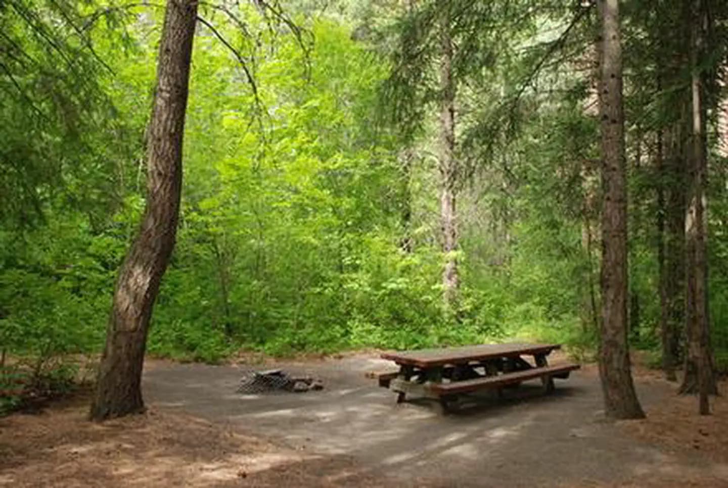
Overview Nestled in a forest canopy of pine and fir on the banks of Icicle Creek, Eightmile Group Campground in Okanogan-Wenatchee National Forest offers a peaceful setting for groups and large gatherings. Recreation Eightmile Group Campground offers outdoor enthusiasts the opportunity to hike, fish, bike and enjoy a long list of outdoor recreational activities throughout the year. This campground has plenty of trails to explore by bike. Anglers may want to cast a line into the deep pools at nearby Toketie Lake. Populations of rainbow and cutthroat trout find habitat in this somewhat secluded lake. The nearby Fourth of July Trail offers hikers expansive ridge line views and challenging terrain. Beginning in the forest at 4,000 feet, the trail quickly climbs in elevation, out of the trees into more open, arid landscapes. The trail continues, traversing through mountain meadows with spectacular views of the Stuart Mountain Range and Icicle Valley. At 10.6 miles, this is a solid day hike, though backpackers can hook up connecting trails to continue for multiple days though adjacent wilderness settings. Facilities Eightmile Group Campground offers outdoor enthusiasts the opportunity to hike, fish, bike and enjoy a long list of outdoor recreational activities throughout the year. This campground has plenty of trails to explore by bike. Anglers may want to cast a line into the deep pools at nearby Toketie Lake. Populations of rainbow and cutthroat trout find habitat in this somewhat secluded lake. The nearby Fourth of July Trail offers hikers expansive ridge line views and challenging terrain. Beginning in the forest at 4,000 feet, the trail quickly climbs in elevation, out of the trees into more open, arid landscapes. The trail continues, traversing through mountain meadows with spectacular views of the Stuart Mountain Range and Icicle Valley. At 10.6 miles, this is a solid day hike, though backpackers can hook up connecting trails to continue for multiple days though adjacent wilderness settings. Natural Features Okanogan-Wenatchee National Forest offers stunning scenic views, with high, glaciated alpine peaks, valleys of old growth forest and rugged shrub-steppe country making up the diverse landscape. Elevations range from below 1,000 feet to over 9,000 feet. More than 700 lakes and mountain ponds dot the glacier-carved terrain of nearby Alpine Lake Wilderness. Tree-covered valleys give way to rocky ridges and rugged peaks along the crest of the Cascades. Many peaks and slopes are permanently cloaked in snowfields. From wet forests of Douglas fir, cedar, and an understory of salal and berries, to firs and mountain hemlock, the landscape opens up to expansive meadows matted with low growth and ends with dry forestland of ponderosa pine and grasses. Congress designated the Alpine Lakes Wilderness in 1976 with a total of 362,789 acres. Prior to designation, aggressive mining and logging operations punched numerous access roads into the area, creating a wildly irregular boundary to this popular area. contact_info For facility specific information, please call (661) 702-1420. Nearby Attractions Visitors enjoy the North Cascades and Mt. Rainer National Parks, where interpretive programs and exhibits offer education about the diverse landscape and history of the area. Guests can also explore the area's colorful railroad and mining history at the Steven's Pass Historic District, or hit the slopes at Steven's Pass Ski Area. Charges & Cancellations Group Sites Group Facility (including Cabins and Lookouts): A visitor who cancels a group overnight facility reservation less than 14 days before the arrival date will pay a $10.00 service fee AND forfeit the first night's use fee. No-Shows A no-show visitor is one who does not arrive at a campground and does not cancel the reservation by check-out time on the day after the scheduled arrival date. Staff will hold a campsite until check-out time on the day following the arrival date. No-shows are assessed $20.00 service fee and forfeit the first night's rate, taxes and applicable add-on for a campsite. Refunds Visitors may submit a refund request through their Recreation.gov profile within 7 days of the end date of their reservation. Refunds will not be issued after the 7 days has ended. Refunds for debit or credit card payments will be issued as a credit to the original bank or credit card used to pay. For check or cash purchases, Recreation.gov will mail a Treasury check for refunds of cash, check, or money order payments to the address associated with the reservation. Treasury check refunds may take up to 6-8 weeks to arrive. In the event of an emergency closure, the Recreation.gov team or facility manager will refund all fees and will attempt to notify you using the contact information within the Recreation.gov visitor profile.
View details →
Overview Pioneer Park Campground is located in northeast Washington on the Pend Oreille River. Visitors enjoy hiking, fishing, boating and swimming. The campground's proximity to the city of Newport provides urban entertainment opportunities as well. Recreation The Pioneer Park Heritage Trail, a short trail that highlights the history of the Kalispel Tribe, is a favorite attraction in the campground. Twelve interpretive displays are dispersed along the 0.3-mile boardwalk trail, which boasts scenic views of the river below. Excellent bass and trout fishing can be found in the Pend Oreille River. A boat ramp, picnic shelter and swimming area are located on-site. Facilities The Pioneer Park Heritage Trail, a short trail that highlights the history of the Kalispel Tribe, is a favorite attraction in the campground. Twelve interpretive displays are dispersed along the 0.3-mile boardwalk trail, which boasts scenic views of the river below. Excellent bass and trout fishing can be found in the Pend Oreille River. A boat ramp, picnic shelter and swimming area are located on-site. Natural Features The campground is surrounded by groves of ponderosa pine, white pine, hemlock and grand fir trees, and sits at an elevation of 2,000 feet. Campsites are spacious and shady, with an understory of wild roses and thimbleberry. Pioneer is situated at the southern edge of Colville National Forest, near the Idaho border. The forest spans 1.1 million acres and encompasses the Okanogan, Kettle River and Selkirk Mountain Ranges. Nearby Attractions The city of Newport is conveniently close for a restaurant outing or summer entertainment. Children will enjoy the Little People's Park in town.
View details →
Overview Indian Flat Group Campground is set on the banks of the Bumping River in the eastern foothills of the Cascades mountain range. Situated beneath a towering mixed conifer forest, this site offers a wonderful setting for large groups looking for a secluded camping experience. Recreation Indian Flat Group Campground is within 10 miles of opportunities to hike, mountain bike, ride horses, ski, raft and enjoy a multitude of outdoor recreational activities throughout the year. Nearby Bumping Lake offers visitors opportunities to boat, fish, swim or simply relax on its sandy beach. The American Ridge Trail offers hikers, overnight backpackers and horseback riders fantastic opportunities to absorb some of the area's stunning beauty. Extending from Bumping River to the notable Pacific Crest trail, the American Ridge Trail offers over 26 miles of towering forests, stretches of meadows, alpine lakes and fantastic ridge line views. Facilities Indian Flat Group Campground is within 10 miles of opportunities to hike, mountain bike, ride horses, ski, raft and enjoy a multitude of outdoor recreational activities throughout the year. Nearby Bumping Lake offers visitors opportunities to boat, fish, swim or simply relax on its sandy beach. The American Ridge Trail offers hikers, overnight backpackers and horseback riders fantastic opportunities to absorb some of the area's stunning beauty. Extending from Bumping River to the notable Pacific Crest trail, the American Ridge Trail offers over 26 miles of towering forests, stretches of meadows, alpine lakes and fantastic ridge line views. Natural Features Okanogan National Forest offers stunning scenic views, with high, glaciated alpine peaks, valleys of old growth forest and rugged shrub-steppe country making up the diverse landscape. Elevations range from below 1,000 feet to more than 9,000 feet. Precipitation varies greatly throughout the area, ranging from approximately 140 inches along the Cascade Crest to only 10 inches along the eastern edge. Visitors can expect many days of warm, sunny weather in the summer, and winters with clear skies and plenty of snow. The surrounding undeveloped wilderness, clean streams and diverse forests support an abundance of wildlife, including deer, squirrels, native fish, black bear and migratory birds. Goat Rocks Wilderness is a stunning adventure for those wanting to traverse higher elevations. Peaks within the area are remnants of an extinct volcano, taking the name "Goat Rocks," in honor of the numerous mountain goats traversing this isolated region. Gilbert Peak is the highest summit in this area, at an elevation of 8,184 feet. Nearby Attractions Boulder Cave National Recreation Trail is one of the most popular places in the Naches District. Visitors can walk the accessible trail along the river or explore Boulder Cave. Interpretive signs along the trail explain the geology, plants, animals and fire history of the area. Visitors enjoy Mt. Rainer National Park, where interpretive programs and exhibits offer education about the diverse landscape and history of the area. The Pacific Crest Trail (PCT), one of the world's premier National Scenic Trails, showcases some of North America's most fantastic scenery winding its way its way from Mexico to Canada through California, Oregon and Washington, is accessible near the campground. Visitors will also enjoy traversing the Chinook Scenic Byway, considered one of Washington's premier driving excursions. Spectacular views of Mount Rainier and surrounding landscape dominate this 92-mile journey.
View details →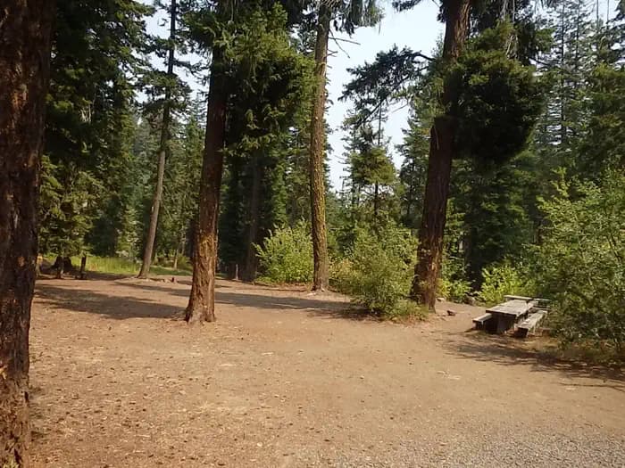
Overview Set on the shores of the scenic American River, Pine Needle Group Campground in Okanogan-Wenatchee National Forest offers an ideal setting for groups and large gatherings. Recreation Pine Needle Group Campground offers outdoor enthusiasts the opportunity to hike, fish, ski, raft and enjoy a multitude of other recreational activities throughout the year. The American River, adjacent to the campground, offers a scenic backdrop for swimmers braving its cold, refreshing waters. Anglers may also want to cast a line into the deep pools lining the shore, as populations of rainbow and brown trout prevail in this waterway. The nearby American Ridge Trail offers hikers, overnight backpackers and horseback riders fantastic opportunities. Extending from Bumping River to the notable Pacific Crest Trail, the American Ridge Trail offers over 26 miles of towering forests, stretches of meadows, alpine lakes and ridge line views. Facilities Pine Needle Group Campground offers outdoor enthusiasts the opportunity to hike, fish, ski, raft and enjoy a multitude of other recreational activities throughout the year. The American River, adjacent to the campground, offers a scenic backdrop for swimmers braving its cold, refreshing waters. Anglers may also want to cast a line into the deep pools lining the shore, as populations of rainbow and brown trout prevail in this waterway. The nearby American Ridge Trail offers hikers, overnight backpackers and horseback riders fantastic opportunities. Extending from Bumping River to the notable Pacific Crest Trail, the American Ridge Trail offers over 26 miles of towering forests, stretches of meadows, alpine lakes and ridge line views. Natural Features Okanogan-Wenatchee National Forest offers stunning scenic views, with high, glaciated alpine peaks, valleys of old growth forest and rugged shrub-steppe country making up the diverse landscape. Elevations range from below 1,000 feet to more than 9,000 feet. Precipitation varies greatly throughout the area, ranging from approximately 140 inches along the Cascade Crest to only 10 inches along the eastern edge. Visitors can expect warm, sunny weather in the summer and winters with clear skies and plenty of snow. Nearby Goat Rocks Wilderness offers excellent hiking. Peaks within the area are remnants of an extinct volcano, taking the name "Goat Rocks" in honor of the numerous mountain goats traversing this isolated region. Gilbert Peak is the highest summit in this area, at an elevation of 8,184 feet. Nearby Attractions Boulder Cave National Recreation Trail is one of the most popular places in the Naches District. Visitors can walk the accessible trail along the river or explore Boulder Cave. Interpretive signs along the trail explain the geology, plants, animals and fire history of the area. Visitors also enjoy Mt. Rainer National Park, where interpretive programs and exhibits offer education about the diverse landscape and history of the area. The spectacular Pacific Crest Trail (PCT), one of the world's premier National Scenic Trails, showcases some of North America's most fantastic scenery, winding its way its way from Mexico to Canada through California, Oregon and Washington, is accessible near the campground. Visitors will also enjoy traversing the Chinook Scenic Byway, considered one of Washington's premier driving excursions. Spectacular views of Mount Rainier, old-growth forests, alpine peaks, jagged ridges and river canyons dominate this 92-mile journey. Additional hiking trails, along with mountain bike trails are with in 5 miles of the campsite, and hunting opportunities are within 10 miles.
View details →
Overview Clear Lake Group Campground is along the North Fork of the Tieton River in the Okanogan-Wenatchee National Forest. The campground sits between popular Rimrock Lake and the quieter Clear Lake beneath a canopy of towering pine and fir trees. Perched on a rocky bluff overlooking the area, this secluded spot offers access to a variety of recreational opportunities. It is an ideal setting for large family and group gatherings. Recreation Clear Lake Group Campground offers outdoor enthusiasts the opportunity to hike, fish, ski, raft and enjoy a multitude of outdoor recreational activities throughout the year. Visitors enjoy the nearby Rimrock Lake for its myriad of water activities, including fishing for kokanee salmon or trout and kayaking along the shore. River enthusiasts may enjoy a whitewater rafting trip on one of the many scenic rivers in the area. The Tieton River is especially exciting in September, when the Bureau of Reclamation floods the Tieton Valley. The river is perfect for river enthusiasts seeking the thrill of whitewater. Facilities Clear Lake Group Campground offers outdoor enthusiasts the opportunity to hike, fish, ski, raft and enjoy a multitude of outdoor recreational activities throughout the year. Visitors enjoy the nearby Rimrock Lake for its myriad of water activities, including fishing for kokanee salmon or trout and kayaking along the shore. River enthusiasts may enjoy a whitewater rafting trip on one of the many scenic rivers in the area. The Tieton River is especially exciting in September, when the Bureau of Reclamation floods the Tieton Valley. The river is perfect for river enthusiasts seeking the thrill of whitewater. Natural Features Okanogan-Wenatchee National Forest offers stunning scenic views, with high, glaciated alpine peaks, valleys of old growth forest and rugged shrub-steppe country making up the diverse landscape. Elevations range from below 1,000 feet to more than 9,000 feet. Precipitation varies greatly throughout the area, ranging from approximately 140 inches along the Cascade Crest to only 10 inches along the eastern edge. Visitors can expect many days of warm, sunny weather in the summer, and winters with clear skies and plenty of snow. The Tieton River, adjacent to Clear Lake Group Campground, is a tributary of the Naches River. Its headwaters originate in Goat Rocks Wilderness, collecting water from snow melt and glaciers in high rugged peaks. These peaks are remnants of an extinct volcano, taking the name "Goat Rocks," in honor of the mountain goats traversing this isolated region. Nearby Attractions Visitors enjoy Mt. Rainer National Park, where interpretive programs and exhibits offer education about the diverse landscape and history of the area. The spectacular Pacific Crest Trail (PCT), one of the world's premier National Scenic Trails, showcases some of North America's most fantastic scenery, winding its way its way from Mexico to Canada through California, Oregon and Washington, and is accessible near the campground. A boat ramp is available within 10 miles of the campground.
View details →
Overview East Kachess Group Campground is tucked away on the eastern shore of Kachess Lake in Okanogan-Wenatchee National Forest. Hemmed in by dense old-growth conifer forest and surrounded by high mountains, East Kachess Group Campground is secluded, making it an ideal setting for groups and families seeking recreation and relaxation. Recreation This is a prime base camp for hiking, fishing, swimming, and mountain biking in summer and early fall and several trails are a short drive from the area. Anglers will enjoy the scenic backdrop of the area while fishing for rainbow trout, cutthroat trout and kokanee salmon from boat or shoreline. Facilities This is a prime base camp for hiking, fishing, swimming, and mountain biking in summer and early fall and several trails are a short drive from the area. Anglers will enjoy the scenic backdrop of the area while fishing for rainbow trout, cutthroat trout and kokanee salmon from boat or shoreline. Natural Features Kachess Lake, adjacent to the campground, is a reservoir that stores and provides water for irrigation for south-central Washington. The area is quite scenic, supporting wildlife such as deer, porcupine, native fish and migratory birds. These species, along with many others, depend on surrounding undeveloped wilderness, clean streams, and diverse forests to live. Endangered and threatened species including the northern spotted owl and gray wolves also find havens in nearby ecosystems. Nearby Attractions Hikers may want to traverse at least a portion of the spectacular Pacific Crest Trail (PCT), one of the world's premier National Scenic Trails. This trail showcases some of North America's most fantastic scenery as it winds its way its way from Mexico to Canada through California, Oregon and Washington.
View details →
Overview Silver Falls Group Campground sits in forested, mountain terrain on the banks of the Entiat River in the Okanogan-Wenatchee National Forest in the Entiat Ranger District. The cascading water of Silver Falls is a draw for many visitors to this particular area, which is especially refreshing in the summer heat. The Silver Falls National Recreation Trail is an exceptional family hike taking you up, around and down the falls. Panoramic views of the surrounding mountains await you on the hike. Recreation Silver Falls Campground is a great base camp for a variety of outdoor recreational activities. Anglers enjoy casting a line into the Entiat River above Entiat Falls, about 2.5 miles up-river from the campground. Carving through a wide, U-shaped valley, the river is dominated by relatively shallow riffles interspersed with pools, plunge pools and glides where the trout fishing is quite good. Populations of rainbow, cutthroat and eastern brook trout are found in this tributary. Selective gear rules apply to fishing in the Entiat River. See Washington Department of Fish and Wildlife for fishing rules and regulations. Silver Falls National Recreation Trail offers a 1.8 mile hike next to one of the most beautiful waterfalls in the region. The trail winds along Silver Creek to the base of the falls, through towering canopies of cedar and pine. The handcrafted stone staircase and bridges along this trail offer stopping points and panoramic views of the surrounding mountains. The Silver Falls Trail is an exceptional family hike taking you up, around and down the falls. The elevation gain is approximately 600 feet. Facilities Silver Falls Campground is a great base camp for a variety of outdoor recreational activities. Anglers enjoy casting a line into the Entiat River above Entiat Falls, about 2.5 miles up-river from the campground. Carving through a wide, U-shaped valley, the river is dominated by relatively shallow riffles interspersed with pools, plunge pools and glides where the trout fishing is quite good. Populations of rainbow, cutthroat and eastern brook trout are found in this tributary. Selective gear rules apply to fishing in the Entiat River. See Washington Department of Fish and Wildlife for fishing rules and regulations. Silver Falls National Recreation Trail offers a 1.8 mile hike next to one of the most beautiful waterfalls in the region. The trail winds along Silver Creek to the base of the falls, through towering canopies of cedar and pine. The handcrafted stone staircase and bridges along this trail offer stopping points and panoramic views of the surrounding mountains. The Silver Falls Trail is an exceptional family hike taking you up, around and down the falls. The elevation gain is approximately 600 feet. Natural Features The Okanogan-Wenatchee National Forest offers stunning scenic vistas, with high, glaciated alpine peaks, valleys of old growth forest and rugged shrub-steppe country making up the diverse landscape. Elevations range from below 1,000 feet to more than 9,000 feet. The surrounding forest provides excellent habitat for a wide range of wildlife. Visitors may catch glimpses of mule deer, elk, bald and golden eagles and a variety of woodpeckers and owls. Precipitation varies greatly throughout the area, ranging from approximately 140 inches along the Cascade Crest to only 10 inches along the eastern edge. Visitors can expect many days of warm, sunny weather in the summer, and winters with clear skies and plenty of snow. Nearby Attractions At Entiat River Road mile marker 27.8 is Box Canyon. This geological formation is about 65 million years in the making and the chasm spans a run of about 500 feet and ranges from 75-150 ft. deep. Fish Tail Falls can be observed from the view point running over, under and through a pile of large boulders, cascading another 15 feet. At times you can see salmon in this pool. Approximately 3 miles north on Entiat River Road from Silver Falls is Entiat Falls. This broad 25 foot cascading natural waterfall makes quite a rejuvenating impression. Bring a picnic lunch or just stretch your legs and enjoy. Take precaution as river rock can be very slick. Ardenvoir is the closest town within 20 miles. Entiat is 29.5 miles away.
View details →
Overview Pine Flats Group Campground is located next to the Mad River within the Pine Flats Campground, in the Okanogan-Wenatchee National Forest, Entiat Ranger District. Visitors have easy access to nearby multiple-use trails. Birding and wildlife viewing are popular activities. Recreation The campground offers great nearby access to trail opportunities for hikers, horseback riders, mountain bikers and motorcyclists. The Lower Mad River Trail (#1409) starts next to the campground. This 14-mile long trail leads to the upper Mad River meadows area and Klone Peak. Spring time wildflower viewing is a popular activity while hiking up the trail. Facilities The campground offers great nearby access to trail opportunities for hikers, horseback riders, mountain bikers and motorcyclists. The Lower Mad River Trail (#1409) starts next to the campground. This 14-mile long trail leads to the upper Mad River meadows area and Klone Peak. Spring time wildflower viewing is a popular activity while hiking up the trail. Natural Features The campground is situated on the banks of the Mad River, at an elevation of 1,621 feet. Ponderosa pines tower over the campground. The group site is adjacent to an open meadow with great wildflowers during the spring bloom season and the Mad River. The surrounding forest provides excellent habitat for a wide range of wildlife. Visitors may catch glimpses of mule deer, moose, bald and golden eagles and a variety of woodpeckers and owls.
View details →
Overview Cottonwood Campground is located along the Naches River in the Northern Cascade Range of Washington. Craggy peaks, mountain meadows and old-growth forests provide visitors with unique landscapes within the Okanogan National Forest. Warm summer days and access to a multitude of recreational activities make it an ideal setting for both individual and family camping excursions. Recreation Cottonwood Campground offers outdoor enthusiasts the opportunity to fish, swim, hike and enjoy a multitude of recreational activities throughout the year. Numerous hiking trails can be accessed near the campground and in the surrounding area. Nearby American Ridge Trail, open to hikers, backpackers and horseback riders, extends over 26 miles from Bumping River to the notable Pacific Crest Trail. Visitors enjoy whitewater rafting on the nearby American River or splashing around in Naches River, which can be accessed from the campground. Facilities Cottonwood Campground offers outdoor enthusiasts the opportunity to fish, swim, hike and enjoy a multitude of recreational activities throughout the year. Numerous hiking trails can be accessed near the campground and in the surrounding area. Nearby American Ridge Trail, open to hikers, backpackers and horseback riders, extends over 26 miles from Bumping River to the notable Pacific Crest Trail. Visitors enjoy whitewater rafting on the nearby American River or splashing around in Naches River, which can be accessed from the campground. Natural Features The Okanogan-Wenatchee National Forest's high, glaciated alpine peaks tower along the Cascade Crest. Lush valleys of old-growth forest define its western boundary, and at its eastern edge, rugged shrub-steppe country comprises a more arid region. Elevations range from below 1,000 feet to over 9,000 feet. The Naches River, adjacent to Cottonwood Campground, is a tributary of the Yakima River in central Washington. In its upper reaches, the Naches River flows through rugged terrain and areas of pristine wilderness. The river was used by Native Americans and settlers throughout history. It has served as a natural corridor between the east and west sides of the Cascades via Naches Pass. contact_info This location has limited staffing. Please call (661) 702-1420 for general information. Nearby Attractions Boulder Cave National Recreation Trail is one of the most popular places in the Naches District. Visitors can walk the accessible trail along the river or explore Boulder Cave. Interpretive signs along the trail explain the geology, plants, animals and fire history of the area. In the fall, thousands of people come to experience whitewater rafting on both the Tieton and American Rivers. Charges & Cancellations Cancellations Individual Campsites: Cancellations up to 2 days before a reservation start date incur a $10.00 cancellation fee. A visitor who cancels a reservation the day before or on the day of arrival will pay a $10.00 service fee AND forfeit the first night's use fee including tax and applicable add-on for a campsite. Cancellations for a one-night reservation will forfeit the entire amount paid and will not be subject to an additional service fee. No-Shows A no-show visitor is one who does not arrive at a campground and does not cancel the reservation by check-out time on the day after the scheduled arrival date. Staff will hold a campsite until check-out time on the day following the arrival date. No-shows are assessed $20.00 service fee and forfeit the first night's rate, taxes and applicable add-on for a campsite. Refunds Visitors may submit a refund request through their Recreation.gov profile within 7 days of the end date of their reservation. Refunds will not be issued after the 7 days has ended. Refunds for debit or credit card payments will be issued as a credit to the original bank or credit card used to pay. For check or cash purchases, Recreation.gov will mail a Treasury check for refunds of cash, check, or money order payments to the address associated with the reservation. Treasury check refunds may take up to 6-8 weeks to arrive. In the event of an emergency closure, the Recreation.gov team or facility manager will refund all fees and will attempt to notify you using the contact information within the Recreation.gov visitor profile.
View details →
Overview Hause Creek Campground is located along the Tieton River in the Okanogan-Wenatchee National Forest in Washington's Northern Cascade Range. Warm summer days and and access to a multitude of recreational activities make the campground an ideal setting for both individual and family camping excursions. Recreation Hause Creek Campground offers outdoor enthusiasts the opportunity to hike, fish, ski, raft and enjoy a multitude of recreational activities throughout the year. River enthusiasts may enjoy a whitewater rafting trip on one of the many scenic rivers in the area. The Tieton River is especially exciting in September when the Bureau of Land Reclamation floods the Tieton Valley, releasing fast and furious water. Facilities Hause Creek Campground offers outdoor enthusiasts the opportunity to hike, fish, ski, raft and enjoy a multitude of recreational activities throughout the year. River enthusiasts may enjoy a whitewater rafting trip on one of the many scenic rivers in the area. The Tieton River is especially exciting in September when the Bureau of Land Reclamation floods the Tieton Valley, releasing fast and furious water. Natural Features The Okanogan-Wenatchee is a unique National Forest, where high, glaciated alpine peaks tower along the Cascade Crest. Lush valleys of old-growth forest define its western boundary, and at its eastern edge, rugged shrub-steppe country comprises a more arid region. Elevations range from below 1,000 feet to over 9,000 feet. Precipitation varies greatly thoughout the area, ranging from approximately 140 inches along the Cascade Crest to only 10 inches along the eastern edge. Visitors can expect many days of warm, sunny weather in the summer and plenty of snow in the winter. Nearby Attractions Boulder Cave National Recreation Trail is one of the most popular places in the Naches District. Visitors can walk the accessible trail along the river or explore Boulder Cave. Interpretive signs along the trail explain the geology, plants, animals and fire history of the area. Hikers may want to traverse a portion of the Pacific Crest Trail (PCT), one of the world's premier National Scenic Trails. This trail showcases some of North America's most fantastic scenery as it winds its way from Mexico to Canada through California, Oregon and Washington. The Goat Rocks Wilderness is nearby. Its peaks are remnants of an extinct volcano, taking the name "Goat Rocks," in honor of the fantastic mountain goats traversing this isolated region. contact_info This location has limited staffing. Please call (661) 702-1420 for general information. Charges & Cancellations Cancellations Individual Campsites: Cancellations up to 2 days before a reservation start date incur a $10.00 cancellation fee. A visitor who cancels a reservation the day before or on the day of arrival will pay a $10.00 service fee AND forfeit the first night's use fee including tax and applicable add-on for a campsite. Cancellations for a one-night reservation will forfeit the entire amount paid and will not be subject to an additional service fee. No-Shows A no-show visitor is one who does not arrive at a campground and does not cancel the reservation by check-out time on the day after the scheduled arrival date. Staff will hold a campsite until check-out time on the day following the arrival date. No-shows are assessed $20.00 service fee and forfeit the first night's rate, taxes and applicable add-on for a campsite. Refunds Visitors may submit a refund request through their Recreation.gov profile within 7 days of the end date of their reservation. Refunds will not be issued after the 7 days has ended. Refunds for debit or credit card payments will be issued as a credit to the original bank or credit card used to pay. For check or cash purchases, Recreation.gov will mail a Treasury check for refunds of cash, check, or money order payments to the address associated with the reservation. Treasury check refunds may take up to 6-8 weeks to arrive. In the event of an emergency closure, the Recreation.gov team or facility manager will refund all fees and will attempt to notify you using the contact information within the Recreation.gov visitor profile.
View details →
Overview Hells Crossing Campground is located along the American River in the Okanogan-Wenatchee National Forest in Washington's Cascade Range. Warm summer days and easy access to an abundance of recreational activities make the campground a perfect setting for individual and group camping excursions. Recreation Hells Crossing Campground offers outdoor enthusiasts the opportunity to hike, fish, ski, raft and enjoy a multitude of recreational activities throughout the year. The American River, which can be accessed from within the campground, offers a scenic backdrop for swimmers braving its cold, refreshing waters. Whitewater enthusiasts may enjoy a rafting trip on the American or on one of many scenic rivers in the area. Facilities Hells Crossing Campground offers outdoor enthusiasts the opportunity to hike, fish, ski, raft and enjoy a multitude of recreational activities throughout the year. The American River, which can be accessed from within the campground, offers a scenic backdrop for swimmers braving its cold, refreshing waters. Whitewater enthusiasts may enjoy a rafting trip on the American or on one of many scenic rivers in the area. Natural Features The Okanogan-Wenatchee is a unique National Forest, where high, glaciated alpine peaks tower along the Cascade Crest. Lush valleys of old-growth forest define its western boundary, and at its eastern edge, rugged shrub-steppe country comprises a more arid region. Elevations range from below 1,000 feet to over 9,000 feet. Precipitation varies greatly thoughout the area, ranging from approximately 140 inches along the Cascade Crest to only 10 inches along the eastern edge. Visitors to the area can expect many days of warm, sunny weather in the summer and plenty of snow in the winter. Nearby Attractions Boulder Cave National Recreation Trail is one of the most popular places in the Naches District. Visitors can walk the accessible trail along the river or explore Boulder Cave. Interpretive signs along the trail explain the geology, plants, animals and fire history of the area. Hikers may want to traverse a portion of the spectacular Pacific Crest Trail (PCT), one of the world's premier National Scenic Trails. This trail showcases some of North America's most fantastic scenery as it winds its way from Mexico to Canada through California, Oregon and Washington. contact_info This location has limited staffing. Please call (661) 702-1420 for general information. Charges & Cancellations Cancellations Individual Campsites: Cancellations up to 2 days before a reservation start date incur a $10.00 cancellation fee. A visitor who cancels a reservation the day before or on the day of arrival will pay a $10.00 service fee AND forfeit the first night's use fee including tax and applicable add-on for a campsite. Cancellations for a one-night reservation will forfeit the entire amount paid and will not be subject to an additional service fee. No-Shows A no-show visitor is one who does not arrive at a campground and does not cancel the reservation by check-out time on the day after the scheduled arrival date. Staff will hold a campsite until check-out time on the day following the arrival date. No-shows are assessed $20.00 service fee and forfeit the first night's rate, taxes and applicable add-on for a campsite. Refunds Visitors may submit a refund request through their Recreation.gov profile within 7 days of the end date of their reservation. Refunds will not be issued after the 7 days has ended. Refunds for debit or credit card payments will be issued as a credit to the original bank or credit card used to pay. For check or cash purchases, Recreation.gov will mail a Treasury check for refunds of cash, check, or money order payments to the address associated with the reservation. Treasury check refunds may take up to 6-8 weeks to arrive. In the event of an emergency closure, the Recreation.gov team or facility manager will refund all fees and will attempt to notify you using the contact information within the Recreation.gov visitor profile.
View details →
Overview Little Naches Campground is located along the Naches River in the Northern Cascades Range of Washington, where craggy peaks, mountain meadows and old-growth forests provide visitors with wild and scenic landscapes within the Okanogan National Forest. Warm summer days and access to a multitude of recreational activities make it an ideal setting for both individual and family camping excursions. Recreation Little Naches Campground offers outdoor enthusiasts the opportunity to fish, swim, hike and enjoy a multitude of recreational activities throughout the year. Numerous hiking trails are accessible near the campground and in the surrounding area. Most notably, Frost Mountain Lookout Trail and Kaner Flat Trail offer views of mixed conifer forests and mountain meadows. River enthusiasts may enjoy a whitewater paddle on the nearby American River or splashing around in Naches River, which can be accessed from the campground. Facilities Little Naches Campground offers outdoor enthusiasts the opportunity to fish, swim, hike and enjoy a multitude of recreational activities throughout the year. Numerous hiking trails are accessible near the campground and in the surrounding area. Most notably, Frost Mountain Lookout Trail and Kaner Flat Trail offer views of mixed conifer forests and mountain meadows. River enthusiasts may enjoy a whitewater paddle on the nearby American River or splashing around in Naches River, which can be accessed from the campground. Natural Features The Okanogan-Wenatchee is a stunning and unique National Forest, with high, glaciated alpine peaks towering along the Cascade Crest. Lush valleys of old-growth forest define its western boundary, and at its eastern edge, rugged shrub-steppe country comprises a more arid region. Elevations range from below 1,000 feet to over 9,000 feet. The Naches River, adjacent to Little Naches Campground, is a tributary of the Yakima River in central Washington. In its upper reaches, the Naches River flows through rugged terrain and areas of pristine wilderness. Before it joins the Yakima River, it makes its way through valleys and is a significant irrigation source for areas northwest of Yakima. Used by Native Americans and settlers throughout history, the river has served as an natural corridor between the east and west sides of the Cascades via Naches Pass. Nearby Attractions Boulder Cave National Recreation Trail is one of the most popular places in the Naches District. Visitors can walk the accessible trail along the river or explore Boulder Cave. Interpretive signs along the trail explain the geology, plants, animals and fire history of the area. In the fall thousands of people come to experience whitewater rafting on both the Tieton and American Rivers. Hikers may want to traverse at least a portion of the spectacular Pacific Crest Trail (PCT), one of the world's premier National Scenic Trails. This trail showcases some of North America's most fantastic scenery, winding its way from Mexico to Canada through California, Oregon and Washington. contact_info This location has limited staffing. Please call (661) 702-1420 for general information. Charges & Cancellations Cancellations Individual Campsites: Cancellations up to 2 days before a reservation start date incur a $10.00 cancellation fee. A visitor who cancels a reservation the day before or on the day of arrival will pay a $10.00 service fee AND forfeit the first night's use fee including tax and applicable add-on for a campsite. Cancellations for a one-night reservation will forfeit the entire amount paid and will not be subject to an additional service fee. No-Shows A no-show visitor is one who does not arrive at a campground and does not cancel the reservation by check-out time on the day after the scheduled arrival date. Staff will hold a campsite until check-out time on the day following the arrival date. No-shows are assessed $20.00 service fee and forfeit the first night's rate, taxes and applicable add-on for a campsite. Refunds Visitors may submit a refund request through their Recreation.gov profile within 7 days of the end date of their reservation. Refunds will not be issued after the 7 days has ended. Refunds for debit or credit card payments will be issued as a credit to the original bank or credit card used to pay. For check or cash purchases, Recreation.gov will mail a Treasury check for refunds of cash, check, or money order payments to the address associated with the reservation. Treasury check refunds may take up to 6-8 weeks to arrive. In the event of an emergency closure, the Recreation.gov team or facility manager will refund all fees and will attempt to notify you using the contact information within the Recreation.gov visitor profile.
View details →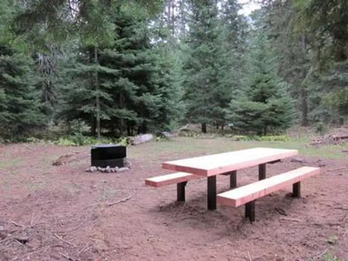
Overview Cougar Flat Campground is nestled into a mountain forest northwest of Naches, Washington. The campground offers an ideal setting for families and outdoor enthusiasts looking for a secluded camping experience in the beautiful Okanogan National Forest. Recreation In addition to being a prime location for hiking, fishing, hunting, horseback riding and mountain biking in summer and early fall, Cougar Flat offers excellent skiing, snowshoeing and snowmobiling in the winter months. Nearby Bumping Lake offers visitors opportunities to boat, fish, swim or simply relax on its sandy beach. The campground is a great base camp for day-hikers and overnight backpackers. Several access trails from the area give hikers the chance to create their own excursions. The American Ridge Trail is a popular among hikers and equestrians, meandering through more than 26 miles of towering forests, mountain meadows and high elevation lakes from the Bumping River to Pacific Crest Trail. Nature lovers may also want to explore the nearby Goose Prairie Trail. Facilities In addition to being a prime location for hiking, fishing, hunting, horseback riding and mountain biking in summer and early fall, Cougar Flat offers excellent skiing, snowshoeing and snowmobiling in the winter months. Nearby Bumping Lake offers visitors opportunities to boat, fish, swim or simply relax on its sandy beach. The campground is a great base camp for day-hikers and overnight backpackers. Several access trails from the area give hikers the chance to create their own excursions. The American Ridge Trail is a popular among hikers and equestrians, meandering through more than 26 miles of towering forests, mountain meadows and high elevation lakes from the Bumping River to Pacific Crest Trail. Nature lovers may also want to explore the nearby Goose Prairie Trail. Natural Features Encompassing more than 4 million acres and stretching north to south from the Canadian border to the Goat Rocks Wilderness, the Okanogan National Forest offers countless recreation opportunities. Visitors are afforded stunning scenic views, with high, glaciated alpine peaks, valleys of old growth forest and rugged shrub-steppe country making up the diverse landscape. Elevations range from below 1,000 feet to more than 9,000 feet. The surrounding undeveloped wilderness, clean streams and diverse forests support an abundance of wildlife, including deer, porcupine, native fish and migratory birds. Endangered and threatened species, including the Northern Bald Eagle, the Northern Spotted Owl, gray wolves and grizzly bears, also find havens in nearby ecosystems. contact_info This location has limited staffing. Please call (661) 702-1420 for general information. Nearby Attractions In the fall thousands of visitors come to experience white water rafting on both the Tieton and American Rivers. Visitors enjoy the Mt. Rainer National Park, where interpretive programs and exhibits offer education about the diverse landscape and history of the area. The Pacific Crest Trail (PCT), one of the world's premier National Scenic Trails, showcases some of North America's most fantastic scenery, winding its way its way from Mexico to Canada through California, Oregon and Washington, and is accessible near the campground. Charges & Cancellations Cancellations Individual Campsites: Cancellations up to 2 days before a reservation start date incur a $10.00 cancellation fee. A visitor who cancels a reservation the day before or on the day of arrival will pay a $10.00 service fee AND forfeit the first night's use fee including tax and applicable add-on for a campsite. Cancellations for a one-night reservation will forfeit the entire amount paid and will not be subject to an additional service fee. No-Shows A no-show visitor is one who does not arrive at a campground and does not cancel the reservation by check-out time on the day after the scheduled arrival date. Staff will hold a campsite until check-out time on the day following the arrival date. No-shows are assessed $20.00 service fee and forfeit the first night's rate, taxes and applicable add-on for a campsite. Refunds Visitors may submit a refund request through their Recreation.gov profile within 7 days of the end date of their reservation. Refunds will not be issued after the 7 days has ended. Refunds for debit or credit card payments will be issued as a credit to the original bank or credit card used to pay. For check or cash purchases, Recreation.gov will mail a Treasury check for refunds of cash, check, or money order payments to the address associated with the reservation. Treasury check refunds may take up to 6-8 weeks to arrive. In the event of an emergency closure, the Recreation.gov team or facility manager will refund all fees and will attempt to notify you using the contact information within the Recreation.gov visitor profile.
View details →
Overview Pleasant Valley Campground is located in the Okanogan-Wenatchee National Forest in the Northern Cascade Range of Washington. With the scenic waters of the American River running alongside the site, and access to pristine wilderness, scenic highways, and a multitude of recreational activities nearby, this campsite offers an ideal setting for outdoor enthusiasts. Recreation Pleasant Valley Campground offers outdoor enthusiasts the opportunity to hike, fish, ski, raft and enjoy a multitude of other outdoor recreational activities throughout the year. Beautiful rivers and streams, high elevation lakes, reservoirs, and small ponds provide an endless number of fishing opportunities for the experienced and beginning angler. The American River, adjacent to the campground, supports a variety of trout including rainbow, brook, and cutthroat. The river also offers a scenic backdrop for swimmers braving its cold, refreshing waters. Whitewater enthusiasts may enjoy a rafting trip on the American, or on one of the many other scenic rivers in the area. Facilities Pleasant Valley Campground offers outdoor enthusiasts the opportunity to hike, fish, ski, raft and enjoy a multitude of other outdoor recreational activities throughout the year. Beautiful rivers and streams, high elevation lakes, reservoirs, and small ponds provide an endless number of fishing opportunities for the experienced and beginning angler. The American River, adjacent to the campground, supports a variety of trout including rainbow, brook, and cutthroat. The river also offers a scenic backdrop for swimmers braving its cold, refreshing waters. Whitewater enthusiasts may enjoy a rafting trip on the American, or on one of the many other scenic rivers in the area. Natural Features The unique beauty of the Okanogan-Wenatchee National Forest attracts visitors from throughout the country. High, glaciated alpine peaks tower along the Cascade Crest. Lush valleys of old growth forest define its western boundary, and at its eastern edge, rugged shrub-steppe country comprises a more arid region. Elevations range from below 1,000 feet to over 9,000 feet. Precipitation varies greatly thoughout the area, ranging from approximately 140 inches along the Cascade Crest to only 10 inches along the eastern edge. Visitors to the area can expect many days of warm, sunny weather in the summer, and clear skies and plenty of snow in winter. Nearby Goat Rocks Wilderness is an exciting adventure for those wanting to traverse higher elevations. Peaks within the area are remnants of an extinct volcano, taking the name "Goat Rocks," in honor of the numerous mountain goats traversing this isolated region. Gilbert Peak is the highest summit in this area at an elevation of 8,184 feet. contact_info This location has limited staffing. Please call (661) 702-1420 for general information. Nearby Attractions Crow Lake, Swamp Lake, Cougar Valley and Union Creek Trails all have trailheads near Pleasant Valley Campground. Hikers may also want to traverse at least a portion of the spectacular Pacific Crest Trail (PCT), one of the world's premier National Scenic Trails. Boulder Cave National Recreation Trail is one of the most popular places in the Naches District. Visitors can walk the accessible trail along the river or explore Boulder Cave. Interpretive signs along the trail explain the geology, plants, animals, and fire history of the area. Nearby Mount Rainier National Park offers fantastic glimpses of glaciers, subalpine ecology and volcanic landscapes. Charges & Cancellations Cancellations Individual Campsites: Cancellations up to 2 days before a reservation start date incur a $10.00 cancellation fee. A visitor who cancels a reservation the day before or on the day of arrival will pay a $10.00 service fee AND forfeit the first night's use fee including tax and applicable add-on for a campsite. Cancellations for a one-night reservation will forfeit the entire amount paid and will not be subject to an additional service fee. No-Shows A no-show visitor is one who does not arrive at a campground and does not cancel the reservation by check-out time on the day after the scheduled arrival date. Staff will hold a campsite until check-out time on the day following the arrival date. No-shows are assessed $20.00 service fee and forfeit the first night's rate, taxes and applicable add-on for a campsite. Refunds Visitors may submit a refund request through their Recreation.gov profile within 7 days of the end date of their reservation. Refunds will not be issued after the 7 days has ended. Refunds for debit or credit card payments will be issued as a credit to the original bank or credit card used to pay. For check or cash purchases, Recreation.gov will mail a Treasury check for refunds of cash, check, or money order payments to the address associated with the reservation. Treasury check refunds may take up to 6-8 weeks to arrive. In the event of an emergency closure, the Recreation.gov team or facility manager will refund all fees and will attempt to notify you using the contact information within the Recreation.gov visitor profile.
View details →
Overview Sawmill Flat Campground is located along the Naches River in the Northern Cascade Range of Washington. The campground provides and ideal setting for both individual and family camping excursions. Recreation Okanogan-Wenatchee National Forest offers a multitude of recreational activities for its visitors. In addition to being a prime location for hiking, fishing, hunting, horseback riding and mountain biking in summer and early fall, the area provides excellent skiing and snowshoeing in the winter. Hikers and backpackers are especially fortunate to have access to a variety of spectacular trails near the campground and in the surrounding areas. Designated Wilderness provides thousands of pristine acres of incredible landscapes to enjoy in solitude or with a small group. Frost Mountain Lookout Trail is a favorite for many in the area, and river enthusiasts may enjoy a whitewater paddle on the nearby American River. Facilities Okanogan-Wenatchee National Forest offers a multitude of recreational activities for its visitors. In addition to being a prime location for hiking, fishing, hunting, horseback riding and mountain biking in summer and early fall, the area provides excellent skiing and snowshoeing in the winter. Hikers and backpackers are especially fortunate to have access to a variety of spectacular trails near the campground and in the surrounding areas. Designated Wilderness provides thousands of pristine acres of incredible landscapes to enjoy in solitude or with a small group. Frost Mountain Lookout Trail is a favorite for many in the area, and river enthusiasts may enjoy a whitewater paddle on the nearby American River. Natural Features Because of its wide geographic range, the Okanogan-Wenatchee is a stunning and unique National Forest. High, glaciated alpine peaks tower along the Cascade Crest. Lush valleys of old growth forest define its western boundary. And, at its eastern edge, rugged shrub-steppe country comprises a more arid region. Elevations range from below 1,000 ft. to over 9,000 ft. The Naches River, adjacent to Sawmill Flat Campground, is a tributary of the Yakima River in central Washington. In its upper reaches the river flows through rugged terrain and areas of pristine wilderness. Before joining the Yakima River it makes its way through valleys and is a significant irrigation source for areas northwest of Yakima. Used by Native Americans and settlers throughout history, the river has served as an natural corridor between the east and west sides of the Cascades through the Naches Pass. contact_info This location has limited staffing. Please call (661) 702-1420 for general information. Nearby Attractions Boulder Cave National Recreation Trail is one of the most popular places in the District. Visitors enjoy the accessible trail along the river or hiking to Boulder Cave. Interpretive signs along the trail explain the geology, plants, animals and fire history of the area. In the fall thousands of people come to experience white water rafting on both the Tieton and American Rivers. Hikers may want to traverse at least a portion of the spectacular Pacific Crest Trail (PCT), one of the world's premier National Scenic Trails. This trail showcases some of North America's most fantastic scenery, winding its way its way from Mexico to Canada through California, Oregon and Washington. Charges & Cancellations Cancellations Individual Campsites: Cancellations up to 2 days before a reservation start date incur a $10.00 cancellation fee. A visitor who cancels a reservation the day before or on the day of arrival will pay a $10.00 service fee AND forfeit the first night's use fee including tax and applicable add-on for a campsite. Cancellations for a one-night reservation will forfeit the entire amount paid and will not be subject to an additional service fee. No-Shows A no-show visitor is one who does not arrive at a campground and does not cancel the reservation by check-out time on the day after the scheduled arrival date. Staff will hold a campsite until check-out time on the day following the arrival date. No-shows are assessed $20.00 service fee and forfeit the first night's rate, taxes and applicable add-on for a campsite. Refunds Visitors may submit a refund request through their Recreation.gov profile within 7 days of the end date of their reservation. Refunds will not be issued after the 7 days has ended. Refunds for debit or credit card payments will be issued as a credit to the original bank or credit card used to pay. For check or cash purchases, Recreation.gov will mail a Treasury check for refunds of cash, check, or money order payments to the address associated with the reservation. Treasury check refunds may take up to 6-8 weeks to arrive. In the event of an emergency closure, the Recreation.gov team or facility manager will refund all fees and will attempt to notify you using the contact information within the Recreation.gov visitor profile
View details →
Overview Cedar Springs Campground is set on the forested banks of the Bumping River, within Okanogan-Wenatchee National Forest. The area offers a delightful setting for visitors seeking recreation and relaxation. Recreation Cedar Springs Campground offers outdoor enthusiasts the opportunity to hike, fish, ski, raft and enjoy a multitude of year-round recreational activities. The Bumping River runs next to the campground, offering a scenic backdrop for swimmers braving its cold, refreshing waters. Anglers enjoy casting a line into the deep pools lining the shore. Populations of rainbow, brook and steelhead trout prevail in this waterway. American Ridge Trail is open to hikers, backpackers and horseback riders. Extending from Bumping River to the notable Pacific Crest Trail, the American Ridge Trail offers over 26 miles of towering forests, stretches of meadows, alpine lakes and ridgeline views. Facilities Cedar Springs Campground offers outdoor enthusiasts the opportunity to hike, fish, ski, raft and enjoy a multitude of year-round recreational activities. The Bumping River runs next to the campground, offering a scenic backdrop for swimmers braving its cold, refreshing waters. Anglers enjoy casting a line into the deep pools lining the shore. Populations of rainbow, brook and steelhead trout prevail in this waterway. American Ridge Trail is open to hikers, backpackers and horseback riders. Extending from Bumping River to the notable Pacific Crest Trail, the American Ridge Trail offers over 26 miles of towering forests, stretches of meadows, alpine lakes and ridgeline views. Natural Features The Okanogan-Wenatchee is comprised of glaciated alpine peaks that tower along the Cascade Crest. Lush valleys of old-growth forest define its western boundary and at its eastern edge, rugged shrub-steppe country comprises a more arid region. Elevations range from below 1,000 feet to over 9,000 feet. Precipitation varies greatly throughout the area, ranging from approximately 140 inches along the Cascade Crest to only 10 inches along the eastern edge. Visitors can expect many days of warm, sunny weather in the summer, and clear skies and plenty of snow in winter. contact_info This location has limited staffing. Please call (661) 702-1420 for general information. Nearby Attractions Boulder Cave National Recreation Trail is one of the most popular places in the Naches District. Visitors can walk the accessible trail along the river or explore Boulder Cave. Interpretive signs along the way explain the geology, plants, animals and fire history of the area. The Chinook Scenic Byway, considered one of Washington's premier driving excursions, beings in Naches and follows along Highway 410. Spectacular views of Mount Rainier, old-growth forests, alpine peaks, jagged ridges and river canyons dominate this 92-mile journey. Visitors enjoy making day trips to nearby Mount Rainier National Park. The park offers fantastic glimpses of glaciers, subalpine ecology and volcanic landscapes. Hikers may want to traverse a portion of the spectacular Pacific Crest Trail (PCT), one of the world's premier National Scenic Trails. This trail showcases some of North America's best scenery as it winds its way from Mexico to Canada through California, Oregon and Washington. Charges & Cancellations Cancellations Individual Campsites: Cancellations up to 2 days before a reservation start date incur a $10.00 cancellation fee. A visitor who cancels a reservation the day before or on the day of arrival will pay a $10.00 service fee AND forfeit the first night's use fee including tax and applicable add-on for a campsite. Cancellations for a one-night reservation will forfeit the entire amount paid and will not be subject to an additional service fee. No-Shows A no-show visitor is one who does not arrive at a campground and does not cancel the reservation by check-out time on the day after the scheduled arrival date. Staff will hold a campsite until check-out time on the day following the arrival date. No-shows are assessed $20.00 service fee and forfeit the first night's rate, taxes and applicable add-on for a campsite. Refunds Visitors may submit a refund request through their Recreation.gov profile within 7 days of the end date of their reservation. Refunds will not be issued after the 7 days has ended. Refunds for debit or credit card payments will be issued as a credit to the original bank or credit card used to pay. For check or cash purchases, Recreation.gov will mail a Treasury check for refunds of cash, check, or money order payments to the address associated with the reservation. Treasury check refunds may take up to 6-8 weeks to arrive. In the event of an emergency closure, the Recreation.gov team or facility manager will refund all fees and will attempt to notify you using the contact information within the Recreation.gov visitor profile.
View details →
Overview Soda Springs Campground is set on the forested banks of the Bumping River in the Okanogan-Wenatchee National Forest. The area offers a delightful setting for visitors seeking recreation and relaxation. Recreation Soda Springs Campground offers outdoor enthusiasts the opportunity to hike, fish, ski, raft and enjoy a multitude of outdoor recreational activities throughout the year. The Bumping River, adjacent to the campground, offers a scenic backdrop for swimmers braving its cold, refreshing waters. Anglers may also want to cast a line into the deep pools lining the shore. Populations of rainbow, brook and steelhead trout prevail in this waterway. The nearby American Ridge Trail offers hikers, overnight backpackers and horseback riders fantastic opportunities to absorb some of the area's stunning beauty. Extending from Bumping River to the notable Pacific Crest Trail, the American Ridge Trail offers more than 26 miles of towering forests, stretches of meadows, alpine lakes and fantastic ridge line views. Trailheads for Goat Creek Trail, Nile Ridge Trail and the Richmond Mine Trail are also nearby. Facilities Soda Springs Campground offers outdoor enthusiasts the opportunity to hike, fish, ski, raft and enjoy a multitude of outdoor recreational activities throughout the year. The Bumping River, adjacent to the campground, offers a scenic backdrop for swimmers braving its cold, refreshing waters. Anglers may also want to cast a line into the deep pools lining the shore. Populations of rainbow, brook and steelhead trout prevail in this waterway. The nearby American Ridge Trail offers hikers, overnight backpackers and horseback riders fantastic opportunities to absorb some of the area's stunning beauty. Extending from Bumping River to the notable Pacific Crest Trail, the American Ridge Trail offers more than 26 miles of towering forests, stretches of meadows, alpine lakes and fantastic ridge line views. Trailheads for Goat Creek Trail, Nile Ridge Trail and the Richmond Mine Trail are also nearby. Natural Features Okanogan-Wenatchee National Forest offers stunning scenic views, with high, glaciated alpine peaks, valleys of old growth forest and rugged shrub-steppe country making up the diverse landscape. Elevations range from below 1,000 feet to more than 9,000 feet. Precipitation varies greatly throughout the area, ranging from approximately 140 inches along the Cascade Crest to only 10 inches along the eastern edge. Visitors to the area can expect many days of warm, sunny weather in the summer, and winters with clear skies and plenty of snow. The surrounding undeveloped wilderness, clean streams and diverse forests support an abundance of wildlife, including deer, porcupine, native fish and migratory birds. Endangered and threatened species, including the Northern Bald Eagle, the Northern Spotted Owl, gray wolves and grizzly bears, also find havens in nearby ecosystems. Nearby Attractions Boulder Cave National Recreation Trail is one of the most popular places in the Naches District. Visitors can walk the accessible trail along the river or explore Boulder Cave. Interpretive signs along the trail explain the geology, plants, animals and fire history of the area. Visitors may want to take some time to visit nearby Mount Rainer National Park. Considered a wonderland, the park offers a fantastic glimpse into glaciers, sub-alpine ecology and volcanic landscapes typical in the region. Nearby Goat Rocks Wilderness is a stunning adventure for those wanting to traverse higher elevations. Peaks within the area are remnants of an extinct volcano, taking the name "Goat Rocks," in honor of the numerous mountain goats traversing this isolated region. Gilbert Peak is the highest summit in this area, at an elevation of 8,184 feet. contact_info This location has limited staffing. Please call (661) 702-1420 for general information. Charges & Cancellations Cancellations Individual Campsites: Cancellations up to 2 days before a reservation start date incur a $10.00 cancellation fee. A visitor who cancels a reservation the day before or on the day of arrival will pay a $10.00 service fee AND forfeit the first night's use fee including tax and applicable add-on for a campsite. Cancellations for a one-night reservation will forfeit the entire amount paid and will not be subject to an additional service fee. No-Shows A no-show visitor is one who does not arrive at a campground and does not cancel the reservation by check-out time on the day after the scheduled arrival date. Staff will hold a campsite until check-out time on the day following the arrival date. No-shows are assessed $20.00 service fee and forfeit the first night's rate, taxes and applicable add-on for a campsite. Refunds Visitors may submit a refund request through their Recreation.gov profile within 7 days of the end date of their reservation. Refunds will not be issued after the 7 days has ended. Refunds for debit or credit card payments will be issued as a credit to the original bank or credit card used to pay. For check or cash purchases, Recreation.gov will mail a Treasury check for refunds of cash, check, or money order payments to the address associated with the reservation. Treasury check refunds may take up to 6-8 weeks to arrive. In the event of an emergency closure, the Recreation.gov team or facility manager will refund all fees and will attempt to notify you using the contact information within the Recreation.gov visitor profile.
View details →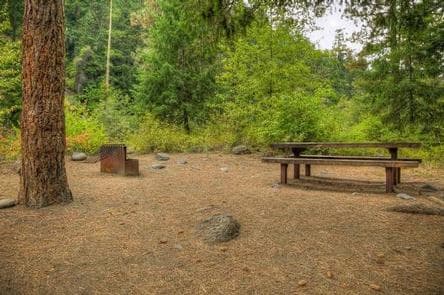
Overview Willows Campground sits on the eastern slopes of the Cascade Mountains at the southern end of the Okanogan-Wenatchee National Forest, offering visitors some of the most stunning scenery in Washington and easy access to an abundance of recreational activities. Recreation In addition to being a prime location for hiking fishing, hunting, horseback riding, and mountain biking in summer and early fall, Willows Campground offers excellent skiing, snowshoeing and snowmobiling in the winter months. Hikers and backpackers are especially fortunate to have access to a variety of spectacular trails near the campground and in the surrounding areas. Designated Wilderness provides thousands of pristine acres of incredible landscapes to enjoy in solitude or with a small group. Whitewater paddling on the Tieton River, adjacent to Willows Campground, is also a popular activity. Facilities In addition to being a prime location for hiking fishing, hunting, horseback riding, and mountain biking in summer and early fall, Willows Campground offers excellent skiing, snowshoeing and snowmobiling in the winter months. Hikers and backpackers are especially fortunate to have access to a variety of spectacular trails near the campground and in the surrounding areas. Designated Wilderness provides thousands of pristine acres of incredible landscapes to enjoy in solitude or with a small group. Whitewater paddling on the Tieton River, adjacent to Willows Campground, is also a popular activity. Natural Features Encompassing more than 4 million acres and stretching north to south from the Canadian border to the Goat Rocks Wilderness, the Okanogan-Wenatchee is a stunning and diverse National Forest. High, glaciated alpine peaks tower along the Cascade Crest and lush valleys of old growth forest define its western boundary. At its eastern edge, rugged shrub-steppe country comprises a more arid region. Elevations range from below 1,000 feet to more than 9,000 feet. Visitors to the area can expect many days of clear, sunny weather in the summer, and winters with clear skies and plenty of snow. contact_info This location has limited staffing. Please call (661) 702-1420 for general information. Nearby Attractions A historic highlight of the area is the last remaining lookout in the Naches Ranger District, Jumpoff Lookout. Visitors will also enjoy traveling the Cascade Lakes Scenic Byway, which climbs into the clouds on a 66-mile drive through the Cascade Mountain range, weaving through snow-capped peaks and alpine lakes. Charges & Cancellations Cancellations Individual Campsites: Cancellations up to 2 days before a reservation start date incur a $10.00 cancellation fee. A visitor who cancels a reservation the day before or on the day of arrival will pay a $10.00 service fee AND forfeit the first night's use fee including tax and applicable add-on for a campsite. Cancellations for a one-night reservation will forfeit the entire amount paid and will not be subject to an additional service fee. No-Shows A no-show visitor is one who does not arrive at a campground and does not cancel the reservation by check-out time on the day after the scheduled arrival date. Staff will hold a campsite until check-out time on the day following the arrival date. No-shows are assessed $20.00 service fee and forfeit the first night's rate, taxes and applicable add-on for a campsite. Refunds Visitors may submit a refund request through their Recreation.gov profile within 7 days of the end date of their reservation. Refunds will not be issued after the 7 days has ended. Refunds for debit or credit card payments will be issued as a credit to the original bank or credit card used to pay. For check or cash purchases, Recreation.gov will mail a Treasury check for refunds of cash, check, or money order payments to the address associated with the reservation. Treasury check refunds may take up to 6-8 weeks to arrive. In the event of an emergency closure, the Recreation.gov team or facility manager will refund all fees and will attempt to notify you using the contact information within the Recreation.gov visitor profile.
View details →
Overview Windy Point Campground is situated in Okanogan-Wenatchee National Forest, offering visitors some of the most stunning scenery in the Northern Cascade Range in Washington and easy access to an abundance of recreational activities. Recreation In addition to being a prime location for hiking fishing, hunting, horseback riding and mountain biking in summer and early fall, Windy Point offers excellent skiing, snowshoeing and snowmobiling during the winter months. Hikers and backpackers are especially fortunate to have access to a variety of spectacular trails near the campground and in the surrounding areas. Designated Wilderness provides thousands of pristine acres of incredible landscapes to enjoy in solitude or with a small group. Whitewater paddling on the Tieton River, near Windy Point Campground, is also a popular activity. Facilities In addition to being a prime location for hiking fishing, hunting, horseback riding and mountain biking in summer and early fall, Windy Point offers excellent skiing, snowshoeing and snowmobiling during the winter months. Hikers and backpackers are especially fortunate to have access to a variety of spectacular trails near the campground and in the surrounding areas. Designated Wilderness provides thousands of pristine acres of incredible landscapes to enjoy in solitude or with a small group. Whitewater paddling on the Tieton River, near Windy Point Campground, is also a popular activity. Natural Features Stretching north to south from the Canadian border to the Goat Rocks Wilderness, the Okanogan-Wenatchee is a stunning and diverse National Forest. High, glaciated alpine peaks tower along the Cascade Crest and lush valleys of old growth forest define its western boundary. A rugged shrub-steppe country comprises a more arid region at its eastern edge. Elevations range from below 1,000 feet to more than 9,000 feet. Visitors to the area can expect many days of clear, sunny weather in the summer, and winters with clear skies and plenty of snow. contact_info This location has limited staffing. Please call (661) 702-1420 for general information. Nearby Attractions A historic highlight of the area is Jumpoff Lookout, the last remaining lookout in the Naches Ranger District. Visitors will also enjoy traveling the Cascade Lakes Scenic Byway which climbs into the clouds on a 66-mile drive through the Cascade Mountain range, weaving through snow-capped peaks and alpine lakes. Hiking is popular for visitors to the campground. Frost Mountain Lookout Trail, Keenan Meadows Trail and the Grey Rock Trail are all favorites in the area. Charges & Cancellations Cancellations Individual Campsites: Cancellations up to 2 days before a reservation start date incur a $10.00 cancellation fee. A visitor who cancels a reservation the day before or on the day of arrival will pay a $10.00 service fee AND forfeit the first night's use fee including tax and applicable add-on for a campsite. Cancellations for a one-night reservation will forfeit the entire amount paid and will not be subject to an additional service fee. No-Shows A no-show visitor is one who does not arrive at a campground and does not cancel the reservation by check-out time on the day after the scheduled arrival date. Staff will hold a campsite until check-out time on the day following the arrival date. No-shows are assessed $20.00 service fee and forfeit the first night's rate, taxes and applicable add-on for a campsite. Refunds Visitors may submit a refund request through their Recreation.gov profile within 7 days of the end date of their reservation. Refunds will not be issued after the 7 days has ended. Refunds for debit or credit card payments will be issued as a credit to the original bank or credit card used to pay. For check or cash purchases, Recreation.gov will mail a Treasury check for refunds of cash, check, or money order payments to the address associated with the reservation. Treasury check refunds may take up to 6-8 weeks to arrive. In the event of an emergency closure, the Recreation.gov team or facility manager will refund all fees and will attempt to notify you using the contact information within the Recreation.gov visitor profile.
View details →
Overview Kettle Falls Campground is on the northern section of Lake Roosevelt and convenient to the town of Kettle Falls. The facility has a multi-lane boat launch, making it popular among boaters, fishermen and water sports enthusiasts. The Kettle Falls area is rich in the history of American Indians as well as the fur trade; campers can learn more at a park visitor center less than 10 miles away. Lake Roosevelt is a 130-mile lake on the Columbia River created by the Grand Coulee Dam. Named after President Franklin D. Roosevelt, it is part of the Lake Roosevelt National Recreation Area and managed by the National Park Service. Recreation The boat launch is directly within the facility, so many recreation activities can take place from the campground, including boating, fishing and water skiing. However, the lake is not very accessible to swimmers since there is a rocky descent from the campground to the water. Facilities The boat launch is directly within the facility, so many recreation activities can take place from the campground, including boating, fishing and water skiing. However, the lake is not very accessible to swimmers since there is a rocky descent from the campground to the water. Natural Features The campground is forested and overlooks Lake Roosevelt. Much of the water originates from glaciers and snow in the cold, high Canadian Rockies, although lake temperatures are pleasant to swim in during summer. The area is abundant with wildlife, including moose, elk, deer and bald eagles. Dozens of species of fish inhabit the lake, such as walleye, bass, rainbow trout, salmon and sturgeon; fishing for sturgeon is now allowed during a limited season. contact_info This location is unstaffed. To speak with our main office for general information, please call: (509) 754-7889. Nearby Attractions The historic St. Paul's Mission, which is run by the National Park Service, is located about two miles from campground. Also in the area are Fort Colville and the Hudson Bay Company Post on the Upper Columbia. St. Paul's Mission . Sherman drive, a scenic loop, is nearby. Charges & Cancellations All changes and cancellations must be made through recreation.gov Late Cancellations or Cancellations within the Cut-off Window Individual Campsites: A customer who cancels a reservation the day before or on the day of arrival will pay a $10.00 service fee AND forfeit the first night's use fee (not to exceed the total paid for the original reservation). Cancellations for a one-night reservation will forfeit the entire amount paid and will not be subject to an additional service fee.
View details →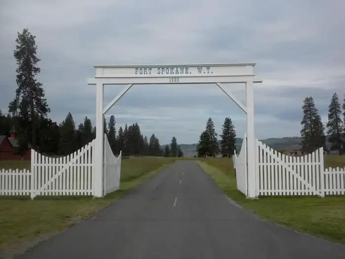
Overview Fort Spokane Campground is a great destination for history buffs, birders and boaters, and the perfect location for travelers who like a combination of history and recreation. Visitors can enjoy boating, fishing, birding or taking in the scenery around the lake at this year-round campground. The facility lies on the shoreline of Lake Roosevelt next to the grounds of a former military fort constructed to keep peace between early settlers and American Indians. Located in the former guardhouse, located in the middle of historic Fort Spokane, the visitor center and museum are open seasonally, from Memorial Day to Labor Day of each year. During the summer of 2023, the Fort Spokane Visitor Center and Museum will be open Friday through Sunday, 11am to 3pm. These hours begin May 26 and end September 3. For an audio description of the park brochure, visit the Publications or Accessibility page of our website: nps.gov/laro Lake Roosevelt is a 130-mile lake of the Columbia River created by the Grand Coulee Dam. Named after President Franklin D. Roosevelt, it is part of the Lake Roosevelt National Recreation Area and managed by the National Park Service. Recreation Fort Spokane boasts some of the best bird habitats in the Lake Roosevelt National Recreation Area. The prime viewing spot is Hawk Creek, only a few miles away. Birders often see Peregrine falcons, Blue herons, finches, Bald eagles, osprey and even the occasional Golden eagle. The former guard house of the fort is still standing and has been converted to a visitor center and museum directly across the street from the campground. The center is open from June through Labor Day, teaching visitors about the military history and Indian boarding school through interpretive programs and exhibits. An interpretive trail around the grounds is open year round, for a more self-guided tour. The lake is abundant with walleye, bass, rainbow trout and salmon, making it a popular place for fishing throughout the year; the shoreline along Fort Spokane does not typically freeze in winter and the campground's boat-launch is open all year. Facilities Fort Spokane boasts some of the best bird habitats in the Lake Roosevelt National Recreation Area. The prime viewing spot is Hawk Creek, only a few miles away. Birders often see Peregrine falcons, Blue herons, finches, Bald eagles, osprey and even the occasional Golden eagle. The former guard house of the fort is still standing and has been converted to a visitor center and museum directly across the street from the campground. The center is open from June through Labor Day, teaching visitors about the military history and Indian boarding school through interpretive programs and exhibits. An interpretive trail around the grounds is open year round, for a more self-guided tour. The lake is abundant with walleye, bass, rainbow trout and salmon, making it a popular place for fishing throughout the year; the shoreline along Fort Spokane does not typically freeze in winter and the campground's boat-launch is open all year. Natural Features Fort Spokane lies on the water amidst Ponderosa pines and shrubs. It is near the confluence of the Spokane River and the Columbia River (Lake Roosevelt). The lake has comfortable temperatures during summer, even though much of the water originates from glaciers and snow in the cold, high Canadian Rockies. The lake area is abundant with wildlife, including moose, elk, deer, bighorn sheep, birds and fish. Nearby Attractions Just across the road from the campground is the Ft. Spokane Visitor Center. Inside the old gaurd house you will find a small museum. There are also trails that include a self guided tour of the grounds. contact_info This location is unstaffed. To speak with our main office for general information, please call: (509) 754-7889. Charges & Cancellations All changes and cancellations must be made through recreation.gov Late Cancellations or Cancellations within the Cut-off Window Individual Campsites: A customer who cancels a reservation the day before or on the day of arrival will pay a $10.00 service fee AND forfeit the first night's use fee (not to exceed the total paid for the original reservation). Cancellations for a one-night reservation will forfeit the entire amount paid and will not be subject to an additional service fee.
View details →
Overview Spring Canyon Campground, on the shoreline of Lake Roosevelt, is perfect for those who enjoy being on the water. The 130-mile long lake is a feature of the Columbia River created by the Grand Coulee Dam. The lake is named after President Franklin D. Roosevelt and is a part of the Lake Roosevelt National Recreation Area, managed by the National Park Service. Campers have the convenience of a day-use swimming area and plenty of space to sit back and soak up the summer sun and cooler days of spring and fall. Recreation Lake Roosevelt provides numerous opportunities for outdoor recreation. Families can cool off in the day-use water access area located approximately 300 yards downhill from the campground. The Day Use area also has a playground. Boating and water sports abound. For campers looking to take a break from the lake, the Bunchgrass Prairie Nature Trail offers a short walk through the sagebrush. Facilities Lake Roosevelt provides numerous opportunities for outdoor recreation. Families can cool off in the day-use water access area located approximately 300 yards downhill from the campground. The Day Use area also has a playground. Boating and water sports abound. For campers looking to take a break from the lake, the Bunchgrass Prairie Nature Trail offers a short walk through the sagebrush. Natural Features Though not directly on the water, the camping area is a short walk from the lake. The green, lush campground has beautiful views of the lake and surrounding hills. Lake temperatures are comfortable for swimming during the summer, even though much of the water originates from glaciers and snowmelt in the cold, high Canadian Rockies. The lake area has abundant wildlife and birds, including eagles and osprey. Dozens of species of fish inhabit the lake. contact_info This location is unstaffed. To speak with our main office for general information, please call: (509) 754-7889. Nearby Attractions The famous Grand Coulee Dam is only three miles from the campground. A laser light show is displayed nightly on the dam from Memorial Day weekend through September 30. Additional services are available in the adjacent town of Grand Coulee. Spring Canyon is a short drive from the Lake Roosevelt National Recreation Area Headquarters, which provides visitor information. Charges & Cancellations All changes and cancellations must be made through recreation.gov
View details →
Overview Evans Group Camp, along the northern shoreline of Lake Roosevelt, is the most northern campground on the lake that can be reserved. The site is long and narrow, an orientation that allows for a fantastic, clear view of the lake from every vantage point. There is one group campsite that can accommodate one group of up to 25 people at a time. Lake Roosevelt is a 130-mile lake on the Columbia River created by the Grand Coulee Dam. Named after President Franklin D. Roosevelt, it is part of the Lake Roosevelt National Recreation Area and managed by the National Park Service. Recreation The boat launch provides year-round access to the lake. Boating, fishing, swimming and water skiing are activities that can easily take place from the campground. Campers might also enjoy relaxing and taking in the beautiful view or attending educational ranger programs. Facilities The boat launch provides year-round access to the lake. Boating, fishing, swimming and water skiing are activities that can easily take place from the campground. Campers might also enjoy relaxing and taking in the beautiful view or attending educational ranger programs. Natural Features Evans provides ample shade with thick forests of ponderosa pine, douglas fir and maple trees. The lake area is abundant with wildlife, including moose, elk and deer. Quite a few bald eagles have been spotted around Evans, and dozens of species of fish inhabit the lake, such as walleye, bass, rainbow trout, salmon and sturgeon. Fishing for sturgeon is now allowed during a short season. Much of the water in the originates from glaciers and snow in the cold, high Canadian Rockies, though temperatures are pleasant to swim in during summer. contact_info This location is unstaffed. To speak with our main office for general information, please call: (509) 754-7889. Charges & Cancellations All changes and cancellations must go through recreation.gov Group Facility (including Cabins and Lookouts): Customers who cancel a group overnight facility reservation less than 14 days before the arrival date will pay a $10.00 service fee AND forfeit the first night's use fee.
View details →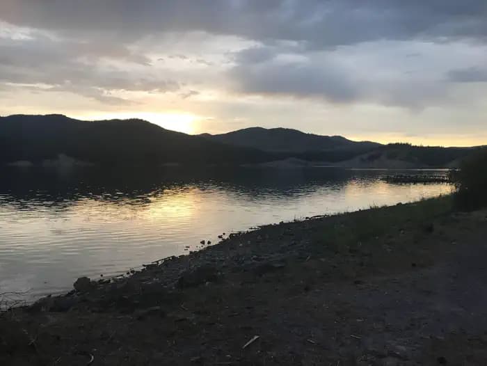
Overview Kettle Falls Locust Grove Group Site is on the northern section of Lake Roosevelt and convenient to the town of Kettle Falls. The facility is 0.25 miles away from the main Kettle Falls Campground, which has a multi-lane boat launch. It is popular for groups of boaters, fishermen and water sports enthusiasts. The Kettle Falls area is rich in history of American Indians as well as the fur trade; campers can learn more at a park visitor center less than 10 miles away. Lake Roosevelt is a 130-mile lake on the Columbia River created by the Grand Coulee Dam. Named after President Franklin D. Roosevelt, it is part of the Lake Roosevelt National Recreation Area and managed by the National Park Service. Recreation The boat launch is in the main campground adjacent to the group sites, making the lake very accessible for boaters and fishermen. There is a former swimming beach at the group area; however, swimming conditions are not ideal. Facilities The boat launch is in the main campground adjacent to the group sites, making the lake very accessible for boaters and fishermen. There is a former swimming beach at the group area; however, swimming conditions are not ideal. Natural Features The actual waterfalls of Kettle Falls are dormant under 80 feet of water formed by the backwaters of Grand Coulee Dam. The two group sites are spacious and set within a grove of locust trees, hence the name. They are near the site of Old Kettle Falls and overlooking Lake Roosevelt. Much of the water originates from glaciers and snow in the cold, high Canadian Rockies, though temperatures warm up in summer. The lake area is abundant with wildlife, including moose, elk, deer and bald eagles. Dozens of species of fish inhabit the lake, such as walleye, bass, rainbow trout, salmon and sturgeon. Fishing for sturgeon is now allowed during a limited season. contact_info This location is unstaffed. To speak with our main office for general information, please call: (509) 754-7889. Nearby Attractions The historic St. Paul's Mission, which is run by the National Park Service, is located about two miles from campground. Also in the area are Fort Colville and the Hudson Bay Company Post on the Upper Columbia, as well as the Sherman Pass Loop scenic drive. St. Paul's Mission Charges & Cancellations All changes and cancellations must go through recreation.gov Group Facility (including Cabins and Lookouts): Customers who cancel a group overnight facility reservation less than 14 days before the arrival date will pay a $10.00 service fee AND forfeit the first night's use fee.
View details →
Overview Gifford Group Site is along the shoreline of Lake Roosevelt, adjacent to the main Gifford Campground. It offers spectacular views of the lake from every vantage point. The facility is composed of one group site that can accommodate a group of up to 50 people at a time. Lake Roosevelt is a 130-mile lake on the Columbia River created by the Grand Coulee Dam. Named after President Franklin D. Roosevelt, it is part of the Lake Roosevelt National Recreation Area, managed by the National Park Service. Recreation This site is popular for hunting groups seeking out the many deer and turkey in the area (hunting is allowed in certain areas of the park). There is no designated swimming area, but shallow water and a beachfront, make for ideal swimming conditions. The boat launch provides year-round access to the lake. Boating, fishing, swimming and water skiing are activities that can easily take place from the campground. Campers might also enjoy relaxing and taking in the beautiful view or attending educational ranger programs. Facilities This site is popular for hunting groups seeking out the many deer and turkey in the area (hunting is allowed in certain areas of the park). There is no designated swimming area, but shallow water and a beachfront, make for ideal swimming conditions. The boat launch provides year-round access to the lake. Boating, fishing, swimming and water skiing are activities that can easily take place from the campground. Campers might also enjoy relaxing and taking in the beautiful view or attending educational ranger programs. Natural Features Gifford sits in a thick Ponderosa pine forest that provide plenty of shade. The lake area is abundant with wildlife, including moose, elk, deer and bald eagles. Dozens of species of fish inhabit the lake such as walleye, bass, rainbow trout, salmon and sturgeon; however, fishing for sturgeon is now allowed During a limited season . Much of the water in the lake originates from glaciers and snowmelt in the cold, steep Canadian Rockies, even though temperatures are pleasant for swimming during summer months. contact_info This location is unstaffed. To speak with our main office for general information, please call: (509) 754-7889. Nearby Attractions The Gifford Ferry is a free ferry offered by the Colville Confederated Tribes that can take passengers across the river. It runs daily and departs every 15 minutes. Charges & Cancellations Changes and cancellations must be made through recreation.gov.
View details →
Overview Hunters Group Site sits along the northern shoreline of Lake Roosevelt. The facility is popular among groups of hunters and fishermen, but is also comfortable for families and other groups of up to 25 people. Although there is no view of the lake directly from the campground, a boat launch and beach are located within the facility. Lake Roosevelt is a 130-mile lake on the Columbia River created by the Grand Coulee Dam. Named after President Franklin D. Roosevelt, it is part of the Lake Roosevelt National Recreation Area managed by the National Park Service. Recreation This campground is popular for hunting groups (hunting is allowed in certain areas of the park) and fishermen. The lake is abundant with walleye, bass, rainbow trout and salmon. Sturgeon also live in the lake; fishing for sturgeon is now allowed For a limited season. The boat launch is open year-round. Families and visitors can attend educational programs, enjoy a leisurely walk to the lake or relax by the beach. Facilities This campground is popular for hunting groups (hunting is allowed in certain areas of the park) and fishermen. The lake is abundant with walleye, bass, rainbow trout and salmon. Sturgeon also live in the lake; fishing for sturgeon is now allowed For a limited season. The boat launch is open year-round. Families and visitors can attend educational programs, enjoy a leisurely walk to the lake or relax by the beach. Natural Features The site is situated in a thick Ponderosa pine forest that provides plenty of shade. The lake area is abundant with wildlife, including moose, elk, deer and bald eagles. Dozens of species of fish inhabit the lake. Much of the water in the lake originates from glaciers and snowmelt from the cold, high Canadian Rockies. Although, lake temperatures are pleasant to swim in during summer. contact_info This location is unstaffed. To speak with our main office for general information, please call: (509) 754-7889. Charges & Cancellations All changes and cancellations must go through recreation.gov Group Facility (including Cabins and Lookouts): Customers who cancel a group overnight facility reservation less than 14 days before the arrival date will pay a $10.00 service fee AND forfeit the first night's use fee.
View details →
Overview Spring Canyon Group Site is perfect for large families and groups of boaters or fishermen. Located on the shoreline of Lake Roosevelt, it offers ample opportunity to get out on the water or relax on the beach and take in the gorgeous lakeside scenery. The 130-mile long lake is a feature of the Columbia River created by the nearby Grand Coulee Dam. The lake is named after President Franklin D. Roosevelt and is part of the Lake Roosevelt National Recreation Area, managed by the National Park Service. Campers have the convenience of a day-use swimming area, a boat ramp within the facility and plenty of space to sit back and soak up the summer sun and cooler days of spring and fall. Recreation Lake Roosevelt provides numerous opportunities for outdoor recreation. Families can cool off in the day-use swimming area located approximately 300 yards downhill from the campground. The swimming area also has a playground. Boating and water sports abound. For campers looking to take a break from the lake, the Bunchgrass Prairie Nature Trail offers a short walk through the sagebrush. Facilities Lake Roosevelt provides numerous opportunities for outdoor recreation. Families can cool off in the day-use swimming area located approximately 300 yards downhill from the campground. The swimming area also has a playground. Boating and water sports abound. For campers looking to take a break from the lake, the Bunchgrass Prairie Nature Trail offers a short walk through the sagebrush. Natural Features One of the group sites is located on the waterfront; the other is within a short walk of the lake and has a beautiful view of the water. Lake temperatures are comfortable for swimming during the summer, even though much of the water originates from glaciers and snowmelt in the cold, high Canadian Rockies. The lake area has abundant wildlife and birds, including eagles and osprey. Dozens of species of fish inhabit the lake. Nearby Attractions The famous Grand Coulee Dam is only three miles from the campground. A laser light show is displayed nightly on the dam from Memorial Day weekend through September 30. Additional services are available in the adjacent town of Grand Coulee. Spring Canyon is a short drive from the Lake Roosevelt National Recreation Area Headquarters, which provides visitor information. contact_info This location is unstaffed. To speak with our main office for general information, please call: (509) 754-7889. Charges & Cancellations All changes and cancellations must go through recreation.gov Group Facility (including Cabins and Lookouts): Customers who cancel a group overnight facility reservation less than 14 days before the arrival date will pay a $10.00 service fee AND forfeit the first night's use fee.
View details →
Overview Situated in the vicinity of majestic Mount Rainier, Big Creek is a family campground nestled among Douglas firs, hemlock, alders and maples. The lush vegetation offers plenty of privacy between sites. The sites at Big Creek form a loop, with only a handful of sites sitting along the banks of Big Creek. Open from mid-May through late September, Big Creek provides an alternative to the campgrounds at Mount Rainier National Park, which can get very crowded during the summer. Recreation Anglers can try their luck at catching brook trout in Big Creek or for those looking to explore the area, the Osborne Mountain Trail starts at the campground. The route is steep, but the scenery is amazing, and the trail can be traversed by foot, horse, mountain bike or dirt bike. Facilities Anglers can try their luck at catching brook trout in Big Creek or for those looking to explore the area, the Osborne Mountain Trail starts at the campground. The route is steep, but the scenery is amazing, and the trail can be traversed by foot, horse, mountain bike or dirt bike. Natural Features Located in southwest Washington State, the Gifford Pinchot National Forest encompasses over 1.3 million acres and includes the 110,000-acre Mount St. Helens National Volcanic Monument established by Congress in 1982. Big Creek is located in the Cowlitz Valley Ranger District, the northernmost portion of the Gifford Pinchot National Forest. This Ranger District manages four Wilderness Areas including the Goat Rocks Wilderness, Glacier View Wilderness, Tatoosh Wilderness and William O' Douglass Wilderness. The Cowlitz Valley Ranger District is roughly located among three volcanic peaks: Mt. Rainier to the north, Mt. Adams to the east, and Mt. St. Helens to the west, providing visitors with a unique geological landscape. contact_info This location has limited staffing. Please call (360) 686-3008 for general information. Nearby Attractions Big Creek is 6 miles from the Nisqually entrance of Mount Rainier National Park. The popular Henry M. Jackson Memorial Visitor Center at Paradise is 21 miles away, and the nearby town of Ashford offers restaurants, along with a few art galleries and shops. Charges & Cancellations Cancellations Individual Campsites: Cancellations up to 2 days before a reservation start date incur a $10.00 cancellation fee. A visitor who cancels a reservation the day before or on the day of arrival will pay a $10.00 service fee AND forfeit the first night's use fee including tax and applicable add-on for a campsite. Cancellations for a one-night reservation will forfeit the entire amount paid and will not be subject to an additional service fee. No-Shows A no-show visitor is one who does not arrive at a campground and does not cancel the reservation by check-out time on the day after the scheduled arrival date. Staff will hold a campsite until check-out time on the day following the arrival date. No-shows are assessed $20.00 service fee and forfeit the first night's rate, taxes and applicable add-on for a campsite. Refunds Visitors may submit a refund request through their Recreation.gov profile within 7 days of the end date of their reservation. Refunds will not be issued after the 7 days has ended. Refunds for debit or credit card payments will be issued as a credit to the original bank or credit card used to pay. For check or cash purchases, Recreation.gov will mail a Treasury check for refunds of cash, check, or money order payments to the address associated with the reservation. Treasury check refunds may take up to 6-8 weeks to arrive. In the event of an emergency closure, the Recreation.gov team or facility manager will refund all fees and will attempt to notify you using the contact information within the Recreation.gov visitor profile.
View details →
Overview Nestled in a grove of towering old-growth conifer trees, the Government Mineral Springs Guard Station is a delightful setting for guests seeking relaxation and recreation in the Gifford Pinchot National Forest. The Government Mineral Springs area has been a draw to recreation enthusiasts since the early 1900's. In 1910, S.D. Fox and the Star Brewing Company of Portland began construction of a hotel near Trapper Creek, which eventually became known as Government Mineral Springs. The popular resort boasted bath houses, Iron Mike Bubbling Springs, a dance pavilion, store, ice cream parlor, goldfish ponds and flower gardens. Early advertisements for the resort claimed the mineral water spas were capable of curing physical ailments. In 1935, the hotel burned to the ground. Camping remained popular at the site, and in 1937, the Civilian Conservation Corps significantly expanded and developed the public campground and built the guard station, which was used for Forest Service administration of the campground and other local recreational use. Today, the cabin provides a unique lodging opportunity. Guests should be aware that during the winter season, the cabin is only accessible via a half-mile trek on skis, snowshoes or snowmobiles from the parking area. There is no motor vehicle access from the road that leads to the cabin when snow is present on the road. Parking at the snow park is required, and requires a snow park pass. This pass can be purchased at local vendors. Recreation Many recreational opportunities are within close proximity of the Guard Station, including fishing, hiking, biking, mushroom and huckleberry picking, hunting, skiing and snowshoeing. Nearby fishing opportunities include spring chinook fishing on the Wind River and lake fishing for brown and brook trout in Soda Peaks Lake, in Trapper Creek Wilderness. A short drive from the cabin is the Falls Creek Falls Trail, a 3.5-mile round-trip hike for the whole family. Accessible year round, the trail follows a forested creek before crossing a suspension bridge, then traverses a side slope which offers views of the creek and interesting rock formations. At the end of the trail is lower Falls Creek Falls, a three-tiered waterfall which drops nearly 250 feet into a pool below the viewpoint. Facilities Many recreational opportunities are within close proximity of the Guard Station, including fishing, hiking, biking, mushroom and huckleberry picking, hunting, skiing and snowshoeing. Nearby fishing opportunities include spring chinook fishing on the Wind River and lake fishing for brown and brook trout in Soda Peaks Lake, in Trapper Creek Wilderness. A short drive from the cabin is the Falls Creek Falls Trail, a 3.5-mile round-trip hike for the whole family. Accessible year round, the trail follows a forested creek before crossing a suspension bridge, then traverses a side slope which offers views of the creek and interesting rock formations. At the end of the trail is lower Falls Creek Falls, a three-tiered waterfall which drops nearly 250 feet into a pool below the viewpoint. Natural Features Trapper Creek Wilderness is within walking distance of the guard station, boasting 6,050 acres of diverse habitat. Cascading streams and waterfalls are plentiful throughout the steep slopes at the lower elevations, while huckleberry fields occur higher near Observation Peak. Wildlife abounds in the area. Animals commonly seen include black tail deer, Roosevelt elk and black bear. The more elusive cougar, bobcat and pine marten are seen occasionally. Spotted owls, barred owls, pileated woodpeckers and goshawks inhabit the forest treetops. Nearby Attractions The guard station is located between Mt. St Helens National Volcanic Monument and the Columbia River Gorge National Scenic Area, convenient for day trips.
View details →
Overview Edgewater Campground is perched along the banks of the Pend Oreille River in the Colville National Forest. The quiet, family-friendly campground attracts visitors who come for boating, hiking and fishing. The picturesque area, surrounded by cedar, hemlock and Douglas fir, boasts views of the Selkirk Mountains. Recreation Trout and bass fishing is great for avid anglers. A boat ramp is located on-site. Hikers enjoy exploring nearby Terry Trail and Box Canyon. Wildlife watching for moose, white-tailed deer and the endangered woodland caribou is another popular activity. Facilities Trout and bass fishing is great for avid anglers. A boat ramp is located on-site. Hikers enjoy exploring nearby Terry Trail and Box Canyon. Wildlife watching for moose, white-tailed deer and the endangered woodland caribou is another popular activity. Natural Features The campground sits on a bluff on the east bank of the river at an elevation of 2,000 feet. Many campsites offer a scenic view of the river. The forest floor is covered with thimbleberry, wild rose and other shrubs. The 1.1 million acre Colville National Forest lies in the northeast corner of Washington. The forest's great salmon runs first attracted native Americans to the area, then miners, homesteaders and fur trappers followed. The variety of resources and natural beauty in the region continues to attract visitors. Three mountain ranges, the Okanogan, Kettle River and Selkirk, run through the Colville Forest. Nearby Attractions Sweet Creek Falls is located just north of the city of Ione.
View details →
Overview Godman Guard Station, built in the 1930s, sits just outside the impressive Wenaha-Tucannon Wilderness. The complex is adjacent to a historic Civilian Conservation Corps campground. Horseback riding and hiking trails into the wilderness are easily accessed from the cabin. Horses are permitted in the area, however, due to sanitary reasons, horses are not allowed near the guard station. Horses may be tied to the barn’s hitching rails located about 200 yards up the hill. The barn cannot be used by renters, just the hitching rails and feed bunks. Winter access is by snowmobile, snowshoes or cross country skis. A groomed snowmobile trail passes right by the cabin. Recreation Guests will delight in viewing scenery along Skyline Drive Road and the Wenaha-Tucannon Wilderness. During the summer months, horseback riding or hiking in the wilderness are popular pastimes. Many trails descend into the rugged river canyons and offer fishing opportunities. Check with the appropriate state Department of Fish and Wildlife for regulations. The Godman Trailhead can be accessed from the cabin. In winter, campers enjoy snowmobiling on groomed trails, snowshoeing and cross-country skiing. Facilities Guests will delight in viewing scenery along Skyline Drive Road and the Wenaha-Tucannon Wilderness. During the summer months, horseback riding or hiking in the wilderness are popular pastimes. Many trails descend into the rugged river canyons and offer fishing opportunities. Check with the appropriate state Department of Fish and Wildlife for regulations. The Godman Trailhead can be accessed from the cabin. In winter, campers enjoy snowmobiling on groomed trails, snowshoeing and cross-country skiing. Natural Features Godman Guard Station is perched above the Wenaha-Tucannon Wilderness at an elevation of 5,600 feet. From a barn about 100 yards up the hill from the cabin, expansive views of the wilderness can be seen. The wilderness includes nearly 180,000 acres of rugged basaltic ridges, steep canyons, rushing rivers and their tributaries and abundant wildlife. Rocky Mountain Elk, bighorn sheep, white-tailed and mule deer, black bears, cougars, coyotes and pine martens inhabit the region. Nearby Attractions The cabin is 28 miles or a one-hour drive from Dayton. Groceries and fuel are available. The Tucannon Last Resort Store is also about an hour's drive away. Charges & Cancellations For Reservation Changes & Cancellation Fees, please see Rules & Reservation Policies.
View details →
Overview Lost Lake Group Site is located in Lost Lake Campground which is situated on the northern edge of Lost Lake on the Tonasket Ranger District of the Okanogan-Wenatchee National Forest. Set beneath mixed-conifer forest and surrounded by mountains, this campground offers one group site, suitable for large family and group camping excursions as well as several non-reservable single and double sites. Recreation Lost Lake Campground offers outdoor enthusiasts the opportunity to hike, fish, and enjoy a long list of outdoor recreational activities. Anglers enjoy boat fishing (with an electric motor only) for rainbow and triploid eastern brook are available in abundance. A boat ramp is available in the campground. For an easy, interpretive hike for the whole family, the Big Tree Trail starts across the road from the Lost Lake guard house at the entrance to the campground. This 0.8 mile trail connects with a loop trail that highlights two 600-year old western larch trees. It is particularly beautiful when the wildflowers are out in June. Another great hike is the Strawberry Mt. Trail that starts just outside the Campground entrance and travels 1.5 miles up to Strawberry Mt. Facilities Lost Lake Campground offers outdoor enthusiasts the opportunity to hike, fish, and enjoy a long list of outdoor recreational activities. Anglers enjoy boat fishing (with an electric motor only) for rainbow and triploid eastern brook are available in abundance. A boat ramp is available in the campground. For an easy, interpretive hike for the whole family, the Big Tree Trail starts across the road from the Lost Lake guard house at the entrance to the campground. This 0.8 mile trail connects with a loop trail that highlights two 600-year old western larch trees. It is particularly beautiful when the wildflowers are out in June. Another great hike is the Strawberry Mt. Trail that starts just outside the Campground entrance and travels 1.5 miles up to Strawberry Mt. Natural Features The Lost Lake area offers a medium sized lake with scenic views, forested mountains, abundant wildlife, and a few hiking trails. Visitors to the area can expect many days of warm, sunny weather in the summer, and winters with clear skies and plenty of snow. The surrounding area has clean streams and diverse forests that support an abundance of wildlife, including deer, porcupine, black bear, cougar, native fish, common loon, bald eagles, and migratory birds. Endangered and threatened species, including gray wolves and Canada lynx, also find havens in nearby ecosystems. Nearby Attractions
View details →
Overview This campground is located along the Middle Fork of the scenic Snoqualmie River in Mt. Baker-Snoqualmie National Forest. Beneath a canopy of towering Douglas fir, cedar and Western hemlock, and located near several hiking trails within a short driving distance, this campground is a perfect site for both individual and small group camping excursions. Recreation In addition to being a prime location for hiking, fishing, horseback riding and picnicking in summer and early fall, Middle Fork offers excellent skiing and snowshoeing in the winter months. Approximately 1,500 miles of trails throughout the area can entice any hiker to get outdoors. From smooth paths meandering through deep quiet forests to challenging ascents up boulder-studded mountains, opportunities abound for every skill level. The popular Middle Fork Trail is a 3 mile trail offering visitors a glimpse into the area's diversity. The trail begins by crossing the Middle Fork of the Snoqualmie River via the Gateway Bridge, then turns upstream and meanders between the river and overhanging cliffs, offering sweeping views of nearby peaks. After climbing away from the river and passing under Stegosaurus Butte, a granite ridge towering over the valley at over 1,000 feet, the trail follows an old logging railroad grade used by pioneers and finally descends back to river level. The Middle Fork Snoqualmie Trail is also used by bicycles and horseback riders. Mountain bikes are allowed on the trail on odd- numbered days of the week. A Recreation Pass is required for each vehicle parked at the trailhead. Facilities In addition to being a prime location for hiking, fishing, horseback riding and picnicking in summer and early fall, Middle Fork offers excellent skiing and snowshoeing in the winter months. Approximately 1,500 miles of trails throughout the area can entice any hiker to get outdoors. From smooth paths meandering through deep quiet forests to challenging ascents up boulder-studded mountains, opportunities abound for every skill level. The popular Middle Fork Trail is a 3 mile trail offering visitors a glimpse into the area's diversity. The trail begins by crossing the Middle Fork of the Snoqualmie River via the Gateway Bridge, then turns upstream and meanders between the river and overhanging cliffs, offering sweeping views of nearby peaks. After climbing away from the river and passing under Stegosaurus Butte, a granite ridge towering over the valley at over 1,000 feet, the trail follows an old logging railroad grade used by pioneers and finally descends back to river level. The Middle Fork Snoqualmie Trail is also used by bicycles and horseback riders. Mountain bikes are allowed on the trail on odd- numbered days of the week. A Recreation Pass is required for each vehicle parked at the trailhead. Natural Features Hemmed in by several designated wilderness areas, Mt. Baker-Snoqualmie National Forest showcases rugged peaks, sparkling alpine lakes and old-growth forests. On a clear day visitors will see Mt. Baker, the most prominent feature of the Mt. Baker Wilderness Area. Rising to an elevation of 10,781 feet, the active volcano from which the forest takes its name is perpetually snow-capped and mantled with an extensive network of creeping glaciers. Mt. Baker's summit, Grant Peak, is actually a 1,300-foot-deep mound of ice, which hides a massive volcanic crater. Wildlife in the area include mountain goats, coyotes, pine marten and a variety of migratory birds and native fish. contact_info For facility specific information, please call (530) 932-0242. Nearby Attractions The Verlot Public Service Center, near the South Fork Stillaguamish River, was built by the Civilian Conservation Corps from 1933 to 1942. Verlot`s handsome buildings reflect the architectural style and fine craftsmanship of that era and are listed on the National Register of Historic Places. Visitors enjoy the North Cascades and Mt. Rainer National Parks, where interpretive programs and exhibits offer education about the diverse landscape and history of the area. Charges & Cancellations Once your reservation start date has begun, neither the Recreation.gov Contact Center nor the campground manager will be able to modify your reservation.
View details →
Overview South Fork Group Campground is located in the Okanogan-Wenatchee National Forest along the South Fork of the Tieton River. Nestled in in the eastern Cascade Mountains, the campground offers warm summer days and access to a multitude of recreational activities, making it an ideal setting for large family and group gatherings. Recreation South Fork Group Campground offers outdoor enthusiasts the opportunity to hike, fish, ski, raft and enjoy a multitude of outdoor recreational activities throughout the year. Rimrock Lake lies less than a mile from the campground. Whether casting a line out for kokanee salmon or trout or paddling a kayak along the shore, visitors will enjoy the mountainous terrain as a backdrop for a myriad of water-based activities. River enthusiasts may enjoy a whitewater rafting trip on one of the many scenic rivers in the area. The Tieton River is especially exciting in September, when the Bureau of Reclamation floods the Tieton Valley, releasing fast and furious water. Facilities South Fork Group Campground offers outdoor enthusiasts the opportunity to hike, fish, ski, raft and enjoy a multitude of outdoor recreational activities throughout the year. Rimrock Lake lies less than a mile from the campground. Whether casting a line out for kokanee salmon or trout or paddling a kayak along the shore, visitors will enjoy the mountainous terrain as a backdrop for a myriad of water-based activities. River enthusiasts may enjoy a whitewater rafting trip on one of the many scenic rivers in the area. The Tieton River is especially exciting in September, when the Bureau of Reclamation floods the Tieton Valley, releasing fast and furious water. Natural Features The Okanogan-Wenatchee National Forest offers stunning scenic views, with high, glaciated alpine peaks, valleys of old growth forest and rugged shrub-steppe country making up the diverse landscape. Elevations range from below 1,000 feet to more than 9,000 feet. Precipitation varies greatly throughout the area, ranging from approximately 140 inches along the Cascade Crest to only 10 inches along the eastern edge. Visitors can expect many days of warm, sunny weather in the summer, and winters with clear skies and plenty of snow. The Tieton River, adjacent to South Fork Group Campground, is a tributary of the Naches River. Its headwaters originate in Goat Rocks Wilderness, collecting water from snowmelt and glaciers in high rugged peaks. These peaks are remnants of an extinct volcano, taking the name "Goat Rocks" in honor of the fantastic mountain goats traversing this isolated region. Nearby Attractions Visitors enjoy Mt. Rainer National Park, where interpretive programs and exhibits offer education about the diverse landscape and history of the area. The spectacular Pacific Crest Trail (PCT), one of the world's premier National Scenic Trails, showcases some of North America's most fantastic scenery, winding its way its way from Mexico to Canada through California, Oregon and Washington, and is accessible near the campground. Other hiking trails are within 5 miles of the campsite, and an accessible boat ramp is within 10 miles.
View details →
Overview A variety of activities await visitors at the open air Swan Lake Kitchen. Located within the Swan Lake Campground, the group site is situated on a large, flat open space near the beach. The kitchen itself is located up the hill from the beach in the trees. The kitchen is accessible via a staircase from the parking area and a path from the beach. A day of swimming, boating, fishing or hiking can be topped off with a trip to the kitchen to wind down and enjoy a group meal. Originally built in 1936 by the Civilian Conservation Corps, the site was historically preserved in 2009 and retains its charming historic character. Recreation Swan Lake has a sandy beach with a swimming dock, plus access to the Swan Lake Trail #14. The trail boasts views of the lake and seasonal huckleberries. Wildlife watching is excellent and the lake is home to loons throughout most of the summer. Facilities Swan Lake has a sandy beach with a swimming dock, plus access to the Swan Lake Trail #14. The trail boasts views of the lake and seasonal huckleberries. Wildlife watching is excellent and the lake is home to loons throughout most of the summer. Natural Features At an elevation of 3,640 feet, Swan Lake Kitchen is located in a wooded area overlooking the 52-acre Swan Lake. The kitchen is on the north end of the lake near the swimming beach. The 1.1 million acre Colville National Forest lies in the northeast corner of Washington. The forest's great salmon runs first attracted native Americans to the area, then miners, homesteaders and fur trappers followed. The variety of resources and natural beauty in the region continues to attract visitors. Nearby Attractions The Republic Ranger Station and the Stonerose Interpretive Center are 15 miles north in the town of Repbulic.
View details →
Overview Nestled in a secluded forest setting, Grouse Creek Group Campground is a hidden gem for groups looking for a quiet getaway trip. The campground is located near the confluence of Grouse Creek and the Chiwawa River, offering scenic landscapes and a multitude of recreational activities. Recreation Grouse Creek Group Campground offers outdoor enthusiasts the opportunity to hike, fish, bike and enjoy a long list of outdoor recreational activities throughout the year. At an elevation of 1,850 feet, Wenatchee Lake provides outdoor enthusiasts with a multitude of recreational opportunities year-round. The area offers a scenic backdrop for swimmers braving its cold, refreshing waters, and for anglers casting a lines from boat or shoreline. Brook trout, smallmouth bass, largemouth bass and cutthroat trout thrive in the lake. Skiing, snowmobiling, tubing, and skijouring are popular winter activities for visitors to the Wenatchee Ranger District. Both motorized and non-motorized Sno-Parks in the area offer access to both groomed trails and natural settings for those wanting to explore the winter wonderland. Facilities Grouse Creek Group Campground offers outdoor enthusiasts the opportunity to hike, fish, bike and enjoy a long list of outdoor recreational activities throughout the year. At an elevation of 1,850 feet, Wenatchee Lake provides outdoor enthusiasts with a multitude of recreational opportunities year-round. The area offers a scenic backdrop for swimmers braving its cold, refreshing waters, and for anglers casting a lines from boat or shoreline. Brook trout, smallmouth bass, largemouth bass and cutthroat trout thrive in the lake. Skiing, snowmobiling, tubing, and skijouring are popular winter activities for visitors to the Wenatchee Ranger District. Both motorized and non-motorized Sno-Parks in the area offer access to both groomed trails and natural settings for those wanting to explore the winter wonderland. Natural Features Okanogan-Wenatchee National Forest offers stunning scenic views, with high, glaciated alpine peaks, valleys of old growth forest and rugged shrub-steppe country making up the diverse landscape. Elevations range from below 1,000 feet to over 9,000 feet. Precipitation varies greatly throughout the area, ranging from approximately 140 inches along the Cascade Crest to only 10 inches along the eastern edge. Visitors can expect many days of warm, sunny weather in the summer, and winters with clear skies and plenty of snow. The surrounding undeveloped wilderness, clean streams and diverse forests support an abundance of wildlife, including mountain goats, porcupine, pine marten, native fish and migratory birds. contact_info This location has limited staffing. Please call (661) 702-1420 for general information. Nearby Attractions Visitors enjoy the North Cascades and Mt. Rainer National Parks, where interpretive programs and exhibits offer education about the diverse landscape and history of the area. The spectacular Pacific Crest Trail (PCT), one of the world's premier National Scenic Trails, showcases some of North America's most fantastic scenery, winding its way its way from Mexico to Canada through California, Oregon and Washington, and is accessible near the campground. Charges & Cancellations Group Sites Group Facility (including Cabins and Lookouts): A visitor who cancels a group overnight facility reservation less than 14 days before the arrival date will pay a $10.00 service fee AND forfeit the first night's use fee. No-Shows A no-show visitor is one who does not arrive at a campground and does not cancel the reservation by check-out time on the day after the scheduled arrival date. Staff will hold a campsite until check-out time on the day following the arrival date. No-shows are assessed $20.00 service fee and forfeit the first night's rate, taxes and applicable add-on for a campsite. Refunds Visitors may submit a refund request through their Recreation.gov profile within 7 days of the end date of their reservation. Refunds will not be issued after the 7 days has ended. Refunds for debit or credit card payments will be issued as a credit to the original bank or credit card used to pay. For check or cash purchases, Recreation.gov will mail a Treasury check for refunds of cash, check, or money order payments to the address associated with the reservation. Treasury check refunds may take up to 6-8 weeks to arrive. In the event of an emergency closure, the Recreation.gov team or facility manager will refund all fees and will attempt to notify you using the contact information within the Recreation.gov visitor profile.
View details →
Overview Wish Poosh Campground sits near the southeastern shore of Cle Elum Lake in the Okanogan-Wenatchee National Forest. This campground is a popular gathering place for individuals and families to enjoy both the mountains and the serenity of the lake at an elevation of 2,300 feet. Recreational opportunities abound for those wanting to take advantage of the trails and waterfront areas nearby. Recreation In addition to being a prime location for hiking, fishing, swimming, horseback riding and mountain biking in summer and early fall, the area offers excellent snowshoeing and snowmobiling in the winter months. Anglers also enjoy the abundance of fishing opportunities. Please check the Washington Department of Fish and Wildlife regulations for the most current fishing information: here The nearby Speelyi Beach features a wide sandy beach surrounded by conifer forest on Cle Elum Lake. Visitors enjoy swimming and kayaking. Facilities In addition to being a prime location for hiking, fishing, swimming, horseback riding and mountain biking in summer and early fall, the area offers excellent snowshoeing and snowmobiling in the winter months. Anglers also enjoy the abundance of fishing opportunities. Please check the Washington Department of Fish and Wildlife regulations for the most current fishing information: here The nearby Speelyi Beach features a wide sandy beach surrounded by conifer forest on Cle Elum Lake. Visitors enjoy swimming and kayaking. Natural Features Okanogan-Wenatchee National Forest offers stunning scenic views, with high, glaciated alpine peaks, valleys of old growth forest and rugged shrub-steppe country making up the diverse landscape. Elevations range from below 1,000 feet to over 9,000 feet. Visitors can expect warm, sunny weather in the summer, and winters with clear skies and plenty of snow. The surrounding undeveloped wilderness, clean streams and diverse forests support an abundance of wildlife, including deer, porcupine, native fish and migratory birds. Nearby Attractions There are hiking trails within 5 miles of the campground, and the spectacular Pacific Crest Trail (PCT), one of the world's premier National Scenic Trails which showcases some of North America's most fantastic scenery as it winds its way its way from Mexico to Canada, is accessible near the campground. Charges & Cancellations Cancellations Individual Campsites: Cancellations up to 2 days before a reservation start date incur a $10.00 cancellation fee. A visitor who cancels a reservation the day before or on the day of arrival will pay a $10.00 service fee AND forfeit the first night's use fee including tax and applicable add-on for a campsite. Cancellations for a one-night reservation will forfeit the entire amount paid and will not be subject to an additional service fee. No-Shows A no-show visitor is one who does not arrive at a campground and does not cancel the reservation by check-out time on the day after the scheduled arrival date. Staff will hold a campsite until check-out time on the day following the arrival date. No-shows are assessed $20.00 service fee and forfeit the first night's rate, taxes and applicable add-on for a campsite. Refunds Visitors may submit a refund request through their Recreation.gov profile within 7 days of the end date of their reservation. Refunds will not be issued after the 7 days has ended. Refunds for debit or credit card payments will be issued as a credit to the original bank or credit card used to pay. For check or cash purchases, Recreation.gov will mail a Treasury check for refunds of cash, check, or money order payments to the address associated with the reservation. Treasury check refunds may take up to 6-8 weeks to arrive. In the event of an emergency closure, the Recreation.gov team or facility manager will refund all fees and will attempt to notify you using the contact information within the Recreation.gov visitor profile.
View details →
Overview Sunset Campground is located in the Gifford Pinchot National Forest. Visitors enjoy scenic views of the river and a waterfall within the campground. The campground is open all year. Recreation There are several hiking trails nearby, including the Silver Star trail which offers excellent views of Portland, Oregon. The area is also popular with kayakers that visit the East Fork Lewis River. Facilities There are several hiking trails nearby, including the Silver Star trail which offers excellent views of Portland, Oregon. The area is also popular with kayakers that visit the East Fork Lewis River. Natural Features The campground is just off the East Fork Lewis River at an elevation of 1,000 feet. The campground road and trail path to the falls are paved and shaded by large evergreen trees. contact_info This location is staffed. Please call (360) 729-0018 to speak with local staff. Nearby Attractions The campground is located in between Mount St. Helens and Mount Adams, and only about an hour north of Portland, Oregon. Charges & Cancellations Cancellations Individual Campsites: Cancellations up to 2 days before a reservation start date incur a $10.00 cancellation fee. A visitor who cancels a reservation the day before or on the day of arrival will pay a $10.00 service fee AND forfeit the first night's use fee including tax and applicable add-on for a campsite. Cancellations for a one-night reservation will forfeit the entire amount paid and will not be subject to an additional service fee. No-Shows A no-show visitor is one who does not arrive at a campground and does not cancel the reservation by check-out time on the day after the scheduled arrival date. Staff will hold a campsite until check-out time on the day following the arrival date. No-shows are assessed $20.00 service fee and forfeit the first night's rate, taxes and applicable add-on for a campsite. Refunds Visitors may submit a refund request through their Recreation.gov profile within 7 days of the end date of their reservation. Refunds will not be issued after the 7 days has ended. Refunds for debit or credit card payments will be issued as a credit to the original bank or credit card used to pay. For check or cash purchases, Recreation.gov will mail a Treasury check for refunds of cash, check, or money order payments to the address associated with the reservation. Treasury check refunds may take up to 6-8 weeks to arrive. In the event of an emergency closure, the Recreation.gov team or facility manager will refund all fees and will attempt to notify you using the contact information within the Recreation.gov visitor profile.
View details →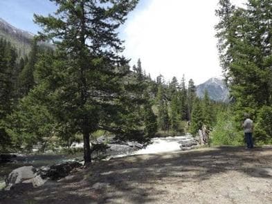
Overview Nestled in a forest canopy of pine and fir on the banks of Icicle Creek, Icicle Group Campground in Okanogan-Wenatchee National Forest offers a peaceful setting for groups and large gatherings. Recreation Icicle Group Campground offers outdoor enthusiasts the opportunity to hike, fish, bike and enjoy a long list of outdoor recreational activities throughout the year. This campground has plenty of trails to explore by bike. Anglers may want to cast a line into the deep pools at nearby Toketie Lake. Populations of rainbow and cutthroat trout find habitat in this somewhat secluded lake. The nearby Fourth of July Trail offers hikers expansive ridge line views and challenging terrain. Beginning in the forest at 4,000 feet, the trail quickly climbs in elevation, out of the trees into more open, arid landscapes. The trail continues, traversing through mountain meadows with spectacular views of the Stuart Mountain Range and Icicle Valley. At 10.6 miles, this is a solid day hike, though backpackers can hook up connecting trails to continue for multiple days though adjacent wilderness settings. Facilities Icicle Group Campground offers outdoor enthusiasts the opportunity to hike, fish, bike and enjoy a long list of outdoor recreational activities throughout the year. This campground has plenty of trails to explore by bike. Anglers may want to cast a line into the deep pools at nearby Toketie Lake. Populations of rainbow and cutthroat trout find habitat in this somewhat secluded lake. The nearby Fourth of July Trail offers hikers expansive ridge line views and challenging terrain. Beginning in the forest at 4,000 feet, the trail quickly climbs in elevation, out of the trees into more open, arid landscapes. The trail continues, traversing through mountain meadows with spectacular views of the Stuart Mountain Range and Icicle Valley. At 10.6 miles, this is a solid day hike, though backpackers can hook up connecting trails to continue for multiple days though adjacent wilderness settings. Natural Features Okanogan-Wenatchee National Forest offers stunning scenic views, with high, glaciated alpine peaks, valleys of old growth forest and rugged shrub-steppe country making up the diverse landscape. Elevations range from below 1,000 feet to over 9,000 feet. More than 700 lakes and mountain ponds dot the glacier-carved terrain of nearby Alpine Lake Wilderness. Tree-covered valleys give way to rocky ridges and rugged peaks along the crest of the Cascades. Many peaks and slopes are permanently cloaked in snowfields. From wet forests of Douglas fir, cedar, and an understory of salal and berries, to firs and mountain hemlock, the landscape opens up to expansive meadows matted with low growth and ends with dry forestland of ponderosa pine and grasses. Congress designated the Alpine Lakes Wilderness in 1976 with a total of 362,789 acres. Prior to designation, aggressive mining and logging operations punched numerous access roads into the area, creating a wildly irregular boundary to this popular area. contact_info This location is unstaffed. To speak with our main office for general information, please call: (661) 702-1420. Nearby Attractions Visitors enjoy the North Cascades and Mt. Rainer National Parks, where interpretive programs and exhibits offer education about the diverse landscape and history of the area. Guests can also explore the area's colorful railroad and mining history at the Steven's Pass Historic District, or hit the slopes at Steven's Pass Ski Area. Charges & Cancellations Group Sites Group Facility (including Cabins and Lookouts): A visitor who cancels a group overnight facility reservation less than 14 days before the arrival date will pay a $10.00 service fee AND forfeit the first night's use fee. No-Shows A no-show visitor is one who does not arrive at a campground and does not cancel the reservation by check-out time on the day after the scheduled arrival date. Staff will hold a campsite until check-out time on the day following the arrival date. No-shows are assessed $20.00 service fee and forfeit the first night's rate, taxes and applicable add-on for a campsite. Refunds Visitors may submit a refund request through their Recreation.gov profile within 7 days of the end date of their reservation. Refunds will not be issued after the 7 days has ended. Refunds for debit or credit card payments will be issued as a credit to the original bank or credit card used to pay. For check or cash purchases, Recreation.gov will mail a Treasury check for refunds of cash, check, or money order payments to the address associated with the reservation. Treasury check refunds may take up to 6-8 weeks to arrive. In the event of an emergency closure, the Recreation.gov team or facility manager will refund all fees and will attempt to notify you using the contact information within the Recreation.gov visitor profile.
View details →
Overview Goodell Creek Campground requires reservations during the peak season, from late May through early September of each year. Important changes to booking windows: To better serve visitors, Goodell Creek Campground will release campsites in two staggered block releases. These block releases will be 6 months in advance and 7 days in advance. Campsites #1 - #13 are available for reservations 6 months in advance. Campsites #14 - #19 are available for reservations 7 days in advance. Any sites not reserved during the peak season are available same-day as first-come, first-served for 1 night only and can only be claimed in person at the campground. Goodell Creek Campground is open as first-come, first-served before and after the peak season, from January through late May, and early September through December of each year. The campground is a small, yet comfortable facility close to the town of Newhalem along the Skagit River. It is surrounded by forests that that can be explored through the area's many hiking trails. The campground has 19 individual campsites. It is private and secluded, yet the town, a visitor center and other amenities are close by. Recreation Campers can walk to several of Newhalem's hiking trails from the connecting trail to the Newhalem Campground. The creek and river are popular for fishing , and boating access is available from the raft launch at the campground. Black bears are active in this campground and the surrounding trails. Be aware of your surroundings while hiking, picnicking, and camping. Use the provided bear boxes in your campsite to store coolers, cookware, and other odorants when not in use. If you encounter a bear around the campground or on a trail, inform campground staff or go to the North Cascades Visitor Center and fill out a bear report. Facilities Campers can walk to several of Newhalem's hiking trails from the connecting trail to the Newhalem Campground. The creek and river are popular for fishing , and boating access is available from the raft launch at the campground. Black bears are active in this campground and the surrounding trails. Be aware of your surroundings while hiking, picnicking, and camping. Use the provided bear boxes in your campsite to store coolers, cookware, and other odorants when not in use. If you encounter a bear around the campground or on a trail, inform campground staff or go to the North Cascades Visitor Center and fill out a bear report. Natural Features The campground has a shaded forested canopy with western redcedar, western hemlock, Douglas-fir, wild red huckleberries, and other native shrubs. Nearby is Newhalem Creek and the Skagit River. The river is the largest river that flows into the Puget Sound area and provides critical habitat for all species of Pacific salmon. The river drains cold, clean glacial meltwater from the mountains of British Columbia and northern Washington. Bald eagles return to its shores every winter. Nearby Attractions The North Cascades Visitor Center is nearby and operates seasonally, typically from May to September. Visitors can find the passport stamp, exhibits, park film, gift store, and much more. The town of Newhalem is a short walk from the campsites, there visitors will find a general store and information center operated by Seattle City Light. contact_info For facility specific information, please call (360) 854-7200.
View details →
Overview The reservation season for the 2025 summer season for the Hoh campground is June 13, 2025 - September 8, 2025. Important information about booking windows: To better serve visitors, Hoh Campground will be releasing campsites in a series of three staggered block releases by loop. These block releases will be 6 months in advance, two weeks in advance, and 4 days in advance. • A loop campsites will be available for reservation 6 months in advance. • C loop campsites will be available for reservations two weeks in advance. • B loop campsites will be available for reservations 4 days in advance. Outside the reservation season, Hoh Campground is open for camping on a first-come, first-served basis. Some campsites may be closed during winter. The Hoh Rain Forest, pronounced "Hoe", earns its name from the ever-flowing Hoh River that carves its way from Mount Olympus towards the Pacific Coast. However, where the name originates, is up for debate. The word "Hoh" undoubtedly comes from Native American languages; possibly the Quileute word "Ohalet" which means "fast moving water" or "snow water." Since the river itself forms from glacial runoff, that origin seems straightforward. Other explanations state that the Quinault word "Qu," meaning "boundary," could be the root of the name as a river as massive as the Hoh certainly forms a formidable boundary across the landscape. A third consideration claims that the word "Hoh" translates to "man with quarreling wives." What the actual history behind the name is, appears to be lost to time. Regardless of the name, there's no question as to the allure that draws visitors back to the rainforest year after year. Throughout the winter season, rain falls frequently in the Hoh Rain Forest, contributing to the yearly average of 140 inches (3.55 meters) of precipitation each year. The result is a lush, green canopy of both coniferous and deciduous species. Mosses and ferns that blanket the surfaces add another dimension to the enchantment of the rainforest. Recreation The trailhead for this area is located next to the Hoh Rainforest Visitor Center, which is a great place for more information. The staff there can give you ideas for your visit and exhibits will help explain what makes this area so special. The visitor center is open daily during the summer, closed January through early March, and generally open Friday through Sunday during the spring and fall seasons (hours may vary according to season). The area offers two short loop trails as well as an out-and-back trail through the forest near the Visitor Center. The Hall of Mosses Trail (.8 miles/ 1.2 km) is an iconic loop that takes you through old growth forest and features a grove of maples trees draped with abundant club moss. The Spruce Nature Trail (1.2 miles/ 1.9 km) is a diverse trail that loops through both old and new growth forest as you walk alongside Taft Creek and the Hoh River. The Hoh River trail is the area's main hiking trail. This out-and-back trail can be taken as far as one desires. Taken all the way, it leads past multiple camping areas, the last being Glacier Meadows at 17.3 miles (27.8 km), and ultimately ends 18.5 miles/ 30 km out at the Blue Glacier moraine looking up at Mt. Olympus. The Hoh Lake trail branches off from the Hoh River trail just after the ranger station and ascends to Bogachiel Peak between the Hoh and the Sol Duc Valley. For those wanting to explore this area as a day hike, there are additional popular turn-around points along the trail. First River access (0.9 miles/ 2.9 km one way) Mineral Creek Falls (2.7 miles/ 4.3 one way) Cedar Grove (4.0 miles/ 6.4 km one way) 5 mile Island (5.0 miles/ 8.0 km one way) All backcountry permits must be reserved online. To get permits and more information on backpacking along the Hoh River Trail and throughout Olympic National Park, visit the Wilderness (Backcountry) Reservations page: https://www.recreation.gov/permits/4098362 Pets are not allowed on trails in the Hoh Rain Forest . Pets are allowed on leash in developed areas such as the campground, picnic areas, and parking lots. Visit our Pets page for more information on where you can take your pet in the park: https://www.nps.gov/olym/planyourvisit/pets.htm Facilities The trailhead for this area is located next to the Hoh Rainforest Visitor Center, which is a great place for more information. The staff there can give you ideas for your visit and exhibits will help explain what makes this area so special. The visitor center is open daily during the summer, closed January through early March, and generally open Friday through Sunday during the spring and fall seasons (hours may vary according to season). The area offers two short loop trails as well as an out-and-back trail through the forest near the Visitor Center. The Hall of Mosses Trail (.8 miles/ 1.2 km) is an iconic loop that takes you through old growth forest and features a grove of maples trees draped with abundant club moss. The Spruce Nature Trail (1.2 miles/ 1.9 km) is a diverse trail that loops through both old and new growth forest as you walk alongside Taft Creek and the Hoh River. The Hoh River trail is the area's main hiking trail. This out-and-back trail can be taken as far as one desires. Taken all the way, it leads past multiple camping areas, the last being Glacier Meadows at 17.3 miles (27.8 km), and ultimately ends 18.5 miles/ 30 km out at the Blue Glacier moraine looking up at Mt. Olympus. The Hoh Lake trail branches off from the Hoh River trail just after the ranger station and ascends to Bogachiel Peak between the Hoh and the Sol Duc Valley. For those wanting to explore this area as a day hike, there are additional popular turn-around points along the trail. First River access (0.9 miles/ 2.9 km one way) Mineral Creek Falls (2.7 miles/ 4.3 one way) Cedar Grove (4.0 miles/ 6.4 km one way) 5 mile Island (5.0 miles/ 8.0 km one way) All backcountry permits must be reserved online. To get permits and more information on backpacking along the Hoh River Trail and throughout Olympic National Park, visit the Wilderness (Backcountry) Reservations page: https://www.recreation.gov/permits/4098362 Pets are not allowed on trails in the Hoh Rain Forest . Pets are allowed on leash in developed areas such as the campground, picnic areas, and parking lots. Visit our Pets page for more information on where you can take your pet in the park: https://www.nps.gov/olym/planyourvisit/pets.htm Natural Features The Hoh Rain Forest is located in the stretch of the Pacific Northwest rainforest which once spanned the Pacific coast from southeastern Alaska to the central coast of California. The Hoh is one of the finest remaining examples of temperate rainforest in the United States and is one of the park's most popular destinations. Nearby Attractions Olympic National Park has much to explore, including temperate rain forests, ocean shores, sub-alpine mountains, lakes and more. Kalaloch, Quinault, and Forks are within a 45 minute to a 90 minute drive.
View details →
Overview Lower Falls Campground is located in the Gifford Pinchot National Forest. Visitors enjoy several waterfalls in the area and access to the Lewis River Trail. The campground is open from May through October. Recreation Near the campground are several trailheads that provide visitors with a variety of recreational opportunities. There are hiking trails, mountain bike trails, horse trails, and motorcycle trails within 10 miles of the campground. The Lewis River contains rainbow, cutthroat, and bull trout as well as whitefish. The area is catch and release only. Facilities Near the campground are several trailheads that provide visitors with a variety of recreational opportunities. There are hiking trails, mountain bike trails, horse trails, and motorcycle trails within 10 miles of the campground. The Lewis River contains rainbow, cutthroat, and bull trout as well as whitefish. The area is catch and release only. Natural Features The campground is just off the Lewis River at an elevation of 1,300 feet. The campground road is paved and shaded by large evergreen trees. There are trails down to the Lewis River and falls area. Nearby Attractions There are falls viewing opportunities at Lower Lewis River Falls, Curly Creek Falls, Big Creek Falls, and Middle Falls, all within 15 minutes of the campground. Hiking trails within 10 miles include trail #31 Lewis River, Trail #5 Quartz Creek, and trail #80 Wright Meadows.
View details →
Overview The gentle Yakima River winds for 27 miles through massive basalt cliffs and rolling desert hills between Ellensburg and Yakima, Washington. This area is popular for wildlife viewing, fishing, and floating the river. Recreation The Yakima River Canyon is a popular destination for plant and wildlife viewing, including bighorn sheep, various birds of prey, and mule deer. This section of the river is classified as a Blue Ribbon trout stream, but is catch and release only. One of the most popular summer activities is floating the river, which is a family friendly Class 1 river with no rapids. Rafters often put in at Umtanum and take out at Roza. Facilities The Yakima River Canyon is a popular destination for plant and wildlife viewing, including bighorn sheep, various birds of prey, and mule deer. This section of the river is classified as a Blue Ribbon trout stream, but is catch and release only. One of the most popular summer activities is floating the river, which is a family friendly Class 1 river with no rapids. Rafters often put in at Umtanum and take out at Roza. Natural Features Within the Yakima River Canyon Campgrounds there are four developed Bureau of Land Management (BLM) sites with river access: Umtanum, Lmuma Creek, Big Pines, and Roza. Visitors have the opportunity to explore the massive basalt cliffs, rolling desert hills, riparian vegetation, and the cool water of the Yakima River. Nearby Attractions The cities of Ellensburg and Yakima, Central Washington University, and Cowiche Canyon trails are near by. Umtanum recreation site offers a footbridge to cross the Yakima River and access to Washington State Department of Fish and Wildlife Lands on the west side of the river.
View details →
Overview Kaner Flat Campground, located in the Little Naches Drainage, is a 49 unit campground that has 25 reservable sites between Memorial Day weekend and Labor Day weekend. After mid-September all sites are available on a first come-first serve basis. Features include an RV loop with long pull through parking, flush toilets, potable water, and an on-site Forest Service Host. Recreation This campground is a popular base camp location for hunting, fishing, and OHV riders. There are a plethora of trails for dirt bikes, jeeps, hiking, mountain biking, and horseback riding near this campground. Facilities This campground is a popular base camp location for hunting, fishing, and OHV riders. There are a plethora of trails for dirt bikes, jeeps, hiking, mountain biking, and horseback riding near this campground. Natural Features The Little Naches River area is surrounded by a predominately ponderosa pine forest. Okanogan-Wenatchee National Forest offers stunning scenic views, with high, glaciated alpine peaks, valleys of old growth forest and rugged shrub-steppe country making up the diverse landscape. Elevations range from below 1,000 feet to more than 9,000 feet. Precipitation varies greatly throughout the area, ranging from approximately 140 inches along the Cascade Crest to only 10 inches along the eastern edge. Visitors can expect many days of warm, sunny weather in the summer, and winters with clear skies and plenty of snow. The area supports wildlife such as deer, squirrels, native fish, black bear and migratory birds. Nearby Attractions Boulder Cave National Recreation Trail is one of the most popular places in the Naches District. Visitors can walk the accessible trail along the river or explore Boulder Cave. Interpretive signs along the trail explain the geology, plants, animals and fire history of the area. Visitors will also enjoy traversing the Chinook Scenic Byway, considered one of Washington's premier driving excursions. Spectacular views of Mount Rainier, old-growth forests, alpine peaks, jagged ridges and river canyons dominate this 92-mile journey. In addition to trails open to multiple uses within 10 miles of the campground, there are also opportunities for gold panning, hunting, and fishing.
View details →
Overview With all campsites located near the shoreline of glacially carved Lake Quinault, visitors are sure to enjoy the beautiful shoreline and interpretive opportunities in the area. From old-growth trees in the surrounding rain forest to excellent fishing, Falls Creek Campground's location is ideal for outdoor enthusiasts. Recreation The forest features 10 miles of hiking trails and many waterfalls within walking distance of the campground. Lake Quinault is managed by the Quinault Indian Nation. As such, you must have a fishing permit and or boat permit through the Quinalt Indian Nation. Both may be purchased through local merchants. Lake Quinault Lodge offers boat and kayak rentals as well as a number of interpretive tours. Facilities The forest features 10 miles of hiking trails and many waterfalls within walking distance of the campground. Lake Quinault is managed by the Quinault Indian Nation. As such, you must have a fishing permit and or boat permit through the Quinalt Indian Nation. Both may be purchased through local merchants. Lake Quinault Lodge offers boat and kayak rentals as well as a number of interpretive tours. Natural Features The forested slopes of Olympic National Park provide a scenic backdrop across Lake Quinault. Towering conifers including Sitka spruce, Douglas fir, western hemlock and western red cedar provide dense shade for this beautiful setting. The forest floor is covered with lush rain forest plants including moss, ferns, false lily-of-the-valley and oxalis. Nearby Attractions Nearby, Lake Quinault Lodge and Rainforest Resort offers restaurants and gift shops. Short trails in the area include the Big Spruce Tree Trail, Forest Service Rainforest Nature Loop, Kestner Homestead Trail, and the Maple Glade Trail. Explore the ocean beaches close-by as well as the National Fish Hatchery. For a more adventuresome day, drive up the valley to hike along the rivers or climb the 4,200 ft. Colonel Bob Peak for expansive views of the mountains and valleys on a clear day. contact_info For facility specific information, please call (360) 288-2525. Charges & Cancellations Reserved sites must be occupied within 24 hours or the site will be forfetied for remainder of reservation.
View details →
Overview American Forks Campground is located about 40 miles west of Naches, Washington, near the American River and Bumping River in the East Cascade mountains. Recreation The campground setting provides ready access to Bumping Lake, where boating and fishing are popular. Hiking and horseback riding trails extend into the William O. Douglas and Norse Peak Wilderness areas, and off-road vehicle and snowmobile access draws visitors to the Little Naches drainage. In winter, snow-shoeing and cross-country skiing are popular in the American River area. A trip along the scenic Mather Parkway is a fantastic outing. The American River, adjacent to the campground, offers a scenic backdrop for anglers. Its cold, clear waters sustain populations of rainbow and brown trout. Whitewater enthusiasts may enjoy a paddle on the river or one of the many other tributaries draining into the Cascade region. Facilities The campground setting provides ready access to Bumping Lake, where boating and fishing are popular. Hiking and horseback riding trails extend into the William O. Douglas and Norse Peak Wilderness areas, and off-road vehicle and snowmobile access draws visitors to the Little Naches drainage. In winter, snow-shoeing and cross-country skiing are popular in the American River area. A trip along the scenic Mather Parkway is a fantastic outing. The American River, adjacent to the campground, offers a scenic backdrop for anglers. Its cold, clear waters sustain populations of rainbow and brown trout. Whitewater enthusiasts may enjoy a paddle on the river or one of the many other tributaries draining into the Cascade region. Natural Features The Okanogan-Wenatchee National Forest is defined by its diverse landscapes, boasting high glaciated alpine peaks, lush valleys of old growth forest, and rugged shrub-steppe country. The American Forks Campground is nestled in an old-growth forest of Douglas fir, western hemlock, and a cedar under story with grassy areas, ferns, and mosses. With the William O. Douglas and Norse Peak Wilderness areas nearby, the location is home to abundant wildlife, including deer, elk, porcupine, native fish, and migratory birds. Endangered and threatened species, including the northern spotted owl, gray wolves, and grizzly bears also find havens in local ecosystems. Summer temperatures are generally sunny and warm with little precipitation, and winters boast mostly clear skies, but plenty of snow. Nearby Attractions Hikers may want to traverse a portion of the spectacular Pacific Crest Trail (PCT), one of the world's premier National Scenic Trails. Enjoy some of North America's most fantastic scenery, as the trail winds from Mexico to Canada through Washington state. Boulder Cave Trail is one of the most popular places in the Naches District. Visitors can walk the accessible trail along the river or explore Boulder Cave. Interpretive signs along the trail explain the geology, plants, animals and history of the area. In addition to hiking, there are a plethora of outdoor activities available within 10 miles of this campground. The list includes lake access with a marina, boat ramp, and dock, mountain biking, off highway vehicle trails,historic sites, horseback riding trails, scenic driving, hunting and fishing.
View details →
Overview For up to date pool schedule information, please visit our website here . Pool access fees are $18 for adults, $12 for children ages 4-12 and $12 for seniors over 62 years old per session. Towel rentals are $5. You may bring your own towel. Lockers are available, but locks are not provided. Located along the Sol Duc River, Sol Duc Hot Springs Resort Campground is on the "edge of the backcountry in the heart of the Olympic National Park" with hot spring pools and access to many hiking trails. In the late 1800s, settlers found the hot springs and called them "Sol Duc" a mispronunciation of the Quileute word for sparkling waters. The first hotel was built at Sol Duc in 1912 but burned down in 1916. The resort was rebuilt on a more modest scale in the 1920s, and completely rebuilt in the 1980s, which reflects how the resort looks today. Recreation.gov offers reservations for 76 of the resort's 82 tent sites and for all 17 of the resort's RV campsites, all nestled under a lush green canopy of old growth forest. Reservations for the remaining 20 tent sites are made directly at the campground as walk in reservations. Advanced reservations are recommended to guarantee a campsite. Multiple hiking trails are accessible directly from the property, with the most popular taking guests to spectacular Sol Duc Falls. Book tent and RV campsites here on Recreation.gov (using the buttons on the right to view sites and availability). Visit the Sol Duc Hot Springs Resort website to book reservations for the cabins. Recreation Reinvigorate your spirit: Hike through dense, old-growth forest to Sol Duc Falls or explore the famous Lover's Lane Loop Trail. The Olympic Peninsula is prized for its wide assortment of hiking trails suitable for all ages and abilities. Multiple treks are available, such as a 1.6 mile (2.6 km) round-trip hike to Sol Duc Falls from the resort. Watch salmon fight their way up the Sol Duc River at the Salmon Cascades Overlook during autumn. Relax: Soak in the Mineral Hot Springs located at the resort. Swim in the large swimming pool, also located at the resort. Facilities Reinvigorate your spirit: Hike through dense, old-growth forest to Sol Duc Falls or explore the famous Lover's Lane Loop Trail. The Olympic Peninsula is prized for its wide assortment of hiking trails suitable for all ages and abilities. Multiple treks are available, such as a 1.6 mile (2.6 km) round-trip hike to Sol Duc Falls from the resort. Watch salmon fight their way up the Sol Duc River at the Salmon Cascades Overlook during autumn. Relax: Soak in the Mineral Hot Springs located at the resort. Swim in the large swimming pool, also located at the resort. Natural Features Sol Doc offers three mineral hot spring pools heated between 98-107F (37C - 40C) and a large freshwater swimming pool that ranges from 50-85F (10C - 29C). Sessions can be purchased at the front desk of the main lodge. Mineral Water Wading Pool: approximately: 98F / 37C / 6-8' deep Large Mineral Fountain Pool: approximately 101F / 38C / 3' deep (meets accessibility standards) Medium Mineral Pool: approximately 104F / 40C / 3' deep Freshwater Pool: Varies seasonally between 50F - 85F / 10C - 30C / 3' - 10' deep (universally accessible) Nearby Attractions Guests can visit the Olympic National Park Visitor Center and Port Angeles. Lake Crescent Lodge, Olympic National Park: Experience self-guided hikes at Marymere Falls Trail, Mt. Storm King, or the Moments in Time Trail, or makes plans for a guided kayak tour, or a meal at the lakefront restaurant. Log Cabin Resort, Olympic National Park: Park visitors can rent a canoe/kayak, stand up paddle boards, and bicycles. Hurricane Ridge: From this area, enjoy hiking, food and beverage services and spectacular views of the Olympic Mountains and Strait of Juan de Fuca. Lake Quinault Lodge: Plan to join a rain forest tour and finish the day with lakefront dining. Forks: Movie buffs will enjoy this town -- the setting of the famed Twilight series, as well as the Timber Museum. Ruby Beach: Don't miss a Pacific Coast beach walk with tide pools and sea stacks. Charges & Cancellations Cancellations must be submitted atleast 72 hours prior to arrival.
View details →
Overview Bonaparte Lake Campground is located on the southern edge of Bonaparte Lake east of Tonasket, WA, in the Okanogan-Wenatchee National Forest. The setting of the campground is in a mixed ponderosa pine and Douglas fir conifer forest at the base of Bonaparte Mountain. This campground has a group site, multiple family and individual campsites available. Recreation Fishing is a popular activity on the lake, with anglers enjoying boat fishing for rainbow, brook, and cutthroat trout as well as using the accessible fishing dock. A boat launch area is available in the campground. Kayaking, canoeing, and swimming can also be enjoyed. Hiking around the lake or up the Pipsissewa Trail, which is accessed from the southern loop, are popular activities. Taking a bike ride on the surrounding roads is also available. Facilities Fishing is a popular activity on the lake, with anglers enjoying boat fishing for rainbow, brook, and cutthroat trout as well as using the accessible fishing dock. A boat launch area is available in the campground. Kayaking, canoeing, and swimming can also be enjoyed. Hiking around the lake or up the Pipsissewa Trail, which is accessed from the southern loop, are popular activities. Taking a bike ride on the surrounding roads is also available. Natural Features Bonaparte Lake's elevation is at 3,600 feet and is home to multiple waterfowl species including the rare northern loon. Mule deer, elk, moose, and the occasional black bear can be sighted in the area. Bonaparte, Spur, and Cumberland Mountains surround the lake. Nearby Attractions Pipsissewa Trail to Pipsissewa Point, which overlooks Bonaparte Lake, is a two mile hike from the campground. Continuing from there onto the South Side trail #308 for five miles will take you to the Bonaparte Mountain Fire Lookout. Lost Lake Campground is approximately 10 miles away on the 33 road. Beaver Lake and Beth Lake Campgrounds are approximately seven miles away on the 32 road. Within 10 miles visitors can explore accessible and interpretive trails, geologic attractions, scenic overlooks, and scenic drives.
View details →
Overview Halfway Flat Campground is located about 30 miles west of Naches, Washington on the east side of the Cascades mountain range. Recreation The campground setting provides ready access to the Naches River, where fishing is popular. Hiking and horseback riding trails extend into the William O. Douglas and Norse Peak Wilderness areas, and off-road vehicle and snowmobile access draws visitors to the Little Naches drainage. Halfway Flat Campground is conveniently located 30 minutes below the summit of Chinook Pass and Mt. Rainer National Park. A trip along the scenic Mather Parkway is a fantastic outing. The Naches River, adjacent to the campground offers a scenic backdrop for anglers. Its cold, clear waters sustain populations of rainbow and brown trout. Whitewater enthusiasts may enjoy a paddle on the river or one of the many other tributaries. Facilities The campground setting provides ready access to the Naches River, where fishing is popular. Hiking and horseback riding trails extend into the William O. Douglas and Norse Peak Wilderness areas, and off-road vehicle and snowmobile access draws visitors to the Little Naches drainage. Halfway Flat Campground is conveniently located 30 minutes below the summit of Chinook Pass and Mt. Rainer National Park. A trip along the scenic Mather Parkway is a fantastic outing. The Naches River, adjacent to the campground offers a scenic backdrop for anglers. Its cold, clear waters sustain populations of rainbow and brown trout. Whitewater enthusiasts may enjoy a paddle on the river or one of the many other tributaries. Natural Features The Okanogan-Wenatchee National Forest is defined by its diverse landscapes, boasting high, glaciated alpine peaks, lush valleys of old growth forest, and rugged shrub-steppe country. The Halfway Flat Campground is nestled in an old-growth forest of Douglas fir, western hemlock, and cedar with grassy areas, ferns and mosses covering the forest floor. With the William O. Douglas and Norse Peak Wilderness areas nearby, the location is home to abundant wildlife, including deer, elk, porcupine, native fish and migratory birds. Endangered and threatened species, including the Northern Spotted Owl, gray wolves, and grizzly bears also find havens in local ecosystems. Summer temperatures are generally sunny and warm with little precipitation, and winters boast mostly clear skies, but plenty of snow. Nearby Attractions Hikers may want to traverse a portion of the spectacular Pacific Crest Trail (PCT), one of the world's premier National Scenic Trails. Boulder Cave Trail is one of the most popular places in the Naches District. Visitors can walk the accessible trail along the river or explore Boulder Cave. Interpretive signs along the trail explain the geology, plants, animals and history of the area. Within 10 miles of the campground there is lake access, a boat ramp, hunting opportunities, historic sites, and trails for horseback riding, mountain biking, and off-highway vehicles.
View details →
Overview Bayview Campground sits along the shore of Baker Lake in the stunning Mt. Baker-Snoqualmie National Forest. This campground was reconstructed in 2017. The unique setting offers many recreational activities and scenic views. Several hiking trails and climbing routes are within a short driving distance. Recreation The surrounding area is a prime location for hiking, climbing, boating, fishing, picnicking and horseback riding in summer and early fall, and snowmobiling in the winter months. Baker Lake is a popular destination for boating, water skiing, canoeing, fishing and swimming. Anglers cast for a number of fish species. The lake is within walking distance of the campground and a great family trail winds for approximately 1 mile around the campground and connects to Horseshoe Cove. Boat ramps are available at Horseshoe Cove, Swift Creek, and Shannon Creek Campgrounds. The nearby Baker Lake Trail is an easy family hike that begins in a majestic stand of Douglas fir. In 1843, a small eruption of Mt. Baker caused a forest fire, and visitors can still see the burned snags of virgin cedar trees that once dominated the area. The trail contours above the eastern shoreline of Baker Lake. The Shadow of the Sentinels Trail begins just south of the campground. This accessible interpretive trail winds through a 500-year old ancient forest. Displays along the path explain the dynamics of the forest. The trail is constructed of asphalt and boardwalks with grades no greater than 8%. Facilities The surrounding area is a prime location for hiking, climbing, boating, fishing, picnicking and horseback riding in summer and early fall, and snowmobiling in the winter months. Baker Lake is a popular destination for boating, water skiing, canoeing, fishing and swimming. Anglers cast for a number of fish species. The lake is within walking distance of the campground and a great family trail winds for approximately 1 mile around the campground and connects to Horseshoe Cove. Boat ramps are available at Horseshoe Cove, Swift Creek, and Shannon Creek Campgrounds. The nearby Baker Lake Trail is an easy family hike that begins in a majestic stand of Douglas fir. In 1843, a small eruption of Mt. Baker caused a forest fire, and visitors can still see the burned snags of virgin cedar trees that once dominated the area. The trail contours above the eastern shoreline of Baker Lake. The Shadow of the Sentinels Trail begins just south of the campground. This accessible interpretive trail winds through a 500-year old ancient forest. Displays along the path explain the dynamics of the forest. The trail is constructed of asphalt and boardwalks with grades no greater than 8%. Natural Features The Mt. Baker-Snoqualmie National Forest showcases rugged peaks, sparkling alpine lakes and old-growth forests, providing visitors with unique and surprising landscapes. Mt. Baker, the most prominent feature of the Mt. Baker Wilderness, dominates the landscape on a clear day. Rising to an elevation of 10,781 feet, the active volcano is perpetually snow-capped and mantled with an extensive network of creeping glaciers. Mt. Baker's summit, Grant Peak, is a 1,300-foot-deep mound of ice, which hides a massive volcanic crater. Wildlife in the area includes mountain goats traversing the higher elevations to squirrels and black bears in the forests. Migratory birds and native fish find ample habitat in the varied ecosystems as well. contact_info For facility specific information, please call (530) 932-0242. Nearby Attractions Hike in the mountains above the lake in the Mt. Baker National Recreation Area or Mt. Baker Wilderness, or take some time to visit North Cascades National Park. This unique park is like no other place on earth. It features a deep blue lake surrounded by sheer, 2,000' cliffs, two picturesque islands and a violent volcanic past. Hiking trails, a visitor center and educational programs are available. Charges & Cancellations Once your reservation start date has begun, neither the Recreation.gov Contact Center nor the campground manager will be able to modify your reservation.
View details →
Overview Gillette Campground is located directly across from Lake Gillette, approximately a quarter-mile from the lake's shore and surrounded by a stand of lodgepole pine and tamarack. Recreation Ample recreation opportunities such as hiking, bicycling, swimming and boating in nearby Gillette Lake are popular activities from this campground. OHVs are allowed to drive in and out of this park. Facilities Ample recreation opportunities such as hiking, bicycling, swimming and boating in nearby Gillette Lake are popular activities from this campground. OHVs are allowed to drive in and out of this park. Natural Features This forested campground provides shade to many of the campsites. Gillette Lake is nearby and can be accessed by foot from the campground. A covered area with a large tree trunk is an interesting attraction along with access to Rufus and Springboard Trails. Nearby Attractions Visitors enjoy Gillette Lake, a covered area with a large tree trunk and access to Rufus and Springboard Trails for hikers.
View details →
Overview Lake Gillette campground lies on the east shore of Lake Gillette, a popular spot for boating and fishing. Recreation With plentiful trails, visitors to the area will enjoy hiking and bicycling and those looking for water recreation can access swimming and boating in nearby Gillette Lake. Facilities With plentiful trails, visitors to the area will enjoy hiking and bicycling and those looking for water recreation can access swimming and boating in nearby Gillette Lake. Natural Features Lodgepole pine and tamarack are found throughout the campground, providing shade to many campsites. A wonderful campground for the entire family, the area offers hike-in access to Gillette Lake and Rufus Trail #148. An amphitheatre is also close and can be reached by one of the many trails. Nearby Attractions Gillette Lake and access to Rufus Trail for hikers.
View details →
Overview Nestled in Okanogan-Wenatchee National Forest, Lake Creek (Entiat River) Campground offers visitors some of the stunning scenery in sunny central Washington and easy access to an abundance of recreational activities, such as hiking, dirt biking and mountain biking. Recreation Hiking, horse riding, mountain biking and dirt biking top the list of recreation activities in the area. Three different trails start adjacent to the campground and are open to most activities. The Silver Falls National Recreation Trail is a short drive up the river and provides a great family hike to spectacular waterfalls. Backpackers and horse riders can enjoy the trails of the Glacier Peak Wilderness from the Entiat River Trailhead approximately 12 miles from the campground. Facilities Hiking, horse riding, mountain biking and dirt biking top the list of recreation activities in the area. Three different trails start adjacent to the campground and are open to most activities. The Silver Falls National Recreation Trail is a short drive up the river and provides a great family hike to spectacular waterfalls. Backpackers and horse riders can enjoy the trails of the Glacier Peak Wilderness from the Entiat River Trailhead approximately 12 miles from the campground. Natural Features Many of the sites overlook the Entiat River as it cascades down the valley to meet the Columbia. The open forest provides plenty of sunshine and diverse habitat that supports deer, bears, coyotes and many other creatures. Salmon and steelhead still use the Entiat as spawning grounds. Nearby Attractions Silver Falls National Scenic Trail provides a one and a half mile loop hike to a large waterfall. Hundreds of miles of multiple use trails are accessible from nearby trailheads. Entiat National Fish Hatchery is at mile six on the Entiat River Road and welcomes visitors in the summer. The tourist destinations of Chelan and Leavenworth are a relatively short drive away.
View details →
Overview North Gorge is a small, but popular, campground at the northeast edge of the park. A few sites are large enough for an RV, but most are built for tent camping. The campground is set in a grove of pines on the edge of the lake. A boat launch and dock are on the north or right side of the main loop. In the summer, North Gorge is busy on the weekends. Recreation The small boat launch provides access to the lake. Boating, fishing, swimming and water skiing are activities that can easily take place from the campground. Campers might also enjoy relaxing and taking in the beautiful view. Facilities The small boat launch provides access to the lake. Boating, fishing, swimming and water skiing are activities that can easily take place from the campground. Campers might also enjoy relaxing and taking in the beautiful view. Natural Features Lake side campground in a beautiful pine forest. Nearby Attractions The historic St. Paul's Mission, which is run by the National Park Service, is located about 18.8 south of the campground in the town of Kettle Falls. Also in the area are Fort Colville and the Hudson Bay Company Post on the Upper Columbia. St. Paul's Mission. Sherman drive, a scenic loop, is nearby. contact_info This location is unstaffed. To speak with our main office for general information, please call: (509) 754-7889. Charges & Cancellations All changes and cancellations need to be made through recreation.gov Late Cancellations or Cancellations within the Cut-off Window Individual Campsites: A customer who cancels a reservation the day before or on the day of arrival will pay a $10.00 service fee AND forfeit the first night's use fee (not to exceed the total paid for the original reservation). Cancellations for a one-night reservation will forfeit the entire amount paid and will not be subject to an additional service fee.
View details →
Overview Marcus Island Campground is tucked into the trees on the lake shore. The campground is heavily shaded and, in the summer, has shoreline on three sides. The main access road is single lane and winding, but campers flock to this shaded area in summer. A boat launch with parking is available before reaching the campground. Recreation The boat launch provides access to the lake when the water is high. Provides a nice shaded campground in a beautiful evergreen forest. Popular for campers, families and fisherman alike. Facilities The boat launch provides access to the lake when the water is high. Provides a nice shaded campground in a beautiful evergreen forest. Popular for campers, families and fisherman alike. Natural Features Marcus Island Campground is tucked into the trees on the lake shore. The campground is heavily shaded and, in the summer, has shoreline on three sides. Nearby Attractions The historic St. Paul's Mission, which is run by the National Park Service, is located about eleven south of the campground in the town of Kettle Falls. Also in the area are Fort Colville and the Hudson Bay Company Post on the Upper Columbia. St. Paul's Mission. Sherman drive, a scenic loop, is nearby. contact_info This location is unstaffed. To speak with our main office for general information, please call: (509) 754-7889. Charges & Cancellations All changes and cancellations need to be made through recreation.gov Late Cancellations or Cancellations within the Cut-off Window Individual Campsites: A customer who cancels a reservation the day before or on the day of arrival will pay a $10.00 service fee AND forfeit the first night's use fee (not to exceed the total paid for the original reservation). Cancellations for a one-night reservation will forfeit the entire amount paid and will not be subject to an additional service fee.
View details →
Overview Snag Cove is a small, fairly isolated campground located on the western side of Lake Roosevelt. Eight out of the nine sites are on the lake shore and all sites are open to tents and RVs. A boat launch with trailer parking and courtesy dock frames one side of the campground. Because of its size and popularity, Snag Cove often fills in the summer. Recreation Snag Cove Campground is popular with families, hunters and fishermen to camp and boat. They can easily access Lake Roosevelt for shoreline fishing, or use the ramp to launch their boat. Facilities Snag Cove Campground is popular with families, hunters and fishermen to camp and boat. They can easily access Lake Roosevelt for shoreline fishing, or use the ramp to launch their boat. Natural Features Beautiful little campground with boat launch sitting along the edge of Lake Roosevelt, nestled in a pine forest. contact_info This location is unstaffed. To speak with our main office for general information, please call: (509) 754-7889. Charges & Cancellations All changes and cancellations must be made through recreation.gov Late Cancellations or Cancellations within the Cut-off Window Individual Campsites: A customer who cancels a reservation the day before or on the day of arrival will pay a $10.00 service fee AND forfeit the first night's use fee (not to exceed the total paid for the original reservation). Cancellations for a one-night reservation will forfeit the entire amount paid and will not be subject to an additional service fee.
View details →
Overview Kettle River is a shady campground on the banks of the Kettle River. Most of the sites are on the shoreline and have beautiful views of the Kettle River and surrounding landscape. Kettle River does not have a boat launch but does have a courtesy dock. This campground is a great place for birding, with a variety of waterfowl and raptors seen in the area. Kettle River Campground is typically quiet and doesn’t often fill. Recreation Kettle River Campground is popular with families to camp. They can easily access the Kettle River for shoreline fishing or birding. Facilities Kettle River Campground is popular with families to camp. They can easily access the Kettle River for shoreline fishing or birding. Natural Features Kettle River Campground provides ample shade with thick forests of ponderosa pine, and douglas fir trees. The lake area is abundant with wildlife, including moose, elk and deer. Quite a few bald eagles have been spotted around Kettle River, and dozens of species of fish inhabit the lake, such as walleye, bass, rainbow trout, salmon and sturgeon. Fishing for sturgeon is now allowed during a short season. Much of the water in the originates from glaciers and snow in the cold, high Canadian Rockies, though temperatures are pleasant to swim in during summer. contact_info This location is unstaffed. To speak with our main office for general information, please call: (509) 754-7889. Nearby Attractions The historic St. Paul's Mission, which is run by the National Park Service, is located about 7.4 miles south of the campground in the town of Kettle Falls. Also in the area are Fort Colville and the Hudson Bay Company Post on the Upper Columbia. St. Paul's Mission. Sherman drive, a scenic loop, is nearby. Charges & Cancellations All changes and cancellations must be made through recreation.gov Late Cancellations or Cancellations within the Cut-off Window Individual Campsites: A customer who cancels a reservation the day before or on the day of arrival will pay a $10.00 service fee AND forfeit the first night's use fee (not to exceed the total paid for the original reservation). Cancellations for a one-night reservation will forfeit the entire amount paid and will not be subject to an additional service fee.
View details →
Overview Kamloops Island is a small, shady campground at the mouth of the Kettle River. The main hub of campsites is tucked into the vegetation at the top and can fit tents and RVs. A cluster of walk-in tent sites is spread out in a grove of pines. Many campsites offer views of the river, lake, and surrounding landscape. There is a courtesy dock, but no boat launch. Recreation Kamloops Island is a beautiful little campground surrounded by the Columbia River on one side and the Kettle River on the other. During the draw down when the water is low the geological beauty comes out in the ravine cut by the Kettle River. This campground is very popular for fishermen and familes alike. Facilities Kamloops Island is a beautiful little campground surrounded by the Columbia River on one side and the Kettle River on the other. During the draw down when the water is low the geological beauty comes out in the ravine cut by the Kettle River. This campground is very popular for fishermen and familes alike. Natural Features Kamloops Island provides ample shade with thick forests of ponderosa pine, and douglas fir trees. The lake area is abundant with wildlife, including moose, elk and deer. Quite a few bald eagles have been spotted around Kamloops, and dozens of species of fish inhabit the lake, such as walleye, bass, rainbow trout, salmon and sturgeon. Fishing for sturgeon is now allowed during a short season. Much of the water in the originates from glaciers and snow in the cold, high Canadian Rockies, though temperatures are pleasant to swim in during summer. Nearby Attractions The historic St. Paul's Mission, which is run by the National Park Service, is located about 4.5 miles south of the campground in the town of Kettle Falls. Also in the area are Fort Colville and the Hudson Bay Company Post on the Upper Columbia. St. Paul's Mission. Sherman drive, a scenic loop, is nearby. contact_info This location is unstaffed. To speak with our main office for general information, please call: (509) 754-7889. Charges & Cancellations All changes an cancellations must be done through recreation.gov. Late Cancellations or Cancellations within the Cut-off Window Individual Campsites: A customer who cancels a reservation the day before or on the day of arrival will pay a $10.00 service fee AND forfeit the first night's use fee (not to exceed the total paid for the original reservation). Cancellations for a one-night reservation will forfeit the entire amount paid and will not be subject to an additional service fee.
View details →
Overview Haag Cove is a quiet, isolated campground on Lake Roosevelt’s west side. Sites are spread out along the shoreline in an open area with scattered pine trees. The open setting does not allow for much privacy between sites, but provides sweeping views of the lake to most campers. The campground is typically quiet though it may fill on holidays and weekends. There is not a boat launch or courtesy dock. Recreation Haag Campground is popular with families, hunters and fishermen to camp. They can easily access Lake Roosevelt for shoreline fishing. Facilities Haag Campground is popular with families, hunters and fishermen to camp. They can easily access Lake Roosevelt for shoreline fishing. Natural Features Beautiful campground on the shore of Lake Roosevelt. Surrounded by trees and bushes. Well shaded. Nearby Attractions French Rock boat launch is just 5.5 miles south of Haag Cove Campground. To the north 8.2 miles is St. Paul's Mission in the town of Kettle Falls. contact_info This location is unstaffed. To speak with our main office for general information, please call: (509) 754-7889. Charges & Cancellations All changes and cancellations must be made through recreation.gov Late Cancellations or Cancellations within the Cut-off Window Individual Campsites: A customer who cancels a reservation the day before or on the day of arrival will pay a $10.00 service fee AND forfeit the first night's use fee (not to exceed the total paid for the original reservation). Cancellations for a one-night reservation will forfeit the entire amount paid and will not be subject to an additional service fee.
View details →
Overview Hawk Creek Campground is tucked back from the lake on Hawk Creek. The campground is popular, but small enough to feel private and secluded. A small waterfall adds ambiance to this beautiful and unique campground. Hawk Creek is close to Fort Spokane Visitor Center, but far enough away to avoid the hustle and bustle. A courtesy dock provides access to Lake Roosevelt. Recreation A small boat ramp provides access to the water. This is a popular place to fish, bird watch, kayak, canoe or simply take a hike through the ravine to the confluence where Hawk Creek meets the Columbia River. Facilities A small boat ramp provides access to the water. This is a popular place to fish, bird watch, kayak, canoe or simply take a hike through the ravine to the confluence where Hawk Creek meets the Columbia River. Natural Features Hawk Creek is nestled in a beutiful ravine with a water fall near the campground. The geological beauty is astonding as you boat out to the confluence. contact_info This location is unstaffed. To speak with our main office for general information, please call: (509) 754-7889. Nearby Attractions Just 8.5 miles away is the Fort Spokane Visitor Center and Museum. The former guardhouse is located in the middle of historic Fort Spokane. The visitor center and museum are open seasonally, from Memorial Day to Labor Day of each year. They may be opened upon request the rest of the year.There are also trails that include a self guided tour of the grounds that are open all year long. Charges & Cancellations All changes and cancellations must be made through recreation.gov Late Cancellations or Cancellations within the Cut-off Window Individual Campsites: A customer who cancels a reservation the day before or on the day of arrival will pay a $10.00 service fee AND forfeit the first night's use fee (not to exceed the total paid for the original reservation). Cancellations for a one-night reservation will forfeit the entire amount paid and will not be subject to an additional service fee.
View details →
Overview Jones Bay is one of Lake Roosevelt’s smaller, more rustic campgrounds. The campground is mostly gravel and packed dirt, with not much vegetation, on the lake shore. It can be reached by boat and has a boat launch and dock. Jones Bay can be also be reached by car, but may be difficult to find. Recreation Jones Bay is popular with people that like a more remote primitive site. There is access to the water with a small boat ramp. Fishing is great from the water or the shore. Facilities Jones Bay is popular with people that like a more remote primitive site. There is access to the water with a small boat ramp. Fishing is great from the water or the shore. Natural Features Jones Bay is located at the bottom of a ravine that opens up into a beautiful bay on Lake Roosevelt. It's located in the brush stepe so has a desert feel to it with the bitter antelope brush and sage. Nearby Attractions Great fishing is just a boat ride away. Beautiful views up and down the lake. contact_info This location is unstaffed. To speak with our main office for general information, please call: (509) 754-7889. Charges & Cancellations All changes an cancellations must be done through recreation.gov. Late Cancellations or Cancellations within the Cut-off Window Individual Campsites: A customer who cancels a reservation the day before or on the day of arrival will pay a $10.00 service fee AND forfeit the first night's use fee (not to exceed the total paid for the original reservation). Cancellations for a one-night reservation will forfeit the entire amount paid and will not be subject to an additional service fee.
View details →FAQ
Camping in Washington
How many campgrounds are listed in Washington?
TheCampVerse currently lists 139 campgrounds in Washington.
What campground types are most common in Washington?
The most common campground types are Campground.
How can I compare campgrounds in Washington?
Use the campground cards and featured links on this page to compare descriptions, amenities, and details before opening each campground profile.
Keep exploring