
Campgrounds in Montana
Experience wide-open camping and mountain adventures in Big Sky Country
92
Campgrounds listed
100%
With photos
100%
Detailed descriptions
Campground
Top campground type
Highlights
Featured campgrounds in Montana
Explore by campground name letter
Jump to A-Z landing hubs for stronger discovery paths beyond Montana.
All campgrounds
Showing 92 campgrounds

Overview Review campsite details -- RV's larger than 20 feet long maybe be to large for many of the campsites. This Campground is located at the very northern end of Canyon Ferry Reservoir, 30 miles east of Helena, Montana, along Montana Highway 284 and offers year-round access to a wide range of recreational opportunities. The Canyon Ferry area has a rich mining history. In the 1850’s the gold rush hit the Canyon Ferry area attracting miners from all over the United States in the hopes of striking it rich. Recreation Canyon Ferry Reservoir offers a wide range of year-round recreational opportunities. Water related activities include everything from swimming and fishing to sailing and motor-boating. Canoeists and kayakers explore the many quiet backwater bays. Jet skiers, windsurfers and water skiers skim the summer waves, while winter draws ice fishermen, ice boaters and ice skaters. Facilities Canyon Ferry Reservoir offers a wide range of year-round recreational opportunities. Water related activities include everything from swimming and fishing to sailing and motor-boating. Canoeists and kayakers explore the many quiet backwater bays. Jet skiers, windsurfers and water skiers skim the summer waves, while winter draws ice fishermen, ice boaters and ice skaters. Natural Features This Campground sits at the north end of Canyon Ferry Reservoir between the Big Belt and Elkhorn’s mountain ranges. Nearby Attractions Canyon Ferry Reservoir is located halfway between Yellowstone National Park and Glacier National Park along with the capital city of Helena, Montana. For up to date events visit, www.helenamt.com. contact_info For facility specific information, please call (406) 475-3920.
View details →
Overview Jo Bonner Campground is located at the Northeastern end of Canyon Ferry Reservoir; 30 miles east of Helena, Montana and offers year-round access to a wide range of recreational opportunities. Jo Bonner Campground is named for Josephine Agnes Martin Bonner (1907-1965) by Montana's Governor John Bonner (1902-1970). Today, Jo Bonner Campground is a small quaint campground that offers easy access. Recreation Canyon Ferry Reservoir offers a wide range of year-round recreational opportunities. Water related activities include everything from swimming and fishing to sailing and motor-boating. Canoeists and kayakers explore the many quiet backwater bays. Jet skiers, windsurfers and water skiers skim the summer waves, while winter draws ice fishermen, ice boaters and ice skaters. Facilities Canyon Ferry Reservoir offers a wide range of year-round recreational opportunities. Water related activities include everything from swimming and fishing to sailing and motor-boating. Canoeists and kayakers explore the many quiet backwater bays. Jet skiers, windsurfers and water skiers skim the summer waves, while winter draws ice fishermen, ice boaters and ice skaters. Natural Features Jo Bonner Campground is located at northern end of Canyon Ferry Reservoir between the Big Belt and Elkhorns mountain ranges. contact_info For facility specific information, please call (406) 475-3920. Nearby Attractions Jo Bonner Campground on Canyon Ferry Reservoir is located halfway between Yellowstone National Park and Glacier National Park along with the capital city of Helena, Montana. For up to date events visit, www.helenamt.com.
View details →
Overview Log Gulch Campground is situated on the picturesque Holter Lake in west central Montana. All sites are reservation only. The site is located approximately 45 miles north of Helena, Montana, and 60 miles south of Great Falls, Montana, along the Missouri River. The area offers stunning views of the Sleeping Giant Wilderness Study Area. Gates of the Mountains Historic Site is in close proximity to the campground, which is accessible via watercraft. The area is overflowing with outdoor adventure opportunities. Whether you're into fishing, hunting, wildlife viewing, hiking, boating, water skiing, or all of the above, all of these activities are in close proximity to Log Gulch Campground. There is surely an activity for everyone! Recreation Log Gulch Campground offers excellent recreational opportunities. Activities in the area include camping, boating (motorized and non-motorized), fishing, water skiing, hiking, scenic/wildlife photography, wildlife viewing, and bird watching. There are trails within the general vicinity, as well as multiple fishing access sites and hunting access points. The recreation opportunities in the area are truly boundless. Facilities Log Gulch Campground offers excellent recreational opportunities. Activities in the area include camping, boating (motorized and non-motorized), fishing, water skiing, hiking, scenic/wildlife photography, wildlife viewing, and bird watching. There are trails within the general vicinity, as well as multiple fishing access sites and hunting access points. The recreation opportunities in the area are truly boundless. Natural Features Every campsite is in close proximity to the lake and mountains. The campground and day-use area have poplar and green ash trees throughout the campground, which provide shade during the height of the summer. The site is situated in a shrub-steppe landscape, mostly comprised of ponderosa pine and bunch grasses. The campground is surrounded by sparsely wooded hills. Nearby Attractions Log Gulch Campground is located in a prime location to get out and recreate outdoors. There is access to public lands, where multiple recreation opportunities and experiences are available. The campground is adjacent to the Missouri River, which was also the historical travel corridor for The Lewis and Clark Trail. Log Gulch Campground is situated between Helena and Great Falls. In Helena, there are great restaurants, museums, the capitol building, old mining settlements, Last Chance Gulch, Reeder's Alley, and a vibrant downtown area. In or near Great Falls, there is the First People's Buffalo Jump and Interpretive Center, Charlie Russell Museum, Lewis and Clark Interpretive Center, Giant Springs Fish Hatchery and State Park, and Tower Rock State Park. The Continental Divide Trail is nearby. Charges & Cancellations Reservation Cancellations & Changes • Cancelling a Reservation: Customers may cancel their reservation prior to arrival both on-line and through the call center. A $10 service fee will be withheld from any refund for a cancellation. Depending on when you cancel in relation to your arrival day, it may be considered a late cancellation (see below). • The $8 reservation fee is non-refundable. • Group Facility (including Cabins and Lookouts): Customers who cancel a group overnight facility reservation less than 14 days before the arrival date will pay a $10.00 service fee AND forfeit the first night's use fee. Late Cancellations or Cancellations within the Cut-off Window • Individual Campsites: A customer who cancels a reservation the day before or on the day of arrival will pay a $10.00 service fee AND forfeit the first night's use fee (not to exceed the total paid for the original reservation). Cancellations for a one-night reservation will forfeit the entire amount paid and will not be subject to an additional service fee. The recreation.gov cancellation policy can be found here: https://www.recreation.gov/rules-reservation-policies
View details →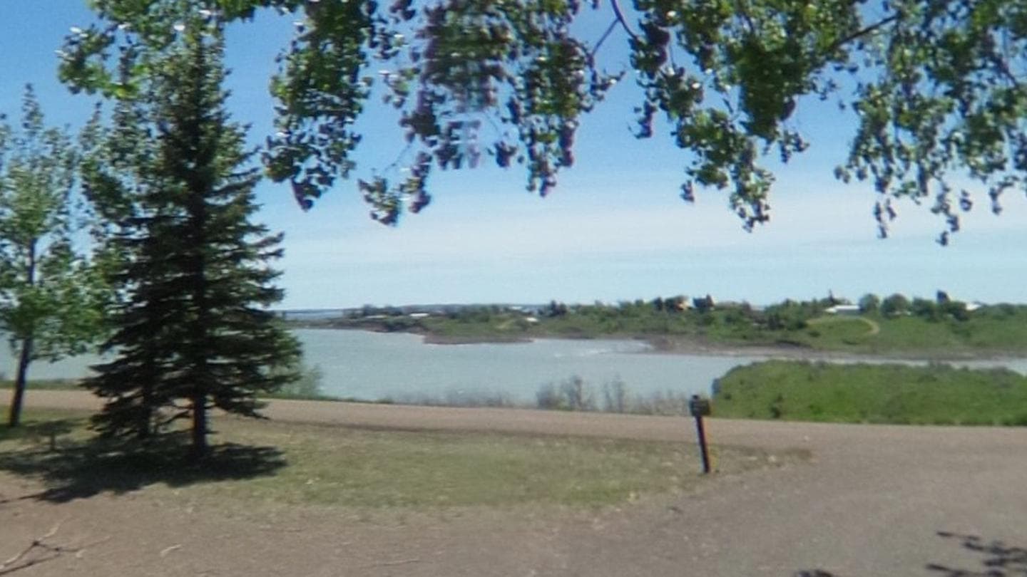
Overview Reservations are only allowed on the day of arrival. Overnight occupany is required. Booking a campsite and not arriving will result in a No-Show per the rules and regulations. This location is not staffed by gate attendants. Check in/out with the camphost or via text. West End Tent and Trailer was historically a first come first serve campground. We have mirrored this with the ability to claim your campsite with an online reservation. You can only claim a campsite today for up to 14 nights from today. No advanced reservations are allowed. West End Tent and Trailer Campground is nestled on a hill on the north shore of Fort Peck Lake. The campground features 13 campsites with electrical hook-ups as well as an overflow section. West End Tent and Trailer tends to be quieter than our main campground and is popular with fishermen thanks to its proximity to a few boat ramps. Fort Peck Dam, which impounds Fort Peck Lake is the first dam built in the upper Missouri River Basin. The area surrounding Fort Peck was first charted by Lewis and Clark in 1804, and the pristine natural condition of the river and surrounding area awed the renowned explorers. When President Franklin D. Roosevelt authorized the Fort Peck project in 1933, thousands of people from all over the country migrated to Montana during the midst of the Great Depression in hopes of earning a living. Today, Fort Peck Lake is a sportsman's paradise with excellent fishing, wildlife viewing and other countless outdoor recreation opportunities. Recreation Fort Peck Lake provides almost 400 square miles of recreation opportunities. These include boating, fishing, canoeing, kayaking, and swimming. There are two boat ramps located within two miles of the campground to provide access. The Beaver Creek Nature Area is five miles away and provide three miles of trails to hike and bike on. Fishing: Fort Peck Lake enjoys nationwide recognition as a hot spot for walleye fishing. Fort Peck Lake provides excellent boating and fishing opportunities. The lake also offers excellent fishing for sauger, smallmouth bass, lake trout, chinook salmon and northern pike. The introduction of cisco as a forage fish in 1983 proved successful and has increased both the size and number of game fish. Wildlife Viewing/Hunting: The Fort Peck Lake Area and the Charles M. Russell Wildlife Refuge provide superb hunting of deer, elk, big horn sheep, and prong horn. The Missouri River Breaks are known for producing large elk and other game animals. Facilities Fort Peck Lake provides almost 400 square miles of recreation opportunities. These include boating, fishing, canoeing, kayaking, and swimming. There are two boat ramps located within two miles of the campground to provide access. The Beaver Creek Nature Area is five miles away and provide three miles of trails to hike and bike on. Fishing: Fort Peck Lake enjoys nationwide recognition as a hot spot for walleye fishing. Fort Peck Lake provides excellent boating and fishing opportunities. The lake also offers excellent fishing for sauger, smallmouth bass, lake trout, chinook salmon and northern pike. The introduction of cisco as a forage fish in 1983 proved successful and has increased both the size and number of game fish. Wildlife Viewing/Hunting: The Fort Peck Lake Area and the Charles M. Russell Wildlife Refuge provide superb hunting of deer, elk, big horn sheep, and prong horn. The Missouri River Breaks are known for producing large elk and other game animals. Natural Features The campground is located on a hill overlooking Fort Peck Lake. Most campsites provide at least a partial view of the lake. It is not uncommon to see deer visit the campground in the evening. The location provides a great view of thunderstorms as they pass over the lake from the safety of a camper. contact_info For facility specific information, please call (406) 526-3411. Nearby Attractions Fort Peck Lake is a Montana treasure for its vast size and outdoor recreation opportunities. Six recreation areas within a few miles of the dam provide access for water sports, fishing and hunting. The Fort Peck Interpretive Center and Museum is located just downstream of Fort Peck Dam. For more information, call 406-526-3411. Tours of the Fort Peck Powerhouse are regulalry scheduled, call 406-526-3411 for more information. The Leo B. Coleman Wildlife Pasture , located just outside the Town of Fort Peck and Downstream Campground is home to Fort Peck's Bison herd and provides an excellent wildlife viewing auto route. The Historic Fort Peck Theater is located in the town of Ft. Peck is a popular historic destination in summer months. The 1.1 million acre Charles M. Russell National Wildlife Refuge surrounds Fort Peck Lake and helps preserve the natural habitat for numerous wildlife species. Charges & Cancellations Reservation changes and cancellations can be made on Recreation.gov or by calling 1-877-444-6777. For more information on rules and policies regarding reservation cancellations and changes, please visit: https://www.recreation.gov/rules-reservation-policies .
View details →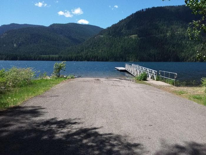
Overview Dorr Skeels Campground is located 13 miles south of Troy on Hwy 56. The Dorr Skeels Campground has 8 overnight campsites, including one host site and 2 day use sites with tables and fire rings. Amenities include potable water, vault toilets, swimming area with beach and a fully developed boat ramp with dock. A security gate is closed at 10:00 pm and opened at 07:00 am daily by the camphost. Recreation The campground has a boat ramp with dock, a beach area and bouyed off swimming area. There are several day use sites available for guests. Facilities The campground has a boat ramp with dock, a beach area and bouyed off swimming area. There are several day use sites available for guests. Natural Features At an elevation of 2,344 feet, the campground is nestled among mature pines at the north end of Bull Lake in the Bull Lake Area. The lake spans 1,162 acres. The lake is popular with recreationists as well as fisherman. Many species of fish can be found there including brook trout, bull trout, kokanee, small and large mouth bass, pike, suckers, whitefish and perch. Nearby Attractions The campground lies along the western edge of the Cabinet Mountains Wilderness and is just north of an ancient cedar grove, Ross Creek Cedars.
View details →
Overview River Point Campground on the West shore of Seeley Lake is bordered by the Clearwater River to the North. Beach-front day-use picnic sites and a roped swimming beach are just a short walk away from the 27 RV/Tent sites. This includes 5 sites with river-front access. River Point is a popular campground and day-use area that sees heavy use all season. The campground is well known for its sweeping views of the eastern shoreline, area peaks, and the old growth Western Larch trees that tower over the valley. Recreation The campground is popular for swimming, fishing, biking and paddling. There is no boat launch at this facility. A portion of the community trails network comes through the campground. The trails provide non-motorized access to town and nearby forest lands. The Clearwater Canoe Trailhead just North of Seeley Lake offers excellent flat water for viewing wildlife such as blue herons and river otters. The water trail is popular with canoeists and kayakers as it stretches 3.5 miles, or a couple of hours, down the river. The Morrell Falls National Recreation Trail on the East side of the valley offers an incredible day hike exploring recent burns, dense forests, and a large waterfall. Facilities The campground is popular for swimming, fishing, biking and paddling. There is no boat launch at this facility. A portion of the community trails network comes through the campground. The trails provide non-motorized access to town and nearby forest lands. The Clearwater Canoe Trailhead just North of Seeley Lake offers excellent flat water for viewing wildlife such as blue herons and river otters. The water trail is popular with canoeists and kayakers as it stretches 3.5 miles, or a couple of hours, down the river. The Morrell Falls National Recreation Trail on the East side of the valley offers an incredible day hike exploring recent burns, dense forests, and a large waterfall. Natural Features The campsites offer the chance to spend time with the old growth Western Larch trees. Many of these trees are over 500 years old and several feet in diameter. Just a short distance away is the Girard Grove, home of a Western Larch tree over 1000 years old and more than seven feet in diameter, known as “Gus”. The historic Camp Paxson can also be seen across the Clearwater River. Bald eagles and osprey dive for fish in the early morning and late evening. Nearby Attractions The town of Seeley Lake, MT on the southeastern tip of the lake offers a variety of recreation services such as boat, canoe, and kayak rentals as well as guide services and resorts. Services like gas, groceries, restaurants, and lodging can also be found in town. Access to a variety of forests, sweeping views, mountain lakes, and rugged peaks can be discovered just a short drive up any of the nearby Forest Service roads. Just a day trip away from Seeley Lake, Glacier National Park is known for a variety of opportunities to explore alpine landscapes, active glaciers, and view unique wildlife. Contact the park for current conditions. Missoula, one one of Western Montana’s outdoor recreation hubs is about an hour from Seeley Lake, MT. Missoula is a full-service city with 2 hospitals, an international airport, and access to services, hotels, and outdoor activities.
View details →
Overview Quartz Flat Campground is located just off of Interstate 90, 45 minutes west of Missoula, Montana and 15 minutes east of Superior, Montana. The paved campground has three loops and 78 sites total. There is water, dump stations, vault and flush toilets, trash, picnic tables, fire rings, a short interpretative trail, and Camp Hosts. The campground sits above the Clark Fork River in the shade of pines trees. Be aware the campground receives alot of noise from Interstate 90 and passing trains. Recreation The campground is in close proximity to launch sites along the Clark Fork River, including the Alberton Gorge. The campground can accomodate large groups recreating on the river or in the National Forest. It is within walking distance from the Clark Fork River and it has a self-guided nature trail. The Quartz Flat Campground is one of three campgrounds located along Interstate 90 between Idaho and Missoula, Montana. Facilities The campground is in close proximity to launch sites along the Clark Fork River, including the Alberton Gorge. The campground can accomodate large groups recreating on the river or in the National Forest. It is within walking distance from the Clark Fork River and it has a self-guided nature trail. The Quartz Flat Campground is one of three campgrounds located along Interstate 90 between Idaho and Missoula, Montana. Natural Features The campground resides in the valley bottom surrounded by pine trees and the Clark Fork River to the north. The campground is flat and easily accessible from Interstate 90. Nearby Attractions Missoula is 50 miles to the east. Superior is 10 miles to the west. St. Regis is 25 miles to the west. Route of the Hiawatha Trail is 53 miles to the west. Lookout Ski Area / Idaho is 58 miles to the west. Alberton Gorge is 11 miles to the east. contact_info For facility specific information, please call (406) 822-4233.
View details →
Overview Cliff Point Campground is located in southwestern Montana on the shoreline of scenic Cliff Lake. It is approximately 43 miles south of Ennis and 35 miles west of Yellowstone National Park. Each site in the small six site campground is equipped with a picnic table and fire ring. There is a centrally located vault toilet and drinking water tap. Some of the sites have partial shade. An undeveloped natural-surface boat launch is very close by and the lake has a no-wake speed limit. Visitors enjoy fishing, boating, and nearby hiking and ATV trails. All campsites are reservation only. With some tight curves and small turn-around loop, the campground may not be suitable for long trailers or RVs. The maximum recommended trailer length is 16 feet. Snow may hamper access during early and late seasons. Site number 6 is reservable two weeks in advance of your arrival date. All other sites have a six month in advance reservation window. Recreation Cliff Lake offers fishing for rainbow and Yellowstone cutthroat trout, as well as boating, canoeing and swimming, despite the cold water. Boats can be rented at Wade Lake Resort. Just five miles away, the world renowned Madison River offers blue ribbon flyfishing . There are hiking opportunities nearby, including the trail to Hidden Lake, beginning at the upper end of Cliff Lake, as well as trails in the nearby Lee Metcalf Wilderness. Off Road Vehicle trails are abundant in the Gravelly range. Facilities Cliff Lake offers fishing for rainbow and Yellowstone cutthroat trout, as well as boating, canoeing and swimming, despite the cold water. Boats can be rented at Wade Lake Resort. Just five miles away, the world renowned Madison River offers blue ribbon flyfishing . There are hiking opportunities nearby, including the trail to Hidden Lake, beginning at the upper end of Cliff Lake, as well as trails in the nearby Lee Metcalf Wilderness. Off Road Vehicle trails are abundant in the Gravelly range. Natural Features At an elevation of 6313 feet, the campground and lake lie in the bottom of a forested ravine at the southern end of the Gravelly mountain range. The 600 acre lake is known for it’s beautiful clear aquamarine water. Wade Lake is less than 1 mile away. Moose, deer, eagles, otters, an occasional bear and a variety of waterfowl can be seen in the area . Nearby Attractions Wade Lake, Wade Lake Campground and Hilltop Campground are within one mile. The west entrance to Yellowstone National Park is about 35 miles east at West Yellowstone. The Earthquake Lake Visitor Center and Geologic Site is about a ten mile drive. The Lee Metcalf designated wilderness begins about five miles to the northeast. A short drive will bring you to much larger Hebgen Lake to the east and Henry's Lake to the south.
View details →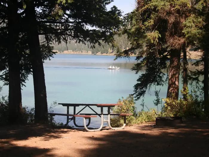
Overview Wade Lake Campground is located in southwestern Montana on the shore of it’s scenic namesake lake. It is approximately 43 miles south of Ennis and 35 miles west of Yellowstone National Park. The 25 site campground, including two group sites, is situated in a dense Douglas Fir forest on the hillside above the lake. Each site is equipped with a picnic table and fire ring. Vault toilets and drinking water taps are provided in each of the two camping loops. The campground is situated on a steep hillside. For many of the sites, particularly in the upper loop, the only flat space for a tent may be in the parking driveway. There is an undeveloped natural-surface boat launch and the lake has a no-wake speed limit. Visitors enjoy fishing, small craft boating, and nearby hiking and ATV trails in the Gravelly Range. Trailers longer than 24 feet are not recommended due to small campsites, narrow roads and tight curves within the campground. Check the driveway length and width before booking to make sure the entirety of your equipment will fit the site. Snow may hinder access in early or late seasons. Cellular service may be available at the top of the hill near the Forest boundary, about 1.5 miles away. All sites are only available through reservations. To provide reservation opportunities for those who are unable to plan six months in advance, site numbers 6, 13, 17, 20 and 25 may only be reserved two weeks prior to arrival date. Sites 2, 9, 14 and 22 may only be reserved four days prior to arrival. All other sites have a six month booking window. Recreation Wade Lake offers fishing for rainbow and brown trout, as well as boating, canoeing and swimming, despite the cold water. Boats can be rented at Wade Lake Resort. Just five miles away, the world renowned Madison River offers blue ribbon flyfishing. Hiking trails begin right at the campground , as well as, in the nearby Lee Metcalf Wilderness. Off Road Vehicle trails are abundant in the Gravelly range though there are no trails in the immediate campground area. Facilities Wade Lake offers fishing for rainbow and brown trout, as well as boating, canoeing and swimming, despite the cold water. Boats can be rented at Wade Lake Resort. Just five miles away, the world renowned Madison River offers blue ribbon flyfishing. Hiking trails begin right at the campground , as well as, in the nearby Lee Metcalf Wilderness. Off Road Vehicle trails are abundant in the Gravelly range though there are no trails in the immediate campground area. Natural Features At an elevation of 6217 feet, the campground and lake lie in the bottom of a forested ravine at the southern end of the Gravelly mountain range. The spring fed 200 acre lake is known for its beautiful clear aquamarine water. The larger Cliff Lake is less than 1 mile away. Moose, deer, eagles, an occasional bear and a variety of waterfowl can be seen in the area . Nearby Attractions Cliff Lake, Cliff Point Campground and Hilltop Campground are within one mile. Hilltop is available on a “first come first served” basis. The west entrance to Yellowstone National Park is about 35 miles east at West Yellowstone. The Earthquake Lake Visitor Center and Geologic Site is about a ten mile drive. The Lee Metcalf designated wilderness begins about five miles to the northeast. A short drive will bring you to much larger Hebgen Lake to the east and Henry's Lake to the south. contact_info For facility specific information, please call (406) 682-4253.
View details →
Overview Eagle Creek Campground is located 2 miles northeast of the town of Gardiner on Jardine Road and approximately 55 miles south of the city of Livingston along scenic HWY 89 S. At an elevation of 6100 feet, the campground overlooks Yellowstone National Park's majestic peaks. This 20-site campground has gravel roads with unpaved sites that accommodate a maximum of 48’ RVs. The Yellowstone River Trailhead is also located within this campground. Vault toilets, fire rings, picnic tables, and horse corrals are provided to the public. There are no hook-ups available. Food storage order is in effect from March 1st through December 1st. Recreation The Yellowstone River Trailhead is located within the camground. There are horse corrals for use by campers and day users. Many other hiking opportunities are locted within a 15 minute drive. The Yellowstone River is close by with access to rafting and fishing activites. Facilities The Yellowstone River Trailhead is located within the camground. There are horse corrals for use by campers and day users. Many other hiking opportunities are locted within a 15 minute drive. The Yellowstone River is close by with access to rafting and fishing activites. Natural Features The campground is located at about 6100 feet overlooking the Gallatin Mountains. There is a small creek that runs along the west side of the campground filled with small Aspen trees. It is not uncommon to have Elk roaming through and bedding in the grass. Nearby Attractions The Northwest entrance to Yellowstone National Park is located about a 10 minute drive away and offers unparalleled wildlife viewing opportunities, breathtaking scenery and unique geological features. Soak and relax at Yellowstone Hotsprings resort situated in the nearby town of Corwin Springs.
View details →
Overview Sloway Campground is located off of Interstate 90, just 60 minutes west of Missoula, Montana and 15 minutes west of Superior, Montana. The paved campground has 27 sites total. There is water, vault toilets, trash services, picnic tables, fire rings, volleyball net, horseshoe pits, and Camp Hosts. The campground sits on the Clark Fork River in the shade of pines trees and has a primitive boat launch and an equestrian site. Be aware the campground receives a lot of noise from Interstate 90 and passing trains. Recreation The campground is in close proximity to launch sites along the Clark Fork River, including the Alberton Gorge. The campground can accommodate small to medium groups recreating on the river or in the National Forest. The Sloway Campground is one of three full-service campgrounds located along Interstate 90 between Idaho and Missoula, Montana. Facilities The campground is in close proximity to launch sites along the Clark Fork River, including the Alberton Gorge. The campground can accommodate small to medium groups recreating on the river or in the National Forest. The Sloway Campground is one of three full-service campgrounds located along Interstate 90 between Idaho and Missoula, Montana. Natural Features The campground resides in the valley bottom surrounded by pine trees and the Clark Fork River to the south. The campground is flat and easily accessible from Interstate 90. Nearby Attractions Missoula is 60 miles to the east. Superior is 8 miles to the east. St. Regis is 7 miles to the west. Route of the Hiawatha Trail is 43 miles to the west. Lookout Ski Area / Idaho is 48 miles to the west. Alberton Gorge is 21 miles to the east.
View details →
Overview Cabin City Campground is located 2.5 miles off of Interstate 90, Exit 22 and is 30 minutes west of Superior, Montana. It is a wooded quiet site adjacent to 12 Mile Creek. The paved campground has 24 sites total. There is water, vault toilets, trash services, picnic tables, fire rings, and Camp Hosts. A short interpretative trail is on site. Recreation Cabin City Campground is located 20 miles from the Hiawatha Bike Trail. The St Regis River and 12 mile Creek provide good areas to fish and nature watch. The Cabin City Campground is one of three full-service campgrounds located along Interstate 90 between Idaho and Missoula, Montana. Facilities Cabin City Campground is located 20 miles from the Hiawatha Bike Trail. The St Regis River and 12 mile Creek provide good areas to fish and nature watch. The Cabin City Campground is one of three full-service campgrounds located along Interstate 90 between Idaho and Missoula, Montana. Natural Features The campground is at 3200 feet in elevation and is surrounded by trees and 12 Mile Creek runs adjacent to it. The campground is fairly flat and easily accessible from Interstate 90. Nearby Attractions Missoula is 65 miles to the east. Superior is 30 miles to the east. St. Regis is 15 miles to the east. Route of the Hiawatha Trail is 30 miles to the west. Lookout Ski Area / Idaho is 40 miles to the west. Alberton Gorge is 45 miles to the east.
View details →
Overview Trout Creek Campground is located off Interstate 90, just 60 minutes west of Missoula, Montana and 10 minutes southeast of Superior, Montnana. The campground is graveled with 12 sites and has a large picnic area. There is no water available or a Camp Host. There are vault toilets, trash services, picnic tables, and fire rings. The campground sits by the Trout Creek stream and is shaded and quiet. Recreation This campground is in close proximity to Heart Lake, HooDoo Lake and the trail system off the state line. Facilities Trout Creek Campground is graveled and has vault toilets and trash services. Each site has a parking space, picnic table, and fire ring. There are 12 sites in total which are back in only and can accommodate RV's 27' to 35' in length depending on the site. Natural Features The campground resides in the valley bottom and Trout Creek runs next to it. The campground is flat and easily accessible from Interstate 90. Nearby Attractions Missoula is 60 miles to the east. Superior is 7 miles to the west. St Regis is 20 miles to the west. Route of the Hiawatha Trail is 50 miles to the west. Lookout Ski Area/Idaho is 54 miles to the west. Alberton Gorge is 21 miles to the east. contact_info For facility specific information, please call (406) 822-4233.
View details →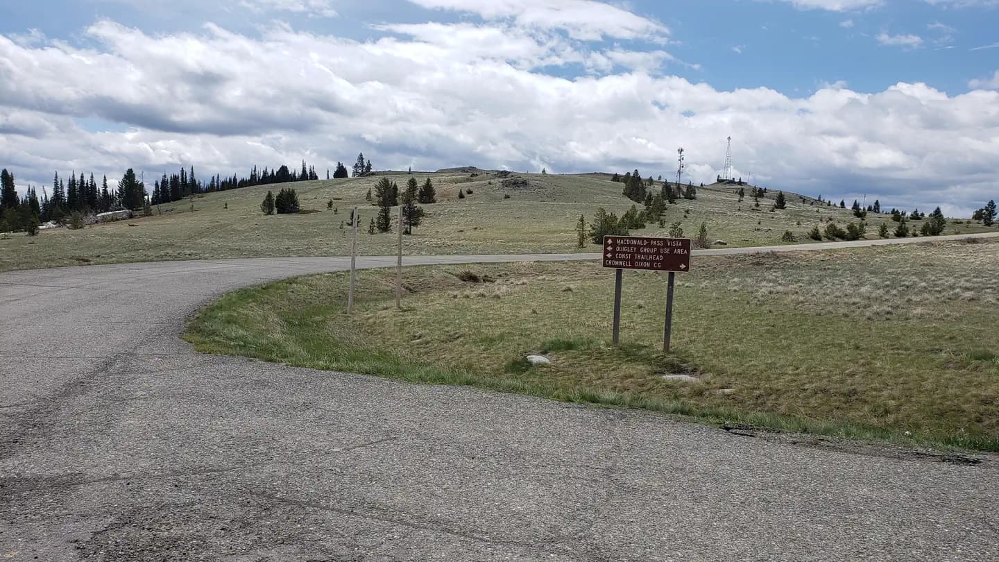
Overview Quigley Group Use Site sits in forested mountain terrain on the top of MacDonald Pass about 15 miles west of Helena, Montana. Quigley is on public land managed by the Helena Ranger District of the Helena-Lewis and Clark National Forest and is adjacent to the Continental Divide National Scenic (CDNST) trail. Located right on the Continental Divide at 6,300 feet elevation, there are spectacular views of surrounding country encompassing meadows, timbered slopes, and mountains. The site is available for rental from June 1 to October 15 each year and closed at all other times. Recreation Quigley Group Use offers outdoor enthusiasts the opportunity to hike, bike and enjoy a long list of outdoor recreational activities on and around the Continental Divide Trail system. Hunting, photography, and exploration are all great recreational activities in this area. There is an extensive road system 10 miles to the west (Little Blackfoot) and five miles to the east (Rimini and Priest Pass) where many people use trucks or ride off-highway vehicles in the summer and fall to see the general area and old mining relics. The area to the south and north is sparsely roaded and offers a non-motorized, more remote experience. Facilities Quigley Group Use offers outdoor enthusiasts the opportunity to hike, bike and enjoy a long list of outdoor recreational activities on and around the Continental Divide Trail system. Hunting, photography, and exploration are all great recreational activities in this area. There is an extensive road system 10 miles to the west (Little Blackfoot) and five miles to the east (Rimini and Priest Pass) where many people use trucks or ride off-highway vehicles in the summer and fall to see the general area and old mining relics. The area to the south and north is sparsely roaded and offers a non-motorized, more remote experience. Natural Features At an elevation of 6,300 feet, beneath a canopy of lodgepole pine and Douglas fir trees, this Group Site is an ideal setting for larger families or groups seeking relaxation and recreation. Nearby rugged ridges, meadows, forests and grasslands provide wildlife diverse ecosystems. Grizzly bear, deer, elk, gray wolf, moose, black bear, mountain lion, all call the area home. contact_info For facility specific information, please call (406) 449-5201. Nearby Attractions The Continental Divide National Scenic Trail (CDNST) mile 616 is just a few hundred feet from the group use site, and the CDNST runs due north and south from there. The City of Helena is about 15 miles away via US Highway 12. Note, the area is near a fee campground and a trailhead, and both are well used by the general public all summer long. The area is not remote, and users can expect to encounter other people recreating.
View details →
Overview Apgar, Fish Creek, and St. Mary Campground reservations WILL NOT provide access to any vehicle reservation areas (including the west side of the Going-to-the-Sun Road, Many Glacier, and North Fork). To obtain a vehicle reservation, visit Glacier National Park Vehicle Reservations on Recreation.gov. Apgar campground is the largest campground in the park. It is situated in trees and provides tent and RV campers with shade and some privacy. Evening sunsets on Lake McDonald are only a short stroll, and you won't want to miss evening programs with a ranger at the Apgar Amphitheater. Many trails are located within a short drive of the campground. Five Group Sites are reservable in advance. Recreation This facility is conveniently located in the western part of the park. Explorers of all ages can attend nightly ranger programs at an amphitheater within the facility. Facilities This facility is conveniently located in the western part of the park. Explorers of all ages can attend nightly ranger programs at an amphitheater within the facility. Natural Features Apgar is heavily forested with partial shade. Some sites have views of Lake McDonald. The park is named for its prominent glacier-carved terrain and remnant glaciers descended from the ice ages almost 10,000 years ago. Its diverse habitats are home to nearly 70 species of mammals including the grizzly bear, wolverine, gray wolf and lynx. Over 270 species of birds visit or reside in the park, including such varied species as harlequin ducks, dippers and golden eagles. Nearby Attractions One must-see attraction is Waterton Lakes National Park, Glacier's sister park across the Canadian-U.S. border. As the other half of Waterton-Glacier International Peace Park, Waterton Lakes offers great hiking, scenic boat cruises and several scenic drives all centered around the townsite of Waterton. Waterton Lakes National Park
View details →
Overview Lost Johnny Campground is located on the Hungry Horse Reservoir, high in the Rocky Mountains, west of the Continental Divide and just south of the Canadian border. Spectacular views and ample opportunities for recreation surround the campground. Lost Johnny Campground has five sites, all of which are reservable. The stay limit is 16 consecutive days. Recreation Swimming and fishing are popular pastimes, and anglers can expect to catch a variety of fish, including cutthroat trout. Boating is also popular on the 27,750-acre reservoir. A concrete boat ramp is accessible from the Doris Point Boat Launch located to the northwest, or at Lost Johnny Point campground which is located to the northeast. Facilities Swimming and fishing are popular pastimes, and anglers can expect to catch a variety of fish, including cutthroat trout. Boating is also popular on the 27,750-acre reservoir. A concrete boat ramp is accessible from the Doris Point Boat Launch located to the northwest, or at Lost Johnny Point campground which is located to the northeast. Natural Features The campground is situated along the massive Hungry Horse Reservoir, which was dammed to provide hydroelectric power and flood control to the area. It is the 10th highest dam in the United States and provides a stunning backdrop. Home to lynx, grizzly bear and bull trout, the forest is a premiere destination for visitors. Nearby Attractions Lost Johnny Campground is approximately 18 miles southwest of the West Glacier entrance to Glacier National Park. contact_info For facility specific information, please call (406) 752-7924. Charges & Cancellations Cancellations made within the 4 Day Reservation Window will be "considered" for a refund, by the concessionaire, of Camping fees only and will automatically forfeit the first nights fee. Day of Arrival cancellations must be turned in by calling Cheryl at 406-752-PWAI (7924) or 406-404-4164 to get the information to the campground Host. All Considerations will be made after your original reservation dates have passed. *No shows have no chance of a refund.
View details →
Overview Seeley Lake Campground is located on the western shore of Seeley Lake, a glacial-formed lake situated in a valley between the Swan and Mission mountain ranges. Seeley Lake is one of a half a dozen lakes within the valley known as the 'Chain of Lakes' through which the Clearwater River flows. Seeley Lake Campground is well known for its picturesque views of the Swan Range and for its towering Western larch trees. The campground receives heavy use and is a popular destination for swimming, boating, fishing, picnicking, and wildlife viewing. Recreation The campground is popular for swimming, boating, paddling and picnicking. Anglers cast for a variety of freshwater fish including Kokanee salmon, bass, whitefish, pike, trout and perch, among other species. Water skiing is a popular activity on the lake. The Clearwater Canoe Trailhead just North of Seeley Lake offers excellent flat water for viewing wildlife such as blue herons and river otters. The water trail is popular with canoeists and kayakers as it stretches 3.5 miles, or a couple of hours, down the river. The Morrell Falls National Recreation Trail on the East side of the valley offers an incredible day hike exploring recent burns, dense forests, and a large waterfall. Facilities The campground is popular for swimming, boating, paddling and picnicking. Anglers cast for a variety of freshwater fish including Kokanee salmon, bass, whitefish, pike, trout and perch, among other species. Water skiing is a popular activity on the lake. The Clearwater Canoe Trailhead just North of Seeley Lake offers excellent flat water for viewing wildlife such as blue herons and river otters. The water trail is popular with canoeists and kayakers as it stretches 3.5 miles, or a couple of hours, down the river. The Morrell Falls National Recreation Trail on the East side of the valley offers an incredible day hike exploring recent burns, dense forests, and a large waterfall. Natural Features The campsites offer the chance to spend time with old growth Western larch trees, a coniferous-decidious tree with distinct needles that turn bright gold in Autumn. Many of these trees are over 500 years old and several feet in diameter. Just a short distance away is the Girard Grove, home of a Western larch tree over 1000 years old and more than seven feet in diameter, known as “Gus”. The area contains a wide variety of wildlife and is home to white-tailed deer, elk, mountain goats, bighorn sheep, moose, grizzly and black bears (learn about bear safety ). Both the bald and golden eagle reside in the forest, along with trumpeter swan, herons and dozens of varieties of ducks. Nearby Attractions The town of Seeley Lake, MT on the southeastern tip of the lake offers a variety of recreation services such as boat, canoe, and kayak rentals as well as guide services and resorts. Services like gas, groceries, restaurants, and lodging can also be found in town. Access to a variety of forests, sweeping views, mountain lakes, and rugged peaks can be discovered just a short drive up any of the nearby Forest Service roads. Just a day trip away from Seeley Lake, Glacier National Park is known for a variety of opportunities to explore alpine landscapes, active glaciers, and view unique wildlife. Contact the park for current conditions. Missoula, one of Western Montana’s outdoor recreation hubs is about an hour from Seeley Lake, MT. Missoula is a full-service city with 2 hospitals, an international airport, and access to services, hotels, and outdoor activities.
View details →
Overview Bear Creek Campground is located at the base of the western slope of the Madison Range in southwest Montana. It's part of an administrative site that also includes the Bear Creek and Bear Creek Bunkhouse rental cabins and a trailhead for entry to the Lee Metcalf Wilderness Area. The small campground features 12 campsites, 6 on each side of the creek. The six sites north of the creek include facilities for horses/stock, while those south of the creek are non-horse use only. This is the only campground on the west side of the Madison mountain range so it can be expected to be crowded and busy during hunting season. There is very little firewood available anywhere near the campground. Recreation Hiking, horseback riding and hunting are very popular activities by visitors to this campground and parking may be difficult to find during peak season. The Middle Fork and Trail Fork trailhead is located only steps away. Because the trails lead to designated Wilderness, no motorized or mechanized use is allowed on the trails. The trailhead is the starting point for those climbing Sphinx Mountain. From December 2 until noon of May 15, the Wildlife Management Area just north of the campground is closed to all entry except to those who stay strictly on the trail and are only passing through to Forest lands. It is open for recreational use the remainder of the year. Facilities Hiking, horseback riding and hunting are very popular activities by visitors to this campground and parking may be difficult to find during peak season. The Middle Fork and Trail Fork trailhead is located only steps away. Because the trails lead to designated Wilderness, no motorized or mechanized use is allowed on the trails. The trailhead is the starting point for those climbing Sphinx Mountain. From December 2 until noon of May 15, the Wildlife Management Area just north of the campground is closed to all entry except to those who stay strictly on the trail and are only passing through to Forest lands. It is open for recreational use the remainder of the year. Natural Features At the base of the Madison mountain range, the campground is situated in a draw between hills on the edge of the National Forest. The Lee Metcalf Wilderness is immediately to the east and a State wildlife management area to the north. The trailhead, at the site, provides access to the Middle Fork and Trail Fork trails, as well as access to ascend Sphinx Mountain, a prominant peak in the range. Most campsites are shaded by Douglas fir and aspen trees. contact_info This location is unstaffed. To speak with our main office for general information, please call: (406) 682-4253. Nearby Attractions The Lee Metcalf Wilderness is adjacent to the campground. The west entrance to Yellowstone National Park is about 70 miles to the southeast. Lewis and Clark State Caverns is about 60 miles to the north.
View details →
Overview Perch Point Recreation area is located west of Fort Peck Dam on the Missouri River in northeastern Montana. Recreation enthusiasts and sportsmen enjoy the beauty of Fort Peck Lake's 1,500 miles of shoreline. A variety of high quality outdoor activities are available, including camping, boating, fishing, hunting, sightseeing and wildlife viewing. Fort Peck Dam, which impounds Fort Peck Lake is the first dam built in the upper Missouri River Basin. The area surrounding Fort Peck was first charted by Lewis and Clark in 1804, and the pristine natural condition of the river and surrounding area awed the renowned explorers. When President Franklin D. Roosevelt authorized the Fort Peck project in 1933, thousands of people from all over the country migrated to Montana during the midst of the Great Depression in hopes of earning a living. Today, Fort Peck Lake is a sportsman's paradise with excellent fishing, wildlife viewing and other countless outdoor recreation opportunities. For more information, visit the Fort Peck Project Websit e or call 406-526-3411. Recreation The vast size of Fort Peck Lake and its remoteness from major population centers provide a variety of high quality outdoor experiences. Popular recreation activities include camping, boating, fishing, hunting, sight-seeing, picnicking, biking, hiking, photography, watching wildlife and just relaxing. Fort Peck Lake: Fifteen hundred miles of pristine shoreline serve as a haven for those wishing to get away from the stresses of modern life. There are 27 recreation areas located around the reservoir, including numerous primitive camping sites. The areas near and around the dam offer paved roads, electricity, showers and playgrounds while facilities around the rest of the lake are more primitive with gravel roads, picnic tables and vault toilets. Access roads to many of the remote areas may be impassable in inclement weather. Facilities The vast size of Fort Peck Lake and its remoteness from major population centers provide a variety of high quality outdoor experiences. Popular recreation activities include camping, boating, fishing, hunting, sight-seeing, picnicking, biking, hiking, photography, watching wildlife and just relaxing. Fort Peck Lake: Fifteen hundred miles of pristine shoreline serve as a haven for those wishing to get away from the stresses of modern life. There are 27 recreation areas located around the reservoir, including numerous primitive camping sites. The areas near and around the dam offer paved roads, electricity, showers and playgrounds while facilities around the rest of the lake are more primitive with gravel roads, picnic tables and vault toilets. Access roads to many of the remote areas may be impassable in inclement weather. Natural Features A panoramic east view of Fort Peck Dam and Lake is a feast to the eyes from Perch Point. Mature cottonwoods dot the landscape providing shade and wildwife habitat. Nearby Attractions • Fort Peck Lake is a Montana treasure for its vast size and outdoor recreation opportunities. Six recreation areas within a few miles of the dam provide access for water sports, fishing and hunting. • The Fort Peck Interpretive Center and Museum, is located just downstream of Fort Peck Dam. For more information, call 406-526-3493. • The Leo B. Coleman Wildlife Pasture, located just outside the Town of Fort Peck and Downstream Campground is home to Fort Peck's Bison Herd and provides an excellent wildlife viewing auto route. • The Historic Fort Peck Theater is located in the town of Ft. Peck is a popular historic destination in summer months. • The 1.1 million acre Charles M. Russell National Wildlife Refuge surrounds Fort Peck Lake and helps preserve the natural habitat for numerous wildlife species. contact_info For facility specific information, please call (406) 526-3411.
View details →
Overview Boomtown Recreation area is located just to the west of Fort Peck Dam on the Missouri River in northeastern Montana. Recreation enthusiasts and sportsmen enjoy the beauty of Fort Peck Lake's 1,500 miles of shoreline. A variety of high quality outdoor activities are available, including camping, boating, fishing, hunting, sightseeing and wildlife viewing. Fort Peck Dam, which impounds Fort Peck Lake is the first dam built in the upper Missouri River Basin. The area surrounding Fort Peck was first charted by Lewis and Clark in 1804, and the pristine natural condition of the river and surrounding area awed the renowned explorers. When President Franklin D. Roosevelt authorized the Fort Peck project in 1933, thousands of people from all over the country migrated to Montana during the midst of the Great Depression in hopes of earning a living. Today, Fort Peck Lake is a sportsman's paradise with excellent fishing, wildlife viewing and other countless outdoor recreation opportunities. For more information, visit the Fort Peck Project Website or call 406-526-3411. Recreation The vast size of Fort Peck Lake and its remoteness from major population centers provide a variety of high quality outdoor experiences. Popular recreation activities include camping, boating, fishing, hunting, sight-seeing, picnicking, biking, hiking, photography, watching wildlife and just relaxing. Fort Peck Lake: Fifteen hundred miles of pristine shoreline serve as a haven for those wishing to get away from the stresses of modern life. There are 27 recreation areas located around the reservoir, including several with primitive camping sites on a first come, first serve basis. The areas near and around the dam offer paved roads, electricity, showers and playgrounds while facilities around the rest of the lake are more primitive with gravel roads, picnic tables and vault toilets. Access roads to many of the remote areas may be impassable in inclement weather. Facilities The vast size of Fort Peck Lake and its remoteness from major population centers provide a variety of high quality outdoor experiences. Popular recreation activities include camping, boating, fishing, hunting, sight-seeing, picnicking, biking, hiking, photography, watching wildlife and just relaxing. Fort Peck Lake: Fifteen hundred miles of pristine shoreline serve as a haven for those wishing to get away from the stresses of modern life. There are 27 recreation areas located around the reservoir, including several with primitive camping sites on a first come, first serve basis. The areas near and around the dam offer paved roads, electricity, showers and playgrounds while facilities around the rest of the lake are more primitive with gravel roads, picnic tables and vault toilets. Access roads to many of the remote areas may be impassable in inclement weather. Natural Features A panoramic east view of Fort Peck Dam and Lake is a feast to the eyes at Boomtown. Mature cottonwoods dot the landscape providing shade and wildwife habitat. Nearby Attractions • Fort Peck Lake is a Montana treasure for its vast size and outdoor recreation opportunities. Six recreation areas within a few miles of the dam provide access for water sports, fishing and hunting. • The Fort Peck Interpretive Center and Museum, is located just downstream of Fort Peck Dam. For more information, call 406-526-3493. • The Leo B. Coleman Wildlife Pasture, located just outside the Town of Fort Peck and Downstream Campground is home to Fort Peck's Bison Herd and provides an excellent wildlife viewing auto route. • The Historic Fort Peck Theater is located in the town of Ft. Peck is a popular historic destination in summer months. • The 1.1 million acre Charles M. Russell National Wildlife Refuge surrounds Fort Peck Lake and helps preserve the natural habitat for numerous wildlife species.
View details →
Overview Lake Alva Campground is located on the North shore of Lake Alva, approximately 11 miles north of Seeley Lake, and offers visitors the chance to camp and enjoy activities such as swimming, boating, fishing, picnicking, and wildlife viewing. The lake is home to a loon population and has protected nesting areas. The birds' mesmerizing calls can often be heard in the campground. All boats on Lake Alva must operate at a "no-wake" speed year-round. Recreation The campground is a popular destination for swimming, boating, paddling, picnicking, and fishing. There are a variety of freshwater fish including Kokanee salmon, perch, pumpkinseed sunfish, and trout, among other species. Motorized boating is allowed on Lake Alva within the "No-Wake" regulation. Many non-motorized boaters find solace during the evening and morning hours on the lake. The Mission Mountain Wilderness Area is about 15 miles northwest of the campground. The area is popular for its scenic views and abundant wildlife. Active glaciers, alpine lakes, meadows and clear, icy streams, along with vertical cliffs and jagged peaks make up the area. Facilities 19 individual RV/tent campsites within Loop 1 are available for reservation the Friday before Memorial Day to the Tuesday after Labor Day. These sites will transition to first-come/first-serve outside of these dates. 20 campsites within Loop 2 are available on a first-come/first-serve basis . These campsites can be paid for onsite by scanning a QR Code using the Recreation.gov mobile app. Visitors will need to download the free recreation.gov mobile app through Android or iOS. This is best done prior to arrival. All campsites are equipped with a picnic table, fire ring with grill, and a paved parking stall. Accessible vault toilets, drinking water and trash receptacles are available throughout the campground. Campground hosts are on site 24 hours a day. The campground also offers a spacious day use area that includes a swimming beach, a concrete boat ramp, paved parking for vehicles/boat trailers, and several picnic areas. Day use facilities are open year-round from 6:00 a.m.-10:00 p.m. Mountain Time. No fees or reservations are required for day use. Natural Features Lake Alva is a glacial-formed lake situated in a valley between the Swan and Mission mountain ranges. It is one of a half a dozen lakes within the valley known as the 'Chain of Lakes' through which the Clearwater River flows. At an elavation of approximately 4,200 feet, temperatures are relatively cool on summer days. The area contains a wide variety of wildlife and is home to white-tailed deer, elk, mountain goats, bighorn sheep, moose, grizzly and black bears (learn about bear safety ). Both the bald and golden eagle reside in the forest, along with trumpeter swan, herons and dozens of varieties of ducks. The lake is home to a loon population and has protected nesting areas. The birds' mesmerizing calls can often be heard in the campground. Nearby Attractions The town of Seeley Lake, MT is about 11 miles south of the campground. A variety of recreation services such as boat, canoe, and kayak rentals as well as guide services and resorts are offered there. Services like gas, groceries, restaurants, and lodging can also be found in town. Access to a variety of forests, sweeping views, mountain lakes, and rugged peaks can be discovered just a short drive up any of the nearby Forest Service roads. Just a day trip away, Glacier National Park is known for a variety of opportunities to explore alpine landscapes, active glaciers, and view unique wildlife. Contact the park for current conditions. Missoula, one of Western Montana’s outdoor recreation hubs is about an hour from Seeley Lake, MT. Missoula is a full-service city with 2 hospitals, an international airport, and access to services, hotels, and outdoor activities. contact_info For facility specific information, please call (406) 677-2233.
View details →
Overview Moose Creek Group Use Area sits in forested mountain terrain 14.5 miles and about 20 minutes west of Helena, Montana. Moose Creek is on public land managed by the Helena Ranger District and is just below the Continental Divide National Scenic (CDNST) trail. There are spectacular views of surrounding country encompassing meadows, timbered slopes, and mountains. The site is available for rental from June 1 to October 15 each year. Recreation Hikers and backpackers can access the CDNST from the Switchback Ridge trail which takes off just north of the site. This is a non-motorized trail with spectacular views and a variety of terrain, open to mountain bikers, stock users, backpackers and day hikers. The trail transitions through thick forest to above tree line and offers spectacular views both east and west of the Continental Divide. Tenmile creek is a stream located just 11.4 miles from Helena. The creek supports a variety of fish, including redear sunfish, rainbow trout and brook trout. Whether spinning, fly fishing or baitcasting, chances of getting a bite here are good. Facilities Moose Creek Group Use Area is a flat, unadorned, undeveloped camping area with a single fire ring and picnic table. The site can accommodate approximately 20 people. There is limited parking, and trailers should not exceed 20 feet in length. Space is available for 1-6 four-person tents. There are no camper hook ups, and water is not available. There is one vault toilet on site. Large groups staying for a longer period often choose to have portable toilet(s) delivered at the start of their stay and pick up at before the end of their stay, at their own expense. Natural Features At an elevation of 4,900 feet, the open area gives views of the forest and its lodgepole pine and Douglas fir trees. Group Site is an ideal setting for large families or groups seeking relaxation and recreation. Nearby rugged ridges, meadows, forests and grasslands provide wildlife diverse ecosystems. Grizzly bear, deer, elk, gray wolf, black bear, moose, mountain lion, all call the area home. Nearby Attractions Switchback trail (348) is located just a short walk-through Moose Creek Campground and behind the information Kiosks. It leads to the Continental Divide National Scenic Trail. The city of Helena is about 14 miles away via US Highway12. Note, there is a near Day Use area and campground, and both are well used by the public all summer long. The area is not remote, and user can expect to encounter other people recreating. Motorized day trips include a drive to Park Lake located approximately 6 miles SE on FS Road 299, and Minnehaha (FS RD 527) south and west to the top of the CDNST. Both roads are accessed with a short drive south of Moose Creek Group Use Area.
View details →
Overview The Pines Recreation area is located on the Fort Peck Reservoir on the Missouri River in northeastern Montana. Recreation enthusiasts and sportsmen enjoy the beauty of Fort Peck Lake's 1,500 miles of shoreline. A variety of high quality outdoor activities are available, including camping, boating, fishing, hunting, sightseeing and wildlife viewing. Fort Peck Dam , which impounds Fort Peck Lake is the first dam built in the upper Missouri River Basin. The area surrounding Fort Peck was first charted by Lewis and Clark in 1804, and the pristine natural condition of the river and surrounding area awed the renowned explorers. When President Franklin D. Roosevelt authorized the Fort Peck project in 1933, thousands of people from all over the country migrated to Montana during the midst of the Great Depression in hopes of earning a living. Today, Fort Peck Lake is a sportsman's paradise with excellent fishing, wildlife viewing and other countless outdoor recreation opportunities. For more information, visit the Fort Peck Project Website or call 406-526-3411. Recreation The vast size of Fort Peck Lake and its remoteness from major population centers provide a variety of high quality outdoor experiences. Popular recreation activities include camping, boating, fishing, hunting, sight-seeing, picnicking, biking, hiking, photography, watching wildlife and just relaxing. Fort Peck Lake: Fifteen hundred miles of pristine shoreline serve as a haven for those wishing to get away from the stresses of modern life. There are 27 recreation areas located around the reservoir. The areas near and around the dam offer paved roads, electricity, showers and playgrounds while facilities around the rest of the lake are more primitive with gravel roads, picnic tables and vault toilets. Access roads to many of the remote areas may be impassable in inclement weather. Fishing : Fort Peck Lake enjoys nationwide recognition as a hot spot for walleye fishing. Fort Peck Lake provides excellent boating and fishing opportunities. The lake also offers excellent fishing for sauger, smallmouth bass, lake trout, chinook salmon and northern pike. The introduction of cisco as a forage fish in 1983 proved successful and has increased both the size and number of game fish. Wildlife Viewing/Hunting: The Fort Peck Lake Area and the Charles M. Russell Wildlife Refuge provide superb hunting of deer, elk, big horn sheep, and prong horn. The Missouri River Breaks are known for producing large elk and other game animals. Hunting is prohibited inside the Pines Recreation area. Interpretive Center & Museum: The Fort Peck Dam Interpretive Center and Museum offers displays of wildlife dioramas, aquariums, dinosaur fossils and dam construction history. Open Friday through Monday 9am to 4pm. Facilities Facilities include two permanent and two temporary low water ramps, courtesy dock, safety lights, fish cleaning station, enclosed shelter with electric grill, playground, 28 campsites, parking areas and four vault toilets. Trash dumpster is located near fire station on Pine Cove Drive Road. No potable water is available. Natural Features The Pines recreation area is one of the most distinctly attractive on Fort Peck Reservoir. It is characterized by a mature Ponderosa Pine forest, a feature unique among the recreation areas at Fort Peck Project. Some trees are in excess of 200 years old, pre-dating the Lewis and Clark Expedition. The topography is gently rolling, with extensive gently sloping shorelines. The area is dominated by pines and junipers with mid-grasses and shrubs in the open areas. Nearby Attractions • Fort Peck Lake is a Montana treasure for its vast size and outdoor recreation opportunities. Six recreation areas within a few miles of the dam provide access for water sports, fishing and hunting. • The Fort Peck Interpretive Center and Museum, is located just downstream of Fort Peck Dam. For more information, call 406-526-3493. • The Leo B. Coleman Wildlife Pasture , located just outside the Town of Fort Peck and Downstream Campground is home to Fort Peck's Bison Herd and provides an excellent wildlife viewing auto route. • The Historic Fort Peck Theater is located in the town of Ft. Peck is a popular historic destination in summer months. • The 1.1 million acre Charles M. Russell National Wildlife Refuge surrounds Fort Peck Lake and helps preserve the natural habitat for numerous wildlife species. • The Fort Peck State Fish Hatchery is located on Yellowstone Drive and is responsible for stocking Fort Peck Lake and other waterways with walleye, northern pike, chinook salmon and rainbow trout. Charges & Cancellations Reservation changes and cancellations can be made on Recreation.gov or by calling 1-877-444-6777. For more information on rules and policies regarding reservation cancellations and changes, please visit: https://www.recreation.gov/rules-reservation-policies .
View details →
Overview Willow Park is located about 50 miles east of Worland, Wyoming on the west side of scenic Cloud Peak Skyway, near the Cloud Peak Wilderness Area. The Bighorn National Forest offers a wide variety of activities, including hiking, fishing, scenic driving and a number of historic sites. The administering organization is Gallatin Canyon Campgrounds; e-mail: office@ceicamp.com Recreation Off-road vehicle trails, scenic jeep roads, hiking and additional fishing streams are available in the surrounding area. Diverse hikes vary from loop trails to treks along creeks and over mountain peaks; many trails access the Cloud Peak Wilderness. Meadowlark Lake is within a couple miles of the campground. This small lake allows motorized craft at a no-wake speed. West Tensleep Lake, a few miles north of the campground, is open to non-motorized craft only. Facilities Off-road vehicle trails, scenic jeep roads, hiking and additional fishing streams are available in the surrounding area. Diverse hikes vary from loop trails to treks along creeks and over mountain peaks; many trails access the Cloud Peak Wilderness. Meadowlark Lake is within a couple miles of the campground. This small lake allows motorized craft at a no-wake speed. West Tensleep Lake, a few miles north of the campground, is open to non-motorized craft only. Natural Features The campground is situated in an open meadow surrounded by a forest of lodgepole pine. Many lakes and streams are found throughout the Bighorn Mountains. Nearby Attractions The James T. Saban Lookout is located just east of Meadowlark Lake. This old fire lookout was built by the CCC decades ago and is no longer active. A short hike leads to the lookout, where hikers are awarded panoramic views of the surrounding area. Deer Haven Lodge and Meadowlark Lodge are nearby, offering dining options, lodging, and fishing and camping supplies. Charges & Cancellations Refunds: Refund requests made through www.recreation.gov will be charged a $10 processing fee. This cancellation processing fee is retained by the reservation service contractor along with the non-refundable reservation fee. All requests for the return of the non-refundable reservation fee and the cancellation processing fee will be declined by the campground concessionaire as they did not receive these fees (these are the fees retained by the reservation contractor, a different entity).
View details →
Overview Rexford Bench Recreation Area is the most highly developed camp area within the Kootenai National Forest. Rexford Bench Campground has 54 sites, 30 are first come-first serve and 24 can be reserved. Kamloops Terrace has 20 sites and additional overflow parking. A high and low water boat ramp is available. A day use area with swimming beach completes this popular area. It is a popular destination for boating, fishing and swimming on Lake Koocanusa, and hiking in the surrounding forest. Beautiful sandstone formations can be viewed not far from the campground, and osprey and eagles can often be seen fishing in the reservoir. Recreation Fishing, boating and swimming are popular activities. Fishing derbies are held several times each year and anglers can expect a catch of kokanee salmon, whitefish and a variety of trout, among others. A variety of hiking trails begins in the campground, including a relatively short interpretive trail that loops around the campground, and the Hoodoo Trail, that leads to impressive sandstone formations that jut out from an inlet along the lake. The Hoodoos can also be seen via boat. Several paths lead from the campground to the adjacent beach, boat ramp and overflow parking area. Facilities Fishing, boating and swimming are popular activities. Fishing derbies are held several times each year and anglers can expect a catch of kokanee salmon, whitefish and a variety of trout, among others. A variety of hiking trails begins in the campground, including a relatively short interpretive trail that loops around the campground, and the Hoodoo Trail, that leads to impressive sandstone formations that jut out from an inlet along the lake. The Hoodoos can also be seen via boat. Several paths lead from the campground to the adjacent beach, boat ramp and overflow parking area. Natural Features The campground is located on an arm of Lake Koocanusa in northwest Montana near the Canadian border. The 46,500-acre reservoir has over 127 miles of shoreline and is formed by 422' Libby Dam on the Kootenai River, which stretches about 90 miles and into Canada. It is a large campground, situated in a ponderosa pine forest at an elevation of 2,470 feet. Osprey often fish around Libby Dam at sunset, making for enjoyable viewing opportunities. Bald eagles can be seen hunting kokanee in the river and lake during the fall. A variety of wildlife also makes its home in the area. Nearby Attractions The Kootenai River, below Libby Dam, is a blue ribbon fishery. Guided tours of the dam and powerhouse are offered at the visitor center throughout the summer. Visitors also enjoy driving the 100-mile loop around the reservoir. Several trails, including some that lead to scenic waterfalls, are located along the route.
View details →
Overview Spring Gulch Campground is a well-maintained campground located about 50 feet from the highway, on the banks of the scenic Bitterroot River. Visitors enjoy a variety of recreational opportunities, including hiking, mountain biking, fishing and swimming. The campground provides accessible sites and amenities, making it a comfortable spot for anyone to relax in the mountains of southwestern Montana. Recreation A number of hiking, biking and horseback riding trails can be accessed near the campground. The Continental Divide National Scenic Trail can be accessed not far from the campground, as well as trails that lead to the area's numerous mountain peaks. A variety of natural hot springs exist in the area, including Lost Trail Hot Springs, which is approximately seven miles south of the campground. The springs are popular places for swimming. A general store and lodging are located nearby. Rafting, canoeing, kayaking and fishing on the Bitterroot River are also popular activities. A short paved path meanders along the river and an accessible fishing dock is located within the campground. Anglers can expect to find mainly cutthroat trout, but other freshwater species are available. Facilities A number of hiking, biking and horseback riding trails can be accessed near the campground. The Continental Divide National Scenic Trail can be accessed not far from the campground, as well as trails that lead to the area's numerous mountain peaks. A variety of natural hot springs exist in the area, including Lost Trail Hot Springs, which is approximately seven miles south of the campground. The springs are popular places for swimming. A general store and lodging are located nearby. Rafting, canoeing, kayaking and fishing on the Bitterroot River are also popular activities. A short paved path meanders along the river and an accessible fishing dock is located within the campground. Anglers can expect to find mainly cutthroat trout, but other freshwater species are available. Natural Features Located on the banks of the Bitterroot River, the campground is nestled in a ponderosa pine forest. It is easily accessible from Highway 93 and sits at an elevation of about 4,300 feet in the Bitterroot National Forest. A variety of wildlife, including big game like mule and white-tailed deer, elk and moose, makes its home in the area. Nearby Attractions The small town of Sula is less than five miles from the campground, offering gas and a post office.
View details →
Overview Bald Mountain Campground is located along the Medicine Wheel Passage Scenic Byway (U.S. Highway 14A), 33 miles east of Lovell, Wyoming. The Medicine Wheel National Historic Landmark is nearby. Visitors enjoy the area for its scenic natural beauty and recreational opportunities. The administering organization is Gallatin Canyon Campgrounds; e-mail: office@ceicamp.com Recreation From the area's historic mining sites to the ancient Native American Medicine Wheel, to hiking through open meadows and along the cliffs on the west rim of the mountains, the Bighorn National Forest offers many recreational opportunities. Jaws Trailhead is near the campground, offering access to Bucking Mule Falls Trail and Porcupine Creek. Scenic off-road driving is available on Hunt Mountain Road or Burgess Overlook jeep trail. Facilities From the area's historic mining sites to the ancient Native American Medicine Wheel, to hiking through open meadows and along the cliffs on the west rim of the mountains, the Bighorn National Forest offers many recreational opportunities. Jaws Trailhead is near the campground, offering access to Bucking Mule Falls Trail and Porcupine Creek. Scenic off-road driving is available on Hunt Mountain Road or Burgess Overlook jeep trail. Natural Features Bald Mountain is part of the Bighorn Range in northern Wyoming. A forest of pine and aspen covers the campground, which sits near top of the mountain at an elevation of 9,200 feet. Small creeks wind through the campground and temperatures can drop significantly once the sun goes down. Nearby Attractions The Medicine Wheel National Historic Landmark is 4 miles from the campground. This unique geoglyph signifies all creation, all races of people, birds, fish, animals, trees and stones. According to tribal beliefs, the circular shape of the wheel represents the earth, sun, moon, cycles of life, seasons and day to night. High Country Lodge is nearby, offering guided horseback riding and backcountry pack trips, off-road vehicle rentals and guided fishing trips. Charges & Cancellations Refunds: Refund requests made through www.recreation.gov will be charged a $10 processing fee. This cancellation processing fee is retained by the reservation service contractor along with the non-refundable reservation fee. All requests for the return of the non-refundable reservation fee and the cancellation processing fee will be declined by the campground concessionaire as they did not receive these fees (these are the fees retained by the reservation contractor, a different entity).
View details →
Overview Apgar, Fish Creek, and St. Mary Campground reservations WILL NOT provide access to any vehicle reservation areas (including the west side of the Going-to-the-Sun Road, Many Glacier, and North Fork). To obtain a vehicle reservation, visit Glacier National Park Vehicle Reservations on Recreation.gov. The St. Mary Campground is reservation only during the peak season. For information on camping outside the reservation timeframe visit the Glacier NPS website . St. Mary Campground is the largest campground on the east side of Glacier National Park, and is conveniently located approximately a half-mile from the St. Mary Visitor Center. The visitor center offers interpretive programs, shuttle service and Red Bus tours leaving from the center. The campground sits near the entrance of the popular scenic byway, the Going-to-the-Sun Road. Generators are allowed only in Loops B & C. Generators are prohibited in Loop A. Recreation St. Mary Campground is located on the east side of the park, which boasts some of the best trails available for day hiking. Trailheads start at a higher elevation than those on the west side, so less ascent is required to reach scenic vistas. Facilities St. Mary Campground is located on the east side of the park, which boasts some of the best trails available for day hiking. Trailheads start at a higher elevation than those on the west side, so less ascent is required to reach scenic vistas. Natural Features Though shade is sparse, the aspen trees that grace St. Mary Campground flutter in spring and summer breezes and provide colorful splashes of yellow late in the season. Views of Singleshot, East Flattop and Red Eagle Mountains provide a dramatic backdrop to the landscape. St. Mary Lake which, although too cold and occasionally too rough to swim in, provides refreshing scenery on warm days. Nearby Attractions One must-see attraction is the sister park across the U.S.-Canadian border, Waterton Lakes National Park . As the other half of the Waterton-Glacier International Peace Park, Waterton Lakes offers fantastic hiking, scenic boat cruises and several scenic drives all centered around the Townsite of Waterton. Immediately east of Glacier National Park lies the picturesque Blackfeet Indian Reservation , spanning 1.5 million acres. Visit the Museum of the Plains Indian, in Browning, Montana, for a fascinating introduction to the rich cultural heritage of the largest Indian tribe in Montana.
View details →
Overview Apgar, Fish Creek, and St. Mary Campground reservations WILL NOT provide access to any vehicle reservation areas (including the west side of the Going-to-the-Sun Road, Many Glacier, and North Fork). To obtain a vehicle reservation, visit Glacier National Park Vehicle Reservations on Recreation.gov. Fish Creek Campground is the second largest campground in Glacier National Park. Glacier National Park, in northwestern Montana, is comprised of pristine forests, alpine meadows, rugged mountains and spectacular lakes. With over 700 miles (1,125 km) of trails, Glacier is a hiker's paradise for visitors seeking wilderness and solitude. It also provides countless scenic vistas for those wishing to relax and take in its natural beauty. The campground is located on the western side of the park at an elevation of nearly 3,500 feet (1,066 m). This area of the park generally receives the most rainfall. Daytime temperatures can exceed 90°F (32°C), although it is frequently 10° to 15° F cooler at higher elevations. Weather in the mountains can be varied, including snow in summer; visitors should come prepared for anything. Recreation This facility is conveniently located in the western part of the park, nearby many day hikes, including Rocky Point Trail, which wanders through a burn area from a 2003 wildfire. Explorers of all ages can attend nightly ranger programs at an amphitheater within the facility. Facilities This facility is conveniently located in the western part of the park, nearby many day hikes, including Rocky Point Trail, which wanders through a burn area from a 2003 wildfire. Explorers of all ages can attend nightly ranger programs at an amphitheater within the facility. Natural Features Fish Creek is heavily forested with plenty of shade. Some sites have views of Lake McDonald. The park is named for its prominent glacier-carved terrain and remnant glaciers descended from the ice ages almost 10,000 years ago. Its diverse habitats are home to nearly 70 species of mammals including the grizzly bear, wolverine, gray wolf and lynx. Over 270 species of birds visit or reside in the park, including such varied species as harlequin ducks, dippers and golden eagles. Nearby Attractions One must-see attraction is Waterton Lakes National Park, Glacier's sister park across the Canadian-U.S. border. As the other half of Waterton-Glacier International Peace Park, Waterton Lakes offers great hiking, scenic boat cruises and several scenic drives all centered around the townsite of Waterton. Waterton Lakes National Park
View details →
Overview Basin Campground is located 7 miles west of Red Lodge, Montana, along Forest Road 2071, which is paved all the way to the campground. The area is a popular location for hiking, backpacking and fishing. Recreation Fishing is a popular activity along the West Fork of Rock Creek and at nearby Wild Bill Lake. The small lake is open to kayaking and canoeing, and an accessible fishing dock is located on the shore. The Basin Lakes Trailhead is just across the road. Silver Run Plateau, West Fork and Timberline Lakes Trails offer access to the Absaroka-Beartooth Wilderness. Mountain bikers enjoy the Ingles Creek Trail and a variety of loop trails at Silver Run. Biking is also allowed on the Basin Lakes Trail. Facilities Fishing is a popular activity along the West Fork of Rock Creek and at nearby Wild Bill Lake. The small lake is open to kayaking and canoeing, and an accessible fishing dock is located on the shore. The Basin Lakes Trailhead is just across the road. Silver Run Plateau, West Fork and Timberline Lakes Trails offer access to the Absaroka-Beartooth Wilderness. Mountain bikers enjoy the Ingles Creek Trail and a variety of loop trails at Silver Run. Biking is also allowed on the Basin Lakes Trail. Natural Features The campground is situated on the banks of the West Fork of Rock Creek. The campground and the area surrounding the campground were burned by the Cascade Fire in 2008, leaving an open landscape abounding with wildflowers. Nearby Attractions The charming town of Red Lodge, Montana offers a variety of dining and lodging options, galleries, shops and summer events. The Home of Champions Rodeo is held on Fourth of July weekend, Beartooth Bike Rally and Iron Horse Rodeo in mid-July, Mountain Man Rendezvous in late July and the Festival of Nations in early August. The Beartooth Highway was deemed "the most beautiful drive in America" by the late Charles Kuralt. It snakes across the rugged Beartooth Mountains from Red Lodge to Cooke City, Montana, and is the highest elevation highway in the Northern Rockies. Along the way, visitors are treated to sweeping views and plentiful outdoor recreation opportunities. contact_info For facility specific information, please call (928) 537-8888. Charges & Cancellations Refunds: Refund requests made through www.recreation.gov will be charged a $10 processing fee. This cancellation processing fee is retained by the reservation service contractor along with the non-refundable reservation fee. All requests for the return of the non-refundable reservation fee and the cancellation processing fee will be declined by the campground concessionaire as they did not receive these fees (these are the fees retained by the reservation contractor, a different entity).
View details →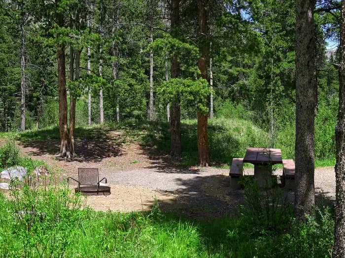
Overview Greenough Lake Campground is within walking distance of its namesake, 12 miles south of Red Lodge, in southern Montana. It is located just off the scenic Beartooth Highway. The area is a popular location for fishing, hiking and scenic driving. Glacier Lake, Hellroaring and Lake Fork trailheads are nearby. Recreation Greenough Lake offers canoeing, kayaking and rainbow trout fishing. The Main Fork of Rock Creek is also a popular fishing stream. The Beartooth Wilderness can be accessed via the Hellroaring and Lake Fork trailheads, both of which are not far from the campground. Visitors also enjoy mountain biking and hiking on the Parkside National Recreation Trail. Hellroaring Road is open to off-road vehicles. Facilities Greenough Lake offers canoeing, kayaking and rainbow trout fishing. The Main Fork of Rock Creek is also a popular fishing stream. The Beartooth Wilderness can be accessed via the Hellroaring and Lake Fork trailheads, both of which are not far from the campground. Visitors also enjoy mountain biking and hiking on the Parkside National Recreation Trail. Hellroaring Road is open to off-road vehicles. Natural Features The campground sits in the shadow of the Beartooth Range, on the banks of Rock Creek, less than a quarter-mile from beautiful Greenough Lake. A forest of aspen and pine trees covers the area. A variety of wildlife, including grizzly bears, deer and elk, makes its home in the surrounding area. contact_info For facility specific information, please call (928) 537-8888. Nearby Attractions The charming town of Red Lodge, Mont., offers a variety of dining and lodging options, galleries, shops and annual summer events. The Home of Champions Rodeo is held on the Fourth of July weekend, the Beartooth Bike Rally and Iron Horse Rodeo take place in mid-July, the Mountain Man Rendezvous is in late July, and the Festival of Nations happens in early August. The Beartooth Highway was deemed "the most beautiful drive in America," by the late Charles Kuralt. It snakes across the rugged Beartooth Mountains from Red Lodge to Cooke City. It is the highest elevation highway in the Northern Rockies. Along the way, visitors are treated to sweeping views and plentiful opportunities for outdoor recreation. Yellowstone National Park's northeast entrance is 55 miles from the campground, via the Beartooth Highway. The park offers unparalleled wildlife viewing opportunities, as well as breathtaking scenery and unique geological features. Charges & Cancellations Refunds: Refund requests made through www.recreation.gov will be charged a $10 processing fee. This cancellation processing fee is retained by the reservation service contractor along with the non-refundable reservation fee. All requests for the return of the non-refundable reservation fee and the cancellation processing fee will be declined by the campground concessionaire as they did not receive these fees (these are the fees retained by the reservation contractor, a different entity).
View details →
Overview Limber Pine Campground is located 12 miles south of Red Lodge, in southern Montana. It is just off the scenic Beartooth Highway. The area is a popular location for fishing, hiking and scenic driving. Greenough Lake is a half-mile away. Glacier Lake, Hellroaring and Lake Fork trailheads are nearby. Recreation The Main Fork of Rock Creek and nearby 5-acre Greenough Lake offer rainbow trout fishing. The lake is also open to canoeing and kayaking. The Beartooth Wilderness can be accessed nearby, via the Hellroaring and Lake Fork trailheads. Visitors also enjoy mountain biking and hiking on the Parkside National Recreation Trail. Hellroaring Road is open to off-road vehicles. Facilities The Main Fork of Rock Creek and nearby 5-acre Greenough Lake offer rainbow trout fishing. The lake is also open to canoeing and kayaking. The Beartooth Wilderness can be accessed nearby, via the Hellroaring and Lake Fork trailheads. Visitors also enjoy mountain biking and hiking on the Parkside National Recreation Trail. Hellroaring Road is open to off-road vehicles. Natural Features The campground sits in the shadow of the Beartooth Range on the banks of Rock Creek. A forest of aspen and pine covers the area. A variety of wildlife, including grizzly bears, deer and elk, makes its home in the surrounding area. Nearby Attractions The charming town of Red Lodge, Mont., offers a variety of dining and lodging options, galleries, shops and annual summer events. The Home of Champions Rodeo is held on Fourth of July weekend, Beartooth Bike Rally and Iron Horse Rodeo take place in mid-July, the Mountain Man Rendezvous is in late July and the Festival of Nations happens in early August. The Beartooth Highway was deemed "the most beautiful drive in America," by the late Charles Kuralt. It snakes across the rugged Beartooth Mountains from Red Lodge to Cooke City. It is the highest elevation highway in the Northern Rockies. Along the way, visitors are treated to sweeping views and plentiful opportunities for outdoor recreation. Yellowstone National Park's northeast entrance is 55 miles from the campground, via the Beartooth Highway. The park offers unparalleled wildlife viewing opportunities, as well as breathtaking scenery and unique geological features. contact_info For facility specific information, please call (928) 537-8888. Charges & Cancellations Refunds: Refund requests made through www.recreation.gov will be charged a $10 processing fee. This cancellation processing fee is retained by the reservation service contractor along with the non-refundable reservation fee. All requests for the return of the non-refundable reservation fee and the cancellation processing fee will be declined by the campground concessionaire as they did not receive these fees (these are the fees retained by the reservation contractor, a different entity).
View details →
Overview Parkside Campground is located 12 miles south of Red Lodge, Montana, just off the scenic Beartooth Highway. The area is a popular location for fishing, hiking and scenic driving. Greenough Lake less than a mile away. Glacier Lake, Hellroaring and Lake Fork Trailheads are nearby. Recreation The Main Fork of Rock Creek and nearby 5-acre Greenough Lake offer rainbow trout fishing. The lake is also open to canoeing and kayaking. The Beartooth Wilderness can be accessed via the Hellroaring and Lake Fork Trailheads, both nearby. Visitors also enjoy mountain biking and hiking on the Parkside National Recreation Trail. Hellroaring Road is open to off-road vehicles. Facilities The Main Fork of Rock Creek and nearby 5-acre Greenough Lake offer rainbow trout fishing. The lake is also open to canoeing and kayaking. The Beartooth Wilderness can be accessed via the Hellroaring and Lake Fork Trailheads, both nearby. Visitors also enjoy mountain biking and hiking on the Parkside National Recreation Trail. Hellroaring Road is open to off-road vehicles. Natural Features The campground sits in the shadow of the Beartooth Range on the banks of Rock Creek. A forest of aspen and pine covers the area. A variety of wildlife, including grizzly bear, deer and elk, make their home in the surrounding area. contact_info For facility specific information, please call (928) 537-8888. Nearby Attractions The charming town of Red Lodge, Montana offers a variety of dining and lodging options, galleries, shops and summer events. The Home of Champions Rodeo is held on the Fourth of July weekend, Beartooth Bike Rally and Iron Horse Rodeo in mid-July, Mountain Man Rendezvous in late July and the Festival of Nations in early August. The Beartooth Highway was deemed "the most beautiful drive in America" by the late Charles Kuralt. It snakes across the rugged Beartooth Mountains from Red Lodge to Cooke City, Montana, and is the highest elevation highway in the Northern Rockies. Along the way, visitors are treated to sweeping views and plentiful outdoor recreation opportunities. Yellowstone National Park's Northeast Entrance is 55 miles from the campground via the Beartooth Highway. The park offers unparalleled wildlife viewing opportunities, as well as breathtaking scenery and unique geological features. Charges & Cancellations Refunds: Refund requests made through www.recreation.gov will be charged a $10 processing fee. This cancellation processing fee is retained by the reservation service contractor along with the non-refundable reservation fee. All requests for the return of the non-refundable reservation fee and the cancellation processing fee will be declined by the campground concessionaire as they did not receive these fees (these are the fees retained by the reservation contractor, a different entity).
View details →
Overview Rattin Campground is located 7 miles south of Red Lodge, Montana, just off the scenic Beartooth Highway. The area is a popular location for fishing, hiking and scenic driving. Recreation The Main Fork of Rock Creek offers rainbow trout fishing. Greenough Lake is 8 miles away and is a popular area for canoeing, kayaking and fishing. The Beartooth Wilderness can be accessed via the Hellroaring and Lake Fork Trailheads, both of which are nearby. Beartrack and Corral Creek Trailheads are close by as well. Visitors also enjoy mountain biking and hiking on the Parkside National Recreation Trail. Hellroaring Road is open to off-road vehicles. Facilities The Main Fork of Rock Creek offers rainbow trout fishing. Greenough Lake is 8 miles away and is a popular area for canoeing, kayaking and fishing. The Beartooth Wilderness can be accessed via the Hellroaring and Lake Fork Trailheads, both of which are nearby. Beartrack and Corral Creek Trailheads are close by as well. Visitors also enjoy mountain biking and hiking on the Parkside National Recreation Trail. Hellroaring Road is open to off-road vehicles. Natural Features The campground sits in the shadow of the Beartooth Range on the banks of Rock Creek. A forest of aspen and pine covers the area. A variety of wildlife, including grizzly bear, deer and elk, make their home in the surrounding area. contact_info For facility specific information, please call (928) 537-8888. Nearby Attractions The charming town of Red Lodge, Montana offers a variety of dining and lodging options, galleries, shops and summer events. The Home of Champions Rodeo is held on the Fourth of July weekend, Beartooth Bike Rally and Iron Horse Rodeo in mid-July, Mountain Man Rendezvous in late July and the Festival of Nations in early August. The Beartooth Highway was deemed "the most beautiful drive in America" by the late Charles Kuralt. It snakes across the rugged Beartooth Mountains from Red Lodge to Cooke City, Montana, and is the highest elevation highway in the Northern Rockies. Along the way, visitors are treated to sweeping views and plentiful outdoor recreation opportunities. Yellowstone National Park's Northeast Entrance is 60 miles from the campground via the Beartooth Highway. The park offers unparalleled wildlife viewing opportunities, as well as breathtaking scenery and unique geological features. Charges & Cancellations Refunds: Refund requests made through www.recreation.gov will be charged a $10 processing fee. This cancellation processing fee is retained by the reservation service contractor along with the non-refundable reservation fee. All requests for the return of the non-refundable reservation fee and the cancellation processing fee will be declined by the campground concessionaire as they did not receive these fees (these are the fees retained by the reservation contractor, a different entity).
View details →
Overview Sheridan Campground is located seven miles south of Red Lodge, in southern Montana. It is just off the scenic Beartooth Highway. The area is a popular location for fishing, hiking and scenic driving. Recreation The Main Fork of Rock Creek offers rainbow trout fishing. Greenough Lake is eight miles away, and is a popular area for canoeing, kayaking and fishing. The Beartooth Wilderness can be accessed via the Hellroaring and Lake Fork trailheads, both nearby. Beartrack and Corral Creek trailheads are not far from the campground as well. Visitors also enjoy mountain biking and hiking on the Parkside National Recreation Trail. Hellroaring Road is open to off-road vehicles. Facilities The Main Fork of Rock Creek offers rainbow trout fishing. Greenough Lake is eight miles away, and is a popular area for canoeing, kayaking and fishing. The Beartooth Wilderness can be accessed via the Hellroaring and Lake Fork trailheads, both nearby. Beartrack and Corral Creek trailheads are not far from the campground as well. Visitors also enjoy mountain biking and hiking on the Parkside National Recreation Trail. Hellroaring Road is open to off-road vehicles. Natural Features The campground sits in the shadow of the Beartooth Range, on the banks of Rock Creek. A forest of aspen and pine covers the area. A variety of wildlife, including grizzly bear, deer and elk, makes its home in the surrounding area. contact_info For facility specific information, please call (928) 537-8888. Nearby Attractions The charming town of Red Lodge, Mont., offers a variety of dining and lodging options, galleries, shops and annual summer events. The Home of Champions Rodeo is held on the Fourth of July weekend, Beartooth Bike Rally and the Iron Horse Rodeo take place in mid-July, the Mountain Man Rendezvous occurs in late July, and the Festival of Nations is in early August. The Beartooth Highway was deemed "the most beautiful drive in America," by the late Charles Kuralt. It snakes across the rugged Beartooth Mountains from Red Lodge to Cooke City. It is the highest elevation highway in the Northern Rockies. Along the way, visitors are treated to sweeping views and plentiful opportunities for outdoor recreation. Yellowstone National Park's northeast entrance is 60 miles from the campground, via the Beartooth Highway. The park offers unparalleled wildlife viewing opportunities, as well as breathtaking scenery and unique geological features. Charges & Cancellations Refunds: Refund requests made through www.recreation.gov will be charged a $10 processing fee. This cancellation processing fee is retained by the reservation service contractor along with the non-refundable reservation fee. All requests for the return of the non-refundable reservation fee and the cancellation processing fee will be declined by the campground concessionaire as they did not receive these fees (these are the fees retained by the reservation contractor, a different entity).
View details →
Overview Lake Inez Campground sits on the eastern shore of Lake Inez, a glacial-formed lake situated in a valley between the Swan and Mission Mountain ranges. Lake Inez is one of a half-dozen lakes within the valley known as the 'Chain of Lakes' through which the Clearwater River flows. The area is a popular for a variety of water-related recreation opportunities including motorized and non-motorized boating, fishing, paddling, swimming, and water skiing. Recreation • Lake Inez is a popular for boating, jet skiing and fishing; however, the available boat ramp is primitive and not paved. Non-motorized boating and swimming are also available and usually done away from high traffic watercraft use. Anglers can expect to see a variety of fish, from salmon to suckers, to pike, trout and perch. • The campground is just a few miles north of the Clearwater Canoe Trail which offers excellent flat water for viewing wildlife such as blue herons and river otters. The water trail is popular with canoeists and kayakers as it stretches 3.5 miles, or a couple of hours, down the river. • The Morrell Falls National Recreation Trail on the East side of the valley offers an incredible day hike exploring recent burns, dense forests, and a large waterfall. Facilities • Lake Inez is a popular for boating, jet skiing and fishing; however, the available boat ramp is primitive and not paved. Non-motorized boating and swimming are also available and usually done away from high traffic watercraft use. Anglers can expect to see a variety of fish, from salmon to suckers, to pike, trout and perch. • The campground is just a few miles north of the Clearwater Canoe Trail which offers excellent flat water for viewing wildlife such as blue herons and river otters. The water trail is popular with canoeists and kayakers as it stretches 3.5 miles, or a couple of hours, down the river. • The Morrell Falls National Recreation Trail on the East side of the valley offers an incredible day hike exploring recent burns, dense forests, and a large waterfall. Natural Features The small campground sits along the eastern shore of 314-acre Lake Inez. A dense conifer forest limits the visibility of the lake, but affords privacy between campsites. Plentiful shrubs and undergrowth give the 4,100-foot elevation campground beautiful colors during the fall. Nearby Attractions • Seeley Lake, Montana is the closest town and is about a 10-minute drive from the campground. A variety of services including gas, groceries, restaurants, boat rentals, guides and resorts can be found in town. Access to a variety of forests, sweeping views, mountain lakes, and rugged peaks can be discovered just a short drive up any of the nearby Forest Service roads. • Just a day trip away, Glacier National Park is known for a variety of opportunities to explore alpine landscapes, active glaciers, and view unique wildlife. Contact the park for current conditions. • About an hour away, Missoula is one of Western Montana’s outdoor recreation hubs. Missoula is a full-service city with 2 hospitals, an international airport, and access to services, hotels, and outdoor activities
View details →
Overview Lakeside Campground is located at the south end of Lake Alva, in Montana's Lolo National Forest. The campground offers a chance to camp and enjoy recreational activities such as swimming, fishing and boating. The lake is home to a loon population and has protected nesting areas. The birds' mesmerizing calls can often be heard in the campground. All boats on Lake Alva must operate at a "no-wake" speed year-round. Recreation Lake Alva is in a great spot for boating and fishing. Anglers will find a variety of freshwater fish, including Kokanee salmon, whitefish, pike, trout and perch, among other species. A boat ramp is available at nearby Lake Alva Campground, one mile north on Highway 83. All motorized boating must operation at a "No-Wake" speed year-round. Many non-motorized boaters find solace during early evening/morning hours on the lake. Swimming is also a popular activity. Facilities Lake Alva is in a great spot for boating and fishing. Anglers will find a variety of freshwater fish, including Kokanee salmon, whitefish, pike, trout and perch, among other species. A boat ramp is available at nearby Lake Alva Campground, one mile north on Highway 83. All motorized boating must operation at a "No-Wake" speed year-round. Many non-motorized boaters find solace during early evening/morning hours on the lake. Swimming is also a popular activity. Natural Features The campground is situated at the south end of Lake Alva, and offers shade and lake access. At an elevation of approximately 4,200 feet, temperatures are relatively cool on summer days. The lake is home to a loon population, and has protected nesting areas during May and June. The birds' mesmerizing calls can often be heard in the campground. Nearby Attractions Seeley Lake is about 10 miles south of the campground, with boating, water skiing and fishing opportunities. The town of Seeley Lake lies on the southeastern tip of the lake. A variety of services are offered there, including boat, canoe, kayak and row boat rentals. The Mission Mountain Wilderness Area is about 15 miles northwest of the campground. The area is popular for its scenic views and abundant wildlife. Active glaciers, alpine lakes, meadows and clear, icy streams, along with vertical cliffs and jagged peaks, make up the area.
View details →
Overview Woodbine Campground is remotely located adjacent to the Absaroka-Beartooth Wilderness in southwestern Montana, about three hours from Yellowstone National Park via the scenic Beartooth Highway. Red Lodge, Montana is 57 miles east; Nye is 7 miles north. Recreation The Stillwater River and nearby streams and lakes offer great fishing opportunities for rainbow, brown and cutthroat trout. Hiking the Woodbine Falls Trail is a popular activity among campers. The 1.5-mile round-trip trail begins in the campground and follows Woodbine Creek before ending at an impressive cascade. The Stillwater Trail provides access to the Absaroka-Beartooth Wilderness and is open to hiking and horseback riding. The trail reaches beautiful Sioux Charley Lake after 3 miles and continues on another 20+ miles into the wilderness. Facilities The Stillwater River and nearby streams and lakes offer great fishing opportunities for rainbow, brown and cutthroat trout. Hiking the Woodbine Falls Trail is a popular activity among campers. The 1.5-mile round-trip trail begins in the campground and follows Woodbine Creek before ending at an impressive cascade. The Stillwater Trail provides access to the Absaroka-Beartooth Wilderness and is open to hiking and horseback riding. The trail reaches beautiful Sioux Charley Lake after 3 miles and continues on another 20+ miles into the wilderness. Natural Features Woodbine Campground is situated on the banks of the Stillwater River at an elevation of 5,300 feet. The campground is wooded and shady, with views of the surrounding snow-covered, 10,000 foot peaks. A variety of wildlife, including deer, elk and bear, can be found in the surrounding area, creating prime opportunities for wildlife viewing. Nearby Attractions The Absarokee-Beartooth Wilderness Area is adjacent, boasting 700 miles of trails and hundreds of alpine lakes. The wilderness borders Yellowstone National Park and is a part of the 20-million-acre Greater Yellowstone Ecosystem. The nearby town of Nye hosts Nye Goes Nuts annually in July. The popular event includes food, drinks, children's games and the chicken chase, a crowd favorite. The small community of Fishtail holds its annual Fishtail Family Fun Day at the end of June, with a pancake breakfast, vendor booths, a parade and live music. contact_info For facility specific information, please call (928) 537-8888.
View details →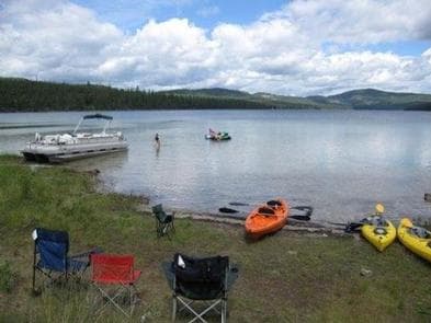
Overview McGregor Lake Campground is located approximately 53 miles southeast of Libby, Montana, on Highway 2 at the west end of McGregor Lake in the Kootenai National Forest. This area is about halfway between Libby and Kalispell in the heart of the Thompson Chain of Lakes, a premier fishing and hunting area. Recreation McGregor Lake is host to a prime mackinaw trout population and offers excellent opportunities for a trophy-size catch. There is a boat ramp on-site for access to the lake. Swimming and water skiing are also popular activities. Hikers can walk the 2.9-mile McGregor Lake Shoreline Trail. Facilities McGregor Lake is host to a prime mackinaw trout population and offers excellent opportunities for a trophy-size catch. There is a boat ramp on-site for access to the lake. Swimming and water skiing are also popular activities. Hikers can walk the 2.9-mile McGregor Lake Shoreline Trail. Natural Features At an elevation of 3,900 feet, the campground is nestled among young pines at the west end of McGregor Lake in the Fisher River Area. The lake spans 1,240 acres, making it the largest lake in the Kootenai National Forest. The Fisher River Area is the watershed formed by the four forks (West, East, Silver Butte, Pleasant Valley) of the Fisher River and Wolf Creek. Within it is the Thompson Chain of Lakes, which consists of more than 20 lakes.
View details →
Overview Downstream Campground is located just below Fort Peck Dam on the Missouri River in northeastern Montana. Recreation enthusiasts and sportsmen enjoy the beauty of Fort Peck Lake's 1,500 miles of shoreline. A variety of high quality outdoor activities are available, including camping, boating, fishing, hunting, sightseeing and wildlife viewing. Fort Peck Dam , which impounds Fort Peck Lake is the first dam built in the upper Missouri River Basin. The area surrounding Fort Peck was first charted by Lewis and Clark in 1804, and the pristine natural condition of the river and surrounding area awed the renowned explorers. When President Franklin D. Roosevelt authorized the Fort Peck project in 1933, thousands of people from all over the country migrated to Montana during the midst of the Great Depression in hopes of earning a living. Today, Fort Peck Lake is a sportsman's paradise with excellent fishing, wildlife viewing and other countless outdoor recreation opportunities. For more information, visit the Fort Peck Project Website or call 406-526-3411. Recreation The vast size of Fort Peck Lake and its remoteness from major population centers provide a variety of high quality outdoor experiences. Popular recreation activities include camping, boating, fishing, hunting, sight-seeing, picnicking, biking, hiking, photography, watching wildlife and just relaxing. Fort Peck Lake: Fifteen hundred miles of pristine shoreline serve as a haven for those wishing to get away from the stresses of modern life. There are 27 recreation areas located around the reservoir. The areas near and around the dam offer paved roads, electricity, showers and playgrounds while facilities around the rest of the lake are more primitive with gravel roads, picnic tables and vault toilets. Access roads to many of the remote areas may be impassable in inclement weather. Fishing: Fort Peck Lake enjoys nationwide recognition as a hot spot for walleye fishing. Fort Peck Lake provides excellent boating and fishing opportunities. The lake also offers excellent fishing for sauger, smallmouth bass, lake trout, chinook salmon and northern pike. The introduction of cisco as a forage fish in 1983 proved successful and has increased both the size and number of game fish. Wildlife Viewing/Hunting: The Fort Peck Lake Area and the Charles M. Russell Wildlife Refuge provide superb hunting of deer, elk, big horn sheep, and prong horn. The Missouri River Breaks are known for producing large elk and other game animals. Trails: Three miles of paved nature trails wind along the Missouri River and through the surrounding wooded area. This trail area is a popular birding and wildlife viewing area. Disc Golf Course: A disc golf course "The Fortress" was installed in summer of 2021. Discs are available to check out at the gate house. Interpretive Center & Museum: The Fort Peck Dam Interpretive Center and Museum offers displays of wildlife dioramas, aquariums, dinosaur fossils and dam construction history. Open Friday through Monday 9am to 4pm. Facilities The vast size of Fort Peck Lake and its remoteness from major population centers provide a variety of high quality outdoor experiences. Popular recreation activities include camping, boating, fishing, hunting, sight-seeing, picnicking, biking, hiking, photography, watching wildlife and just relaxing. Fort Peck Lake: Fifteen hundred miles of pristine shoreline serve as a haven for those wishing to get away from the stresses of modern life. There are 27 recreation areas located around the reservoir. The areas near and around the dam offer paved roads, electricity, showers and playgrounds while facilities around the rest of the lake are more primitive with gravel roads, picnic tables and vault toilets. Access roads to many of the remote areas may be impassable in inclement weather. Fishing: Fort Peck Lake enjoys nationwide recognition as a hot spot for walleye fishing. Fort Peck Lake provides excellent boating and fishing opportunities. The lake also offers excellent fishing for sauger, smallmouth bass, lake trout, chinook salmon and northern pike. The introduction of cisco as a forage fish in 1983 proved successful and has increased both the size and number of game fish. Wildlife Viewing/Hunting: The Fort Peck Lake Area and the Charles M. Russell Wildlife Refuge provide superb hunting of deer, elk, big horn sheep, and prong horn. The Missouri River Breaks are known for producing large elk and other game animals. Trails: Three miles of paved nature trails wind along the Missouri River and through the surrounding wooded area. This trail area is a popular birding and wildlife viewing area. Disc Golf Course: A disc golf course "The Fortress" was installed in summer of 2021. Discs are available to check out at the gate house. Interpretive Center & Museum: The Fort Peck Dam Interpretive Center and Museum offers displays of wildlife dioramas, aquariums, dinosaur fossils and dam construction history. Open Friday through Monday 9am to 4pm. Natural Features A shady grove of cottonwoods covers the grassy campground, making Downstream a pleasant place during the heat of the summer. In autumn, the leaves turn a beautiful golden yellow. Three fishing ponds, including scenic Winter Harbor, dot the landscape below the dam. contact_info For facility specific information, please call (406) 526-3224. Nearby Attractions Fort Peck Lake is a Montana treasure for its vast size and outdoor recreation opportunities. Six recreation areas within a few miles of the dam provide access for water sports, fishing and hunting. The Fort Peck Interpretive Center and Museum , is located just downstream of Fort Peck Dam. For more information, call 406-526-3493. The Leo B. Coleman Wildlife Pasture , located just outside the Town of Fort Peck and Downstream Campground is home to Fort Peck's Bison Herd and provides an excellent wildlife viewing auto route. The Historic Fort Peck Theater is located in the town of Ft. Peck is a popular historic destination in summer months. The 1.1 million acre Charles M. Russell National Wildlife Refuge surrounds Fort Peck Lake and helps preserve the natural habitat for numerous wildlife species. Charges & Cancellations Reservation changes and cancellations can be made on Recreation.gov or by calling 1-877-444-6777. For more information on rules and policies regarding reservation cancellations and changes, please visit: https://www.recreation.gov/rules-reservation-policies .
View details →
Overview Cascade Campground is located 11 miles west of Red Lodge, in southern Montana. It conveniently sits along Forest Road 2071, which is paved for most of the route. The area is a popular location for hiking, backpacking and fishing. Recreation Fishing is a popular activity along the West Fork of Rock Creek and at nearby Wild Bill Lake. The small lake is open to kayaking and canoeing, and an accessible fishing dock is located on the shore. The Basin Lakes Trailhead is three miles away, across the road from Basin Campground. Silver Run Plateau, West Fork and Timberline Lakes trails offer access to the Absaroka-Beartooth Wilderness. Mountain bikers enjoy the Ingles Creek Trail and a variety of loop trails at Silver Run. Biking is also allowed on the Basin Lakes Trail. Facilities Fishing is a popular activity along the West Fork of Rock Creek and at nearby Wild Bill Lake. The small lake is open to kayaking and canoeing, and an accessible fishing dock is located on the shore. The Basin Lakes Trailhead is three miles away, across the road from Basin Campground. Silver Run Plateau, West Fork and Timberline Lakes trails offer access to the Absaroka-Beartooth Wilderness. Mountain bikers enjoy the Ingles Creek Trail and a variety of loop trails at Silver Run. Biking is also allowed on the Basin Lakes Trail. Natural Features The campground is situated on the banks of the West Fork of Rock Creek. The area surrounding the campground was burned by the Cascade Fire in 2008, which left many open glades with abundant wildflowers. Nearby Attractions The charming town of Red Lodge, Mont., offers a variety of dining and lodging options, galleries, shops and annual summer events. The Home of Champions Rodeo is held on the Fourth of July weekend, Beartooth Bike Rally and Iron Horse Rodeo take place in mid-July, the Mountain Man Rendezvous is in late July and the Festival of Nations happens in early August. The Beartooth Highway was deemed "the most beautiful drive in America," by the late Charles Kuralt. It snakes across the rugged Beartooth Mountains from Red Lodge to Cooke City. It is the highest elevation highway in the Northern Rockies. Along the way, visitors are treated to sweeping views and plentiful opportunities for outdoor recreation. contact_info For facility specific information, please call (928) 537-8888. Charges & Cancellations Refunds: Refund requests made through www.recreation.gov will be charged a $10 processing fee. This cancellation processing fee is retained by the reservation service contractor along with the non-refundable reservation fee. All requests for the return of the non-refundable reservation fee and the cancellation processing fee will be declined by the campground concessionaire as they did not receive these fees (these are the fees retained by the reservation contractor, a different entity).
View details →
Overview North Dickey Lake Campground is a beautiful campground next to scenic Dickey Lake and several hiking and mountain biking trails. It's conveniently located off the main highway and provides a secluded location for outdoor enjoyment. A day use area is located at South Dickey Day use area, on the opposite side of the lake. Recreation The adjacent lake provides ample opportunity for boating, fishing, swimming and water skiing. Anglers can expect a catch of kokanee salmon, kamloop and rainbow trout. A grassy beach is also available at South Dickey Day Use area, a popular swimming area on the lake. A variety of hiking trails begin in the area, including the accessible, half-mile Dickey Lake Overlook Trail, which is also open to mountain biking. It leads to a viewing platform with nice views of the lake. Another trail heads from the campground to Mt. Marston. Educational programs are offered throughout the summer. A general store, with fuel and groceries, is located about 3 miles to the north and a small restaurant and coffee shop are located about 2 miles to the west of the campground. Facilities The adjacent lake provides ample opportunity for boating, fishing, swimming and water skiing. Anglers can expect a catch of kokanee salmon, kamloop and rainbow trout. A grassy beach is also available at South Dickey Day Use area, a popular swimming area on the lake. A variety of hiking trails begin in the area, including the accessible, half-mile Dickey Lake Overlook Trail, which is also open to mountain biking. It leads to a viewing platform with nice views of the lake. Another trail heads from the campground to Mt. Marston. Educational programs are offered throughout the summer. A general store, with fuel and groceries, is located about 3 miles to the north and a small restaurant and coffee shop are located about 2 miles to the west of the campground. Natural Features The campground is located in northwestern Montana on a hillside next to the 800-acre lake. It is nestled in a forest of larch and fir trees at an elevation of about 3,100 feet. In the spring and early summer, the sound of the loon can often be heard from the campground. Nearby Attractions The campground is 20 miles from the United States-Canadian border, and 65 miles from the entrance to Glacier National Park.
View details →
Overview Indian Trees Campground is a quiet place to stay 3/4 miles off of Highway 93 in the mountains of southwest Montana. It provides access to a number of enjoyable recreational activities, as well as the vast scenery of the rugged Bitterroot National Forest. The area boasts wild game, high quality water and wild and scenic rivers. Recreation Visitors enjoy a variety of recreational opportunities, including hiking, mountain biking and horseback riding. A number of trails can be accessed near the campground, including the Nez Perce National Historic Trail and the Lewis and Clark National Historic Trail. The Nez Perce NHT is a 3.1-mile trail begins near the turnoff to the campground and follows a portion of the original Nez Perce route. Explorers in the early 1800s also used the route, and wagon ruts are still visible along parts of the trail. The Continental Divide National Scenic Trail is also nearby. Fishing is available in nearby Camp Creek. Anglers will find mostly cutthroat trout but other species are available. A variety of wildlife, including big game like mule and white-tailed deer, elk and moose, makes its home in the area. Facilities Visitors enjoy a variety of recreational opportunities, including hiking, mountain biking and horseback riding. A number of trails can be accessed near the campground, including the Nez Perce National Historic Trail and the Lewis and Clark National Historic Trail. The Nez Perce NHT is a 3.1-mile trail begins near the turnoff to the campground and follows a portion of the original Nez Perce route. Explorers in the early 1800s also used the route, and wagon ruts are still visible along parts of the trail. The Continental Divide National Scenic Trail is also nearby. Fishing is available in nearby Camp Creek. Anglers will find mostly cutthroat trout but other species are available. A variety of wildlife, including big game like mule and white-tailed deer, elk and moose, makes its home in the area. Natural Features The campground is conveniently located near Highway 93, at an elevation of about 5,100 feet. It is named for the numerous scarred ponderosa pine trees in the area. Native American populations that once lived in or frequented the area stripped the trees of bark to expose and extract the tree's sweet cambium layer for food. The trees remain historically significant and provide shade to the campground. Nearby Attractions Popular Lost Trail Hot Springs is located less than a half-mile from the campground. Unlike the majority of natural hot springs, Lost Trail lacks sulfur, making it odorless and very comfortable for swimming. A general store and lodging is located in Sula Store, about 5 miles north.
View details →
Overview Nestled in the Lodgepole pine forests of southwestern Montana, Spring Hill Campground is eight miles from Georgetown Lake, a popular destination for fishing, boating and water sports. Spring Hill is located in the Pintler Ranger District of the Beaverhead-Deerlodge National Forest, the largest national forest in Montana. Surrounding mountains add to the majestic scenery and provide ample outdoor recreation opportunities during the summer season. Once on-site, you may be able to pay for your campsite(s) by scanning a QR code using the Recreation.gov mobile app, and the Scan and Pay feature. If this option is available, you will need to first download the free Recreation.gov mobile app https://www.recreation.gov/mobile-app prior to your arrival as some remote areas have limited or no cellular service. Recreation Canoeing and boating are popular activities at Georgetown Lake. Hikers, horseback riders and mountain bikers will find no shortage of trails within a few miles of the campground. Warm Springs Creek is well-known among Montana anglers as a source of rainbow, cutthroat, brook and brown trout. Georgetown Lake is a prime destination for fishing and fly fishing with kokanee salmon, rainbow and brook trout being the most sought-after species. It is illegal to target Bull Trout, if caught they must be released immediately with minimal handling. Participants must have Montana licenses to hunt or fish. Facilities Canoeing and boating are popular activities at Georgetown Lake. Hikers, horseback riders and mountain bikers will find no shortage of trails within a few miles of the campground. Warm Springs Creek is well-known among Montana anglers as a source of rainbow, cutthroat, brook and brown trout. Georgetown Lake is a prime destination for fishing and fly fishing with kokanee salmon, rainbow and brook trout being the most sought-after species. It is illegal to target Bull Trout, if caught they must be released immediately with minimal handling. Participants must have Montana licenses to hunt or fish. Natural Features Warm Springs Creek runs nearby the campground alongside Warm Springs Road. Nearby Georgetown Lake, a large mountain lake of more than 3,000 acres at an elevation of over 6,000 feet, draws the most attention from visitors. The area immediately surrounding the campground is abundantly populated with Lodgepole pines and is home to local wildlife, including moose, elk, white-tailed deer and even bighorn sheep. Nearby Attractions The historic town of Anaconda is only a short drive away. contact_info For facility specific information, please call (406) 859-3211. Charges & Cancellations Must cancel 4 days in advance
View details →
Overview Fales Flat Campground is a group facility on Nez Perce Fork of the Bitterroot River. It is also well equipped for equestrian campers. The campground provides access to a variety of hiking and horseback riding trails in the area, as well as a variety of historic sites that denote the presence of the Nez Perce many years ago. Recreation Fly fishing and wading in the Nez Perce Fork, which runs alongside the campground, are also popular activities. A variety of trails and unimproved roads are great for hiking and horseback riding. Three trails originate near the campground, including the Watchtower Trail and Sheephead Creek Trail which access the Selway-Bitterroot Wilderness and can be hiked as a loop. A steep, 2-mile trail leads to the historic Bare Cone Lookout. Facilities Fly fishing and wading in the Nez Perce Fork, which runs alongside the campground, are also popular activities. A variety of trails and unimproved roads are great for hiking and horseback riding. Three trails originate near the campground, including the Watchtower Trail and Sheephead Creek Trail which access the Selway-Bitterroot Wilderness and can be hiked as a loop. A steep, 2-mile trail leads to the historic Bare Cone Lookout. Natural Features The campground is located in a large meadow at the base of Nez Perce Pass along the Nez Perce Fork of the Bitterroot River. The area is believed to have been used by the Nez Perce Nimi'ipuu tribe during its travels to the buffalo country in eastern Montana. Nearby Attractions The campground is about 23 miles from the town of Conner. A variety of services are offered there.
View details →
Overview Larry Creek Group Campground is located in western Montana's Bitterroot National Forest. It is a great location for an extended family or group getaway, providing access to many fishing, hiking, mountain biking and hunting opportunities. Recreation A variety of non-motorized trails are nearby, including a half-mile nature trail that highlights some the area's best features. The 9-mile Bass Creek Trail is located just south of the campground and leads to a scenic overlook and many fishing holes. Bass Lake, Bass Creek and numerous additional mountain streams make the campground a very popular location for fishing. An interpretive trail, fitness trail and volleyball court are located within the campground. Facilities A variety of non-motorized trails are nearby, including a half-mile nature trail that highlights some the area's best features. The 9-mile Bass Creek Trail is located just south of the campground and leads to a scenic overlook and many fishing holes. Bass Lake, Bass Creek and numerous additional mountain streams make the campground a very popular location for fishing. An interpretive trail, fitness trail and volleyball court are located within the campground. Natural Features The campground sits at a fairly low elevation in the Bass Creek Recreation Area between Missoula and Hamilton. It is situated west of the Lee Metcalf National Wildlife Refuge, in an area forested with pine, spruce and fir trees. A variety of wildlife, including mule and white-tailed deer, elk, moose and birds can often be seen in the area. Nearby Attractions The Lee Metcalf National Wildlife Refuge is located along the Bitterroot River about 20 miles from the campground. The refuge provides visitors with opportunities for wildlife observation, photography, hunting, fishing and environmental education. A wildlife viewing area offers 2.5 miles of nature trails, including an accessible 0.5-mile path. The trails meander through meadows and woodlands along the river. A variety of services are available in the neighboring city of Stevensville.
View details →
Overview Spanish Creek Cabin was constructed in 1934 and retains much of its rustic character from that time. The cabin is available year-round and offers an excellent base camp for a variety of summer and winter recreation opportunities. It is adjacent to a popular trailhead and a campground. Guests may drive to the cabin during summer months. During the winter (December 2nd through May 15th) the access road is gated 3.5 miles from the cabin and guest should be prepared to hike, bike, ski or snowshoe to the cabin. Guests are responsible for their own travel arrangements and safety, and must bring several of their own amenities. Recreation A nearby trailhead provides access to a network of trails that head south into the Lee Metcalf Wilderness and west into non-wilderness areas.The trails can be used by hikers, equestrians, snowshoers and cross-country skiers. Trails also lead to Little Hell Roaring Creek, the north end of the Madison Range and the South Fork of Spanish Creek. This area also offers opportunities for fishing and hunting. Facilities A nearby trailhead provides access to a network of trails that head south into the Lee Metcalf Wilderness and west into non-wilderness areas.The trails can be used by hikers, equestrians, snowshoers and cross-country skiers. Trails also lead to Little Hell Roaring Creek, the north end of the Madison Range and the South Fork of Spanish Creek. This area also offers opportunities for fishing and hunting. Natural Features The cabin sits at the base of the Lee Metcalf Wilderness, in a large meadow, at an elevation of 6,200 feet. Wildflowers add bursts of color around the cabin each summer. South Fork Spanish Creek flows nearby. The densely-forested peaks of the Madison Range surround the cabin. This area is home to grizzly bears, moose, elk, deer and bighorn sheep, as well as a variety of bird species.
View details →
Overview Big Larch Campground is located on the east shoreline of Seeley Lake within the Lolo National Forest in Montana. A great place to cool off on a hot day, it has a beach and a boat ramp, as well as ample shade for those who just want to relax and enjoy nature. The campground is a favorite of locals, with plenty of space for camping, picnicking and recreating on the water. Recreation • The campground is popular for swimming, fishing, biking, paddling and boating. Anglers cast for a variety of freshwater fish including Kokanee salmon, bass, whitefish, pike, trout and perch, among other species. Water skiing is a popular activity on the lake. • The Clearwater Canoe Trailhead just North of Seeley Lake offers excellent flat water for viewing wildlife such as blue herons and river otters. The water trail is popular with canoeists and kayakers as it stretches 3.5 miles, or a couple of hours, down the river. • The Morrell Falls National Recreation Trail on the East side of the valley offers an incredible day hike exploring recent burns, dense forests, and a large waterfall. Facilities • The campground is popular for swimming, fishing, biking, paddling and boating. Anglers cast for a variety of freshwater fish including Kokanee salmon, bass, whitefish, pike, trout and perch, among other species. Water skiing is a popular activity on the lake. • The Clearwater Canoe Trailhead just North of Seeley Lake offers excellent flat water for viewing wildlife such as blue herons and river otters. The water trail is popular with canoeists and kayakers as it stretches 3.5 miles, or a couple of hours, down the river. • The Morrell Falls National Recreation Trail on the East side of the valley offers an incredible day hike exploring recent burns, dense forests, and a large waterfall. Natural Features Big Larch Campground is located on the east shoreline of Seeley Lake, a 1,025 acre, glacial-formed lake within the "Chain of Lakes" - through which the Clearwater River flows. The campground is nestled in a mixed conifer forest, including plenty of tall larch and pine trees. While there is ample space between sites, the lack of understory makes for minimal privacy. At an elevation of about 4,000 feet, temperatures are pleasant throughout most of the summer months. The area contains a wide variety of wildlife and is home to white-tailed deer, elk, mountain goats, bighorn sheep, moose, grizzly and black bears (learn about bear safety ). Both the bald and golden eagle reside in the forest, along with trumpeter swan, herons and dozens of varieties of ducks. Nearby Attractions • The town of Seeley Lake, MT on the southeastern tip of the lake offers a variety of recreation services such as boat, canoe, and kayak rentals as well as guide services and resorts. Services like gas, groceries, restaurants, and lodging can also be found in town. Access to a variety of forests, sweeping views, mountain lakes, and rugged peaks can be discovered just a short drive up any of the nearby Forest Service roads. • Just a day trip away from Seeley Lake, Glacier National Park is known for a variety of opportunities to explore alpine landscapes, active glaciers, and view unique wildlife. Contact the park for current conditions. • About an hour from Seeley Lake, Missoula is one of Western Montana’s outdoor recreation hubs. Missoula is a full-service city with 2 hospitals, an international airport, and access to services, hotels, and outdoor activities.
View details →
Overview May Creek Cabin is located on the Lewis and Clark National Historic Trail in western Montana. It was built by miners in the early 1900s and used by them for about 30 years. Hunters occupied it for about 30 years after that. The cabin went unused for nearly 30 years and was restored for public use in 1993. In 2011, more work was completed to enhance the quality and safety of the structure. Summer and fall months give visitors plenty of daylight and moderate temperatures to explore the surrounding meadows, peaks and valleys, as well as fish in plentiful mountain streams. The cabin can be accessed by driving to May Creek Campground and then hiking or skiing just over two miles, depending on conditions. Guests are responsible for their own travel arrangements and safety, and must bring several of their own amenities. Recreation Early explorers crossed through the area, leaving a variety of trails for hiking, mountain biking or horseback riding, including the Nez Perce Trail, the Lewis and Clark National Historic Trail and the Continental Divide National Historic Trail. Historic sites are located along all routes. A GPS unit, compass and area maps are helpful in reaching the cabin and exploring the area. The surrounding hills and valleys are popular for hiking and backpacking in the summer and fall, and for cross-country skiing and snowshoeing, although extreme caution is urged to avoid avalanche danger. Fishing and wading are available in the adjacent May Creek. Anglers might catch brook or rainbow trout, which are plentiful in the alpine waters. Facilities Early explorers crossed through the area, leaving a variety of trails for hiking, mountain biking or horseback riding, including the Nez Perce Trail, the Lewis and Clark National Historic Trail and the Continental Divide National Historic Trail. Historic sites are located along all routes. A GPS unit, compass and area maps are helpful in reaching the cabin and exploring the area. The surrounding hills and valleys are popular for hiking and backpacking in the summer and fall, and for cross-country skiing and snowshoeing, although extreme caution is urged to avoid avalanche danger. Fishing and wading are available in the adjacent May Creek. Anglers might catch brook or rainbow trout, which are plentiful in the alpine waters. Natural Features The rustic cabin is situated at the base of the Anaconda Mountain Range in the Beaverhead-Deerlodge National Forest of southwestern Montana. It is nestled in evergreen forest near the banks of May Creek at an elevation of about 6,600 feet. The Anacondas are home to abundant wildlife, including mountain lions, elk, deer, moose and bears ( learn more about bear safety ). This area is a major spot for elk calving. Nearby Attractions The Big Hole National Battlefield is located about nine miles east of the cabin. It is the site of the Nez Perce War of 1877, a battle between the Native American tribe, the United States Army and civilian volunteers.
View details →
Overview Basin Station Cabin is a primitive, rustic, two-room structure located in the Hebgen Lake Ranger District of the Custer Gallatin National Forest. The cabin is open year-round. The adjacent road is heavily traveled. Winter guests can snowshoe, ski, or snowmobile to the cabin up to three miles from the nearest available parking. This cabin is parking accessible during warmer months. Guests are responsible for their own travel arrangements and safety, and they must bring several of their own amenities. Recreation Basin Station is surrounded by hiking, horseback riding, and mountain biking trails as well as ATV/UTV and motorcyles routes subject to seasonal restrictions and delayed open dates. Please contact the Hebgen Lake Ranger District to obtain open dates. Horses are not allowed at the cabin. The horse corral is used administratively by the USDA Forest Service. Winter activities in the area include cross-country skiing, snowmobiling, and snowshoeing. Nearby Hebgen Lake offers opportunities for fishing, boating, and hunting. A public boat launch with two docks is located about two miles from the cabin at Lonesomehurst Campground and additional access to the lake is available through surrounding day use areas. Facilities Basin Station is surrounded by hiking, horseback riding, and mountain biking trails as well as ATV/UTV and motorcyles routes subject to seasonal restrictions and delayed open dates. Please contact the Hebgen Lake Ranger District to obtain open dates. Horses are not allowed at the cabin. The horse corral is used administratively by the USDA Forest Service. Winter activities in the area include cross-country skiing, snowmobiling, and snowshoeing. Nearby Hebgen Lake offers opportunities for fishing, boating, and hunting. A public boat launch with two docks is located about two miles from the cabin at Lonesomehurst Campground and additional access to the lake is available through surrounding day use areas. Natural Features The cabin sits in an open meadow in the Upper Madison River Valley with views of distant evergreen forests and mountain peaks on all sides. It is situated within a couple miles of the South Fork Arm of the Madison River; just down the road from Hebgen Lake. The area around Basin Station Cabin is grizzly bear habitat, it's also home to bison, elk, pronghorn, and other wildlife. Nearby Attractions The cabin is approximately nine miles from West Yellowstone, MT, home of the West Gate to Yellowstone National Park. Other attractions include; Hebgen Lake, Earthquake lake and the Earthquake Lake Visitor Center, and Henry's Lake State Park across the Idaho Border.
View details →
Overview Moose Lake Cabin is located in the Beaverhead-Deerlodge National Forest in southwestern Montana. The historic cabin, which was built in 1917 for use as a Forest Service work station, offers visitors close access to the Anaconda-Pintler Wilderness Area, which covers almost 250 square miles of mountain ranges. The cabin is a short drive to Georgetown Lake, Discovery Ski Area, Gem Mountain, and the town of Philipsburg with its well known Sweet Palace and microbrewery. Many lakes and streams provide ample access to world famous trout fishing and the area also boasts miles of roads and trails. The cabin is located a short walk from Middle Fork Rock Cr and is surrounded by public land in all directions. Hiking, backpacking, hunting, fishing, horseback riding, OHV riding, skiing, snowmobiling, and snowshoeing are common activites, The cabin can typically be accessed by vehicle, depending on road and weather conditions. Moose Lake Road is plowed during winter, but the access spur to the cabin is not regularly plowed and guests should plan on walking this final 100 yards in the winter months. Recreation Moose Lake Cabin provides access to hunting, fishing, hiking or just relaxing. Fishing for brook and cutthroat trout is excellent in the area. The Middle Fork of Rock Creek as well as Copper Creek and other smaller creeks are close by. It is illegal to target Bull Trout, if caught they must be released immediately with minimal handling. Participants must have Montana licenses to hunt or fish. Visitors also enjoy snowmobiling, cross country skiing, and snowshoeing in the area during the winter. Various weather conditions can increase avalanche danger in the area; visitors are encouraged to carry proper backcountry equipment, including a beacon, shovel and probe while recreating. Hiking and horseback riding trails lead into the Anaconda-Pintler Wilderness. There are three trailheads in the area, none more than a six mile drive from the cabin. As a reminder, pelletized or certified weed seed free feed and straw is required in all National Forests in Montana. Facilities Moose Lake Cabin provides access to hunting, fishing, hiking or just relaxing. Fishing for brook and cutthroat trout is excellent in the area. The Middle Fork of Rock Creek as well as Copper Creek and other smaller creeks are close by. It is illegal to target Bull Trout, if caught they must be released immediately with minimal handling. Participants must have Montana licenses to hunt or fish. Visitors also enjoy snowmobiling, cross country skiing, and snowshoeing in the area during the winter. Various weather conditions can increase avalanche danger in the area; visitors are encouraged to carry proper backcountry equipment, including a beacon, shovel and probe while recreating. Hiking and horseback riding trails lead into the Anaconda-Pintler Wilderness. There are three trailheads in the area, none more than a six mile drive from the cabin. As a reminder, pelletized or certified weed seed free feed and straw is required in all National Forests in Montana. Natural Features The cabin is located on the Middle Fork of Rock Creek (Moose Lake Road, FR 5106) near the Anaconda-Pintler Wilderness. It sits at the edge of an open meadow, surrounded by evergreens and nearby peaks. The Middle Fork of Rock Creek flows about 100 yards behind the cabin. There is easy access to the creek, and good fishing. The cabin has dodged several large wildfires, and you will see old fire scars from lightning caused fires on the ridges. The area is known for its high, rugged and beautiful mountain scenery, as well as the variety of wildlife that makes its home there, including elk, moose, deer, mountain lions and bears(grizzly and black bears) ( learn more about bear safety ). Nearby Attractions The Skalkaho Highway (Highway 38) leads into the Sapphire Mountains along a primitive and once widely used Native American trail. The scenic drive, which is closed during winter, was built to provide access between mining areas and agricultural communities in the Bitterroot Valley. About 30 miles from the cabin, the road leads to Skalkaho Falls in the neighboring Bitterroot National Forest. Moose Lake day use area is available for swimming and picnics in the summer, and ice fishing in winter. There is a groomed snowmobile route from Copper Creek campground to Frog Pond Basin. There are many trailheads in the vicinity, both wilderness access and non. There is an ATV loop from Copper creek over O'brien ridge to Frog Pond Basin and back down to Copper Creek. Georgetown Lake can be accessed by highways or dirt roads. Discovery Ski Area is a short drive away. The town of Philipsburg has restaraunts, gift shops, gem shops, a micro brewery, candy shop, gas station, grocery store, skating rink, historic theater, and has events throughout the year. Charges & Cancellations Reservations are nonrefundable unless extenuating circumstances warrant otherwise. Determination will be made on a case by case basis.
View details →
Overview Stony Cabin is a small primitive cabin that was built in 1914 as a place for Forest Service employees to sleep while working in the area. The cabin is situated close to Stony Creek Road and across the street from Stony Creek Campground. It is not remote but ideal for those who want to stay in a cabin while friends camp across the street at the campground. It provides access to Rock Creek, a Blue Ribbon Trout Stream, and Stony Creek. The cabin is within close proximity to a variety of hiking and biking trails also. Guests can enjoy winter recreation on those same trails when there is snow in the area, typically from December until April of each year. The cabin is available all year, offering the opportunity to experience the backcountry of western Montana in all seasons. The cabin can be accessed by vehicle most of the year. There is limited parking in the driveway and trailers are not recommended. Guests are responsible for their own travel arrangements and safety, and must bring their own personal amenities. Recreation Fishing is available in Rock Creek and Stony Creek and anglers might find plentiful brook, brown and rainbow trout. Much of the stream is protected from bull or west slope cutthroat trout fishing to improve the fishery. It is illegal to target Bull Trout, if caught they must be released immediately with minimal handling. Big game hunting is possible in designated areas. Appropriate licensing is required to fish and hunt in Montana. Rock creek is a popular rafting and boating trip at appropriate water levels. A variety of hiking, mountain biking, ATV and horseback riding trails as well as old roads climb into the steep drainages and canyons of the Bitterroot Range. Stony Lake trailhead is at the end of the road another 3 miles, and it is open to foot, horse, and bike travel. Guests also enjoy snowmobiling, cross country skiing, and snowshoeing in the area during the winter. Facilities Fishing is available in Rock Creek and Stony Creek and anglers might find plentiful brook, brown and rainbow trout. Much of the stream is protected from bull or west slope cutthroat trout fishing to improve the fishery. It is illegal to target Bull Trout, if caught they must be released immediately with minimal handling. Big game hunting is possible in designated areas. Appropriate licensing is required to fish and hunt in Montana. Rock creek is a popular rafting and boating trip at appropriate water levels. A variety of hiking, mountain biking, ATV and horseback riding trails as well as old roads climb into the steep drainages and canyons of the Bitterroot Range. Stony Lake trailhead is at the end of the road another 3 miles, and it is open to foot, horse, and bike travel. Guests also enjoy snowmobiling, cross country skiing, and snowshoeing in the area during the winter. Natural Features Many older maps still refer to this cabin as the Squaw Rock Cabin because the notable Squaw Rock formation overlooks the site. This cabin is right off of Stony Creek Road and across from Stony Creek Campground in the Beaverhead-Deerlodge National Forest. The cabin is very close to the confluence of Rock and Stony Creeks. The area is known for its high, rugged and beautiful mountain scenery, as well as the variety of wildlife that makes its home there, including bighorn sheep, elk, moose, deer, mountain lions and bears ( learn more about bear safety ). Charges & Cancellations Reservations are nonrefundable unless extenuating circumstances warrant otherwise. Determination will be made on a case by case basis.
View details →
Overview Bloody Dick Cabin, named after the English Trapper Richard "Bloody" Leigh, is a small wood frame cabin. Nestled in the evergreens near Reservoir Lake in Southwestern Montana's Bitterroot Mountains - the cabin is available for rental year-round. Popularity peaks during the summer and fall seasons with hikers, ohv enthusiasts, and big game hunters. During spring and winter, the nearby lake freezes promoting ice fishing while several area winter trails offer cross-country skiing and snowmobiling. During the snow free season- the cabin is accessible by passenger vehicle, however some portions are gravel, dirt and rock, making it rough and slow going. Snow conditions limit mobility in the area. Depending on the snow levels, renters may need to travel up to 23 miles by snowmobile or skis to reach the cabin. Renters are responsible for their own travel arrangements and safety, and must bring several of their own amenities. There is no cell phone coverage in the area. Recreation Fishing is available in Bloody Dick Creek, as well as on nearby Reservoir Lake - where non-motorized boats are welcome. Anglers might catch a variety of trout, including Rainbow or Brown. Montana fishing licenses are required. All boats must be inspected and registered - to reduce the spread of aquatic nussiances. Hiking and mountain biking are popular at nearby trailheads. Trails include to the Nez Perce National Historic Trail, Lewis and Clark National Historic Trail and the Continental Divide National Scenic Trail. Snowmobiling, cross country skiing and snowshoeing are popular in the area throughout the winter. Obtaining the South Beaverhead National Forest Map will aid in navigating the forest's roads and trails. Maps are available electronically (for mobile devices) or in paper form via a computer at http://www.fs.usda.gov/bdnf. Maps are also available at the Dillon District Office located at 420 Barrett Street Dillon, MT 59725 (406) 683-3958. Office hours are Monday - Friday 7:30 - 4:30. Facilities Fishing is available in Bloody Dick Creek, as well as on nearby Reservoir Lake - where non-motorized boats are welcome. Anglers might catch a variety of trout, including Rainbow or Brown. Montana fishing licenses are required. All boats must be inspected and registered - to reduce the spread of aquatic nussiances. Hiking and mountain biking are popular at nearby trailheads. Trails include to the Nez Perce National Historic Trail, Lewis and Clark National Historic Trail and the Continental Divide National Scenic Trail. Snowmobiling, cross country skiing and snowshoeing are popular in the area throughout the winter. Obtaining the South Beaverhead National Forest Map will aid in navigating the forest's roads and trails. Maps are available electronically (for mobile devices) or in paper form via a computer at http://www.fs.usda.gov/bdnf. Maps are also available at the Dillon District Office located at 420 Barrett Street Dillon, MT 59725 (406) 683-3958. Office hours are Monday - Friday 7:30 - 4:30. Natural Features The cabin is located beneath the Continental Divide in a Lodgepole Pine Forest. Access from Highway 278 places the cabin around 25 miles south of Jackson, Montana. Access from Highway 324 is a similar distance northwest of Grant, MT. It is situated next to Bloody Dick Creek at an elevation of about 7,100 feet. The creek is fed by cold water springs in the area. A variety of shorebirds can be seen near the winding creek and plenty of wildlife make their home in the area as well. Bears, both Black and Grizzly, are present in the area - proper Food Storage is a REQUIRED. Reservoir Lake is about a mile north of the cabin. The 11-acre lake is equipped with a primitive boat ramp. A small campground sits on the edge of the lake.
View details →
Overview Birch Creek Cabin is a historic log cabin with electricity. It provides access to a variety of hiking, ohv, and for cross-country skiing and snowshoe trails (depending on the season). A vaulted toilet lies 100' west of the cabin. Guests can typically access the cabin by vehicle, depending on conditions. The roads leading to the cabin are gravel - but suitable for passenger cars (depending on the season and snow levels). The final quarter-mile may be covered with impassible snow during the winter, requiring skis, snowshoes or snowmobile to complete the route. There is a reliable parking area just off of the Birch Creek Road near the Thief Creek Bridge. Guests are responsible for their own travel arrangements and safety, and must bring several of their own amenities. Recreation An extensive network of hiking trails exists on the surrounding peaks and valleys. Some lead to alpine lakes, which offer quality mountain fishing. Grayling, cutthroat trout, brook trout and rainbow trout can all be found in the mountain waters. There are two popular cross-country skiing and snowshoeing trails adjacent to the cabin. The Birch Creek Loop and the May Lake Ski Trail both traverse through the area. Old mining roads are plentiful in the area, providing excellent opportunities for exploration on foot, bike, ohv or horseback. Facilities An extensive network of hiking trails exists on the surrounding peaks and valleys. Some lead to alpine lakes, which offer quality mountain fishing. Grayling, cutthroat trout, brook trout and rainbow trout can all be found in the mountain waters. There are two popular cross-country skiing and snowshoeing trails adjacent to the cabin. The Birch Creek Loop and the May Lake Ski Trail both traverse through the area. Old mining roads are plentiful in the area, providing excellent opportunities for exploration on foot, bike, ohv or horseback. Natural Features The cabin sits below a historic Civilian Conservation Corps work camp at the confluence of Birch Creek and Thief Creek. It is situated on the eastern slopes of the Pioneer Mountains in southwestern Montana, and was used as a forest ranger station as early as 1908. A forested picnic area is nearby. An abundance of wildlife live in the area, including elk, moose, deer, pine marten, wolverine, northern goshawk, wolf, black bear and (rarely) grizzly bear. Nearby Attractions Farlin Mining Community, Torrey Mountain, Tweedy Mountain, Thief Creek Road (passable in summer and fall), Aspen Picnic Area, Dinner Station Campground, Bond Lake Trailhead, Deerhead Lake Trailhead, Minneopa Trailhead. From Willow Creek Road - Gorge Lake Trailhead, Torrey Lake Trailhead, Rainbow Lake Trailheads
View details →
Overview The Bend Guard Station is located in a historic site within the Lolo National Forest of northwestern Montana. It is equipped with modern features, including a full-service kitchen and bathrooms, and provides guests with access to a variety of activities. The cabin sits within an open meadow surrounded by an evergreen forest, providing beautiful scenery during any season. Recreation The Bend area offers opportunities for a variety of outdoor recreation experiences, including hiking, fishing, mountain biking, cross country skiing, snowshoeing and berry picking. A variety of trails snake around the campground and through the forest, several of which are accessible near the cabin. The Thompson River is a short walk from the cabin. Anglers might see a variety of trout as well as mountain whitefish in the river. Facilities The Bend area offers opportunities for a variety of outdoor recreation experiences, including hiking, fishing, mountain biking, cross country skiing, snowshoeing and berry picking. A variety of trails snake around the campground and through the forest, several of which are accessible near the cabin. The Thompson River is a short walk from the cabin. Anglers might see a variety of trout as well as mountain whitefish in the river. Natural Features The 3,200-foot elevation site has multiple structures and has previously been used as a ranger station for the old Cabinet National Forest, which was divided by the Forest Service in 1954. The original log cabin is on-site and was constructed in 1911. While there are several buildings at Bend, the only one available for recreation rental use is the combined bunkhouse and cookhouse building. It was built in 1923 to house Forest Service work crews and rangers working in the area and was remodeled in 1984. The 2 million-acre forest includes four wilderness areas and a wide variety of trees, plants and wildlife. The area is home to mountain goats, bighorn sheep, elk, moose, deer and grizzly and black bears. Both the bald and golden eagle reside in the forest, along with trumpeter swan, herons and dozens of varieties of duck. The cabin is accessible by vehicle, but requires high-clearance with tire chains during winter months. The roads leading to the cabin may not be plowed on a regular basis in the winter. Four-wheel drive is highly recommended. There is no cell phone service or a land line at Bend. The nearest cell phone service is a few miles away. Guests are responsible for their own travel arrangements and safety, and must bring several of their own amenities. contact_info For facility specific information, please call (406) 210-5287. Nearby Attractions Fishing and water sports are available at Thompson and McGregor Lakes, both of which are a 30-minute drive from the cabin.
View details →
Overview Crystal Lake Cabin provides sweeping views of Crystal Lake in the heart of the Big Snowy Mountains of Central Montana. Located about 20 miles south of Lewistown, the cabin adjoins Crystal Lake Campground, providing conveniences like a picnic area and boat ramp for non-motorized boats. Recreation opportunities abound, including floating, fishing, canoeing and hiking. Access from December 1 through June 15 is by snowshoe, snowmobile, cross country skiing or hiking for 6 miles. Recreation The Ice Caves Trail leads hikers to the ridgetop of the Big Snowy Mountains, where it intersects with the Crystal Cascades Trail Bypass. The Lake Loop Trail trailhead, located at the north end of the Crystal Lake Campground, takes hikers to Grand View Trail Junction and additional ridgetop views. Both the Ice Caves Trail and Grand View Trail may be impacted by winter snow as late as the first part of July. The lake freezes over and ice fishing is possible if the ice is thin enough for fish to survive. In summer months, the lake is stocked with rainbow trout. Kayaking and canoeing is popular. Facilities The Ice Caves Trail leads hikers to the ridgetop of the Big Snowy Mountains, where it intersects with the Crystal Cascades Trail Bypass. The Lake Loop Trail trailhead, located at the north end of the Crystal Lake Campground, takes hikers to Grand View Trail Junction and additional ridgetop views. Both the Ice Caves Trail and Grand View Trail may be impacted by winter snow as late as the first part of July. The lake freezes over and ice fishing is possible if the ice is thin enough for fish to survive. In summer months, the lake is stocked with rainbow trout. Kayaking and canoeing is popular. Natural Features The cabin sits near the shores of Crystal Lake. The beautiful lake spans 45 acres at an elevation of 5,700 feet. With a maximum depth of 15 feet, the lake seeps fresh water through a porous limestone bottom. The lake generally freezes in the winter. The Big Snowy Mountains, lush with mixed conifers, rise up from the lake, providing spectacular views. The highest peaks in the mountain range reach 8,600 feet. Nearby Attractions Crystal Lake, Ice Caves
View details →
Overview Judith Guard Station is a historic Ranger Station dating back to the early 1900s. Designated as a National Historic Site, the cabin is decorated with historically accurate furnishings and wallpaper. It is just a stone's throw from the Middle Fork of the Judith River and a small campground with a picnic area. Mandatory bear food storage requirements apply, with specfic compliance information posted at the cabin. The cabin, located about 30 miles south of Stanford, may be accessed by regular passenger vehicle until snow season. The road is usually plowed within 2 miles of the station, and a four-wheel-drive vehicle can often make the trip. In times of heavy snowfall, the last half-mile to the cabin may require a snowmobile, skis or snowshoes. Recreation Hiking, OHVing, hunting and mountain biking opportunities abound. Nearby hunting includes deer and elk in designated areas. Snow shoeing and cross country skiing are popular activities during the winter months. Facilities Hiking, OHVing, hunting and mountain biking opportunities abound. Nearby hunting includes deer and elk in designated areas. Snow shoeing and cross country skiing are popular activities during the winter months. Natural Features Judith Guard Station sits at an elevation of 5,000 feet on the northern banks of the Middle Fork of the Judith River. The region boasts wooded hills topped with Ponderosa Pine, lodgepole pine and Douglas fir. Wildlife in the area includes deer, elk, bear, bobcats and montain lions. Nearby Attractions Judith River State Wildlfe Management Area lies north of the cabin and Middle fork of the Judith River in close proximity .Grocery stores and gas is available in Stanford, about 30 miles from the cabin. Sapphire Village 5 miles to the northeast
View details →
Overview Aspen Grove Group Use Campground sits in forested mountain terrain on the banks of the Blackfoot River in the Helena-Lewis and Clark National Forest. At an elevation of 4,800 feet beneath a canopy of cottonwood, aspen, juniper, Lodgepole pine and Douglas fir, this campground is an ideal setting for larger families or groups seeking relaxation and recreation. It is seperated fom the rest of the campground and offers guests there ownprivate area, bathroom, water spigot, and parking. Recreation Aspen Grove Group Campground offers outdoor enthusiasts the opportunity to hike, fish, bike, hunt and enjoy a long list of outdoor recreational activities throughout the year. Indian Meadows Trailhead, located approximately 9 miles from Aspen Grove, offers access to a number of hiking trails in the Scapegoat Wilderness. Alice Creek Trailhead, located approximately 15 miles from Aspen Grove, also offers hiking opportunities into the Scapegoat Wilderness and along the Lewis and Clark historic trail to Lewis and Clark Pass. Visitors can also access the Continental Divide National Scenic Trail in several different locations around the Lincoln Valley. The CDT offers sweeping views of the area and highlights the marked change in landscape on either side of the Divide. The Blackfoot River, adjacent to the campground, is renowned for its recreational opportunities, most notably fly fishing. The Blackfoot is a fast, cold river with many deep spots, making it prime habitat for populations of cutthroat, rainbow, and brown trout. Facilities Aspen Grove Group Campground offers outdoor enthusiasts the opportunity to hike, fish, bike, hunt and enjoy a long list of outdoor recreational activities throughout the year. Indian Meadows Trailhead, located approximately 9 miles from Aspen Grove, offers access to a number of hiking trails in the Scapegoat Wilderness. Alice Creek Trailhead, located approximately 15 miles from Aspen Grove, also offers hiking opportunities into the Scapegoat Wilderness and along the Lewis and Clark historic trail to Lewis and Clark Pass. Visitors can also access the Continental Divide National Scenic Trail in several different locations around the Lincoln Valley. The CDT offers sweeping views of the area and highlights the marked change in landscape on either side of the Divide. The Blackfoot River, adjacent to the campground, is renowned for its recreational opportunities, most notably fly fishing. The Blackfoot is a fast, cold river with many deep spots, making it prime habitat for populations of cutthroat, rainbow, and brown trout. Natural Features Visitors to the Helena-Lewis and Clark National Forest are treated spectacular scenery as well as an abundance of natural and cultural resources in the area. Rugged ridges, alpine meadows, forests, grasslands and rivers provide wildlife diverse ecosystems. Grizzly bear, lynx, wolverine, deer, elk, gray wolf, moose, black bear, mountain lion, mountain goat and mountain sheep all call the area home. Nearby Attractions Located in Northwestern Montana on both sides of the Continental Divide, the Scapegoat Wilderness-Bob Marshall Wilderness Complex is more than 1.5 million acres, the third largest in the lower 48 states. The Lewis and Clark Expedition of 1804-1806 spent many months traveling through the varied scenery of Montana. Many areas of the landscape along the expedition's route on the Helena National Forest look much the same as in 1805-1806. Visit the routes of the famous explorers on public lands in Helena-Lewis and Clark National Forest. Click here for more information about the Lewis and Clark National Historic Trail.
View details →
Overview Yaak River Campground is located approximately 8 miles west of Troy, Montana and 6.5 miles east of the Idaho border on Highway 2 . This campground is located at the confluence of the Kootenai and Yaak Rivers. There are campsites on both sides of the Yaak River. Recreation The Yaak and Kootenai Rivers provide ample opportunity for visitors to enjoy fishing, rafting and canoeing, among other activities. Boats can be launched at a primitive boat ramp near the campground. Anglers can expect a catch of mostly whitefish and a variety of trout. Hiking and mountain biking opportunities are available on a variety of trails within the Cabinet Mountains. Kootenai Falls, the largest un-dammed waterfall in the state and an attraction of historical significance for the Kootenai Tribe, is located about 15 miles east of Yaak River Campground. It offers spectacular views, as the river drops 300 feet in just a few hundred yards. A swinging bridge is available and provides a different point of view to see the falls. Facilities The Yaak and Kootenai Rivers provide ample opportunity for visitors to enjoy fishing, rafting and canoeing, among other activities. Boats can be launched at a primitive boat ramp near the campground. Anglers can expect a catch of mostly whitefish and a variety of trout. Hiking and mountain biking opportunities are available on a variety of trails within the Cabinet Mountains. Kootenai Falls, the largest un-dammed waterfall in the state and an attraction of historical significance for the Kootenai Tribe, is located about 15 miles east of Yaak River Campground. It offers spectacular views, as the river drops 300 feet in just a few hundred yards. A swinging bridge is available and provides a different point of view to see the falls. Natural Features The group day use area is located on the east side (Loop A) of Yaak River Campground. Both facilities are in a heavily wooded part of the forest, with the Yaak and Kootenai Rivers running nearby. Tall grasses, shrubs and young pines cover the ground and mature evergreens offer shade overhead. The facility is situated at an elevation of about 1,900 feet, close to the Montana-Idaho border in northwestern Montana. A variety of wildlife makes its home in the area. Nearby Attractions Yaak River Campground is located along the David Thompson Historic Route, which is listed as one of the Top 10 Scenic Drives in the Northern Rocky Mountains. Ross Creek Giant Cedars, a 100-acre grove of majestic cedar trees, is about 23 miles south of the campground.
View details →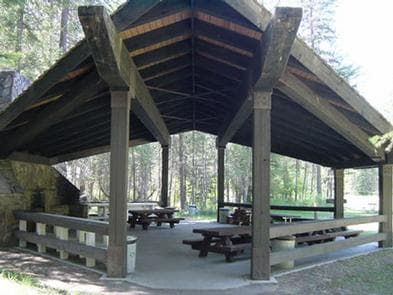
Overview McGillivray Campground has 33 total campsites and provides reservation opportunities for two group sites within the campground loops and a large group shelter located within the facility . The two smaller group sites in the campground will accommodate up to 25 people each. The group shelter will accommodate up to 200 people making it great for reunions and receptions. A high and low water boat ramp, swim beach and picnic area are also available at McGillivray Campground Recreation Fishing derbies are held multiple times each year and anglers can expect kokanee salmon, whitefish and a variety of trout. Facilities Fishing derbies are held multiple times each year and anglers can expect kokanee salmon, whitefish and a variety of trout. Natural Features The McGillivary is located on the western shore of Lake Koocanusa in northwest Montana, at an elevation of about 2,520 feet. It is nestled in a heavily forested area with dense vegetation on the forest floor. The adjacent 46,500-acre reservoir has over 127 miles of shoreline and is formed by the 422' tall Libby Dam on the Kootenai River, which stretches about 90 miles and into Canada. Osprey often fish around Libby Dam at sunset, making for enjoyable viewing opportunities. Bald eagles can be seen hunting kokanee in the river and lake during the fall. A variety of wildlife also makes its home in the area. Nearby Attractions The Kootenai River, below Libby Dam, is a blue ribbon fishery. Guided tours of the dam and powerhouse are offered at the visitor center throughout the summer season. Visitors enjoy driving the 100-mile loop around the reservoir. Several trails, including some that lead to scenic waterfalls, are located along the route.
View details →
Overview Timberlane Campground group site is located along a forest creek and in an area thick with towering trees. Several hiking trails exist in the area. The group pavilion accommodates up to 100 people and is set up for reunions and receptions. Its a great place to enjoy the Kootenai National Forest. Recreation Horseshoe pits, a volleyball court and a large, grassy play field are available at the campground. Pipe Creek allows visitors to enjoy fishing and swimming in the clear mountain water. The campground and picnic area are surrounded by a 1-mile hiking trail. Visitors also enjoy scenic drives, biking and watching for wildlife along any of the roadways in the area. Pipe Creek Road heads deep into the surrounding forest. Facilities Horseshoe pits, a volleyball court and a large, grassy play field are available at the campground. Pipe Creek allows visitors to enjoy fishing and swimming in the clear mountain water. The campground and picnic area are surrounded by a 1-mile hiking trail. Visitors also enjoy scenic drives, biking and watching for wildlife along any of the roadways in the area. Pipe Creek Road heads deep into the surrounding forest. Natural Features The Timberlane campground and group site is located along Pipe Creek in the Kootenai National Forest of northwestern Montana. It lies in a mixed conifer forest at an elevation of about 2,600 feet. A variety of wildlife make its home in the area. The area is historically significant, once a former habitat and hunting ground for the Kootenai Tribe. Certain parts of the forest remain sacred to the tribe, including a location on Pipe Creek that contains soft, multicolored stone, which was used to carve bowls for tobacco pipes used in ceremonies. Pipe Creek used to produce stones of several different colors. Nearby Attractions Timberlane Campground is near the David Thompson Historic Route, the 67-mile Lake Koocanusa Scenic Byway and the Scenic Tour of the Kootenai River bike route. The town of Libby is nearby, making the campground a perfect location for overnight stays during the wildly popular Logger Days, various car club events and Nordicfest.
View details →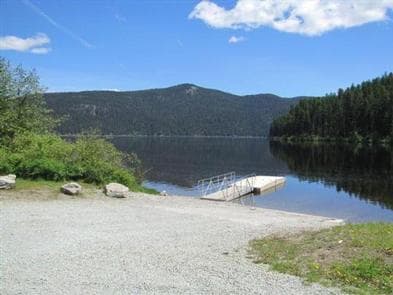
Overview Tally Lake Campground is located on the northern shores of its namesake lake, west of Whitefish, Montana. The campground is popular with locals and tourists visiting the Flathead National Forest and offers a variety of recreation facilities and activities for the whole family. The campground has 38 rentable sites with 21 of them being reservable and 17 are for our walk-up visitors. We also have a group site, site 39 and also our Pavilion group site available for reservations. The stay limit is 16 consecutive nights. Recreation Hiking, horseback riding and biking trails wind around the Tally Lake Campground and the lake. Wildlife like waterfowl, bald eagles and migratory birds are commonly spotted. (No horses are allowed in the campground) A dock provides access to the lake's best fishing, which includes kokanee salmon, a variety of trout and northern pike. Visitors also enjoy boating, water skiing and other water recreation on the 1,326 acres of Tally Lake. This campground also offers Kayak, Paddleboard and Canoe rentals. Facilities Hiking, horseback riding and biking trails wind around the Tally Lake Campground and the lake. Wildlife like waterfowl, bald eagles and migratory birds are commonly spotted. (No horses are allowed in the campground) A dock provides access to the lake's best fishing, which includes kokanee salmon, a variety of trout and northern pike. Visitors also enjoy boating, water skiing and other water recreation on the 1,326 acres of Tally Lake. This campground also offers Kayak, Paddleboard and Canoe rentals. Natural Features The campground is nestled in the highlands of northwestern Montana, adjacent to Tally Lake, which is the deepest natural lake in Montana. It sits in a mature forest of Western Larch and Douglas fir trees. Nearby Attractions The popular Whitefish Lake is about 20 miles from the campground. Visitors to the area also enjoy the Forest Service Summit Nature Center at Whitefish Mountain Resort, located about 25 miles away and accessed by the resort chairlift or the Danny On hiking trail. Charges & Cancellations Cancellations made within the 4 Day Reservation Window will be "considered" for a refund, by the concessionaire, of Camping fees only and will automatically forfeit the first nights fee. Day of Arrival cancellations must be turned in by calling Cheryl at 406-752-PWAI (7924) or 406-404-4164 to get the information to the campground Host. All Considerations will be made after your original reservation dates have passed. *No shows have no chance of a refund.
View details →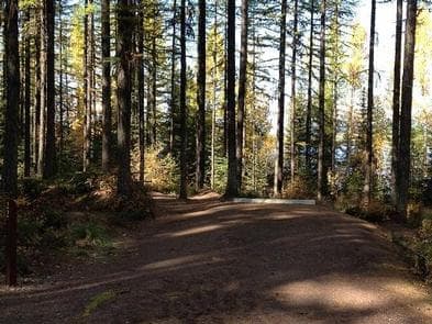
Overview Lid Creek Campground lies on the Hungry Horse Reservoir, in the heart of the Rocky Mountains, west of the Continental Divide and just south of the Canadian border. Spectacular views and ample opportunities for recreation surround the campground, keeping visitors coming back to the area again and again. Here, we have 22 rentable sites with 13 of them being reservable and 9 for our walk-up visitors. The stay limit is 16 consecutive nights. Recreation Visitors to the area enjoy a variety of biking and hiking trails that begin near the campground and wind around the reservoir. Boating, swimming and fishing are excellent pastimes on the 27,750-acre Hungry Horse Reservoir. Anglers can expect a catch of cutthroat trout and other varieties. Facilities Visitors to the area enjoy a variety of biking and hiking trails that begin near the campground and wind around the reservoir. Boating, swimming and fishing are excellent pastimes on the 27,750-acre Hungry Horse Reservoir. Anglers can expect a catch of cutthroat trout and other varieties. Natural Features The campground is located along the Hungry Horse Reservoir within the Flathead National Forest in northwestern Montana. It is nestled in a mixed forest of conifers at an elevation of 3,600 feet. The area is popular for its plentiful huckleberry bushes. Home to lynx, grizzly bear, and bull trout and with numerous lakes, streams, and rivers to enjoy, the forest is a premiere destination for visitors. Nearby Attractions Lid Creek Campground is just 23 miles southwest of the West Glacier entrance into Glacier National Park. Charges & Cancellations Cancellations made within the 4 Day Reservation Window will be "considered" for a refund, by the concessionaire, of Camping fees only and will automatically forfeit the first nights fee. Day of Arrival cancellations must be turned in by calling Cheryl at 406-752-PWAI (7924) or 406-404-4164 to get the information to the campground Host. All Considerations will be made after your original reservation dates have passed. *No shows have no chance of a refund.
View details →
Overview This recreation area is located near the village of Swan Lake at the north end of the scenic Swan Valley in northwest Montana. The campground consists of two loops. Ponderosa Loop offers open, large sites with plenty of space, while sites at Birch Loop are shaded and more clustered together. There is also a reservable group site which accomodates up to 100 people. Here, we have 38 rentable sites. 24 sites are reservable and 14 sites are for our walk-up visitors. The stay limit is 16 consecutive days. Recreation Campers and day-use visitors have access to a boat ramp and a beach. Both power and non-motorized boating is permitted. This campground also offers Kayak, Paddleboard and Canoe rentals and firewood for sale. Anglers can fish for several kinds of trout as well as Kokanee salmon and Northern Pike. Bike lanes wind throughout the campground. Facilities Campers and day-use visitors have access to a boat ramp and a beach. Both power and non-motorized boating is permitted. This campground also offers Kayak, Paddleboard and Canoe rentals and firewood for sale. Anglers can fish for several kinds of trout as well as Kokanee salmon and Northern Pike. Bike lanes wind throughout the campground. Natural Features In the heart of the Rocky Mountains lies the 2.4 million acre Flathead National Forest. Home to lynx, grizzly bear, and bull trout, with numerous lakes, streams and rivers to enjoy, the forest is the premiere destination for visitors looking to experience natural landscapes of the American West. Swan Lake is surrounded by dense conifer forest and the craggy, snow-covered peaks of the Swan Mountain Range. contact_info For facility specific information, please call (406) 210-8199. Nearby Attractions Glacier National Park is within an hour drive. About a mile from the campground is the Swan River National Wildlife Refuge, with a wildlife and bird observation area. Charges & Cancellations Please cancel 4 days prior. For day of arrival cancellations please call Leona at 406- 210-8199 so we can get the information to the Campground Host. All Considerations will be made after your original reservation dates have passed. *No shows have no chance of a refund.
View details →
Overview Emery Bay Campground is located on the Hungry Horse Reservoir, high in the Rocky Mountains, less than 30 miles from the Continental Divide, surrounded by towering mountain peaks. Visitors can expect a variety of recreational activities, including fishing, boating, swimming, hiking, exploring and big game hunting. This Campground has 26 sites, 16 of which are reservable and 10 are walk-up sites. The stay limit is 16 consecutive days. Recreation Boating is popular on the 27,750-acre reservoir, and a native boat ramp for smaller watercraft is available. Swimming and fishing are also popular pastimes, and anglers can expect a catch of cutthroat trout and other varieties. Facilities Boating is popular on the 27,750-acre reservoir, and a native boat ramp for smaller watercraft is available. Swimming and fishing are also popular pastimes, and anglers can expect a catch of cutthroat trout and other varieties. Natural Features The campground is situated along the massive Hungry Horse Reservoir, which was dammed to provide hydroelectric power and flood control to the area. It is the 10th highest dam in the United States and provides a stunning backdrop. Nearby Attractions Emery Bay Campground is just 15 miles southwest of the West Glacier entrance into Glacier National Park. Charges & Cancellations Cancellations made within the 4 Day Reservation Window will be "considered" for a refund, by the concessionaire, of Camping fees only and will automatically forfeit the first nights fee. Day of Arrival cancellations must be turned in by calling Cheryl at 406-752-PWAI (7924) or 406-404-4164 to get the information to the campground Host. All Considerations will be made after your original reservation dates have passed. *No shows have no chance of a refund.
View details →
Overview The Holland Lake Campground and Group Site are located on the shores of Holland Lake in the Swan Valley of northwest Montana. Holland Lake Campground is a great place to enjoy the Flathead National Forest. It offers clean campsites with great lake access and ample opportunities for hiking on the scenic Holland Falls National Recreation Trail. Holland Lake Campground has 38 rentable sites, 24 of which are reservable and 14 for walk-up visitors. The stay limit is 16 consecutive days in the regular camp sites and 10 days in the group site. Recreation The trailhead for the popular and easy Holland Falls National Recreation Trail is near the campground. The 1.6-mile trail climbs 750 feet, following the shoreline of Holland Lake to the base of Holland Falls waterfall. Holland Lake provides visitors with plenty of access to water-related recreation. Boating is popular on the lake, as well as water skiing and fishing. Anglers can look forward to catching a variety of trout and Kokanee salmon. Paddleboards, Kayaks and Canoes are available for rent for $10/hr., $25/4 hrs. or $40/8hrs. Facilities The trailhead for the popular and easy Holland Falls National Recreation Trail is near the campground. The 1.6-mile trail climbs 750 feet, following the shoreline of Holland Lake to the base of Holland Falls waterfall. Holland Lake provides visitors with plenty of access to water-related recreation. Boating is popular on the lake, as well as water skiing and fishing. Anglers can look forward to catching a variety of trout and Kokanee salmon. Paddleboards, Kayaks and Canoes are available for rent for $10/hr., $25/4 hrs. or $40/8hrs. Natural Features At an elevation of 4,050 feet, the campground sits among Tamarack, Ponderosa pine and Douglas fir trees. There are some sites close to the 416-acre lake; others are further back or higher on the bank. A variety of wildlife, including grizzly and black bear, make their home in the area. Nearby Attractions The campground is 25 miles north of the charming town of Seeley Lake. contact_info For facility specific information, please call (406) 210-8199. Charges & Cancellations Please cancel 4 days prior to first day of reservation. For day of arrival cancellations please call Leona at 406- 210-8199 so we can get the information to the Campground Host. All Considerations will be made after your original reservation dates have passed. *No shows have no chance of a refund.
View details →
Overview Alta Campground is located in a scenic forest in the heart of Montana's Bitterroot National Forest. The West Fork of the Bitterroot River flows nearby, giving visitors access to some of the best fishing the area has to offer, as well as other water-related recreation. Recreation Fly fishing and wading in the Bitterroot River, which runs alongside the campground, are popular activities. During high water season, canoeing and rafting are available as well. A variety of trails and unimproved roads are great for exploring by bike or off-road vehicle. Hiking trails to various mountain peaks, including to Lookout, Razorback and Thunder Mountains, as well as Beaver and Deer Creek Points, are nearby. The Alta Pine interpretive trail is nearby. Painted Rocks Lake is located about five miles north of the campground. Visitors enjoy swimming, boating and fishing. Anglers will find mountain whitefish and a variety of trout. Facilities Fly fishing and wading in the Bitterroot River, which runs alongside the campground, are popular activities. During high water season, canoeing and rafting are available as well. A variety of trails and unimproved roads are great for exploring by bike or off-road vehicle. Hiking trails to various mountain peaks, including to Lookout, Razorback and Thunder Mountains, as well as Beaver and Deer Creek Points, are nearby. The Alta Pine interpretive trail is nearby. Painted Rocks Lake is located about five miles north of the campground. Visitors enjoy swimming, boating and fishing. Anglers will find mountain whitefish and a variety of trout. Natural Features The campground is located along the West Fork of the Bitterroot River, a popular fishing river in the area. Large, yellow-barked ponderosa pine trees tower above many of the campsites, which along with fir, aspen and lodgepole pine, provide pleasant shade. The campground is situated at an elevation of about 4,580 feet. A variety of wildlife can be seen in the area, including bald eagles, mule and white-tailed deer, moose, elk, bighorn sheep and numerous songbirds. Nearby Attractions The Alta Ranger Station, located on the West Fork of the Bitterroot River, was the first Forest Service Ranger Station in the United States, built in 1899. It remains a popular tourist location and is just minutes from the campground. Hughes Creek, once a vibrant placer gold mining site, is nearby. The historic area accounted for 88 percent of all the placer gold recovered in Ravalli County from 1904-1948. Horse Creek natural hot springs can be found about 18 miles south from the campground, via gravel road with high-clearance vehicle recommended. The nearest town is Conner, which provides some services and is approximately 27 miles to the north. Darby is about 32 miles away and offers full services. Charges & Cancellations A $10.00 service fee will apply if you change or cancel your reservation. Late cancellations are subject to additional fees. For full details see NRRS Reservation Policy.
View details →
Overview Rombo Campground is located in a scenic area along the West Fork Bitterroot River in the mountains of southwestern Montana. The area is home to a variety of big game and wildlife, and provides access to a number of outdoor activities, including fishing, seasonal rafting and various trail opportunities. Recreation Fly fishing and wading in the West Fork Bitterroot River are popular activities. During high water season, kayaking and rafting are available as well. Painted Rocks Lake is just five miles south of the campground. Visitors enjoy swimming, boating and fishing. Anglers will find mountain whitefish and a variety of trout. Many trails and unimproved roads in the area are great for exploring by bike or off-road vehicle. Hiking trails to various mountain peaks are nearby. Facilities Fly fishing and wading in the West Fork Bitterroot River are popular activities. During high water season, kayaking and rafting are available as well. Painted Rocks Lake is just five miles south of the campground. Visitors enjoy swimming, boating and fishing. Anglers will find mountain whitefish and a variety of trout. Many trails and unimproved roads in the area are great for exploring by bike or off-road vehicle. Hiking trails to various mountain peaks are nearby. Natural Features The campground is located along the West Fork of the Bitterroot River. Large yellow-barked ponderosa pine trees tower above many of the campsites, which along with fir, aspen and lodgepole pine, provide pleasant shade. The campground is situated at an elevation of 4,600 feet. A variety of wildlife makes its home in the area, including bald eagles, mule and white-tailed deer, moose, elk, bighorn sheep and numerous songbirds. Nearby Attractions The Alta Ranger Station, located on the West Fork of the Bitterroot River, was the first Forest Service Ranger Station in the United States, built in 1899. It remains a popular tourist location and is a short distance from the campground. Horse Creek Hot Springs is about 29 miles from the campground and can be accessed via a gravel road with a high-clearance vehicle. A post office and a general store can be found in Conner, 16 miles from the campground. Darby is 24 miles from the campground. It is a full-service community with fuel, lodging, a grocery store, and other local businesses.
View details →
Overview Apgar, Fish Creek, and St. Mary Campground reservations WILL NOT provide access to any vehicle reservation areas (including the west side of the Going-to-the-Sun Road, Many Glacier, and North Fork). To obtain a vehicle reservation, visit Glacier National Park Vehicle Reservations on Recreation.gov. Apgar Campground is situated on the southern tip of Lake McDonald in beautiful Glacier National Park in northwestern Montana. Pristine forests, alpine meadows, rugged mountains and spectacular lakes are found throughout the park. With over 700 miles of trails, Glacier is a paradise for hikers seeking wilderness and solitude. It also provides countless scenic vistas for those wishing to relax and take in the natural beauty of the park. Recreation Lake McDonald provides great opportunities for boating, water skiing, canoeing and fishing in its cold mountain waters. A variety of fish are found in the lake, including cutthroat, rainbow, bull and lake trout, whitefish and Kokanee salmon. The campground is conveniently close to many trailheads for day hikes, including Apgar Lookout Trail, a 3.3-mile (5.3 km) trail leading up to a fire lookout with breathtaking views of Lake McDonald. The Apgar Bike Path, a paved 1.5-mile (2.4 km) trail popular for walking and biking, leads to the nearby Apgar Visitor Center and Village. Horseback ride reservations, boat rentals, shuttle service and Red Bus Tour reservations are available here. One of the most amazing highlights of Glacier National Park is a drive on the Going-to-the-Sun Road, which travels past the campground. This engineering marvel spans 50 miles (80 km) through the park's wild interior, winding around mountainsides and treating visitors to some of the best sights in northwest Montana. Facilities Lake McDonald provides great opportunities for boating, water skiing, canoeing and fishing in its cold mountain waters. A variety of fish are found in the lake, including cutthroat, rainbow, bull and lake trout, whitefish and Kokanee salmon. The campground is conveniently close to many trailheads for day hikes, including Apgar Lookout Trail, a 3.3-mile (5.3 km) trail leading up to a fire lookout with breathtaking views of Lake McDonald. The Apgar Bike Path, a paved 1.5-mile (2.4 km) trail popular for walking and biking, leads to the nearby Apgar Visitor Center and Village. Horseback ride reservations, boat rentals, shuttle service and Red Bus Tour reservations are available here. One of the most amazing highlights of Glacier National Park is a drive on the Going-to-the-Sun Road, which travels past the campground. This engineering marvel spans 50 miles (80 km) through the park's wild interior, winding around mountainsides and treating visitors to some of the best sights in northwest Montana. Natural Features Apgar is located in a dense forest on the western side of the park at an elevation of nearly 3,500 feet (1067 m). This area of the park generally receives the most rainfall. Daytime temperatures can exceed 90 degrees, although it is frequently 10 to 15 degrees cooler at higher elevations. Weather in the mountains can be varied, including snow in summer. Visitors should come prepared for anything. The park is named for its prominent glacier-carved terrain and remnant glaciers descended from the ice ages almost 10,000 years ago. Its diverse habitats are home to nearly 70 species of mammals including the grizzly bear, wolverine, gray wolf and lynx. Over 270 species of birds visit or reside in the park, including such varied species as Harlequin ducks, Dippers and Golden eagles. Nearby Attractions One must-see attraction is Waterton Lakes National Park, Glacier's sister park across the Canadian-U.S. border. As the other half of Waterton-Glacier International Peace Park, Canada's Waterton Lakes National Park offers great hiking, scenic boat cruises and several scenic drives all centered around the townsite of Waterton.
View details →
Overview Doris Creek Campground is located on the Hungry Horse Reservoir, high in the Rocky Mountains, west of the Continental Divide and just south of the Canadian border. Spectacular views and ample opportunities for recreation surround the campground. Here, we have 9 sites, 5 for reservations and 4 that are walk-up. The stay limit is 16 consecutive days. Recreation Boating is popular on the 27,750-acre reservoir, and a concrete boat ramp is accessible at Doris Point Boat Launch above the campground which also provides ample parking. Swimming and fishing are also popular pastimes, and anglers can expect to catch a variety of fish, including cutthroat trout. Facilities Boating is popular on the 27,750-acre reservoir, and a concrete boat ramp is accessible at Doris Point Boat Launch above the campground which also provides ample parking. Swimming and fishing are also popular pastimes, and anglers can expect to catch a variety of fish, including cutthroat trout. Natural Features The campground is situated along the massive Hungry Horse Reservoir, which was dammed to provide hydroelectric power and flood control to the area. It is the 10th highest dam in the United States and provides a stunning backdrop. Home to lynx, grizzly bear and bull trout, the forest is a premiere destination for visitors. Nearby Attractions Doris Creek Campground is approximately 14 miles southwest of the West Glacier entrance to Glacier National Park. Charges & Cancellations Cancellations made within the 4 Day Reservation Window will be "considered" for a refund, by the concessionaire, of Camping fees only and will automatically forfeit the first nights fee. Day of Arrival cancellations must be turned in by calling Cheryl at 406-752-PWAI (7924) or 406-404-4164 to get the information to the campground Host. All Considerations will be made after your original reservation dates have passed. *No shows have no chance of a refund.
View details →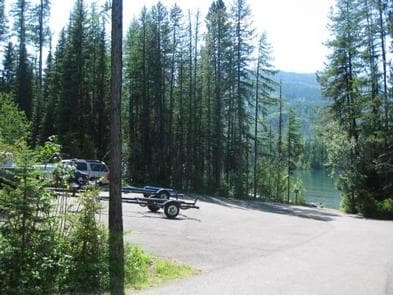
Overview Lost Johnny Point Campground is located on the Hungry Horse Reservoir, high in the Rocky Mountains, west of the Continental Divide and just south of the Canadian border. Spectacular views and ample opportunities for recreation surround the campground. Lost Johnny Point Campground has 21 camp sites, 12 which are reservable and 9 for our walk-up visitors. The stay limit is 16 consecutive days. Recreation Boating is popular on the 27,750-acre reservoir, and a concrete boat ramp is accessible from within the campground. Swimming and fishing are also popular pastimes, and anglers can expect to catch a variety of fish, including cutthroat trout. Facilities Boating is popular on the 27,750-acre reservoir, and a concrete boat ramp is accessible from within the campground. Swimming and fishing are also popular pastimes, and anglers can expect to catch a variety of fish, including cutthroat trout. Natural Features The campground is situated along the massive Hungry Horse Reservoir, which was dammed to provide hydroelectric power and flood control to the area. It is the 10th highest dam in the United States and provides a stunning backdrop. Home to lynx, grizzly bear and bull trout, the forest is a premiere destination for visitors. Nearby Attractions Lost Johnny Point Campground is approximately 18 miles southwest of the West Glacier entrance to Glacier National Park. Charges & Cancellations Cancellations made within the 4 Day Reservation Window will be "considered" for a refund, by the concessionaire, of Camping fees only and will automatically forfeit the first nights fee. Day of Arrival cancellations must be turned in by calling Cheryl at 406-752-PWAI (7924) or 406-404-4164 to get the information to the campground Host. All Considerations will be made after your original reservation dates have passed. *No shows have no chance of a refund.
View details →
Overview Devil Creek Campground is located 32 miles southeast of West Glacier, Montana, and six miles west of Marias Pass, a high mountain pass located in Glacier National Park. This location has 13 campsites, 7 which are reservable and 6 that are walk-up sites. The stay limit is 16 consecutive nights. Recreation The campground is adjacent to US Highway 2 in a heavily wooded conifer forest. Traveling to the campground on Highway 2 offers stunning scenery and opportunities for wildlife viewing. Devil Creek Trail #167 provides access to Spotted Bear Wilderness. Facilities The campground is adjacent to US Highway 2 in a heavily wooded conifer forest. Traveling to the campground on Highway 2 offers stunning scenery and opportunities for wildlife viewing. Devil Creek Trail #167 provides access to Spotted Bear Wilderness. Natural Features In the heart of the Rocky Mountains, west of the continental divide and just south of the Canadian border, lies the 2.4 million acre Flathead National Forest. Home to lynx, grizzly bear, and bull trout and with numerous lakes streams and rivers to enjoy, the forest is a premiere destination for visitors. The campground lies between East Glacier and West Glacier. Nearby Attractions The campground is just six miles east of Marias Pass, and 32 miles southeast of West Glacier, the west entrance to Glacier National Park. Charges & Cancellations Cancellations made within the 4 Day Reservation Window will be "considered" for a refund, by the concessionaire, of Camping fees only and will automatically forfeit the first nights fee. Day of Arrival cancellations must be turned in by calling Cheryl at 406-752-PWAI (7924) or 406-404-4164 to get the information to the campground Host. All Considerations will be made after your original reservation dates have passed. *No shows have no chance of a refund.
View details →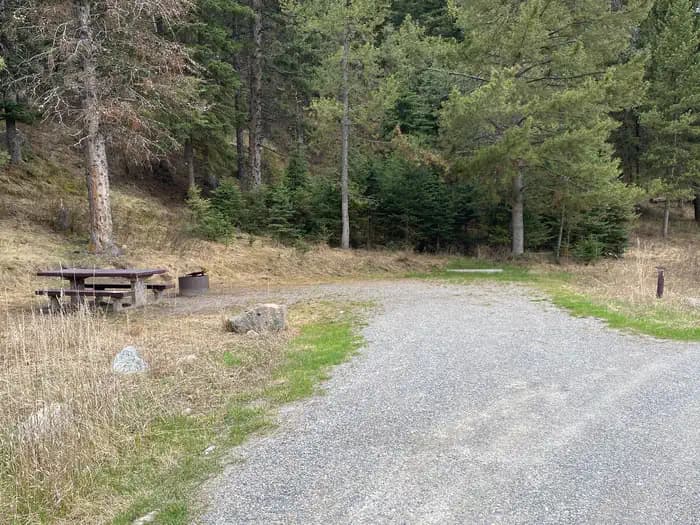
Overview Madison River Campground is located in southwestern Montana just beyond the banks of it’s namesake river. It is approximately 34 miles south of Ennis and about 45 miles west of Yellowstone National Park. The ten site campground borders a Douglas Fir covered hillside to the back, with the Madison River just across the road, on the front side. Each site is equipped with a picnic table and fire ring. Vault toilets and drinking water taps are located near each site, along the one-way road. Visitors enjoy fishing, sight-seeing and nearby hiking and ATV trails. Riverview Campground is only about a quarter mile away and West Fork Campground is less than one mile and both are available on a “first come, first served” basis. Campsite 8 has a two week in advance booking window Recreation Just across the gravel road, and for about a 40 mile length, the world renowned Madison River offers blue ribbon flyfishing. Nearby Wade and Cliff Lakes also offer fishing opportunities as well as small craft boating, canoeing and swimming. Hebgen and Henry's Lakes are each about a 30 minute drive. There are many hiking trails in the area, including just beyond the highway in the Lee Metcalf Wilderness. Off Road Vehicle trail riding is popular in the Gravelly range. Facilities Just across the gravel road, and for about a 40 mile length, the world renowned Madison River offers blue ribbon flyfishing. Nearby Wade and Cliff Lakes also offer fishing opportunities as well as small craft boating, canoeing and swimming. Hebgen and Henry's Lakes are each about a 30 minute drive. There are many hiking trails in the area, including just beyond the highway in the Lee Metcalf Wilderness. Off Road Vehicle trail riding is popular in the Gravelly range. Natural Features At an elevation of 5910 feet, the campground is situated on the west side of the world renowned Madison River and at the southern end of the Gravelly Mountain range. The Lee Metcalf Wilderness is about two miles directly to the west. Wade and Cliff Lakes are about ten miles away. The campground is backed by a forest of predominantly Douglas Fir trees. Nearby Attractions Wade and Cliff Lakes are ten miles away. Riverview and West Fork Campgrounds are less than one mile away, and available on a first come, first served basis, while Wade, Cliff Point and Hilltop Campgrounds are ten miles. The west entrance to Yellowstone National Park is less than 40 miles east, at West Yellowstone. The Earthquake Lake Visitor Center and Geologic Site is only about a ten minute drive.
View details →
Overview White Earth Group Use Shelter is located at White Earth Campground, just east of the town of Winston, Montana, on Canyon Ferry Reservoir. In 1805, the Lewis and Clark expedition passed through this region. On July 22, 1805, Sacagawea recognizes the country and assures the men that the three forks of the Missouri were of no great distance. This news gave the expedition hope in the anticipation of soon reaching the headwaters of the Missouri River. Recreation Canyon Ferry Reservoir offers a wide range of year-round recreational opportunities. Water related activities include everything from swimming and fishing to sailing and motor-boating. Canoeists and kayakers explore the many quiet backwater bays. Jet skiers, windsurfers and water skiers skim the summer waves, while winter draws ice fishermen and ice skaters. Facilities Canyon Ferry Reservoir offers a wide range of year-round recreational opportunities. Water related activities include everything from swimming and fishing to sailing and motor-boating. Canoeists and kayakers explore the many quiet backwater bays. Jet skiers, windsurfers and water skiers skim the summer waves, while winter draws ice fishermen and ice skaters. Natural Features White Earth Campground sits along the banks of Canyon Ferry Reservoir in the open valley between the Big Belt and Elkhorn mountain ranges. contact_info For facility specific information, please call (406) 475-3920. Nearby Attractions White Earth Group Use Shelter is located halfway between Yellowstone National Park and Glacier National Park. The city of Helena, MT, the state's capital, is 25 miles away. For up-to-date events visit www.helenamt.com/
View details →
Overview Indian Road Group Use Shelter is located at the southern end of Canyon Ferry Reservoir, just north of Townsend. It can accommodate up to 75 people and is attached to Indian Road campground. This 33’ X44’ shelter offers 8 picnic tables and 2 grills. Two vault toilets are located just across the parking lot. There is also a small fishing pond for kids and individuals with disabilities. This area is open to the public on a first come first serve baisis. Recreation Canyon Ferry Reservoir offers a wide range of year-round recreational opportunities. Water related activities include everything from swimming and fishing to sailing and motor-boating. Canoeists and kayakers explore the many quiet backwater bays. Jet skiers, windsurfers and water skiers skim the summer waves, while winter draws ice fishermen, ice boaters and skaters. Facilities Canyon Ferry Reservoir offers a wide range of year-round recreational opportunities. Water related activities include everything from swimming and fishing to sailing and motor-boating. Canoeists and kayakers explore the many quiet backwater bays. Jet skiers, windsurfers and water skiers skim the summer waves, while winter draws ice fishermen, ice boaters and skaters. Natural Features Indian Road Group Use Shelter sits along the Missouri River at the south end of Canyon Ferry Reservoir between the Big Belt and Elkhorns Mountain ranges. Young willows line the small fishing pond and mature cottonwoods provide shade in the grassy areas around the pavilion. contact_info For facility specific information, please call (406) 475-3920. Nearby Attractions Indian Road Group Use Shelter Is located along the Missouri River at the south end of Canyon Ferry Reservoir, between the Big Belt and Elkhorns Mountain ranges. The Canyon Ferry Wildlife Management Area, managed by FWP, is in close proximity; offering ample opportunities for bird watching and paddling during permitted seasons. For up-to-date events in Broadwater County, Townsend, Montana, visit www.townsendmt.com , and for Helena visit, www.helenamt.com .
View details →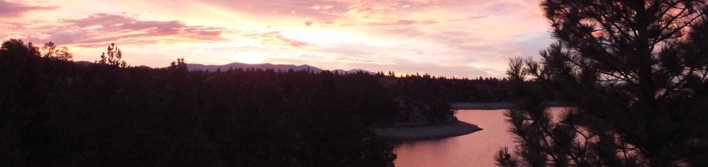
Overview Hellgate Campground is located 30 miles east of Helena, Montana, along Montana Highway 284. In July of 1805 the Lewis and Clark Expedition traveled through the Canyon Ferry area exploring and mapping the Missouri River. When Lewis visited the area he described it as a beautiful and extensive plain country of about 10 to 12 miles wide which extended upwards further than an eye could see. In the 1850s the gold rush hit the Canyon Ferry area attracting miners from all over the United States in the hopes of striking it rich. Recreation Canyon Ferry Reservoir offers a wide range of year-round recreational opportunities. Water related activities include everything from swimming and fishing to sailing and motor-boating. Canoeists and kayakers explore the many quiet backwater bays. Jet skiers, windsurfers and water skiers skim the summer waves, while winter draws ice fishermen and ice skaters. Facilities Canyon Ferry Reservoir offers a wide range of year-round recreational opportunities. Water related activities include everything from swimming and fishing to sailing and motor-boating. Canoeists and kayakers explore the many quiet backwater bays. Jet skiers, windsurfers and water skiers skim the summer waves, while winter draws ice fishermen and ice skaters. Natural Features Hellgate Campground and Group Use Shelter Area sits along the banks of Canyon Ferry Reservoir in an open valley between the Big Belt and Elkhorns mountain ranges. Along the bank of the reservoir there is a narrow riparian canopy that provides partial shade. Nearby Attractions Hellgate Campground and Group Use Shelter Area is located halfway between Yellowstone National Park and Glacier National Park. The city of Helena, Montana, the state capital, is 25 miles away and the city of Townsend, Montana, is 21 miles away. For up to date events visit, click here contact_info For facility specific information, please call (406) 475-3920.
View details →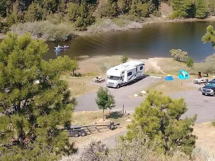
Overview Court Sheriff Campground is located at the very north end of Canyon Ferry Reservoir, 30 miles east of Helena, Montana, along Montana Highway 284. Court Sheriff Campground offers year-round access to a wide range of recreational opportunities. Court Sheriff Campground is named for the Sheriff family. In 1865 Court Sheriff moved into the region from the state of Illinois to Montana to work the mines. Court Sheriff first worked the mines in Diamond City, then hired on as a carpenter to help build a wooden flume for the Magpie-Gave Hill ditch. In 1875 he opened a general mercantile to serve the miners east of the Missouri River at Cavetown. He moved to nearby Canyon Ferry in 1880, and by 1883 had established a general store and later added a livery stable and two-and-a-half-story hotel. Recreation Canyon Ferry Reservoir offers a wide range of year-round recreational opportunities. Water related activities include everything from swimming and fishing to sailing and motor-boating. Canoeists and kayakers explore the many quiet backwater bays. Jet skiers, windsurfers and water skiers skim the summer waves, while winter draws ice fishermen, ice boaters and ice skaters. Facilities Canyon Ferry Reservoir offers a wide range of year-round recreational opportunities. Water related activities include everything from swimming and fishing to sailing and motor-boating. Canoeists and kayakers explore the many quiet backwater bays. Jet skiers, windsurfers and water skiers skim the summer waves, while winter draws ice fishermen, ice boaters and ice skaters. Natural Features Court Sheriff Campground sits at the north end of Canyon Ferry Reservoir between the Big Belt and Elkhorns mountain ranges. Nearby Attractions Court Sheriff Campground on Canyon Ferry Reservoir is located halfway between Yellowstone National Park and Glacier National Park along with the capital city of Helena, Montana. For up to date events visit, www.helenamt.com . contact_info For facility specific information, please call (406) 475-3920.
View details →
Overview Riverside Campground is located 30 miles east of Helena, Montana, below the dam at the northern end of Canyon Ferry Reservoir. Riverside Campground provides space for campers, day users, and large groups. 27 paved campsites, a group use area with a picnic pavilion, 6 pit toilets, an accessible fishing dock, a boat ramp and day use picnic area. This popular location below the dam attracts many families, boaters and fisherman. Recreation Canyon Ferry Reservoir offers a wide range of year-round recreational opportunities. Water related activities include everything from swimming and fishing to sailing and motor-boating. Canoeists and kayakers explore the many quiet backwater bays. Jet skiers, windsurfers and water skiers skim the summer waves, while winter draws ice fishermen and ice skaters. Facilities Canyon Ferry Reservoir offers a wide range of year-round recreational opportunities. Water related activities include everything from swimming and fishing to sailing and motor-boating. Canoeists and kayakers explore the many quiet backwater bays. Jet skiers, windsurfers and water skiers skim the summer waves, while winter draws ice fishermen and ice skaters. Natural Features Riverside Campground sits below Canyon Ferry Dam along the banks of Hauser Reservoir. The current is swift, and swimming is not advised. Ample fish in the water makes this a prime location for bird watching. Loons, cormorants and pelicans are often present patrolling the waters; while bald eagles and osprey make appearances to showcase their fish hunting skills. contact_info For facility specific information, please call (406) 475-3920. Nearby Attractions Riverside Campground is located halfway between Yellowstone National Park and Glacier National Park. The city of Helena, Montana, the state capital, is 25 miles away. For up to date events visit, www.helenamt.com.
View details →
Overview The Crystal Lake Group Campground is located in the beautiful Big Snowies south of Lewistown, Montana, at 5,700 feet. Home to the Crystal Lake recreation area, visitors enjoy hiking and fishing in the Snowies. Recreation The lake provides opportunities for swimming, fishing and canoeing. The various trails that stem from the Crystal Lake complex provide excellent views and interesting photo opportunities. One trail displays old hieroglyphs in a cave allowing visitors a glimpse of the past. Facilities The lake provides opportunities for swimming, fishing and canoeing. The various trails that stem from the Crystal Lake complex provide excellent views and interesting photo opportunities. One trail displays old hieroglyphs in a cave allowing visitors a glimpse of the past. Natural Features Settled in the basin of Crystal Lake, the group site offers great access to trails and ta short drive or walk to the lake. Some trees are around the campsite but may not offer much shade. Nearby Attractions Ice Caves Trail, Cascade Trails and the lake are all located in the complex.
View details →
Overview Porcupine Campground is located along the Medicine Wheel Passage Scenic Byway (U.S. Highway 14A), 33 miles east of Lovell, Wyoming. The Medicine Wheel National Historic Landmark is nearby. Visitors enjoy the area for its scenic natural beauty, recreational opportunities and excellent habitat for a variety of wildlife species. Fishing is popular on nearby streams and lakes. The administering organization is Gallatin Canyon Campgrounds; e-mail: gccampgrounds13@gmail.com Recreation From the area's historic mining sites to the ancient Native American Medicine Wheel, to hiking through open meadows and along the cliffs on the west rim of the mountains, the Bighorn National Forest offers many recreational opportunities. Jaws Trailhead is near the campground, offering access to Bucking Mule Falls Trail and Porcupine Creek. Scenic off-road driving is available on Hunt Mountain Road or Burgess Overlook jeep trail. Facilities From the area's historic mining sites to the ancient Native American Medicine Wheel, to hiking through open meadows and along the cliffs on the west rim of the mountains, the Bighorn National Forest offers many recreational opportunities. Jaws Trailhead is near the campground, offering access to Bucking Mule Falls Trail and Porcupine Creek. Scenic off-road driving is available on Hunt Mountain Road or Burgess Overlook jeep trail. Natural Features Nearby Bald Mountain is part of the Bighorn Range in northern Wyoming. A forest of pine and aspen covers the campground at an elevation of 8,900 feet. Temperatures can drop significantly once the sun goes down. Summer daytime temperatures range from 60s-90s with nighttime temperatures down to the 50s. June is sometimes rainy while the rest of the summer offers fair, clear, sunny days. Thunderstorms and snowstorms can arise at any time. Autumn temperatures are cool with frosts by mid-September. contact_info For facility specific information, please call (406) 587-9054. Nearby Attractions The Medicine Wheel National Historic Landmark is four miles from the campground. This unique geoglyph signifies all creation, all races of people, birds, fish, animals, trees and stones. According to tribal beliefs, the circular shape of the wheel represents the earth, sun, moon, cycles of life, seasons and day to night. High Country Lodge is nearby, offering guided horseback riding and backcountry pack trips, off-road vehicle rentals and guided fishing trips. Charges & Cancellations Refunds: Refund requests made through www.recreation.gov will be charged a $10 processing fee. This cancellation processing fee is retained by the reservation service contractor along with the non-refundable reservation fee. All requests for the return of the non-refundable reservation fee and the cancellation processing fee will be declined by the campground concessionaire as they did not receive these fees (these are the fees retained by the reservation contractor, a different entity).
View details →
Overview Murray Bay Campground is located on the Hungry Horse Reservoir, high in the Rocky Mountains, less than 30 miles from the Continental Divide, surrounded by towering mountain peaks. Visitors can expect a variety of recreational activities, including, fishing, boating, swimming, hiking, exploring and big game hunting. Murray Bay Campground has 20 sites, 11 which are reservable and 9 that are for our walk up visitors. The stay limit is 16 consecutive days. Recreation Boating is popular on the 27,750-acre reservoir, and a concrete boat ramp is accessible from within the campground. Swimming and fishing are also popular pastimes, and anglers can expect to catch a variety of fish, including cutthroat trout. Facilities Boating is popular on the 27,750-acre reservoir, and a concrete boat ramp is accessible from within the campground. Swimming and fishing are also popular pastimes, and anglers can expect to catch a variety of fish, including cutthroat trout. Natural Features The campground is situated along the massive Hungry Horse Reservoir, which was dammed to provide hydroelectric power and flood control to the area. It is the 10th highest dam in the United States and provides a stunning backdrop. Nearby Attractions Murray Bay Campground is approximately 31 miles southwest of the West Glacier entrance to Glacier National Park. Charges & Cancellations Cancellations made within the 4 Day Reservation Window will be "considered" for a refund, by the concessionaire, of Camping fees only and will automatically forfeit the first nights fee. Day of Arrival cancellations must be turned in by calling Cheryl at 406-752-PWAI (7924) or 406-404-4164 to get the information to the campground Host. All Considerations will be made after your original reservation dates have passed. *No shows have no chance of a refund.
View details →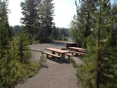
Overview Riverside Campground is located on the Hungry Horse Reservoir, high in the Rocky Mountains, less than 30 miles from the Continental Divide, surrounded by towering mountain peaks. Visitors can expect a variety of recreational activities, including fishing, boating, swimming, hiking, exploring and big game hunting. Riverside has 3 campsites, all reservable. The stay limit is 16 consecutive nights. Recreation Boating is popular on the 27,750-acre reservoir, and a concrete boat ramp is accessible from within the campground. Swimming and fishing are also popular pastimes, and anglers can expect to catch a variety of fish, including cutthroat trout. Facilities Boating is popular on the 27,750-acre reservoir, and a concrete boat ramp is accessible from within the campground. Swimming and fishing are also popular pastimes, and anglers can expect to catch a variety of fish, including cutthroat trout. Natural Features The campground is situated along the massive Hungry Horse Reservoir, which was dammed to provide hydroelectric power and flood control to the area. It is the 10th highest dam in the United States and provides a stunning backdrop. Nearby Attractions Riverside Campground is approximately 31 miles southwest of the West Glacier entrance to Glacier National Park. Charges & Cancellations Cancellations made within the 4 Day Reservation Window will be "considered" for a refund, by the concessionaire, of Camping fees only and will automatically forfeit the first nights fee. Day of Arrival cancellations must be turned in by calling Cheryl at 406-752-PWAI (7924) or 406-404-4164 to get the information to the campground Host. All Considerations will be made after your original reservation dates have passed. *No shows have no chance of a refund.
View details →
Overview The Many Glacier Campground is located on the east side of Glacier National Park, at an elevation of approximately 4,500 feet. The campground is located about 22 miles from the town of St. Mary and the east entrance to Glacier National Park. Babb, Montana, is the closest community to the Many Glacier Campground and is located approximately 12 miles east of the campground. Babb has a general store, gas station, several restaurants and an U.S. Post Office. Cell phone coverage is not available in the campground. However, limited coverage is available in Babb. Recreation Many Glacier Campground is located on the east side of the Continental Divide, and has excellent trails available for day hiking and overnight backpacking. Trailheads start at a higher elevation than those on the west side of the park, resulting in a shorter ascent to reach scenic vistas. Trails traverse areas frequented by grizzly and black bears, so take these safety precautions -- hike in groups, make lots of noise to avoid surprise encounters and carry bear pepper spray (know how to use it). Facilities Many Glacier Campground is located on the east side of the Continental Divide, and has excellent trails available for day hiking and overnight backpacking. Trailheads start at a higher elevation than those on the west side of the park, resulting in a shorter ascent to reach scenic vistas. Trails traverse areas frequented by grizzly and black bears, so take these safety precautions -- hike in groups, make lots of noise to avoid surprise encounters and carry bear pepper spray (know how to use it). Natural Features Many Glacier Campground is situated in a mature Douglas fir, lodgepole pine and quaking aspen forest. Vegetation is dense and provides partial shade for almost all campsites. Occasional strong wind gusts occur, however, with tree cover, most sites have some protection from the weather. Nearby natural features include Swiftcurrent Creek and Lake, and mountain views of Altyn, Henkel, Wilber, Grinnell Point, Allen and Wynn. contact_info This location is unstaffed. To speak with our main office for general information, please call: (406) 888-7800. Nearby Attractions If you have the time and a current passport, be sure to visit Waterton Lakes National Park in Alberta, Canada. Waterton Lakes National Park is a sister park to Glacier and both are known collectively as "Waterton-Glacier International Peace Park" -- the first international peace park in the world and designated in 1932. Waterton Lakes National Park offers fantastic hiking, scenic boat cruises and several short drives to view wildlife and access numerous hiking trails. Waterton Lakes National Park is located approximately 45 miles north of the town of Babb, Montana. Take Montana highway # 89 north to the intersection of Highway#17 or the Chief Mountain International Peace Park Highway. Continue north to the Chief Mountain international border crossing, where the road number changes to highway #6 and then highway # 5 into Waterton Lakes National Park.
View details →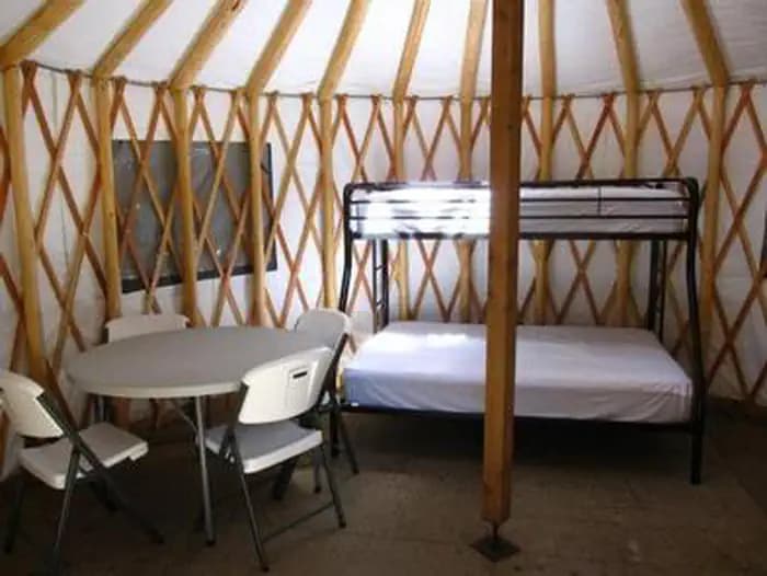
Overview The Whitetail Yurt is nestled among the pine trees along the Yaak River within Whitetail Campground. Enjoy the comforts of a domed tent with a locking door, windows and wooden floor in this 16' yurt. Recreation Opportunities abound from this location. Hiking, fishing, floating, hunting, scenic and historical driving tours are just some of the activities to be enjoyed. Facilities Opportunities abound from this location. Hiking, fishing, floating, hunting, scenic and historical driving tours are just some of the activities to be enjoyed. Natural Features The yurt is situated adjacent to the Yaak River at an elevation of 2,918 feet within the Salish Mountain Range of the Rocky Mountains in the Kootenai National Forest. Yaak River and its many tributaries provide habitat for a variety of trout and big game animals. The Yaak Valley has been an important route through history as a trail for the Kootenai Indians, early prospectors and loggers. Nearby Attractions The town of Yaak is located approximately 5.3 miles northeast where you can grab a bite to eat or attend a community event.
View details →
Overview Sprague Creek is a small campground located on the northeast shore of Lake McDonald, just off Going-to-the-Sun Road. The maximum size limit allowed for all vehicles as well as combinations of vehicles and towed units in Sprague Creek Campground is 21 feet in length (including bumpers) and/or 8 feet in width (including mirrors). The campground is located within trees, providing shade during warm summers. Some sites near the shore have unobstructed views of Lake McDonald. Recreation Amenities such as a camp store, resturant, gift shop, tour buses, boat tours, and horse rides can be found at the historic Lake McDonald Lodge, about a mile away from the campground. Evening programs with a ranger are also located at Lake McDonald Lodge. Use Glacier's free shuttle service at this campground to access other shuttle stops on the Going-to-the-Sun Road. Facilities Amenities such as a camp store, resturant, gift shop, tour buses, boat tours, and horse rides can be found at the historic Lake McDonald Lodge, about a mile away from the campground. Evening programs with a ranger are also located at Lake McDonald Lodge. Use Glacier's free shuttle service at this campground to access other shuttle stops on the Going-to-the-Sun Road. Natural Features Sprague Creek is heavily forested with partial shade. Some sites have views of Lake McDonald. The park is named for its prominent glacier-carved terrain and remnant glaciers descended from the ice ages almost 10,000 years ago. Its diverse habitats are home to nearly 70 species of mammals including the grizzly bear, wolverine, gray wolf and lynx. Over 270 species of birds visit or reside in the park, including such varied species as harlequin ducks, dippers and golden eagles. Nearby Attractions One must-see attraction is Waterton Lakes National Park, Glacier's sister park across the Canadian-U.S. border. As the other half of Waterton-Glacier International Peace Park, Canada's Waterton Lakes National Park offers great hiking, scenic boat cruises and several scenic drives all centered around the townsite of Waterton.
View details →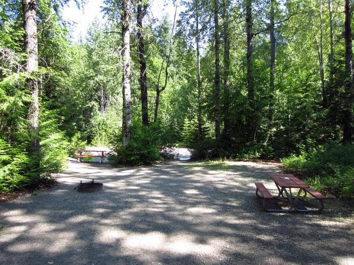
Overview Avalanche campground in located in one of the most popular sections of Glacier National Park west of the Continental Divide. The campground accommodates tent and RV campers. However, only 50 sites will accommodate vehicle lengths up to 26 feet. Bring your hiking boots and binoculars. Two popular day hikes offer spectacular scenery and glimpses of birds and wildlife that inhabit the area. Recreation Avalanche is in one of the most popular sections of Glacier National Park west of the Continental Divide. Two popular day hikes offer spectacular scenery and glimpses of birds and wildlife that inhabit the area. Facilities Avalanche is in one of the most popular sections of Glacier National Park west of the Continental Divide. Two popular day hikes offer spectacular scenery and glimpses of birds and wildlife that inhabit the area.
View details →
Overview Two Medicine is a 100 site campground located in the Two Medicine Valley of Glacier National Park. There is a ranger station and campstore in close proximity, but no other services or accommodations are located in the valley. There is no cell service or wifi. Generators are allowed only in Loops B & C. Generators are prohibited in Loop A. Recreation Two Medicine Campground is located on the east side of the park, which boasts some of the best trails available for day hiking. Trailheads start at a higher elevation than those on the west side, so less ascent is required to reach scenic vistas. Facilities Two Medicine Campground is located on the east side of the park, which boasts some of the best trails available for day hiking. Trailheads start at a higher elevation than those on the west side, so less ascent is required to reach scenic vistas. contact_info This location is unstaffed. To speak with our main office for general information, please call: (406) 888-7800. Nearby Attractions One must-see attraction is the sister park across the U.S.-Canadian border, Waterton Lakes National Park . As the other half of the Waterton-Glacier International Peace Park, Waterton Lakes offers fantastic hiking, scenic boat cruises and several scenic drives all centered around the Townsite of Waterton. Immediately east of Glacier National Park lies the picturesque Blackfeet Indian Reservation , spanning 1.5 million acres. Visit the Museum of the Plains Indian, in Browning, Montana, for a fascinating introduction to the rich cultural heritage of the largest Indian tribe in Montana.
View details →
Overview Holter Lake Campground is situated on the picturesque Holter Lake in west central Montana. The site is located approximately 45 miles north of Helena, Montana, along the Missouri River. The area offers stunning views of the Sleeping Giant Wilderness Study Area. Gates of the Mountains Historic Site is in close proximity of the campground, which is accessible via a watercraft. The area is overflowing with outdoor adventure opportunities. Whether you're into fishing, hunting, wildlife viewing, hiking, boating, water skiing, or all of the above, all of these activities are in close proximity to Holter Lake Campground. There is surely an activity for everyone! Recreation Holter Lake Campground offers excellent recreational opportunities. Activities in the area include camping, boating (motorized and non-motorized), fishing, water skiing, hiking, scenic/wildlife photography, wildlife viewing, and bird watching. There are trails within the general vicinity, as well as multiple fishing access sites and hunting access points. The recreation opportunities in the area are truly boundless. Facilities Holter Lake Campground offers excellent recreational opportunities. Activities in the area include camping, boating (motorized and non-motorized), fishing, water skiing, hiking, scenic/wildlife photography, wildlife viewing, and bird watching. There are trails within the general vicinity, as well as multiple fishing access sites and hunting access points. The recreation opportunities in the area are truly boundless. Natural Features Every campsite has a view of the lake and mountains. The campground and day-use area has poplar and green ash trees throughout the campground, which provide shade during the height of the summer. The site is situated in a shrub-steppe landscape, mostly comprised of sage brush and bunch grasses. The campground is surrounded by sparsely wooded hills. Nearby Attractions Holter Lake Campground is located in a prime location to get out and recreate outdoors. There is access to public lands, where multiple recreation opportunities and experiences are available. The campground is adjacent to the Missouri River, which was also the historical travel corridor for The Lewis and Clark Trail. Holter Lake Campground is situated between Helena and Great Falls. In Helena, there are great restaurants, museums, the capitol building, old mining settlements, Last Chance Gulch, Reeder's Alley, and a vibrant downtown area. In or near Great Falls, there is the First People's Buffalo Jump and Interpretive Center, Charlie Russell museum, Lewis and Clark Interpretive Center, Giant Springs Fish Hatchery and State Park, and Tower Rock State Park. The Continental Divide Trail is nearby. Charges & Cancellations Reservation Cancellations & Changes • Cancelling a Reservation: Customers may cancel their reservation prior to arrival both on-line and through the call center. A $10 service fee will be withheld from any refund for a cancellation. Depending on when you cancel in relation to your arrival day, it may be considered a late cancellation (see below). Late Cancellations or Cancellations within the Cut-off Window • Individual Campsites: A customer who cancels a reservation the day before or on the day of arrival will pay a $10.00 service fee AND forfeit the first night's use fee (not to exceed the total paid for the original reservation). Cancellations for a one-night reservation will forfeit the entire amount paid and will not be subject to an additional service fee. The recreation.gov cancellation policy can be found here: https://www.recreation.gov/rules-reservation-policies
View details →
Overview The Dillon Field Office is unable to make reservations for you. Please call Recreation.gov (877-444-6777) to book a reservation or book online. Campsites are available for reservation for the Peak-Season times of May 1st through September 15th. All sites are first-come-first-serve from September 16th through April 30th. Trapper Springs Campground is adjacent to the lower Madison River and provides good access for camping, fishing and floating. The campground has 15 camp sites, 9 available for reservations. There is no boat launch available at this site, but there are several in the vicinity. The campground serves as a great central location to access the lower Madison River. The day use area has a large pavilion with parking for 20 vehicles. The pavilion can be reserved for groups ($50/day). The day use area also offers a wheelchair accessible trail to the river. The campground has 15 camping sites with two accessible vault toilets. Organized Group permits are required for groups larger than 15 people. Recreation The Madison River is well known for its robust trout fishery. The lower Madison River is a very popular destination for non-angling floaters (tubers) during the warm summer months. Trapper Springs sits roughly half way between Warm Springs boat launch and Black's Ford Fishing Access Site. Facilities The Madison River is well known for its robust trout fishery. The lower Madison River is a very popular destination for non-angling floaters (tubers) during the warm summer months. Trapper Springs sits roughly half way between Warm Springs boat launch and Black's Ford Fishing Access Site. Natural Features Madison River Nearby Attractions Lower Madison River, Bear Trap Canyon unit of the Lee Metcalf Wilderness Area, Norris Hot Springs contact_info This location is unstaffed. To speak with our main office for general information, please call: (406) 683-8000. Charges & Cancellations Failing to arrive on the first night of your reservation will result in a forfeiture of your reservation and your site may be made available to someone else.
View details →
Overview The Dillon Field Office is unable to make reservations for you. Please call Recreation.gov (877-444-6777) to book a reservation or book online. Campsites are available for reservation for the Peak-Season times of May 1st through September 15th. From September 16th through April 30th, all sites are first-come-first-serve. Red Mountain Campground is adjacent to the lower Madison River and provides good access for camping, fishing and floating. The campground has 19 camp sites, 11 available for reservations. The campground has a volunteer seasonal campground host. There is no boat launch available at this site, but there are several in the vicinity. The campground serves as a great central location to access the lower Madison River. During peak season you can expect the campground to be full on weekends with lighter use during the work week. Recreation The Madison River is well known for its robust trout fishery. The lower Madison River is a very popular destination for non-angling floaters (tubers) during the warm summer months. Red Mountain sits roughly half way between Warm Springs boat launch and Black's Ford Fishing Access Site. Facilities The Madison River is well known for its robust trout fishery. The lower Madison River is a very popular destination for non-angling floaters (tubers) during the warm summer months. Red Mountain sits roughly half way between Warm Springs boat launch and Black's Ford Fishing Access Site. Natural Features Madison River contact_info This location is unstaffed. To speak with our main office for general information, please call: (406) 683-8000. Nearby Attractions Lower Madison River, Bear Trap Canyon unit of the Lee Metcalf Wilderness Area, Norris Hot Springs For additional information please visit; https://www.blm.gov/visit/red-mountain-campground Charges & Cancellations Failing to arrive on the first night of your reservation will result in a forfeiture of your reservation and your site may be made available to someone else.
View details →
Overview White Sandy is located on the west side of Hauser Lake at the confluence of Prickly Pear creek. White Sandy faces Eldorado Bar and the beautiful Big Belt mountains. It is in an ideal location for outdoor recreation, wildlife watching, water sports, camping and swimming. Recreation White Sandy offers excellent recreational access. There is a beach area, picnic areas, as well as a ramada/pavilion with power and lights, available by advanced reservation. There are vault toilets located in convenient locations throughout the site. There are trails throughout White Sandy as well as in the surrounding area. Additionally, there are multiple trails within the larger Hauser Lake Recreation area, as well as multiple fishing access sites, hunting access, wildlife viewing and of course, boating. World class mountain biking trails abound in the area as well. The recreation opportunities are truly boundless. Facilities White Sandy offers excellent recreational access. There is a beach area, picnic areas, as well as a ramada/pavilion with power and lights, available by advanced reservation. There are vault toilets located in convenient locations throughout the site. There are trails throughout White Sandy as well as in the surrounding area. Additionally, there are multiple trails within the larger Hauser Lake Recreation area, as well as multiple fishing access sites, hunting access, wildlife viewing and of course, boating. World class mountain biking trails abound in the area as well. The recreation opportunities are truly boundless. Natural Features The campground and day use areas are situated in a shrub-steppe landscape, mostly comprised of sage brush and bunch grasses. Every campsite has a view of the lake and mountains. While there are some ponderosa pine and deciduous trees throughout the area, they are scarce and do not provide a large amount of shade, but the lake does help keep the temperatures down a bit on those hot summer days. Nearby Attractions White Sandy is located in a prime location to get out and recreate outdoors, or within the capital of Montana. There are hundreds of miles of trails, Bureau of Land Management and Forest Service lands, state parks, the Lewis and Clark Trail and so much more. Helena (only a short drive away) has all the amenities of a large city with small town charm. There are great restaurants, museums, the capitol building, old mining settlements, Last Chance Gulch, Reeder's Alley and a vibrant downtown with a walking mall area. Charges & Cancellations Reservation Cancellations & Changes • Cancelling a Reservation: Customers may cancel their reservation prior to arrival both on-line and through the call center. A $10 service fee will be withheld from any refund for a cancellation. Depending on when you cancel in relation to your arrival day, it may be considered a late cancellation (see below). • Group Facility (including Cabins and Lookouts): Customers who cancel a group overnight facility reservation less than 14 days before the arrival date will pay a $10.00 service fee AND forfeit the first night's use fee. Late Cancellations or Cancellations within the Cut-off Window • Individual Campsites: A customer who cancels a reservation the day before or on the day of arrival will pay a $10.00 service fee AND forfeit the first night's use fee (not to exceed the total paid for the original reservation). Cancellations for a one-night reservation will forfeit the entire amount paid and will not be subject to an additional service fee. The recreation.gov cancellation policy can be found here: https://www.recreation.gov/rules-reservation-policies
View details →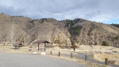
Overview Devil's Elbow Recreation Area is situated on the picturesque "Devil's Elbow" of Hauser Lake. Just a short drive from Helena, the area offers stunning views of the Big Belt and Elkhorn mountains. The area is overflowing with outdoor adventure opportunities. Whether you're into fishing, hunting, wildlife viewing, hiking, mountain biking, boating or all of the above; all of these things are immediately accessed from (the greater) Hauser Lake Recreation Area. There is surely an activity for everyone! While just a short drive from Helena, the state capital; the feeling of seclusion and abundant nature is sure to impress. Recreation Devil's Elbow offers excellent recreational access. Devil's Elbow has a small beach area, picnic areas, as well as a ramada/pavilion with power and lights, available by advanced reservation. There are vault toilets located in convenient locations throughout the area. There is a network of non-motorized dirt, gravel and paved trails throughout Devil's Elbow, Two Camps Vista and Clark's Bay that allow you to walk or bike around the area without contending with vehicles. There are multiple trails within the larger Hauser Lake Recreation area, as well as multiple fishing access sites, hunting access, wildlife viewing and of course, boating. There are several world class mountain biking trails in the area as well. The recreation opportunities in the area are truly boundless. Facilities Devil's Elbow offers excellent recreational access. Devil's Elbow has a small beach area, picnic areas, as well as a ramada/pavilion with power and lights, available by advanced reservation. There are vault toilets located in convenient locations throughout the area. There is a network of non-motorized dirt, gravel and paved trails throughout Devil's Elbow, Two Camps Vista and Clark's Bay that allow you to walk or bike around the area without contending with vehicles. There are multiple trails within the larger Hauser Lake Recreation area, as well as multiple fishing access sites, hunting access, wildlife viewing and of course, boating. There are several world class mountain biking trails in the area as well. The recreation opportunities in the area are truly boundless. Natural Features The campground and day use areas are situated in a shrub-steppe landscape, mostly comprised of sage brush and bunch grasses. Every campsite has a view of the lake and mountains. While there are some ponderosa pine and deciduous trees throughout the area, they are scarce and do not provide a large amount of shade, but the lake does help keep the temperatures down a bit on those hot summer days. Nearby Attractions Devil's Elbow is located in a prime location to get out and recreate outdoors, or within the capital of Montana. There are hundreds of miles of trails, Bureau of Land Management and Forest Service lands, state parks, the Lewis and Clark Trail and so much more. Helena (only a short drive away) has all the amenities of a large city with small town charm. There are great restaurants, museums, the capitol building, old mining settlements, Last Chance Gulch, Reeder's Alley and a vibrant downtown with a walking mall area. Charges & Cancellations Reservation Cancellations & Changes • Cancelling a Reservation: Customers may cancel their reservation prior to arrival both on-line and through the call center. A $10 service fee will be withheld from any refund for a cancellation. Depending on when you cancel in relation to your arrival day, it may be considered a late cancellation (see below). • Group Facility (including Cabins and Lookouts): Customers who cancel a group overnight facility reservation less than 14 days before the arrival date will pay a $10.00 service fee AND forfeit the first night's use fee. Late Cancellations or Cancellations within the Cut-off Window • Individual Campsites: A customer who cancels a reservation the day before or on the day of arrival will pay a $10.00 service fee AND forfeit the first night's use fee (not to exceed the total paid for the original reservation). Cancellations for a one-night reservation will forfeit the entire amount paid and will not be subject to an additional service fee. The recreation.gov cancellation policy can be found here: https://www.recreation.gov/rules-reservation-policies
View details →FAQ
Camping in Montana
How many campgrounds are listed in Montana?
TheCampVerse currently lists 92 campgrounds in Montana.
What campground types are most common in Montana?
The most common campground types are Campground.
How can I compare campgrounds in Montana?
Use the campground cards and featured links on this page to compare descriptions, amenities, and details before opening each campground profile.
Keep exploring