
Campgrounds in Wyoming
Camp in the rugged wilderness and near iconic landmarks in the Equality State
97
Campgrounds listed
100%
With photos
100%
Detailed descriptions
Campground
Top campground type
Highlights
Featured campgrounds in Wyoming
Explore by campground name letter
Jump to A-Z landing hubs for stronger discovery paths beyond Wyoming.
All campgrounds
Showing 97 campgrounds

The Tail Race Campground features three campsites with fire rings and a vault toilet. This campground is wedged between Fontenelle Reservoir and Seedskadee National Wildlife Refuge, and so makes a fantastic site for birding, fishing, or non-motorized water sports. Historically, this area was a gathering place for trappers during their annual rendezvous, and the modern day explorer can still see the lure of such a rich and welcoming area.
View details →
Overview Hoop Lake Trailhead Campground is a high elevation campground, 9,000 feet, in the north east corner of the state of Utah, between Flaming Gorge and Evanston, Wyoming. It offers lake access and access to the High Uinta Wilderness. Campers are drawn to the area to boat and fish in the lake and to hike or horseback ride on the many trails. Recreation This off-the-beaten path area is a kind of recreationists paradise, with boating and fishing in Hoop Lake, more fishing in nearby Beaver Meadow Reservoir, and trails galore. There is easy access to Hoop Lake trailhead, and access to the High Uintas Wilderness. Facilities This off-the-beaten path area is a kind of recreationists paradise, with boating and fishing in Hoop Lake, more fishing in nearby Beaver Meadow Reservoir, and trails galore. There is easy access to Hoop Lake trailhead, and access to the High Uintas Wilderness. Natural Features The campground is timbered and has great views of the lake with access for fishing and boating. There is plenty of sightseeing and wildlife watching for the numerous birds, elk, deer, moose, and beaver who frequent the area. Nearby Attractions Charges & Cancellations Reservation Cancellations & Changes Cancelling a Reservation: Customers may cancel their reservation prior to arrival both on-line and through the call center. A $10 service fee will be withheld from any refund for a cancellation. Depending on when you cancel in relation to your arrival day, it may be considered a late cancellation (see below). Changing an Existing Reservation: When changes are made prior to the cut-off window: If a customer wants to switch dates that are entirely outside of the original reservation dates, there is a $10 change fee. There is no change fee if a customer extends or shortens a reservation, as long as the change includes dates from the original reservation. If they choose to depart early, they may forfeit the recreation fee for the day of departure. There is no change fee if the customer wants to switch sites that are the same price with the same reservation dates in the same facility. If a reservation is made that includes dates beyond the maximum booking window, that reservation cannot be changed until 18 days have passed from the original booking date. Late Cancellations or Cancellations within the Cut-off Window Individual Campsites: A customer who cancels a reservation the day before or on the day of arrival will pay a $10.00 service fee AND forfeit the first night's use fee (not to exceed the total paid for the original reservation). Cancellations for a one-night reservation will forfeit the entire amount paid and will not be subject to an additional service fee. Cabins / Lookouts: Customers who cancel a cabin or lookout reservation less than 14 days before the arrival date will pay a $10.00 service fee AND forfeit the first night's use fee. Group Facility (including Cabins and Lookouts): Customers who cancel a group overnight facility reservation less than 14 days before the arrival date will pay a $10.00 service fee AND forfeit the first night's use fee. Group Day Use Area: Customers who cancel a group day-use facility reservation less than 14 days before the arrival date will forfeit the total day-use fee. Changes or Cancellations within the Cut-off Window: Once a reservation date has begun, customers cannot change a reservation using the online system or through the Call Center (see below for early departures). If the location is staffed, on-site personnel may or may not be able to assist with changes or cancellations (check with local staff). No-Shows Overnight and Day-Use Facilities: A no-show customer is one who does not arrive at a campground and does not cancel the reservation by check-out time on the day after the scheduled arrival date (or for day-use facilities, by check-in time the day of arrival). Staff will hold a campsite until check-out time on the day following the arrival date and will hold group day-use facilities until check-in time on the arrival date. No-shows are assessed $20.00 service fee and forfeit the first night’s recreation fee for a campsite or forfeit the entire day-use fee for a day-use facility. Early Departures If a customer departs prior to the scheduled check-out date, they may be eligible for a partial refund. Please notify staff at the facility if you depart early to allow others to use the site. Customers may notify the call center to request a refund of remaining unused nights. If a customer requests a refund for an early departure after the facility check-out time has passed, the customer will not be refunded for that night and is eligible for a refund on any additional nights that will not be used. Interagency Pass Discounts The following are the only Interagency Passes that provide a discount on camping reservations and some tickets: Senior Annual Pass Senior Lifetime Pass Access Pass Golden Age Pass Golden Access Pass Eligible pass discounts only apply to individual campsites and may apply to a ticket for the pass holder. Interagency Pass discounts do not apply to group reservations, cabins, shelters, and multi-use sites (doubles, triples, etc.). Pass discounts only apply to the recreation (or use) fee for the facility. Other charges such as electricity or water hookups, reservation or other fees are not eligible for a discount. The holder of the pass must occupy the site for which the discount is applied. The pass can only be used for one site during a time period. Refunds Customers may submit a refund request through their Recreation.gov profile within 7 days of the end date of their reservation. Customers may also initiate a refund request through the call center at any time after their reservation has ended. Fees: Applicable fees, such as reservation fees, service/cancellation fees, lottery application fees, and change fees, are non-refundable. Debit or Credit Card Purchases: Refunds for debit or credit card payments made after October 1, 2018 will be issued as a credit to the original bank or credit card used to pay. In the event that a customer has cancelled this card, they will need to contact their card company to have the funds released. We cannot issue refunds to any card other than the one used to pay. If a customer paid with a debit or credit card prior to October 1, 2018 their refund will be issued in the form of a Treasury check. Check or Cash Purchases: Recreation.gov will mail a Treasury check for refunds of cash, check, or money order payments to the address associated with the reservation. You may update the address at the time you request the refund. It may take up to 6-8 weeks for the Treasury check to arrive. Please make sure your address is up to date in your customer profile. Emergency Closures: In the event of an emergency closure, the Recreation.gov team or facility manager will refund all fees and will attempt to notify you using the contact information within your Recreation.gov customer profile. Reservation fees for free tickets are non-refundable in the event of an emergency closure. Recreation.gov Billing Information Reservation transactions will appear on customer's credit card statements as "Recreation.gov 877-444-6777 NM" Changes to Policies and Procedures Recreation.gov reserves the right, when necessary, to modify reservation policies. These policies were last updated September 2019.
View details →
Overview Hoop Lake Campground is located 35 miles south of Mountain View, WY at an elevation of 9,000 feet. It’s located in the Uinta Mountains on the shores of its beautiful mountain lake namesake. Campers are drawn to the area to boat and fish in the lake and to hike or horseback ride on the many trails. Recreation This off-the-beaten path area is a kind of recreationists paradise, with boating and fishing in Hoop Lake, more fishing in nearby Beaver Meadow Reservoir, and trails galore. There is easy access to Hoop Lake trailhead, and access to the High Uintas Wilderness. Facilities This off-the-beaten path area is a kind of recreationists paradise, with boating and fishing in Hoop Lake, more fishing in nearby Beaver Meadow Reservoir, and trails galore. There is easy access to Hoop Lake trailhead, and access to the High Uintas Wilderness. Natural Features The campground is timbered and has great views of the lake with access for fishing and boating. There is plenty of sightseeing and wildlife watching for the numerous birds, elk, deer, moose, and beaver who frequent the area. Nearby Attractions Charges & Cancellations Reservation Cancellations & Changes Cancelling a Reservation: Customers may cancel their reservation prior to arrival both on-line and through the call center. A $10 service fee will be withheld from any refund for a cancellation. Depending on when you cancel in relation to your arrival day, it may be considered a late cancellation (see below). Changing an Existing Reservation: When changes are made prior to the cut-off window: If a customer wants to switch dates that are entirely outside of the original reservation dates, there is a $10 change fee. There is no change fee if a customer extends or shortens a reservation, as long as the change includes dates from the original reservation. If they choose to depart early, they may forfeit the recreation fee for the day of departure. There is no change fee if the customer wants to switch sites that are the same price with the same reservation dates in the same facility. If a reservation is made that includes dates beyond the maximum booking window, that reservation cannot be changed until 18 days have passed from the original booking date. Late Cancellations or Cancellations within the Cut-off Window Individual Campsites: A customer who cancels a reservation the day before or on the day of arrival will pay a $10.00 service fee AND forfeit the first night's use fee (not to exceed the total paid for the original reservation). Cancellations for a one-night reservation will forfeit the entire amount paid and will not be subject to an additional service fee. Cabins / Lookouts: Customers who cancel a cabin or lookout reservation less than 14 days before the arrival date will pay a $10.00 service fee AND forfeit the first night's use fee. Group Facility (including Cabins and Lookouts): Customers who cancel a group overnight facility reservation less than 14 days before the arrival date will pay a $10.00 service fee AND forfeit the first night's use fee. Group Day Use Area: Customers who cancel a group day-use facility reservation less than 14 days before the arrival date will forfeit the total day-use fee. Changes or Cancellations within the Cut-off Window: Once a reservation date has begun, customers cannot change a reservation using the online system or through the Call Center (see below for early departures). If the location is staffed, on-site personnel may or may not be able to assist with changes or cancellations (check with local staff). No-Shows Overnight and Day-Use Facilities: A no-show customer is one who does not arrive at a campground and does not cancel the reservation by check-out time on the day after the scheduled arrival date (or for day-use facilities, by check-in time the day of arrival). Staff will hold a campsite until check-out time on the day following the arrival date and will hold group day-use facilities until check-in time on the arrival date. No-shows are assessed $20.00 service fee and forfeit the first night’s recreation fee for a campsite or forfeit the entire day-use fee for a day-use facility. Early Departures If a customer departs prior to the scheduled check-out date, they may be eligible for a partial refund. Please notify staff at the facility if you depart early to allow others to use the site. Customers may notify the call center to request a refund of remaining unused nights. If a customer requests a refund for an early departure after the facility check-out time has passed, the customer will not be refunded for that night and is eligible for a refund on any additional nights that will not be used. Interagency Pass Discounts The following are the only Interagency Passes that provide a discount on camping reservations and some tickets: Senior Annual Pass Senior Lifetime Pass Access Pass Golden Age Pass Golden Access Pass Eligible pass discounts only apply to individual campsites and may apply to a ticket for the pass holder. Interagency Pass discounts do not apply to group reservations, cabins, shelters, and multi-use sites (doubles, triples, etc.). Pass discounts only apply to the recreation (or use) fee for the facility. Other charges such as electricity or water hookups, reservation or other fees are not eligible for a discount. The holder of the pass must occupy the site for which the discount is applied. The pass can only be used for one site during a time period. Refunds Customers may submit a refund request through their Recreation.gov profile within 7 days of the end date of their reservation. Customers may also initiate a refund request through the call center at any time after their reservation has ended. Fees: Applicable fees, such as reservation fees, service/cancellation fees, lottery application fees, and change fees, are non-refundable. Debit or Credit Card Purchases: Refunds for debit or credit card payments made after October 1, 2018 will be issued as a credit to the original bank or credit card used to pay. In the event that a customer has cancelled this card, they will need to contact their card company to have the funds released. We cannot issue refunds to any card other than the one used to pay. If a customer paid with a debit or credit card prior to October 1, 2018 their refund will be issued in the form of a Treasury check. Check or Cash Purchases: Recreation.gov will mail a Treasury check for refunds of cash, check, or money order payments to the address associated with the reservation. You may update the address at the time you request the refund. It may take up to 6-8 weeks for the Treasury check to arrive. Please make sure your address is up to date in your customer profile. Emergency Closures: In the event of an emergency closure, the Recreation.gov team or facility manager will refund all fees and will attempt to notify you using the contact information within your Recreation.gov customer profile. Reservation fees for free tickets are non-refundable in the event of an emergency closure. Recreation.gov Billing Information Reservation transactions will appear on customer's credit card statements as "Recreation.gov 877-444-6777 NM" Changes to Policies and Procedures Recreation.gov reserves the right, when necessary, to modify reservation policies. These policies were last updated September 2019.
View details →
Overview Meeks Cabin Campground is on the banks of Meeks Cabin Reservoir at an 8,700 foot elevation. Meeks Cabin Reservoir is situated in both Utah and the southwest corner of Wyoming. Recreation The 470-acre dam, though not a swimmer’s destination, allows for boating and fishing. The campground has lake access, however the boat ramp is closer to the dam. Facilities The 470-acre dam, though not a swimmer’s destination, allows for boating and fishing. The campground has lake access, however the boat ramp is closer to the dam. Natural Features This pine and aspen-filled campground is a single loop overlooking the water. Nearby Attractions Charges & Cancellations Reservation Cancellations & Changes Cancelling a Reservation: Customers may cancel their reservation prior to arrival both on-line and through the call center. A $10 service fee will be withheld from any refund for a cancellation. Depending on when you cancel in relation to your arrival day, it may be considered a late cancellation (see below). Changing an Existing Reservation: When changes are made prior to the cut-off window: If a customer wants to switch dates that are entirely outside of the original reservation dates, there is a $10 change fee. There is no change fee if a customer extends or shortens a reservation, as long as the change includes dates from the original reservation. If they choose to depart early, they may forfeit the recreation fee for the day of departure. There is no change fee if the customer wants to switch sites that are the same price with the same reservation dates in the same facility. If a reservation is made that includes dates beyond the maximum booking window, that reservation cannot be changed until 18 days have passed from the original booking date. Late Cancellations or Cancellations within the Cut-off Window Individual Campsites: A customer who cancels a reservation the day before or on the day of arrival will pay a $10.00 service fee AND forfeit the first night's use fee (not to exceed the total paid for the original reservation). Cancellations for a one-night reservation will forfeit the entire amount paid and will not be subject to an additional service fee. Cabins / Lookouts: Customers who cancel a cabin or lookout reservation less than 14 days before the arrival date will pay a $10.00 service fee AND forfeit the first night's use fee. Group Facility (including Cabins and Lookouts): Customers who cancel a group overnight facility reservation less than 14 days before the arrival date will pay a $10.00 service fee AND forfeit the first night's use fee. Group Day Use Area: Customers who cancel a group day-use facility reservation less than 14 days before the arrival date will forfeit the total day-use fee. Changes or Cancellations within the Cut-off Window: Once a reservation date has begun, customers cannot change a reservation using the online system or through the Call Center (see below for early departures). If the location is staffed, on-site personnel may or may not be able to assist with changes or cancellations (check with local staff). No-Shows Overnight and Day-Use Facilities: A no-show customer is one who does not arrive at a campground and does not cancel the reservation by check-out time on the day after the scheduled arrival date (or for day-use facilities, by check-in time the day of arrival). Staff will hold a campsite until check-out time on the day following the arrival date and will hold group day-use facilities until check-in time on the arrival date. No-shows are assessed $20.00 service fee and forfeit the first night’s recreation fee for a campsite or forfeit the entire day-use fee for a day-use facility. Early Departures If a customer departs prior to the scheduled check-out date, they may be eligible for a partial refund. Please notify staff at the facility if you depart early to allow others to use the site. Customers may notify the call center to request a refund of remaining unused nights. If a customer requests a refund for an early departure after the facility check-out time has passed, the customer will not be refunded for that night and is eligible for a refund on any additional nights that will not be used. Interagency Pass Discounts The following are the only Interagency Passes that provide a discount on camping reservations and some tickets: Senior Annual Pass Senior Lifetime Pass Access Pass Golden Age Pass Golden Access Pass Eligible pass discounts only apply to individual campsites and may apply to a ticket for the pass holder. Interagency Pass discounts do not apply to group reservations, cabins, shelters, and multi-use sites (doubles, triples, etc.). Pass discounts only apply to the recreation (or use) fee for the facility. Other charges such as electricity or water hookups, reservation or other fees are not eligible for a discount. The holder of the pass must occupy the site for which the discount is applied. The pass can only be used for one site during a time period. Refunds Customers may submit a refund request through their Recreation.gov profile within 7 days of the end date of their reservation. Customers may also initiate a refund request through the call center at any time after their reservation has ended. Fees: Applicable fees, such as reservation fees, service/cancellation fees, lottery application fees, and change fees, are non-refundable. Debit or Credit Card Purchases: Refunds for debit or credit card payments made after October 1, 2018 will be issued as a credit to the original bank or credit card used to pay. In the event that a customer has cancelled this card, they will need to contact their card company to have the funds released. We cannot issue refunds to any card other than the one used to pay. If a customer paid with a debit or credit card prior to October 1, 2018 their refund will be issued in the form of a Treasury check. Check or Cash Purchases: Recreation.gov will mail a Treasury check for refunds of cash, check, or money order payments to the address associated with the reservation. You may update the address at the time you request the refund. It may take up to 6-8 weeks for the Treasury check to arrive. Please make sure your address is up to date in your customer profile. Emergency Closures: In the event of an emergency closure, the Recreation.gov team or facility manager will refund all fees and will attempt to notify you using the contact information within your Recreation.gov customer profile. Reservation fees for free tickets are non-refundable in the event of an emergency closure. Recreation.gov Billing Information Reservation transactions will appear on customer's credit card statements as "Recreation.gov 877-444-6777 NM" Changes to Policies and Procedures Recreation.gov reserves the right, when necessary, to modify reservation policies. These policies were last updated September 2019.
View details →
Overview Wolverine ATV Trailhead Campground is located just a few miles off the Mirror Lake Scenic Byway, 35 miles from Evanston, Wyoming. The byway cuts through the Uinta Mountains, which are known for their abundant recreational opportunities and scenic beauty. Recreation This campground has quick access to a number of ATV trails and adventures. Christmas Meadows Trail, for hiking and horseback riding, begins a few miles away. Numerous additional hiking, biking, horseback and off-road vehicle riding trails crisscross this beautiful region. Fly-fishing for cutthroat and brook trout is a popular activity on Stillwater Fork, which can be accessed nearby. Facilities This campground has quick access to a number of ATV trails and adventures. Christmas Meadows Trail, for hiking and horseback riding, begins a few miles away. Numerous additional hiking, biking, horseback and off-road vehicle riding trails crisscross this beautiful region. Fly-fishing for cutthroat and brook trout is a popular activity on Stillwater Fork, which can be accessed nearby. Natural Features This small campground is situated among a thin forest of pine and aspen trees, which provide only limited shade. Summer wildflowers and grasses dot the landscape. Nearby Attractions Mirror Lake Scenic Byway parallels the Lower Provo River as it snakes across a portion of the Uinta Mountains, leading to numerous high alpine lakes and streams, countless trails, breathtaking scenic viewpoints and various campgrounds. Fishing, canoeing, hiking, backpacking, horseback riding and biking are popular activities. The High Uintas Wilderness can be accessed from several trails along the byway.
View details →
Overview At just under 10,500 feet Silver Lake Campground is the highest elevation campground on the Brush Creek/Hayden Ranger District. It opens in late June or early July depending on snow depth. The campground is beside the Snowy Range Scenic Byway on Silver Lake. This facility provides easy access to exploring the trails, lakes, streams, and glacial landscapes of the area. Facilities include 17 campsites with 3 RV pull-throughs (trailers under 32'), picnic tables, toilets, water, fire grates, and trash receptacles with a 14 day stay limit. There are two trailheads at the campground. Popular attractions near this campground include Silver Lake, Lake Marie Falls, Mirror Lake, Medicine Bow Peak Trail, French Creek CanyonTrail and Miners Cabin Trail. Recreation The Snowy Range offers endless recreational activities for any kind of visitor. Specifically, the Snowy Range contains a network of hiking trails suitable for day hiking and for extended, backcountry trips. Additionally, Streams and over 100 lakes in the area provide a variety of challenging recreational-fishing opportunities in the area. Popular attractions near this campground include Silver Lake, Lake Marie Falls, Mirror Lake, Medicine Bow Peak Trail, French Creek Canyon Trail and Miners Cabin Trail. Winter activities in the area include snowshoeing and skiing. Mountain Biking Areas for Mountain Biking at Snowy Range Area Bow River Campground Deep Creek Campground French Creek Campground French Creek Canyon Trail Keystone Cabins Lake Owen Trailhead Little Brooklyn Guard Station Little Laramie Trailhead North Fork Campground Pinkham Mountain Trailhead Rock Creek Trailhead Sheep Lake Trailhead Snow Survey Cabin Spruce Mountain Fire Lookout Tie Hack Lower Trailhead Tie Hack Upper Trailhead Tipple Trail Trailhead Mountain Climbing Areas for Mountain Climbing at Snowy Range Area Lewis Lake Picnic Site Libby Lake Picnic Site Day Hiking Areas for Day Hiking at Snowy Range Area Brooklyn Lake Campground Brush Creek Trails Chimney Park Trailhead Corner Mountain Trailhead Crater Lake Trailhead Deep Creek Campground Deep Lake Trail Dipper Lake Trail French Creek Campground French Creek Canyon Trail Green Rock Parking Lot Green Rock Picnic Site Keystone Cabins Lake Owen Trailhead Lakes Trailhead Lewis Lake Picnic Site Libby Lake Picnic Site Little Brooklyn Guard Station Little Laramie Trailhead Meadow Falls Trailhead Miner's Cabin Trailhead North Fork Campground Platte River Wilderness Quealy Lake Trailhead Rock Creek Trailhead Routt Access Trailhead Ryan Park Campground Savage Run Wilderness Sheep Lake Trailhead Silver Lake Campground Silver Lake Trailhead Six Mile Trailhead Snow Survey Cabin South Brush Creek Campground Spruce Mountain Fire Lookout Sugarloaf Campground Tie Hack Lower Trailhead Tie Hack Upper Trailhead Tipple Trail Trailhead West Lake Marie Backpacking Areas for Backpacking at Snowy Range Area Crater Lake Trailhead Deep Lake Trail Dipper Lake Trail Lakes Trailhead Lewis Lake Picnic Site Libby Lake Picnic Site Platte River Wilderness Quealy Lake Trailhead Rock Creek Trailhead Savage Run Wilderness Sheep Lake Trailhead Six Mile Trailhead Viewing Wildlife Areas for Viewing Wildlife at Snowy Range Area Brooklyn Lake Campground Keystone Cabins Libby Flats Observation Site Little Brooklyn Guard Station Snow Survey Cabin Spruce Mountain Fire Lookout Tipple Trail Trailhead Facilities The Snowy Range offers endless recreational activities for any kind of visitor. Specifically, the Snowy Range contains a network of hiking trails suitable for day hiking and for extended, backcountry trips. Additionally, Streams and over 100 lakes in the area provide a variety of challenging recreational-fishing opportunities in the area. Popular attractions near this campground include Silver Lake, Lake Marie Falls, Mirror Lake, Medicine Bow Peak Trail, French Creek Canyon Trail and Miners Cabin Trail. Winter activities in the area include snowshoeing and skiing. Mountain Biking Areas for Mountain Biking at Snowy Range Area Bow River Campground Deep Creek Campground French Creek Campground French Creek Canyon Trail Keystone Cabins Lake Owen Trailhead Little Brooklyn Guard Station Little Laramie Trailhead North Fork Campground Pinkham Mountain Trailhead Rock Creek Trailhead Sheep Lake Trailhead Snow Survey Cabin Spruce Mountain Fire Lookout Tie Hack Lower Trailhead Tie Hack Upper Trailhead Tipple Trail Trailhead Mountain Climbing Areas for Mountain Climbing at Snowy Range Area Lewis Lake Picnic Site Libby Lake Picnic Site Day Hiking Areas for Day Hiking at Snowy Range Area Brooklyn Lake Campground Brush Creek Trails Chimney Park Trailhead Corner Mountain Trailhead Crater Lake Trailhead Deep Creek Campground Deep Lake Trail Dipper Lake Trail French Creek Campground French Creek Canyon Trail Green Rock Parking Lot Green Rock Picnic Site Keystone Cabins Lake Owen Trailhead Lakes Trailhead Lewis Lake Picnic Site Libby Lake Picnic Site Little Brooklyn Guard Station Little Laramie Trailhead Meadow Falls Trailhead Miner's Cabin Trailhead North Fork Campground Platte River Wilderness Quealy Lake Trailhead Rock Creek Trailhead Routt Access Trailhead Ryan Park Campground Savage Run Wilderness Sheep Lake Trailhead Silver Lake Campground Silver Lake Trailhead Six Mile Trailhead Snow Survey Cabin South Brush Creek Campground Spruce Mountain Fire Lookout Sugarloaf Campground Tie Hack Lower Trailhead Tie Hack Upper Trailhead Tipple Trail Trailhead West Lake Marie Backpacking Areas for Backpacking at Snowy Range Area Crater Lake Trailhead Deep Lake Trail Dipper Lake Trail Lakes Trailhead Lewis Lake Picnic Site Libby Lake Picnic Site Platte River Wilderness Quealy Lake Trailhead Rock Creek Trailhead Savage Run Wilderness Sheep Lake Trailhead Six Mile Trailhead Viewing Wildlife Areas for Viewing Wildlife at Snowy Range Area Brooklyn Lake Campground Keystone Cabins Libby Flats Observation Site Little Brooklyn Guard Station Snow Survey Cabin Spruce Mountain Fire Lookout Tipple Trail Trailhead Natural Features The Snowy Range rises from sagebrush and lodgepole pine forests in lower elevations to spruce-fir forests and alpine areas in the high country. The area offers views of rugged peaks over 12,000 feet, gorgeous snow-melt lakes and stunning displays of native wildflowers. Nearby Attractions Popular attractions near this campground include Silver Lake, Lake Marie Falls, Mirror Lake, Medicine Bow Peak Trail, French Creek Canyon Trail and Miners Cabin Trail. Silver Lake can be acessed using the Silver Lake Trail that surrounds the lake. The lake is 17 acres in size with a maximum water depth of 25 feet. Brook trout reside in the lake. The Snowy Range Scenic Byway is a 29-mile stretch of paved road crosses through spectacular alpine habitats.
View details →
Overview Tie City Campground is comprised of 17 campsites in a single tear-drop loop. Some sites are nestled in a dense grove of aspen, fir, and spruce while others are in a grassy meadow. This campground will have a mix of reservation sites and first-come, first-served sites for the 2024 season. If you are not reserving your site, you may be able to pay for your campsite(s) by cash or check once you are at the campground. Recreation The Tie City trailhead leads to a network of challenging mountain bike trails, and is also used in the winter for cross country skiing. The South Fork of Lodgepole Creek runs close to the Tie City Campground and across the 719 road from Yellow Pine, which has good brook trout fishing. Facilities The Tie City trailhead leads to a network of challenging mountain bike trails, and is also used in the winter for cross country skiing. The South Fork of Lodgepole Creek runs close to the Tie City Campground and across the 719 road from Yellow Pine, which has good brook trout fishing. Natural Features The Medicine Bow-Routt National Forests and Thunder Basin National Grassland encompasses nearly 3 million acres from central and northeastern Wyoming to north-central Colorado. Lodgepole pine, aspen, fir, spruce, and shrubs dominate the landscape of the national forests. The Grassland boasts numerous species of grasses and wildflowers that add color to the landscape during warmer months. Black bear, bobcat, coyote, elk, mule deer, pronghorn antelope, and moose are just some of the many animals that inhabit these rich and diverse lands. Nearby Attractions Vedauwoo Recreation Area is nearby. Vedauwoo is a group of spectacular granite rock formations rising out of the thin soils on Pole Mountain. The area is a popular destination for rock climbers, hikers, mountain bikers and others who enjoy numerous opportunities to follow their own spirit of play in this gorgeous natural landscape.
View details →
Overview Vedauwoo Campground is composed of two camping areas, the main Vedauwoo Campground and the Vedauwoo Tent Campground. The main Vedauwoo Campground includes two loops with 29 campsites of standard nonelectric sites and walk-in tent sites. Vedauwoo Tent Campground contains a loop of 20 tent-only sites. All sites have tables, fire rings, trash pick up and access to vault toilets. Potable water may be available inside the main campground, look for the water handpump in the main campground's north loop. There is access to rock climbing and a nature trail through the rocks. The main Vedauwoo Campground and the Vedauwoo Tent Campground will both have a mix of reservation sites and first-come, first-served sites for the 2024 season. If you are not reserving your site, you may be able to pay for your campsite(s) by cash or check once you are at the campground. Recreation The rock formations at Vedauwoo provide oppotrunity for all types of rock climbing. Sightseeing and wildflower viewing begin within a short walk or drive from any campsite. Turtle Rock trail leaves from the campground and winds its way between multiple rock formations while passing meadows, streams, beaver ponds and forested areas. Box Canyon trail leaves from the picnic area, contains great views along a short distance and is fully accessible to people with disabilities. Facilities The rock formations at Vedauwoo provide oppotrunity for all types of rock climbing. Sightseeing and wildflower viewing begin within a short walk or drive from any campsite. Turtle Rock trail leaves from the campground and winds its way between multiple rock formations while passing meadows, streams, beaver ponds and forested areas. Box Canyon trail leaves from the picnic area, contains great views along a short distance and is fully accessible to people with disabilities. Natural Features The campground winds around the boulders, slabs and cliffs of the Vedauwoo rock formation. The formation is made up of 10 square miles of weathered Sherman granite, providing lots of space to explore. The vegetation is a variety of Limber pine, Engleman spruce, Douglas fir, and Aspen. The general area was once used as a hideout for outlaws. Native Americans thought playful spirits piled up the boulders. Nearby Attractions Popular attractions near this campground include Turtle Rock Trail, Box Canyon Trail, and the Tie City trail system.
View details →
Overview The campground is composed of 19 sites in a single loop among a nice stand of mixed conifers and Aspen. It has corrals available outside the campground, but no horses are allowed inside the campground. Recreation The campground connects to the Tie City trail system which is a challenging network of mountain bike trails, and is also used in the winter for cross country skiing. Facilities The campground connects to the Tie City trail system which is a challenging network of mountain bike trails, and is also used in the winter for cross country skiing. Natural Features The Medicine Bow-Routt National Forests and Thunder Basin National Grassland encompasses nearly 3 million acres from central and northeastern Wyoming to north-central Colorado. Lodgepole pine, aspen, fir, spruce, and shrubs dominate the landscape of the national forests. The Grassland boasts numerous species of grasses and wildflowers that add color to the landscape during warmer months. Black bear, bobcat, coyote, elk, mule deer, pronghorn antelope, and moose are just some of the many animals that inhabit these rich and diverse lands. Nearby Attractions Vedauwoo Recreation Area is nearby. Vedauwoo is a group of spectacular granite rock formations rising out of the thin soils on Pole Mountain. The area is a popular destination for rock climbers, hikers, mountain bikers and others who enjoy numerous opportunities to follow their own spirit of play in this gorgeous natural landscape.
View details →
Overview South Brush Creek Campground is located on the west side of the Snowy Range along the shore of South Brush Creek and is a sunny campground composed of two sections located in a dense stand of Lodgepole pines, fir and Aspen trees next to South Brush Creek. The campground has 20 sites, with 6 pull-through sites for trailers under 25 feet. Amenities include picnic tables, fire grates, toilets, trash service, and a camp host on site, and water is available late May through mid September. Pets are allowed but must be kept on a leash no longer than 6 feet and under control at all times. Many hiking, OHV, and fishing opportunities are available in the area Recreation The Snowy Range area in the Medicine Bow National Forest is located in southeast Wyoming. The Laramie Ranger District, Brush Creek/Hayden Ranger District, and Parks Ranger District manage portions of the Snowy Range. Year-round recreation uses include hiking, fishing, hunting, snowmobiling, skiing, OHV riding, camping, and biking. Primary access across the Snowy Range is by Highway 130, known as the Snowy Range Scenic Byway. Mountain Biking Areas for Mountain Biking at Snowy Range Area Bow River Campground Deep Creek Campground French Creek Campground French Creek Canyon Trail Keystone Cabins Lake Owen Trailhead Little Brooklyn Guard Station Little Laramie Trailhead North Fork Campground Pinkham Mountain Trailhead Rock Creek Trailhead Sheep Lake Trailhead Snow Survey Cabin Spruce Mountain Fire Lookout Tie Hack Lower Trailhead Tie Hack Upper Trailhead Tipple Trail Trailhead Mountain Climbing Areas for Mountain Climbing at Snowy Range Area Lewis Lake Picnic Site Libby Lake Picnic Site Day Hiking Areas for Day Hiking at Snowy Range Area Brooklyn Lake Campground Brush Creek Trails Chimney Park Trailhead Corner Mountain Trailhead Crater Lake Trailhead Deep Creek Campground Deep Lake Trail Dipper Lake Trail French Creek Campground French Creek Canyon Trail Green Rock Parking Lot Green Rock Picnic Site Keystone Cabins Lake Owen Trailhead Lakes Trailhead Lewis Lake Picnic Site Libby Lake Picnic Site Little Brooklyn Guard Station Little Laramie Trailhead Meadow Falls Trailhead Miner's Cabin Trailhead North Fork Campground Platte River Wilderness Quealy Lake Trailhead Rock Creek Trailhead Routt Access Trailhead Ryan Park Campground Savage Run Wilderness Sheep Lake Trailhead Silver Lake Campground Silver Lake Trailhead Six Mile Trailhead Snow Survey Cabin South Brush Creek Campground Spruce Mountain Fire Lookout Sugarloaf Campground Tie Hack Lower Trailhead Tie Hack Upper Trailhead Tipple Trail Trailhead West Lake Marie Backpacking Areas for Backpacking at Snowy Range Area Crater Lake Trailhead Deep Lake Trail Dipper Lake Trail Lakes Trailhead Lewis Lake Picnic Site Libby Lake Picnic Site Platte River Wilderness Quealy Lake Trailhead Rock Creek Trailhead Savage Run Wilderness Sheep Lake Trailhead Six Mile Trailhead Viewing Wildlife Areas for Viewing Wildlife at Snowy Range Area Brooklyn Lake Campground Keystone Cabins Libby Flats Observation Site Little Brooklyn Guard Station Snow Survey Cabin Spruce Mountain Fire Lookout Tipple Trail Trailhead Facilities The Snowy Range area in the Medicine Bow National Forest is located in southeast Wyoming. The Laramie Ranger District, Brush Creek/Hayden Ranger District, and Parks Ranger District manage portions of the Snowy Range. Year-round recreation uses include hiking, fishing, hunting, snowmobiling, skiing, OHV riding, camping, and biking. Primary access across the Snowy Range is by Highway 130, known as the Snowy Range Scenic Byway. Mountain Biking Areas for Mountain Biking at Snowy Range Area Bow River Campground Deep Creek Campground French Creek Campground French Creek Canyon Trail Keystone Cabins Lake Owen Trailhead Little Brooklyn Guard Station Little Laramie Trailhead North Fork Campground Pinkham Mountain Trailhead Rock Creek Trailhead Sheep Lake Trailhead Snow Survey Cabin Spruce Mountain Fire Lookout Tie Hack Lower Trailhead Tie Hack Upper Trailhead Tipple Trail Trailhead Mountain Climbing Areas for Mountain Climbing at Snowy Range Area Lewis Lake Picnic Site Libby Lake Picnic Site Day Hiking Areas for Day Hiking at Snowy Range Area Brooklyn Lake Campground Brush Creek Trails Chimney Park Trailhead Corner Mountain Trailhead Crater Lake Trailhead Deep Creek Campground Deep Lake Trail Dipper Lake Trail French Creek Campground French Creek Canyon Trail Green Rock Parking Lot Green Rock Picnic Site Keystone Cabins Lake Owen Trailhead Lakes Trailhead Lewis Lake Picnic Site Libby Lake Picnic Site Little Brooklyn Guard Station Little Laramie Trailhead Meadow Falls Trailhead Miner's Cabin Trailhead North Fork Campground Platte River Wilderness Quealy Lake Trailhead Rock Creek Trailhead Routt Access Trailhead Ryan Park Campground Savage Run Wilderness Sheep Lake Trailhead Silver Lake Campground Silver Lake Trailhead Six Mile Trailhead Snow Survey Cabin South Brush Creek Campground Spruce Mountain Fire Lookout Sugarloaf Campground Tie Hack Lower Trailhead Tie Hack Upper Trailhead Tipple Trail Trailhead West Lake Marie Backpacking Areas for Backpacking at Snowy Range Area Crater Lake Trailhead Deep Lake Trail Dipper Lake Trail Lakes Trailhead Lewis Lake Picnic Site Libby Lake Picnic Site Platte River Wilderness Quealy Lake Trailhead Rock Creek Trailhead Savage Run Wilderness Sheep Lake Trailhead Six Mile Trailhead Viewing Wildlife Areas for Viewing Wildlife at Snowy Range Area Brooklyn Lake Campground Keystone Cabins Libby Flats Observation Site Little Brooklyn Guard Station Snow Survey Cabin Spruce Mountain Fire Lookout Tipple Trail Trailhead Natural Features South Brush Creek Campground is situated in a pine, fir and aspen forest forest on the shores of South Brush Creek in the Medicine Bow National Forest in south-central Wyoming. Black bear, bobcat, coyote, elk, mule deer and moose are just some of the many animals that inhabit these rich and diverse lands. Nearby Attractions The Snowy Range Scenic Byway is a 29-mile stretch of paved road crosses through spectacular alpine habitats.
View details →
Overview A campground in the Sierra Madre Range that sees medium use in the summer and fall. Facilities include 16 campsites, 4 are pull-through sites, picnic tables, fire rings, vault toilets, and water. The campground has a 14 day stay limit. Jack Creek Guard Station and Jack Creek Crew Quarters are nearby. This campground has primitive roads in the area for OHV riding. Both motorized and non-motorized portions of the Continental Divide National Scenic Trail are also in the vacinity. Trash Service is NOT Provided Recreation The Snowy Range offers endless recreational activities for any kind of visitor. Specifically, the Snowy Range contains a network of hiking trails suitable for day hiking and for extended, backcountry trips. Additionally, Streams and over 100 lakes in the area provide a variety of challenging recreational-fishing opportunities in the area. Popular attractions near this campground include Silver Lake, Lake Marie Falls, Mirror Lake, Medicine Bow Peak Trail, French Creek Canyon Trail and Miners Cabin Trail. Winter activities in the area include snowshoeing and skiing. Mountain Biking Areas for Mountain Biking at Snowy Range Area • Bow River Campground • Deep Creek Campground • French Creek Campground • French Creek Canyon Trail • Keystone Cabins • Lake Owen Trailhead • Little Brooklyn Guard Station • Little Laramie Trailhead • North Fork Campground • Pinkham Mountain Trailhead • Rock Creek Trailhead • Sheep Lake Trailhead • Snow Survey Cabin • Spruce Mountain Fire Lookout • Tie Hack Lower Trailhead • Tie Hack Upper Trailhead • Tipple Trail Trailhead Mountain Climbing Areas for Mountain Climbing at Snowy Range Area • Lewis Lake Picnic Site • Libby Lake Picnic Site Day Hiking Areas for Day Hiking at Snowy Range Area • Brooklyn Lake Campground • Brush Creek Trails • Chimney Park Trailhead • Corner Mountain Trailhead • Crater Lake Trailhead • Deep Creek Campground • Deep Lake Trail • Dipper Lake Trail • French Creek Campground • French Creek Canyon Trail • Green Rock Parking Lot • Green Rock Picnic Site • Keystone Cabins • Lake Owen Trailhead • Lakes Trailhead • Lewis Lake Picnic Site • Libby Lake Picnic Site • Little Brooklyn Guard Station • Little Laramie Trailhead • Meadow Falls Trailhead • Miner's Cabin Trailhead • North Fork Campground • Platte River Wilderness • Quealy Lake Trailhead • Rock Creek Trailhead • Routt Access Trailhead • Ryan Park Campground • Savage Run Wilderness • Sheep Lake Trailhead • Silver Lake Campground • Silver Lake Trailhead • Six Mile Trailhead • Snow Survey Cabin • South Brush Creek Campground • Spruce Mountain Fire Lookout • Sugarloaf Campground • Tie Hack Lower Trailhead • Tie Hack Upper Trailhead • Tipple Trail Trailhead • West Lake Marie Backpacking Areas for Backpacking at Snowy Range Area • Crater Lake Trailhead • Deep Lake Trail • Dipper Lake Trail • Lakes Trailhead • Lewis Lake Picnic Site • Libby Lake Picnic Site • Platte River Wilderness • Quealy Lake Trailhead • Rock Creek Trailhead • Savage Run Wilderness • Sheep Lake Trailhead • Six Mile Trailhead Viewing Wildlife Areas for Viewing Wildlife at Snowy Range Area • Brooklyn Lake Campground • Keystone Cabins • Libby Flats Observation Site • Little Brooklyn Guard Station • Snow Survey Cabin • Spruce Mountain Fire Lookout • Tipple Trail Trailhead Facilities The Snowy Range offers endless recreational activities for any kind of visitor. Specifically, the Snowy Range contains a network of hiking trails suitable for day hiking and for extended, backcountry trips. Additionally, Streams and over 100 lakes in the area provide a variety of challenging recreational-fishing opportunities in the area. Popular attractions near this campground include Silver Lake, Lake Marie Falls, Mirror Lake, Medicine Bow Peak Trail, French Creek Canyon Trail and Miners Cabin Trail. Winter activities in the area include snowshoeing and skiing. Mountain Biking Areas for Mountain Biking at Snowy Range Area • Bow River Campground • Deep Creek Campground • French Creek Campground • French Creek Canyon Trail • Keystone Cabins • Lake Owen Trailhead • Little Brooklyn Guard Station • Little Laramie Trailhead • North Fork Campground • Pinkham Mountain Trailhead • Rock Creek Trailhead • Sheep Lake Trailhead • Snow Survey Cabin • Spruce Mountain Fire Lookout • Tie Hack Lower Trailhead • Tie Hack Upper Trailhead • Tipple Trail Trailhead Mountain Climbing Areas for Mountain Climbing at Snowy Range Area • Lewis Lake Picnic Site • Libby Lake Picnic Site Day Hiking Areas for Day Hiking at Snowy Range Area • Brooklyn Lake Campground • Brush Creek Trails • Chimney Park Trailhead • Corner Mountain Trailhead • Crater Lake Trailhead • Deep Creek Campground • Deep Lake Trail • Dipper Lake Trail • French Creek Campground • French Creek Canyon Trail • Green Rock Parking Lot • Green Rock Picnic Site • Keystone Cabins • Lake Owen Trailhead • Lakes Trailhead • Lewis Lake Picnic Site • Libby Lake Picnic Site • Little Brooklyn Guard Station • Little Laramie Trailhead • Meadow Falls Trailhead • Miner's Cabin Trailhead • North Fork Campground • Platte River Wilderness • Quealy Lake Trailhead • Rock Creek Trailhead • Routt Access Trailhead • Ryan Park Campground • Savage Run Wilderness • Sheep Lake Trailhead • Silver Lake Campground • Silver Lake Trailhead • Six Mile Trailhead • Snow Survey Cabin • South Brush Creek Campground • Spruce Mountain Fire Lookout • Sugarloaf Campground • Tie Hack Lower Trailhead • Tie Hack Upper Trailhead • Tipple Trail Trailhead • West Lake Marie Backpacking Areas for Backpacking at Snowy Range Area • Crater Lake Trailhead • Deep Lake Trail • Dipper Lake Trail • Lakes Trailhead • Lewis Lake Picnic Site • Libby Lake Picnic Site • Platte River Wilderness • Quealy Lake Trailhead • Rock Creek Trailhead • Savage Run Wilderness • Sheep Lake Trailhead • Six Mile Trailhead Viewing Wildlife Areas for Viewing Wildlife at Snowy Range Area • Brooklyn Lake Campground • Keystone Cabins • Libby Flats Observation Site • Little Brooklyn Guard Station • Snow Survey Cabin • Spruce Mountain Fire Lookout • Tipple Trail Trailhead Nearby Attractions Welcome to Medicine Bow-Routt National Forests and Thunder Basin National Grassland! Visitor opportunities abound on almost 2.9 million acres of National Forest System lands. The Medicine Bow and Routt National Forests provide year-round recreation opportunities for you. These activities include hiking, biking, camping, snowmobiling, skiing, horseback riding, OHV riding, fishing and hunting, just to name a few. Elevation ranges from 5,500 to 12,940 feet. Beautiful vistas await sightseers and photographers. The Thunder Basin National Grassland provides unique opportunities for recreation, including hiking, sightseeing, hunting, and fishing. Elevation on the national grassland ranges from 3,600 to 5,200 feet. Charges & Cancellations If I book this reservation today, what are my options to change or cancel? Please remember that reservations at these facilities prevent other visitors from using these sites. Planned changes to your stay should be made as far in advance as possible. You can make changes to your reservation ahead of your arrival date in My Reservations. Changes If your new stay dates are completely different from your original stay dates, there is a $10 change fee (per reserved site). There are no additional fees for: • Adding or removing nights to your stay. • Changing to a different campsite. Balances will adjust based on your new stay's nightly rate. Cancellations You can cancel the reservation any time before the date of your scheduled arrival. You will receive a refund for your stay, minus the following fees: • $10 cancellation fee • Any reservation fees (only if paid when booking) • Any previous change fees Late cancellation penalties may also apply: What is “Late”? For individual campsites, a late cancellation applies starting from midnight 1 calendar day before your scheduled check-in. For cabins and group sites, a late cancellation applies starting from midnight 14 calendar days or fewer before your scheduled check-in. Late Fee In addition to the fees listed above, a late cancellation will also subtract your first night's recreation use fee from any refund owed. As of the expected check-in day, cancellations or changes to your stay are not possible through My Reservations. It is at the facility's discretion to support additional Late Cancellations, No Show, or Early Departure updates – on-site personnel may not be able to assist. These changes carry penalties and may forfeit recreation use fees. For additional details, please visit here.
View details →
Overview This campground is three miles off the Snowy Range Scenic Byway (Hwy 130) beside North Brush Creek. Lincoln Park campground is situated at 7,800 feet elevation and offers a great base camp to explore the Medicine Bow National Forest. It includes 12 campsites suitable for trailer, tent, and RV camping. Sites include picnic tables and fire grates, and potable water, toilets, and Trash Service Is Not Provided. Check-out time is 12:00 p.m. on the last day of the reservation. are accessible during the open season. Stump Hollow Trail, Cedar Creek Trail, and Kennaday Peak are popular OHV destinations and trails nearby. Kennaday Peak offers a panoramic view of the area. To plan your trail riding, check out the Motor Vehicle Use Map to ensure that you ride safely and legally. Other activities include fishing in nearby streams that support populations of brook and brown trout. Hiking, horseback riding, mountain biking, hunting, picnicking, winter sports, and wildlife viewing opportunities abound in the Snowy Range area. Recreation The Snowy Range offers endless recreational activities for any kind of visitor. Specifically, the Snowy Range contains a network of hiking trails suitable for day hiking and for extended, backcountry trips. Additionally, Streams and over 100 lakes in the area provide a variety of challenging recreational-fishing opportunities in the area. Popular attractions near this campground include Silver Lake, Lake Marie Falls, Mirror Lake, Medicine Bow Peak Trail, French Creek Canyon Trail and Miners Cabin Trail. Winter activities in the area include snowshoeing and skiing. Mountain Biking Areas for Mountain Biking at Snowy Range Area Bow River Campground Deep Creek Campground French Creek Campground French Creek Canyon Trail Keystone Cabins Lake Owen Trailhead Little Brooklyn Guard Station Little Laramie Trailhead North Fork Campground Pinkham Mountain Trailhead Rock Creek Trailhead Sheep Lake Trailhead Snow Survey Cabin Spruce Mountain Fire Lookout Tie Hack Lower Trailhead Tie Hack Upper Trailhead Tipple Trail Trailhead Mountain Climbing Areas for Mountain Climbing at Snowy Range Area Lewis Lake Picnic Site Libby Lake Picnic Site Day Hiking Areas for Day Hiking at Snowy Range Area Brooklyn Lake Campground Brush Creek Trails Chimney Park Trailhead Corner Mountain Trailhead Crater Lake Trailhead Deep Creek Campground Deep Lake Trail Dipper Lake Trail French Creek Campground French Creek Canyon Trail Green Rock Parking Lot Green Rock Picnic Site Keystone Cabins Lake Owen Trailhead Lakes Trailhead Lewis Lake Picnic Site Libby Lake Picnic Site Little Brooklyn Guard Station Little Laramie Trailhead Meadow Falls Trailhead Miner's Cabin Trailhead North Fork Campground Platte River Wilderness Quealy Lake Trailhead Rock Creek Trailhead Routt Access Trailhead Ryan Park Campground Savage Run Wilderness Sheep Lake Trailhead Silver Lake Campground Silver Lake Trailhead Six Mile Trailhead Snow Survey Cabin South Brush Creek Campground Spruce Mountain Fire Lookout Sugarloaf Campground Tie Hack Lower Trailhead Tie Hack Upper Trailhead Tipple Trail Trailhead West Lake Marie Backpacking Areas for Backpacking at Snowy Range Area Crater Lake Trailhead Deep Lake Trail Dipper Lake Trail Lakes Trailhead Lewis Lake Picnic Site Libby Lake Picnic Site Platte River Wilderness Quealy Lake Trailhead Rock Creek Trailhead Savage Run Wilderness Sheep Lake Trailhead Six Mile Trailhead Viewing Wildlife Areas for Viewing Wildlife at Snowy Range Area Brooklyn Lake Campground Keystone Cabins Libby Flats Observation Site Little Brooklyn Guard Station Snow Survey Cabin Spruce Mountain Fire Lookout Tipple Trail Trailhead Facilities The Snowy Range offers endless recreational activities for any kind of visitor. Specifically, the Snowy Range contains a network of hiking trails suitable for day hiking and for extended, backcountry trips. Additionally, Streams and over 100 lakes in the area provide a variety of challenging recreational-fishing opportunities in the area. Popular attractions near this campground include Silver Lake, Lake Marie Falls, Mirror Lake, Medicine Bow Peak Trail, French Creek Canyon Trail and Miners Cabin Trail. Winter activities in the area include snowshoeing and skiing. Mountain Biking Areas for Mountain Biking at Snowy Range Area Bow River Campground Deep Creek Campground French Creek Campground French Creek Canyon Trail Keystone Cabins Lake Owen Trailhead Little Brooklyn Guard Station Little Laramie Trailhead North Fork Campground Pinkham Mountain Trailhead Rock Creek Trailhead Sheep Lake Trailhead Snow Survey Cabin Spruce Mountain Fire Lookout Tie Hack Lower Trailhead Tie Hack Upper Trailhead Tipple Trail Trailhead Mountain Climbing Areas for Mountain Climbing at Snowy Range Area Lewis Lake Picnic Site Libby Lake Picnic Site Day Hiking Areas for Day Hiking at Snowy Range Area Brooklyn Lake Campground Brush Creek Trails Chimney Park Trailhead Corner Mountain Trailhead Crater Lake Trailhead Deep Creek Campground Deep Lake Trail Dipper Lake Trail French Creek Campground French Creek Canyon Trail Green Rock Parking Lot Green Rock Picnic Site Keystone Cabins Lake Owen Trailhead Lakes Trailhead Lewis Lake Picnic Site Libby Lake Picnic Site Little Brooklyn Guard Station Little Laramie Trailhead Meadow Falls Trailhead Miner's Cabin Trailhead North Fork Campground Platte River Wilderness Quealy Lake Trailhead Rock Creek Trailhead Routt Access Trailhead Ryan Park Campground Savage Run Wilderness Sheep Lake Trailhead Silver Lake Campground Silver Lake Trailhead Six Mile Trailhead Snow Survey Cabin South Brush Creek Campground Spruce Mountain Fire Lookout Sugarloaf Campground Tie Hack Lower Trailhead Tie Hack Upper Trailhead Tipple Trail Trailhead West Lake Marie Backpacking Areas for Backpacking at Snowy Range Area Crater Lake Trailhead Deep Lake Trail Dipper Lake Trail Lakes Trailhead Lewis Lake Picnic Site Libby Lake Picnic Site Platte River Wilderness Quealy Lake Trailhead Rock Creek Trailhead Savage Run Wilderness Sheep Lake Trailhead Six Mile Trailhead Viewing Wildlife Areas for Viewing Wildlife at Snowy Range Area Brooklyn Lake Campground Keystone Cabins Libby Flats Observation Site Little Brooklyn Guard Station Snow Survey Cabin Spruce Mountain Fire Lookout Tipple Trail Trailhead Nearby Attractions Popular attractions near this campground include Silver Lake, Lake Marie Falls, Mirror Lake, Medicine Bow Peak Trail, French Creek Canyon Trail and Miners Cabin Trail. Silver Lake can be acessed using the Silver Lake Trail that surrounds the lake. The lake is 17 acres in size with a maximum water depth of 25 feet. Brook trout reside in the lake. The Snowy Range Scenic Byway is a 29-mile stretch of paved road crosses through spectacular alpine habitats. Charges & Cancellations If I book this reservation today, what are my options to change or cancel? Please remember that reservations at these facilities prevent other visitors from using these sites. Planned changes to your stay should be made as far in advance as possible. You can make changes to your reservation ahead of your arrival date in My Reservations. Changes If your new stay dates are completely different from your original stay dates, there is a $10 change fee (per reserved site). There are no additional fees for: Adding or removing nights to your stay. Changing to a different campsite. Balances will adjust based on your new stay's nightly rate. Cancellations You can cancel the reservation any time before the date of your scheduled arrival. You will receive a refund for your stay, minus the following fees: $10 cancellation fee Any reservation fees (only if paid when booking) Any previous change fees Late cancellation penalties may also apply: What is “Late”? For individual campsites, a late cancellation applies starting from midnight 1 calendar day before your scheduled check-in. For cabins and group sites, a late cancellation applies starting from midnight 14 calendar days or fewer before your scheduled check-in. Late Fee In addition to the fees listed above, a late cancellation will also subtract your first night's recreation use fee from any refund owed. As of the expected check-in day, cancellations or changes to your stay are not possible through My Reservations. It is at the facility's discretion to support additional Late Cancellations, No Show, or Early Departure updates – on-site personnel may not be able to assist. These changes carry penalties and may forfeit recreation use fees. For additional details, please visit here.
View details →
Overview The facility lies at an elevation of 8,800 feet within the Bottle Creek Campground in the Medicine Bow National Forest. The area's year-round recreation opportunities offer something for every adventurer and outdoor lover. Hiking, fishing and camping are available nearby. Trash Service is NOT Provided Recreation Bicycling Road Cycling Fishing River and Stream Fishing Brook, brown and rainbow trout can be found in the Encampment River and the North Fork Encampment River. Day Hiking Day hiking at Green Mountain Falls and Encampment River. (For more information, go to home page, click recreation, then click day hiking.) Hunting Big Game Hunting OHV Riding & Camping OHV Road Riding Facilities Bicycling Road Cycling Fishing River and Stream Fishing Brook, brown and rainbow trout can be found in the Encampment River and the North Fork Encampment River. Day Hiking Day hiking at Green Mountain Falls and Encampment River. (For more information, go to home page, click recreation, then click day hiking.) Hunting Big Game Hunting OHV Riding & Camping OHV Road Riding Natural Features This campground offers 16 small campsites (trailers less than 16 feet), picnic tables, toilets, fire grates, potable water and trash cans. Popular recreational activities in the area include day hiking at Green Mountain Falls and Encampment River, fishing the Encampment and North Fork Encampment rivers, wildlife watching and visiting the Continental Divide. Wildlife is common, so plan to keep a clean camp. Nearby Attractions The town of Encampment is just a 10min drive, there our resturants, gas, and a small store Charges & Cancellations If I book this reservation today, what are my options to change or cancel? Please remember that reservations at these facilities prevent other visitors from using these sites. Planned changes to your stay should be made as far in advance as possible. You can make changes to your reservation ahead of your arrival date in My Reservations. Changes If your new stay dates are completely different from your original stay dates, there is a $10 change fee (per reserved site). There are no additional fees for: • Adding or removing nights to your stay. • Changing to a different campsite. Balances will adjust based on your new stay's nightly rate. Cancellations You can cancel the reservation any time before the date of your scheduled arrival. You will receive a refund for your stay, minus the following fees: • $10 cancellation fee • Any reservation fees (only if paid when booking) • Any previous change fees Late cancellation penalties may also apply: What is “Late”? For individual campsites, a late cancellation applies starting from midnight 1 calendar day before your scheduled check-in. For cabins and group sites, a late cancellation applies starting from midnight 14 calendar days or fewer before your scheduled check-in. Late Fee In addition to the fees listed above, a late cancellation will also subtract your first night's recreation use fee from any refund owed. As of the expected check-in day, cancellations or changes to your stay are not possible through My Reservations. It is at the facility's discretion to support additional Late Cancellations, No Show, or Early Departure updates – on-site personnel may not be able to assist. These changes carry penalties and may forfeit recreation use fees. For additional details, please visit here.
View details →
Overview French Creek Campground is located on Forest Road 206. Facilities include 11 campsites (small trailers only up to 32 feet), water, picnic tables, toilets, fire grates and Trash Service is NOT Provided . Note: No water or trash services beyond mid September.) Fishing access is available nearby in both North and South French Creeks. The Lower Tie Hack trailhead is .25 mile east of the campground. Recreation The Snowy Range offers endless recreational activities for any kind of visitor. Specifically, the Snowy Range contains a network of hiking trails suitable for day hiking and for extended, backcountry trips. Additionally, Streams and over 100 lakes in the area provide a variety of challenging recreational-fishing opportunities in the area. Popular attractions near this campground include Silver Lake, Lake Marie Falls, Mirror Lake, Medicine Bow Peak Trail, French Creek Canyon Trail and Miners Cabin Trail. Winter activities in the area include snowshoeing and skiing. Mountain Biking Areas for Mountain Biking at Snowy Range Area • Bow River Campground • Deep Creek Campground • French Creek Campground • French Creek Canyon Trail • Keystone Cabins • Lake Owen Trailhead • Little Brooklyn Guard Station • Little Laramie Trailhead • North Fork Campground • Pinkham Mountain Trailhead • Rock Creek Trailhead • Sheep Lake Trailhead • Snow Survey Cabin • Spruce Mountain Fire Lookout • Tie Hack Lower Trailhead • Tie Hack Upper Trailhead • Tipple Trail Trailhead Mountain Climbing Areas for Mountain Climbing at Snowy Range Area • Lewis Lake Picnic Site • Libby Lake Picnic Site Day Hiking Areas for Day Hiking at Snowy Range Area • Brooklyn Lake Campground • Brush Creek Trails • Chimney Park Trailhead • Corner Mountain Trailhead • Crater Lake Trailhead • Deep Creek Campground • Deep Lake Trail • Dipper Lake Trail • French Creek Campground • French Creek Canyon Trail • Green Rock Parking Lot • Green Rock Picnic Site • Keystone Cabins • Lake Owen Trailhead • Lakes Trailhead • Lewis Lake Picnic Site • Libby Lake Picnic Site • Little Brooklyn Guard Station • Little Laramie Trailhead • Meadow Falls Trailhead • Miner's Cabin Trailhead • North Fork Campground • Platte River Wilderness • Quealy Lake Trailhead • Rock Creek Trailhead • Routt Access Trailhead • Ryan Park Campground • Savage Run Wilderness • Sheep Lake Trailhead • Silver Lake Campground • Silver Lake Trailhead • Six Mile Trailhead • Snow Survey Cabin • South Brush Creek Campground • Spruce Mountain Fire Lookout • Sugarloaf Campground • Tie Hack Lower Trailhead • Tie Hack Upper Trailhead • Tipple Trail Trailhead • West Lake Marie Backpacking Areas for Backpacking at Snowy Range Area • Crater Lake Trailhead • Deep Lake Trail • Dipper Lake Trail • Lakes Trailhead • Lewis Lake Picnic Site • Libby Lake Picnic Site • Platte River Wilderness • Quealy Lake Trailhead • Rock Creek Trailhead • Savage Run Wilderness • Sheep Lake Trailhead • Six Mile Trailhead Viewing Wildlife Areas for Viewing Wildlife at Snowy Range Area • Brooklyn Lake Campground • Keystone Cabins • Libby Flats Observation Site • Little Brooklyn Guard Station • Snow Survey Cabin • Spruce Mountain Fire Lookout • Tipple Trail Trailhead Facilities The Snowy Range offers endless recreational activities for any kind of visitor. Specifically, the Snowy Range contains a network of hiking trails suitable for day hiking and for extended, backcountry trips. Additionally, Streams and over 100 lakes in the area provide a variety of challenging recreational-fishing opportunities in the area. Popular attractions near this campground include Silver Lake, Lake Marie Falls, Mirror Lake, Medicine Bow Peak Trail, French Creek Canyon Trail and Miners Cabin Trail. Winter activities in the area include snowshoeing and skiing. Mountain Biking Areas for Mountain Biking at Snowy Range Area • Bow River Campground • Deep Creek Campground • French Creek Campground • French Creek Canyon Trail • Keystone Cabins • Lake Owen Trailhead • Little Brooklyn Guard Station • Little Laramie Trailhead • North Fork Campground • Pinkham Mountain Trailhead • Rock Creek Trailhead • Sheep Lake Trailhead • Snow Survey Cabin • Spruce Mountain Fire Lookout • Tie Hack Lower Trailhead • Tie Hack Upper Trailhead • Tipple Trail Trailhead Mountain Climbing Areas for Mountain Climbing at Snowy Range Area • Lewis Lake Picnic Site • Libby Lake Picnic Site Day Hiking Areas for Day Hiking at Snowy Range Area • Brooklyn Lake Campground • Brush Creek Trails • Chimney Park Trailhead • Corner Mountain Trailhead • Crater Lake Trailhead • Deep Creek Campground • Deep Lake Trail • Dipper Lake Trail • French Creek Campground • French Creek Canyon Trail • Green Rock Parking Lot • Green Rock Picnic Site • Keystone Cabins • Lake Owen Trailhead • Lakes Trailhead • Lewis Lake Picnic Site • Libby Lake Picnic Site • Little Brooklyn Guard Station • Little Laramie Trailhead • Meadow Falls Trailhead • Miner's Cabin Trailhead • North Fork Campground • Platte River Wilderness • Quealy Lake Trailhead • Rock Creek Trailhead • Routt Access Trailhead • Ryan Park Campground • Savage Run Wilderness • Sheep Lake Trailhead • Silver Lake Campground • Silver Lake Trailhead • Six Mile Trailhead • Snow Survey Cabin • South Brush Creek Campground • Spruce Mountain Fire Lookout • Sugarloaf Campground • Tie Hack Lower Trailhead • Tie Hack Upper Trailhead • Tipple Trail Trailhead • West Lake Marie Backpacking Areas for Backpacking at Snowy Range Area • Crater Lake Trailhead • Deep Lake Trail • Dipper Lake Trail • Lakes Trailhead • Lewis Lake Picnic Site • Libby Lake Picnic Site • Platte River Wilderness • Quealy Lake Trailhead • Rock Creek Trailhead • Savage Run Wilderness • Sheep Lake Trailhead • Six Mile Trailhead Viewing Wildlife Areas for Viewing Wildlife at Snowy Range Area • Brooklyn Lake Campground • Keystone Cabins • Libby Flats Observation Site • Little Brooklyn Guard Station • Snow Survey Cabin • Spruce Mountain Fire Lookout • Tipple Trail Trailhead Charges & Cancellations If I book this reservation today, what are my options to change or cancel? Please remember that reservations at these facilities prevent other visitors from using these sites. Planned changes to your stay should be made as far in advance as possible. You can make changes to your reservation ahead of your arrival date in My Reservations. Changes If your new stay dates are completely different from your original stay dates, there is a $10 change fee (per reserved site). There are no additional fees for: • Adding or removing nights to your stay. • Changing to a different campsite. Balances will adjust based on your new stay's nightly rate. Cancellations You can cancel the reservation any time before the date of your scheduled arrival. You will receive a refund for your stay, minus the following fees: • $10 cancellation fee • Any reservation fees (only if paid when booking) • Any previous change fees Late cancellation penalties may also apply: What is “Late”? For individual campsites, a late cancellation applies starting from midnight 1 calendar day before your scheduled check-in. For cabins and group sites, a late cancellation applies starting from midnight 14 calendar days or fewer before your scheduled check-in. Late Fee In addition to the fees listed above, a late cancellation will also subtract your first night's recreation use fee from any refund owed. As of the expected check-in day, cancellations or changes to your stay are not possible through My Reservations. It is at the facility's discretion to support additional Late Cancellations, No Show, or Early Departure updates – on-site personnel may not be able to assist. These changes carry penalties and may forfeit recreation use fees. For additional details, please visit here.
View details →
Overview At an elevation of 10,800 feet, Sugarloaf is the highest elevation campground that the Medicine Bow-Routt National Forest has to offer and it is one of the highest elevation campgrounds in the United States. The sites at this location offer a breathtaking panorama of the Snowy Range which peaks out at 12,000 feet. There is little or no shade in the campground due to elevation, the pine beetle infestation, and the removal of hazard trees. This campground will have a mix of reservation sites and first-come, first-served sites for the 2024 season. If you are not reserving your site, you may be able to pay for your campsite(s) by cash or check once you are at the campground. Recreation Sugarloaf Campground is near a variety of hiking trails and two crystal clear snow-melt lakes: Libby and Lewis Lakes. Non-motorized craft can be used on these lakes but you must carry your boat to the water's edge. Both Libby and Lewis lakes contain brook trout and splake (a hybrid of a male brook trout and female lake trout). Lewis Lake is annually stocked by the Wyoming Game and Fish Department (WGFD). Use of live-bait fish is prohibited in lakes and streams within the Forest. Three popular trailheads originate in this area that range in difficulty level to accomadate visitor's interests. Savage Run Wilderness and Platte River Wilderness are nearby to the south for visitors that desire a more remote setting. Facilities Sugarloaf Campground is near a variety of hiking trails and two crystal clear snow-melt lakes: Libby and Lewis Lakes. Non-motorized craft can be used on these lakes but you must carry your boat to the water's edge. Both Libby and Lewis lakes contain brook trout and splake (a hybrid of a male brook trout and female lake trout). Lewis Lake is annually stocked by the Wyoming Game and Fish Department (WGFD). Use of live-bait fish is prohibited in lakes and streams within the Forest. Three popular trailheads originate in this area that range in difficulty level to accomadate visitor's interests. Savage Run Wilderness and Platte River Wilderness are nearby to the south for visitors that desire a more remote setting. Natural Features The campground sits on a spruce and fir-lined hillside in the midst of a fisherman's paradise of 102 recreational lakes. This is a rustic, picturesque campground where every site has delightful views of the Snowy Range. The Medicine Bow-Routt National Forests and Thunder Basin National Grassland encompass nearly 3 million acres from central and northeastern Wyoming to north-central Colorado. Black bear, bobcat, coyote, elk, marmots, moose, mule deer, and pikas are just some of the many animals that inhabit these rich and diverse lands. Nearby Attractions The campground is 1.5 miles from the Libby Flats Observation Area. Visitors can find many more outdoor opportunities in the surrounding Medicine Bow-Routt National Forest including hiking, biking, camping, horseback riding, fishing, hunting, sightseeing, and winter sports.
View details →
Overview The campground is adjacent to Lake Owen. It is comprised of two loops under a stand of Lodgepole pines and a few Aspen. Both loops have sites overlooking the lake and site with scenic views of the Snowy Range. There are 35 campsites with tables, fire rings, pedestal grills, trash collection, and vault toilets. The understory is grass, but sites are well separated providing adequate privacy. There is a 14 day stay limit. Owen Lake is 55 acres and offers fishing and boating access. This location is available on a first-come, first-served basis only. Visitors are required to physically arrive at the campground to purchase and claim a site. Once on-site, you may be able to pay for your campsite(s) by scanning a QR code using the Recreation.gov mobile app, and the Scan and Pay feature. If this option is available, you will need to first download the free Recreation.gov mobile app https://www.recreation.gov/mobile-app prior to your arrival as some remote areas have limited or no cellular service. contact_info For facility specific information, please call (307) 745-2300.
View details →
Overview Located off the Snowy Range Scenic Byway in the Libby Creek Recreation Area, the Pine Campground sits along the banks of Libby Creek. This is a small but pleasant campground with 6 sites. This location is available on a first-come, first-served basis only. Visitors are required to physically arrive at the campground to purchase and claim a site. Once on-site, you may be able to pay for your campsite(s) by cash, check, or scanning a QR code using the Recreation.gov mobile app, and the Scan and Pay feature. If this option is available, you will need to first download the free Recreation.gov mobile app https://www.recreation.gov/mobile-app prior to your arrival as some remote areas have limited or no cellular service. Recreation Further down Barber Lake Road from Pine Campground is Barber Lake Picnic Site which features a retention pond that is typically stocked with Rainbow Trout in the summer months. Additionally, there is a nearby trail system that comes from Corner Mountain Trailhead. Facilities Further down Barber Lake Road from Pine Campground is Barber Lake Picnic Site which features a retention pond that is typically stocked with Rainbow Trout in the summer months. Additionally, there is a nearby trail system that comes from Corner Mountain Trailhead. Natural Features Pine Campground sits next to Libby Creek, which flows down from Libby Lake. Nearby Attractions Further down the road from Pine Campground is Barber Lake Picnic Site which features a retention pond that is typically stocked with Rainbow Trout in the summer months. Additionally, there is a nearby trail system that comes from Corner Mountain Trailhead. contact_info For facility specific information, please call (307) 745-2300.
View details →
Overview Located off the Snowy Range Scenic Byway in the Libby Recreation Area, this campground has 16 campsites (trailers under 22 feet), picnic tables, vault toilets, drinking water (sometimes), campfire rings, and pedestal grills. There is fishing access at Libby Creek and the nearby Barber Lake Picnic Site. This campground will have a mix of reservation sites and first-come, first-served sites for the 2024 season. If you are not reserving your site, you may be able to pay for your campsite(s) by cash, check, or by scanning a QR code using the Recreation.gov mobile app, and the Scan and Pay feature. If this option is available, you will need to first download the free Recreation.gov mobile app https://www.recreation.gov/mobile-app prior to your arrival as some remote areas have limited or no cellular service. Recreation Further down Barber Lake Road from Willow Campground is Barber Lake Picnic Site which features a retention pond that is typically stocked with Rainbow Trout in the summer months. Additionally, there is a nearby trail system that comes from Corner Mountain Trailhead. Facilities Further down Barber Lake Road from Willow Campground is Barber Lake Picnic Site which features a retention pond that is typically stocked with Rainbow Trout in the summer months. Additionally, there is a nearby trail system that comes from Corner Mountain Trailhead. Natural Features Willow Campground sits next to Libby Creek, which flows down from Libby Lake. Nearby Attractions Further down Barber Lake Road from Willow Campground is Barber Lake Picnic Site which features a retention pond that is typically stocked with Rainbow Trout in the summer months. Additionally, there is a nearby trail system that comes from Corner Mountain Trailhead. contact_info For facility specific information, please call (307) 745-2300.
View details →
Overview This campground was decommissioned for 10 years due to pine beetle infestation. Through a partnership with Common Outdoor Ground, Forest Service employees were able to clean up the campground and get it in working order in 2021. The campground still doesn't have many trees, but it is just as beautiful as before. It was recently closed in 2023 for a renovation to make the campground more accessible. Areas that were addressed for accessibility include campfire rings, site paths to connect spaces, and ramps for easier grade changes. Picnic tables were placed with enough room for wheelchair access but since they are not bolted down they may have moved. These changes were not implemented at every site, but wherever possible. There are 24 sites with access to a picnic table, fire ring, trash collection, and vault toilets. The campground is convenient to the Snowy Range Scenic Byway (State 130). Dogs must be leashed in the campground. This campground will have a mix of reservation sites and first-come, first-served sites for the 2024 season. If you are not reserving your site, you may be able to pay for your campsite(s) by cash, check, or by scanning a QR code using the Recreation.gov mobile app, and the Scan and Pay feature. If this option is available, you will need to first download the free Recreation.gov mobile app https://www.recreation.gov/mobile-app prior to your arrival as some remote areas have limited or no cellular service. Recreation Fishing opportunities are plenty with 102 recreational lakes in this area. An extensive network of trails have multiple points of entry along Forest Service Road 317 which will take you to Brooklyn Lake, located 3 miles north of campground. Facilities Fishing opportunities are plenty with 102 recreational lakes in this area. An extensive network of trails have multiple points of entry along Forest Service Road 317 which will take you to Brooklyn Lake, located 3 miles north of campground. Natural Features Nash Fork Creek meanders next to the campground. There are 102 recreational lakes in this area, with an extensive network of trails linking them including Brooklyn Lake, which is located 3 miles north of campground. The Medicine Bow-Routt National Forests and Thunder Basin National Grassland encompass nearly 3 million acres from central and northeastern Wyoming to north-central Colorado. Black bear, bobcat, coyote, elk, marmots, moose, and mule deer are just some of the many animals that inhabit these rich and diverse lands. contact_info For facility specific information, please call (307) 745-2300. Nearby Attractions The campground is 4 miles from the Libby Flats Observation Area. Visitors can find many more outdoor opportunities in the surrounding Medicine Bow-Routt National Forest including hiking, biking, camping, horseback riding, fishing, hunting, sightseeing, and winter sports.
View details →
Overview The campground is at the eastern edge of the Platte River Wilderness, and has 14 sites. It is a single loop with one side running parallel to Pelton Creek among Lodgepole pines. Some sites overlook the creek and a meadow. The understory is grass and the sites are fairly close together providing minimal privacy. A trailhead provides wilderness access via the Douglas Creek Trail or the Platte Ridge Trail. 14 day stay limit. Stock unloading facility near campground, however no stock are allowed in the campground. Picnic tables, toilets, drinking water, and campfire rings. Fishing is available in Douglas Creek. This campground will have a mix of reservation sites and first-come, first-served sites for the 2024 season. If you are not reserving your site, you may be able to pay for your campsite(s) by cash, check, or by scanning a QR code using the Recreation.gov mobile app, and the Scan and Pay feature. If this option is available, you will need to first download the free Recreation.gov mobile app https://www.recreation.gov/mobile-app prior to your arrival as some remote areas have limited or no cellular service. Recreation In addition to the camping and fishing provided by this campground, the Platte Ridge and Douglas Creek Trails take off from the north end of the campground and go deep into the heart of the Platte River Wilderness Facilities In addition to the camping and fishing provided by this campground, the Platte Ridge and Douglas Creek Trails take off from the north end of the campground and go deep into the heart of the Platte River Wilderness Natural Features Pelton Creek Campground lies at the convergence of Douglas Creek and Pelton Creek, just outside of the Platte River Wilderness. Although the Mullen Fire went through this area in 2020, the campground was spared and it remains as a remote oasis for developed recreation. The campground itself still retains tall pine trees that provide excellent shade and ambiance for a summer camping destination. The meandering creeks and tall brush can attract moose so be sure to know what's around you if you venture down to the water's edge. Nearby Attractions Platte River Wilderness mainly lies within the Medicine Bow National Forest in Wyoming, but also includes a small portion within the Routt National Forest in Colorado. It is managed by the U.S. Forest Service and is located on the Brush Creek/Hayden, Laramie and Parks Ranger Districts. Average elevation is 7,700 feet. The United States Congress designated the Platte River Wilderness in 1984 and it has a total of 23,492 acres. Colorado contains approximately 743 acres. Wyoming contains approximately 22,749 acres. The North Platte River features blue-ribbon trout fishing, as well as rafting and kayaking. North Gate Canyon is a popular white-water rafting section of water. Douglas Creek is also noted for its' excellent trout fishing opportunities. Hiking, backpacking and hunting are other popular activities. The Douglas Creek Trail follows the creek for 9.5 miles through an open canyon with trailheads at both ends. You can hike a loop from the Pelton Creek Trailhead by exiting the Douglas Creek Trail to return via the Platte River Trail. contact_info For facility specific information, please call (307) 745-2300.
View details →
Overview Rob Roy Campground is comprised of a cascading, tight looped configuration along a hillside among mixed pines. Some sites overlook the Rob Roy Reservoir, but most are tucked into the hillside. Rob Roy Reservoir is 500 acres and is a popular area for boating and fishing. It is accessible through the nearby Rob Roy Day Use Area which has a boat ramp for access. There are 65 sites that provide picnic tables, fire rings, pedestal grills, trash collection, and vault toilets. Max trailer length is 35 feet. There are facilities nearby in Albany. This campground will have a few reservation sites, but most will be first-come, first-served sites for the 2024 season. If you are not reserving your site, you may be able to pay for your campsite(s) by cash, check, or by scanning a QR code using the Recreation.gov mobile app, and the Scan and Pay feature. If this option is available, you will need to first download the free Recreation.gov mobile app https://www.recreation.gov/mobile-app prior to your arrival as some remote areas have limited or no cellular service. Recreation Rob Roy Reservoir is 500 acres and is a popular area for boating and fishing. It is accessible through the nearby Rob Roy Day Use Area which has a boat ramp for access. Many visitors bring recreational vehicles including dirt bikes, UTVs, and ATVs to drive around on the numerous Forest Service roads that will take you throughout the Snowy Range. Facilities Rob Roy Reservoir is 500 acres and is a popular area for boating and fishing. It is accessible through the nearby Rob Roy Day Use Area which has a boat ramp for access. Many visitors bring recreational vehicles including dirt bikes, UTVs, and ATVs to drive around on the numerous Forest Service roads that will take you throughout the Snowy Range. contact_info For facility specific information, please call (307) 745-2300. Nearby Attractions Rob Roy Reservoir is 500 acres and is a popular area for boating and fishing. It is accessible through the nearby Rob Roy Day Use Area which has a boat ramp for access. Many visitors bring recreational vehicles including dirt bikes, UTVs, and ATVs to drive around on the numerous Forest Service roads that will take you throughout the Snowy Range.
View details →
Overview Campbell Creek Campground sits at an elevation of 7,920 feet in a remote area at the western end of the Laramie Mountains on the Douglas Ranger District. There are 6 sites under mature pine trees with picnic tables, fire rings, pedestal grills, a vault toilet, pump water well, and trash bins. This is possibly the most peaceful and popular campground on the Douglas Ranger District. Recreation Recreation The Laramie Peak area in the Medicine Bow National Forest is located in Central Wyoming. The Douglas Ranger District manages the Laramie Peak and Thunder basin National Grasslands areas. Year-round recreation uses include hiking, fishing, hunting, OHV riding, camping, biking and horseback trail riding. Primary access across the district is by I-25 and Highway 59. Mountain Biking • Twin Peaks Trail • Upper Deer Creek Trail • Elkhorn Day Hiking • Twin Peaks Trail • Upper Deer Creek Trail • Elkhorn Backpacking • Twin Peaks Trail • Upper Deer Creek Trail Horseback riding • Twin Peaks Trail • Upper Deer Creek Trail • Elkhorn OHV Riding • Twin Peaks Trail • Lower Deer Creek • Elkhorn Facilities Recreation The Laramie Peak area in the Medicine Bow National Forest is located in Central Wyoming. The Douglas Ranger District manages the Laramie Peak and Thunder basin National Grasslands areas. Year-round recreation uses include hiking, fishing, hunting, OHV riding, camping, biking and horseback trail riding. Primary access across the district is by I-25 and Highway 59. Mountain Biking • Twin Peaks Trail • Upper Deer Creek Trail • Elkhorn Day Hiking • Twin Peaks Trail • Upper Deer Creek Trail • Elkhorn Backpacking • Twin Peaks Trail • Upper Deer Creek Trail Horseback riding • Twin Peaks Trail • Upper Deer Creek Trail • Elkhorn OHV Riding • Twin Peaks Trail • Lower Deer Creek • Elkhorn Natural Features Campbell Creek Campground sits at an elevation of 7,920 feet in a remote area at the western end of the Laramie Mountains on the Douglas Ranger District. Visitors can enjoy listening to the gurgling of Campbell Creek which runs through the middle of the campground while staying cool under the thick forest canopy. The road leading into the area passes through the scenic LaPrele Canyon and crosses the LaPrele Creek multiple times. Nearby Attractions Nearby attractions include the #618 Twin Peaks Trail, #659 Deer Creek Trail, #696 Elkhorn Trail, the historic LaPrele Guard Station, and Little Medicine Falls. The open season generally runs from early June through early November, weather dependent. All sites are first-come first-serve if not reserved through Recreation.gov. Charges & Cancellations If I book this reservation today, what are my options to change or cancel? Please remember that reservations at these facilities prevent other visitors from using these sites. Planned changes to your stay should be made as far in advance as possible. You can make changes to your reservation ahead of your arrival date in My Reservations. Changes If your new stay dates are completely different from your original stay dates, there is a $10 change fee (per reserved site). There are no additional fees for: Adding or removing nights to your stay. Changing to a different campsite. Balances will adjust based on your new stay's nightly rate. Cancellations You can cancel the reservation any time before the date of your scheduled arrival. You will receive a refund for your stay, minus the following fees: $10 cancellation fee Any reservation fees (only if paid when booking) Any previous change fees Late cancellation penalties may also apply: What is “Late”? For individual campsites, a late cancellation applies starting from midnight 1 calendar day before your scheduled check-in. For cabins and group sites, a late cancellation applies starting from midnight 14 calendar days or fewer before your scheduled check-in. Late Fee In addition to the fees listed above, a late cancellation will also subtract your first night's recreation use fee from any refund owed. As of the expected check-in day, cancellations or changes to your stay are not possible through My Reservations. It is at the facility's discretion to support additional Late Cancellations, No Show, or Early Departure updates – on-site personnel may not be able to assist. These changes carry penalties and may forfeit recreation use fees. For additional details, please visit here. Scan and Pay Rules The above guidance for modifications, cancellations, and refunds do not apply to campsites reserved using the Scan and Pay feature. There are no refunds, modifications, cancellations, or other fee changes allowed with Scan and Pay payments. This system is the same as putting cash into a fee tube and cannot be refunded.
View details →
Overview Curtis Gulch Campground sits at an elevation of 6,640 feet deep inside the long and scenic LaBonte Canyon. There are 6 sites with picnic tables, fire rings, pedestal grills, a vault toilet, pump water well, and trash bins. Recreation Recreation The canyon bottom is about 6,700 feet in elevation and has granite rock formations for technical rock climbing and photography. LaBonte Creek runs through the entire length of the canyon and offers anglers many opportunities to catch the rainbow trout stocked annually by the WGFD. For OHV riding, the LaBonte Canyon Trail starts at the back of the campground, and The Big Bear Trail System is located just 1/4 mile up the canyon. Both are 50” or less OHV trails but are also commonly used for hiking, biking, and horseback riding. FSRD #610, Devil's Pass, and the South Fork LaBonte Trails to the south offer additional opportunities for adventure. The Curtis Gulch Trail is non-motorized and starts at the trail parking area just outside the campground. The Laramie Peak Unit of the Medicine Bow National Forest is located in Central Wyoming. The Douglas Ranger District manages the Laramie Peak and Thunder Basin National Grasslands. Year-round recreation uses include hiking, fishing, hunting, climbing, OHV riding, dirt bike riding, camping, biking, and horseback trail riding. Primary access across the district is by I-25 and Highway 59. Mountain Biking • Curtis Gulch Trail • Labonte Canyon Trail • Big Bear Canyon Trails Rock Climbing • Curtis Gulch Trail Day Hiking • Curtis Gulch Trail • Labonte Canyon Trail • Big Bear Canyon Trails Backpacking • Curtis Gulch Trail • Big Bear Canyon Trails • Labonte Canyon Trail Horseback riding • Curtis Gulch Trail • Labonte Canyon Trail • Big Bear Canyon Trails OHV Riding •Labonte Canyon Trail • Devils Pass/South Fork Labonte Trails • Big Bear Canyon Trails Facilities Recreation The canyon bottom is about 6,700 feet in elevation and has granite rock formations for technical rock climbing and photography. LaBonte Creek runs through the entire length of the canyon and offers anglers many opportunities to catch the rainbow trout stocked annually by the WGFD. For OHV riding, the LaBonte Canyon Trail starts at the back of the campground, and The Big Bear Trail System is located just 1/4 mile up the canyon. Both are 50” or less OHV trails but are also commonly used for hiking, biking, and horseback riding. FSRD #610, Devil's Pass, and the South Fork LaBonte Trails to the south offer additional opportunities for adventure. The Curtis Gulch Trail is non-motorized and starts at the trail parking area just outside the campground. The Laramie Peak Unit of the Medicine Bow National Forest is located in Central Wyoming. The Douglas Ranger District manages the Laramie Peak and Thunder Basin National Grasslands. Year-round recreation uses include hiking, fishing, hunting, climbing, OHV riding, dirt bike riding, camping, biking, and horseback trail riding. Primary access across the district is by I-25 and Highway 59. Mountain Biking • Curtis Gulch Trail • Labonte Canyon Trail • Big Bear Canyon Trails Rock Climbing • Curtis Gulch Trail Day Hiking • Curtis Gulch Trail • Labonte Canyon Trail • Big Bear Canyon Trails Backpacking • Curtis Gulch Trail • Big Bear Canyon Trails • Labonte Canyon Trail Horseback riding • Curtis Gulch Trail • Labonte Canyon Trail • Big Bear Canyon Trails OHV Riding •Labonte Canyon Trail • Devils Pass/South Fork Labonte Trails • Big Bear Canyon Trails Natural Features The Curtis Gulch Campground is located at the end of FSRD 658 in LaBonte Canyon. The natural beauty of the steep canyon sides, LaBonte Creek running the length of the entire canyon, and patches of aspen within the mature conifer forest, makes this area one of the most popular and frequently visited on the district. Nearby Attractions LaBonte Creek and Toltec Reservoir offer anglers many fishing opportunities. Brumley FSRD 690, Devil's Pass FSRD 610, and the FSTR 635 S Fork LaBonte trails offer OHV riders additional areas to explore. Charges & Cancellations If I book this reservation today, what are my options to change or cancel? Please remember that reservations at these facilities prevent other visitors from using these sites. Planned changes to your stay should be made as far in advance as possible. You can make changes to your reservation ahead of your arrival date in My Reservations. Changes If your new stay dates are completely different from your original stay dates, there is a $10 change fee (per reserved site). There are no additional fees for: Adding or removing nights to your stay. Changing to a different campsite. Balances will adjust based on your new stay's nightly rate. Cancellations You can cancel the reservation any time before the date of your scheduled arrival. You will receive a refund for your stay, minus the following fees: $10 cancellation fee Any reservation fees (only if paid when booking) Any previous change fees Late cancellation penalties may also apply: What is “Late”? For individual campsites, a late cancellation applies starting from midnight 1 calendar day before your scheduled check-in. For cabins and group sites, a late cancellation applies starting from midnight 14 calendar days or fewer before your scheduled check-in. Late Fee In addition to the fees listed above, a late cancellation will also subtract your first night's recreation use fee from any refund owed. As of the expected check-in day, cancellations or changes to your stay are not possible through My Reservations. It is at the facility's discretion to support additional Late Cancellations, No Show, or Early Departure updates – on-site personnel may not be able to assist. These changes carry penalties and may forfeit recreation use fees. For additional details, please visit here. Scan and Pay Rules The above guidance for modifications, cancellations, and refunds do not apply to campsites reserved using the Scan and Pay feature. There are no refunds, modifications, cancellations, or other fee changes allowed with Scan and Pay payments. This system is the same as putting cash into a fee tube and cannot be refunded.
View details →
Overview Vedauwoo Tent Campground contains a loop of 20 tent-only sites. All sites have tables, fire rings, trash pick up and access to vault toilets. Water may be available inside the main campground, look for the water handpump in the main campground's northern loop containing sites 19-29. There is access to rock climbing and a nature trail through the rocks. The Vedauwoo Tent Campground will have a mix of reservation sites and first-come, first-served sites for the 2025 season. If you are not reserving your site, you may be able to pay for your campsite(s) by cash or check once you are at the campground. Recreation The rock formations at Vedauwoo provide oppotrunity for all types of rock climbing. Sightseeing and wildflower viewing begin within a short walk or drive from any campsite. Turtle Rock trail leaves from the campground and winds its way between multiple rock formations while passing meadows, streams, beaver ponds and forested areas. Box Canyon trail leaves from the picnic area, contains great views along a short distance and is fully accessible to people with disabilities. Facilities Vedauwoo Tent Campground accomodates only tents with parking spaces for a normal sized vehicle. Sites are equipped with picnic tables, campfire rings, and pedestal grills. The campground also offers vault toilets, trash receptacles, and a water handpump. No electrical hook-ups, water hook-ups, or black water hook-ups are available. Handpump water may be available in the main campground from July to September. These dates may vary due to weather, well and/or pump maintenance, and water testing requirements. As such, we encourage you to bring your own water or call ahead. Natural Features The campground winds around the boulders, slabs and cliffs of the Vedauwoo rock formation. The formation is made up of 10 square miles of weathered Sherman granite, providing lots of space to explore. The vegetation is a variety of Limber pine, Engleman spruce, Douglas fir, and Aspen. The general area was once used as a hideout for outlaws. Native Americans thought playful spirits piled up the boulders. Nearby Attractions Popular attractions near this campground include Turtle Rock Trail, Box Canyon Trail, and the Tie City trail system.
View details →
The New Fork Campground at 6,800 feet is located adjacent to the beautiful New Fork River. This site provides a put in-takeout point for river float trips. There are 2 camping sites, a vault toilet, 2 picnic tables and a boat launch. This is a good area for camping, fishing, boating and picnicking.
View details →
Five Springs Falls Campground provides an excellent opportunity for camping, hiking, picnicking, and sightseeing. The elevation ranges from 6,520 feet at the campground to 7,240 feet at the forest boundary. This area offers breathtaking views of northern Bighorn Basin with a panoramic view of the Bighorn, Pryor, and Absaroka Mountains. Wildlife in the area include: deer, elk, moose, black bear, and mountain lion. The lower loop of the campground contains 9 campsites with tent pads, fire rings, picnic tables, and a central toilet facility. The sites in the lower loop are suitable for tent camping or picnicking only, with the exception of the host site (#1), where parking a camp trailer is possible. A water faucet adjacent to the host site is available for all visitors. A short hike on the trail from the parking area leads to a lookout of Five Springs Falls. There are 2 benches located along the trail to the falls. The upper loop of the campground contains 10 campsites with tent pads, fire rings, and a central toilet facility. Travel up the access road to the campsites, which are located along the right side of the road, and surrounding the upper parking area. Some of the campsites in the upper loops are designed as pull-through sites suitable for camp trailers. There are 2 benches located to the left of the access road adjacent to the toilet facility that provide an overlook of the surrounding mountain ranges. The upper loop of the campground also provides access to trails leading to the Bighorn National Forest.
View details →
The Encampment River Campground is a great location near the Encampment River for fishing, floating and hiking the Encampment River Trail. The campground has 8 campsites, vault toilet, day use parking and a foot trail. Each campsite features a picnic table, fire ring or grill, sandy tent pad, and parking space. No pull-throughs please and horses are not allowed in the campground. Bring potable water and firewood. Camping season is typically June through mid-November. The trail is open to hikers year round. No motor vehicles are allowed on the trail. Camping fees are $10 per campsite per night. The riparian area has cottonwoods, willows, juniper, wild rose, grasses and sagebrush. Visitors will see a variety of wildlife including bald eagles, bighorn sheep, pronghorn, mule deer, grouse, rattlesnakes. Both rainbow trout and brown trout are abundant.
View details →
The Cottonwood Campground is a developed camping site an semi-alpine setting. The site features 18 campsites, fire rings, water, picnic tables, Accessible vault toilets, garbage collection, and can accommodate large recreational vehicles. Season of use runs June 1 to October 31. The Green Mountain Loop Road above the campground is open June 15 - December 1.
View details →
Overview South Fork Campground is located 15 miles west of Buffalo, Wyoming on the east side of scenic Cloud Peak Skyway, near the Cloud Peak Wilderness Area. The surrounding Bighorn National Forest offers a wide variety of activities, including hiking, fishing, scenic driving and a number of historic sites. The administering organization is Gallatin Canyon Campgrounds; e-mail: gccampgrounds13@gmail.com Recreation Tie Hack Reservoir is nearby, offering a great location for canoeing and fishing. Anglers will find rainbow, cutthroat, brown and brook trout in the lake. The Circle Park Trailhead is 3 miles from the campground. This beautiful trail accesses numerous alpine lakes and two 12,000' peaks within the Cloud Peak Wilderness. Many additional hiking trails are available in the area. Scenic off-road driving is available at nearby Elgin Park, Pole Creek and Crazy Woman Canyon Roads. Hiking and mountain biking are allowed on these roads as well. Facilities Tie Hack Reservoir is nearby, offering a great location for canoeing and fishing. Anglers will find rainbow, cutthroat, brown and brook trout in the lake. The Circle Park Trailhead is 3 miles from the campground. This beautiful trail accesses numerous alpine lakes and two 12,000' peaks within the Cloud Peak Wilderness. Many additional hiking trails are available in the area. Scenic off-road driving is available at nearby Elgin Park, Pole Creek and Crazy Woman Canyon Roads. Hiking and mountain biking are allowed on these roads as well. Natural Features The campground is situated on the banks of South Fork Clear Creek at an elevation of 7,800 feet. A dense forest of lodgepole pine covers the campground. Nearby Attractions South Fork Lodge is located across the highway from the campground, offering dining options, lodging, guided horseback riding, a fishing pond and a small store with fishing and camping supplies. Charges & Cancellations Refunds: Refund requests made through www.recreation.gov will be charged a $10 processing fee. This cancellation processing fee is retained by the reservation service contractor along with the non-refundable reservation fee. All requests for the return of the non-refundable reservation fee and the cancellation processing fee will be declined by the campground concessionaire as they did not receive these fees (these are the fees retained by the reservation contractor, a different entity).
View details →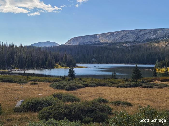
Overview Adventurers love sleeping under the towering trees and night sky of the secluded Brooklyn Lake Campground in the mountains of southeastern Wyoming. Located eight miles northwest of Centennial, Wyoming, the facility is situated along a small, picturesque lake at an elevation of 10,500 feet. This campground will have a mix of reservation sites and first-come, first-served sites for the 2024 season. If you are not reserving your site, you may be able to pay for your campsite(s) by cash or check once you are at the campground. Recreation Popular activities include hiking, fishing and non-motorized boating. The 36-acre lake is a nice canoeing spot with calm water. Non-motorized boats are allowed on Brooklyn Lake with carry-down access for small recreational watercrafts. There is no boat ramp and trailered vessels cannot be used at this location. Fishing is good for brook trout. From the campground, hikers can access the Sheep Lake and Lost Lake Trails. Sheep Lake Trail also allows horseback riding. Facilities Popular activities include hiking, fishing and non-motorized boating. The 36-acre lake is a nice canoeing spot with calm water. Non-motorized boats are allowed on Brooklyn Lake with carry-down access for small recreational watercrafts. There is no boat ramp and trailered vessels cannot be used at this location. Fishing is good for brook trout. From the campground, hikers can access the Sheep Lake and Lost Lake Trails. Sheep Lake Trail also allows horseback riding. Natural Features The scenery at Brooklyn Lake can't be beat. Pine forests and grasslands surround the lake, and the snow-capped Browns Peak protrudes into the crisp, blue summer sky. The Medicine Bow-Routt National Forests and Thunder Basin National Grassland encompass nearly 3 million acres from central and northeastern Wyoming to north-central Colorado. Black bear, bobcat, coyote, elk, mule deer and moose are just some of the many animals that inhabit these rich and diverse lands. Nearby Attractions Visitors can find many more outdoor opportunities in the surrounding national forests and grasslands, including hiking, biking, camping, horseback riding, fishing, hunting, sightseeing and winter sports.
View details →
Overview Hidden Valley Group Picnic Site offers a large open space, surrounded by scenic forests, for groups of up to 300 people to gather amidst a beautiful outdoor setting. This is an excellent facility for family reunions, weddings and large outdoor sporting events and can be used as an overnight campground as well. Recreation Volleyball and kickball are popular at this site, but guests must bring their own volleyball. Facilities Volleyball and kickball are popular at this site, but guests must bring their own volleyball. Natural Features The picnic site lies just east of Laramie, Wyoming, at an elevation of 8,636 feet. The Medicine Bow-Routt National Forests and Thunder Basin National Grassland encompass nearly 3 million acres from central and northeastern Wyoming to north-central Colorado. Lodgepole pine, aspen, fir, spruce, and shrubs dominate the landscape of the national forests. The Grassland boasts numerous species of grasses and wildflowers that add color to the landscape during warmer months. Black bear, bobcat, coyote, elk, mule deer, and moose are just some of the many animals that inhabit these rich and diverse lands. Nearby Attractions Many more outdoor opportunities exist in the surrounding national forests and grasslands, including hiking, biking, camping, horseback and off-road vehicle riding, fishing, hunting, sightseeing, and winter sports.
View details →
Overview This is a large, RV-friendly campground. The sound of the North Fork of the Little Laramie River can be heard throughout most of the campground. The facility is popular for RV camping, fishing, hiking, and mountain biking. Recreation Mountain bikers and hikers have the ease of accessing the scenic, well-known North Fork Trail #390 from the campground. Visitors who would like a more leisurely experience can drive the scenic Highway 130 or take in the view at the North Fork Overlook nearby. Anglers can fish for trout in the clear mountain waters of the North Fork of the Little Laramie. Facilities Mountain bikers and hikers have the ease of accessing the scenic, well-known North Fork Trail #390 from the campground. Visitors who would like a more leisurely experience can drive the scenic Highway 130 or take in the view at the North Fork Overlook nearby. Anglers can fish for trout in the clear mountain waters of the North Fork of the Little Laramie. Natural Features Located at an elevation of 9,200 feet, the campground sits in a thick forest of lodgepole pine and spruce. The sound of the Little Laramie River can be heard from most campsites. The Medicine Bow-Routt National Forests and Thunder Basin National Grassland encompass nearly 3 million acres from central and northeastern Wyoming to north-central Colorado. Black bear, bobcat, coyote, elk, mule deer and moose are just some of the many animals that inhabit these rich and diverse lands. Nearby Attractions Visitors can find many more outdoor opportunities in the surrounding national forests and grasslands, including hiking, biking, camping, horseback and off-road vehicle riding, fishing, hunting, sightseeing and winter sports.
View details →
Overview Ryan Park Campground is located at 8,009 ft elevation on the Snowy Range Scenic Byway near Saratoga, Wyoming. The campground is next to Barrett Creek in the Medicine Bow National Forest and features 49 campsites (13 RV pull-through sites) and 1 group campsite. Sites feature picnic tables and fire grates, and toilets, potable water, and trash services are accessible during the summer season. Pets are allowed but must be kept on a leash no longer than 6 ft at all times. In addition to exploring the historic sites, visitors can enjoy hiking, mountain biking, fishing, picnicking (also available at nearby Mirror Lake), horseback riding and wildlife viewing. The Civilian Conservation Corps used this site as a prisoner of war camp in the 1930s. Although little remains, visitors can learn more from the historic interpretive signs at the campground. Recreation The Snowy Range area in the Medicine Bow National Forest is located in southeast Wyoming. The Laramie Ranger District, Brush Creek/Hayden Ranger District, and Parks Ranger District manage portions of the Snowy Range. Year-round recreation uses include hiking, fishing, hunting, snowmobiling, skiing, OHV riding, camping, and biking. Primary access across the Snowy Range is by Highway 130, known as the Snowy Range Scenic Byway. Mountain Biking Areas for Mountain Biking at Snowy Range Area Bow River Campground Deep Creek Campground French Creek Campground French Creek Canyon Trail Keystone Cabins Lake Owen Trailhead Little Brooklyn Guard Station Little Laramie Trailhead North Fork Campground Pinkham Mountain Trailhead Rock Creek Trailhead Sheep Lake Trailhead Snow Survey Cabin Spruce Mountain Fire Lookout Tie Hack Lower Trailhead Tie Hack Upper Trailhead Tipple Trail Trailhead Mountain Climbing Areas for Mountain Climbing at Snowy Range Area Lewis Lake Picnic Site Libby Lake Picnic Site Day Hiking Areas for Day Hiking at Snowy Range Area Brooklyn Lake Campground Brush Creek Trails Chimney Park Trailhead Corner Mountain Trailhead Crater Lake Trailhead Deep Creek Campground Deep Lake Trail Dipper Lake Trail French Creek Campground French Creek Canyon Trail Green Rock Parking Lot Green Rock Picnic Site Keystone Cabins Lake Owen Trailhead Lakes Trailhead Lewis Lake Picnic Site Libby Lake Picnic Site Little Brooklyn Guard Station Little Laramie Trailhead Meadow Falls Trailhead Miner's Cabin Trailhead North Fork Campground Platte River Wilderness Quealy Lake Trailhead Rock Creek Trailhead Routt Access Trailhead Ryan Park Campground Savage Run Wilderness Sheep Lake Trailhead Silver Lake Campground Silver Lake Trailhead Six Mile Trailhead Snow Survey Cabin South Brush Creek Campground Spruce Mountain Fire Lookout Sugarloaf Campground Tie Hack Lower Trailhead Tie Hack Upper Trailhead Tipple Trail Trailhead West Lake Marie Backpacking Areas for Backpacking at Snowy Range Area Crater Lake Trailhead Deep Lake Trail Dipper Lake Trail Lakes Trailhead Lewis Lake Picnic Site Libby Lake Picnic Site Platte River Wilderness Quealy Lake Trailhead Rock Creek Trailhead Savage Run Wilderness Sheep Lake Trailhead Six Mile Trailhead Viewing Wildlife Areas for Viewing Wildlife at Snowy Range Area Brooklyn Lake Campground Keystone Cabins Libby Flats Observation Site Little Brooklyn Guard Station Snow Survey Cabin Spruce Mountain Fire Lookout Tipple Trail Trailhead Facilities The Snowy Range area in the Medicine Bow National Forest is located in southeast Wyoming. The Laramie Ranger District, Brush Creek/Hayden Ranger District, and Parks Ranger District manage portions of the Snowy Range. Year-round recreation uses include hiking, fishing, hunting, snowmobiling, skiing, OHV riding, camping, and biking. Primary access across the Snowy Range is by Highway 130, known as the Snowy Range Scenic Byway. Mountain Biking Areas for Mountain Biking at Snowy Range Area Bow River Campground Deep Creek Campground French Creek Campground French Creek Canyon Trail Keystone Cabins Lake Owen Trailhead Little Brooklyn Guard Station Little Laramie Trailhead North Fork Campground Pinkham Mountain Trailhead Rock Creek Trailhead Sheep Lake Trailhead Snow Survey Cabin Spruce Mountain Fire Lookout Tie Hack Lower Trailhead Tie Hack Upper Trailhead Tipple Trail Trailhead Mountain Climbing Areas for Mountain Climbing at Snowy Range Area Lewis Lake Picnic Site Libby Lake Picnic Site Day Hiking Areas for Day Hiking at Snowy Range Area Brooklyn Lake Campground Brush Creek Trails Chimney Park Trailhead Corner Mountain Trailhead Crater Lake Trailhead Deep Creek Campground Deep Lake Trail Dipper Lake Trail French Creek Campground French Creek Canyon Trail Green Rock Parking Lot Green Rock Picnic Site Keystone Cabins Lake Owen Trailhead Lakes Trailhead Lewis Lake Picnic Site Libby Lake Picnic Site Little Brooklyn Guard Station Little Laramie Trailhead Meadow Falls Trailhead Miner's Cabin Trailhead North Fork Campground Platte River Wilderness Quealy Lake Trailhead Rock Creek Trailhead Routt Access Trailhead Ryan Park Campground Savage Run Wilderness Sheep Lake Trailhead Silver Lake Campground Silver Lake Trailhead Six Mile Trailhead Snow Survey Cabin South Brush Creek Campground Spruce Mountain Fire Lookout Sugarloaf Campground Tie Hack Lower Trailhead Tie Hack Upper Trailhead Tipple Trail Trailhead West Lake Marie Backpacking Areas for Backpacking at Snowy Range Area Crater Lake Trailhead Deep Lake Trail Dipper Lake Trail Lakes Trailhead Lewis Lake Picnic Site Libby Lake Picnic Site Platte River Wilderness Quealy Lake Trailhead Rock Creek Trailhead Savage Run Wilderness Sheep Lake Trailhead Six Mile Trailhead Viewing Wildlife Areas for Viewing Wildlife at Snowy Range Area Brooklyn Lake Campground Keystone Cabins Libby Flats Observation Site Little Brooklyn Guard Station Snow Survey Cabin Spruce Mountain Fire Lookout Tipple Trail Trailhead Natural Features The campground is situated in a mountainous area along Barrett Creek in the Medicine Bow National Forest. The surrounding forest consists of evergreen trees and aspen that turn golden in fall. The Medicine Bow-Routt National Forests and Thunder Basin National Grassland encompass nearly 3 million acres from central and northeastern Wyoming to north-central Colorado. Black bear, bobcat, coyote, elk, mule deer and moose are just some of the many animals that inhabit these rich and diverse lands. Nearby Attractions The historic Brush Creek Visitor Center is located 2.5 miles west of the campground and provides information on various outdoor recreation opportunities, including hiking, biking, camping, horseback and off-road vehicle riding, fishing, hunting, sightseeing and winter sports. Please Call Brush Creek/Hayden Ranger District for Visitor Center Hours. 2171 Highway 130 PO Box 249 Saratoga, WY 82331 Phone: (307) 326-5258 Fax: (307) 326-5250 Hours: 8:30 a.m. - 12 p.m., 1 p.m.- 4:30 p.m., Monday - Friday
View details →
Overview Buckboard Crossing Campground is located on the far northwest shore of Flaming Gorge Reservoir at an elevation of 6,100 feet. Boating, fishing and water skiing are popular activities. Recreation Fishing, boating, canoeing, water skiing and swimming are popular activities on the lake. Campers are offered the convenience of an adjacent boat ramp, marina and fish cleaning station. Buckboard Marina has boat rentals, fuel, slips, fishing licenses, bait and groceries. Facilities Fishing, boating, canoeing, water skiing and swimming are popular activities on the lake. Campers are offered the convenience of an adjacent boat ramp, marina and fish cleaning station. Buckboard Marina has boat rentals, fuel, slips, fishing licenses, bait and groceries. Natural Features The campground is situated in a high desert landscape with sagebrush and a few scattered trees. Natural shade is minimal. Typical weather ranges from warm days to cool nights. Nearby Attractions Flaming Gorge Dam offers guided tours of the working hydroelectric plant and the dam itself; The adjacent visitor center contains area history exhibits.
View details →
Overview Firehole Canyon Campground is located on the far northeastern shore of Flaming Gorge Reservoir within the Flaming Gorge Recreation Area on the Ashley National Forest. Rock Springs, Wyoming, is just 29 miles away. Boating, fishing and water skiing are popular activities. Recreation Fishing, boating, canoeing, water skiing and swimming are popular activities on the lake. Campers are offered the convenience of an adjacent boat ramp and a beach area. Facilities Fishing, boating, canoeing, water skiing and swimming are popular activities on the lake. Campers are offered the convenience of an adjacent boat ramp and a beach area. Natural Features The campground lies in a high desert environment at an elevation of 6,300 feet. Russian olive trees and sagebrush are scattered throughout the site. Shade is minimal. The site affords scenic views of the reservoir and surrounding bluffs and red rock formations. Nearby Attractions Flaming Gorge Dam offers guided tours of the working hydroelectric plant and the dam, and the adjacent visitor center contains area history exhibits.
View details →
Overview Fremont Lake Campground is located on the east shore of pristine Fremont Lake at an elevation of 7,400 feet, just 7 miles northeast of Pinedale, Wyoming, the nearest full-service community. Water sports and fishing are popular activities on the scenic lake. Recreation The lake provides many recreational activities. Anglers enjoy fishing for lake, rainbow and brown trout, as well as kokanee salmon. Visitors also enjoy boating, sailing, canoeing, kayaking and swimming. Facilities The lake provides many recreational activities. Anglers enjoy fishing for lake, rainbow and brown trout, as well as kokanee salmon. Visitors also enjoy boating, sailing, canoeing, kayaking and swimming. Natural Features Fremont Lake sits at the foot of the rugged Wind River Range, known for its craggy granite peaks and sparkling glacial lakes. The campground is situated on a forested hillside above the lake. Aspen, Douglas fir, juniper and a dense understory provide shade and privacy between campsites. Nearby Attractions The Museum of the Mountain Man in Pinedale features a large collection of Rocky Mountain fur trade era artifacts. Exhibits include American Indian and Mountain Man displays, as well as history of the settlement of Sublette County, Wyoming.
View details →
Overview Located just 24 miles north of Pinedale, New Fork Group Campground includes large picnic tables, BBQ stands, a fire ring, and a double vault toilet for your large party needs. Just a short hike away is New Fork Lake, which offers great boating, canoeing and swimming. Anglers fish for kokanee salmon, brook, lake and rainbow trout. A boat ramp is located approximately one mile from the group site. There is no drinking water available and proper food storage is required. Recreation The 1,070-acre New Fork Lake offers great boating, canoeing and swimming. Anglers fish for kokanee salmon and brook, lake and rainbow trout. A large cement boat ramp is located a mile and a half from the campground, at the lake's northwestern shore. New Fork Trail, for hiking and horseback riding, begins at the entrance to the neighboring Narrows Campground (2.5 miles away). The trail provides back country access through New Fork Canyon into the Bridger Wilderness, and connects with several other trails. Horse corrals are located at the trailhead. Facilities The 1,070-acre New Fork Lake offers great boating, canoeing and swimming. Anglers fish for kokanee salmon and brook, lake and rainbow trout. A large cement boat ramp is located a mile and a half from the campground, at the lake's northwestern shore. New Fork Trail, for hiking and horseback riding, begins at the entrance to the neighboring Narrows Campground (2.5 miles away). The trail provides back country access through New Fork Canyon into the Bridger Wilderness, and connects with several other trails. Horse corrals are located at the trailhead. Natural Features The group site lies in a grassy meadow surrounded by lodgepole pine trees, which provide only very limited shade. As there is no traditional defined parking area, the group site allows for informal camping, gatherings and family affairs. Nearby Attractions Pinedale is 24 miles from the site and is the nearest full-service community.
View details →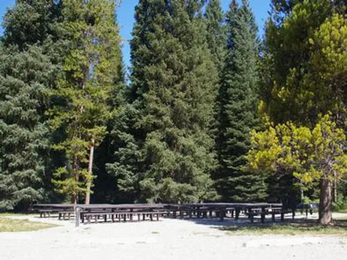
Overview Reunion Flat Campground is located in beautiful Teton Canyon in the Caribou-Targhee National Forest. Hiking, backpacking and horseback riding are popular activities in this scenic region. Recreation The towering Teton Range and Jedediah Smith Wilderness are adjacent to the canyon, offering excellent hiking, backpacking and horseback riding opportunities. Trails begin just up-canyon at Teton Canyon Campground. Teton Creek offers fishing for brook and Yellowstone cutthroat trout. Facilities The towering Teton Range and Jedediah Smith Wilderness are adjacent to the canyon, offering excellent hiking, backpacking and horseback riding opportunities. Trails begin just up-canyon at Teton Canyon Campground. Teton Creek offers fishing for brook and Yellowstone cutthroat trout. Natural Features The campground is situated along Teton Creek in a forest of pine, spruce, fir and the occasional aspen, which provides partial shade. Vibrant summer wildflowers dot the landscape. A variety of wildlife makes its home in the area, including moose and deer. Nearby Attractions Popular activities in the area include the Teton Valley Summer Festival over the Fourth of July in Driggs, Idaho, complete with a hot air balloon festival, parade, rodeo, bike races and antique and craft booths. Grand Targhee Resort is nearby and hosts annual music festivals, including Targhee Fest in mid-July and Targhee Bluegrass Festival in mid-August. The resort also offers lift-served hiking and mountain biking, scenic lift rides, guided horseback riding, a climbing wall and an 18-hole disc golf course. Grand Teton and Yellowstone National Parks are both within a few hour's drive.
View details →
Overview Teton Canyon Campground is located in beautiful Teton Canyon at an elevation of approximately 6,500 feet. Driggs, Idaho is just 11 miles away. Hiking, backpacking and horseback riding are popular activities in this scenic region. Recreation The towering Teton Range and Jedediah Smith Wilderness are adjacent to the canyon. Excellent hiking, backpacking and horseback riding opportunities abound, with trails leaving from the campground. A horse staging area is located at the trailhead parking area. Teton Creek runs alongside the campground. Fly-fishermen love casting for brook and Yellowstone cutthroat trout. Facilities The towering Teton Range and Jedediah Smith Wilderness are adjacent to the canyon. Excellent hiking, backpacking and horseback riding opportunities abound, with trails leaving from the campground. A horse staging area is located at the trailhead parking area. Teton Creek runs alongside the campground. Fly-fishermen love casting for brook and Yellowstone cutthroat trout. Natural Features The campground is situated along Teton Creek, with partial views of the nearby Teton Range. A dense forest of pine, spruce and fir covers half of the campground, providing nice shade. The other half of the campground is more open, with aspens and pines dotting the summer wildflower-filled meadows. A variety of wildlife makes its home in the area, including moose and deer. Nearby Attractions Popular activities in the area include the Teton Valley Summer Festival over the Fourth of July in Driggs, complete with a hot air balloon festival, parade, rodeo, bike races and antique and craft booths. Grand Targhee Resort is nearby and hosts outstanding annual music festivals: Targhee Fest is in mid-July; Targhee Bluegrass Festival is in mid-August. The resort also offers lift-served hiking and mountain biking, scenic lift rides, guided horseback riding, a climbing wall and an 18-hole disc golf course. A disc golf tournament is held annually in late July. Grand Teton and Yellowstone National Parks are both within a few hours drive.
View details →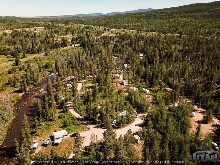
Overview Stillwater Campground is located 32 miles from Evanston, Wyoming, just off the Mirror Lake Scenic Byway at an elevation of 8,500 feet. The confluence of the Stillwater Fork and Hayden Fork is just outside the campground, providing great fishing opportunities. The byway cuts through the Uinta Mountains, which are known for their abundant recreational opportunities and scenic beauty. Recreation Fly-fishing for cutthroat and brook trout is a very popular activity on both the Stillwater and Hayden Forks. Numerous hiking, biking, horseback and off-road vehicle riding trails crisscross this beautiful region. Facilities Fly-fishing for cutthroat and brook trout is a very popular activity on both the Stillwater and Hayden Forks. Numerous hiking, biking, horseback and off-road vehicle riding trails crisscross this beautiful region. Natural Features The campground is situated along the Stillwater Fork among a thin forest of pine and aspen trees, which provide only limited shade. Summer wildflowers and grasses dot the landscape. contact_info For facility specific information, please call (385) 273-1100. Nearby Attractions Mirror Lake Scenic Byway parallels the Lower Provo River as it snakes across a portion of the Uinta Mountains, leading to numerous high alpine lakes and streams, countless trails, breathtaking scenic viewpoints and various campgrounds. Fishing, canoeing, hiking, backpacking, horseback riding and biking are popular activities. The High Uintas Wilderness can be accessed from several trails along the byway. Charges & Cancellations Change and Cancellation Policies and Fees Overnight and Day Use Facilities: To ensure fairness, reservation arrival or departure dates may not be changed beyond the booking window until 18 days after booking the reservation. Camping / Day Use: A $10.00 service fee will apply if you change or cancel your reservation (including campsites, cabins, lookouts, group facilities, etc.). The $10.00 service fee will be deducted from the refund amount. You can cancel or change reservations through Recreation.gov or by calling 1-877-444-6777. Late Cancellations Overnight and Day Use Facilities: Late cancellations are those cancelled between 12:01 a.m. (Eastern) on the day before arrival and check out time on the day after arrival. Individual Campsites: If a customer cancels a reservation the day before or on the day of arrival they will be charged a $10.00 service fee and will also forfeit the first night's use fee (not to exceed the total paid for the original reservation). Cancellations for a single night's reservation will forfeit the entire use fee but no cancellation fee will apply. Cabins / Lookouts: Customers will be charged a $10.00 cancellation fee and forfeit the first night's use fee if a cabin or lookout reservation is cancelled within 14 days of the scheduled arrival date. Cancellations for a single night's use will not be assessed a service fee. Group Facility: If a customer cancels a group overnight facility reservation within 14 days of the scheduled arrival date they will be charged the $10.00 service fee and forfeit the first night's use fee. Cancellations for a single night's use will not be assessed a service fee. Group Day Use Area: If a customer cancels a group day use facility reservation within 14 days of the scheduled arrival date, they will forfeit the total day use fee with no service fee charge. No-Shows Camping / Day Use: A camping no-show customer is one who does not arrive at a campground and does not cancel the reservation by check-out time on the day after the scheduled arrival date. Reserved campsites and group overnight facilities will be held until check-out time on the day following your scheduled arrival. Group day-use facilities will be held until check-in time on your scheduled arrival date. If a customer does not arrive at the campground or group facility by check-out time the day after arrival or does not cancel the reservation by the times listed under "Late Cancellations" above, the customer may be assessed a $20.00 service fee and forfeit use fees. Refunds Customers must request refunds no later than 14 days after the scheduled departure date. Recreation.gov will not grant refund requests after 14 days of departure. Reservation Fee: For some facilities, tours or permits an additional reservation fee is charged. For some overnight and day-use facilities, an additional non-refundable reservation fee may apply. The non-refundable reservation fee for tours and tickets is $1.00. The non-refundable reservation fee for permits varies by location. Refunds for Bankcard Purchases: Refunds for bank card payments will be issued as a credit to the original bank card. Refunds for Check or Cash Purchases: Refunds for Recreation.gov payments made by check or money order, and cash payments at selected campgrounds will be issued a check refund. A refund will be processed within 30 days of receipt and approval. Please Note: Refund requests made during or after departure can only be processed when approved by the facility management staff based upon local policy. Refunds for Emergency Closures: In the event of an emergency closure, the Recreation.gov team will attempt to notify users and offer alternate dates (as appropriate). If this is not possible, reservations will be cancelled and all fees paid will be refunded. Reservation fees for free tickets are non-refundable in the event of an emergency closure. Recreation.gov Billing Information Reservation transaction will appear on customer's credit card statements as "Recreation.gov 877-444-6777." Changes to Policies and Procedures Recreation.gov reserves the right, when necessary, to modify reservation policies. These policies were last updated July 2018.
View details →
Overview Lakeview Campground is located on Meadowlark Lake about 50 miles east of Worland, Wyoming on the west side of scenic Cloud Peak Skyway, near the Cloud Peak Wilderness Area. The Bighorn National Forest offers a wide variety of activities, including hiking, fishing, scenic driving and a number of historic sites. The administering organization is Gallatin Canyon Campgrounds; e-mail: gccampgrounds13@gmail.com Recreation Meadowlark Lake covers 325 acres and is open to boating at a wake-less speed, making it a perfect location for canoeing and fishing. Anglers will find rainbow, cutthroat, brown and brook trout in the cool waters of the lake. Off-road vehicle trails, scenic jeep roads, hiking and additional fishing streams are available in the surrounding area. Diverse hikes vary from loop trails to treks along creeks and over mountain peaks; many trails access the Cloud Peak Wilderness. Facilities Meadowlark Lake covers 325 acres and is open to boating at a wake-less speed, making it a perfect location for canoeing and fishing. Anglers will find rainbow, cutthroat, brown and brook trout in the cool waters of the lake. Off-road vehicle trails, scenic jeep roads, hiking and additional fishing streams are available in the surrounding area. Diverse hikes vary from loop trails to treks along creeks and over mountain peaks; many trails access the Cloud Peak Wilderness. Natural Features The campground overlooks scenic Meadowlark Lake, which can be viewed from several sites. A forest of lodgepole pine and Douglas fir trees covers the campground. Many additional lakes and streams are found in the surrounding area. Nearby Attractions The High Park Lookout is located just east of Meadowlark Lake. This old fire lookout was built by the CCC decades ago and is no longer active. A short hike leads to the lookout, where hikers are awarded panoramic views of the surrounding area. West Tensleep Lake is about 10 miles north of Meadowlark Lake and is open to non-motorized craft only. The popular West Tensleep Lake Trail begins here and leads into the Cloud Peak Wilderness. Deer Haven Lodge and Meadowlark Lodge are nearby, offering dining options, lodging, guided horseback riding and fishing and camping supplies. Charges & Cancellations Refunds: Refund requests made through www.recreation.gov will be charged a $10 processing fee. This cancellation processing fee is retained by the reservation service contractor along with the non-refundable reservation fee. All requests for the return of the non-refundable reservation fee and the cancellation processing fee will be declined by the campground concessionaire as they did not receive these fees (these are the fees retained by the reservation contractor, a different entity).
View details →
Overview Sitting Bull Campground is located 51 miles east of Worland, Wyoming on the west side of scenic Cloud Peak Skyway, near the Cloud Peak Wilderness Area. The Bighorn National Forest offers a wide variety of activities, including hiking, fishing, scenic driving and a number of historic sites. The administering organization is Gallatin Canyon Campgrounds; e-mail: gccampgrounds13@gmail.com Recreation Nearby Meadowlark Lake covers 325 acres and is open to boating at a wake-less speed, making it a perfect location for canoeing and fishing. Anglers will find rainbow, cutthroat, brown and brook trout in the cool waters of the lake. Off-road vehicle trails, scenic jeep roads, hiking and additional fishing streams are available in the surrounding area. Diverse hikes vary from loop trails to treks along creeks and over mountain peaks; many trails access the Cloud Peak Wilderness. Facilities Nearby Meadowlark Lake covers 325 acres and is open to boating at a wake-less speed, making it a perfect location for canoeing and fishing. Anglers will find rainbow, cutthroat, brown and brook trout in the cool waters of the lake. Off-road vehicle trails, scenic jeep roads, hiking and additional fishing streams are available in the surrounding area. Diverse hikes vary from loop trails to treks along creeks and over mountain peaks; many trails access the Cloud Peak Wilderness. Natural Features Sitting Bull is situated on the edge of a forest of lodgepole pine, adjacent to a beautiful mountain meadow, a prime location for wildlife viewing. Most sites afford expansive views of the surrounding Bighorn Mountains. Nearby Attractions The High Park Lookout is located just east of Meadowlark Lake. This old fire lookout was built by the CCC decades ago and is no longer active. A short hike leads to the lookout, where hikers are awarded panoramic views of the surrounding area. West Tensleep Lake is about 10 miles north of the campground and is open to non-motorized craft only. The popular West Tensleep Lake Trail begins here and leads into the Cloud Peak Wilderness. Deer Haven Lodge and Meadowlark Lodge are nearby, offering dining options, lodging, guided horseback riding and fishing and camping supplies. Charges & Cancellations Refunds: Refund requests made through www.recreation.gov will be charged a $10 processing fee. This cancellation processing fee is retained by the reservation service contractor along with the non-refundable reservation fee. All requests for the return of the non-refundable reservation fee and the cancellation processing fee will be declined by the campground concessionaire as they did not receive these fees (these are the fees retained by the reservation contractor, a different entity).
View details →
Overview West Tensleep Lake Campground is located on West Tensleep Lake on the west side of scenic Cloud Peak Skyway, near the Cloud Peak Wilderness Area. The Bighorn National Forest offers a wide variety of activities, including hiking, fishing, scenic driving and a number of historic sites. The administering organization is Gallatin Canyon Campgrounds; e-mail: gccampgrounds13@gmail.com Recreation West Tensleep Lake covers 125 acres and is open to non-motorized watercraft only, making it a perfect location for canoeing and fishing. Anglers will find rainbow, brown and brook trout in the cool waters of the lake. The popular West Tensleep Lake Trail begins just outside the campground. The trail leads into the Cloud Peak Wilderness, passing Lake Helen, Lake Marion and Misty Moon Lake before climbing to the summit of the 13,167 foot Cloud Peak, the highest peak in the Bighorn Range. Off-road vehicle trails, scenic jeep roads, hiking and horseback riding trails and many fishing streams are available in the surrounding area. Facilities West Tensleep Lake covers 125 acres and is open to non-motorized watercraft only, making it a perfect location for canoeing and fishing. Anglers will find rainbow, brown and brook trout in the cool waters of the lake. The popular West Tensleep Lake Trail begins just outside the campground. The trail leads into the Cloud Peak Wilderness, passing Lake Helen, Lake Marion and Misty Moon Lake before climbing to the summit of the 13,167 foot Cloud Peak, the highest peak in the Bighorn Range. Off-road vehicle trails, scenic jeep roads, hiking and horseback riding trails and many fishing streams are available in the surrounding area. Natural Features The campground is situated on the southern shore of scenic West Tensleep Lake, in an area full of alpine lakes and creeks. A forest of lodgepole pine, Douglas fir and spruce trees covers the area. Nearby Attractions Meadowlark Lake is within a few miles of the campground. This small lake allows motorized craft at a no-wake speed. The High Park Lookout is located just east of Meadowlark Lake. This old fire lookout was built by the CCC decades ago and is no longer active. A short hike leads to the lookout, where hikers are awarded panoramic views of the surrounding area. Deer Haven Lodge and Meadowlark Lodge are nearby, offering dining, lodging, guided horseback riding and fishing and camping supplies. Charges & Cancellations Refunds: Refund requests made through www.recreation.gov will be charged a $10 processing fee. This cancellation processing fee is retained by the reservation service contractor along with the non-refundable reservation fee. All requests for the return of the non-refundable reservation fee and the cancellation processing fee will be declined by the campground concessionaire as they did not receive these fees (these are the fees retained by the reservation contractor, a different entity).
View details →
Overview Willow Park is located about 50 miles east of Worland, Wyoming on the west side of scenic Cloud Peak Skyway, near the Cloud Peak Wilderness Area. The Bighorn National Forest offers a wide variety of activities, including hiking, fishing, scenic driving and a number of historic sites. The administering organization is Gallatin Canyon Campgrounds; e-mail: office@ceicamp.com Recreation Off-road vehicle trails, scenic jeep roads, hiking and additional fishing streams are available in the surrounding area. Diverse hikes vary from loop trails to treks along creeks and over mountain peaks; many trails access the Cloud Peak Wilderness. Meadowlark Lake is within a couple miles of the campground. This small lake allows motorized craft at a no-wake speed. West Tensleep Lake, a few miles north of the campground, is open to non-motorized craft only. Facilities Off-road vehicle trails, scenic jeep roads, hiking and additional fishing streams are available in the surrounding area. Diverse hikes vary from loop trails to treks along creeks and over mountain peaks; many trails access the Cloud Peak Wilderness. Meadowlark Lake is within a couple miles of the campground. This small lake allows motorized craft at a no-wake speed. West Tensleep Lake, a few miles north of the campground, is open to non-motorized craft only. Natural Features The campground is situated in an open meadow surrounded by a forest of lodgepole pine. Many lakes and streams are found throughout the Bighorn Mountains. Nearby Attractions The James T. Saban Lookout is located just east of Meadowlark Lake. This old fire lookout was built by the CCC decades ago and is no longer active. A short hike leads to the lookout, where hikers are awarded panoramic views of the surrounding area. Deer Haven Lodge and Meadowlark Lodge are nearby, offering dining options, lodging, and fishing and camping supplies. Charges & Cancellations Refunds: Refund requests made through www.recreation.gov will be charged a $10 processing fee. This cancellation processing fee is retained by the reservation service contractor along with the non-refundable reservation fee. All requests for the return of the non-refundable reservation fee and the cancellation processing fee will be declined by the campground concessionaire as they did not receive these fees (these are the fees retained by the reservation contractor, a different entity).
View details →
Overview Hunter Trailhead is a campground constructed with the equestrian camper in mind, but available for all users. The campground is located in Johnson Country, Wyoming, just two miles off the Cloud Peak Scenic Byway on Highway 16. The winding drive to the campground travels two miles west of U.S. Highway 16 on Forest Road 19 and is an easily accessible gravel road offering views of wildlife, mountain streams, and abundant wildflowers. Recreation Rising between the Powder River and Big Horn Basins, this scenic country offers year round recreation connecting visitors to a land rich in history and solitude. For centuries, the mountain landscape has provided renewal for Native Americans, homesteaders and modern day explorers creating a human connection with this spectacular place. The Hunter Trailhead provides numerous hiking and horse friendly trails to access front-country, the Cloud Peak Wilderness as well as the Rock Creek Recommended Wilderness Area. The surrounding Bighorn National Forest offers a wide variety of activities, including hiking, fishing, scenic driving, wildlife and a number of historic sites. Facilities Rising between the Powder River and Big Horn Basins, this scenic country offers year round recreation connecting visitors to a land rich in history and solitude. For centuries, the mountain landscape has provided renewal for Native Americans, homesteaders and modern day explorers creating a human connection with this spectacular place. The Hunter Trailhead provides numerous hiking and horse friendly trails to access front-country, the Cloud Peak Wilderness as well as the Rock Creek Recommended Wilderness Area. The surrounding Bighorn National Forest offers a wide variety of activities, including hiking, fishing, scenic driving, wildlife and a number of historic sites. Natural Features No region in Wyoming is provided with a more diverse landscape - from lush grasslands to alpine meadows, from crystal-clear lakes to glacially-carved valleys, from rolling hills to sheer mountain walls. The campground is situated high in the Bighorn Mountains in northern Wyoming, at an elevation of 7,800 feet, so be prepared for all types of weather. A dense forest of lodgepole pine is the dominant vegetative cover. Nearby Attractions Tie Hack Reservoir is a 15-minute drive southeast of the campground. The scenic lake offers a great location for canoeing and fishing. Anglers there cast for rainbow, cutthroat, brown and brook trout.
View details →
Overview Prune Creek Campground is located along the Bighorn Scenic Byway (U.S. Highway 14) near the Burgess Junction at an elevation of 7,700 feet. The Bighorn National Forest offers a wide variety of activities, including hiking, fishing, scenic driving and a number of historic sites. The administering organization is Gallatin Canyon Campgrounds; e-mail: gccampgrounds13@gmail.com Recreation Off-road vehicle trails, scenic jeep roads, hiking, fishing and canoeing are available in the surrounding area. Diverse hikes vary from loop trails to treks along creeks and over mountain peaks; many trails access the Cloud Peak Wilderness. Nearby Sibley Lake is open to non-motorized craft and offers an accessible fishing dock on the shoreline. Anglers fish for rainbow, brown and brook trout. Facilities Off-road vehicle trails, scenic jeep roads, hiking, fishing and canoeing are available in the surrounding area. Diverse hikes vary from loop trails to treks along creeks and over mountain peaks; many trails access the Cloud Peak Wilderness. Nearby Sibley Lake is open to non-motorized craft and offers an accessible fishing dock on the shoreline. Anglers fish for rainbow, brown and brook trout. Natural Features The campground is situated on the banks of the South Fork Tongue River in the Bighorn Mountains, where craggy granite peaks rise over 13,000 feet above sea level. A forest of lodgepole pines covers the area, creating excellent wildlife habitat. Nearby Attractions Shell Falls Visitor Center, at the overlook of Shell Falls, is about 23 miles southwest. This center offers interpretive trails, scenic views, and educational displays about natural features such as flora and fauna and area history. The Medicine Wheel National Historic Landmark is about 28 miles from the campground. This unique geoglyph signifies all creation, all races of people, birds, fish, animals, trees and stones. According to tribal beliefs, the circular shape of the wheel represents the earth, sun, moon, the cycles of life, seasons and day to night. Arrowhead Lodge, Bear Lodge and Elk View Inn are nearby, offering off-road vehicle rentals and fishing supplies, as well as dining options and general stores. Charges & Cancellations Refunds: Refund requests made through www.recreation.gov will be charged a $10 processing fee. This cancellation processing fee is retained by the reservation service contractor along with the non-refundable reservation fee. All requests for the return of the non-refundable reservation fee and the cancellation processing fee will be declined by the campground concessionaire as they did not receive these fees (these are the fees retained by the reservation contractor, a different entity).
View details →
Overview Bald Mountain Campground is located along the Medicine Wheel Passage Scenic Byway (U.S. Highway 14A), 33 miles east of Lovell, Wyoming. The Medicine Wheel National Historic Landmark is nearby. Visitors enjoy the area for its scenic natural beauty and recreational opportunities. The administering organization is Gallatin Canyon Campgrounds; e-mail: office@ceicamp.com Recreation From the area's historic mining sites to the ancient Native American Medicine Wheel, to hiking through open meadows and along the cliffs on the west rim of the mountains, the Bighorn National Forest offers many recreational opportunities. Jaws Trailhead is near the campground, offering access to Bucking Mule Falls Trail and Porcupine Creek. Scenic off-road driving is available on Hunt Mountain Road or Burgess Overlook jeep trail. Facilities From the area's historic mining sites to the ancient Native American Medicine Wheel, to hiking through open meadows and along the cliffs on the west rim of the mountains, the Bighorn National Forest offers many recreational opportunities. Jaws Trailhead is near the campground, offering access to Bucking Mule Falls Trail and Porcupine Creek. Scenic off-road driving is available on Hunt Mountain Road or Burgess Overlook jeep trail. Natural Features Bald Mountain is part of the Bighorn Range in northern Wyoming. A forest of pine and aspen covers the campground, which sits near top of the mountain at an elevation of 9,200 feet. Small creeks wind through the campground and temperatures can drop significantly once the sun goes down. Nearby Attractions The Medicine Wheel National Historic Landmark is 4 miles from the campground. This unique geoglyph signifies all creation, all races of people, birds, fish, animals, trees and stones. According to tribal beliefs, the circular shape of the wheel represents the earth, sun, moon, cycles of life, seasons and day to night. High Country Lodge is nearby, offering guided horseback riding and backcountry pack trips, off-road vehicle rentals and guided fishing trips. Charges & Cancellations Refunds: Refund requests made through www.recreation.gov will be charged a $10 processing fee. This cancellation processing fee is retained by the reservation service contractor along with the non-refundable reservation fee. All requests for the return of the non-refundable reservation fee and the cancellation processing fee will be declined by the campground concessionaire as they did not receive these fees (these are the fees retained by the reservation contractor, a different entity).
View details →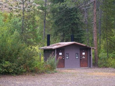
Overview Station Creek Campground is located in beautiful Snake River Canyon, just 27 miles southwest of Jackson, in western Wyoming. It sits at an elevation of 5,800 feet. Visitors enjoy fishing and whitewater rafting on the Snake River. Recreation Fly-fishing for cutthroat, rainbow and brown trout is a popular activity on the Snake, as is whitewater rafting and kayaking. A boat ramp is nearby. Facilities Fly-fishing for cutthroat, rainbow and brown trout is a popular activity on the Snake, as is whitewater rafting and kayaking. A boat ramp is nearby. Natural Features The campground is situated in a forest of lodgepole pines, which provide partial shade throughout the campground. Summer wildflowers are abundant in the area. The Snake River can be accessed across the road and down an embankment. Nearby Attractions The city of Jackson is 25 miles north of the campground, offering restaurants, groceries, shops, galleries and ski resorts with summer activities. Grand Teton National Park is approximately 40 miles north, providing opportunities for boating, fishing, hiking, canoeing and outstanding mountain scenery.
View details →
Overview Little Cottonwood Group Campground is located in beautiful Snake River Canyon, just 30 miles southwest of Jackson, in western Wyoming. It sits at an elevation of 5,700 feet. Visitors enjoy fishing and whitewater rafting on the adjacent Snake River. Recreation Fly-fishing for cutthroat, rainbow and brown trout is a popular activity on the Snake, as is whitewater rafting and kayaking. A boat ramp is nearby. Facilities Fly-fishing for cutthroat, rainbow and brown trout is a popular activity on the Snake, as is whitewater rafting and kayaking. A boat ramp is nearby. Natural Features The campground is situated in a forest of pine and aspen trees, which provide partial shade. Summer wildflowers are abundant. The Snake River is below the campground, down the hillside. Nearby Attractions The city of Jackson is about 25 miles north, offering restaurants, groceries, shops, galleries and ski resorts with summer activities. Grand Teton National Park is approximately 40 miles north of the campground. It provides opportunities for boating, fishing, hiking, canoeing and outstanding mountain scenery.
View details →
Overview Narrows Campground is located next to scenic New Fork Lake, at the edge of the Wind River Range in northwestern Wyoming. Visitors enjoy hiking and horseback riding into the adjacent Bridger Wilderness, as well as boating and fishing on the lake. Recreation New Fork Lake offers great boating, canoeing and swimming. Anglers fish for kokanee salmon, brook, lake and rainbow trout. A large cement boat ramp is located less than one mile from the campground. New Fork Trail, for hiking and horseback riding, begins at the campground entrance and provides back country access through New Fork Canyon into the Bridger Wilderness. The trail also connects with several other trails in the area. Horse corrals are located at the trailhead. Facilities New Fork Lake offers great boating, canoeing and swimming. Anglers fish for kokanee salmon, brook, lake and rainbow trout. A large cement boat ramp is located less than one mile from the campground. New Fork Trail, for hiking and horseback riding, begins at the campground entrance and provides back country access through New Fork Canyon into the Bridger Wilderness. The trail also connects with several other trails in the area. Horse corrals are located at the trailhead. Natural Features The campground is situated above New Fork Lake, in a dense grove of aspens, at an elevation of 7,800 feet. Shade is plentiful in most sites throughout the campground. Most sites afford scenic lake views. Summer wildflowers vividly carpet the campground. A variety of wildlife makes its home around the lake. Nearby Attractions Pinedale is 26 miles away and is the nearest full-service community.
View details →
Overview Clearwater Campground is located along the Buffalo Bill Scenic Byway, about 32 miles west of Cody, in northwestern Wyoming. It is 20 miles east of the east entrance to Yellowstone National Park. The surrounding area offers many outdoor recreational opportunities, including fishing, hiking and viewing local wildlife. Recreation Great opportunities for hiking, fishing, scenic driving and wildlife viewing are available around the campground. The North Fork of the Shoshone River is a popular fly-fishing location for rainbow and Yellowstone cutthroat trout. Facilities Great opportunities for hiking, fishing, scenic driving and wildlife viewing are available around the campground. The North Fork of the Shoshone River is a popular fly-fishing location for rainbow and Yellowstone cutthroat trout. Natural Features The campground is situated on the banks of the North Fork of the Shoshone River and has beautiful views of the surrounding mountains. Douglas fir and large juniper trees cover the campground, which sits at an elevation of 6,000 feet. A wide variety of wildlife lives in the area. Visitors often glimpse grizzly bears, deer, elk, bison, moose, fox, coyotes and bald eagles. Nearby Attractions Pahaska Tepee, west of the campground, is home to Buffalo Bill's original hunting lodge, built in 1904. Tours are offered daily between Memorial Day and Labor Day. Pahaska also offers guided horseback rides, a gift shop, restaurant and lodging. Yellowstone National Park's east entrance is 25 miles from the campground via the Buffalo Bill Cody Scenic Byway. The park offers unparalleled wildlife viewing opportunities, as well as breathtaking scenery and unique geological features. The small, historic city of Cody offers a variety of dining, lodging and shopping options. The Buffalo Bill Historical Center offers extensive displays of Greater Yellowstone natural history, Plains Indians artifacts, western art, firearms, Buffalo Bill memorabilia and a wild sheep exhibit.
View details →
Overview Threemile Campground is located just three miles from the east entrance of Yellowstone National Park, and 50 miles from the full service gateway community of Cody, in northwestern Wyoming. The area is an ideal destination for a family getaway, with many opportunities for outdoor recreation. Hard-sided camp trailers and RVs are required. Recreation Great opportunities for hiking, fishing, scenic driving and wildlife viewing are available around the campground. The North Fork of the Shoshone River is a popular fly-fishing location for rainbow and Yellowstone cutthroat trout. The nearby Pahaska Trail provides access into the North Absaroka Wilderness Area. Facilities Great opportunities for hiking, fishing, scenic driving and wildlife viewing are available around the campground. The North Fork of the Shoshone River is a popular fly-fishing location for rainbow and Yellowstone cutthroat trout. The nearby Pahaska Trail provides access into the North Absaroka Wilderness Area. Natural Features The campground is situated along the North Fork of the Shoshone River and has beautiful views of the surrounding mountains. A forest of lodgepole pine covers the campground, which sits at an elevation of 6,700 feet. A wide variety of wildlife lives in the area. Visitors often glimpse grizzly bears, deer, elk, bison, moose, fox, coyotes and bald eagles. Nearby Attractions Pahaska Tepee is just a mile west of the campground. This historic site is home to Buffalo Bill's original hunting lodge, built in 1904. Tours are offered daily between Memorial Day and Labor Day. Pahaska also offers guided horseback rides, a gift shop, restaurant and lodging. Yellowstone National Park's east entrance is three miles from the campground via the Buffalo Bill Cody Scenic Byway. The park offers unparalleled wildlife viewing opportunities, as well as breathtaking scenery and unique geological features. The small, historic city of Cody offers a variety of dining, lodging and shopping options. The Buffalo Bill Historical Center offers extensive displays of Greater Yellowstone natural history, Plains Indians artifacts, western art, firearms, Buffalo Bill memorabilia and a wild sheep exhibit.
View details →
Overview Sulphur Campground is located 39 miles from Evanston, Wyoming, just off the Mirror Lake Scenic Byway at the confluence of Stillwater Fork and Hayden River. Numerous hiking, biking, horse and ATV trails crisscross this beautiful region. Recreation Fishing is very popular on the waterways. Canoeing, hiking, backpacking, horseback riding and biking are popular activities. The High Uintas Wilderness can be accessed via several trails along the Mirror Lake Scenic Byway. A short trail can be accessed from the campground leading to Bourbon Lake. Facilities Fishing is very popular on the waterways. Canoeing, hiking, backpacking, horseback riding and biking are popular activities. The High Uintas Wilderness can be accessed via several trails along the Mirror Lake Scenic Byway. A short trail can be accessed from the campground leading to Bourbon Lake. Natural Features Sulphur Campground sits at an elevation of 9,100 feet. Pines and aspens provide limited shade, and summer wildflowers dot the area. The Hayden Fork of the Bear River runs next to the campground. These and other streams lead to numerous high alpine lakes and fishing holes, countless trails, breathtaking scenic viewpoints and various campgrounds. contact_info For facility specific information, please call (385) 273-1100. Nearby Attractions The 65-mile Mirror Lake Scenic Byway parallels the Lower Provo River as it snakes across a portion of the Uinta Mountains. Charges & Cancellations Change and Cancellation Policies and Fees Overnight and Day Use Facilities: To ensure fairness, reservation arrival or departure dates may not be changed beyond the booking window until 18 days after booking the reservation. Camping / Day Use: A $10.00 service fee will apply if you change or cancel your reservation (including campsites, cabins, lookouts, group facilities, etc.). The $10.00 service fee will be deducted from the refund amount. You can cancel or change reservations through Recreation.gov or by calling 1-877-444-6777. Late Cancellations Overnight and Day Use Facilities: Late cancellations are those cancelled between 12:01 a.m. (Eastern) on the day before arrival and check out time on the day after arrival. Individual Campsites: If a customer cancels a reservation the day before or on the day of arrival they will be charged a $10.00 service fee and will also forfeit the first night's use fee (not to exceed the total paid for the original reservation). Cancellations for a single night's reservation will forfeit the entire use fee but no cancellation fee will apply. Cabins / Lookouts: Customers will be charged a $10.00 cancellation fee and forfeit the first night's use fee if a cabin or lookout reservation is cancelled within 14 days of the scheduled arrival date. Cancellations for a single night's use will not be assessed a service fee. Group Facility: If a customer cancels a group overnight facility reservation within 14 days of the scheduled arrival date they will be charged the $10.00 service fee and forfeit the first night's use fee. Cancellations for a single night's use will not be assessed a service fee. Group Day Use Area: If a customer cancels a group day use facility reservation within 14 days of the scheduled arrival date, they will forfeit the total day use fee with no service fee charge. No-Shows Camping / Day Use: A camping no-show customer is one who does not arrive at a campground and does not cancel the reservation by check-out time on the day after the scheduled arrival date. Reserved campsites and group overnight facilities will be held until check-out time on the day following your scheduled arrival. Group day-use facilities will be held until check-in time on your scheduled arrival date. If a customer does not arrive at the campground or group facility by check-out time the day after arrival or does not cancel the reservation by the times listed under "Late Cancellations" above, the customer may be assessed a $20.00 service fee and forfeit use fees. Refunds Customers must request refunds no later than 14 days after the scheduled departure date. Recreation.gov will not grant refund requests after 14 days of departure. Reservation Fee: For some facilities, tours or permits an additional reservation fee is charged. For some overnight and day-use facilities, an additional non-refundable reservation fee may apply. The non-refundable reservation fee for tours and tickets is $1.00. The non-refundable reservation fee for permits varies by location. Refunds for Bankcard Purchases: Refunds for bank card payments will be issued as a credit to the original bank card. Refunds for Check or Cash Purchases: Refunds for Recreation.gov payments made by check or money order, and cash payments at selected campgrounds will be issued a check refund. A refund will be processed within 30 days of receipt and approval. Please Note: Refund requests made during or after departure can only be processed when approved by the facility management staff based upon local policy. Refunds for Emergency Closures: In the event of an emergency closure, the Recreation.gov team will attempt to notify users and offer alternate dates (as appropriate). If this is not possible, reservations will be cancelled and all fees paid will be refunded. Reservation fees for free tickets are non-refundable in the event of an emergency closure. Recreation.gov Billing Information Reservation transaction will appear on customer's credit card statements as "Recreation.gov 877-444-6777." Changes to Policies and Procedures Recreation.gov reserves the right, when necessary, to modify reservation policies. These policies were last updated July 2018.
View details →
Overview Boulder Park Campground is located about 50 miles east of Worland, Wyoming on the west side of scenic Cloud Peak Skyway, near the Cloud Peak Wilderness area. The Bighorn National Forest offers a wide variety of activities, including hiking, fishing, scenic driving and a number of historic sites. The administering organization is Gallatin Canyon Campgrounds; e-mail: gccampgrounds13@gmail.com Recreation Off-road vehicle trails, scenic jeep roads, hiking and additional fishing streams are available in the surrounding area. Diverse hikes vary from loop trails to treks along creeks and over mountain peaks; many trails access the Cloud Peak Wilderness. Meadowlark Lake is within a couple miles of the campground. This small lake allows motorized craft at a wake-less speed. West Tensleep Lake, a few miles north of the campground, is open to non-motorized craft only. Both lakes are great locations for canoeing and fishing. Facilities Off-road vehicle trails, scenic jeep roads, hiking and additional fishing streams are available in the surrounding area. Diverse hikes vary from loop trails to treks along creeks and over mountain peaks; many trails access the Cloud Peak Wilderness. Meadowlark Lake is within a couple miles of the campground. This small lake allows motorized craft at a wake-less speed. West Tensleep Lake, a few miles north of the campground, is open to non-motorized craft only. Both lakes are great locations for canoeing and fishing. Natural Features The campground sits on the banks of West Tensleep Creek in an open meadow surrounded by a forest of lodgepole pine. Many lakes and streams are found in the surrounding Bighorn Mountains. Nearby Attractions The High Park Lookout is located just east of Meadowlark Lake. This old fire lookout was built by the CCC decades ago and is no longer active. A short hike leads to the lookout, where hikers are awarded panoramic views of the surrounding area. Deer Haven Lodge and Meadowlark Lodge are nearby, offering dining options, lodging, guided horseback riding and fishing and camping supplies. Charges & Cancellations Refunds: Refund requests made through www.recreation.gov will be charged a $10 processing fee. This cancellation processing fee is retained by the reservation service contractor along with the non-refundable reservation fee. All requests for the return of the non-refundable reservation fee and the cancellation processing fee will be declined by the campground concessionaire as they did not receive these fees (these are the fees retained by the reservation contractor, a different entity).
View details →
Overview Hettinger Group Campground is located 14 miles west of Buffalo, Wyoming on the east side of scenic Cloud Peak Skyway, near the Cloud Peak Wilderness Area. The surrounding Bighorn National Forest offers a wide variety of activities, including hiking, fishing, scenic driving and a number of historic sites. The administering organization is Gallatin Canyon Campgrounds; e-mail: gccampgrounds13@gmail.com Recreation Tie Hack Reservoir is a short drive away, offering a great location for canoeing and fishing. Anglers cast for rainbow, cutthroat, brown and brook trout. A short trail leads from the campground to the lake. The Circle Park Trailhead is 3 miles from the campground. This beautiful trail accesses numerous alpine lakes and two 12,000' peaks within the Cloud Peak Wilderness. Many additional hiking trails are available in the area. Scenic off-road driving is available on nearby Elgin Park, Pole Creek and Crazy Woman Canyon Roads. Hiking and mountain biking are allowed on these roads as well. Facilities Tie Hack Reservoir is a short drive away, offering a great location for canoeing and fishing. Anglers cast for rainbow, cutthroat, brown and brook trout. A short trail leads from the campground to the lake. The Circle Park Trailhead is 3 miles from the campground. This beautiful trail accesses numerous alpine lakes and two 12,000' peaks within the Cloud Peak Wilderness. Many additional hiking trails are available in the area. Scenic off-road driving is available on nearby Elgin Park, Pole Creek and Crazy Woman Canyon Roads. Hiking and mountain biking are allowed on these roads as well. Natural Features The campground is situated in a small meadow within a dense forest of lodgepole pine. Tie Hack Reservoir and several creeks are nearby. Nearby Attractions South Fork Lodge is nearby, offering dining options, lodging, guided horseback riding, a fishing pond and a small store with fishing and camping supplies. Charges & Cancellations Refunds: Refund requests made through www.recreation.gov will be charged a $10 processing fee. This cancellation processing fee is retained by the reservation service contractor along with the non-refundable reservation fee. All requests for the return of the non-refundable reservation fee and the cancellation processing fee will be declined by the campground concessionaire as they did not receive these fees (these are the fees retained by the reservation contractor, a different entity).
View details →
Overview Pine Island Group Area is located along the Bighorn Scenic Byway (U.S. Highway 14) near the Burgess Junction at an elevation of 8,400 feet. The Bighorn National Forest offers a wide variety of activities, including hiking, fishing, scenic driving and a number of historic sites. The administering organization is Gallatin Canyon Campgrounds; e-mail: gccampgrounds13@gmail.com Recreation Off-road vehicle trails, scenic jeep roads, hiking, fishing and canoeing are available in the surrounding area. Diverse hikes vary from loop trails to treks along creeks and over mountain peaks; many trails access the Cloud Peak Wilderness. Nearby Sibley Lake is open to non-motorized craft and offers an accessible fishing dock on the shoreline. Anglers fish for rainbow, brown and brook trout. Facilities Off-road vehicle trails, scenic jeep roads, hiking, fishing and canoeing are available in the surrounding area. Diverse hikes vary from loop trails to treks along creeks and over mountain peaks; many trails access the Cloud Peak Wilderness. Nearby Sibley Lake is open to non-motorized craft and offers an accessible fishing dock on the shoreline. Anglers fish for rainbow, brown and brook trout. Natural Features The campground is situated on the banks of the South Fork Tongue River in the Bighorn Mountains, where craggy granite peaks rise over 13,000 feet above sea level. A forest of lodgepole pine covers the area, creating excellent wildlife habitat. Englemann spruce and Douglas fir dot the landscape. Nearby Attractions Shell Falls Visitor Center, at the overlook of Shell Falls, is about 22 miles southwest. This center offers interpretive trails, scenic views, and educational displays about natural features such as flora and fauna and area history. The Medicine Wheel National Historic Landmark is about 27 miles from the campground. This unique geoglyph signifies all creation and according to tribal beliefs, the circular shape of the wheel represents the earth, sun, moon, the cycles of life, seasons and day to night. Arrowhead Lodge, Bear Lodge and Elk View Inn are nearby, offering off-road vehicle rentals and fishing supplies, as well as dining options and general stores. Charges & Cancellations Refunds: Refund requests made through www.recreation.gov will be charged a $10 processing fee. This cancellation processing fee is retained by the reservation service contractor along with the non-refundable reservation fee. All requests for the return of the non-refundable reservation fee and the cancellation processing fee will be declined by the campground concessionaire as they did not receive these fees (these are the fees retained by the reservation contractor, a different entity).
View details →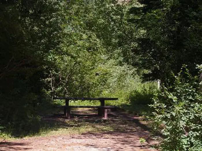
Overview Trail Creek Campground is located along Trail Creek on scenic Teton Pass, just 7 miles from Victor, Idaho at an elevation of 6,600 feet. Visitors enjoy fishing, exploring local trails and sightseeing in this beautiful region. Recreation Trail Creek offers fishing for Yellowstone cutthroat and brook trout. Hiking, mountain biking and horseback riding are popular activities on the nearby Mikesell Canyon Trail, which begins 2 miles away at Mike Harris Campground. Facilities Trail Creek offers fishing for Yellowstone cutthroat and brook trout. Hiking, mountain biking and horseback riding are popular activities on the nearby Mikesell Canyon Trail, which begins 2 miles away at Mike Harris Campground. Natural Features The campground is situated on the banks of Trail Creek in an open grassy meadow lined with Douglas fir, spruce and aspen trees. A variety of wildlife makes its home in the area, including moose and deer. Summer wildflowers are abundant. Nearby Attractions Popular activities in the area include the Teton Valley Summer Festival over the Fourth of July in Driggs, with a hot air balloon festival, parade, rodeo, bike races and craft booths. Grand Targhee Resort is nearby with outstanding annual music festivals: Targhee Fest is in mid-July; Targhee Bluegrass Festival is in mid-August. The resort also offers lift-served hiking and mountain biking, scenic lift rides, guided horseback riding, a climbing wall and an 18-hole disc golf course. Grand Teton National Park's Granite Entrance is 20 miles away; Jackson, Wyoming is 17 miles away. Yellowstone National Park is within a couple hours drive.
View details →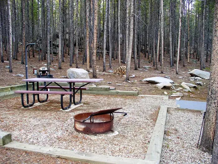
Overview Tie Hack Campground is located close to Tie Hack Reservoir, just 15 miles west of Buffalo, Wyoming on the east side of scenic Cloud Peak Skyway, near the Cloud Peak Wilderness Area. The Bighorn National Forest offers a wide variety of activities, including hiking, fishing, scenic driving and a number of historic sites. The administering organization is Gallatin Canyon Campgrounds; e-mail: gccampgrounds13@gmail.com Recreation Tie Hack Reservoir offers a great location for canoeing and fishing. Anglers cast for rainbow, cutthroat, brown and brook trout. A short trail leads from the campground to the lake. The Circle Park Trailhead is 3 miles from the campground. This beautiful trail accesses numerous alpine lakes and two 12,000' peaks within the Cloud Peak Wilderness. Many additional hiking trails are available in the area. Scenic off-road driving is available on nearby Elgin Park, Pole Creek and Crazy Woman Canyon Roads. Hiking and mountain biking are allowed on these roads as well. Facilities Tie Hack Reservoir offers a great location for canoeing and fishing. Anglers cast for rainbow, cutthroat, brown and brook trout. A short trail leads from the campground to the lake. The Circle Park Trailhead is 3 miles from the campground. This beautiful trail accesses numerous alpine lakes and two 12,000' peaks within the Cloud Peak Wilderness. Many additional hiking trails are available in the area. Scenic off-road driving is available on nearby Elgin Park, Pole Creek and Crazy Woman Canyon Roads. Hiking and mountain biking are allowed on these roads as well. Natural Features The campground is situated near the shore of scenic Tie Hack Reservoir at an elevation of 7,900 feet. A dense forest of lodgepole pine covers the campground. Rock outcroppings are found inside the campground and along the shoreline. Nearby Attractions South Fork Lodge is nearby, offering dining options, lodging, guided horseback riding, a fishing pond and a small store with fishing and camping supplies. Charges & Cancellations Refunds: Refund requests made through www.recreation.gov will be charged a $10 processing fee. This cancellation processing fee is retained by the reservation service contractor along with the non-refundable reservation fee. All requests for the return of the non-refundable reservation fee and the cancellation processing fee will be declined by the campground concessionaire as they did not receive these fees (these are the fees retained by the reservation contractor, a different entity).
View details →
Overview Lost Cabin Campground is located 29 miles west of Buffalo, Wyoming on the east side of scenic Cloud Peak Skyway, near the Cloud Peak Wilderness Area. The Bighorn National Forest offers a wide variety of activities, including hiking, fishing, scenic driving and a number of historic sites. The administering organization is Gallatin Canyon Campgrounds; e-mail: gccampgrounds13@gmail.com Recreation Scenic off-road driving is available on nearby Elgin Park, Pole Creek and Crazy Woman Canyon Roads. Hiking and mountain biking are allowed on these roads as well. Many additional hiking trails are available in the Cloud Peak Wilderness. A short trail leads from the campground to a scenic creek below. Facilities Scenic off-road driving is available on nearby Elgin Park, Pole Creek and Crazy Woman Canyon Roads. Hiking and mountain biking are allowed on these roads as well. Many additional hiking trails are available in the Cloud Peak Wilderness. A short trail leads from the campground to a scenic creek below. Natural Features The campground is situated on a hillside above Highway 16. A dense forest of lodgepole pine covers the area and North Fork Creek flows nearby. Nearby Attractions Meadowlark Lake is 20 minutes west of the campground, and Tie Hack Reservoir is 20 minutes north. Both lakes are great locations for canoeing and fishing. The High Park Lookout is located just east of Meadowlark Lake. This old fire lookout was built by the CCC decades ago and is no longer active. A short hike leads to the lookout, where hikers are awarded panoramic views of the surrounding area. South Fork Lodge is nearby, offering dining options, lodging, guided horseback riding and fishing and camping supplies. Charges & Cancellations Refunds: Refund requests made through www.recreation.gov will be charged a $10 processing fee. This cancellation processing fee is retained by the reservation service contractor along with the non-refundable reservation fee. All requests for the return of the non-refundable reservation fee and the cancellation processing fee will be declined by the campground concessionaire as they did not receive these fees (these are the fees retained by the reservation contractor, a different entity).
View details →
Overview Sibley Lake Campground is located at Sibley Lake along the Bighorn Scenic Byway (U.S. Highway 14) near the Burgess Junction at an elevation of 7,900 feet. The Bighorn National Forest offers a wide variety of activities, including hiking, fishing, scenic driving and a number of historic sites. The administering organization is Gallatin Canyon Campgrounds; e-mail: gccampgrounds13@gmail.com Recreation Sibley Lake is open to non-motorized craft and offers an accessible fishing dock on the shoreline. Anglers fish for rainbow, brown and brook trout. Off-road vehicle trails, scenic jeep roads, hiking and additional fishing streams are available in the surrounding area. Diverse hikes vary from loop trails to treks along creeks and over mountain peaks; many trails access the Cloud Peak Wilderness. Facilities Sibley Lake is open to non-motorized craft and offers an accessible fishing dock on the shoreline. Anglers fish for rainbow, brown and brook trout. Off-road vehicle trails, scenic jeep roads, hiking and additional fishing streams are available in the surrounding area. Diverse hikes vary from loop trails to treks along creeks and over mountain peaks; many trails access the Cloud Peak Wilderness. Natural Features The campground is situated near Sibley Lake and Prune Creek in the Bighorn Mountains, where craggy granite peaks rise over 13,000 feet above sea level. A forest of lodgepole pine covers the area, creating excellent wildlife habitat. Nearby Attractions Shell Falls Visitor Center, at the overlook of Shell Falls, is about 25 miles southwest. This center offers interpretive trails, scenic views, and educational displays about natural features such as flora and fauna and area history. Charges & Cancellations Refunds: Refund requests made through www.recreation.gov will be charged a $10 processing fee. This cancellation processing fee is retained by the reservation service contractor along with the non-refundable reservation fee. All requests for the return of the non-refundable reservation fee and the cancellation processing fee will be declined by the campground concessionaire as they did not receive these fees (these are the fees retained by the reservation contractor, a different entity).
View details →
Overview Tie Flume Campground is located just off the Bighorn Scenic Byway (U.S. Highway 14) near the Burgess Overlook and Woodrock areas at an elevation of 8,400 feet. The Bighorn National Forest, where the campground is located, offers a wide variety of activities, including hiking, fishing, scenic driving and a number of historic sites. The administering organization is Gallatin Canyon Campgrounds; e-mail: gccampgrounds13@gmail.com Recreation Off-road vehicle trails, scenic jeep roads, hiking, fishing and canoeing are available in the surrounding area. Diverse hikes vary from loop trails to treks along creeks and over mountain peaks; many trails access the Cloud Peak Wilderness. Nearby Sibley Lake is open to non-motorized craft and offers an accessible fishing dock on the shoreline. Anglers fish for rainbow, brown and brook trout. Facilities Off-road vehicle trails, scenic jeep roads, hiking, fishing and canoeing are available in the surrounding area. Diverse hikes vary from loop trails to treks along creeks and over mountain peaks; many trails access the Cloud Peak Wilderness. Nearby Sibley Lake is open to non-motorized craft and offers an accessible fishing dock on the shoreline. Anglers fish for rainbow, brown and brook trout. Natural Features The campground is situated on the banks of the South Tongue River in the Bighorn Mountains, where craggy granite peaks rise over 13,000 feet above sea level. A forest of lodgepole pine covers the area, creating excellent wildlife habitat. Nearby Attractions Decades ago, many trees in the Tie Flume area were cut for railroad ties. Remnants of the old splash dams and tie flumes are found on the river around the campground. Shell Falls Visitor Center, at the overlook of Shell Falls, is about 18 miles southwest. This center offers interpretive trails, scenic views, and educational displays about natural features such as flora and fauna and area history. Bear Lodge, Elk View Inn and other nearby lodges provide guided horseback riding and fishing adventures, off-road vehicle rentals and fishing supplies, as well as dining options, showers and general stores. The Red Gulch Dinosaur Tracksite, near the town of Shell, is the largest of its kind in the state and one of only a few in the world from the Middle Jurassic Period. The tracks found here are approximately 167 million years old. Charges & Cancellations Refunds: Refund requests made through www.recreation.gov will be charged a $10 processing fee. This cancellation processing fee is retained by the reservation service contractor along with the non-refundable reservation fee. All requests for the return of the non-refundable reservation fee and the cancellation processing fee will be declined by the campground concessionaire as they did not receive these fees (these are the fees retained by the reservation contractor, a different entity).
View details →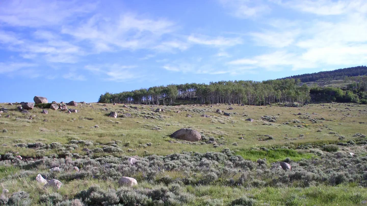
Overview Shell Creek Campground is located just off the Bighorn Scenic Byway (U.S. Highway 14) at an elevation of 7,500 feet. The Bighorn National Forest offers a wide variety of activities, including hiking, fishing, scenic driving and a number of historic sites. The administering organization is Gallatin Canyon Campgrounds; e-mail: office@ceicamp.com Recreation Scenic off-road driving is available on Battle Creek Road to Medicine Lodge Lake, Ranger Creek Road to Shell Reservoir, Hunt Mountain Road and the Burgess Overlook jeep trail. Diverse hiking opportunities vary from loop trails to treks along creeks and over mountain peaks including access to the Cloud Peak Wilderness. The Adelaide Trail, for hiking and horseback riding is nearby, providing access to Shell Creek and the Shell Creek Trail. Many creeks, lakes and ponds dot the region, offering some of the best trout fly-fishing in the state. Facilities Scenic off-road driving is available on Battle Creek Road to Medicine Lodge Lake, Ranger Creek Road to Shell Reservoir, Hunt Mountain Road and the Burgess Overlook jeep trail. Diverse hiking opportunities vary from loop trails to treks along creeks and over mountain peaks including access to the Cloud Peak Wilderness. The Adelaide Trail, for hiking and horseback riding is nearby, providing access to Shell Creek and the Shell Creek Trail. Many creeks, lakes and ponds dot the region, offering some of the best trout fly-fishing in the state. Natural Features The campground is situated on the banks of Shell Creek in the Bighorn Mountains, where craggy granite peaks rise over 13,000 feet above sea level. The area is forested with a mix of fir, aspen and cottonwood trees. An abundance of wildlife lives in the area. Nearby Attractions Shell Falls Visitor Center, at the overlook of Shell Falls, is about 6 miles west. This center offers interpretive trails, scenic views, and educational displays about natural features such as flora and fauna and area history. Elk View Inn and other nearby lodges offer fishing adventures and off-road vehicle rentals and fishing supplies, as well as dining options, showers and general stores. The Red Gulch Dinosaur Tracksite, near the town of Shell, is the largest of its kind in the state and one of only a few in the world from the Middle Jurassic Period. The tracks found here are approximately 167 million years old. Charges & Cancellations Refunds: Refund requests made through www.recreation.gov will be charged a $10 processing fee. This cancellation processing fee is retained by the reservation service contractor along with the non-refundable reservation fee. All requests for the return of the non-refundable reservation fee and the cancellation processing fee will be declined by the campground concessionaire as they did not receive these fees (these are the fees retained by the reservation contractor, a different entity).
View details →
Overview North Tongue Campground is located just off the Bighorn Scenic Byway (U.S. Highway 14) near the Burgess Junction at an elevation of 8,400 feet. The Bighorn National Forest offers a wide variety of activities, including hiking, fishing, scenic driving and a number of historic sites. The administering organization is Gallatin Canyon Campgrounds; e-mail: gccampgrounds13@gmail.com Recreation Off-road vehicle trails, scenic jeep roads, hiking, fishing and canoeing are available in the surrounding area. Diverse hikes vary from loop trails to treks along creeks and over mountain peaks; many trails access the Cloud Peak Wilderness. Nearby Sibley Lake is open to non-motorized craft and offers an accessible fishing dock on the shoreline. Anglers fish for rainbow, brown and brook trout. Facilities Off-road vehicle trails, scenic jeep roads, hiking, fishing and canoeing are available in the surrounding area. Diverse hikes vary from loop trails to treks along creeks and over mountain peaks; many trails access the Cloud Peak Wilderness. Nearby Sibley Lake is open to non-motorized craft and offers an accessible fishing dock on the shoreline. Anglers fish for rainbow, brown and brook trout. Natural Features The campground is situated on the banks of the North Fork Tongue River and Big Willow Creek in the Bighorn Mountains, where craggy granite peaks rise over 13,000 feet above sea level. A forest of lodgepole pine covers the area, creating excellent wildlife habitat. Englemann spruce and Douglas fir dot the landscape. Nearby Attractions Shell Falls Visitor Center, at the overlook of Shell Falls, is about 22 miles southwest. This center offers interpretive trails, scenic views, and educational displays about natural features such as flora and fauna and area history. The Medicine Wheel National Historic Landmark is 25 miles from the campground. This unique geoglyph signifies all creation, and according to tribal beliefs, the circular shape of the wheel represents the earth, sun, moon, cycles of life, seasons and day to night. Bear Lodge and Elk View Inn are nearby, offering off-road vehicle rentals and fishing supplies, as well as dining options and general stores. Charges & Cancellations Refunds: Refund requests made through www.recreation.gov will be charged a $10 processing fee. This cancellation processing fee is retained by the reservation service contractor along with the non-refundable reservation fee. All requests for the return of the non-refundable reservation fee and the cancellation processing fee will be declined by the campground concessionaire as they did not receive these fees (these are the fees retained by the reservation contractor, a different entity).
View details →
Overview Owen Creek Campground is located along the Bighorn Scenic Byway (U.S. Highway 14) near the Burgess Overlook and Woodrock areas at an elevation of 8,400 feet. The Bighorn National Forest offers a wide variety of activities, including hiking, fishing, scenic driving and a number of historic sites. The administering organization is Gallatin Canyon Campgrounds; e-mail: gccampgrounds13@gmail.com Recreation Off-road vehicle trails, scenic jeep roads, hiking, fishing and canoeing are available in the surrounding area. Diverse hikes vary from loop trails to treks along creeks and over mountain peaks; many trails access the Cloud Peak Wilderness. Nearby Sibley Lake is open to non-motorized craft and offers an accessible fishing dock on the shoreline. Anglers fish for rainbow, brown and brook trout. Facilities Off-road vehicle trails, scenic jeep roads, hiking, fishing and canoeing are available in the surrounding area. Diverse hikes vary from loop trails to treks along creeks and over mountain peaks; many trails access the Cloud Peak Wilderness. Nearby Sibley Lake is open to non-motorized craft and offers an accessible fishing dock on the shoreline. Anglers fish for rainbow, brown and brook trout. Natural Features The campground is situated on the banks of Owen Creek in the Bighorn Mountains, where craggy granite peaks rise over 13,000 feet above sea level. The area is forested with a mix of pine and aspen trees. An abundance of wildlife lives in the area. Nearby Attractions Shell Falls Visitor Center, at the overlook of Shell Falls, is about 22 miles southwest. This center offers interpretive trails, scenic views, and educational displays about natural features such as flora and fauna and area history. Bear Lodge, Elk View Inn and other nearby lodges provide guided horseback riding and fishing adventures, off-road vehicle rentals and fishing supplies, as well as dining options, showers and general stores. The Red Gulch Dinosaur Tracksite, near the town of Shell, is the largest of its kind in the state and one of only a few in the world from the Middle Jurassic Period. The tracks found here are approximately 167 million years old. Charges & Cancellations Refunds: Refund requests made through www.recreation.gov will be charged a $10 processing fee. This cancellation processing fee is retained by the reservation service contractor along with the non-refundable reservation fee. All requests for the return of the non-refundable reservation fee and the cancellation processing fee will be declined by the campground concessionaire as they did not receive these fees (these are the fees retained by the reservation contractor, a different entity).
View details →
Overview Rex Hale Campground is located along the Buffalo Bill Scenic Byway about 36 miles west of Cody, in northwestern Wyoming. It is just over 16 miles east of Yellowstone National Park's east entrance. The surrounding area offers many outdoor recreational opportunities, including fishing, hiking and viewing local wildlife. The campground is named after Rex Hale, one of 15 firefighters who died in the 1937 Blackwater Fire, which burned more than 1,700 acres of Forest Service lands within the Shoshone National Forest. Recreation Great opportunities for hiking, fishing, scenic driving and wildlife viewing are available around the campground. The North Fork of the Shoshone River is a popular fly-fishing location for rainbow and Yellowstone cutthroat trout. A firefighter memorial is located along the highway, just over a mile west of the campground. Forest Service Trail 758 leads to two additional memorials, which mark the locations where other firefighters lost their lives in the Blackwater Fire. Mummy Cave is less than a mile from the campground. This historical site was discovered in 1957 and found to have been occupied for a period of over 9,000 years. Many artifacts, including a mummified ancient inhabitant, were excavated from the large alcove, which was placed on the National Register of Historic Places in 1981. Facilities Great opportunities for hiking, fishing, scenic driving and wildlife viewing are available around the campground. The North Fork of the Shoshone River is a popular fly-fishing location for rainbow and Yellowstone cutthroat trout. A firefighter memorial is located along the highway, just over a mile west of the campground. Forest Service Trail 758 leads to two additional memorials, which mark the locations where other firefighters lost their lives in the Blackwater Fire. Mummy Cave is less than a mile from the campground. This historical site was discovered in 1957 and found to have been occupied for a period of over 9,000 years. Many artifacts, including a mummified ancient inhabitant, were excavated from the large alcove, which was placed on the National Register of Historic Places in 1981. Natural Features The campground is situated near the banks of the North Fork of the Shoshone River and offers views of spectacular red cliffs, where bighorn sheep may be seen early in the season. A wide variety of wildlife lives in the surrounding area. Visitors often glimpse grizzly bears, deer, elk, bison, moose, fox, coyotes and bald eagles. Nearby Attractions Pahaska Tepee, west of the campground, is home to Buffalo Bill's original hunting lodge, built in 1904. Tours are offered daily between Memorial Day and Labor Day. Pahaska also offers guided horseback rides, a gift shop, restaurant and lodging. Yellowstone National Park's east entrance is 18 miles from the campground via the Buffalo Bill Cody Scenic Byway. The park offers unparalleled wildlife viewing opportunities, as well as breathtaking scenery and unique geological features. The small, historic city of Cody offers a variety of dining, lodging and shopping options. The Buffalo Bill Historical Center offers extensive displays of Greater Yellowstone natural history, Plains Indians artifacts, western art, firearms, Buffalo Bill memorabilia and a wild sheep exhibit.
View details →
Overview The Jack Creek Crew Quarters is a large modern facility available for $225 per night from mid-June through late October. This two-story log facility has a fully equipped double kitchen with propane ranges, refrigerators, and sinks. There are bathrooms with showers on both levels. Solar panels provide limited electricity. Plan for limited use of both electricity and water. The five-bedroom facility sleeps up to 15 people in single and bunk beds (bedding not provided) and can be rented for up to 14 consecutive nights. Heat is propane. Picnic tables and a large charcoal grill are on site. Basic cooking and eating utensils are furnished. Trash service is NOT provided . This beautiful area is a mixture of lodge pole pine, aspen and mixed conifer forest with fishing, hiking, mountain biking, picnicking, horseback riding and hunting available in the general area. The Continental Divide National Scenic Trail is west of the cabin. Wildlife in the area include elk, deer, bear and moose. Jack Creek Campground is one mile away. Saddle/ pack animals may not be be kept within the Jack Creek Crew Quarters area. Campers, tents or trailers may not be set up at this facility. Please Clean up after your pets. Recreation Lake and Pond Fishing Areas for Lake and Pond Fishing at Sierra Madre Area Brush Creek/Hayden Ranger District Office Hog Park Boat Dock and Ramp Hog Park Campground Hog Park Picnic Site Lake View Picnic Site at Hog Park River and Stream Fishing Areas for River and Stream Fishing at Sierra Madre Area Big Creek-Holroyd Park Trailhead Bottle Creek Campground Bottle Creek Group Picnic Site Brush Creek/Hayden Ranger District Office East Fork - Encampment River Trail Encampment River Wilderness Hog Park Campground Huston Park Wilderness Jack Creek Campground Jack Creek Crew Quarters Jack Creek Guard Station Purgatory Gulch Trailhead Day Hiking Areas for Day Hiking at Sierra Madre Area Baby Lake Trailhead Big Creek Park Trailhead Big Creek-Holroyd Park Trailhead Bottle Creek Campground Bottle Creek Group Picnic Site Bottle Creek Trails Brush Creek/Hayden Ranger District Office CDNST - Deep Jack Trailhead CDNST - Pipeline Trailhead CDNST - Red Mountain Trailhead Commissary Park Trailhead East Fork - Encampment River Trail Encampment River Wilderness Green Mountain Falls Trailhead Green Mountain Trailhead Hog Park Campground Huston Park Wilderness Jack Creek Campground Jack Creek Crew Quarters Lost Creek Campground Purgatory Gulch Trailhead Backpacking Areas for Backpacking at Sierra Madre Area Baby Lake Trailhead Brush Creek/Hayden Ranger District Office CDNST - Deep Jack Trailhead CDNST - Pipeline Trailhead CDNST - Red Mountain Trailhead Commissary Park Trailhead East Fork - Encampment River Trail Encampment River Wilderness Green Mountain Trailhead Huston Park Wilderness Purgatory Gulch Trailhead Viewing Wildlife Areas for Viewing Wildlife at Sierra Madre Area Brush Creek/Hayden Ranger District Office Hog Park Campground Jack Creek Crew Quarters Jack Creek Guard Station Sandstone Cabin Viewing Plants Areas for Viewing Plants at Sierra Madre Area Brush Creek/Hayden Ranger District Office Hog Park Campground Jack Creek Crew Quarters Jack Creek Guard Station Viewing Scenery Areas for Viewing Scenery at Sierra Madre Area Brush Creek/Hayden Ranger District Office Encampment River Wilderness Green Mountain Falls Trailhead Hog Park Campground Huston Park Wilderness Facilities Lake and Pond Fishing Areas for Lake and Pond Fishing at Sierra Madre Area Brush Creek/Hayden Ranger District Office Hog Park Boat Dock and Ramp Hog Park Campground Hog Park Picnic Site Lake View Picnic Site at Hog Park River and Stream Fishing Areas for River and Stream Fishing at Sierra Madre Area Big Creek-Holroyd Park Trailhead Bottle Creek Campground Bottle Creek Group Picnic Site Brush Creek/Hayden Ranger District Office East Fork - Encampment River Trail Encampment River Wilderness Hog Park Campground Huston Park Wilderness Jack Creek Campground Jack Creek Crew Quarters Jack Creek Guard Station Purgatory Gulch Trailhead Day Hiking Areas for Day Hiking at Sierra Madre Area Baby Lake Trailhead Big Creek Park Trailhead Big Creek-Holroyd Park Trailhead Bottle Creek Campground Bottle Creek Group Picnic Site Bottle Creek Trails Brush Creek/Hayden Ranger District Office CDNST - Deep Jack Trailhead CDNST - Pipeline Trailhead CDNST - Red Mountain Trailhead Commissary Park Trailhead East Fork - Encampment River Trail Encampment River Wilderness Green Mountain Falls Trailhead Green Mountain Trailhead Hog Park Campground Huston Park Wilderness Jack Creek Campground Jack Creek Crew Quarters Lost Creek Campground Purgatory Gulch Trailhead Backpacking Areas for Backpacking at Sierra Madre Area Baby Lake Trailhead Brush Creek/Hayden Ranger District Office CDNST - Deep Jack Trailhead CDNST - Pipeline Trailhead CDNST - Red Mountain Trailhead Commissary Park Trailhead East Fork - Encampment River Trail Encampment River Wilderness Green Mountain Trailhead Huston Park Wilderness Purgatory Gulch Trailhead Viewing Wildlife Areas for Viewing Wildlife at Sierra Madre Area Brush Creek/Hayden Ranger District Office Hog Park Campground Jack Creek Crew Quarters Jack Creek Guard Station Sandstone Cabin Viewing Plants Areas for Viewing Plants at Sierra Madre Area Brush Creek/Hayden Ranger District Office Hog Park Campground Jack Creek Crew Quarters Jack Creek Guard Station Viewing Scenery Areas for Viewing Scenery at Sierra Madre Area Brush Creek/Hayden Ranger District Office Encampment River Wilderness Green Mountain Falls Trailhead Hog Park Campground Huston Park Wilderness Natural Features From open, high expanses to valleys and canyons that rise steeply to snowy ranges, the Medicine Bow-Routt National Forests encompass mountain ranges, tributaries to the North Platte River and the Colorado River, and a mix of forested ecology with spruce, lodgepole pine, subalpine fir, aspen and shrub lands. The Jack Creek Crew Quarters sits in a clearing surrounded by a mixture of lodgepole pine, aspen and mixed conifer forest at an elevation of 8,500 feet. Wildlife viewing is abundant in the area, including elk, deer, bear and moose. Nearby Attractions Southwest of Saratoga, Wyo. on the Medicine Bow National Forest lies the Sierra Madre Range, which is a part of the main range of the Rocky Mountains. There are two wilderness areas in the Sierra Madre Range: Huston Park Wilderness and Encampment River Wilderness. Named for the famous battle between Indians and Fur Trappers in 1841, the 57-mile Battle Pass Scenic Byway runs through this area. This byway is known for its scenic views, especially during fall when the colors are changing. This area has many activities such as hiking, fishing, mountain biking, camping, snowmobiling, and cross country skiing.
View details →
Overview The Jack Creek Guard Station is available mid-June through October, weather permitting. This was the northern ranger cabin for the historic Encampment Ranger District, built by Ranger Evie Williams in 1934, and is listed on the National Register of Historic Places. The one-room cabin can accommodate up to four people with two bunk beds, a combination wood/propane cook stove, simple table and chairs. There is no indoor plumbing, a vault toilet is located within walking distances . Water is available during the summer months from the freeze-proof hydrant outside and from the Jack Creek Campground nearby . Items to bring include bedding/sleeping bag, food, dish soap and sponge, trash bags, first aid kit, flashlight, towels and washcloths, personal items. Basic cooking and eating utensils are provided. Utensils need to be cleaned and put away after use. The garbage is pack-in, pack-out. Saddle/ pack animals may not be be kept within the Jack Creek Guard Station area. Campers, tents or trailers may not be set up at this facility. Please clean up after your pets. The Jack Creek Guard Station is located southwest of Saratoga, Wyoming, offering visitors a unique lodging experience in the Medicine Bow-Routt National Forests. The guard station once served as the northern ranger cabin for the historic Encampment Ranger District. It was constructed by Ranger Evie Williams in 1934. Oral history states that Ranger Williams spent most of his construction dollars on the material for the foundation and chimney, and used his own funds to finish the windows and roof. The guard station is now listed on the National Register of Historic Places and offers guests recreation and relaxation in a delightful natural setting. The cabin is typically open from mid-June through mid-October and is accessible by vehicle. Basic amenities are provided, but guests will need to pack in some of their own supplies and gear. Recreation Lake and Pond Fishing Areas for Lake and Pond Fishing at Sierra Madre Area Brush Creek/Hayden Ranger District Office Hog Park Boat Dock and Ramp Hog Park Campground Hog Park Picnic Site Lake View Picnic Site at Hog Park River and Stream Fishing Areas for River and Stream Fishing at Sierra Madre Area Big Creek-Holroyd Park Trailhead Bottle Creek Campground Bottle Creek Group Picnic Site Brush Creek/Hayden Ranger District Office East Fork - Encampment River Trail Encampment River Wilderness Hog Park Campground Huston Park Wilderness Jack Creek Campground Jack Creek Crew Quarters Jack Creek Guard Station Purgatory Gulch Trailhead Day Hiking Areas for Day Hiking at Sierra Madre Area Baby Lake Trailhead Big Creek Park Trailhead Big Creek-Holroyd Park Trailhead Bottle Creek Campground Bottle Creek Group Picnic Site Bottle Creek Trails Brush Creek/Hayden Ranger District Office CDNST - Deep Jack Trailhead CDNST - Pipeline Trailhead CDNST - Red Mountain Trailhead Commissary Park Trailhead East Fork - Encampment River Trail Encampment River Wilderness Green Mountain Falls Trailhead Green Mountain Trailhead Hog Park Campground Huston Park Wilderness Jack Creek Campground Jack Creek Crew Quarters Lost Creek Campground Purgatory Gulch Trailhead Backpacking Areas for Backpacking at Sierra Madre Area Baby Lake Trailhead Brush Creek/Hayden Ranger District Office CDNST - Deep Jack Trailhead CDNST - Pipeline Trailhead CDNST - Red Mountain Trailhead Commissary Park Trailhead East Fork - Encampment River Trail Encampment River Wilderness Green Mountain Trailhead Huston Park Wilderness Purgatory Gulch Trailhead Viewing Wildlife Areas for Viewing Wildlife at Sierra Madre Area Brush Creek/Hayden Ranger District Office Hog Park Campground Jack Creek Crew Quarters Jack Creek Guard Station Sandstone Cabin Viewing Plants Areas for Viewing Plants at Sierra Madre Area Brush Creek/Hayden Ranger District Office Hog Park Campground Jack Creek Crew Quarters Jack Creek Guard Station Viewing Scenery Areas for Viewing Scenery at Sierra Madre Area Brush Creek/Hayden Ranger District Office Encampment River Wilderness Green Mountain Falls Trailhead Hog Park Campground Huston Park Wilderness Facilities Lake and Pond Fishing Areas for Lake and Pond Fishing at Sierra Madre Area Brush Creek/Hayden Ranger District Office Hog Park Boat Dock and Ramp Hog Park Campground Hog Park Picnic Site Lake View Picnic Site at Hog Park River and Stream Fishing Areas for River and Stream Fishing at Sierra Madre Area Big Creek-Holroyd Park Trailhead Bottle Creek Campground Bottle Creek Group Picnic Site Brush Creek/Hayden Ranger District Office East Fork - Encampment River Trail Encampment River Wilderness Hog Park Campground Huston Park Wilderness Jack Creek Campground Jack Creek Crew Quarters Jack Creek Guard Station Purgatory Gulch Trailhead Day Hiking Areas for Day Hiking at Sierra Madre Area Baby Lake Trailhead Big Creek Park Trailhead Big Creek-Holroyd Park Trailhead Bottle Creek Campground Bottle Creek Group Picnic Site Bottle Creek Trails Brush Creek/Hayden Ranger District Office CDNST - Deep Jack Trailhead CDNST - Pipeline Trailhead CDNST - Red Mountain Trailhead Commissary Park Trailhead East Fork - Encampment River Trail Encampment River Wilderness Green Mountain Falls Trailhead Green Mountain Trailhead Hog Park Campground Huston Park Wilderness Jack Creek Campground Jack Creek Crew Quarters Lost Creek Campground Purgatory Gulch Trailhead Backpacking Areas for Backpacking at Sierra Madre Area Baby Lake Trailhead Brush Creek/Hayden Ranger District Office CDNST - Deep Jack Trailhead CDNST - Pipeline Trailhead CDNST - Red Mountain Trailhead Commissary Park Trailhead East Fork - Encampment River Trail Encampment River Wilderness Green Mountain Trailhead Huston Park Wilderness Purgatory Gulch Trailhead Viewing Wildlife Areas for Viewing Wildlife at Sierra Madre Area Brush Creek/Hayden Ranger District Office Hog Park Campground Jack Creek Crew Quarters Jack Creek Guard Station Sandstone Cabin Viewing Plants Areas for Viewing Plants at Sierra Madre Area Brush Creek/Hayden Ranger District Office Hog Park Campground Jack Creek Crew Quarters Jack Creek Guard Station Viewing Scenery Areas for Viewing Scenery at Sierra Madre Area Brush Creek/Hayden Ranger District Office Encampment River Wilderness Green Mountain Falls Trailhead Hog Park Campground Huston Park Wilderness Natural Features From open, high expanses to valleys and canyons that rise steeply to snowy ranges, the Medicine Bow-Routt National Forests encompass mountain ranges, tributaries to the North Platte River and the Colorado River, and a mix of forested ecology with spruce, lodgepole pine, subalpine fir, aspen and shrub lands. The Jack Creek Guard Station sits in a clearing with lodgepole pine, aspen and mixed conifer forest at an elevation of 8,500 feet. Wildlife viewing is abundant in the area, including elk, deer, bear and moose. Nearby Attractions
View details →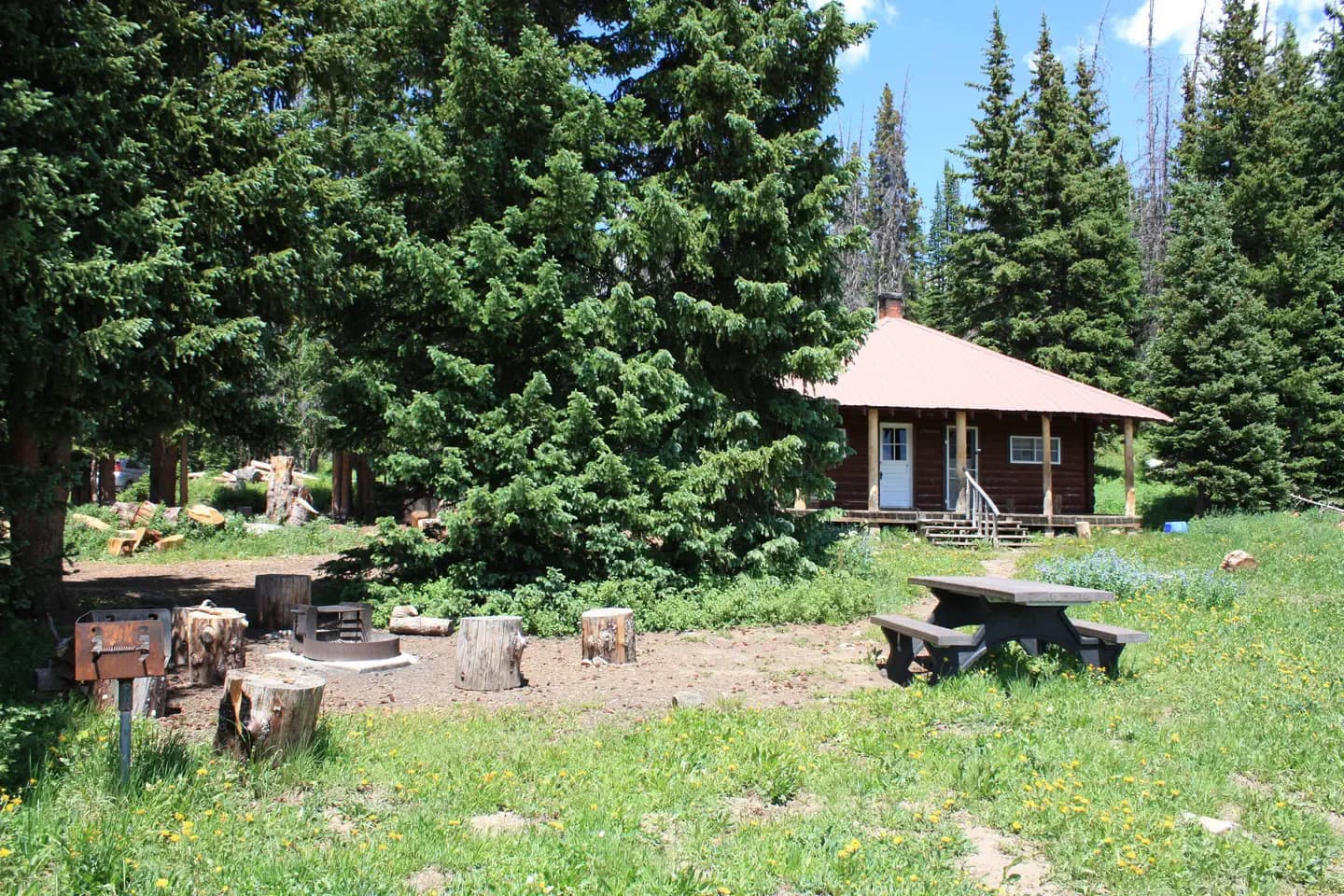
Overview Little Brooklyn Guard Station is located nine miles west of Centennial, Wyoming just off the Snowy Range Scenic Byway at an elevation of 10,340 feet. The guard station was constructed in 1931 as housing for Forest Service employees. Today, it is a unique year-round lodging experience for guests seeking recreation and relaxation in southeastern Wyoming. During the dry, summer months, guests can drive directly to the cabin; however during the snowy months, access is limited to snowmobiles, skis or snowshoes. Guests can expect to travel about three miles from the parking lot at Green Rock Recreation Area. Access is limited during the shoulder seasons of spring and fall when snow isnt deep enough to snowmobile on, but too deep to drive in. Please understand these limitations before deciding to reserve the cabin during this time of year. The cabin offers many modern amenities, but guests should be prepared to pack in some of their own supplies and gear, especially in winter. As stated above, please be aware that there may be snow in the area until mid-July and the road can be muddy, bumpy, or inaccessible; we recommend calling the USFS Laramie Ranger District office at (307) 745-2300 prior to your reservation to receive the latest weather and road conditions. Recreation A vast hiking trail system that accesses the highest elevations of the Snowy Range is available within 2 miles of the cabin. Hikers may attempt to summit Medicine Bow Peak, the highest peak in the Range at an elevation of 12,013 feet. Sheep Lakes Trail and Glacier Lakes Trails are also nearby. Fishing is available at many alpine lakes and streams, including Brooklyn Lake and Little Brooklyn Lake, which is within walking distance of the cabin. Winter brings deep powder snow for the snowmobiler, snowshoer and cross-country skier. Opportunities exist for hiking, mountain biking, horseback riding and hunting in designated areas nearby. Facilities A vast hiking trail system that accesses the highest elevations of the Snowy Range is available within 2 miles of the cabin. Hikers may attempt to summit Medicine Bow Peak, the highest peak in the Range at an elevation of 12,013 feet. Sheep Lakes Trail and Glacier Lakes Trails are also nearby. Fishing is available at many alpine lakes and streams, including Brooklyn Lake and Little Brooklyn Lake, which is within walking distance of the cabin. Winter brings deep powder snow for the snowmobiler, snowshoer and cross-country skier. Opportunities exist for hiking, mountain biking, horseback riding and hunting in designated areas nearby. Natural Features From valleys and canyons that rise steeply to jagged ridges, the area around the cabin boasts alpine lakes and a mixed forest of spruce, lodgepole pine, subalpine fir and aspen. In the summer, guests can enjoy a view of wildflowers spilling down the meadow in front of the cabin to the edge of serene Little Brooklyn Lake. In winter, this same meadow is blanketed in pristine snow. Wildlife is abundant near the cabin, including elk, deer and coyotes. Migratory birds, squirrels and an occasional black bear find habitat in the forest as well. Nearby Attractions Guests can travel the Snowy Range Scenic Byway (Highway 130) in the summer. There are many campgrounds, picnic areas and hiking trails along its course. The small Snowy Range Ski Resort is adjacent to this scenic byway as well; however, portions of Highway 130 are not completely accessible during the winter. Charges & Cancellations Refunds may be processed on a case-by-case basis. There are no refunds for reservation processing fees. Please be aware of changes in weather and road conditions prior to arrival and plan accordingly.
View details →
Overview Sandstone Cabin is located beside State Highway 70 in the Sierra Madre Range. The cabin is nestled among beautiful aspen trees, and is frequented by moose, elk, and bears. The cabin features propane lights, heat, a propane stove and refrigerator, in addition to offering limited solar power. The cabin will sleep five to six people in 2 bunks and one queen bed. Potable water is availble. Individuals can reserve the Sandstone Cabin up to 14 consecutive nights from mid-June to late October. Please clean up after your pets. Host is located on site. Recreation Lake and Pond Fishing Areas for Lake and Pond Fishing at Sierra Madre Area Brush Creek/Hayden Ranger District Office Hog Park Boat Dock and Ramp Hog Park Campground Hog Park Picnic Site Lake View Picnic Site at Hog Park River and Stream Fishing Areas for River and Stream Fishing at Sierra Madre Area Big Creek-Holroyd Park Trailhead Bottle Creek Campground Bottle Creek Group Picnic Site Brush Creek/Hayden Ranger District Office East Fork - Encampment River Trail Encampment River Wilderness Hog Park Campground Huston Park Wilderness Jack Creek Campground Jack Creek Crew Quarters Jack Creek Guard Station Purgatory Gulch Trailhead Day Hiking Areas for Day Hiking at Sierra Madre Area Baby Lake Trailhead Big Creek Park Trailhead Big Creek-Holroyd Park Trailhead Bottle Creek Campground Bottle Creek Group Picnic Site Bottle Creek Trails Brush Creek/Hayden Ranger District Office CDNST - Deep Jack Trailhead CDNST - Pipeline Trailhead CDNST - Red Mountain Trailhead Commissary Park Trailhead East Fork - Encampment River Trail Encampment River Wilderness Green Mountain Falls Trailhead Green Mountain Trailhead Hog Park Campground Huston Park Wilderness Jack Creek Campground Jack Creek Crew Quarters Lost Creek Campground Purgatory Gulch Trailhead Backpacking Areas for Backpacking at Sierra Madre Area Baby Lake Trailhead Brush Creek/Hayden Ranger District Office CDNST - Deep Jack Trailhead CDNST - Pipeline Trailhead CDNST - Red Mountain Trailhead Commissary Park Trailhead East Fork - Encampment River Trail Encampment River Wilderness Green Mountain Trailhead Huston Park Wilderness Purgatory Gulch Trailhead Viewing Wildlife Areas for Viewing Wildlife at Sierra Madre Area Brush Creek/Hayden Ranger District Office Hog Park Campground Jack Creek Crew Quarters Jack Creek Guard Station Sandstone Cabin Viewing Plants Areas for Viewing Plants at Sierra Madre Area Brush Creek/Hayden Ranger District Office Hog Park Campground Jack Creek Crew Quarters Jack Creek Guard Station Viewing Scenery Areas for Viewing Scenery at Sierra Madre Area Brush Creek/Hayden Ranger District Office Encampment River Wilderness Green Mountain Falls Trailhead Hog Park Campground Huston Park Wilderness Facilities Lake and Pond Fishing Areas for Lake and Pond Fishing at Sierra Madre Area Brush Creek/Hayden Ranger District Office Hog Park Boat Dock and Ramp Hog Park Campground Hog Park Picnic Site Lake View Picnic Site at Hog Park River and Stream Fishing Areas for River and Stream Fishing at Sierra Madre Area Big Creek-Holroyd Park Trailhead Bottle Creek Campground Bottle Creek Group Picnic Site Brush Creek/Hayden Ranger District Office East Fork - Encampment River Trail Encampment River Wilderness Hog Park Campground Huston Park Wilderness Jack Creek Campground Jack Creek Crew Quarters Jack Creek Guard Station Purgatory Gulch Trailhead Day Hiking Areas for Day Hiking at Sierra Madre Area Baby Lake Trailhead Big Creek Park Trailhead Big Creek-Holroyd Park Trailhead Bottle Creek Campground Bottle Creek Group Picnic Site Bottle Creek Trails Brush Creek/Hayden Ranger District Office CDNST - Deep Jack Trailhead CDNST - Pipeline Trailhead CDNST - Red Mountain Trailhead Commissary Park Trailhead East Fork - Encampment River Trail Encampment River Wilderness Green Mountain Falls Trailhead Green Mountain Trailhead Hog Park Campground Huston Park Wilderness Jack Creek Campground Jack Creek Crew Quarters Lost Creek Campground Purgatory Gulch Trailhead Backpacking Areas for Backpacking at Sierra Madre Area Baby Lake Trailhead Brush Creek/Hayden Ranger District Office CDNST - Deep Jack Trailhead CDNST - Pipeline Trailhead CDNST - Red Mountain Trailhead Commissary Park Trailhead East Fork - Encampment River Trail Encampment River Wilderness Green Mountain Trailhead Huston Park Wilderness Purgatory Gulch Trailhead Viewing Wildlife Areas for Viewing Wildlife at Sierra Madre Area Brush Creek/Hayden Ranger District Office Hog Park Campground Jack Creek Crew Quarters Jack Creek Guard Station Sandstone Cabin Viewing Plants Areas for Viewing Plants at Sierra Madre Area Brush Creek/Hayden Ranger District Office Hog Park Campground Jack Creek Crew Quarters Jack Creek Guard Station Viewing Scenery Areas for Viewing Scenery at Sierra Madre Area Brush Creek/Hayden Ranger District Office Encampment River Wilderness Green Mountain Falls Trailhead Hog Park Campground Huston Park Wilderness Natural Features From open, high expanses to valleys and canyons that rise steeply to snowy ranges, the Medicine Bow-Routt National Forests encompass mountain ranges, tributaries to the North Platte River and the Colorado River, and a mix of forested ecology with spruce, lodgepole pine, subalpine fir, aspen and shrub lands. Sandstone Cabin sits in a clearing surrounded by a mixture of lodgepole pine, aspen and mixed conifer forest at an elevation of 8,200 feet. Wildlife viewing is abundant in the area, including elk, deer and moose. Nearby Attractions Battle Highway, which passes right by the cabin, is a scenic drive featuring historic copper mining sites that were developed from 1897-1908 in the Sierra Madres. The drive is about 58 miles, beginning in Baggs, Wyoming and ending in Riverside, Wyoming. Interpretive signs along the route explain points of interest.
View details →
Overview Hog Park Campground offers a peaceful setting on the southeast shore of Hog Park Reservoir. The campground provides access to the water for boating, fishing and water sports, as well as options for hiking the Continental Divide National Scenic Trail. It lies high in the Medicine Bow-Routt National Forests at an elevation of about 8,400 feet. Recreation Lake and Pond Fishing Areas for Lake and Pond Fishing at Sierra Madre Area Brush Creek/Hayden Ranger District Office Hog Park Boat Dock and Ramp Hog Park Campground Hog Park Picnic Site Lake View Picnic Site at Hog Park River and Stream Fishing Areas for River and Stream Fishing at Sierra Madre Area Big Creek-Holroyd Park Trailhead Bottle Creek Campground Bottle Creek Group Picnic Site Brush Creek/Hayden Ranger District Office East Fork - Encampment River Trail Encampment River Wilderness Hog Park Campground Huston Park Wilderness Jack Creek Campground Jack Creek Crew Quarters Jack Creek Guard Station Purgatory Gulch Trailhead Day Hiking Areas for Day Hiking at Sierra Madre Area Baby Lake Trailhead Big Creek Park Trailhead Big Creek-Holroyd Park Trailhead Bottle Creek Campground Bottle Creek Group Picnic Site Bottle Creek Trails Brush Creek/Hayden Ranger District Office CDNST - Deep Jack Trailhead CDNST - Pipeline Trailhead CDNST - Red Mountain Trailhead Commissary Park Trailhead East Fork - Encampment River Trail Encampment River Wilderness Green Mountain Falls Trailhead Green Mountain Trailhead Hog Park Campground Huston Park Wilderness Jack Creek Campground Jack Creek Crew Quarters Lost Creek Campground Purgatory Gulch Trailhead Backpacking Areas for Backpacking at Sierra Madre Area Baby Lake Trailhead Brush Creek/Hayden Ranger District Office CDNST - Deep Jack Trailhead CDNST - Pipeline Trailhead CDNST - Red Mountain Trailhead Commissary Park Trailhead East Fork - Encampment River Trail Encampment River Wilderness Green Mountain Trailhead Huston Park Wilderness Purgatory Gulch Trailhead Viewing Wildlife Areas for Viewing Wildlife at Sierra Madre Area Brush Creek/Hayden Ranger District Office Hog Park Campground Jack Creek Crew Quarters Jack Creek Guard Station Sandstone Cabin Viewing Plants Areas for Viewing Plants at Sierra Madre Area Brush Creek/Hayden Ranger District Office Hog Park Campground Jack Creek Crew Quarters Jack Creek Guard Station Viewing Scenery Areas for Viewing Scenery at Sierra Madre Area Brush Creek/Hayden Ranger District Office Encampment River Wilderness Green Mountain Falls Trailhead Hog Park Campground Huston Park Wilderness Facilities Lake and Pond Fishing Areas for Lake and Pond Fishing at Sierra Madre Area Brush Creek/Hayden Ranger District Office Hog Park Boat Dock and Ramp Hog Park Campground Hog Park Picnic Site Lake View Picnic Site at Hog Park River and Stream Fishing Areas for River and Stream Fishing at Sierra Madre Area Big Creek-Holroyd Park Trailhead Bottle Creek Campground Bottle Creek Group Picnic Site Brush Creek/Hayden Ranger District Office East Fork - Encampment River Trail Encampment River Wilderness Hog Park Campground Huston Park Wilderness Jack Creek Campground Jack Creek Crew Quarters Jack Creek Guard Station Purgatory Gulch Trailhead Day Hiking Areas for Day Hiking at Sierra Madre Area Baby Lake Trailhead Big Creek Park Trailhead Big Creek-Holroyd Park Trailhead Bottle Creek Campground Bottle Creek Group Picnic Site Bottle Creek Trails Brush Creek/Hayden Ranger District Office CDNST - Deep Jack Trailhead CDNST - Pipeline Trailhead CDNST - Red Mountain Trailhead Commissary Park Trailhead East Fork - Encampment River Trail Encampment River Wilderness Green Mountain Falls Trailhead Green Mountain Trailhead Hog Park Campground Huston Park Wilderness Jack Creek Campground Jack Creek Crew Quarters Lost Creek Campground Purgatory Gulch Trailhead Backpacking Areas for Backpacking at Sierra Madre Area Baby Lake Trailhead Brush Creek/Hayden Ranger District Office CDNST - Deep Jack Trailhead CDNST - Pipeline Trailhead CDNST - Red Mountain Trailhead Commissary Park Trailhead East Fork - Encampment River Trail Encampment River Wilderness Green Mountain Trailhead Huston Park Wilderness Purgatory Gulch Trailhead Viewing Wildlife Areas for Viewing Wildlife at Sierra Madre Area Brush Creek/Hayden Ranger District Office Hog Park Campground Jack Creek Crew Quarters Jack Creek Guard Station Sandstone Cabin Viewing Plants Areas for Viewing Plants at Sierra Madre Area Brush Creek/Hayden Ranger District Office Hog Park Campground Jack Creek Crew Quarters Jack Creek Guard Station Viewing Scenery Areas for Viewing Scenery at Sierra Madre Area Brush Creek/Hayden Ranger District Office Encampment River Wilderness Green Mountain Falls Trailhead Hog Park Campground Huston Park Wilderness Natural Features Southwest of Saratoga, Wyo. on the Medicine Bow National Forest lies the Sierra Madre Range, which is a part of the main range of the Rocky Mountains. There are two wilderness areas in the Sierra Madre Range: Huston Park Wilderness and Encampment River Wilderness. Named for the famous battle between Indians and Fur Trappers in 1841, the 57-mile Battle Pass Scenic Byway runs through this area. This byway is known for its scenic views, especially during fall when the colors are changing. This area has many activities such as hiking, fishing, mountain biking, camping, snowmobiling, and cross country skiing. The Medicine Bow-Routt National Forests and Thunder Basin National Grassland encompass nearly 3 million acres from central and northeastern Wyoming to north-central Colorado. This campground has been logged to remove all beetle killed trees and is now a sunny campground with a broad view of the reservoir and surrounding mountains. Areas of interest include the Continental Divide, Green Mountain Falls and the Encampment River headwaters.
View details →
Overview Bottle Creek Group Picnic Site offers a large area for groups of up to 200 people to gather and enjoy the outdoors. The facility lies at an elevation of 8,800 feet within the Bottle Creek Campground in the Medicine Bow National Forest. The area's year-round recreation opportunities offer something for every adventurer and outdoor lover. Hiking, fishing and camping are available nearby. Trash Service is NOT Provided. Recreation Visitors come to Bottle Creek to picnic, fish, hike, camp and relax in the shade of the forest. Fishing for brown and rainbow trout is available on the Encampment and North Fork Encampment River. The adjacent campground is fairly open and makes an excellent base for fall hunting. Day hiking is popular on the Green Mountain Falls and Encampment River Trails. Facilities Visitors come to Bottle Creek to picnic, fish, hike, camp and relax in the shade of the forest. Fishing for brown and rainbow trout is available on the Encampment and North Fork Encampment River. The adjacent campground is fairly open and makes an excellent base for fall hunting. Day hiking is popular on the Green Mountain Falls and Encampment River Trails. Natural Features The Medicine Bow-Routt National Forests and Thunder Basin National Grassland encompass nearly 3 million acres from central and northeastern Wyoming to north-central Colorado. Lodgepole pine, aspen, fir, spruce and shrubs dominate the landscape of the national forests. The Grassland boasts numerous species of grasses and wildflowers that add color to the landscape during warmer months. The Bottle Creek area is populated with pine and aspen, providing a blanket of shade for picnickers. Black bear, bobcat, coyote, elk, mule deer and moose are just some of the many animals that inhabit these rich and diverse lands. Nearby Attractions Visitors can find many more outdoor opportunities in the surrounding national forests and grasslands, including hiking, biking, camping, horseback and off-road vehicle riding, fishing, hunting, sightseeing and winter sports.
View details →
Overview Dead Swede Campground is located just off the Bighorn Scenic Byway (U.S. Highway 14) near the Burgess Overlook and Woodrock areas at an elevation of 8,400 feet. The Bighorn National Forest offers a wide variety of activities, including hiking, fishing, scenic driving and a number of historic sites. The administering organization is Gallatin Canyon Campgrounds; e-mail: gccampgrounds13@gmail.com Recreation Off-road vehicle trails, scenic jeep roads, hiking, fishing and canoeing are available in the surrounding area. Diverse hikes vary from loop trails to treks along creeks and over mountain peaks; many trails access the Cloud Peak Wilderness. Nearby Sibley Lake is open to non-motorized craft and offers an accessible fishing dock on the shoreline. Anglers fish for rainbow, brown and brook trout. Facilities Off-road vehicle trails, scenic jeep roads, hiking, fishing and canoeing are available in the surrounding area. Diverse hikes vary from loop trails to treks along creeks and over mountain peaks; many trails access the Cloud Peak Wilderness. Nearby Sibley Lake is open to non-motorized craft and offers an accessible fishing dock on the shoreline. Anglers fish for rainbow, brown and brook trout. Natural Features The campground is situated on the banks of the South Tongue River in the Bighorn Mountains, where craggy granite peaks rise over 13,000 feet above sea level. A forest of lodgepole pines covers the area, creating great wildlife habitat. Nearby Attractions Decades ago, many trees in the Tie Flume area were cut for railroad ties. Remnants of the old splash dams and tie flumes are found on the nearby river. Shell Falls Visitor Center, at the overlook of Shell Falls, is about 21 miles southwest. This center offers interpretive trails, scenic views, and educational displays about natural features such as flora and fauna and area history. Bear Lodge, Elk View Inn and other nearby lodges provide guided horseback riding and fishing adventures, off-road vehicle rentals and fishing supplies, as well as dining options, showers and general stores. The Red Gulch Dinosaur Tracksite, near the town of Shell, is the largest of its kind in the state and one of only a few in the world from the Middle Jurassic Period. The tracks found here are approximately 167 million years old. Charges & Cancellations Refunds : Refund requests made through www.recreation.gov will be charged a $10 processing fee. This cancellation processing fee is retained by the reservation service contractor along with the non-refundable reservation fee. All requests for the return of the non-refundable reservation fee and the cancellation processing fee will be declined by the campground concessionaire as they did not receive these fees (these are the fees retained by the reservation contractor, a different entity).
View details →
Overview The Snow Survey Cabin provides visitors with a rustic accommodation on the Snowy Range. The cabin, located just off the Snowy Range Scenic Byway at nearly 10,000 feet elevation is available for rent year round. This is an excellent cabin to enjoy everything from warm summer evenings to winter snowmachining or cross country skiing. The one room cabin can accommodate up to four people on two sets of bunk beds. There is a propane cook stove/heater, and solar lights. West access to the cabin during the winter months is one mile from the upper "chains end" gate. A lower closure gate is six miles from the cabin. Winter renters access the cabin via snowmachine, skis, or snowshoes. There is no indoor plumbing, a vault toilet is located outside. Plan to bring water with you. Basic cooking and eating utensils, plates, knives, forks, spoons, cups, and basic pots and pans are furnished. If you use these items, they need to be cleaned and put away after use. The garbage is pack in, pack out. Recreational opportunities accessible from the cabin are almost unlimited. In summer months a vast hiking trail system that accesses the highest elevations of the Snowy Range including Medicine Bow Peak is nearby. Beginning in late spring, fishing is available at many alpine lakes and streams including the very popular Mirror Lake Day use site. Winter brings deep snow for the snowmachiner or cross country skier. Recreation In the summer months, a vast hiking trail system accessing the highest elevations of the Snowy Range extends from the cabin's back door. Hikers looking for a challenge can make the trek up Medicine Bow Peak at an elevation of 12,013 feet, or hike nearby Browns Peak or Sugarloaf Mountain. Fishing is available at many alpine lakes and streams, including the popular Mirror Lake day use site. Winter brings deep powder snow for the snowmobiler and cross-country skier. Lake and Pond Fishing Areas for Lake and Pond Fishing at Snowy Range Area Bow River Campground Brooklyn Lake Campground Deep Creek Campground Deep Lake Trail Dipper Lake Trail Lake Owen Boat Ramp Lake Owen Campground Lakes Trailhead Lewis Lake Picnic Site Libby Lake Picnic Site Little Brooklyn Guard Station Miller Lake Dispersed Campground Mirror Lake Picnic & Fishing Site Quealy Lake Trailhead Rob Roy Boat Ramp Rob Roy Campground Sheep Lake Trailhead Silver Lake Campground Silver Lake Trailhead Snow Survey Cabin Sugarloaf Campground West Lake Marie River and Stream Fishing Areas for River and Stream Fishing at Snowy Range Area Bow River Campground Deep Creek Campground French Creek Campground French Creek Canyon Trail Libby Creek Aspen Campground Libby Creek Fir Picnic Site Libby Creek Pine Campground Libby Creek Spruce Campground Libby Creek Willow Campground Lincoln Park Campground Nash Fork Campground North Fork Campground Platte River Wilderness Rock Creek Trailhead Routt Access Parking Lot Routt Access Trailhead Ryan Park Campground Savage Run Wilderness Six Mile Campground Six Mile Trailhead Tie Hack Lower Trailhead Tie Hack Upper Trailhead Mountain Biking Areas for Mountain Biking at Snowy Range Area Bow River Campground Deep Creek Campground French Creek Campground French Creek Canyon Trail Keystone Cabins Lake Owen Trailhead Little Brooklyn Guard Station Little Laramie Trailhead North Fork Campground Pinkham Mountain Trailhead Rock Creek Trailhead Sheep Lake Trailhead Snow Survey Cabin Spruce Mountain Fire Lookout Tie Hack Lower Trailhead Tie Hack Upper Trailhead Tipple Trail Trailhead Mountain Climbing Areas for Mountain Climbing at Snowy Range Area Lewis Lake Picnic Site Libby Lake Picnic Site Day Hiking Areas for Day Hiking at Snowy Range Area Brooklyn Lake Campground Brush Creek Trails Chimney Park Trailhead Corner Mountain Trailhead Crater Lake Trailhead Deep Creek Campground Deep Lake Trail Dipper Lake Trail French Creek Campground French Creek Canyon Trail Green Rock Parking Lot Green Rock Picnic Site Keystone Cabins Lake Owen Trailhead Lakes Trailhead Lewis Lake Picnic Site Libby Lake Picnic Site Little Brooklyn Guard Station Little Laramie Trailhead Meadow Falls Trailhead Miner's Cabin Trailhead North Fork Campground Platte River Wilderness Quealy Lake Trailhead Rock Creek Trailhead Routt Access Trailhead Ryan Park Campground Savage Run Wilderness Sheep Lake Trailhead Silver Lake Campground Silver Lake Trailhead Six Mile Trailhead Snow Survey Cabin South Brush Creek Campground Spruce Mountain Fire Lookout Sugarloaf Campground Tie Hack Lower Trailhead Tie Hack Upper Trailhead Tipple Trail Trailhead West Lake Marie Backpacking Areas for Backpacking at Snowy Range Area Crater Lake Trailhead Deep Lake Trail Dipper Lake Trail Lakes Trailhead Lewis Lake Picnic Site Libby Lake Picnic Site Platte River Wilderness Quealy Lake Trailhead Rock Creek Trailhead Savage Run Wilderness Sheep Lake Trailhead Six Mile Trailhead Viewing Wildlife Areas for Viewing Wildlife at Snowy Range Area Brooklyn Lake Campground Keystone Cabins Libby Flats Observation Site Little Brooklyn Guard Station Snow Survey Cabin Spruce Mountain Fire Lookout Tipple Trail Trailhead Facilities In the summer months, a vast hiking trail system accessing the highest elevations of the Snowy Range extends from the cabin's back door. Hikers looking for a challenge can make the trek up Medicine Bow Peak at an elevation of 12,013 feet, or hike nearby Browns Peak or Sugarloaf Mountain. Fishing is available at many alpine lakes and streams, including the popular Mirror Lake day use site. Winter brings deep powder snow for the snowmobiler and cross-country skier. Lake and Pond Fishing Areas for Lake and Pond Fishing at Snowy Range Area Bow River Campground Brooklyn Lake Campground Deep Creek Campground Deep Lake Trail Dipper Lake Trail Lake Owen Boat Ramp Lake Owen Campground Lakes Trailhead Lewis Lake Picnic Site Libby Lake Picnic Site Little Brooklyn Guard Station Miller Lake Dispersed Campground Mirror Lake Picnic & Fishing Site Quealy Lake Trailhead Rob Roy Boat Ramp Rob Roy Campground Sheep Lake Trailhead Silver Lake Campground Silver Lake Trailhead Snow Survey Cabin Sugarloaf Campground West Lake Marie River and Stream Fishing Areas for River and Stream Fishing at Snowy Range Area Bow River Campground Deep Creek Campground French Creek Campground French Creek Canyon Trail Libby Creek Aspen Campground Libby Creek Fir Picnic Site Libby Creek Pine Campground Libby Creek Spruce Campground Libby Creek Willow Campground Lincoln Park Campground Nash Fork Campground North Fork Campground Platte River Wilderness Rock Creek Trailhead Routt Access Parking Lot Routt Access Trailhead Ryan Park Campground Savage Run Wilderness Six Mile Campground Six Mile Trailhead Tie Hack Lower Trailhead Tie Hack Upper Trailhead Mountain Biking Areas for Mountain Biking at Snowy Range Area Bow River Campground Deep Creek Campground French Creek Campground French Creek Canyon Trail Keystone Cabins Lake Owen Trailhead Little Brooklyn Guard Station Little Laramie Trailhead North Fork Campground Pinkham Mountain Trailhead Rock Creek Trailhead Sheep Lake Trailhead Snow Survey Cabin Spruce Mountain Fire Lookout Tie Hack Lower Trailhead Tie Hack Upper Trailhead Tipple Trail Trailhead Mountain Climbing Areas for Mountain Climbing at Snowy Range Area Lewis Lake Picnic Site Libby Lake Picnic Site Day Hiking Areas for Day Hiking at Snowy Range Area Brooklyn Lake Campground Brush Creek Trails Chimney Park Trailhead Corner Mountain Trailhead Crater Lake Trailhead Deep Creek Campground Deep Lake Trail Dipper Lake Trail French Creek Campground French Creek Canyon Trail Green Rock Parking Lot Green Rock Picnic Site Keystone Cabins Lake Owen Trailhead Lakes Trailhead Lewis Lake Picnic Site Libby Lake Picnic Site Little Brooklyn Guard Station Little Laramie Trailhead Meadow Falls Trailhead Miner's Cabin Trailhead North Fork Campground Platte River Wilderness Quealy Lake Trailhead Rock Creek Trailhead Routt Access Trailhead Ryan Park Campground Savage Run Wilderness Sheep Lake Trailhead Silver Lake Campground Silver Lake Trailhead Six Mile Trailhead Snow Survey Cabin South Brush Creek Campground Spruce Mountain Fire Lookout Sugarloaf Campground Tie Hack Lower Trailhead Tie Hack Upper Trailhead Tipple Trail Trailhead West Lake Marie Backpacking Areas for Backpacking at Snowy Range Area Crater Lake Trailhead Deep Lake Trail Dipper Lake Trail Lakes Trailhead Lewis Lake Picnic Site Libby Lake Picnic Site Platte River Wilderness Quealy Lake Trailhead Rock Creek Trailhead Savage Run Wilderness Sheep Lake Trailhead Six Mile Trailhead Viewing Wildlife Areas for Viewing Wildlife at Snowy Range Area Brooklyn Lake Campground Keystone Cabins Libby Flats Observation Site Little Brooklyn Guard Station Snow Survey Cabin Spruce Mountain Fire Lookout Tipple Trail Trailhead Natural Features From valleys and canyons that rise steeply to jagged ridges, the Snowy Range boasts alpine lakes, wildflower meadows and a mixed forest of spruce, lodgepole pine, subalpine fir and aspen. At elevations of 9,000 to 12,000 feet, it lives up to its name, as snow can fall in the area during any month of the year. Wildlife viewing is abundant near the cabin, including elk, deer and moose. Migratory birds, squirrels and an occasional black bear find habitat in the forest as well. Nearby Attractions The Snowy Range is transected by Wyoming Highway 130 between Laramie and Saratoga. This is the Snowy Range Scenic Byway. Many campgrounds, picnic areas and hiking trails are located along its course. The small Snowy Range Ski Resort is accessible from this scenic byway as well; however, portions of Highway 130 are not completely accessible during the winter.
View details →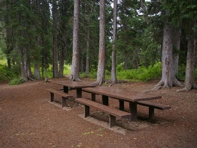
Overview Cottonwood Group Campsite is located near the scenic Cottonwood Lake below Salt River Pass in the forest of western Wyoming. Recreation The lake offers great canoeing and boating for smaller craft and fishing for brook and cutthroat trout. Hiking, mountain biking and horseback riding trails are in the area, as well as a motorized route for trail vehicles Facilities The lake offers great canoeing and boating for smaller craft and fishing for brook and cutthroat trout. Hiking, mountain biking and horseback riding trails are in the area, as well as a motorized route for trail vehicles Natural Features Peaceful North Fork Creek flows through the campground. Its banks and the surrounding canyon are forested by dense stands of pines and aspens, which offer excellent shade and privacy. Vibrant summer wildflowers are abundant.
View details →
Overview Big Game Campground is located along the Buffalo Bill Scenic Byway about 29 miles west of Cody, in northwestern Wyoming. It is 23 miles east of the east entrance to Yellowstone National Park. The surrounding area offers many outdoor recreational opportunities, including fishing, hiking and viewing local wildlife. Recreation Great opportunities for hiking, fishing, scenic driving and wildlife viewing are available around the campground. The North Fork of the Shoshone River is a popular fly-fishing location for rainbow and Yellowstone cutthroat trout. The Wapiti Wayside is less than a half-mile east of the campground, and offers interpretive information on bears and other local wildlife. Facilities Great opportunities for hiking, fishing, scenic driving and wildlife viewing are available around the campground. The North Fork of the Shoshone River is a popular fly-fishing location for rainbow and Yellowstone cutthroat trout. The Wapiti Wayside is less than a half-mile east of the campground, and offers interpretive information on bears and other local wildlife. Natural Features The campground is situated among cottonwood and juniper trees, along the North Fork Shoshone River, at an elevation of 6,000 feet. A wide variety of wildlife lives in the surrounding area. Visitors often glimpse grizzly bears, deer, elk, bison, moose, fox, coyotes and bald eagles. Nearby Attractions Pahaska Tepee, west of the campground, is home to Buffalo Bill's original hunting lodge, built in 1904. Tours are offered daily between Memorial Day and Labor Day. Pahaska also offers guided horseback rides, a gift shop, restaurant and lodging. Yellowstone National Park's east entrance is 23 miles from the campground via the Buffalo Bill Cody Scenic Byway. The park offers unparalleled wildlife viewing opportunities, as well as breathtaking scenery and unique geological features. The small, historic city of Cody offers a variety of dining, lodging and shopping options. The Buffalo Bill Historical Center offers extensive displays of Greater Yellowstone natural history, Plains Indians artifacts, western art, firearms, Buffalo Bill memorabilia and a wild sheep exhibit.
View details →
Overview Hunter Peak Campground is located on the Chief Joseph Scenic Highway/State Highway 296, approximately four miles south of the junction with scenic Beartooth Highway/U.S. Highway 12. The campground is about 60 miles northeast of Cody, in northwestern Wyoming. Recreation The Clarks Fork offers outstanding fishing opportunities for rainbow and cutthroat trout. Many hiking trails are located in the area, including the Clarks Fork Trailhead, which is across the highway from the campground. Facilities The Clarks Fork offers outstanding fishing opportunities for rainbow and cutthroat trout. Many hiking trails are located in the area, including the Clarks Fork Trailhead, which is across the highway from the campground. Natural Features The campground sits on the banks of the Clarks Fork of the Yellowstone River, at an elevation of 6,500 feet. A mixed conifer forest covers the campground. A variety of wildlife, including grizzly bear, deer and elk makes its home in the area. Nearby Attractions The Beartooth Highway was deemed "the most beautiful drive in America," by the late Charles Kuralt. It snakes across the rugged Beartooth Mountains from Red Lodge to Cooke City, Mont., and is the highest elevation highway in the Northern Rockies. Along the way, visitors are treated to sweeping views and plentiful outdoor recreation opportunities. Yellowstone National Park's northeast entrance is approximately 24 miles from the campground via the Beartooth Highway. The park offers unparalleled wildlife viewing opportunities, as well as breathtaking scenery and unique geological features.
View details →
Overview Wapiti Campground is located is located along the Buffalo Bill Scenic Byway about 30 miles west of Cody, in northwestern Wyoming. It is 22 miles east of the east entrance to Yellowstone National Park. The surrounding area offers many outdoor recreational opportunities, including fishing, hiking and viewing local wildlife. Recreation Great opportunities for hiking, fishing, scenic driving and wildlife viewing are available around the campground. The North Fork of the Shoshone River is a popular fly-fishing location for rainbow and Yellowstone cutthroat trout. The Wapiti Wayside is located less than a quarter-mile east of the campground and offers interpretive information on grizzly bears and other local wildlife. Facilities Great opportunities for hiking, fishing, scenic driving and wildlife viewing are available around the campground. The North Fork of the Shoshone River is a popular fly-fishing location for rainbow and Yellowstone cutthroat trout. The Wapiti Wayside is located less than a quarter-mile east of the campground and offers interpretive information on grizzly bears and other local wildlife. Natural Features The campground is situated among cottonwood and juniper trees, along the North Fork of the Shoshone River, at an elevation of 6,000 feet. Ancient cliffs from the Absaroka volcanic mud flow tower above the campground. A wide variety of wildlife lives in the area. Visitors often glimpse grizzly bears, deer, elk, bison, moose, fox, coyotes and bald eagles. Nearby Attractions Pahaska Tepee, west of the campground, is home to Buffalo Bill's original hunting lodge, built in 1904. Tours are offered daily between Memorial Day and Labor Day. Pahaska also offers guided horseback rides, a gift shop, restaurant and lodging. Yellowstone National Park's east entrance is 22 miles from the campground via the Buffalo Bill Cody Scenic Byway. The park offers unparalleled wildlife viewing opportunities, as well as breathtaking scenery and unique geological features. The small, historic city of Cody offers a variety of dining, lodging and shopping options. The Buffalo Bill Historical Center offers extensive displays of Greater Yellowstone natural history, Plains Indians artifacts, western art, firearms, Buffalo Bill memorabilia and a wild sheep exhibit.
View details →
Overview Half Moon Lake campground is situated just off the northeast shore of Half Moon Lake at an elevation of 7,600 feet in the Bridger-Teton National Forest, Wyoming. Recreation This lake provides many recreational activities. Anglers enjoy fishing for rainbow trout, brown trout, lake trout and other various species of fish native to the area. Visitors also enjoy water sports such as boating, swimming, canoeing and paddle boarding. Two miles down the gravel road is an excellent hiking trail for users of all abilities. Facilities This lake provides many recreational activities. Anglers enjoy fishing for rainbow trout, brown trout, lake trout and other various species of fish native to the area. Visitors also enjoy water sports such as boating, swimming, canoeing and paddle boarding. Two miles down the gravel road is an excellent hiking trail for users of all abilities. Natural Features Half Moon Lake was created by glacial movements and is now surrounded by the foot hills of the Wind River Mountains. Along the lakeshore and the hillsides you will find lodgepole pine, Douglas-fir and aspen stands interspersed with sagebrush and rocky outcroppings. Nearby Attractions The Museum of the Mountain Man, located in Pinedale, features a large collection of Rocky Mountain fur trade artifacts, Native American displays, as well as history of the settlement of Sublette County. In July look for the annual Green River Rendezvous. For more information please see the Sublette County Chamber of Commerce or pinedaleonline.com.
View details →
Overview Starting Friday, November 1, 2024, the front loop of the campground will be first come, first served until mid-April. The only way to pay is Scan and Pay via the recreation.gov app. For reservations at the campgrounds managed by Yellowstone National Park Lodges (Fishing Bridge RV Park, Bridge Bay, Canyon, Madison, and Grant Village campgrounds), please visit the Yellowstone National Park Lodges website: http://www.yellowstonenationalparklodges.com/stay/camping/ Recreation There are many recreational opportunities in the Mammoth Hot Springs area including hiking, fishing, and wildlife viewing. A highlight is to explore the boardwalks above Mammoth Hot Springs to view the the steaming hydrothermal features or take a drive around the vibrant travertine terraces. In the winter, ski or snowshoe among the whiffs of sulfur along the Upper Terraces. You can also explore the historic Fort Yellowstone area. Visit the park's website to learn more: https://www.nps.gov/yell/planyourvisit/explore-mammoth.htm Facilities There are many recreational opportunities in the Mammoth Hot Springs area including hiking, fishing, and wildlife viewing. A highlight is to explore the boardwalks above Mammoth Hot Springs to view the the steaming hydrothermal features or take a drive around the vibrant travertine terraces. In the winter, ski or snowshoe among the whiffs of sulfur along the Upper Terraces. You can also explore the historic Fort Yellowstone area. Visit the park's website to learn more: https://www.nps.gov/yell/planyourvisit/explore-mammoth.htm Natural Features The Mammoth Campground is situated in a high sagebrush steppe, scattered juniper and Douglas fir trees provide shade during hot summer months. Wildlife including elk, bison, pronghorn, and mule deer frequent the Mammoth Hot Springs and Northern area of the park, depending on the season. The road from the North Entrance to the Mammoth Campground winds up the Gardner River canyon, past crumbling walls of sandstone and ancient mudflows. The vegetation is much thicker in the canyon than on the open prairie down below, the common trees being Rocky Mountain juniper, cottonwood, and Douglas-fir. Low-growing willows also crowd the river's edge in the flatter, flood-prone sections of the canyon. Watch for wildlife, which varies by the season. Eagles, osprey, dippers, and kingfishers can be spotted along the river, while bighorn sheep climb along the steeper parts of the canyon. Elk are common in Mammoth Hot Springs, while bison can often been seen along the road out to Tower–Roosevelt. Spring and Fall daytime temperatures range from 30°F to the 60°F with overnight lows in the teens to single digits. Snow is common in the spring and fall. Summer temperatures are often around 70°F to 80°F and occasionally 90°F at lower elevations. Nights are usually cool and temperatures may drop below freezing at higher elevations. Thunderstorms are common in the afternoons. During winter, sub-zero temperatures and snow are common, especially at night and at higher elevations. Winter temperatures range from 0—20°F (-20—-5°C) throughout the day, with sub-zero temperatures overnight. Nearby Attractions Visit the park's website to learn more about the Mammoth Hot Springs area: https://www.nps.gov/yell/planyourvisit/explore-mammoth.htm Charges & Cancellations Changing Reservations: There is no change fee if a visitor extends or shortens a reservation, as long as the change includes dates from the original reservation. Additionally, there is no change fee if the visitor wants to switch sites that are the same price with the same reservation dates in the same facility. If a visitor wants to switch dates that are entirely outside of the original reservation dates, there is a $10 change fee. If a reservation is made that includes dates beyond the maximum booking window, that reservation cannot be changed until 18 days have passed from the original booking date. Once a reservation date has begun, visitors cannot change a reservation using the online system or through the Call Center. Onsite staff will assist with changes or cancellations. Cancellations: Visitors may cancel their reservation prior to arrival both on-line and through the call center. A $10 service fee will be withheld from any refund for a cancellation. A visitor who cancels a reservation the day before or on the day of arrival will pay a $10.00 service fee AND forfeit the first night's approved rate including tax and applicable add-on. Cancellations for a one-night reservation will forfeit the entire amount paid and will not be subject to an additional service fee. Visitors who cancel a group overnight facility reservation less than 14 days prior to arrival date will pay a $10 service fee AND forfeit the first night’s rate. No-Shows: A no-show visitor is one who does not arrive at a campground and does not cancel the reservation by check-out time on the day after the scheduled arrival date. Staff will hold a campsite until check-out time on the day following the arrival date. No-shows are assessed $20.00 service fee and forfeit the first night's rate, taxes and applicable add-on for a campsite. Early Departures: Visitors are requested to notify staff at the facility if they depart early to allow others to use the site. If the visitor chooses to depart early, they may forfeit the approved rate and applicable tax and applicable add-on for the day of departure. If a visitor departs prior to the scheduled check-out date, they may be eligible for a partial refund. Visitors may notify the Recreation.gov call center to request a refund of remaining unused nights. If a visitor requests a refund for an early departure after the facility check-out time (10 am) has passed, the visitor will not be refunded for that night and is eligible for a refund on any additional nights that will not be used. Refunds: Visitors may submit a refund request through their Recreation.gov profile within 7 days of the end date of their reservation. Visitors may also initiate a refund request through the call center at any time after their reservation has ended. Refunds for debit or credit card payments will be issued as a credit to the original bank or credit card used to pay. For check or cash purchases, Recreation.gov will mail a Treasury check for refunds of cash, check, or money order payments to the address associated with the reservation. Treasury check refunds may take up to 6-8 weeks to arrive. In the event of an emergency closure, the Recreation.gov team or facility manager will refund all fees and will attempt to notify you using the contact information within the Recreation.gov visitor profile.
View details →
Overview Gros Ventre (pronounced ‘grow-vont’), means “big belly” in French, and the Gros Ventre Campground—surrounded by cottonwood trees and featuring stunning views of Blacktail Butte and the Teton Mountains—is truly magnificent! The campground’s location next to the Gros Ventre River offers some of the best opportunities in the park for wildlife sightings, as bison, moose, mule deer and a wide variety of birds are known to frequent the area. For avid anglers, the Gros Ventre River offers plentiful cutthroat trout, brook trout, and whitefish. While none of Gros Ventre’s campsites are on the river, all are within walking distance. The campground offers camping for tents and dry camping for RVs. Campsites include 279 individual campsites, 4 large group sites, and 39 electric-only sites, 10 of which are ADA-accessible. The campground is open from late-April to early-October. While Gros Ventre Campground doesn’t always fill as quickly as some of the other park campgrounds, visitors are still encouraged to plan and book early. Campground has two dump stations with limited use availability. Please inquire with campground staff upon arrival for use information. Recreation Grab your fly fishing rod and take a short walk down to the Gros Ventre River. Or, if you prefer, our experienced guides offer private guided fly fishing down the famous and scenic Snake River. The Gros Ventre area is a prime location for wildlife watching and photography. Walk along the banks of the river under cottonwood trees and willows to capture that perfect photo of a beaver, moose, elk, bison, or bears. (Be sure to maintain appropriate distance!) Located a short drive away is Mormon Row, featuring the iconic and historic John Moulton barn. Blacktail Butte Trail is a 7.3-mile, moderately trafficked out and back trail, located near Gros Ventre which features beautiful wildflowers, sage brush, and lodgepole pine. The butte is known for its views of the Gros Ventre and Teton Mountain Ranges. Sport climbing is a popular activity in the area; Blacktail Butte’s limestone wall offers mostly 5.10, 5.11, and 5.12 climbs with incredible Teton views. Facilities Grab your fly fishing rod and take a short walk down to the Gros Ventre River. Or, if you prefer, our experienced guides offer private guided fly fishing down the famous and scenic Snake River. The Gros Ventre area is a prime location for wildlife watching and photography. Walk along the banks of the river under cottonwood trees and willows to capture that perfect photo of a beaver, moose, elk, bison, or bears. (Be sure to maintain appropriate distance!) Located a short drive away is Mormon Row, featuring the iconic and historic John Moulton barn. Blacktail Butte Trail is a 7.3-mile, moderately trafficked out and back trail, located near Gros Ventre which features beautiful wildflowers, sage brush, and lodgepole pine. The butte is known for its views of the Gros Ventre and Teton Mountain Ranges. Sport climbing is a popular activity in the area; Blacktail Butte’s limestone wall offers mostly 5.10, 5.11, and 5.12 climbs with incredible Teton views. Natural Features The Gros Ventre Campground is situated in a tranquil setting with incredible views of Blacktail Butte and the Grand Teton Mountain Range. Within walking distance is the Gros Ventre River, which runs through forests, cliffs, and narrow canyons. This area is known for its remarkable fly fishing and photography opportunities. Gros Ventre is home to elk, moose, mule deer, bighorn sheep, wolves, black and grizzly bears, and more. Bears are often seen on trails and in the developed areas. Being prepared for an animal encounter can help ensure your safety as well as that of the wildlife that call this spectacular area home. Nearby Attractions Gros Ventre Campground is the closest in the park to the town of Jackson, where you can visit the National Museum of Wildlife Art located just outside of town, walk under the famous giant elk antler archway in town center, attend the Jackson Hole Rodeo, browse local shops, and dine at one of the many restaurants. Or head north and take a self-guided tour of Grand Teton via the 43-mile Scenic Loop Drive, offering an opportunity to photograph the famous landscape and local wildlife. Then make your way to the historic Jackson Lake Lodge for its famous huckleberry milkshakes and spectacular Teton views through 60-foot tall wall-to-wall windows. While you’re there, book a scenic raft trip, park bus tour, or horseback ride. Go a few miles further to Colter Bay Village where you can rent a kayak or canoe, take a guided boat ride to the majestic base of the Teton Range, or just enjoy lunch and the stunning lake view from the marina. From there, it’s a short drive to Yellowstone National Park’s south entrance. contact_info This location has limited staffing. Please call (877) 444-6777 for general information. Charges & Cancellations Changing Reservations: There is no change fee if a visitor extends or shortens a reservation, as long as the change includes dates from the original reservation. Additionally, there is no change fee if the visitor wants to switch sites that are the same price with the same reservation dates in the same facility. If a visitor wants to switch dates that are entirely outside of the original reservation dates, there is a $10 change fee. If a reservation is made that includes dates beyond the maximum booking window, that reservation cannot be changed until 18 days have passed from the original booking date. Once a reservation date has begun, visitors cannot change a reservation using the online system or through the Call Center. Onsite staff will assist with changes or cancellations. Cancellations: Visitors may cancel their reservation prior to arrival both on-line and through the call center. A $10 service fee will be withheld from any refund for a cancellation. A visitor who cancels a reservation the day before or on the day of arrival will pay a $10.00 service fee AND forfeit the first night's approved rate including tax and applicable add-on. Cancellations for a one-night reservation will forfeit the entire amount paid and will not be subject to an additional service fee. Visitors who cancel a group overnight facility reservation less than 14 days prior to arrival date will pay a $10 service fee AND forfeit the first night’s rate. No-Shows: A no-show visitor is one who does not arrive at a campground and does not cancel the reservation by check-out time on the day after the scheduled arrival date. Staff will hold a campsite until check-out time on the day following the arrival date. No-shows are assessed $20.00 service fee and forfeit the first night's rate, taxes and applicable add-on for a campsite. Early Departures: Visitors are requested to notify staff at the facility if they depart early to allow others to use the site. If the visitor chooses to depart early, they may forfeit the approved rate and applicable tax and applicable add-on for the day of departure. If a visitor departs prior to the scheduled check-out date, they may be eligible for a partial refund. Visitors may notify the Recreation.gov call center to request a refund of remaining unused nights. If a visitor requests a refund for an early departure after the facility check-out time (11 am) has passed, the visitor will not be refunded for that night and is eligible for a refund on any additional nights that will not be used. Refunds: Visitors may submit a refund request through their Recreation.gov profile within 7 days of the end date of their reservation. Visitors may also initiate a refund request through the call center at any time after their reservation has ended. Refunds for debit or credit card payments will be issued as a credit to the original bank or credit card used to pay. For check or cash purchases, Recreation.gov will mail a Treasury check for refunds of cash, check, or money order payments to the address associated with the reservation. Treasury check refunds may take up to 6-8 weeks to arrive. In the event of an emergency closure, the Recreation.gov team or facility manager will refund all fees and will attempt to notify you using the contact information within the Recreation.gov visitor profile.
View details →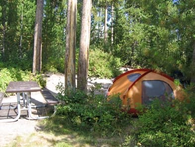
Overview The Signal Mountain Campground is centrally located inside Grand Teton National Park (GTNP) and provides a convenient basecamp for accessing all the park has to offer. This 80-site campground is located adjacent to Signal Mountain Lodge which provides many amenities you might need for your National Park adventures. The campground sits on the southeast shore of Jackson Lake, and offers easy access to the lake waters and short walks to unparalleled views of the Teton Range. The area is frequented by various park wildlife, large and small, as well as a variety of bird species. The Signal Mountain Campground is normally one of the first campgrounds to open and last to close in the park, and can often have lingering snowpack during the opening weeks after heavy winters and possible early wintery weather at the end of the season. Due to the variability of weather in the Tetons, visitors should come prepared, especially during the months of May and October. Recreation There are many popular activities to be taken advantage of from the Signal Mountain Campground. Hiking is a popular park activity and the campground provides direct access to two of the park’s shorter trails. The lakeshore trail is a 3 mile out-and-back trail following the lakeshore bluff to a popular backcountry campsite and the Signal Mountain Summit trail is a 6-mile loop trail. Both trails provide breathtaking views and opportunities for wildlife viewing. Being centrally located in GTNP, many of the park’s classic hikes are located within 15-20-minute drives including the Jenny Lake area, Lupine Meadows, Cascade Canyon, String Lake, Taggart Lake and Paintbrush Canyon trails to name a few. Another popular activity at the Signal Mountain Campground is playing on Jackson Lake. This large alpine lake stretches nearly 7 miles wide and 15 miles long with a maximum depth over 400 feet. Water temperatures generally vary from 50-70 degrees during the campground’s season and is popular for trout fishing, power boats, kayaks and paddle boards. Signal Mountain Marina offers kayak, canoe and motor boat rentals which affords access to the lake for those traveling without their own gear. In addition, Signal Mountain Lodge offers guided fishing trips on Jackson Lake and scenic float trips on the Snake River, contact the Signal Mountain Lodge front desk for more information. Popular spots for swimming are at the boat ramp and picnic areas located at the north and south sides of the campground. Photography and sightseeing are other popular focuses for campers staying at the Signal Mountain Campground. Want that iconic sunset or sunrise photo of the Tetons? Look no further. The area offers numerous great opportunities for landscape and nightscape photography often with the bonus for some wildlife shots. This is a great spot to spend your “rest” day during a busy vacation, but still feel like you can enjoy the park and not have to feel the need to get back in the car. Facilities There are many popular activities to be taken advantage of from the Signal Mountain Campground. Hiking is a popular park activity and the campground provides direct access to two of the park’s shorter trails. The lakeshore trail is a 3 mile out-and-back trail following the lakeshore bluff to a popular backcountry campsite and the Signal Mountain Summit trail is a 6-mile loop trail. Both trails provide breathtaking views and opportunities for wildlife viewing. Being centrally located in GTNP, many of the park’s classic hikes are located within 15-20-minute drives including the Jenny Lake area, Lupine Meadows, Cascade Canyon, String Lake, Taggart Lake and Paintbrush Canyon trails to name a few. Another popular activity at the Signal Mountain Campground is playing on Jackson Lake. This large alpine lake stretches nearly 7 miles wide and 15 miles long with a maximum depth over 400 feet. Water temperatures generally vary from 50-70 degrees during the campground’s season and is popular for trout fishing, power boats, kayaks and paddle boards. Signal Mountain Marina offers kayak, canoe and motor boat rentals which affords access to the lake for those traveling without their own gear. In addition, Signal Mountain Lodge offers guided fishing trips on Jackson Lake and scenic float trips on the Snake River, contact the Signal Mountain Lodge front desk for more information. Popular spots for swimming are at the boat ramp and picnic areas located at the north and south sides of the campground. Photography and sightseeing are other popular focuses for campers staying at the Signal Mountain Campground. Want that iconic sunset or sunrise photo of the Tetons? Look no further. The area offers numerous great opportunities for landscape and nightscape photography often with the bonus for some wildlife shots. This is a great spot to spend your “rest” day during a busy vacation, but still feel like you can enjoy the park and not have to feel the need to get back in the car. Natural Features The Signal Mountain Campground sits slightly elevated from Jackson Lake in a predominantly lodgepole pine forest, which continues up Signal Mountain to the east. Signal Mountain itself is an isolated glacial moraine which rises over 800ft and offers sweeping views of the Jackson Hole valley. The campground is located directly across the lake waters from Mt. Moran, the park’s second tallest peak. The dramatic Teton Range, from the Grand Teton to the south, to the park’s northern peaks, are visible from the lake shore and a few select sites. The campground is frequented by various park wildlife including red fox, coyotes, bears, bats and mule deer to name a few. Often, eagles and osprey are found perched amongst the lake shore trees as they search the lake waters. To protect the park wildlife and fellow campers, proper food storage is enforced and regularly monitored . Nearby Attractions Aside from centralized access to all Grand Teton National Park’s offerings including the Jenny Lake area, the Signal Mountain Campground offer’s convenient access to all of Jackson Hole and Yellowstone’s South Entrance in less than an hour’s drive. The Jackson Hole Airport, 29 miles south, provides numerous daily direct flights from many cities around the country. The town of Jackson is located 38 miles south and offers hundreds of dining and shopping options as well as galleries, museums, tourist attractions, movie theaters, medical facilities, auto repair shops, and more. Teton Village, located 30 miles south, offers many dining and shopping options, as well as gondola and aerial tram rides. The campground also provides easy access for starting your Yellowstone National Park adventures which is only 25 miles north. Charges & Cancellations Please see Recreation.gov Rules and Reservations Policies for detailed information. https://www.recreation.gov/rules-reservation-policies
View details →
Overview The Lizard Creek Campground is located in the northern portion of Grand Teton National Park (GTNP) and provides a convenient basecamp for campers taking day trips to both Grand Teton and Yellowstone National Parks. This 60-site campground sits on the northern shore of Jackson Lake and offers access to the lake waters and views of the northern Teton Mountain Range. The area is frequented by various park wildlife, large and small as well as a variety of bird species. This Campground is normally one of the last campgrounds to open and first to close for the season in the park and can often see quickly changing weather patterns. The Lizard Creek Campground provides the perfect location for visitors to GTNP looking to avoid the crowds and who don’t need more than the basic amenities. Recreation The campground is a popular location for park visitors looking for access to both Grand Teton and Yellowstone National Parks . Hiking is one of the parks’ most popular activities. While no hiking trails leave directly from the campground proper, several trails can be found at Colter Bay located 7 miles south, and in Yellowstone located 8 miles north. Another popular activity at the Lizard Creek Campground is recreating on Jackson Lake. This large alpine lake stretches nearly 7 miles wide and 15 miles long, with a maximum depth of over 400 feet. Water temperatures generally vary from 50-70 degrees during the campground’s season. The campground provides convenient access for trout fishing and canoe/kayak use. Many campers can be found cooling off on the shores of Jackson Lake. Lizard Creek Campground does not have a boat ramp. Boat ramp access is available at Signal Mountain lodge as well as kayake, canoe and motor boat rentals at the Signal Mountain Lodge marina. In addition, Signal Mountain Lodge offers guided fishing trips on Jackson Lake and scenic float trips on the Snake River, contact the Signal Mountain Lodge front desk for more information. Photography and sightseeing are other popular focuses for campers staying at the Lizard Creek Campground. The location provides a unique perspective of the lake and mountains for sunrise and sunset photographs. The area offers numerous great opportunities for landscape and nightscape photography, often with the bonus for wildlife shots. This is a great spot to spend your “rest” day away from the crowds. Facilities The campground is a popular location for park visitors looking for access to both Grand Teton and Yellowstone National Parks . Hiking is one of the parks’ most popular activities. While no hiking trails leave directly from the campground proper, several trails can be found at Colter Bay located 7 miles south, and in Yellowstone located 8 miles north. Another popular activity at the Lizard Creek Campground is recreating on Jackson Lake. This large alpine lake stretches nearly 7 miles wide and 15 miles long, with a maximum depth of over 400 feet. Water temperatures generally vary from 50-70 degrees during the campground’s season. The campground provides convenient access for trout fishing and canoe/kayak use. Many campers can be found cooling off on the shores of Jackson Lake. Lizard Creek Campground does not have a boat ramp. Boat ramp access is available at Signal Mountain lodge as well as kayake, canoe and motor boat rentals at the Signal Mountain Lodge marina. In addition, Signal Mountain Lodge offers guided fishing trips on Jackson Lake and scenic float trips on the Snake River, contact the Signal Mountain Lodge front desk for more information. Photography and sightseeing are other popular focuses for campers staying at the Lizard Creek Campground. The location provides a unique perspective of the lake and mountains for sunrise and sunset photographs. The area offers numerous great opportunities for landscape and nightscape photography, often with the bonus for wildlife shots. This is a great spot to spend your “rest” day away from the crowds. Natural Features The Lizard Creek Campground sits slightly elevated from Jackson Lake on Fonda Point in the northern portion of Grand Teton National Park. Offering sweeping views of the northern Teton Mountain Range; looking south from the lakeshore. It is surrounded by a predominantly lodgepole pine and spruce forest. The campground is frequented by various park wildlife including red fox, coyotes, bears and mule deer to name a few. Often bald eagles and osprey are found perched amongst the lake shore trees as they search the lake waters. To protect the park wildlife and fellow campers, proper food storage is enforced and regularly monitored. Nearby Attractions The Lizard Creek Campground offer’s a convenient location to access to both Grand Teton and Yellowstone National Parks. The South Entrance of Yellowstone is located only 11 miles north. Leek’s Pizzeria is located 7 miles south and offers indoor and outdoor dining with handmade pizza and sandwich offerings. Colter Bay located 8 miles south offers an expanded grocery store, as well as public showers and laundromat. The town of Jackson, Wyoming is located 55 miles south and offers many dining and shopping options as well as galleries, museums, tourist attractions, movie theaters, medical facilities, auto mechanics, and much more. Not having larger facilities nearby provides for a quieter and slower paced atmosphere than other locations in the park. Charges & Cancellations Please see recreation.gov Rules and Reservations Policies page for detailed information. https://www.recreation.gov/rules-reservation-policies
View details →
Overview Porcupine Campground is located along the Medicine Wheel Passage Scenic Byway (U.S. Highway 14A), 33 miles east of Lovell, Wyoming. The Medicine Wheel National Historic Landmark is nearby. Visitors enjoy the area for its scenic natural beauty, recreational opportunities and excellent habitat for a variety of wildlife species. Fishing is popular on nearby streams and lakes. The administering organization is Gallatin Canyon Campgrounds; e-mail: gccampgrounds13@gmail.com Recreation From the area's historic mining sites to the ancient Native American Medicine Wheel, to hiking through open meadows and along the cliffs on the west rim of the mountains, the Bighorn National Forest offers many recreational opportunities. Jaws Trailhead is near the campground, offering access to Bucking Mule Falls Trail and Porcupine Creek. Scenic off-road driving is available on Hunt Mountain Road or Burgess Overlook jeep trail. Facilities From the area's historic mining sites to the ancient Native American Medicine Wheel, to hiking through open meadows and along the cliffs on the west rim of the mountains, the Bighorn National Forest offers many recreational opportunities. Jaws Trailhead is near the campground, offering access to Bucking Mule Falls Trail and Porcupine Creek. Scenic off-road driving is available on Hunt Mountain Road or Burgess Overlook jeep trail. Natural Features Nearby Bald Mountain is part of the Bighorn Range in northern Wyoming. A forest of pine and aspen covers the campground at an elevation of 8,900 feet. Temperatures can drop significantly once the sun goes down. Summer daytime temperatures range from 60s-90s with nighttime temperatures down to the 50s. June is sometimes rainy while the rest of the summer offers fair, clear, sunny days. Thunderstorms and snowstorms can arise at any time. Autumn temperatures are cool with frosts by mid-September. contact_info For facility specific information, please call (406) 587-9054. Nearby Attractions The Medicine Wheel National Historic Landmark is four miles from the campground. This unique geoglyph signifies all creation, all races of people, birds, fish, animals, trees and stones. According to tribal beliefs, the circular shape of the wheel represents the earth, sun, moon, cycles of life, seasons and day to night. High Country Lodge is nearby, offering guided horseback riding and backcountry pack trips, off-road vehicle rentals and guided fishing trips. Charges & Cancellations Refunds: Refund requests made through www.recreation.gov will be charged a $10 processing fee. This cancellation processing fee is retained by the reservation service contractor along with the non-refundable reservation fee. All requests for the return of the non-refundable reservation fee and the cancellation processing fee will be declined by the campground concessionaire as they did not receive these fees (these are the fees retained by the reservation contractor, a different entity).
View details →
Overview Doyle Creek Campground is located 30 miles west of Buffalo, Wyoming, on the east side of scenic Cloud Peak Skyway, near the Cloud Peak Wilderness area. Located in the Bighorn National Forest, visitors to the area enjoy a wide variety of activities, including hiking, fishing, scenic driving and a number of historic sites. The area offers excellent habitat for a wide variety of wildlife species. The administering organization is Gallatin Canyon Campgrounds; e-mail: gccampgrounds13@gmail.com Recreation Scenic off-highway driving is available on nearby Elgin Park, Pole Creek and Crazy Woman Canyon Roads. Hiking and mountain biking are allowed on these roads as well. ATV trails are adjacent to camp. Many additional hiking trails are available in the Cloud Peak Wilderness. Fishing is popular in the campground and nearby streams and lakes. Facilities Scenic off-highway driving is available on nearby Elgin Park, Pole Creek and Crazy Woman Canyon Roads. Hiking and mountain biking are allowed on these roads as well. ATV trails are adjacent to camp. Many additional hiking trails are available in the Cloud Peak Wilderness. Fishing is popular in the campground and nearby streams and lakes. Natural Features Located at 8,100 feet in elevation, the campground is situated in a densely forested area of lodgepole pine. Campsites are located on a creek and meadow in a peaceful and remote setting. Temperatures can drop significantly once the sun goes down. Summer daytime temperatures range from the 60s-90s, with nighttime temperatures down to the 50s. June is sometimes rainy while the rest of the summer has fair, clear, sunny days. Thunderstorms and snowstorms can arise at any time. Autumn temperatures are cool with frosts by mid-September. Nearby Attractions Scenic driving on Cloud Peak Skyway. Charges & Cancellations Refunds: Refund requests made through www.recreation.gov will be charged a $10 processing fee. This cancellation processing fee is retained by the reservation service contractor along with the non-refundable reservation fee. All requests for the return of the non-refundable reservation fee and the cancellation processing fee will be declined by the campground concessionaire as they did not receive these fees (these are the fees retained by the reservation contractor, a different entity).
View details →
Overview Island Park Campground is located in pine and spruce forest on West Tensleep Creek near West Tensleep Lake and the Cloud Peak Wilderness. Located 21 miles northeast of Ten Sleep, Wyoming, and 55 east of Worland, Wyoming, on US Hwy 16 this campground is nestled in the Bighorn National Forest offering a wide variety of activities including, hiking, fishing, scenic driving and a number of historic sites. The administering organization is Gallatin Canyon Campgrounds; e-mail: gccampgrounds13@gmail.com Recreation Meadowlark Lake is seven miles distant and allows motorized craft with a no-wake rule. West Tensleep Lake is a scenic, 125-acre lake open to non-motorized craft only, making it a perfect location for canoeing and fishing. Anglers will find rainbow, brown and brook trout in the cool waters of the lake. Off-road vehicle trails, scenic jeep roads, hiking and horseback riding trails and many fishing streams are available in the surrounding area. Facilities Meadowlark Lake is seven miles distant and allows motorized craft with a no-wake rule. West Tensleep Lake is a scenic, 125-acre lake open to non-motorized craft only, making it a perfect location for canoeing and fishing. Anglers will find rainbow, brown and brook trout in the cool waters of the lake. Off-road vehicle trails, scenic jeep roads, hiking and horseback riding trails and many fishing streams are available in the surrounding area. Natural Features West Tensleep Creek is adjacent to the campground and West Tensleep Lake is four miles away, along with other lakes and creeks. Hiking trails into the Cloud Peak Wilderness start about five miles from the campground. A forest of lodgepole pine, Douglas fir and spruce trees covers the area. Nearby Attractions The High Park Lookout is located just east of Meadowlark Lake. This old fire lookout was built by the CCC decades ago and is no longer active. A short hike leads to the lookout, where hikers are awarded panoramic views of the Cloud Peak Wilderness and the surrounding area. Deer Haven Lodge and Meadowlark Lodge are nearby, offering dining, lodging, guided horseback riding and fishing and camping supplies. Charges & Cancellations Refunds: Refund requests made through www.recreation.gov will be charged a $10 processing fee. This cancellation processing fee is retained by the reservation service contractor along with the non-refundable reservation fee. All requests for the return of the non-refundable reservation fee and the cancellation processing fee will be declined by the campground concessionaire as they did not receive these fees (these are the fees retained by the reservation contractor, a different entity).
View details →
Overview Leigh Creek Campground is located about 35 miles east of Worland, Wyoming, on the west side of scenic Cloud Peak Skyway, near the Cloud Peak Wilderness area. Located in the Bighorn National Forest, visitors to the area enjoy a wide variety of activities including hiking, fishing, scenic driving, and a number of historic sites. The administering organization is Gallatin Canyon Campgrounds; e-mail: gccampgrounds13@gmail.com Recreation Off-highway vehicle trails, scenic jeep roads, hiking and additional fishing streams are available in the surrounding area. Diverse hikes vary from loop trails to treks along creeks and over mountain peaks; many trails access the Cloud Peak Wilderness, which is 14 miles northeast of the campground. Meadowlark Lake is about 11 miles from the campground. This small lake allows motorized craft at a wake-less speed. West Tensleep Lake is 14 miles northeast of the campground and is open to non-motorized craft only. Both lakes are great locations for canoeing and fishing. Facilities Off-highway vehicle trails, scenic jeep roads, hiking and additional fishing streams are available in the surrounding area. Diverse hikes vary from loop trails to treks along creeks and over mountain peaks; many trails access the Cloud Peak Wilderness, which is 14 miles northeast of the campground. Meadowlark Lake is about 11 miles from the campground. This small lake allows motorized craft at a wake-less speed. West Tensleep Lake is 14 miles northeast of the campground and is open to non-motorized craft only. Both lakes are great locations for canoeing and fishing. Natural Features The campground sits on the banks of Tensleep Creek surrounded by a forest of lodgepole pine. Many lakes and streams are found in the surrounding Bighorn Mountains. Nearby Attractions The High Park Lookout is located just east of Meadowlark Lake. This old fire lookout was built by the CCC decades ago and is no longer active. A short hike leads to the lookout, where hikers are awarded panoramic views of the surrounding area. Deer Haven Lodge and Meadowlark Lodge are nearby, offering dining options, lodging, guided horseback riding and fishing and camping supplies. Charges & Cancellations Refunds: Refund requests made through www.recreation.gov will be charged a $10 processing fee. This cancellation processing fee is retained by the reservation service contractor along with the non-refundable reservation fee. All requests for the return of the non-refundable reservation fee and the cancellation processing fee will be declined by the campground concessionaire as they did not receive these fees (these are the fees retained by the reservation contractor, a different entity).
View details →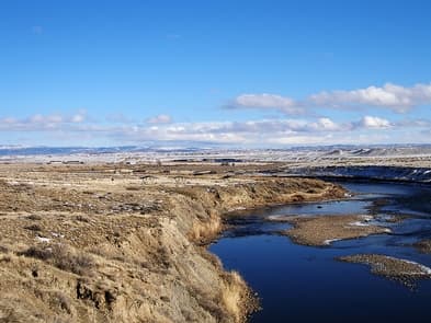
Pete's Draw has both a day-use and overnight camping area to enjoy hiking, wildlife viewing, picnicking, fishing, boating and camping. There's a parking area, vault toilet, seven overnight campsites with picnic tables, fire rings, shelters, tent pads, and RV parking, trash receptacle, and a hardened pedestrian trail. No water is available at this campground. Campsites are first come, first served. No overnight parking is allowed in the day use area. This campground receives heavy visitation in the spring and early summer months.
View details →
Chalk Bluffs has an access road and parking area, vault toilet, eleven overnight camping sites with tent pads, picnic tables, fire rings, RV parking, boat ramp and a parking area large enough for vehicles and drift boat trailers. No water is available in this campground. Campsites are first come, first served.
View details →
Overview Availability will go live on Recreation.gov on a 6-month rolling basis for RV sites, Tent sites, and Camper Cabins. Located in the John D. Rockefeller, Jr. Memorial Parkway, directly between Grand Teton and Yellowstone National Parks and just minutes from both, Headwaters Campground offers the perfect basecamp for exploration. Situated in a spectacular wooded setting with rolling hills and Teton mountain views, this campground is the perfect place to unwind and unplug, as there is limited cellular or internet service. Commune with nature and spot bear, moose, mule deer, and more as you stroll along nearby Polecat Creek. For avid anglers, the Snake River offers plentiful cutthroat trout, brook trout, and whitefish. While none of Headwater’s campsites are on the river, all are within walking distance. The campground offers 34 tent sites, 97 full-hookup and pull-through RV sites, and 40 Camper Cabins, and is open from June to October. Visitors are encouraged to plan ahead and book early. Recreation The Headwaters area is a prime location for wildlife watching and photography. Walk along the banks of Polecat Creek through wildflower meadows and conifer forests to capture that perfect photo of a beaver, moose, elk, bison, bear, or birds. (Be sure to maintain appropriate distance!) Although soaking is not permitted, Huckleberry Hot Springs is an easy 2.5-mile loop that starts at Polecat Creek. The Flagg Canyon trail is a good option for all ability levels. This 5.1-mile out and back hike winds through meadows and cliffs along the Snake River, and features a waterfall. There is plenty of wildlife to see in this area, including marmot, elk, and white-throated swift. Facilities The Headwaters area is a prime location for wildlife watching and photography. Walk along the banks of Polecat Creek through wildflower meadows and conifer forests to capture that perfect photo of a beaver, moose, elk, bison, bear, or birds. (Be sure to maintain appropriate distance!) Although soaking is not permitted, Huckleberry Hot Springs is an easy 2.5-mile loop that starts at Polecat Creek. The Flagg Canyon trail is a good option for all ability levels. This 5.1-mile out and back hike winds through meadows and cliffs along the Snake River, and features a waterfall. There is plenty of wildlife to see in this area, including marmot, elk, and white-throated swift. Natural Features Headwaters at Flagg Ranch is situated in a tranquil setting along the upper reaches of the Snake River, surrounded by meadows and conifer forests. The Yellowstone Plateau rises to the north, and Huckleberry Mountain to the east. Within walking distance is Polecat Creek, which runs through forests, wildflower meadows, and thermal features. For avid anglers, the Snake River offers plentiful cutthroat trout, brook trout, and whitefish. This area is known for its remarkable fly fishing and photography opportunities. Headwaters is home to elk, moose, mule deer, wolves, black and grizzly bears, a wide variety of birds and more. Bears are often seen on trails and in the developed areas. Being prepared for an animal encounter can help ensure your safety as well as that of the wildlife that call this spectacular area home. Nearby Attractions One of the many reasons visitors return to Headwaters at Flagg Ranch year after year is its close proximity to Yellowstone’s south entrance, just a few miles north. But while it wouldn’t be difficult to spend all your time exploring our country’s very first national park (and the second-largest in the lower 48 states), there is much to see and do in the opposite direction as well. Take a self-guided tour of Grand Teton National Park via the 43-mile Scenic Loop Drive, offering an opportunity to photograph the park’s famous landscape and local wildlife. Spend a few hours at Colter Bay Village, located about 30 minutes south of Headwaters Campground, where you can rent a kayak or canoe, take a guided boat ride to the majestic base of the Teton Range, or just enjoy lunch and the stunning lake view from the marina. Continue on and stop in at the historic Jackson Lake Lodge for its famous huckleberry milkshakes and spectacular Teton views through 60-foot tall wall-to-wall windows. While you’re there, book a scenic raft trip or park bus tour. From there, continue south to the town of Jackson, located about 50 miles from Headwaters, where you can visit the National Museum of Wildlife Art just outside of town, walk under the famous giant elk antler archway in town center, attend the Jackson Hole Rodeo, browse local shops, and dine at one of the many restaurants. contact_info Between 06/01/2024 and 09/30/2024 this location is staffed. Please call (307) 543-2861 to speak with local staff. From 10/01/2024 to 05/31/2025 this location is unstaffed. Please call (800) 443-2311 for general information. Charges & Cancellations Changing Reservations: If a visitor wants to switch dates that are entirely outside of the original reservation dates, there is a $10 change fee. There is no change fee if a visitor extends or shortens a reservation, as long as the change includes dates from the original reservation. Additionally, there is no change fee if the visitor wants to switch sites that are the same price with the same reservation dates in the same facility. If the visitor chooses to depart early, they may forfeit the approved rate and applicable tax and applicable add-on for the day of departure. If a reservation is made that includes dates beyond the maximum booking window, that reservation cannot be changed until 18 days have passed from the original booking date. Once a reservation date has begun, visitors cannot change a reservation using the online system or through the Call Center. Onsite staff will assist with changes or cancellations. Deposits: A deposit made by cash, check, or credit card will be required for the full reservation utilizing the applicable approved rate with tax and applicable add-on to hold a reservation. Cancellations: Visitors may cancel their reservation prior to arrival both on-line and through the call center. A $10 service fee will be withheld from any refund for a cancellation. Cancellations within 24 hours of check-in are subject to the late cancellation policy. Visitors who cancel a group overnight facility reservation less than 14 days prior to arrival date will pay a $10 service fee AND forfeit the first night’s rate Late Cancellations or Cancellations within the Cut-off Window: Late Cancellations or Cancellations within the Cut-off Window: A visitor who cancels a reservation the day before or on the day of arrival will pay a $10.00 service fee AND forfeit the first night's approved rate including tax and applicable add-on. Cancellations for a one-night reservation will forfeit the entire amount paid and will not be subject to an additional service fee. No-Shows: A no-show visitor is one who does not arrive at a campground and does not cancel the reservation by check-out time on the day after the scheduled arrival date. Staff will hold a campsite until check-out time on the day following the arrival date. No-shows are assessed $20.00 service fee and forfeit the first night's rate, taxes and applicable add-on for a campsite. Early Departures: If a visitor departs prior to the scheduled check-out date, they may be eligible for a partial refund. Visitors are requested to notify staff at the facility if they depart early to allow others to use the site. Visitors may notify the call center to request a refund of remaining unused nights. If a visitor requests a refund for an early departure after the facility check-out time (11 am) has passed, the visitor will not be refunded for that night and is eligible for a refund on any additional nights that will not be used. Refunds: Visitors may submit a refund request through their Recreation.gov profile within 7 days of the end date of their reservation. Visitors may also initiate a refund request through the call center at any time after their reservation has ended. Debit or Credit Card Purchases: Refunds for debit or credit card payments will be issued as a credit to the original bank or credit card used to pay. Check or Cash Purchases: Recreation.gov will mail a Treasury check for refunds of cash, check, or money order payments to the address associated with the reservation. Treasury check refunds may take up to 6-8 weeks to arrive. Emergency Closures: In the event of an emergency closure, the Recreation.gov team or facility manager will refund all fees and will attempt to notify the visitor using the contact information within the Recreation.gov visitor profile.
View details →
Overview Located about eight miles south of Mammoth Hot Springs on the road to Norris, Indian Creek Campground—elevation 7,300 feet (2225 m)—sits near the base of the Gallatin Mountains and offers breathtaking views of Electric Peak. The area offers easy access to fishing and hiking. The campground is away from the main road and provides a quieter, more primitive, experience than many other locations. For reservations at the campgrounds managed by Yellowstone National Park Lodges (Fishing Bridge RV Park, Bridge Bay, Canyon, Madison, and Grant Village campgrounds), please visit the Yellowstone National Park Lodges website: http://www.yellowstonenationalparklodges.com/stay/camping/ Recreation Fishing, hiking, wildlife viewing are the highlights for this campground. The Big Horn Pass trailhead is on the entrance road to the campground. Facilities Fishing, hiking, wildlife viewing are the highlights for this campground. The Big Horn Pass trailhead is on the entrance road to the campground. Natural Features Highlights in the area include Obsidian Creek and the Gardner River, Big Horn Pass Trail, Sheepeater Cliff picnic area, and Willow Park for wildlife viewing. contact_info This location has limited staffing. Please call (307) 344-2289 for general information. Nearby Attractions Big Horn Pass trailhead Sheepeaters Cliff picnic area Rustic Falls Apollonaris Spring Obsidian Cliff Charges & Cancellations Changing Reservations: There is no change fee if a visitor extends or shortens a reservation, as long as the change includes dates from the original reservation. Additionally, there is no change fee if the visitor wants to switch sites that are the same price with the same reservation dates in the same facility. If a visitor wants to switch dates that are entirely outside of the original reservation dates, there is a $10 change fee. If a reservation is made that includes dates beyond the maximum booking window, that reservation cannot be changed until 18 days have passed from the original booking date. Once a reservation date has begun, visitors cannot change a reservation using the online system or through the Call Center. Onsite staff will assist with changes or cancellations. Cancellations: Visitors may cancel their reservation prior to arrival both on-line and through the call center. A $10 service fee will be withheld from any refund for a cancellation. A visitor who cancels a reservation the day before or on the day of arrival will pay a $10.00 service fee AND forfeit the first night's approved rate including tax and applicable add-on. Cancellations for a one-night reservation will forfeit the entire amount paid and will not be subject to an additional service fee. Visitors who cancel a group overnight facility reservation less than 14 days prior to arrival date will pay a $10 service fee AND forfeit the first night’s rate. No-Shows: A no-show visitor is one who does not arrive at a campground and does not cancel the reservation by check-out time on the day after the scheduled arrival date. Staff will hold a campsite until check-out time on the day following the arrival date. No-shows are assessed $20.00 service fee and forfeit the first night's rate, taxes and applicable add-on for a campsite. Early Departures: Visitors are requested to notify staff at the facility if they depart early to allow others to use the site. If the visitor chooses to depart early, they may forfeit the approved rate and applicable tax and applicable add-on for the day of departure. If a visitor departs prior to the scheduled check-out date, they may be eligible for a partial refund. Visitors may notify the Recreation.gov call center to request a refund of remaining unused nights. If a visitor requests a refund for an early departure after the facility check-out time (10 am) has passed, the visitor will not be refunded for that night and is eligible for a refund on any additional nights that will not be used. Refunds: Visitors may submit a refund request through their Recreation.gov profile within 7 days of the end date of their reservation. Visitors may also initiate a refund request through the call center at any time after their reservation has ended. Refunds for debit or credit card payments will be issued as a credit to the original bank or credit card used to pay. For check or cash purchases, Recreation.gov will mail a Treasury check for refunds of cash, check, or money order payments to the address associated with the reservation. Treasury check refunds may take up to 6-8 weeks to arrive. In the event of an emergency closure, the Recreation.gov team or facility manager will refund all fees and will attempt to notify you using the contact information within the Recreation.gov visitor profile.
View details →
Overview Tower Fall Campground—elevation 6,600 feet (2012 m)—is located on the north side of the steep, winding, road to Dunraven Pass. The campground is near the Tower General Store and Tower Fall. The Lamar Valley, with spectacular wildlife viewing opportunities, is located nearby as are several hiking trails. Roosevelt Lodge, a short drive from the campground, offers dining and horseback riding. For reservations at the campgrounds managed by Yellowstone National Park Lodges (Fishing Bridge RV Park, Bridge Bay, Canyon, Madison, and Grant Village campgrounds), please visit the Yellowstone National Park Lodges website: http://www.yellowstonenationalparklodges.com/stay/camping/ Recreation For information on recreation opportunities in Yellowstone National Park please visit: https://www.nps.gov/yell/index.htm Facilities For information on recreation opportunities in Yellowstone National Park please visit: https://www.nps.gov/yell/index.htm Natural Features The Tower Fall Campground is located in the Tower-Roosevelt Area which is in the park's northern range. A short hike is located just outside the campground to get to an overlook view of Tower Fall. The Lamar Valley is an excellent place to view wildlife, with it being one of the major summer grounds for bison and elk, which attracts predators like wolves and grizzly bears. Mt Washburn is also located south and includes a day hike to the Mt Washburn lookout point. Elk, bison, deer, and pronghorn thrive in the grasslands of this area, known as the northern range. In fact, some of the largest wild herds of bison and elk in North America are found here. The northern range is critical winter habitat for these large animals, which in turn provide food for several packs of wolves. Coyotes are also common, and occasional bobcat, cougar, or red fox are reported. The gorge and cliffs between the junction and Tower Fall provide habitat for bighorn sheep, osprey, peregrine falcons, and red-tailed hawks. Both grizzly and black bears are sighted throughout the area, particularly in the spring. Black bears are more commonly seen around Tower Fall and Tower Junction. Grizzlies are sometimes seen in the Lamar Valley and on the north slopes of Mount Washburn, particularly in the spring when elk are calving. Road pullouts provide excellent places from which to watch wildlife. Nearby Attractions Highlights in the area include the Tower Fall overlook, Mount Washburn, the Lamar and Yellowstone Rivers, and the Lamar Valley for wildlife viewing. For more information, visit the park's website: https://www.nps.gov/yell/planyourvisit/towerrplan.htm Charges & Cancellations Changing Reservations: There is no change fee if a visitor extends or shortens a reservation, as long as the change includes dates from the original reservation. Additionally, there is no change fee if the visitor wants to switch sites that are the same price with the same reservation dates in the same facility. If a visitor wants to switch dates that are entirely outside of the original reservation dates, there is a $10 change fee. If a reservation is made that includes dates beyond the maximum booking window, that reservation cannot be changed until 18 days have passed from the original booking date. Once a reservation date has begun, visitors cannot change a reservation using the online system or through the Call Center. Onsite staff will assist with changes or cancellations. Cancellations: Visitors may cancel their reservation prior to arrival both on-line and through the call center. A $10 service fee will be withheld from any refund for a cancellation. A visitor who cancels a reservation the day before or on the day of arrival will pay a $10.00 service fee AND forfeit the first night's approved rate including tax and applicable add-on. Cancellations for a one-night reservation will forfeit the entire amount paid and will not be subject to an additional service fee. Visitors who cancel a group overnight facility reservation less than 14 days prior to arrival date will pay a $10 service fee AND forfeit the first night’s rate. No-Shows: A no-show visitor is one who does not arrive at a campground and does not cancel the reservation by check-out time on the day after the scheduled arrival date. Staff will hold a campsite until check-out time on the day following the arrival date. No-shows are assessed $20.00 service fee and forfeit the first night's rate, taxes and applicable add-on for a campsite. Early Departures: Visitors are requested to notify staff at the facility if they depart early to allow others to use the site. If the visitor chooses to depart early, they may forfeit the approved rate and applicable tax and applicable add-on for the day of departure. If a visitor departs prior to the scheduled check-out date, they may be eligible for a partial refund. Visitors may notify the Recreation.gov call center to request a refund of remaining unused nights. If a visitor requests a refund for an early departure after the facility check-out time (10 am) has passed, the visitor will not be refunded for that night and is eligible for a refund on any additional nights that will not be used. Refunds: Visitors may submit a refund request through their Recreation.gov profile within 7 days of the end date of their reservation. Visitors may also initiate a refund request through the call center at any time after their reservation has ended. Refunds for debit or credit card payments will be issued as a credit to the original bank or credit card used to pay. For check or cash purchases, Recreation.gov will mail a Treasury check for refunds of cash, check, or money order payments to the address associated with the reservation. Treasury check refunds may take up to 6-8 weeks to arrive. In the event of an emergency closure, the Recreation.gov team or facility manager will refund all fees and will attempt to notify you using the contact information within the Recreation.gov visitor profile.
View details →
Overview Near some of the best wildlife watching opportunities in the park. Located at the end of a two mile dirt road, this campground is best suited for tents and small RVs. There are plenty of hiking and fishing opportunities in the area, including the Slough Creek Trail which begins nearby. Nighttime offers a quiet, unimpeded view of the stars and the possibility of hearing wolves howl. Elevation: 6,250 ft (1905 m). Recreation There are many opportunties for recreation in the Slough Creek area including hiking, fishing, wildlife viewing, backpacking and photography. Visit the park's website to learn more: https://www.nps.gov/yell/planyourvisit/towerrplan.htm Facilities There are many opportunties for recreation in the Slough Creek area including hiking, fishing, wildlife viewing, backpacking and photography. Visit the park's website to learn more: https://www.nps.gov/yell/planyourvisit/towerrplan.htm Natural Features The Slough Creek Campground is located on the park's Northern Range, a few miles from where Slough Creek meets the Lamar River. The Lamar Valley is an excellent place to view wildlife, with it being one of the major summer grounds for bison and elk, which attracts predators like wolves and grizzly bears. Elk, bison, deer, and pronghorn thrive in the grasslands of this area, known as the northern range. In fact, some of the largest wild herds of bison and elk in North America are found here. The northern range is critical winter habitat for these large animals, which in turn provide food for several packs of wolves. Coyotes are also common, and occasional bobcat, cougar, or red fox are reported. The gorge and cliffs between the junction and Tower Fall provide habitat for bighorn sheep, osprey, peregrine falcons, and red-tailed hawks. Both grizzly and black bears are sighted throughout the area, particularly in the spring. Black bears are more commonly seen around Tower Fall and Tower Junction. Grizzlies are sometimes seen in the Lamar Valley and on the north slopes of Mount Washburn, particularly in the spring when elk are calving. Road pullouts provide excellent places from which to watch wildlife. The campground can access the Slough Creek Trail, which follows a historic wagon trail into the Absaroka-Beartooth Wilderness beyond Yellowstone. It begins with a steep climb then descends to the first meadow. Stop and relax here or continue to the second meadow. Be alert for bears and moose. Slough Creek is a popular fishing area. Nearby Attractions Highlights in the area include the Slough Creek Trail, the Lamar and Yellowstone Rivers, and the Lamar Valley for wildlife viewing. For more information, visit the park's website: https://www.nps.gov/yell/planyourvisit/towerrplan.htm Charges & Cancellations
View details →
Overview The Green River Lakes Lodge is located 50 miles north of Pinedale, Wyoming. The lodge is available as a rental for day use events such as weddings, family reunions, or meetings for up to 50 guests, or as an overnight rental for smaller groups of up to 12 guests. Recreation During the summer months, hiking and horseback riding into the Bridger Wilderness and Wind River Range are popular activities enjoyed by visitors to the area. The lake is open to small watercraft only, making it an excellent location for canoeing, kayaking, and paddle boarding. There is a small boat launch located on the lakeshore, but turnaround space is limited and the access route steep. Anglers fish for brook, cutthroat, rainbow and Mackinaw trout. Fall and winter opportunities abound also, from hunting and late season hiking to snowmobiling and ice fishing. Access in winter is via 20 mile groomed snowmachine trail. Facilities During the summer months, hiking and horseback riding into the Bridger Wilderness and Wind River Range are popular activities enjoyed by visitors to the area. The lake is open to small watercraft only, making it an excellent location for canoeing, kayaking, and paddle boarding. There is a small boat launch located on the lakeshore, but turnaround space is limited and the access route steep. Anglers fish for brook, cutthroat, rainbow and Mackinaw trout. Fall and winter opportunities abound also, from hunting and late season hiking to snowmobiling and ice fishing. Access in winter is via 20 mile groomed snowmachine trail. Natural Features The lodge is set upon the lakeshore of the lower Green River Lake, at an elevation of 8,000 feet. A commanding view of Square Top can be seen right from the living room of the two bedroom/two bath rental unit. The lower lake sits on the western edge of the rugged Wind River Range and the Bridger Wilderness. The area is replete with wildlife and provides access to scenic mountain views, as well as plentiful opportunities for recreation. Nearby Attractions Nearby is a developed campground, and trails for non-motorized use including the popular Continental Divide National Scenic Trail, as well as fishing and canoeing on the lake. During the winter months, a system of groomed snowmobile trails provide access to the lodge. Pinedale is the nearest full service community, and it located 50 miles south of Green River Lakes.
View details →
The Blucher Creek Campground is 74 miles from Rock Springs and 70 miles from Lander. It's an ADA accessible site and features a safety structure, accessible picnic tables, fire rings and an accessible vault toilet. Stay limit is 14 days. There are no fees associated with this site.
View details →
The site of the first Fire Guard Station, Sweetwater Guard Station, has three walk in access campsites and an additional eight sites featuring picnic tables, fire rings at each site. Nestled in the Wind River Mountains, this campground located about 73 miles from Rock Springs and 69 miles from Lander. It is ADA accessible and is a non-fee area.
View details →
The Buffalo Creek Campground is located off of the scenic South Bighorn/Red Wall Back Country Byway. It has four camping sites, a vault toilet and fire rings. It is partially accessible. The Buffalo Creek Campground is about 24 miles north of Arminto. There no fees associated with this campground and also no water is available at this campground. Campsites are first come, first served.
View details →
Visitors to the Grave Springs Campground can camp, hunt, picnic, and it offers excellent small stream fishing and wildlife viewing. The site has twelve camping sites with RV parking and tent pads, two camping sites for tents only with parking and tent pads, vault toilet, tables and fire rings. The site is ADA accessible. There are no fees associate with this campground; nor is water available at this campground. Campsites are first come, first served.
View details →FAQ
Camping in Wyoming
How many campgrounds are listed in Wyoming?
TheCampVerse currently lists 97 campgrounds in Wyoming.
What campground types are most common in Wyoming?
The most common campground types are Campground.
How can I compare campgrounds in Wyoming?
Use the campground cards and featured links on this page to compare descriptions, amenities, and details before opening each campground profile.
Keep exploring